


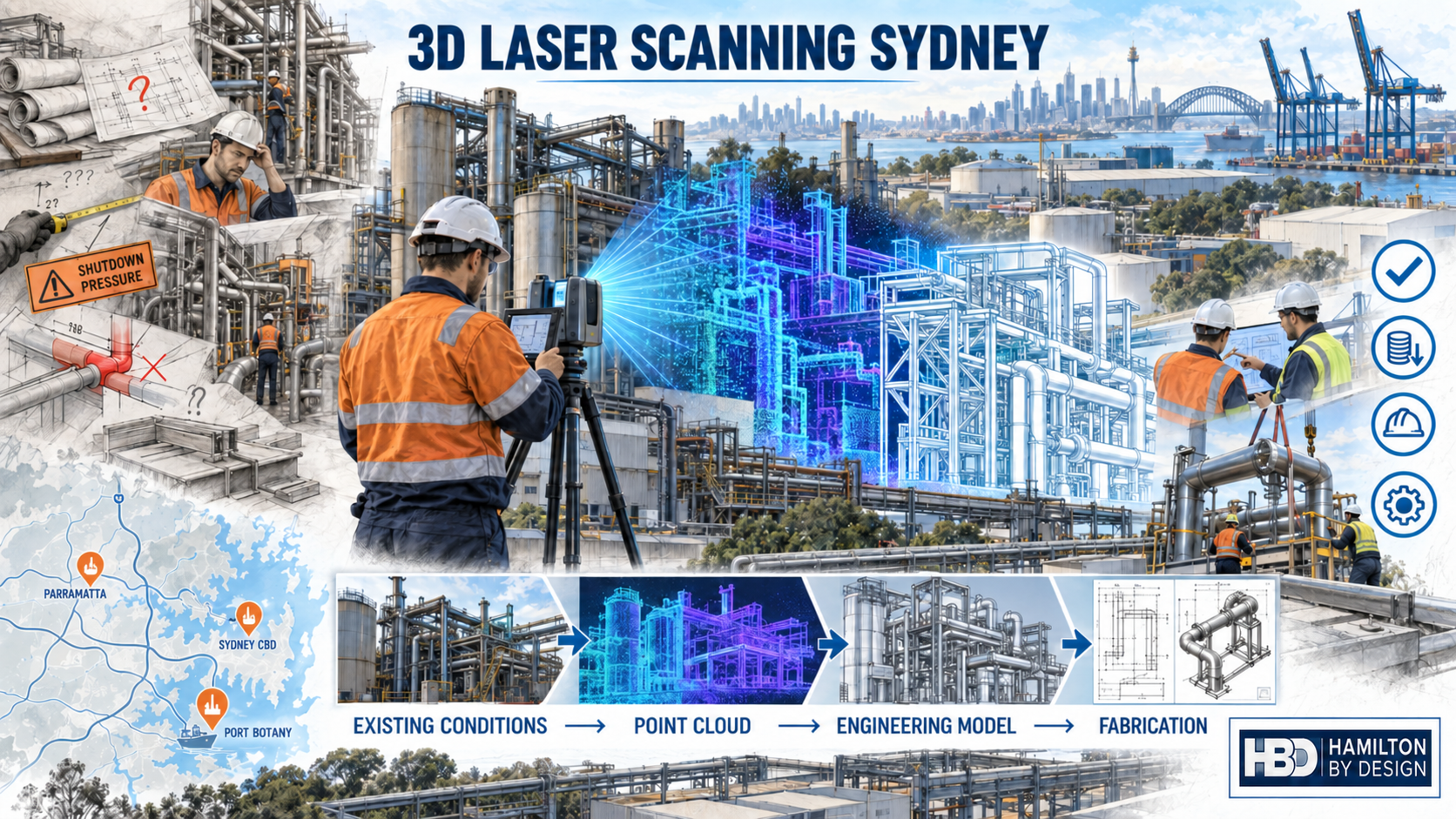
3D Laser Scanning Sydney
Engineering-grade LiDAR scanning, point-cloud modelling and scan-to-CAD services across Greater Sydney

Hamilton By Design provides engineer-led 3D laser scanning across Sydney for industrial facilities, manufacturing plants, infrastructure, commercial buildings and brownfield upgrade projects.
Using terrestrial LiDAR scanning, we capture existing structures, equipment and services and transform the registered point-cloud data into useful engineering information. Deliverables can include 3D CAD models, existing-condition drawings, general arrangements, equipment layouts and fabrication-ready documentation.
Our integrated workflow helps asset owners, engineers, project managers and fabricators make decisions using measured site information rather than incomplete drawings or assumptions.
3D scanning services available across Sydney
Our Sydney 3D laser scanning services can assist with:
- Industrial plants and manufacturing facilities
- Brownfield equipment upgrades
- Conveyors, transfer chutes and materials-handling systems
- Structural steel, platforms and access systems
- Pipework, ductwork and plant services
- Commercial plant rooms and building services
- Warehouses and automated distribution facilities
- Tanks, pumps, skids and mechanical equipment
- Fabrication interfaces and connection points
- Existing-condition and as-built documentation
- Dimensional verification and installation planning
- Reverse engineering of machinery and components
The required scanning density, accuracy, coordinate system and deliverables are established for each project. This ensures that the captured data is suitable for its intended engineering purpose without creating unnecessary processing or modelling costs.
From site scanning to engineering deliverables
Hamilton By Design combines reality capture with practical mechanical engineering and CAD experience.
1. Project and access planning
We first identify the area to be captured, the purpose of the survey and the decisions the information must support. We also consider site access, operating equipment, safety requirements, shutdown constraints and any required project coordinates.
2. LiDAR scanning on site
A terrestrial laser scanner records millions of measured points throughout the nominated area. Multiple scan positions are used to capture equipment, structures, services, connection points and surrounding obstructions.
3. Point-cloud registration
The individual scans are registered into a coordinated point cloud. The dataset is reviewed, cleaned and organised around the project scope.
4. Scan-to-CAD modelling
Required plant, structures and interfaces can be modelled using SolidWorks, Autodesk Inventor or AutoCAD-compatible workflows. The point cloud remains the measurable reference for the existing installation.
5. Engineering and fabrication documentation
Depending on the project, outputs may include:
- Registered E57, RCP or other agreed point-cloud formats
- Existing-condition drawings
- 2D general arrangement drawings
- 3D CAD models
- STEP and Parasolid files
- DXF profiles for cutting
- Fabrication and installation drawings
- Clearance and interference reviews
- Equipment layout concepts
- As-built documentation
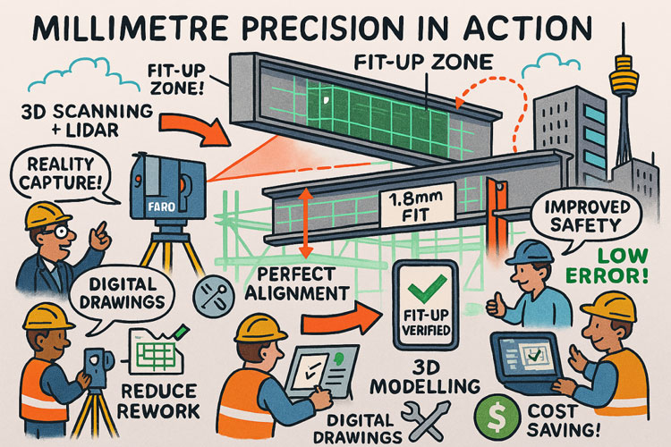
Why use 3D laser scanning?
Sydney projects frequently involve congested sites, restricted access, short shutdown windows and existing assets for which the original drawings may be incomplete or outdated.
A registered point cloud provides a detailed digital record of the accessible environment at the time of scanning. It can help project teams:
- Reduce dependence on manual measurements
- Identify surrounding obstructions and installation constraints
- Check equipment clearances before fabrication
- Coordinate new work with existing structures and services
- Reduce return visits for missed measurements
- Plan prefabrication and off-site assembly
- Review proposed designs inside the existing environment
- Preserve existing-condition information for future projects
- Communicate spatial information to engineers, fabricators and contractors
Three-dimensional scanning does not remove the need for engineering judgement. Its value comes from combining measured geometry with appropriate modelling, design control, verification and understanding of how the information will be used.
Industrial 3D laser scanning across Greater Sydney
Hamilton By Design supports projects throughout Sydney’s major industrial areas. Each location page provides information relevant to the local industrial environment while this page remains the central resource for Sydney-wide 3D laser scanning.
Western Sydney and the Cumberland industrial area
We provide scanning, reverse engineering and CAD support across established manufacturing, warehousing and engineering precincts, including:
- 3D laser scanning Wetherill Park
- Reverse engineering Smithfield
- 3D laser scanning Yennora
- 3D laser scanning Villawood
- Reverse engineering Granville
- 3D laser scanning Rydalmere
- Industrial 3D scanning Camellia
- Industrial 3D laser scanning Silverwater
Blacktown, Penrith and the Western Sydney growth corridor
Services are available for factories, warehouses, processing facilities, infrastructure and new industrial developments throughout Western Sydney:
- 3D laser scanning Blacktown
- Reverse engineering Seven Hills
- 3D laser scanning Glendenning
- Industrial 3D laser scanning Eastern Creek
- Reverse engineering St Marys
- Industrial 3D scanning Emu Plains
- 3D laser scanning Penrith
- Industrial scanning Western Sydney
- 3D laser scanning Marsden Park and Riverstone
- Industrial 3D scanning Mamre Road and Kemps Creek
South Western Sydney and Macarthur
We support machinery, manufacturing, food-processing, warehousing and materials-handling projects across Sydney’s south-western industrial areas:
- 3D laser scanning Ingleburn and Minto
- 3D laser scanning Smeaton Grange
- 3D laser scanning Prestons
- 3D laser scanning Chipping Norton
- Reverse engineering Milperra
- Reverse engineering Condell Park
- 3D laser scanning Revesby
- 3D laser scanning Greenacre
Southern Sydney and the Sutherland Shire
Scanning and reverse-engineering services are available for workshops, manufacturing operations, industrial equipment and energy-related infrastructure:
- Reverse engineering Kingsgrove
- Reverse engineering Peakhurst
- 3D laser scanning Riverwood
- Reverse engineering Taren Point
- 3D laser scanning Kirrawee and Caringbah
- Reverse engineering Kirrawee
- Industrial 3D laser scanning Kurnell
Sydney CBD, eastern suburbs and Port Botany
We assist with plant rooms, building services, industrial facilities, logistics infrastructure and brownfield projects across central and eastern Sydney:
- Industrial engineering Alexandria and Rosebery
- Industrial 3D scanning Mascot
- Industrial 3D laser scanning Botany
North Shore and Northern Beaches
Our services extend to specialised manufacturing, machinery, commercial facilities, technical operations and industrial businesses across northern Sydney:
- 3D laser scanning Chatswood and the North Shore
- 3D laser scanning Artarmon
- Reverse engineering Brookvale
- 3D laser scanning Warriewood and Mona Vale
Applications across Sydney industries
Manufacturing and process plants
Scanning can document production equipment, tanks, pipework, services and structural interfaces before machinery is modified, replaced or relocated.
Warehouses and distribution facilities
Point clouds can support conveyor layouts, automation interfaces, equipment clearances, building measurements and verification of existing slab, column and roof geometry.
Ports, terminals and heavy industry
LiDAR scanning can assist with brownfield modifications involving conveyors, transfer points, access structures, pipework and fixed mechanical equipment.
Commercial buildings and plant rooms
Scanning can capture congested mechanical spaces and existing services before equipment replacement, refurbishment or routing changes.
Water and wastewater infrastructure
Reality capture can support pump, pipework, platform, access and equipment modifications where existing drawings do not fully represent site conditions.
Why work with Hamilton By Design?
Hamilton By Design combines LiDAR capture with mechanical engineering, industrial maintenance, CAD modelling and fabrication experience.
This means the scanning scope can be developed around the intended engineering outcome—not simply the production of a point cloud.
Our capabilities include:
- FARO terrestrial laser scanning
- Point-cloud registration and processing
- SolidWorks and Inventor modelling
- AutoCAD-compatible drawings
- Reverse engineering
- Mechanical equipment and plant-layout design
- Fabrication documentation
- Brownfield upgrade support
- Constructability and installation reviews
We can work directly with asset owners, project engineers, maintenance teams, manufacturers, fabricators and engineering contractors.
Frequently asked questions
What can be captured using 3D laser scanning?
Accessible structures, machinery, pipework, ductwork, plant rooms, conveyors, platforms, tanks, buildings and surrounding obstructions can generally be captured. The scope should identify which features and interfaces are critical.
Is a point cloud the same as a CAD model?
No. A point cloud is a collection of measured spatial data. A CAD model is a simplified engineering representation created from selected parts of that data. The required modelling detail depends on how the model will be used.
Can you provide fabrication drawings?
Yes. Where included in the agreed scope, scan data can be used to support 3D modelling, general arrangements and fabrication drawings for mechanical and industrial projects.
What file formats are available?
Depending on the project, deliverables may include E57, RCP, LAS, STEP, Parasolid, DXF, DWG-compatible drawings and PDF drawing packages.
Can scanning eliminate every site measurement?
Scanning captures extensive visible geometry, but critical interfaces may still require targeted verification. Accuracy requirements, hidden surfaces, reflective materials, access restrictions and project tolerances should be considered during scope development.
Do you service all of Greater Sydney?
Yes. Hamilton By Design services the Sydney CBD, North Shore, Northern Beaches, Western Sydney, South Western Sydney, the Sutherland Shire, Port Botany and surrounding industrial areas.
Discuss your Sydney scanning project
If you are planning a plant upgrade, equipment replacement, shutdown, fabrication project or existing-condition survey, Hamilton By Design can help establish an appropriate scanning and modelling scope.
To request a proposal, please provide:
- The site location
- The approximate area or equipment to be scanned
- The purpose of the scan
- Required point-cloud, CAD or drawing deliverables
- Access and shutdown constraints
- Required delivery timeframe
Contact Hamilton By Design to discuss engineer-led 3D laser scanning, point-cloud modelling and scan-to-CAD services across Sydney.




Let’s talk about your Sydney project
If you have a shutdown, upgrade or brownfield project coming up in Sydney, now is the right time to talk about 3D LiDAR scanning and 3D modelling. Early digital capture and smart modelling cost far less than late-stage rework and site delays.
Our clients

























Contact Hamilton By Design to discuss:
- What area you need scanned
- What decisions you’re trying to make (or drawings you need)
- Shutdown dates and access constraints
- How we can package scanning, 3D modelling and drafting to suit your project and budget



3D Point Clouds Are a Game-Changer for Your Projects
Your Experts in 3D Laser Scanning & Mechanical Design
3D CAD Modelling | 3D Scanning
3D Scanning for Construction in Sydney
Transforming Projects with 3D Scanning in Sydney
3D LiDAR Scanning – Digital Quality Assurance