


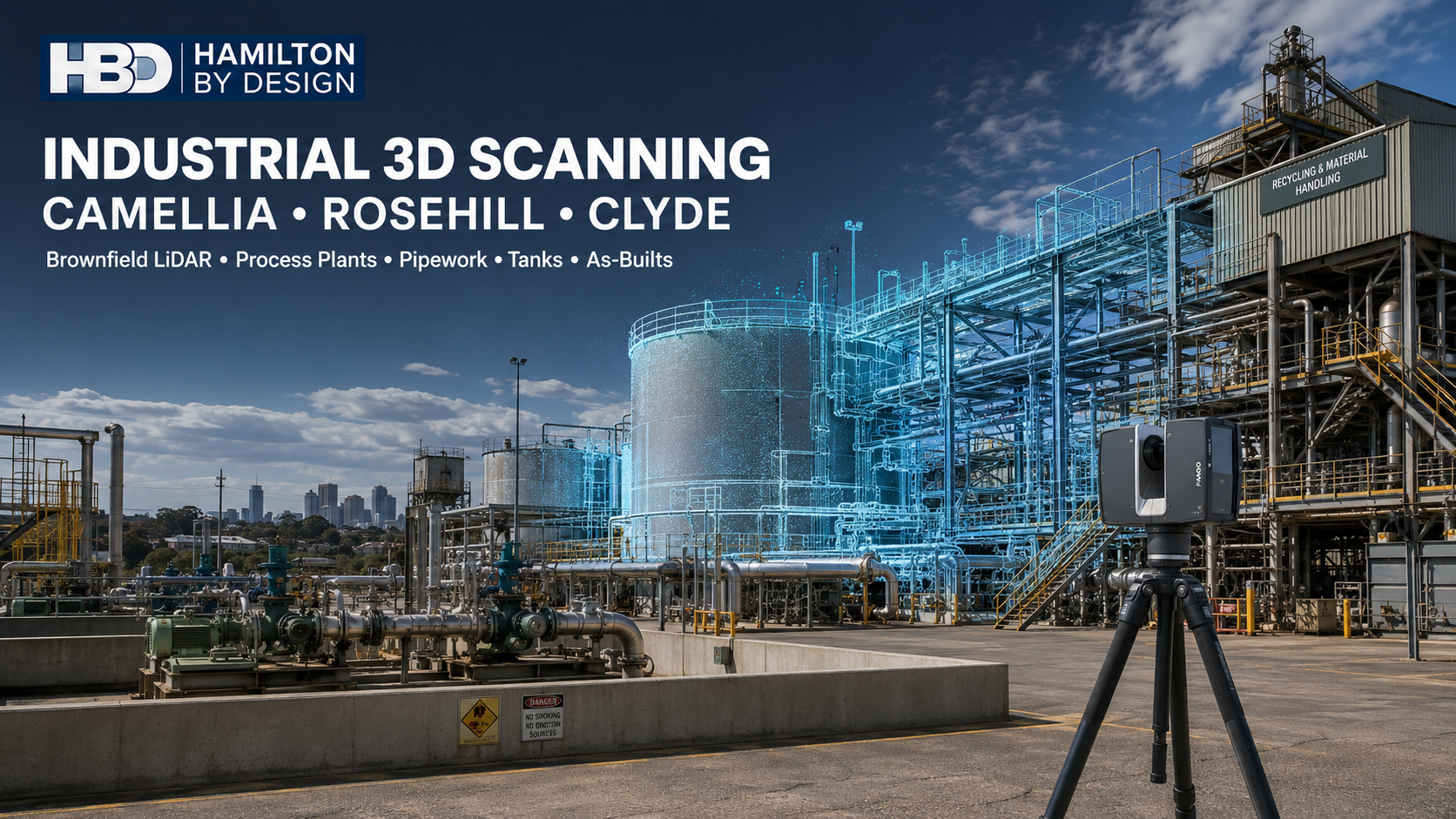
Industrial 3D Scanning in Camellia, Rosehill and Clyde: Engineering Better Brownfield Decisions

Camellia, Rosehill and Clyde contain some of the most complex industrial and infrastructure environments in Western Sydney. The area combines bulk-fuel storage, process pipework, recycling facilities, asphalt production, waste handling, transport infrastructure, water assets and former heavy-industrial land.
These facilities frequently contain assets installed or modified over many decades. Original drawings may be incomplete, superseded or inconsistent with what is physically present. Pipework may have been rerouted, structural steel modified, equipment replaced and access systems added without every change being incorporated into the master drawing set.
For asset owners, engineers and contractors, this uncertainty creates a fundamental problem: reliable engineering decisions require reliable information about existing conditions.
Hamilton By Design provides 3D laser scanning for engineering projects across Sydney and Australia. By combining LiDAR capture with mechanical engineering, CAD modelling and technical drafting, we help clients convert complex brownfield sites into accurate and usable engineering information.
An important Western Sydney industrial precinct
Camellia, Rosehill and Clyde remain strategically important because of their proximity to Parramatta, major arterial roads, rail infrastructure, utilities and the broader Sydney industrial market.
The precinct includes several different types of operations:
- Bulk-fuel receipt, storage and distribution
- Tank farms, pumping systems and process pipework
- Asphalt production and reclaimed-asphalt processing
- Waste transfer and materials recovery
- Water, wastewater and pipeline infrastructure
- Transport and light-rail assets
- Warehousing, maintenance and industrial services
- Remediation and redevelopment of former industrial land
Viva Energy’s Clyde Terminal operates as a finished-petroleum-product storage and distribution facility. Its infrastructure includes storage tanks, bunds, pumps, pipelines, drainage, instrumentation and firewater systems.
Downer’s Rosehill operations include asphalt production, reclaimed-asphalt processing, material storage and resource-recovery equipment. Veolia also operates waste-management infrastructure in the Clyde area and holds approval for a proposed materials-recycling facility at Camellia.
Sydney Water is progressing plans for substantial water-resource-recovery and pipeline infrastructure within the Camellia–Rosehill industrial precinct. These established and proposed operations create continuing demand for brownfield investigation, plant documentation, constructability assessment and accurate tie-in information.
Why brownfield industrial sites are difficult to document
A brownfield project is undertaken within or around existing infrastructure. Unlike a new greenfield development, the design team cannot assume that the site is empty, geometrically simple or fully documented.
Industrial brownfield sites commonly contain:
- Congested pipe racks
- Closely spaced valves, flanges and cable trays
- Tanks and pressure equipment
- Structural frames and access platforms
- Operating machinery
- Underground and overhead services
- Restricted maintenance areas
- Hazardous substances
- Traffic and mobile-plant movements
- Structures that have been modified repeatedly
Traditional site measurement remains useful, but tape measures and isolated measurements cannot efficiently describe every relationship within a complex plant. Small errors in equipment location, flange orientation or structural clearance may result in fabricated components that do not fit.
Engineering-grade LiDAR creates a dense spatial record of visible site conditions. A registered point cloud can show the relationship between pipework, tanks, structures, equipment, platforms and surrounding infrastructure.
Hamilton By Design can then convert selected information into 3D scanning and CAD modelling deliverables suited to the client’s actual engineering purpose.
Five major problems affecting local industrial facilities
1. Incomplete or unreliable drawings
Many industrial facilities retain drawings from their original construction. However, these documents may not include subsequent maintenance changes, emergency repairs, equipment replacements or production modifications.
Designing from an inaccurate drawing creates avoidable project risk. A pipe shown in the wrong position can affect a new support, platform or equipment installation. An undocumented beam may obstruct a lifting path. A modified stairway may reduce the available maintenance envelope.
LiDAR scanning helps establish a new existing-condition baseline. Historical drawings can be compared with the point cloud, and important differences can be incorporated into updated models and as-built documentation.
2. Congested pipework and difficult tie-ins
Pipework modifications are among the most demanding brownfield activities. New lines must avoid existing services while maintaining appropriate access, support, drainage, isolation and maintenance requirements.
A point cloud can assist engineers in identifying:
- Existing pipe routes
- Valve and flange positions
- Nozzle locations
- Pipe-rack congestion
- Structural obstructions
- Available support locations
- Access and maintenance clearances
- Potential tie-in points
Proposed pipework can be modelled within the captured environment before fabrication begins. This reduces reliance on assumptions and supports more informed constructability reviews.
Laser scanning does not determine pipe-wall thickness, material grade, internal condition or process suitability. These matters require appropriate records, engineering assessment and, where necessary, specialist inspection or nondestructive testing.
3. Ageing structures and access systems
Older industrial plants may contain structural steel, platforms, stairs, ladders, handrails and pipe supports that have been exposed to corrosion, vibration, impact or changing loads.
LiDAR can document visible geometry, including member positions, platform levels and apparent displacement. The captured data can support structural assessment, access reviews and the development of replacement or modification concepts.
Where load capacity must be verified, scanning data should be combined with material information, connection details, inspection findings and engineering calculations. Hamilton By Design can also provide finite element analysis and mechanical assessment where FEA is appropriate to the design question.
4. Safety risks around machinery and operational plant
Recycling, asphalt, terminal and process operations may expose personnel to moving machinery, stored energy, hazardous substances, vehicles, elevated work and restricted access.
Hamilton By Design can use captured plant information to support:
- Machinery risk assessments
- Guarding reviews
- Access and egress studies
- Maintenance-clearance assessments
- Isolation-point documentation
- Conveyor and transfer-point reviews
- Vehicle and pedestrian separation
- Equipment-removal planning
- Safer platform and stair concepts
Our industrial machine-guarding design and verification services can help clients identify mechanical hazards and develop practical engineering controls.
Scanning can reduce repeated measurement visits and minimise the amount of time personnel spend close to operating equipment. However, scanning does not replace site induction, permits, isolation procedures, hazardous-area controls or a site-specific safe system of work.
5. Redevelopment and infrastructure interfaces
Camellia, Rosehill and Clyde include continuing industrial operations, remediated land, redevelopment areas and proposed major infrastructure. New work must often be coordinated around retained assets, contaminated ground, operational boundaries and existing utilities.
A coordinated spatial record helps stakeholders understand:
- What infrastructure currently exists
- Which assets are retained or removed
- Where new construction must connect
- How demolition may affect surrounding plant
- Whether proposed equipment will physically fit
- How construction access can be maintained
- Where interfaces exist between contractors
This information is valuable during concept design, detailed design, procurement, fabrication, installation and final handover.
Brownfield LiDAR and process-plant scanning
Hamilton By Design can capture complete plant areas or targeted zones, depending on the project objective.
Potential applications include:
- Process-plant scanning
- Tank and tank-farm documentation
- Pump and valve station capture
- Pipe-rack scanning
- Structural-steel surveys
- Equipment and machinery capture
- Plant-room modelling
- Conveyor and materials-handling layouts
- Access-platform documentation
- Shutdown and tie-in planning
- Demolition studies
- Installation verification
- As-built documentation
The purpose of the scan should be established before fieldwork begins. A project intended to produce a general plant layout may require different coverage and modelling detail from a project intended to manufacture a replacement spool or fit a new item of machinery.
This engineering-led approach helps ensure that data is captured for a defined project outcome rather than producing a large point cloud with no clear delivery strategy.
Mechanical engineering and design support

A point cloud is a highly useful source of geometric information, but it is not automatically an engineering solution.
Hamilton By Design combines reality capture with mechanical design to help clients progress from existing-condition information to practical project deliverables. Our services can include:
- Mechanical equipment layouts
- Pipe-support concepts
- Machinery and component design
- Maintenance-access improvements
- Guarding and safety modifications
- Equipment replacement studies
- Lifting and removal assessments
- Structural interfaces
- Fabrication-ready CAD models
- Bills of materials
- Engineering calculations
- FEA where appropriate
Because the same team can undertake scanning, modelling and mechanical design, the engineering intent remains connected to the captured site information. This reduces the communication gap that can occur when one contractor scans the facility and an unrelated team later attempts to interpret the point cloud.
Mechanical drafting and manufacturing drawings
Industrial projects eventually require information that fabricators, installers and maintenance personnel can use.
Hamilton By Design provides mechanical drafting services for:
- General arrangement drawings
- Fabrication drawings
- Assembly drawings
- Weldment drawings
- Pipe-support drawings
- Platforms, stairs and guarding
- Equipment layouts
- Installation details
- Sections and elevations
- Bills of materials
- As-built drawing updates
Technical documentation may be developed with reference to the AS 1100 series and applicable structural, mechanical, welding, pressure-equipment and client-specific requirements.
Our article explaining how AS 1100 and LiDAR scanning work together outlines how spatial site data can be converted into controlled engineering documentation.
Australian Standards and safety considerations
The applicable standards depend on the asset, process, contractual requirements and intended work. Standards that may be relevant to industrial projects in Camellia, Rosehill and Clyde include:
- AS 1100 series for technical drawing
- AS 1210 for pressure vessels
- AS 4041 for pressure piping
- AS/NZS 1200 for pressure equipment
- AS 1657 for fixed platforms, walkways, stairs and ladders
- AS 1940 for flammable and combustible liquids
- AS 4100 for steel structures
- AS/NZS 1170 series for structural design actions
- AS/NZS 4024 series for machinery safety
- AS/NZS IEC 60079 series for explosive atmospheres
- AS 2865 for confined spaces
- AS ISO 31000 for risk management
- AS 1418 and AS 2550 series for cranes, hoists and their safe use
- AS 2359 series for powered industrial trucks
- AS 4991 for lifting devices
Hamilton By Design has prepared an overview of Australian Standards relevant to engineering, scanning and documentation projects.
The applicable standard, edition and acceptance criteria must be confirmed for each project. Scanning assists the engineering process by improving existing-condition information; it does not, by itself, certify that a plant or structure complies with a particular standard.
Engineering support for industrial logistics
Industrial logistics involves more than truck access. Equipment, materials, maintenance personnel and waste streams must move safely through constrained operational environments.
Hamilton By Design can assist with:
- Loading and unloading layouts
- Forklift and pedestrian separation
- Vehicle and mobile-plant interfaces
- Equipment-removal routes
- Crane and lifting access
- Laydown-area planning
- Maintenance staging
- Shutdown sequencing
- Conveyor and transfer arrangements
- Clearance assessment beneath structures
- Transport and installation frames
A three-dimensional model allows movement paths and physical clearances to be reviewed before site mobilisation. This is particularly useful where a large component must pass through an existing plant, underneath pipework or between operating assets.
Retaining a reliable plant-data baseline
A scan should not be treated as a short-term project by-product. When appropriately managed, it can become a valuable plant information resource.
Hamilton By Design can retain or help clients manage:
- Registered process-plant point clouds
- Pipe-route information
- Tank and nozzle geometry
- Structural-steel models
- Equipment layouts
- Tie-in information
- As-built drawings
- Modification records
- Plant baseline datasets
Retention arrangements should address ownership, confidentiality, cybersecurity, revision control, permitted users, file formats and the agreed retention period.
Future projects can refer to the baseline dataset, although critical dimensions should be checked where the site may have changed since the original scan.
Who benefits from industrial 3D scanning?
Industrial 3D scanning can assist:
- Asset owners
- Plant managers
- Maintenance teams
- Project engineers
- Reliability engineers
- Mechanical and structural engineers
- Equipment suppliers
- Fabricators
- Construction contractors
- Demolition contractors
- Safety professionals
- Industrial developers
The greatest value is generally achieved when scanning is integrated into the engineering workflow from the beginning of the project.
Frequently asked questions
What is industrial 3D laser scanning?
Industrial 3D laser scanning uses LiDAR technology to measure visible surfaces and create a three-dimensional point cloud. The point cloud records the spatial relationship between equipment, structures, pipework and surrounding plant.
Can scanning replace existing engineering drawings?
Scanning can be used to verify, update or supplement existing drawings. The point cloud itself is not automatically a controlled engineering drawing. Selected information must be interpreted, modelled and documented in an appropriate CAD or BIM format.
Can Hamilton By Design scan an operating process plant?
Yes, subject to the client’s access requirements, permits, inductions, hazardous-area controls and safe work procedures. A site-specific capture plan should identify operating restrictions and areas that cannot be safely accessed.
Can LiDAR see through tanks, pipes or walls?
No. LiDAR records surfaces that are visible from the scanner position. It does not see through solid objects or determine internal pipe condition, wall thickness or material composition. Multiple scan positions are used to reduce line-of-sight shadows.
What deliverables can be produced?
Deliverables may include registered point clouds, viewer files, 2D layouts, 3D CAD models, BIM models, equipment arrangements, pipework models, structural models, fabrication drawings and as-built documentation. The appropriate deliverable depends on the intended engineering use.
Is 3D scanning the same as surveying?
Not necessarily. Hamilton By Design provides engineering-focused reality capture and modelling. Where cadastral boundaries, registered survey certification or formally controlled survey coordinates are required, a suitably qualified surveyor should establish or verify the necessary control.
Can point clouds support pipework modifications?
Yes. Point clouds can document existing pipe routes, supports, flanges, valves, structures and surrounding obstructions. Proposed pipework can then be modelled against the captured environment to improve tie-in planning and reduce clashes.
Can scanning identify corrosion or structural defects?
Scanning can document visible geometry and, in some cases, apparent deformation. It does not replace detailed inspection, material testing, thickness measurement or specialist NDT. These inputs can be combined with the captured geometry for a broader engineering assessment.
How accurate is industrial laser scanning?
Accuracy depends on the scanner, range, surface properties, environmental conditions, scan geometry, registration method and survey control. The required tolerance should be agreed before scanning so the capture and verification process can be planned appropriately.
Why use an engineering company for LiDAR scanning?
An engineering-led scanning team can plan the capture around the intended design, fabrication or safety outcome. Hamilton By Design can interpret the point cloud, develop engineering models and progress the information into drawings and practical design solutions.
Better information for safer industrial decisions
Brownfield projects are difficult because existing conditions are complex, congested and not always properly documented. Industrial 3D scanning gives project teams a more reliable basis for design, coordination and planning.
For facilities in Camellia, Rosehill and Clyde, the combination of heavy industry, process plant, tanks, pipework, recycling equipment and major infrastructure makes accurate site information especially valuable.
Hamilton By Design combines engineering-grade LiDAR scanning with mechanical engineering, 3D modelling, drafting and safety-focused design. Our objective is not simply to scan a site. It is to turn captured information into practical engineering deliverables that help clients reduce uncertainty, improve constructability and make better-informed brownfield decisions.

Contact Us – Talk To Us
Our clients:
























