


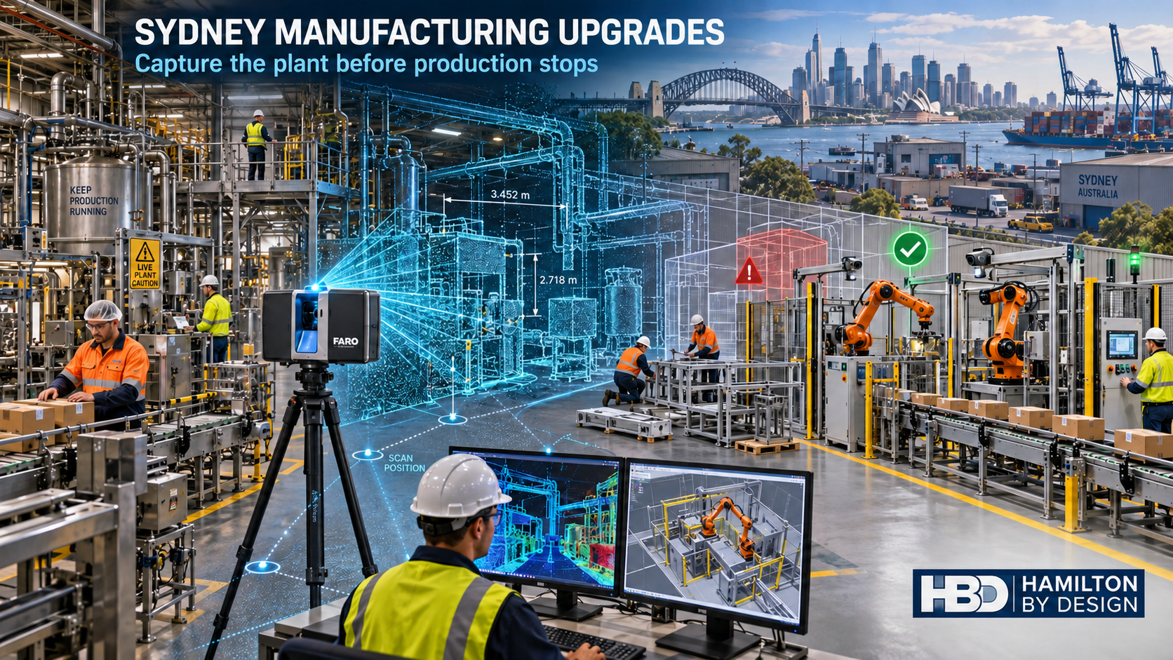

Australian manufacturing is entering a period of accelerated technological and operational change. Automation, artificial intelligence, mobile robotics and data-driven production systems are creating opportunities for Sydney manufacturers to improve productivity, production quality and competitiveness.
However, introducing new technology into an existing factory is rarely as simple as purchasing a machine and installing it.
New production equipment must fit within an established operating environment containing conveyors, services, access platforms, structural elements, pipework, electrical infrastructure and other machinery. If the existing factory is not accurately documented before an upgrade begins, installation problems can lead to delays, rework and extended production shutdowns.
For manufacturers, lost time during an upgrade means lost production. Depending on the facility, even a few additional hours of downtime can affect output targets, labour utilisation, customer deliveries and revenue.
Trends shaping Australian manufacturing
The September 2026 edition of Manufacturers’ Monthly included an article titled “The trends shaping Australian manufacturing.” The article discussed the growing importance of automation, artificial intelligence, mobile robotics and data-driven production systems within Australian industry.
It also made an important observation: successful automation does not depend solely on purchasing technology. Manufacturers need reliable systems supported by engineering capability, maintenance, service and long-term relationships.
This is particularly relevant to brownfield manufacturing facilities across Sydney.
Many factories were constructed or expanded over several decades. Machines may have been relocated, production lines modified, services rerouted and safety systems upgraded without every alteration being incorporated into the original drawings.
Consequently, the available drawings may no longer represent the factory as it exists today.
Before a manufacturer invests in new automation or production equipment, it is important to establish a reliable record of the existing facility. Three-dimensional LiDAR scanning provides a practical way to collect that information.
The industrial diversity of Sydney
Sydney’s manufacturing sector is not concentrated in a single precinct. It extends across Western Sydney, South-West Sydney, the Parramatta industrial corridor, the inner south, the Sutherland Shire and the Northern Beaches.
These areas contain food and beverage manufacturers, pharmaceutical businesses, metal fabricators, plastics manufacturers, logistics facilities, engineering workshops, chemical-processing operations and businesses supplying construction, transport, defence and infrastructure projects.
The requirements of each facility are different, but many face a common challenge: upgrading an operating factory while minimising disruption to production.
A manufacturer in Wetherill Park may be rearranging machinery to accommodate a new production cell. A business requiring reverse engineering in Smithfield may need to reproduce an obsolete component. A facility considering 3D laser scanning in Ingleburn or Minto may be planning a conveyor extension or automation project.
In each case, reliable existing-condition information provides the foundation for better planning.
What is 3D LiDAR scanning?
A terrestrial 3D LiDAR scanner uses laser measurements to capture the visible surfaces of a factory, production line or industrial facility. Each scan records millions of measured points, collectively forming a three-dimensional point cloud.
The resulting dataset can capture:
- existing production equipment;
- conveyors and transfer points;
- pipework and ducting;
- access platforms, stairs and handrails;
- columns, beams and visible building geometry;
- floor levels and penetrations;
- overhead services;
- electrical cabinets;
- maintenance access areas;
- machine interfaces; and
- restricted installation spaces.
Multiple scan positions can be registered together to create a coordinated digital record of the required work area.
The point cloud can then support equipment layouts, clash reviews, three-dimensional CAD models, general-arrangement drawings and installation planning.
This approach is applicable to established facilities such as those requiring industrial 3D laser scanning in Silverwater and to machinery-focused projects requiring reverse engineering in Seven Hills.
Why scanning should happen before upgrade design
A production upgrade normally begins with a desired outcome. The manufacturer may want to:
- increase production capacity;
- replace unreliable equipment;
- reduce manual handling;
- introduce robotics;
- improve guarding;
- modify product flow;
- lower energy consumption;
- improve cleaning access;
- introduce condition monitoring; or
- reconfigure the line for a different product.
The design team must then determine how the proposed equipment will interact with the existing facility.
When that assessment is based on outdated drawings or isolated manual measurements, important constraints may remain undiscovered until fabrication or installation.
Typical problems include:
- equipment that does not fit through the proposed installation route;
- conveyors that do not align with existing machinery;
- pipework or ducting occupying the required space;
- columns conflicting with new equipment;
- insufficient maintenance clearance;
- access platforms obstructing robotic movement;
- floor penetrations in unsuitable locations;
- incorrect equipment-interface heights;
- inaccurate machine centre lines; and
- guarding that cannot be installed as designed.
A detailed LiDAR survey does not remove every project risk, but it substantially improves the quality of the existing-condition information available to designers, fabricators and installers.
Businesses considering 3D laser scanning in Revesby, factory scanning in Chipping Norton or 3D laser scanning in Prestons can use the resulting point cloud to assess proposed equipment against measured site geometry before a shutdown begins.
Lost upgrade time becomes lost production
Production downtime is one of the most significant risks associated with brownfield factory upgrades.
Manufacturers may schedule installation work during a weekend, planned maintenance period or annual shutdown. These windows are often tightly controlled because production must resume by a defined time.
If a dimensional error is discovered during installation, the consequences can extend beyond the cost of modifying one component. A delay can affect the entire commissioning sequence.
For example, a support frame may need to be cut and altered because it conflicts with an existing service. This can delay equipment installation, guarding, electrical work, testing and commissioning. Production cannot restart until the complete system is safe and operational.
The resulting cost may include:
- lost production output;
- additional contractor hours;
- extended crane or access-equipment hire;
- emergency fabrication;
- express freight;
- delayed commissioning;
- missed customer deliveries;
- idle production employees; and
- disruption to downstream operations.
The cost of collecting accurate site data before design is generally small compared with the potential cost of an unplanned shutdown extension.
This consideration is especially important for high-throughput logistics and manufacturing facilities around Eastern Creek, port-related and process operations requiring industrial scanning in Botany, and manufacturers planning factory scanning in Smeaton Grange.
Moving uncertainty out of the shutdown window
The purpose of pre-upgrade scanning is not merely to produce an impressive point-cloud image. Its practical purpose is to move uncertainty away from the shutdown window and into the planning stage.
Before production stops, the project team can examine:
- whether the new equipment will fit;
- whether existing services must be relocated;
- whether the proposed installation route is practical;
- how the new equipment will connect to the existing line;
- whether maintenance and cleaning access will remain available;
- whether guarding can be installed;
- where temporary equipment can be positioned; and
- which components should be prefabricated.
Questions resolved during design are generally less expensive than problems discovered during installation.
For manufacturers using 3D laser scanning in Glendenning, reverse engineering in St Marys or 3D laser scanning in Yennora, the same principle applies: capture the existing conditions before committing to the final arrangement.
Supporting design while the production line remains operational
One of the principal advantages of 3D scanning is that much of the upgrade planning can occur while the existing production line remains operational.
Subject to site access and safety requirements, the facility can be scanned during normal production, a short maintenance window, a weekend or a planned low-activity period. The resulting point cloud provides a reference that the project team can continue using after leaving the site.
Designers can use the dataset to:
- establish the existing production-line arrangement;
- determine equipment footprints and interface positions;
- examine installation and removal routes;
- assess access for cranes, forklifts and elevated work platforms;
- plan temporary works and equipment laydown areas;
- identify potential spatial clashes;
- develop preliminary equipment arrangements;
- prepare fabrication drawings; and
- coordinate proposed changes with the existing plant.
This allows more decisions to be made before manufacturing or installation begins.
The approach is relevant to machinery and component projects requiring reverse engineering in Milperra or reverse engineering in Condell Park, as well as facility-layout projects requiring 3D laser scanning in Villawood.
Existing drawings may not represent the existing plant
Many brownfield factories have drawing sets containing valuable information. However, the presence of drawings does not automatically mean that they accurately reflect current site conditions.
A facility may have undergone years of incremental changes, including:
- replacement machines with different footprints;
- locally fabricated platforms;
- undocumented pipework;
- revised production-line layouts;
- temporary modifications that became permanent;
- new electrical cabinets;
- relocated access routes;
- additional guarding; and
- building alterations.
These changes can create a gap between the documented factory and the physical factory.
Scanning helps identify that gap. Existing drawings can still be used, but they can be reviewed against measured conditions rather than accepted without verification.
This can be valuable in established industrial areas such as Rydalmere, Camellia and Granville, where industrial properties may have undergone multiple changes during their operating lives.
From point cloud to installation planning
After scanning, the registered point cloud can be imported into suitable engineering and design platforms. Depending on the project requirements, the data may be used directly as a spatial reference or converted into selected CAD geometry.
Not every visible object must be modelled. The level of modelling should suit the decisions the project team needs to make.
For example:
- a preliminary layout may require equipment envelopes and building geometry;
- a conveyor modification may require accurate transfer points, centre lines and support locations;
- a pipework project may require pipe centre lines, flange locations and nearby obstructions;
- a robotic cell may require a detailed working envelope and guarding layout;
- a replacement component may require higher-resolution scanning or direct measurement; and
- a fabrication package may require verified interfaces and defined tolerances.
The most effective scope is based on the project outcome rather than an assumption that every captured surface must become a detailed solid model.
Manufacturers planning projects around Blacktown, Emu Plains and Penrith can use this staged approach to match the amount of modelling to the upgrade’s actual requirements.
Supporting Western Sydney’s manufacturing growth
Western Sydney continues to accommodate major industrial, logistics and advanced-manufacturing activity. New development is occurring alongside older facilities that require continuing upgrades.
For established plants, the challenge is often to introduce modern production systems within buildings that were not originally designed for them. For new facilities, accurate scanning can still assist when equipment installation, services and building works have developed separately.
Hamilton By Design provides industrial scanning across Western Sydney to support the transition from existing-condition capture to engineering documentation.
Growth areas such as Marsden Park and Riverstone and the Mamre Road and Kemps Creek industrial precinct are likely to contain a combination of new facilities, expanding operations and future production changes.
Collecting and retaining accurate spatial data can help these businesses manage later modifications without repeatedly starting from incomplete information.
South and South-West Sydney manufacturing
South and South-West Sydney contain a broad range of food-production facilities, packaging operations, engineering workshops, warehouses and light-manufacturing businesses.
Plants in these areas may face restricted access, congested production floors and limited shutdown periods. These conditions increase the value of completing measurement and design work before installation begins.
Relevant local capabilities include:
- 3D laser scanning in Greenacre;
- reverse engineering in Kingsgrove;
- reverse engineering in Peakhurst; and
- 3D laser scanning in Riverwood.
Scanning may be used to document a single machine, a production cell or a larger operating area. The correct extent depends on the proposed upgrade and the equipment or services likely to be affected.
Inner-south and airport industrial areas
The industrial areas around Alexandria, Rosebery, Mascot and Botany combine older industrial buildings with newer logistics, technology, food-production and commercial facilities.
These properties can present particular upgrade challenges, including restricted delivery access, limited internal space, overhead services and buildings that have undergone multiple changes of use.
Industrial engineering support in Alexandria and Rosebery can help businesses document existing machinery and plan modifications. Similarly, industrial 3D scanning in Mascot can assist with factory layouts, equipment installation and access planning.
Where installation access is restricted, the point cloud can also help the project team investigate how equipment will be delivered, moved through the building and positioned without relying solely on assumptions made from a floor plan.
Sutherland Shire and southern industrial facilities
The Sutherland Shire contains engineering businesses, manufacturers, processing facilities and workshops serving Sydney’s construction, marine and industrial markets.
Projects may involve production machinery, pumping equipment, fabricated components, plant modifications or replacement parts.
Hamilton By Design supports this region through services including:
- reverse engineering in Taren Point;
- 3D laser scanning in Kirrawee and Caringbah;
- machinery reverse engineering in Kirrawee; and
- industrial 3D laser scanning in Kurnell.
The same principle remains central: the quality of the upgrade decision depends partly on the quality of the information used to describe the existing plant.
Northern Sydney and Northern Beaches manufacturing
Although Western and South-West Sydney contain many of the city’s major industrial precincts, specialist manufacturers and engineering businesses also operate across Northern Sydney and the Northern Beaches.
These businesses may work from smaller, space-constrained facilities where equipment access and floor-area efficiency are critical.
Local services include:
- 3D laser scanning and reverse engineering in Artarmon;
- reverse engineering in Brookvale; and
- 3D laser scanning in Warriewood and Mona Vale.
In smaller factories, a poorly planned equipment change can consume valuable production area or restrict access to surrounding machinery. A three-dimensional survey helps assess spatial relationships before new equipment is ordered or fabricated.
Connecting the physical factory with digital manufacturing
The move toward smarter manufacturing depends on reliable information about physical assets.
Automation systems may produce large volumes of operational data, but an upgrade project still requires an accurate understanding of where equipment is located and how it interfaces with the surrounding facility.
A registered point cloud can provide the geometric foundation for a digital representation of the factory. Depending on the project requirements, the data may support:
- scan-to-CAD modelling;
- production-line layouts;
- digital-twin development;
- robotic-cell planning;
- conveyor modifications;
- clash detection;
- machine-guarding reviews;
- fabrication drawings;
- shutdown planning; and
- future asset-management activities.
This can be particularly valuable for manufacturers operating facilities that have grown through multiple stages of expansion.
Instead of starting each upgrade with another series of disconnected measurements, the business can retain a controlled digital record and update it as the facility changes.
Data collection must be planned around the intended outcome
Not every scanning project requires the same level of detail.
A general factory-layout survey differs from a dimensional inspection or metrology survey of a machine component. Similarly, a scan intended for equipment-placement planning may not capture every concealed service or individual fastening detail.
Before scanning begins, the manufacturer and scanning provider should agree on:
- the purpose of the proposed upgrade;
- the decisions the data must support;
- the required deliverables;
- the areas that must be captured;
- critical equipment interfaces;
- required measurement confidence;
- production and access restrictions;
- areas concealed by guarding or stored materials;
- whether equipment will be operating during scanning;
- required file formats; and
- how the data will be stored for future projects.
Clear scope definition helps ensure that the collected data is suitable for the engineering decisions it will support.
Capturing machine interfaces—not just the building
A factory scan should be planned with an understanding of the proposed mechanical work.
A survey that captures the overall building but misses critical equipment interfaces may not provide enough information for fabrication or installation.
Depending on the project, important details may include:
- machine centre lines;
- mounting surfaces;
- conveyor elevations;
- shaft positions;
- flange faces;
- bolt-hole locations and clocking;
- pipe centre lines;
- connection points;
- guarding interfaces;
- access requirements; and
- maintenance-removal paths.
Plant condition must also be considered. Product build-up, stored materials, temporary equipment and guarding can obscure important geometry. The scanning plan should identify whether cleaning, access or limited equipment removal is required before data capture.
This is why industrial scanning benefits from being undertaken with the intended engineering and fabrication workflow in mind.
From point cloud to manufacturable outcome
Collecting the scan is only the first stage.
The information must be interpreted by people who understand machinery, fabrication, installation and industrial workflows. A point cloud is valuable, but the final benefit comes from using it to support a practical engineering outcome.
Hamilton By Design combines 3D LiDAR scanning with mechanical design, drafting, reverse engineering and fabrication support. This provides a connected workflow from existing-condition capture through to CAD development and upgrade documentation.
A typical process may include:
- Define the production problem and required outcome.
- Identify the critical equipment and facility interfaces.
- Scan the existing factory, machinery or production line.
- Register and review the point-cloud data.
- Develop the required layouts or CAD models.
- Insert the proposed equipment into the existing environment.
- Review access, interfaces, clearances and potential clashes.
- Prepare drawings to support fabrication and installation.
- Confirm the shutdown and installation sequence.
- Retain the approved information for future upgrades.
Keeping scanning and mechanical design within a connected workflow helps maintain responsibility for how the captured information is interpreted and used.
A practical first step for Sydney manufacturers
Before changing a production line, installing automation or ordering new machinery, manufacturers should first establish whether their existing facility information is accurate enough to support the proposed decision.
Useful questions include:
- Do the existing drawings reflect current site conditions?
- Have previous modifications been documented?
- Are the machinery interfaces accurately recorded?
- Is the proposed installation route known?
- Have maintenance and cleaning clearances been considered?
- Can the equipment be prefabricated confidently?
- Have potential clashes been reviewed before the shutdown?
- Will the resulting information be retained for later upgrades?
If the answers are uncertain, collecting 3D LiDAR data can provide a stronger starting point.
The objective is not simply to create a point cloud or a three-dimensional model. The objective is to use reliable information to make better engineering decisions, reduce installation risk and protect production time.
In manufacturing, time lost during an upgrade is rarely limited to the installation team. It can become lost output, delayed orders, additional labour and reduced revenue.
Capturing the existing factory before designing the upgrade helps move uncertainty away from the shutdown window—when every hour matters—and into the planning stage, where problems are generally easier and less expensive to resolve.
Frequently asked questions
Why should a factory be scanned before an equipment upgrade?
Scanning establishes a measured record of the existing factory, machinery and visible services. This helps designers evaluate equipment fit, access, interfaces and potential clashes before fabrication or installation begins.
Can a factory be scanned while production is operating?
In many cases, yes. The scanning approach must be coordinated with site safety, access requirements, moving machinery and personnel. Some areas may need to be captured during a maintenance period or temporary shutdown.
Does LiDAR scanning eliminate the need for site verification?
No. LiDAR scanning improves the available information, but critical interfaces, concealed conditions and fabrication dimensions may still require targeted verification. The required checks should be defined according to the project risk and intended deliverables.
Can point-cloud data support new machinery layouts?
Yes. Point-cloud data can be used as a spatial reference for positioning proposed machines, conveyors, platforms, pipework and guarding within the existing facility.
Can scanning help shorten a shutdown?
Scanning itself does not guarantee a shorter shutdown. However, it can allow more design, coordination, clash review and prefabrication to occur before production stops, reducing the likelihood of avoidable installation delays.
Can the scan data be retained for future upgrades?
Yes. The point cloud, CAD models and associated drawings can form part of the facility’s controlled engineering record. The retained data should include appropriate file management, revision control and notes explaining the captured scope and date.
Is 3D LiDAR suitable for reverse engineering individual parts?
Terrestrial LiDAR is generally suited to facilities, machinery arrangements and larger equipment. Smaller or detailed components may require a metrology-grade scanner, close-range scanner, conventional measurement or a combination of methods.
What information should be provided before requesting a scan?
The manufacturer should explain the purpose of the upgrade, the area involved, the required deliverables, critical interfaces, access restrictions, planned installation date and available shutdown window. This allows the survey and modelling scope to be matched to the required outcome.
Protect production by improving information
Sydney manufacturers are being encouraged to adopt smarter systems, automation and more data-driven production methods. These technologies offer significant opportunities, but they must be integrated into real factories containing existing equipment, undocumented changes and operational constraints.
Reliable spatial data provides a bridge between upgrade ambition and installation reality.
By scanning before designing, manufacturers can better understand their existing plant, coordinate new equipment, identify likely conflicts and prepare more of the work before production stops.
The principle is straightforward:
Capture the factory. Plan the upgrade. Resolve the conflicts. Then interrupt production.
That sequence cannot remove every project risk, but it can prevent avoidable uncertainty from consuming valuable shutdown time.
Article referenced: “The trends shaping Australian manufacturing,” Manufacturers’ Monthly, September 2026, p. 4.

Contact Us – Talk To Us
Our clients:
























