Structural Drafting Software Is Only as Good as the Engineering Behind It

Engineer operating an engineering-grade LiDAR scanner to capture an industrial steel structure for structural drafting and fabrication documentation

Structural Drafting Software โ€” Why Engineering Leadership Matters

Structural drafting underpins how assets are designed, reviewed, fabricated, and built. While there is no shortage of powerful drafting software on the market, successful project outcomes are not defined by software alone โ€” they are defined by engineering judgement applied through the right tools.

At Hamilton By Design, we operate across multiple structural drafting platforms to suit asset risk, fabrication pathways, and project complexity. Below are the five most widely used structural drafting software platforms in industry today โ€” and how they fit into an engineering-led workflow.


AutoCAD โ€” The Industry Baseline for Structural Drafting

AutoCAD remains the most widely accepted platform for 2D structural drafting across Australia.

It is commonly used for:

  • General arrangement drawings
  • Structural sections and details
  • Retrofit and brownfield documentation
  • As-built drawings

AutoCADโ€™s strength lies in its universality and clarity, particularly for issuing IFC documentation. However, on complex or fabrication-heavy projects, AutoCAD alone relies heavily on the experience and discipline of the engineer and drafter producing the drawings.


Revit โ€” Coordinated Structural Documentation in a BIM Environment

Revit enables a model-driven approach to structural drafting, where plans, sections, elevations, and schedules are generated from a single coordinated model.

It is well suited to:

  • Building structures
  • Multidiscipline coordination
  • Projects requiring digital handover or asset information models

While Revit is a powerful coordination tool, its effectiveness depends on engineering control of modelling assumptions, member sizing, and load paths. Without that oversight, models can appear complete while concealing risk.


Engineering-led LiDAR scanning of an industrial steel platform to produce accurate structural drafting data

Tekla Structures โ€” Fabrication-Level Structural Drafting

Tekla Structures is widely recognised as the benchmark platform for steel and concrete detailing.

It is commonly used where:

  • Fabrication accuracy is critical
  • Connection design must be unambiguous
  • CNC data, BOMs, and shop drawings are required

Tekla excels in mining, heavy industry, and complex steel structures where what is modelled is what gets built. Its strength is not simply its software capability, but its ability to enforce constructability and clarity.


Advance Steel โ€” Steel Detailing Within an AutoCAD Environment

Advance Steel extends traditional AutoCAD workflows into 3D steel detailing.

It is often selected where:

  • Fabricators operate primarily in AutoCAD
  • 3D steel modelling is required without a full BIM transition
  • Fabrication drawings and NC data are needed

Advance Steel provides an efficient pathway from drafting to fabrication when applied within an engineering-controlled workflow.


Our clients:


SolidWorks โ€” Structural Drafting for Industrial and Mechanical Assets

SolidWorks is widely used for industrial structures integrated with mechanical equipment.

It is particularly effective for:

  • Platforms, frames, skids, and support structures
  • Conveyors and transfer stations
  • Structures requiring integration with machinery and FEA

For industrial environments, SolidWorks enables structural drafting to be developed in context, reducing interface risk between mechanical and structural elements.


Software Is a Tool โ€” Engineering Is the Outcome

No single software platform is โ€œbestโ€ in all circumstances. Each has strengths depending on:

  • Asset type
  • Fabrication method
  • Risk profile
  • Compliance requirements

The real differentiator is engineering leadership โ€” selecting the right platform, applying the correct standards, and ensuring drawings are fit-for-purpose and fit-for-fabrication.


Hamilton By Design logo displayed on a blue tilted rectangle with a grey gradient background

Structural Drafting Done Properly

At Hamilton By Design, structural drafting is delivered as part of an engineering-led service, not a drafting-only output. Our work is supported by:

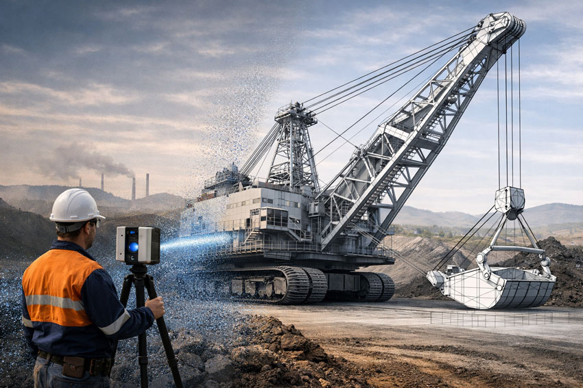
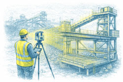
  • Engineering-grade 3D LiDAR scanning
  • Fabrication-ready documentation
  • Australian Standards-aligned detailing
  • Clear accountability from concept through to construction

If your project requires structural drafting that stands up to fabrication, construction, and long-term operation, we can help.


Need Structural Drafting Support?

If youโ€™re planning a new structure, upgrading an existing asset, or preparing fabrication documentation, contact Hamilton By Design to discuss how an engineering-led drafting approach can reduce risk and improve outcomes.

Name
Would you like us to arrange a phone consultation for you?
Address

Hunter Valley Laser Scanning | CAD-Ready SolidWorks & Inventor

Engineering-grade LiDAR scanning of a dragline at a Hunter Valley mine producing CAD-ready data for SolidWorks and Autodesk Inventor

Hunter Valley Laser Scanning | CAD-Ready SolidWorks & Inventor

Engineering-Grade 3D & LiDAR Scanning Built for SolidWorks & Autodesk Inventor

The Hunter Valley is home to critical mining, power generation, manufacturing, and heavy-industry assets. In these environments, laser scanning is only valuable if the data can be used directly in engineering design software.

At Hamilton By Design, we deliver Hunter Valley laser scanning services that are purpose-built for engineering workflows โ€” ensuring scan data can be reliably used in SolidWorks and Autodesk Inventor without rework, approximation, or loss of accuracy.


Why โ€œScan-Onlyโ€ Data Is a Problem

Many laser scanning services focus on data capture only. While the point cloud may look impressive, it often fails at the most important step:

Can the scan be used directly in CAD and engineering design?

If the answer is no, the scan has limited value.

Common issues with low-grade or technician-only scanning include:

  • Point clouds that are not registered or scaled correctly
  • Insufficient accuracy for mechanical design tolerances
  • Poor alignment to real-world coordinate systems
  • Data that cannot be reliably modelled in SolidWorks or Inventor
  • Extra time and cost spent โ€œfixingโ€ scan data before design can begin

Why would you spend money on a scan that cannot be used for engineering?


Engineer performing engineering-grade laser scanning of a dragline excavator at a Hunter Valley mine for SolidWorks and Autodesk Inventor design

Engineering-Grade Laser Scanning โ€” Designed for CAD Use

Hamilton By Design approaches laser scanning as an engineering input, not a visual deliverable.

Our Hunter Valley laser scanning services are planned and executed so that scan data can be:

  • Used directly in SolidWorks
  • Imported and referenced accurately in Autodesk Inventor
  • Modelled into fabrication-ready geometry
  • Trusted for mechanical, structural, and layout decisions

This means the scan is not the end product โ€” it is the foundation for engineering and design.


Why Scanner Capability Matters

Not all scanners โ€” or scanning providers โ€” are equal.

Low-accuracy or inappropriate scanning equipment can result in:

  • Global accuracy drift
  • Poor definition of critical interfaces
  • Inability to confidently model mating parts, pipework, or steelwork
  • Designs that โ€œlook rightโ€ on screen but fail on site

Hamilton By Design uses engineering-grade scanning equipment and workflows, ensuring the captured data supports:

  • Mechanical equipment upgrades
  • Structural modifications
  • Conveyor, chute, and platform design
  • Fabrication and installation planning

Hunter Valley Applications Where CAD-Ready Scans Matter

Mining & CHPP Upgrades

Laser scanning of conveyors, transfer stations, chutes, and structures that must integrate precisely with new mechanical equipment.

Power Generation & Utilities

Accurate capture of plant rooms, pipework, platforms, and access systems for compliance and upgrade works.

Manufacturing & Heavy Industry

Reliable spatial data to support machinery installation, relocation, and layout optimisation.

Brownfield Construction & Retrofits

Engineering-grade scans to avoid clashes, rework, and costly shutdown overruns.


Engineer-Led Scanning โ€” Not Just Data Capture

At Hamilton By Design, laser scanning is delivered by engineers who understand how the data will be used.

This ensures:

  • Scan resolution and accuracy are matched to design intent
  • Critical interfaces are captured correctly
  • Data integrates seamlessly with CAD workflows
  • Accountability is maintained from scan through to design and documentation

You donโ€™t just receive a point cloud โ€” you receive usable engineering data.


Deliverables That Engineers Can Actually Use

Depending on your project, we provide:

  • Registered, engineering-grade point clouds
  • CAD-ready reference data for SolidWorks and Inventor
  • Section views and alignment references
  • Models and drawings derived directly from scan data
  • Documentation suitable for fabrication and construction

Everything is scoped so the scan adds value immediately, not later after rework.


Hunter Valley Laser Scanning โ€” Designed to Be Used, Not Admired

Laser scanning should remove uncertainty, not create more work.

By ensuring scan data can be used directly in SolidWorks and Autodesk Inventor, Hamilton By Design helps Hunter Valley projects move from site capture to design, fabrication, and installation with confidence.

Hamilton By Design delivers engineering-grade laser scanning in the Hunter Valley โ€” built for real engineering outcomes, not just visualisation.

Contact us to discuss your Hunter Valley laser scanning requirements or arrange an engineering-led site scan.

Name
Would you like us to arrange a phone consultation for you?
Address

Reality Capture Sydney for Real Estate & Property Assets

Engineer using a LiDAR scanner to capture a Sydney harbour-front residential property with Sydney Harbour Bridge in the background

Reality Capture Sydney for Real Estate & Property Assets

High-Accuracy Digital Records and Premium Visual Context

Sydneyโ€™s real estate and commercial property market demands accurate information, clear presentation, and confidence in decision-making. Whether supporting leasing, refurbishment, due diligence, or long-term asset management, reality capture in Sydney provides property owners and managers with a reliable digital record of what exists today.

Hamilton By Design delivers professional reality capture services in Sydney, combining high-accuracy spatial data with high-end visual outputs suited to commercial and premium property assets.


Reality capture of a Sydney waterfront residential property using LiDAR scanning with harbour and bridge context

What Is Reality Capture for Real Estate?

In a property context, reality capture is the process of digitally recording buildings and spaces using advanced laser scanning and spatial capture technologies. The result is a dimensionally accurate digital representation of an asset that can be reused across multiple projects without repeated site visits.

Reality capture is commonly used across Sydney for:

  • Accurate existing-condition records
  • Leasing and tenancy planning
  • Commercial fit-outs and refurbishments
  • Asset documentation and compliance support
  • Due diligence during acquisition or divestment

Unlike traditional photography or basic floor plans, reality capture provides measurable, verifiable data that reduces uncertainty and risk.


High-End Capture of Sydneyโ€™s Harbour & Landmark Context

For premium assets, context matters. Hamilton By Design captures high-resolution reality capture imagery that includes Sydneyโ€™s built environment and surrounding landmark context, where appropriate.

This may include:

  • Harbour-front commercial buildings
  • Assets with views or proximity to Sydney Harbour
  • Visual context incorporating the Sydney Harbour Bridge
  • CBD and waterfront developments

These high-end visuals support investor presentations, leasing material, and executive-level decision-making, while remaining grounded in accurate spatial data.


Why Reality Capture Matters in Sydneyโ€™s Property Market

Sydney properties often involve:

  • High asset values
  • Live, occupied buildings
  • Tight refurbishment timeframes
  • Complex services and structural interfaces

Reality capture helps property stakeholders to:

โœ” Verify what exists before committing capital
โœ” Reduce surprises during refurbishments
โœ” Support consultants with reliable base information
โœ” Minimise disruption to tenants
โœ” Maintain a long-term digital record of the asset

For property owners and managers, this translates directly to reduced risk and better outcomes.


Typical Real Estate Applications

As-Built Property Records

Create accurate digital records where original drawings are missing, outdated, or unreliable.

Leasing & Tenancy Planning

Support test fits, space planning, and consultant coordination with trusted spatial data.

Refurbishment & Upgrade Projects

Capture existing conditions prior to works to reduce redesign, delays, and cost overruns.

Due Diligence & Asset Review

Provide clarity and confidence during acquisition, divestment, or asset reviews.


A Professional, Asset-Focused Approach

While many services focus on visual outputs alone, Hamilton By Design approaches reality capture from an asset and decision-support perspective. Our deliverables are:

  • Dimensionally reliable
  • Fit for professional use
  • Suitable for consultants and contractors
  • Appropriate for commercial and executive audiences

This ensures reality capture data can be relied upon when property decisions carry financial and contractual significance.


Deliverables to Suit Property Clients

Depending on your requirements, we can provide:

  • Registered point clouds
  • CAD-ready base files
  • Accurate spatial references
  • Section views and area verification
  • Digital records suitable for future upgrades

All outputs are tailored to the intended property use, not generic scanning deliverables.


Our clients:


Reality Capture Sydney โ€” Confidence for Property Decisions

Reality capture removes uncertainty from property decisions. By accurately capturing what exists today, Sydney property owners and managers can plan, lease, refurbish, and manage assets with confidence.

Hamilton By Design supports Sydney real estate and commercial property clients with professional reality capture services that combine accuracy, clarity, and premium presentation.

Contact Hamilton By Design to discuss your Sydney property or real estate reality capture requirements.

Name
Would you like us to arrange a phone consultation for you?
Address

Reality Capture Sydney

Engineer using a LiDAR scanner to capture a Sydney harbour-front residential property with Sydney Harbour Bridge in the background

Reality Capture Sydney | Property & Real Estate Services

Engineering-Grade LiDAR & Digital Reality Capture for the Built Environment

As Sydneyโ€™s construction, infrastructure, and industrial assets become more complex, traditional measurement methods are no longer sufficient. Reality capture has become a critical enabler for accurate planning, risk reduction, and confident project delivery across the built environment in Sydney.

Hamilton By Design provides engineering-grade reality capture services in Sydney, combining high-accuracy LiDAR laser scanning with practical engineering workflows to deliver reliable as-built data, digital twins, and construction-ready models.

Learn more about our Sydney scanning capability:
https://www.hamiltonbydesign.com.au/home/engineering-services/3d-scanning-sydney/3d-scanning-services-in-sydney/


What Is Reality Capture?

Reality capture is the process of digitally recording real-world assets using technologies such as:

  • LiDAR laser scanning
  • High-resolution spatial data capture
  • Registered point clouds
  • 3D models aligned to real geometry

The result is an accurate digital representation of existing conditions โ€” enabling engineers, designers, and constructors to work from a single source of truth rather than assumptions or outdated drawings.


Reality capture of a Sydney waterfront residential property using LiDAR scanning with harbour and bridge context

Why Reality Capture Matters in Sydney

Sydney projects frequently involve:

  • Live operational assets
  • Brownfield construction and upgrades
  • Tight construction tolerances
  • Complex interfaces between structural, mechanical, and architectural systems

Reality capture enables project teams to:

โœ” Verify existing conditions before design
โœ” Reduce rework and construction clashes
โœ” Improve coordination across disciplines
โœ” Accelerate approvals and decision-making
โœ” Improve safety by minimising site re-visits

This is particularly valuable across commercial buildings, transport infrastructure, industrial facilities, utilities, and large refurbishment projects.


Engineering-Led Reality Capture โ€” The Hamilton By Design Difference

At Hamilton By Design, reality capture is not treated as a standalone surveying task. Our services are engineer-led, ensuring the data captured is fit for downstream use in:

  • Mechanical and structural design
  • Construction coordination
  • Retrofit and upgrade works
  • Fabrication and installation planning

Our Sydney reality capture services integrate directly with CAD, BIM, and engineering documentation workflows โ€” ensuring accountability from scan through to design and delivery.


Typical Reality Capture Applications in Sydney

As-Built Documentation

Capture accurate as-built conditions for compliance, certification, handover, or future upgrades.

Construction & Refurbishment Projects

Scan existing buildings and structures prior to modifications, extensions, or adaptive reuse.

Industrial & Infrastructure Assets

Capture complex geometry such as plant rooms, pipework, platforms, and structural steel.

Digital Twins & Asset Records

Create reliable digital records that support ongoing asset management and lifecycle planning.


Deliverables Tailored to Project Needs

Depending on your scope, Hamilton By Design can provide:

  • Registered LiDAR point clouds
  • CAD-ready geometry
  • BIM-compatible models
  • Section views and reference drawings
  • Engineering drawings derived from scan data

All deliverables are issued to suit engineers, builders, asset owners, and project managers working across Sydney.


Hamilton By Design logo displayed on a blue tilted rectangle with a grey gradient background

Reality Capture Sydney โ€” Build with Confidence

Reality capture removes uncertainty from complex projects. By accurately capturing what exists today, project teams can design, coordinate, and construct with confidence tomorrow.

Hamilton By Design supports Sydney-based projects with engineering-grade reality capture, practical deliverables, and a deep understanding of how digital data is used in real construction and industrial environments.

Contact Hamilton By Design to discuss your Sydney reality capture requirements or arrange a site scan.

Name
Would you like us to arrange a phone consultation for you?
Address

3D Construction Scanning Darwin

Engineering-grade 3D laser scanner capturing Darwin port infrastructure, harbour assets, and urban skyline

Engineering-Grade LiDAR for Accurate As-Built & Construction Delivery

Construction projects in Darwin operate in a demanding environment โ€” tropical weather, remote logistics, accelerated schedules, and complex interfaces between structural, mechanical, and architectural elements. 3D construction scanning provides a reliable digital foundation to reduce risk, eliminate rework, and support confident decision-making throughout the project lifecycle.

Hamilton By Design delivers engineering-grade 3D construction scanning in Darwin, supporting contractors, engineers, builders, and asset owners with accurate spatial data, as-built models, and construction-ready documentation.

๐Ÿ‘‰ Learn more about our Darwin scanning capability:
https://www.hamiltonbydesign.com.au/3d-scanning-in-darwin/
https://www.hamiltonbydesign.com.au/home/engineering-services/3d-scanning-darwin/darwin-lidar-laser-scanning-services/


What Is 3D Construction Scanning?

3D construction scanning uses high-accuracy LiDAR laser scanners to capture the real-world geometry of construction sites, partially completed works, and existing assets. The output is a dense, survey-grade point cloud that can be used to create:

  • Accurate as-built drawings
  • BIM and digital twin models
  • Clash detection and coordination models
  • Verification of construction tolerances
  • Retrofit and upgrade designs

Unlike traditional tape or total-station methods, LiDAR captures millions of points per second, ensuring complex geometry is recorded correctly the first time.


Engineering-grade 3D laser scanner capturing Darwin port infrastructure, harbour assets, and urban skyline

Why 3D Construction Scanning Matters in Darwin

Construction in Darwin often involves:

  • Live brownfield sites
  • Remote or logistically constrained projects
  • Tight shutdown or installation windows
  • High consequences of dimensional errors

3D construction scanning enables:

โœ” Reduced rework and RFIs
โœ” Improved trade coordination
โœ” Accurate verification before fabrication
โœ” Faster design and approval cycles
โœ” Safer site data capture with minimal disruption

This is particularly valuable for industrial buildings, ports, power generation facilities, defence infrastructure, and commercial developments across the Northern Territory.


Typical Construction Applications

As-Built Verification

Confirm what has actually been built โ€” not what was assumed โ€” before handover, certification, or the next construction stage.

Construction Progress Capture

Document progress at key milestones to support planning, claims, and coordination.

Retrofit & Upgrade Projects

Capture existing structures accurately before mechanical, electrical, or structural upgrades commence.

Clash Detection & Coordination

Overlay scanned data with design models to identify clashes early and avoid costly site changes.


Hamilton By Design logo displayed on a blue tilted rectangle with a grey gradient background

Engineering-Led Scanning โ€” Not Just Data Capture

At Hamilton By Design, 3D construction scanning is delivered by engineers, not just scanning technicians. This means:

  • Scan strategies aligned to engineering outcomes
  • Data captured at appropriate accuracy for construction tolerances
  • Deliverables tailored for CAD, BIM, and fabrication workflows
  • Clear accountability from scan to design to documentation

Our scanning integrates directly with mechanical design, structural analysis, and construction documentation services โ€” providing a single source of truth for your project.


Deliverables to Suit Construction Teams

Depending on your requirements, we can provide:

  • Registered point clouds
  • CAD-ready models
  • Revit / BIM outputs
  • Section views and construction references
  • Engineering drawings derived from scan data

All deliverables are tailored to suit builders, engineers, subcontractors, and asset owners.


Our clients:


3D Construction Scanning Darwin โ€” Partner with Confidence

Whether you are delivering a new build, managing a complex refurbishment, or upgrading an existing facility, 3D construction scanning in Darwin provides the clarity and accuracy needed to build with confidence.

Hamilton By Design supports construction projects across Darwin and the Northern Territory with engineering-grade LiDAR scanning, practical deliverables, and real-world construction experience.

Let Connect us to discuss your project requirements or arrange a site scan.

Name
Would you like us to arrange a phone consultation for you?
Address