Mechanical Engineering Sydney Ports

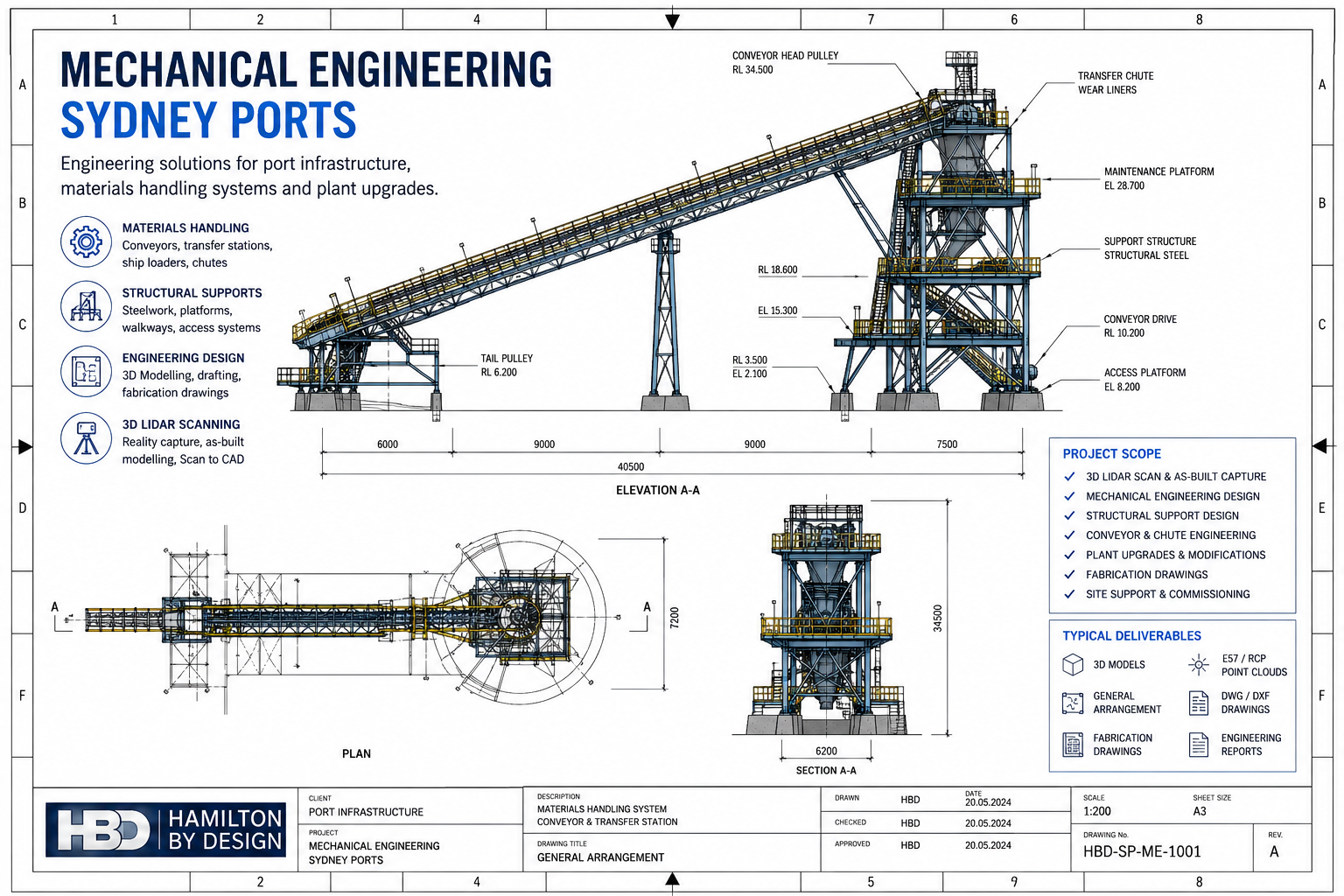
Mechanical Engineering Sydney Ports technical drawing showing conveyor systems, transfer stations, structural steel, materials handling infrastructure, 3D LiDAR scanning services and engineering deliverables by Hamilton By Design.

Mechanical Engineering Sydney Ports | Hamilton By Design

Blue 3D LiDAR scanner icon on a tripod with scanning waves

Sydney’s ports are critical infrastructure assets that support Australia’s import, export, logistics and maritime industries. Maintaining, upgrading and expanding port facilities requires practical mechanical engineering expertise capable of working within live operating environments while minimising disruption to ongoing operations.

Hamilton By Design provides mechanical engineering services for Sydney ports, marine terminals, bulk handling facilities, container terminals, wharves and associated industrial infrastructure. Our services support asset owners, port operators, contractors, manufacturers and maintenance teams requiring engineering solutions for materials handling systems, plant upgrades, structural modifications and brownfield developments.

Based in NSW and supporting projects throughout Sydney and regional Australia, we combine mechanical engineering, 3D LiDAR scanning, CAD design and engineering documentation to deliver practical, engineering-led outcomes.


Mechanical Engineering Services for Sydney Ports

Port facilities contain a wide range of mechanical systems that require ongoing maintenance, modification and improvement. Our engineering services are tailored to support both day-to-day operational requirements and major capital projects.

Typical services include:

  • Mechanical engineering design
  • Materials handling system design
  • Conveyor upgrades and modifications
  • Transfer chute design
  • Structural steel support design
  • Walkways, platforms and access systems
  • Equipment relocation projects
  • Plant upgrade engineering
  • Mechanical drafting and documentation
  • Reverse engineering of components
  • Engineering inspections and assessments
  • Brownfield infrastructure modifications
  • 3D LiDAR scanning and reality capture
  • Scan to CAD services
  • As-built documentation

Our experience across industrial and mining environments provides practical insight into maintaining operational facilities while delivering engineering improvements.


Industries and Port Infrastructure We Support

Sydney ports contain a diverse range of infrastructure requiring specialised engineering support.

We regularly assist with:

Bulk Materials Handling Facilities

  • Conveyor systems
  • Transfer stations
  • Ship loaders
  • Hopper systems
  • Stockpile conveyors
  • Materials handling equipment
  • Dust collection systems

Container Terminal Infrastructure

  • Container handling equipment
  • Mechanical support structures
  • Equipment foundations
  • Maintenance access systems
  • Service platforms

Marine and Wharf Facilities

  • Wharf structures
  • Mechanical services infrastructure
  • Pipework systems
  • Utility installations
  • Maintenance access platforms

Industrial Port Facilities

  • Warehouses
  • Processing plants
  • Storage facilities
  • Bulk liquid terminals
  • Manufacturing facilities
  • Logistics infrastructure

Engineering Design for Brownfield Port Facilities

Many Sydney port facilities have been operating for decades and contain limited or outdated engineering documentation.

Before modifications can commence, accurate information about existing conditions is essential.

Hamilton By Design specialises in engineering support for brownfield environments through:

  • Existing condition surveys
  • 3D LiDAR scanning
  • Point cloud capture
  • As-built modelling
  • Scan to CAD conversion
  • Equipment verification
  • Clash detection
  • Layout development

By capturing existing infrastructure before design begins, project risks can be significantly reduced while improving installation accuracy.


3D LiDAR Scanning and Mechanical Engineering

Modern engineering projects increasingly rely on accurate digital representations of existing facilities.

Our engineering team uses advanced 3D LiDAR scanning technology to capture:

  • Conveyors
  • Pipework
  • Structural steel
  • Transfer stations
  • Ship loading infrastructure
  • Equipment layouts
  • Processing plant assets
  • Mechanical services

The resulting point cloud data can be converted into engineering models and drawings used for:

  • Upgrade design
  • Retrofit projects
  • Structural modifications
  • Equipment replacements
  • Maintenance planning
  • Fabrication detailing

This approach reduces site rework, minimises clashes and improves project confidence.


Materials Handling Engineering

Materials handling systems form the backbone of many port operations.

Our mechanical engineering services include:

Conveyor System Design

We provide engineering support for:

  • New conveyor installations
  • Conveyor upgrades
  • Conveyor extensions
  • Transfer point modifications
  • Conveyor guarding
  • Structural support systems

Transfer Chute Design

Efficient transfer chutes are critical for reducing wear, dust generation and material spillage.

Services include:

  • Chute assessments
  • Flow analysis
  • Wear reduction solutions
  • Maintenance improvements
  • Upgrade concepts

Maintenance and Asset Improvement

Engineering support can assist with:

  • Reliability improvements
  • Equipment modifications
  • Replacement strategies
  • Asset life extension
  • Shutdown planning

Mechanical Drafting and Documentation

Clear engineering documentation is essential for fabrication, installation and maintenance activities.

Deliverables may include:

  • General arrangement drawings
  • Mechanical layouts
  • Fabrication drawings
  • Assembly drawings
  • Equipment models
  • Structural details
  • Site layouts
  • Installation drawings
  • CAD documentation

We work with commonly used engineering platforms including:

  • SolidWorks
  • Autodesk Inventor
  • AutoCAD
  • Autodesk ReCap
  • Navisworks

Typical Deliverables

Depending on project requirements, deliverables may include:

  • Mechanical engineering reports
  • Concept designs
  • Detailed engineering drawings
  • General arrangement drawings
  • CAD models
  • SolidWorks models
  • STEP files
  • DWG files
  • DXF files
  • Point cloud data
  • E57 files
  • RCP and RCS files
  • As-built documentation
  • Equipment layouts
  • Engineering recommendations

Our objective is to provide practical deliverables that can be directly used by project teams, fabricators and contractors.


Why Choose Hamilton By Design?

Hamilton By Design combines practical engineering experience with modern digital engineering technologies.

Our clients benefit from:

  • Mechanical engineering expertise
  • Engineering-led LiDAR scanning services
  • Brownfield project experience
  • Materials handling knowledge
  • Practical design solutions
  • Fast project mobilisation
  • Australia-wide support
  • Accurate engineering documentation

By combining engineering design with reality capture technologies, we help reduce project uncertainty while improving the quality of engineering outcomes.


Frequently Asked Questions

What mechanical engineering services do you provide for Sydney ports?

We provide engineering design, conveyor upgrades, materials handling engineering, plant modifications, structural support design, drafting and 3D LiDAR scanning services.

Can you scan existing port infrastructure before design work begins?

Yes. We provide engineering-grade 3D LiDAR scanning services to accurately capture existing facilities and create as-built models.

Do you work on operational port facilities?

Yes. Many projects are completed within live operational environments, allowing engineering work to be undertaken while minimising disruption.

Can you convert point clouds into CAD models?

Yes. Point cloud data can be converted into CAD drawings, SolidWorks models and engineering documentation.

Do you support conveyor upgrade projects?

Yes. We regularly assist with conveyor modifications, transfer chute improvements and materials handling upgrades.

Can you provide fabrication drawings?

Yes. Detailed fabrication and installation drawings can be produced where required.

What software do you use?

We commonly use SolidWorks, Autodesk Inventor, AutoCAD, Autodesk ReCap and Navisworks.

Do you provide Scan to CAD services?

Yes. We convert laser scan data into accurate engineering drawings and 3D models.

Do you work outside Sydney?

Yes. We support projects throughout NSW and Australia, including ports, mining operations, manufacturing facilities and industrial sites.

How do I obtain a quote?

Contact Hamilton By Design with your project requirements, available drawings and site information. We can then prepare a tailored proposal for your Sydney port engineering project.

Hamilton By Design logo displayed on a blue tilted rectangle with a grey gradient background

Contact Hamilton By Design

If you require Mechanical Engineering Sydney Ports services, Hamilton By Design can assist with engineering design, plant upgrades, materials handling systems, 3D LiDAR scanning, Scan to CAD and engineering documentation.

Contact our team today to discuss your Sydney port infrastructure project and obtain a tailored engineering solution.

Talk to Us – Contact Us

Name
Would you like us to arrange a phone consultation for you?
Address

Our clients:



3D LiDAR Scanning Darwin for engineering surveys, laser scanning, reality capture and point cloud modelling services
3D LiDAR Scanning Australia engineering services for laser scanning, reality capture, scan-to-CAD, Scan-to-BIM and as-built documentation across Australia
3D LiDAR scanning services on the Central Coast providing engineering-grade laser scanning, point cloud capture, scan-to-CAD modelling and industrial reality capture for infrastructure and industrial projects.

Scan to CAD Services for Sydney Ports

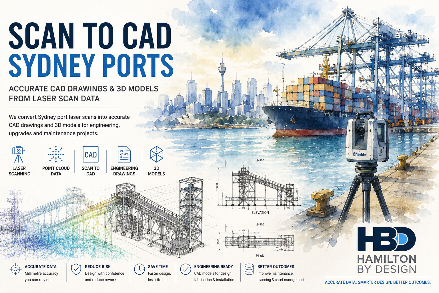
Scan to CAD Sydney Ports hero image showing Sydney Harbour port infrastructure, container terminal operations, LiDAR scanning equipment, point cloud data and engineering CAD models used for mechanical engineering, drafting and asset management projects.

Sydney’s ports and marine infrastructure are constantly evolving through maintenance programs, equipment upgrades, expansion projects and operational improvements. Accurate information about existing assets is essential for successful engineering design, fabrication and construction.

Hamilton By Design provides professional Scan to CAD services for Sydney ports, transforming laser scan and LiDAR point cloud data into accurate CAD drawings, 3D models and engineering documentation.

Our engineering-led approach ensures point cloud data is converted into practical deliverables that support mechanical engineering, drafting, fabrication, asset management and infrastructure upgrades.

Whether you require a simple as-built drawing or a complete 3D plant model, our Scan to CAD services provide accurate digital information that helps reduce project risk and improve engineering outcomes.


What is Scan to CAD?

Scan to CAD is the process of converting laser scan data into usable engineering drawings and 3D models.

Using point cloud data captured through terrestrial LiDAR scanning, engineers and drafters can create:

  • AutoCAD Drawings
  • General Arrangement Drawings
  • Plant Layouts
  • Structural Models
  • Mechanical Equipment Models
  • Pipework Models
  • As-Built Documentation
  • BIM Models
  • Digital Twin Assets

This process allows existing facilities to be accurately documented without relying on outdated or incomplete drawings.


Why Sydney Ports Require Scan to CAD Services

Many port facilities have been modified numerous times throughout their operational life.

Common challenges include:

  • Missing documentation
  • Outdated drawings
  • Unknown modifications
  • Congested infrastructure
  • Limited access areas
  • Restricted shutdown windows
  • Complex equipment layouts

By converting reality capture data into engineering-ready CAD models, project teams can work from accurate information that reflects actual site conditions.


Typical Sydney Port Infrastructure We Model

Container Terminals

We create CAD models and drawings for:

  • Container handling equipment
  • Crane support structures
  • Storage facilities
  • Maintenance workshops
  • Access infrastructure

Bulk Materials Handling Facilities

Our Scan to CAD services support:

  • Conveyors
  • Transfer stations
  • Chutes
  • Hoppers
  • Ship loaders
  • Stackers
  • Reclaimers

Marine Infrastructure

We can model:

  • Wharves
  • Jetties
  • Berths
  • Marine loading facilities
  • Access walkways
  • Structural steelwork

Industrial Plant Infrastructure

Including:

  • Pipework systems
  • Pump stations
  • Mechanical equipment
  • Structural steel
  • Maintenance platforms
  • Process infrastructure

Engineering Applications of Scan to CAD

Mechanical Engineering

Accurate CAD models provide the foundation for:

  • Equipment replacement projects
  • Plant upgrades
  • Retrofit design
  • Conveyor modifications
  • Maintenance planning
  • Shutdown engineering

Engineers can design around actual site conditions, reducing installation risks and minimising costly modifications.


Engineering Drafting

Point cloud data can be converted into:

  • Fabrication Drawings
  • General Arrangement Drawings
  • Layout Drawings
  • Equipment Drawings
  • Structural Steel Drawings
  • Installation Documentation

This allows engineering teams to produce reliable documentation from accurate site information.


Brownfield Engineering Projects

Scan to CAD is particularly valuable for brownfield projects where original drawings may no longer reflect existing conditions.

Benefits include:

  • Reduced site visits
  • Improved design accuracy
  • Clash detection
  • Better installation planning
  • Reduced construction risk

Shutdown Planning

Port shutdowns involve significant planning and coordination.

Accurate CAD models allow project teams to:

  • Verify clearances
  • Plan installations
  • Assess access requirements
  • Identify clashes
  • Improve shutdown efficiency

CAD Deliverables Available

Hamilton By Design can provide a range of engineering deliverables depending on project requirements.

2D Deliverables

  • AutoCAD Drawings
  • Floor Plans
  • Elevations
  • Sections
  • Layout Drawings
  • General Arrangement Drawings
  • As-Built Documentation

3D Deliverables

  • SolidWorks Models
  • Inventor Models
  • STEP Files
  • SAT Files
  • Parasolid Files
  • Plant Models

BIM Deliverables

  • Revit Models
  • IFC Models
  • Asset Information Models
  • Scan to BIM Models

Benefits of Scan to CAD for Sydney Port Projects

Accurate Engineering Information

CAD models are created directly from point cloud data, providing confidence that designs are based on actual site conditions.


Reduced Design Risk

Accurate models help identify clashes and installation issues before fabrication begins.


Faster Project Delivery

Engineering teams can begin work immediately without waiting for extensive site measurements.


Improved Asset Management

Accurate CAD documentation supports maintenance planning, inspections and future upgrades.


Better Project Outcomes

Reliable information results in improved decision making throughout the project lifecycle.


Why Choose Hamilton By Design?

Hamilton By Design combines:

  • Scan to CAD Services
  • 3D LiDAR Scanning
  • Mechanical Engineering
  • Engineering Drafting
  • Reverse Engineering
  • Scan to BIM
  • Asset Management Support

Unlike traditional drafting providers, we understand how engineering models are used throughout design, fabrication, installation and maintenance activities.

Our engineering-first approach ensures practical outcomes that support the long-term management and improvement of port infrastructure assets.


Sydney Port Facilities We Support

We provide Scan to CAD services throughout:

  • Port Botany
  • White Bay
  • Glebe Island
  • Sydney Harbour Industrial Facilities
  • Container Terminals
  • Bulk Handling Facilities
  • Marine Infrastructure Assets
  • Intermodal Freight Terminals

We also support projects throughout:

  • Sydney
  • Newcastle
  • Central Coast
  • Wollongong
  • Regional NSW
  • Australia-wide

Hamilton By Design logo displayed on a blue tilted rectangle with a grey gradient background

Need Scan to CAD Services for a Sydney Port Project?

Whether you require accurate as-built drawings, 3D plant models, mechanical engineering support or asset documentation, Hamilton By Design can convert your laser scan data into engineering-ready CAD deliverables.

Our Services Include:

โœ” Scan to CAD
โœ” 3D LiDAR Scanning
โœ” Mechanical Engineering
โœ” Engineering Drafting
โœ” Reverse Engineering
โœ” Scan to BIM
โœ” Digital Twin Development
โœ” Asset Documentation

Contact Hamilton By Design today to discuss your Sydney port infrastructure project and obtain a tailored proposal.

Talk to Us – Contact Us

Name
Would you like us to arrange a phone consultation for you?
Address

Our clients:



Frequently Asked Questions โ€“ Scan to CAD Sydney Ports

1. What is Scan to CAD and how is it used in Sydney ports?

Scan to CAD is the process of converting laser scan or LiDAR point cloud data into accurate 2D drawings and 3D CAD models. Sydney port operators use Scan to CAD for engineering design, maintenance planning, equipment upgrades and asset management projects.


2. What types of port infrastructure can be converted into CAD models?

Hamilton By Design can create CAD models of:

  • Container terminals
  • Wharves and jetties
  • Ship loaders
  • Conveyors
  • Chutes and hoppers
  • Pipework systems
  • Structural steelwork
  • Pump stations
  • Marine loading facilities
  • Industrial plant equipment

3. Why use Scan to CAD instead of traditional site measurements?

Scan to CAD uses millions of measured data points captured by LiDAR scanners, creating a far more detailed and accurate representation of existing conditions than traditional manual measurements.


4. What CAD deliverables can be produced from point cloud data?

Common deliverables include:

  • AutoCAD drawings
  • General arrangement drawings
  • Layout drawings
  • Structural steel models
  • Mechanical equipment models
  • Pipework models
  • Fabrication drawings
  • As-built documentation

5. Can Scan to CAD support brownfield port upgrades?

Yes. Scan to CAD is particularly valuable for brownfield projects where original drawings may be outdated, missing or no longer reflect actual site conditions. Accurate models help reduce design risks and improve project outcomes.


6. What file formats can Hamilton By Design provide?

We can provide deliverables in formats including:

  • DWG
  • DXF
  • STEP
  • SAT
  • Parasolid
  • SolidWorks
  • Inventor
  • IFC
  • Revit

Depending on project requirements.


7. How does Scan to CAD reduce engineering project risk?

Accurate CAD models allow engineers to verify dimensions, identify clashes, check clearances and develop designs based on actual site conditions. This reduces rework, installation issues and costly construction delays.


8. Can point cloud data be used for mechanical engineering projects?

Absolutely. Point cloud data provides the foundation for equipment upgrades, conveyor modifications, plant expansions, structural changes and reverse engineering projects commonly undertaken within Sydney ports.


9. Can Scan to CAD data be used for BIM and digital twin projects?

Yes. CAD models generated from laser scan data can be incorporated into BIM workflows, digital twin platforms, asset management systems and future infrastructure planning projects.


10. Why choose Hamilton By Design for Scan to CAD services in Sydney ports?

Hamilton By Design combines:

  • 3D LiDAR Scanning
  • Scan to CAD
  • Mechanical Engineering
  • Engineering Drafting
  • Reverse Engineering
  • Scan to BIM
  • Digital Twin Development

Unlike drafting-only providers, we understand how engineering models are used throughout design, fabrication, construction and maintenance, ensuring practical outcomes for port infrastructure projects.


3D LiDAR Scanning Services for Sydney Ports

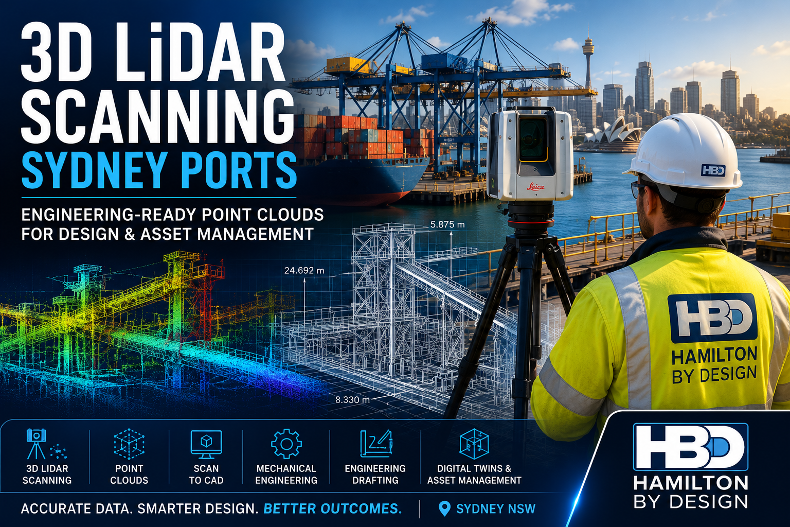
Engineer using 3D LiDAR scanner at Sydney port with container cranes, marine infrastructure and point cloud overlay for engineering design.

Sydney’s ports are critical gateways for Australia’s import, export and logistics industries. Facilities such as container terminals, bulk materials handling operations, fuel terminals, marine loading facilities and supporting infrastructure require accurate engineering information to support maintenance, upgrades and future expansion.

Hamilton By Design provides engineering-grade 3D LiDAR scanning services for Sydney ports, delivering highly accurate point cloud data for engineering design, drafting, asset management, digital twins and brownfield infrastructure projects.

Using advanced terrestrial LiDAR technology, we capture millions of measurement points across complex operating environments, creating detailed digital records that allow engineers, asset owners and project teams to make informed decisions with confidence.


What is 3D LiDAR Scanning?

LiDAR (Light Detection and Ranging) uses laser technology to accurately measure and record physical assets.

The result is a highly detailed point cloud, representing existing infrastructure in three dimensions. This digital dataset can be used for:

  • Mechanical engineering
  • Structural engineering
  • Engineering drafting
  • Scan to CAD workflows
  • Asset management
  • Digital twin development
  • BIM modelling
  • Shutdown planning
  • As-built verification

For ports and marine facilities, LiDAR scanning provides an efficient method of capturing accurate site information while reducing the need for repeat site visits.


Why Sydney Ports Use LiDAR Scanning

Many port facilities have evolved over decades through multiple upgrade projects, equipment replacements and operational modifications.

As a result, common challenges include:

  • Missing drawings
  • Outdated documentation
  • Inaccessible areas
  • Congested infrastructure
  • Unknown clearances
  • Limited shutdown windows
  • Safety restrictions

LiDAR scanning creates a complete digital record of the facility, allowing project teams to design around actual site conditions rather than assumptions.


Typical Sydney Port Assets We Scan

Container Terminals

We capture:

  • Container crane structures
  • Storage yards
  • Maintenance workshops
  • Container handling equipment
  • Access roads and infrastructure

Bulk Materials Handling Facilities

Our scanning services support:

  • Conveyors
  • Transfer stations
  • Ship loaders
  • Stackers
  • Reclaimers
  • Chutes and hoppers
  • Stockpile systems

Marine Infrastructure

LiDAR scanning is ideal for:

  • Wharves
  • Jetties
  • Berths
  • Loading facilities
  • Access walkways
  • Marine structures

Industrial Plant Assets

We regularly scan:

  • Pipework systems
  • Pump stations
  • Mechanical equipment
  • Structural steelwork
  • Maintenance platforms
  • Process infrastructure

Benefits of LiDAR Scanning for Port Engineering Projects

Accurate Site Capture

LiDAR scanning captures millions of survey-grade measurements to create a highly accurate representation of existing conditions.


Engineering-Ready Point Clouds

Data is delivered in formats suitable for engineering workflows including:

  • E57
  • RCP
  • RCS
  • LAS
  • LGS

Reduced Project Risk

Accurate site information reduces:

  • Design clashes
  • Installation issues
  • Site rework
  • Construction delays

Faster Engineering Design

Engineering teams can begin modelling and drafting immediately using accurate site information.


Improved Shutdown Planning

Detailed reality capture allows project teams to:

  • Plan work before mobilisation
  • Reduce site measurements
  • Minimise downtime
  • Improve installation efficiency

Engineering Applications

Mechanical Engineering

LiDAR scanning supports:

  • Equipment upgrades
  • Conveyor modifications
  • Plant expansions
  • Equipment replacement projects
  • Retrofit engineering

By designing around actual site conditions, engineers can reduce uncertainty and improve installation outcomes.


Engineering Drafting

Point cloud data can be converted into:

  • General arrangement drawings
  • Plant layouts
  • Fabrication drawings
  • Structural steel models
  • Equipment drawings
  • Installation documentation

Scan to CAD

Hamilton By Design can convert point cloud data into:

  • AutoCAD models
  • SolidWorks models
  • Inventor models
  • STEP files
  • As-built CAD documentation

This is particularly valuable when original drawings are unavailable or no longer accurate.


Asset Management & Digital Twins

Many port operators are implementing digital asset management systems.

LiDAR scanning provides the foundation for:

  • Digital twins
  • Asset registers
  • BIM models
  • Maintenance planning
  • Future upgrade projects

Engineering Deliverables

Depending on project requirements, Hamilton By Design can provide:

Point Cloud Deliverables

  • E57
  • RCP
  • RCS
  • LAS
  • LGS

CAD Deliverables

  • DWG
  • DXF
  • AutoCAD Models
  • Engineering Layouts

3D Models

  • SolidWorks
  • Inventor
  • STEP
  • Parasolid
  • SAT

BIM Deliverables

  • Revit Models
  • IFC Models
  • Scan to BIM Models
  • Asset Information Models

Why Choose Hamilton By Design?

Unlike many reality capture providers, Hamilton By Design combines:

  • 3D LiDAR Scanning
  • Mechanical Engineering
  • Engineering Drafting
  • Scan to CAD
  • Reverse Engineering
  • Structural Design Support
  • Digital Engineering Workflows

This engineering-first approach ensures that the information captured on site directly supports practical project outcomes.

Our team understands how point cloud data is used during engineering, design, fabrication and construction, enabling us to deliver solutions that reduce risk and improve project efficiency.


Sydney Port Locations We Support

We provide services throughout:

  • Port Botany
  • White Bay
  • Glebe Island
  • Sydney Harbour Industrial Facilities
  • Container Terminals
  • Bulk Handling Facilities
  • Intermodal Freight Terminals
  • Marine Infrastructure Assets

We also support projects throughout:

  • Sydney
  • Newcastle
  • Central Coast
  • Wollongong
  • Regional NSW
  • Australia-wide
Hamilton By Design logo displayed on a blue tilted rectangle with a grey gradient background

Need a 3D LiDAR Scanning Quote for a Sydney Port Project?

Whether you’re planning a brownfield upgrade, shutdown project, asset management program or engineering design activity, Hamilton By Design can provide accurate, engineering-grade reality capture services tailored to your project requirements.

Our Sydney Port Services Include:

โœ” 3D LiDAR Scanning
โœ” Terrestrial Laser Scanning
โœ” Scan to CAD
โœ” Mechanical Engineering
โœ” Engineering Drafting
โœ” Reverse Engineering
โœ” Scan to BIM
โœ” Digital Twin Development

Contact Hamilton By Design to discuss your Sydney port infrastructure project and obtain a tailored proposal.

Talk to Us – Contact Us

Name
Would you like us to arrange a phone consultation for you?
Address

Our clients:


Frequently Asked Questions โ€“ 3D LiDAR Scanning Sydney Ports

1. What is 3D LiDAR scanning and how is it used in Sydney ports?

3D LiDAR scanning uses laser technology to capture millions of accurate measurements of existing infrastructure. In Sydney ports, it is used to document container terminals, wharves, conveyors, ship loaders, pipework and marine facilities for engineering, maintenance and upgrade projects.


2. What are the benefits of LiDAR scanning for port infrastructure projects?

LiDAR scanning provides accurate as-built information, reduces site visits, improves engineering design accuracy, minimises project risk and helps prevent costly rework during construction and shutdown activities.


3. What types of Sydney port assets can be scanned?

Hamilton By Design can scan a wide range of infrastructure including:

  • Container terminals
  • Wharves and jetties
  • Ship loaders
  • Conveyors
  • Chutes and hoppers
  • Pipework systems
  • Structural steelwork
  • Pump stations
  • Marine loading facilities
  • Maintenance platforms

4. How accurate is 3D LiDAR scanning?

Engineering-grade LiDAR scanning can achieve millimetre-level accuracy. Typical registered point cloud datasets for industrial facilities are suitable for mechanical engineering, drafting, Scan to CAD and BIM workflows.


5. Can LiDAR scanning be performed while a port remains operational?

Yes. Many scanning projects are completed during normal operations, maintenance periods or scheduled shutdowns. The scanning process is non-contact and can often be completed with minimal disruption to operations.


6. What deliverables can be produced from a LiDAR scanning project?

Deliverables may include:

  • E57 Point Clouds
  • RCP and RCS Files
  • AutoCAD Drawings
  • SolidWorks Models
  • STEP Files
  • General Arrangement Drawings
  • Scan to BIM Models
  • Asset Information Models

7. How does LiDAR scanning support mechanical engineering projects?

LiDAR scanning provides accurate dimensional data that engineers can use to design replacement equipment, upgrade conveyors, modify structures, assess clearances and plan brownfield engineering projects with confidence.


8. Can point cloud data be converted into CAD models?

Yes. Hamilton By Design provides Scan to CAD services, converting point cloud data into accurate 2D drawings and 3D models suitable for engineering design, drafting, fabrication and asset management.


9. Is LiDAR scanning suitable for digital twin and asset management projects?

Absolutely. LiDAR scanning forms the foundation of many digital twin initiatives by creating accurate digital representations of physical assets that can be used for maintenance planning, inspections, upgrades and future development projects.


10. Why choose Hamilton By Design for Sydney port LiDAR scanning?

Hamilton By Design combines:

  • 3D LiDAR Scanning
  • Mechanical Engineering
  • Engineering Drafting
  • Scan to CAD
  • Reverse Engineering
  • Digital Twin Development

Unlike survey-only providers, we understand how scan data is used throughout the engineering lifecycle, delivering practical outcomes for Sydney port operators, engineering consultants and infrastructure asset owners.


3D Scanning Services for Sydney Ports and Marine Infrastructure

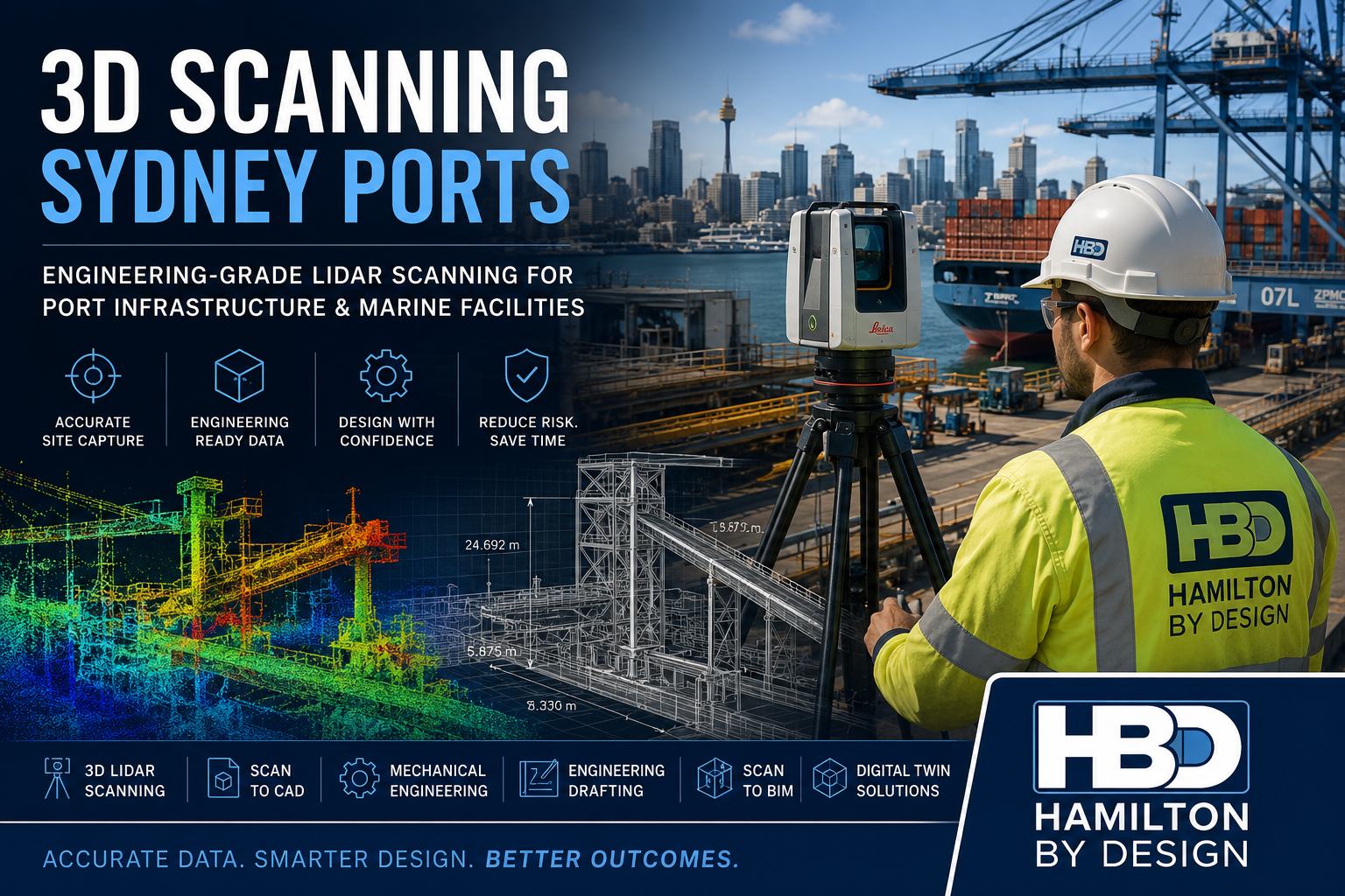
Engineer performing terrestrial LiDAR scanning at Sydney port infrastructure with container cranes, marine facilities and digital point cloud modelling for engineering design and asset management.

3D Scanning Sydney Ports | Engineering LiDAR Scanning Services


Sydney is home to some of Australia’s busiest maritime and logistics facilities. From container terminals and bulk materials handling infrastructure through to wharves, jetties, ship loading facilities and industrial port assets, accurate site information is critical when planning upgrades, maintenance activities and engineering projects.

Hamilton By Design provides engineering-grade 3D scanning services for Sydney ports, delivering accurate reality capture data that supports mechanical engineering, drafting, structural design, Scan to CAD, asset management and brownfield infrastructure upgrades.

Using advanced terrestrial LiDAR scanning technology, we capture existing conditions quickly and safely, producing highly detailed point cloud data that can be converted into engineering deliverables including:

  • 3D CAD Models
  • AutoCAD Drawings
  • General Arrangement Drawings
  • Scan to BIM Models
  • Structural Steel Models
  • Mechanical Equipment Models
  • Plant Layouts
  • As-Built Documentation
  • Digital Twin Models

Our engineering-led approach means the scan data is collected with the end engineering outcome in mind.


Why Sydney Ports Require Accurate 3D Scanning

Port infrastructure is continually evolving.

Container terminals, bulk handling facilities, fuel terminals, intermodal logistics hubs and marine infrastructure are frequently upgraded to accommodate increasing throughput, changing equipment requirements and modern safety standards.

One of the largest challenges facing engineering teams is obtaining reliable information about existing assets.

Common issues include:

  • Outdated drawings
  • Missing documentation
  • Multiple undocumented modifications
  • Restricted site access
  • Shutdown constraints
  • Safety requirements
  • Complex pipework and structures
  • Congested operating environments

Engineering-grade 3D scanning provides an accurate digital representation of existing conditions, allowing projects to progress with confidence.


Typical Sydney Port Infrastructure We Scan

Hamilton By Design regularly supports industrial and infrastructure environments where accurate site data is essential.

Typical assets include:

Container Terminals

  • Container handling equipment
  • Crane support structures
  • Container storage areas
  • Access roads
  • Maintenance workshops

Bulk Materials Handling Facilities

  • Conveyors
  • Transfer stations
  • Chutes
  • Hoppers
  • Loading facilities
  • Stockpile infrastructure

Marine Infrastructure

  • Wharves
  • Jetties
  • Berths
  • Mooring structures
  • Marine loading arms
  • Access walkways

Industrial Port Assets

  • Pipework systems
  • Pump stations
  • Mechanical equipment
  • Structural steelwork
  • Maintenance platforms
  • Access structures

Engineering Applications of 3D Scanning in Sydney Ports

The value of a high-quality scan extends far beyond simple surveying.

Our clients use scan data to support a wide range of engineering activities.

Mechanical Engineering

3D scanning enables engineers to:

  • Verify existing plant dimensions
  • Design replacement equipment
  • Check equipment clearances
  • Plan shutdown activities
  • Validate installation requirements
  • Develop retrofit solutions

Mechanical engineering projects can proceed with confidence knowing the design is based on actual site conditions.


Scan to CAD

Point cloud data can be converted into:

  • AutoCAD layouts
  • Equipment drawings
  • Structural steel models
  • Plant layouts
  • Detailed engineering documentation

This provides accurate engineering information where original drawings may no longer exist.


Brownfield Design Projects

Many Sydney port facilities have been operating for decades.

Over time, modifications can create significant discrepancies between drawings and reality.

3D scanning provides:

  • Accurate as-built verification
  • Clash detection
  • Installation planning
  • Design validation
  • Reduced project risk

Shutdown Planning

Port shutdowns are expensive and highly planned events.

Accurate site data allows engineering teams to:

  • Complete design work before site mobilisation
  • Reduce field measurements
  • Minimise rework
  • Improve installation certainty
  • Reduce shutdown durations

Benefits of Engineering-Grade LiDAR Scanning

Improved Accuracy

Laser scanning captures millions of measurement points, creating a highly accurate representation of existing conditions.

Reduced Site Visits

Comprehensive data capture reduces the need for repeat site attendance.

Improved Safety

Site exposure can be significantly reduced by using digital site information during design development.

Faster Project Delivery

Design teams can begin work sooner with accurate information available immediately after processing.

Better Project Outcomes

Improved information leads to improved engineering decisions.


Deliverables Available

Hamilton By Design can provide deliverables tailored to project requirements.

Common outputs include:

Point Cloud Deliverables

  • E57
  • RCP
  • RCS
  • LAS
  • LGS

CAD Deliverables

  • DWG
  • DXF
  • AutoCAD Models
  • Layout Drawings

3D Models

  • SolidWorks
  • Inventor
  • STEP
  • SAT
  • Parasolid

BIM Deliverables

  • Revit Models
  • Scan to BIM
  • Asset Information Models
  • Digital Twin Foundations

Why Choose Hamilton By Design?

Unlike survey-only providers, Hamilton By Design combines:

  • Mechanical Engineering
  • Engineering Drafting
  • 3D LiDAR Scanning
  • Scan to CAD
  • Reverse Engineering
  • Structural Detailing
  • Industrial Design Support

This allows us to understand not only how to capture data but how that information will be used during engineering and construction activities.

Our team has supported projects throughout Australia across:

  • Ports
  • Mining
  • Materials Handling
  • Manufacturing
  • Water Infrastructure
  • Industrial Processing Plants
  • Energy Facilities

Sydney Port Scanning Services

We support projects across:

  • Port Botany
  • White Bay
  • Glebe Island
  • Sydney Harbour Industrial Facilities
  • Intermodal Freight Terminals
  • Bulk Handling Facilities
  • Container Terminals
  • Marine Infrastructure Assets

We also support engineering projects throughout:

  • Sydney
  • Newcastle
  • Central Coast
  • Wollongong
  • Regional NSW
  • Australia-wide industrial facilities

Hamilton By Design logo displayed on a blue tilted rectangle with a grey gradient background

Need a 3D Scanning Quote for a Sydney Port Project?

Whether you require accurate site capture for a brownfield upgrade, mechanical engineering project, shutdown planning exercise or Scan to CAD workflow, Hamilton By Design can provide engineering-grade LiDAR scanning services tailored to your project requirements.

Our services include:

โœ“ 3D LiDAR Scanning
โœ“ Terrestrial Laser Scanning
โœ“ Scan to CAD
โœ“ Mechanical Engineering
โœ“ Engineering Drafting
โœ“ Reverse Engineering
โœ“ Scan to BIM
โœ“ Asset Capture & Digital Twin Development

Contact Hamilton By Design today to discuss your Sydney port infrastructure project and obtain a tailored proposal.

Talk to Us – Contact Us

Name
Would you like us to arrange a phone consultation for you?
Address

Our clients:
Frequently Asked Questions โ€“ 3D Scanning Sydney Ports

1. What is 3D scanning and how is it used in Sydney ports?

3D scanning uses LiDAR technology to capture millions of accurate measurement points from existing infrastructure. In Sydney ports, it is commonly used to document wharves, conveyors, ship loaders, pipelines, structural steelwork and terminal facilities for engineering and design projects.


2. What types of port infrastructure can be scanned?

Hamilton By Design can scan a wide range of port assets including:

  • Container terminals
  • Bulk materials handling facilities
  • Conveyors
  • Transfer stations
  • Wharves and jetties
  • Structural steelwork
  • Pipework systems
  • Pump stations
  • Ship loading equipment
  • Maintenance platforms
  • Marine infrastructure

3. How accurate is LiDAR scanning for engineering projects?

Engineering-grade terrestrial LiDAR scanning typically achieves millimetre-level accuracy. Depending on project requirements, scan registration accuracy is commonly within ยฑ5 mm to ยฑ10 mm across large industrial facilities.


4. Can 3D scanning be completed while a port remains operational?

Yes. Most scanning projects can be undertaken during normal operations, planned maintenance periods or shutdowns. This minimises disruption while providing comprehensive site data for engineering teams.


5. What deliverables can be produced from a port scanning project?

Deliverables may include:

  • E57 point clouds
  • RCP and RCS files
  • AutoCAD drawings
  • 3D CAD models
  • SolidWorks models
  • STEP files
  • General arrangement drawings
  • Scan to BIM models
  • As-built documentation

6. How does 3D scanning reduce engineering project risk?

Accurate site data helps eliminate assumptions and reduces the likelihood of design clashes, installation issues and costly rework. Engineers can design directly from verified site conditions rather than relying on outdated drawings.


7. Can laser scan data be converted into CAD drawings?

Yes. Hamilton By Design provides Scan to CAD services that convert point cloud data into:

  • Floor plans
  • Elevations
  • Sections
  • Equipment layouts
  • Structural steel models
  • Mechanical engineering drawings

8. What are the benefits of 3D scanning for port shutdown planning?

3D scanning allows engineering teams to:

  • Capture existing conditions before shutdowns
  • Reduce field measurements
  • Improve installation planning
  • Identify clashes early
  • Minimise shutdown durations
  • Improve project execution

9. Can 3D scanning support digital twin and BIM projects?

Yes. Laser scan data provides the foundation for digital twin and BIM workflows. Accurate models can be created for asset management, maintenance planning, future upgrades and operational optimisation.


10. Why choose Hamilton By Design for Sydney port scanning projects?

Hamilton By Design combines:

  • Engineering-grade LiDAR scanning
  • Mechanical engineering expertise
  • Engineering drafting services
  • Scan to CAD capability
  • Reverse engineering experience
  • Brownfield industrial project experience

Unlike survey-only providers, we understand how scan data is used throughout the engineering, design, fabrication and construction process, helping deliver practical outcomes for port infrastructure projects.


Scan to BIM Sydney

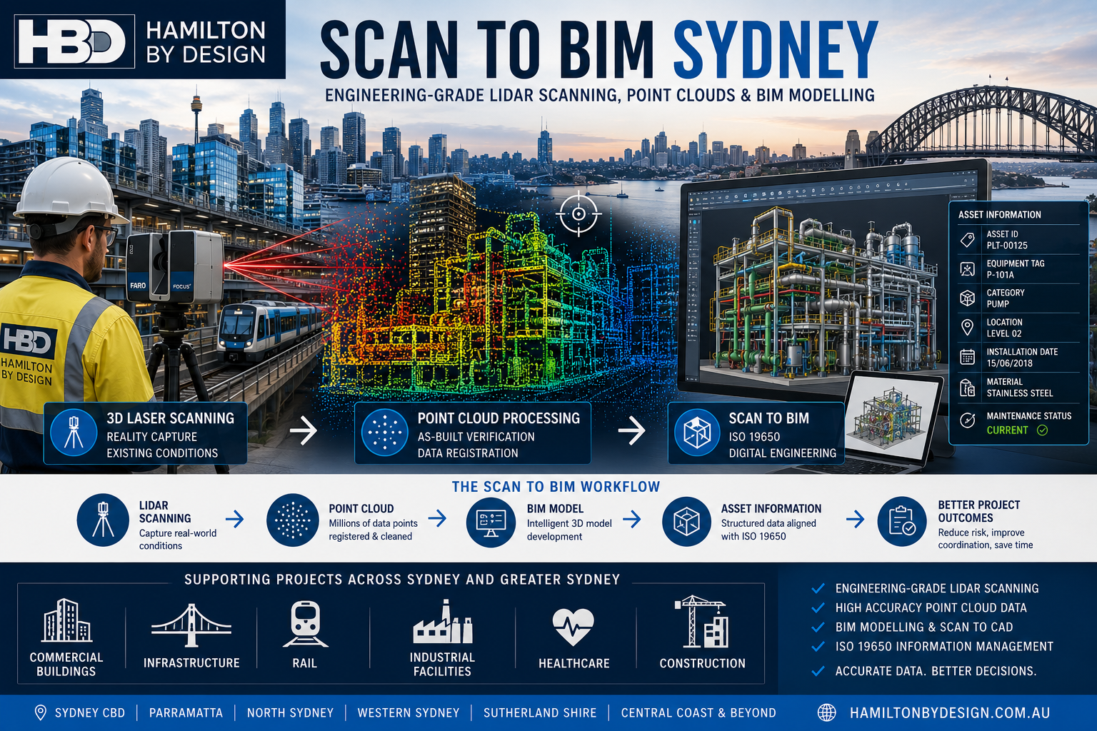
Scan to BIM Sydney infographic showing LiDAR laser scanning, point cloud processing and BIM modelling workflow for Sydney commercial, infrastructure and industrial projects using ISO 19650 information management principles.

Engineering-Grade Reality Capture and BIM Modelling

Sydney is Australia’s largest construction, infrastructure and commercial property market. From high-rise developments and transport infrastructure to hospitals, industrial facilities and heritage buildings, project teams increasingly rely on accurate digital information to reduce risk and improve project outcomes.

Scan to BIM Sydney combines advanced 3D laser scanning, LiDAR technology and Building Information Modelling (BIM) to create accurate digital representations of existing assets. The result is a reliable foundation for design, construction, maintenance and asset management decisions.

At Hamilton By Design, Scan to BIM is delivered from an engineering perspective, ensuring that models are developed to support real project requirements rather than simply producing visual geometry.


What is Scan to BIM?

Scan to BIM is the process of capturing existing conditions using high-accuracy laser scanning equipment and converting the resulting point cloud data into intelligent BIM models.

The process typically includes:

  • 3D Laser Scanning and LiDAR Capture
  • Point Cloud Registration
  • Existing Condition Surveys
  • Scan to CAD Conversion
  • BIM Model Development
  • As-Built Verification
  • Asset Information Management
  • Design Coordination and Clash Detection

The final BIM model provides a detailed and measurable representation of the real-world asset.


Why Sydney Projects Use Scan to BIM

Many Sydney assets have undergone multiple modifications over decades. Original drawings are often incomplete, outdated or unavailable.

Scan to BIM helps project teams overcome these challenges by providing:

Improved Accuracy

Laser scanning captures millions of measurements in a matter of minutes, creating an accurate record of existing conditions.

Reduced Project Risk

Accurate as-built information reduces design assumptions and minimises costly rework during construction.

Better Coordination

Architects, engineers, contractors and asset owners can work from a common source of information.

Faster Project Delivery

Reliable digital data allows design teams to progress more efficiently and with greater confidence.

Enhanced Safety

Understanding existing conditions before commencing work helps identify potential hazards and access constraints.


Applications of Scan to BIM in Sydney

Hamilton By Design supports a wide range of industries and project types across Sydney and Greater Sydney.

Commercial Buildings

  • Office towers
  • Shopping centres
  • Mixed-use developments
  • Building refurbishments
  • Property management

Infrastructure

  • Rail facilities
  • Transport interchanges
  • Utility assets
  • Water treatment facilities
  • Public infrastructure projects

Industrial Facilities

  • Manufacturing plants
  • Warehouses
  • Processing facilities
  • Bulk materials handling systems
  • Distribution centres

Healthcare and Education

  • Hospitals
  • Medical centres
  • Universities
  • Schools
  • Research facilities

Heritage Buildings

Laser scanning provides a non-contact method of accurately documenting complex heritage structures while preserving historical integrity.


Engineering-Led Scan to BIM

A successful Scan to BIM project requires more than simply converting a point cloud into a model.

Engineering considerations include:

  • Required level of detail (LOD)
  • Asset criticality
  • Intended use of the model
  • Data accuracy requirements
  • Information classification
  • Future maintenance requirements

Hamilton By Design applies engineering knowledge throughout the process to ensure the final BIM model supports operational and project objectives.


Scan to BIM and ISO 19650

Modern BIM projects increasingly require structured information management.

The international standard ISO 19650 provides a framework for managing information throughout the asset lifecycle.

By aligning Scan to BIM workflows with ISO 19650 principles, organisations can improve:

  • Information quality
  • Document control
  • Asset data consistency
  • Collaboration between stakeholders
  • Long-term asset management outcomes

For further information, read:

๐Ÿ‘‰ ISO 19650, Scan to BIM and Information Management


Academic Perspective on Scan to BIM

While Scan to BIM offers significant benefits, organisations should also understand its limitations, implementation challenges and future development pathways.

For a detailed academic discussion, including the advantages, disadvantages and future direction of Scan to BIM technologies, refer to:

๐Ÿ‘‰ Scan to BIM Academic Review


Typical Scan to BIM Workflow

1. Site Capture

High-accuracy LiDAR scanning is performed across the project area.

2. Point Cloud Processing

Individual scans are registered into a unified point cloud dataset.

3. Data Review

The point cloud is reviewed and validated against project requirements.

4. BIM Development

The point cloud is converted into BIM geometry and asset information.

5. Quality Assurance

Models are checked against project specifications and accuracy requirements.

6. Information Delivery

The final BIM deliverables are provided for design, construction or asset management use.


Scan to BIM Sydney Services

Hamilton By Design supports projects throughout:

  • Sydney CBD
  • Western Sydney
  • Parramatta
  • Liverpool
  • Penrith
  • North Sydney
  • Chatswood
  • Macquarie Park
  • Sutherland Shire
  • Newcastle and Hunter Region
  • Central Coast

Services include:

  • Engineering-Grade LiDAR Scanning
  • Scan to BIM
  • Scan to CAD
  • Point Cloud Processing
  • As-Built Modelling
  • Structural Modelling
  • Mechanical Plant Modelling
  • Asset Information Capture
  • Digital Engineering Support

Why Choose Hamilton By Design?

Hamilton By Design combines practical engineering experience with advanced reality capture technology.

Our approach focuses on delivering information that can be used by engineers, project managers, contractors and asset owners to make better decisions throughout the asset lifecycle.

Whether supporting a commercial building upgrade, industrial facility expansion, transport infrastructure project or digital asset management initiative, our Scan to BIM services provide a reliable foundation for project success.


Hamilton By Design logo displayed on a blue tilted rectangle with a grey gradient background

Contact Hamilton By Design


Looking for Scan to BIM Sydney services?

Hamilton By Design provides engineering-grade LiDAR scanning, point cloud processing, Scan to CAD and BIM modelling services across Sydney, Greater Sydney and regional New South Wales.

Accurate Data. Better Design. Safer Construction. Smarter Asset Management.

Name
Would you like us to arrange a phone consultation for you?
Address

Academic Review

Australian Drafting logo featuring bold white text reading "Australian Drafting" centred on a blue rounded rectangle background.
Engineering Governance title graphic featuring bold white text reading "Engineering Governance" centred on a blue rounded rectangle background.
Mechanical, Structural & Pipework Drafting service banner by Hamilton By Design featuring white text on a blue background.
Mechanical engineering services
Blue rounded button with the text โ€œSolidWorks Designโ€ in white.
Finite Element Analysis (FEA) engineering simulation button
3D LiDAR Scanning Darwin for engineering surveys, laser scanning, reality capture and point cloud modelling services
3D LiDAR Scanning Australia engineering services for laser scanning, reality capture, scan-to-CAD, Scan-to-BIM and as-built documentation across Australia
3D LiDAR scanning services on the Central Coast providing engineering-grade laser scanning, point cloud capture, scan-to-CAD modelling and industrial reality capture for infrastructure and industrial projects.
3D LiDAR Scanning Perth for engineering surveys, laser scanning, reality capture and point cloud modelling services
3D LiDAR Scanning Sydney for engineering surveys, laser scanning, reality capture and point cloud modelling services
3D LiDAR Scanning Brisbane for engineering surveys, laser scanning, reality capture and point cloud modelling services
3D LiDAR Scanning Canberra for engineering surveys, laser scanning, reality capture and point cloud modelling services
3D LiDAR Scanning Newcastle for engineering surveys, laser scanning, reality capture and point cloud modelling services
3D LiDAR Scanning Adelaide for engineering surveys, laser scanning, reality capture and point cloud modelling services
3D LiDAR Scanning Darwin for engineering surveys, laser scanning, reality capture and point cloud modelling services
3D LiDAR Scanning Australia engineering services for laser scanning, reality capture, scan-to-CAD, Scan-to-BIM and as-built documentation across Australia
3D LiDAR scanning services on the Central Coast providing engineering-grade laser scanning, point cloud capture, scan-to-CAD modelling and industrial reality capture for infrastructure and industrial projects.

Automated Object Recognition from Point Clouds | AI-Assisted Scan-to-BIM Workflows

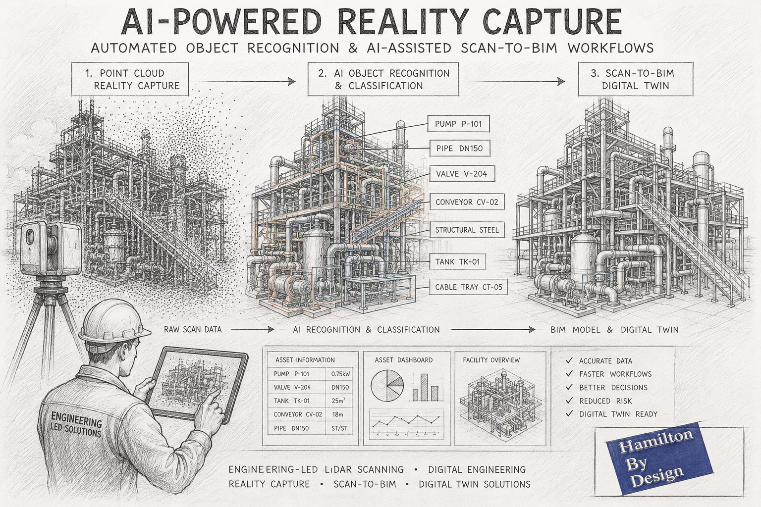
AI-assisted Scan-to-BIM workflow illustrated as a pencil sketch showing an industrial processing plant progressing from LiDAR point cloud capture through automated object recognition to a completed BIM digital twin model.

Automated Object Recognition from Point Clouds and AI-Assisted Scan-to-BIM Workflows

How Artificial Intelligence is Transforming Reality Capture and Digital Engineering

The reality capture industry is experiencing a significant transformation. While terrestrial LiDAR scanning, laser scanning and photogrammetry have been widely adopted across mining, manufacturing, construction and infrastructure sectors for many years, the emergence of Artificial Intelligence (AI) is fundamentally changing how point cloud data is processed and utilised.

Traditionally, converting a point cloud into useful engineering information required substantial manual effort. Engineers, designers and BIM technicians would spend hundreds of hours identifying equipment, tracing pipework, modelling structures and generating asset information from raw scan data.

Today, advances in automated object recognition and AI-assisted Scan-to-BIM workflows are reducing these manual processes and opening new opportunities for asset owners, engineering consultants and project teams.

At Hamilton By Design, we continue to monitor and evaluate emerging AI technologies while combining them with engineering-led reality capture workflows to deliver practical outcomes for industrial and infrastructure projects throughout Australia.


What is Automated Object Recognition?

Automated object recognition refers to the ability of software systems to identify and classify objects within a point cloud automatically.

Instead of manually examining millions or billions of points, AI algorithms analyse geometric patterns, spatial relationships, colours and textures to determine what each object represents.

For example, AI systems may automatically identify:

  • Structural steel members
  • Pipework systems
  • Valves
  • Pumps
  • Conveyors
  • Electrical equipment
  • Cable trays
  • Tanks and vessels
  • Building columns
  • Walls and floors
  • Doors and windows
  • Handrails and platforms
  • Mechanical equipment

The objective is to transform unstructured point cloud data into structured engineering information.

This allows project teams to move from raw scan data to usable digital assets much faster than traditional modelling methods.


Understanding Point Clouds

A point cloud is a collection of millions or billions of measured points captured using:

  • Terrestrial LiDAR scanners
  • Mobile mapping systems
  • Drone LiDAR systems
  • Photogrammetry
  • Structured light scanners
  • Handheld scanning systems

Each point contains spatial coordinates representing a physical location in the real world.

Modern scanners can capture:

  • Plant rooms
  • Industrial facilities
  • Processing plants
  • Mining infrastructure
  • Commercial buildings
  • Manufacturing equipment
  • Transport infrastructure
  • Refineries and smelters

The challenge has never been collecting data.

The challenge is turning that data into engineering information.

This is where AI is beginning to provide significant value.


Why Traditional Point Cloud Processing is Time Consuming

Historically, engineering teams have relied on manual modelling workflows.

A typical process might involve:

  1. Capturing scan data
  2. Registering point clouds
  3. Cleaning noise
  4. Importing into CAD or BIM software
  5. Identifying equipment manually
  6. Modelling structures
  7. Modelling pipework
  8. Generating asset information
  9. Producing drawings and deliverables

For complex facilities such as mines, smelters, power stations and manufacturing plants, this work can require hundreds or even thousands of engineering hours.

Although highly accurate, these workflows can be expensive and time intensive.


How AI is Changing Reality Capture

Artificial Intelligence is introducing a new layer of automation.

Modern AI systems can learn from vast datasets of industrial and architectural objects.

Rather than simply displaying a point cloud, AI attempts to understand what the data represents.

Examples include:

Pipe Recognition

AI algorithms can automatically identify cylindrical features and classify them as pipework.

Software can estimate:

  • Pipe centre lines
  • Pipe diameters
  • Connections
  • Elbows
  • Tees
  • Reducers

Structural Steel Recognition

Machine learning systems can identify:

  • Universal beams
  • Columns
  • Channels
  • Angles
  • Bracing members

This can accelerate structural modelling workflows.

Equipment Classification

AI systems are increasingly capable of identifying:

  • Pumps
  • Motors
  • Gearboxes
  • Tanks
  • Vessels
  • Heat exchangers

Although verification is still required, the process can dramatically reduce manual modelling time.

Building Element Recognition

For architectural and BIM applications, AI can automatically detect:

  • Walls
  • Floors
  • Ceilings
  • Doors
  • Windows
  • Roof systems

This enables faster generation of BIM models.


What is AI-Assisted Scan-to-BIM?

Scan-to-BIM is the process of converting reality capture data into Building Information Models.

Traditionally, BIM technicians manually created geometry based on point cloud information.

AI-assisted Scan-to-BIM introduces automated recognition tools that accelerate this process.

The workflow generally follows:

Step 1 โ€“ Reality Capture

A facility is scanned using terrestrial LiDAR technology.

Hamilton By Design typically captures:

  • Industrial facilities
  • Manufacturing plants
  • Mining infrastructure
  • Commercial buildings
  • Mechanical plant rooms
  • Process facilities

Step 2 โ€“ Point Cloud Registration

Individual scans are combined into a single registered dataset.

The result becomes a complete digital representation of the facility.

Step 3 โ€“ AI Object Recognition

Artificial Intelligence analyses the point cloud.

Potential objects are automatically identified and classified.

Step 4 โ€“ BIM Generation

Recognised objects are converted into BIM components.

This may include:

  • Structural members
  • Architectural features
  • Mechanical equipment
  • Pipework
  • Services

Step 5 โ€“ Engineering Verification

Engineers and BIM specialists verify the results.

This remains one of the most important stages.

AI can accelerate workflows, but engineering judgement remains essential.

Step 6 โ€“ Digital Twin Development

The resulting BIM model can support:

  • Asset management
  • Facility upgrades
  • Maintenance planning
  • Shutdown planning
  • Construction sequencing
  • Digital twin initiatives

Applications in Mining and Heavy Industry

Mining operations generate enormous quantities of asset information.

Facilities often contain:

  • Conveyors
  • Crushers
  • Chutes
  • Screens
  • Tanks
  • Pipework
  • Structural steel
  • Electrical infrastructure

AI-assisted recognition has the potential to significantly improve the efficiency of:

Brownfield Modifications

Existing assets can be scanned and classified more rapidly.

Shutdown Planning

Equipment and access areas can be documented more efficiently.

Asset Registers

Physical assets can be linked to digital asset management systems.

Digital Twin Creation

AI can accelerate the development of operational digital twins.

Condition Assessment

Automated recognition may eventually support condition monitoring and defect identification.


Current Limitations of AI Recognition

Despite impressive progress, AI is not yet capable of fully replacing experienced engineers.

Several challenges remain.

Complex Industrial Environments

Industrial facilities contain:

  • Congested pipework
  • Obstructions
  • Corrosion
  • Dust accumulation
  • Non-standard equipment

These conditions can confuse automated systems.

Unique Equipment

Mining and manufacturing plants often contain custom-built equipment.

AI systems trained on generic datasets may struggle to identify these assets accurately.

Data Quality

Recognition performance depends heavily on:

  • Scan quality
  • Resolution
  • Registration accuracy
  • Coverage

Poor quality input data typically produces poor quality output.

Engineering Intent

AI can identify geometry.

Understanding engineering intent remains much more difficult.

An experienced engineer can determine:

  • Why a system was designed a certain way
  • Potential maintenance issues
  • Access requirements
  • Structural concerns
  • Process constraints

This knowledge is difficult to automate.


Why Engineering Expertise Still Matters

At Hamilton By Design, we believe AI should be viewed as an engineering productivity tool rather than a replacement for engineering expertise.

The highest quality outcomes are achieved when:

  • High-quality scan data is captured
  • AI assists with recognition
  • Engineers validate results
  • Designers refine models
  • Project teams apply practical experience

This hybrid approach combines automation with engineering judgement.

For industrial facilities, this remains the most reliable pathway to accurate digital deliverables.


The Future of AI in Reality Capture

Over the next decade we expect to see:

Faster Model Creation

Many routine modelling tasks will become increasingly automated.

Improved Asset Classification

AI systems will recognise a broader range of industrial equipment.

Automated Drawing Generation

Point clouds may eventually generate engineering drawings automatically.

Predictive Asset Management

Digital twins may combine scan data with operational data to predict failures.

Real-Time Facility Updates

Facilities may continuously update digital models as changes occur.

Intelligent Maintenance Planning

AI systems could identify maintenance requirements before failures occur.


How Hamilton By Design Uses Reality Capture Today

Hamilton By Design provides engineering-led reality capture services throughout Australia.

Our services include:

  • Terrestrial LiDAR scanning
  • Engineering-grade reality capture
  • Point cloud registration
  • Scan-to-CAD
  • Scan-to-BIM
  • Reverse engineering
  • Mechanical design
  • Structural modelling
  • Digital engineering support
  • Asset documentation

We work across:

  • Mining
  • Manufacturing
  • Energy
  • Infrastructure
  • Commercial buildings
  • Water and wastewater facilities

Our focus remains on delivering practical engineering outcomes from accurate measured data.

As AI-assisted workflows continue to mature, we expect these technologies to further enhance project efficiency while maintaining the engineering oversight required for complex industrial environments.


Hamilton By Design logo displayed on a blue tilted rectangle with a grey gradient background

Automated object recognition and AI-assisted Scan-to-BIM workflows represent one of the most exciting developments in the reality capture industry.

The ability to automatically identify equipment, classify assets and accelerate BIM creation has the potential to significantly reduce modelling time while improving access to engineering information.

However, successful implementation still depends on high-quality scan data, robust workflows and experienced engineering oversight.

The future of digital engineering is unlikely to be fully manual or fully automated.

Instead, it will combine advanced reality capture technologies, artificial intelligence and practical engineering expertise to create smarter, more efficient project delivery.

For organisations looking to develop accurate digital representations of existing assets, AI-assisted reality capture is rapidly becoming an important part of the engineering toolkit.


Contact Us – Talk to Us

Name
Would you like us to arrange a phone consultation for you?
Address


Mechanical Engineering | Structural Engineering


3D CAD Modelling Australia service banner for Hamilton By Design
Australian Drafting logo featuring bold white text reading "Australian Drafting" centred on a blue rounded rectangle background.
Engineering Governance title graphic featuring bold white text reading "Engineering Governance" centred on a blue rounded rectangle background.
Mechanical, Structural & Pipework Drafting service banner by Hamilton By Design featuring white text on a blue background.
Mechanical engineering services
Blue rounded button with the text โ€œSolidWorks Designโ€ in white.
Finite Element Analysis (FEA) engineering simulation button
3D LiDAR Scanning Darwin for engineering surveys, laser scanning, reality capture and point cloud modelling services
3D LiDAR Scanning Australia engineering services for laser scanning, reality capture, scan-to-CAD, Scan-to-BIM and as-built documentation across Australia
3D LiDAR scanning services on the Central Coast providing engineering-grade laser scanning, point cloud capture, scan-to-CAD modelling and industrial reality capture for infrastructure and industrial projects.
3D LiDAR Scanning Perth for engineering surveys, laser scanning, reality capture and point cloud modelling services
3D LiDAR Scanning Sydney for engineering surveys, laser scanning, reality capture and point cloud modelling services
3D LiDAR Scanning Brisbane for engineering surveys, laser scanning, reality capture and point cloud modelling services
3D LiDAR Scanning Canberra for engineering surveys, laser scanning, reality capture and point cloud modelling services
3D LiDAR Scanning Newcastle for engineering surveys, laser scanning, reality capture and point cloud modelling services
3D LiDAR Scanning Adelaide for engineering surveys, laser scanning, reality capture and point cloud modelling services
3D LiDAR Scanning Darwin for engineering surveys, laser scanning, reality capture and point cloud modelling services
3D LiDAR Scanning Australia engineering services for laser scanning, reality capture, scan-to-CAD, Scan-to-BIM and as-built documentation across Australia
3D LiDAR scanning services on the Central Coast providing engineering-grade laser scanning, point cloud capture, scan-to-CAD modelling and industrial reality capture for infrastructure and industrial projects.