


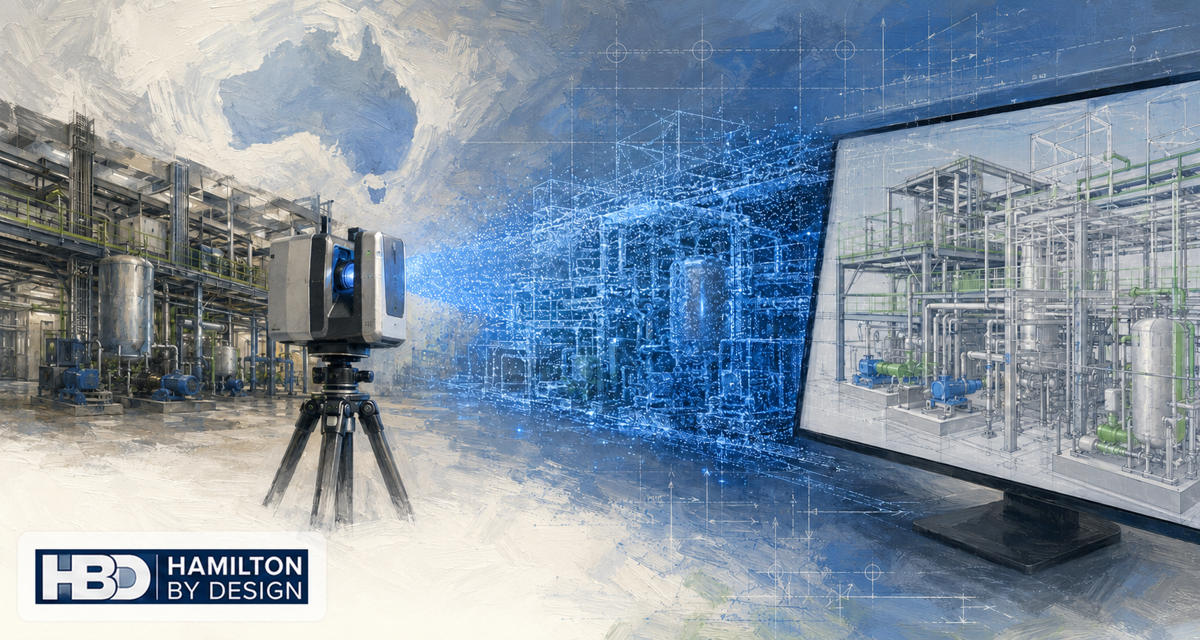
Scan to BIM Services South Australia
Hamilton By Design provides Scan to BIM services across South Australia, helping project teams turn real site conditions into accurate digital models for design, coordination, drafting and asset documentation.
Using LiDAR scanning, point cloud processing and CAD modelling, we capture existing buildings, plant rooms, industrial sites, structures and infrastructure so engineers, designers, builders and asset owners can work from reliable as-built information.
Academic research supports this approach. Laser scanning is widely used to capture dense 3D measurements of existing assets, and that point cloud data can then be used to create as-built BIM and CAD models [1].
Accurate Site Data Before Design Starts
Many projects begin with old drawings, incomplete records or site measurements that no longer match the current site.
That creates risk.
Designs may clash with existing pipework, steelwork, services, plant equipment, access platforms or building elements. Fabricated components may not fit. Site teams may lose time resolving problems that could have been found earlier.
Scan to BIM helps reduce this risk by capturing the real site before design or fabrication begins.
Hamilton By Design can provide:
- 3D LiDAR site scanning
- Registered point clouds
- Scan to CAD modelling
- BIM-ready geometry
- Existing condition models
- 2D drawings from point cloud data
- Mechanical and structural CAD models
- As-built verification
- Design support for brownfield projects
Research into BIM for existing buildings highlights this same problem: older assets often have missing, uncertain or outdated documentation, which makes reliable site capture important before refurbishment, maintenance or upgrade work [4].
What Is Scan to BIM?
Scan to BIM is the process of capturing a real site using 3D laser scanning and converting that scan data into a digital model.
The process generally includes:
- Site capture using LiDAR scanning
- Point cloud registration and processing
- Review of site features and project requirements
- CAD or BIM modelling from the point cloud
- Delivery of drawings, models or coordination files
The final output may be a detailed 3D model, a simplified design model, a Revit-ready reference, a SolidWorks model, AutoCAD geometry, fabrication drawings or as-built documentation.
The right deliverable depends on the project.
LiDAR Scanning for Existing Buildings and Industrial Sites
Hamilton By Design uses 3D LiDAR scanning to capture accurate site geometry. This is especially useful where manual measurement is difficult, unsafe, time-consuming or likely to miss important details.
LiDAR scanning can capture:
- Building interiors and exteriors
- Plant rooms
- Pipework and mechanical services
- Structural steel
- Conveyors and transfer stations
- Tanks and processing equipment
- Platforms, stairs and access ways
- Brownfield industrial facilities
- Construction sites
- Existing infrastructure
Research has shown that laser scanners can rapidly capture “as-is” site conditions, which may differ from design drawings or historical records [2]. This is one of the main reasons Scan to BIM is useful for brownfield and existing-site work.
Point Clouds to CAD and BIM Models
A point cloud by itself is valuable, but most project teams need usable model data.
Hamilton By Design can convert point clouds into practical CAD and BIM-ready deliverables, including:
- 3D CAD models
- 2D layouts and sections
- General arrangement drawings
- Mechanical design models
- Structural drafting models
- Scan-to-CAD files
- As-built models
- Clash review geometry
- Fabrication support drawings
We can work with common engineering and drafting workflows, including SolidWorks, AutoCAD, Inventor, ReCap and Navisworks-style coordination processes.
Research into scan-to-BIM workflows confirms that point clouds can be used to create information-rich 3D models for renovation planning, space planning, facility maintenance and existing-condition documentation [2].
Why Scan to BIM Matters
Scan to BIM helps reduce uncertainty before design, fabrication or construction begins.
It gives the project team a clearer understanding of the existing site, which can support better decisions and reduce avoidable rework.
Key benefits include:
- Reduced site rework
- Better design accuracy
- Improved clash detection
- Faster site verification
- Safer measurement of hard-to-access areas
- Better brownfield project planning
- More reliable as-built documentation
- Improved communication between site and office teams
Point cloud data can also support dimensional checking and construction verification. Research has shown that laser scan data can be used to compare 3D CAD model objects against as-built site conditions for dimensional compliance control [3].
For complex sites, the value is not just in the scan itself. The real value is turning captured data into engineering information that people can actually use.
Scan to BIM for Brownfield Projects
Brownfield projects are one of the strongest uses for Scan to BIM.
Existing facilities often change over many years. Drawings may be outdated, undocumented modifications may exist, and access for measurement may be limited.
Scan to BIM can assist with:
- Equipment upgrades
- Plant modifications
- Pipework changes
- Structural steel upgrades
- Conveyor and chute modifications
- Access platform design
- Shutdown planning
- Construction sequencing
- Fabrication checking
- As-built documentation
For existing buildings and industrial sites, research identifies the creation and updating of BIM information as a major challenge, especially where existing data is uncertain or incomplete [4]. Scan to BIM helps address this by starting with real captured site geometry.
Scan to BIM for Construction and Project Coordination
Scan to BIM can also support construction coordination and progress review.
By comparing point cloud data with design models, project teams can better understand what has been installed, what has changed and where issues may exist.
This can assist with:
- Construction progress checks
- Dimensional verification
- Clash review
- Installation planning
- Site coordination
- Quality control
- Handover documentation
Academic research has explored the use of 3D sensing and BIM-related workflows for automated progress tracking, showing that laser scanning can support more reliable construction status information than manual methods alone [5].
Industries We Support
Hamilton By Design supports Scan to BIM and point cloud modelling for a range of Australian industries, including:
- Mining and mineral processing
- Manufacturing
- Water and wastewater infrastructure
- Commercial buildings
- Industrial facilities
- Construction projects
- Mechanical services
- Structural drafting
- Process plants
- Brownfield engineering projects
Our background in mechanical engineering, drafting and site-based industrial work helps us understand what needs to be captured and how the model will be used.
Australia-Wide Scan to BIM Services
Hamilton By Design provides Scan to BIM services across Australia, including:
- Sydney
- Central Coast
- Newcastle
- Hunter Valley
- Brisbane
- Melbourne
- Perth
- Adelaide
- Mount Isa
- Regional NSW
- Regional Queensland
- Western Australia mining and industrial regions
We support projects where accurate site data is required before engineering, drafting, construction or fabrication begins.
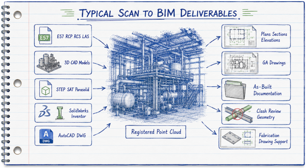
Typical Deliverables
Depending on the project scope, deliverables may include:
- Registered point cloud files
- E57, RCP, RCS or LAS files
- 3D CAD models
- STEP, SAT or Parasolid files
- SolidWorks or Inventor models
- AutoCAD DWG drawings
- 2D plans, sections and elevations
- General arrangement drawings
- As-built documentation
- Clash review geometry
- Fabrication drawing support
The level of detail can be adjusted to suit the project. Not every project needs a fully detailed BIM model. Sometimes a simplified but accurate design model is the best result.
Need Scan to BIM Support?
If your project depends on accurate existing site information, Hamilton By Design can help capture, process and model the data needed for design and coordination.
We can assist with site scanning, point cloud modelling, mechanical CAD, structural drafting and as-built documentation for projects across Australia.
Contact Hamilton By Design to discuss your Scan to BIM, LiDAR scanning or point cloud modelling requirements.

Talk to Us – Contact Us
Our clients:

























FAQs
What is Scan to BIM?
Scan to BIM is the process of using 3D laser scanning to capture an existing site and convert the point cloud data into a digital model for design, coordination or documentation.
What is the difference between a point cloud and a BIM model?
A point cloud is the raw 3D scan data made up of millions of measured points. A BIM or CAD model is created from that point cloud so designers and engineers can work with usable geometry.
Can you provide CAD models instead of Revit models?
Yes. Hamilton By Design can provide CAD-based deliverables such as SolidWorks, Inventor, AutoCAD, STEP, SAT and DWG files depending on the project requirements.
Is Scan to BIM useful for industrial sites?
Yes. Scan to BIM is highly useful for industrial and brownfield sites where existing drawings may be outdated, incomplete or difficult to verify.
Do you provide Scan to BIM services Australia-wide?
Yes. Hamilton By Design supports Scan to BIM, LiDAR scanning and point cloud modelling projects across Australia.
What industries use Scan to BIM?
Scan to BIM is used in construction, mining, manufacturing, water infrastructure, industrial facilities, commercial buildings and mechanical engineering projects.
Can Scan to BIM reduce project rework?
Yes. By capturing accurate existing site conditions before design or fabrication, Scan to BIM can help reduce clashes, measurement errors and site rework.
What files can be delivered?
Common deliverables include E57, RCP, RCS, LAS, DWG, STEP, SAT, Parasolid, SolidWorks, Inventor and AutoCAD files.
Academic References
[1] Tang, P., Huber, D., Akinci, B., Lipman, R. and Lytle, A. (2010). Automatic reconstruction of as-built building information models from laser-scanned point clouds: A review of related techniques. Automation in Construction, 19(7), pp. 829–843.
[2] Xiong, X., Adan, A., Akinci, B. and Huber, D. (2013). Automatic creation of semantically rich 3D building models from laser scanner data. Automation in Construction, 31, pp. 325–337.
[3] Bosché, F. (2010). Automated recognition of 3D CAD model objects in laser scans and calculation of as-built dimensions for dimensional compliance control in construction. Advanced Engineering Informatics, 24(1), pp. 107–118.
[4] Volk, R., Stengel, J. and Schultmann, F. (2014). Building Information Modeling (BIM) for existing buildings: Literature review and future needs. Automation in Construction, 38, pp. 109–127.
[5] Turkan, Y., Bosché, F., Haas, C.T. and Haas, R. (2012). Automated progress tracking using 4D schedule and 3D sensing technologies. Automation in Construction, 22, pp. 414–421.