LOD in BIM vs Reality Capture – Why the Industry Has Moved On
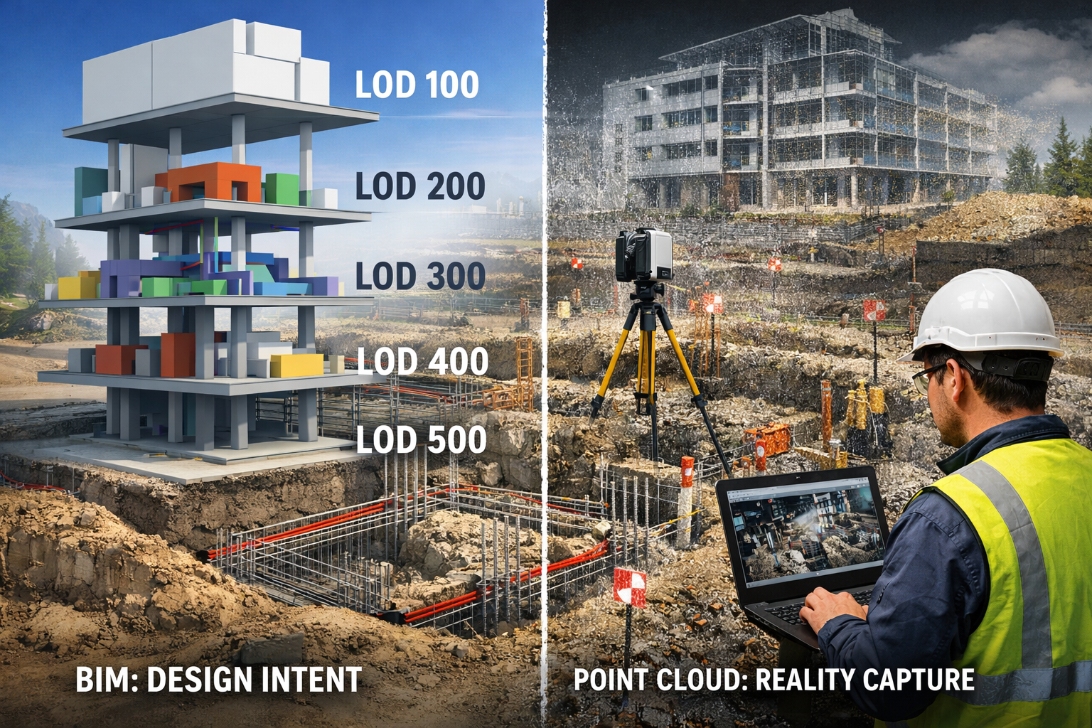
Building Information Modelling (BIM) has traditionally used Levels of Development (LOD 100 to LOD 500) to define how detailed a model is.
While this framework has been useful, it’s important to understand a key limitation:
Even at LOD 500, BIM is still a model of what was intended — not a record of what was actually built.
The Problem with LOD 100–500
BIM models are:
- Interpreted by designers
- Simplified for usability
- Dependent on assumptions
- Not always updated to reflect site changes
This becomes a serious issue when dealing with:
- Foundations below ground
- Reinforcement (reo bar) placement
- Embedded services
- Construction tolerances
- Variations during construction
In short:
LOD does not equal reality.
What 3D Point Cloud Data Offers
3D LiDAR scanning captures millions of measured points to create a true record of physical conditions.
Unlike BIM, point cloud data is:
- Measured, not assumed
- Highly detailed
- Time-stamped
- Able to be tied to survey or GPS control
Capture at Every Stage of Construction
A structured scanning approach allows you to capture:
Before Concrete Pour
- Reinforcement size, spacing, and placement
- Depth and profile of foundations
- Installed embedments and anchor points
During Construction
- Installed services (pipework, cable trays, ducts)
- Real-world clashes and deviations
After Completion
- True as-built conditions
- Full spatial record of the asset
Protecting Yourself Legally
Years after construction, disputes can arise.
You are left with two options:
- A BIM model showing what should have been built
- A point cloud showing what was actually built
The difference is critical.
Point cloud data provides:
- A defensible, time-based record
- Evidence aligned to survey control
- Clarity without assumptions
Without this, proving something like reinforcement placement may require destructive investigation or excavation.

The Industry Shift
The construction industry is moving beyond LOD 500 toward reality capture as the new standard.
A modern workflow includes:
- Pre-construction scans
- In-progress verification scans
- Final as-built scans
This creates a complete, measurable digital record of the asset.
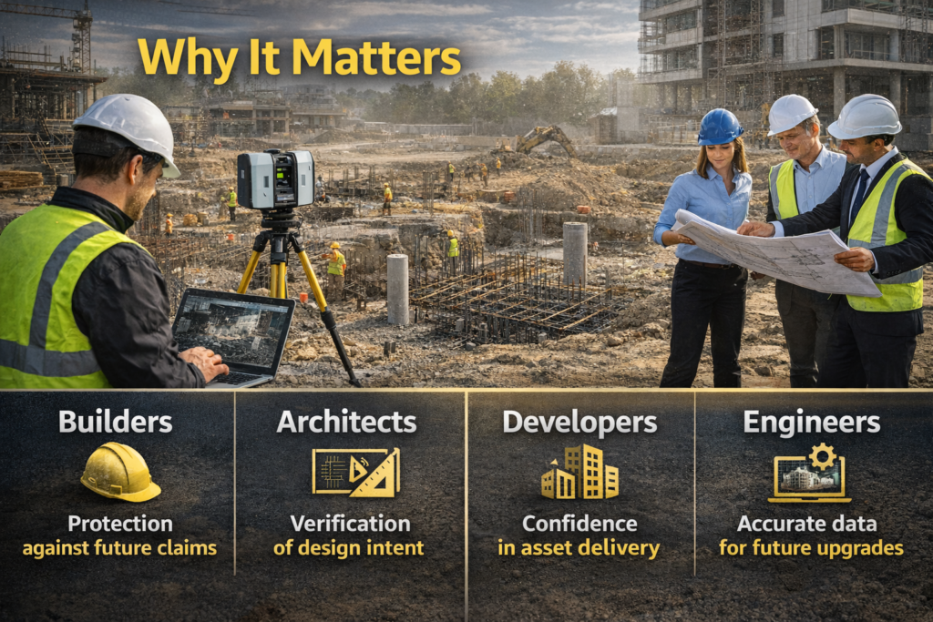
Why It Matters
- Builders – Protection against future claims
- Architects – Verification of design intent
- Developers – Confidence in asset delivery
- Engineers – Accurate data for future upgrades
Engage Hamilton By Design
At Hamilton By Design, we deliver engineering-led 3D LiDAR scanning and point cloud solutions across every stage of construction.
We don’t just capture data — we provide:
- Accurate, survey-aligned point clouds
- Scan-to-CAD and BIM integration
- Defensible records for long-term asset protection
Final Thought
A BIM model shows what you intended to build.
A point cloud shows what you actually built.
When it matters most — in design, construction, or court —
only one provides a true record.




Our clients




























Talk to Us – Contact Us