

Sydney’s ports are critical gateways for Australia’s import, export and logistics industries. Facilities such as container terminals, bulk materials handling operations, fuel terminals, marine loading facilities and supporting infrastructure require accurate engineering information to support maintenance, upgrades and future expansion.
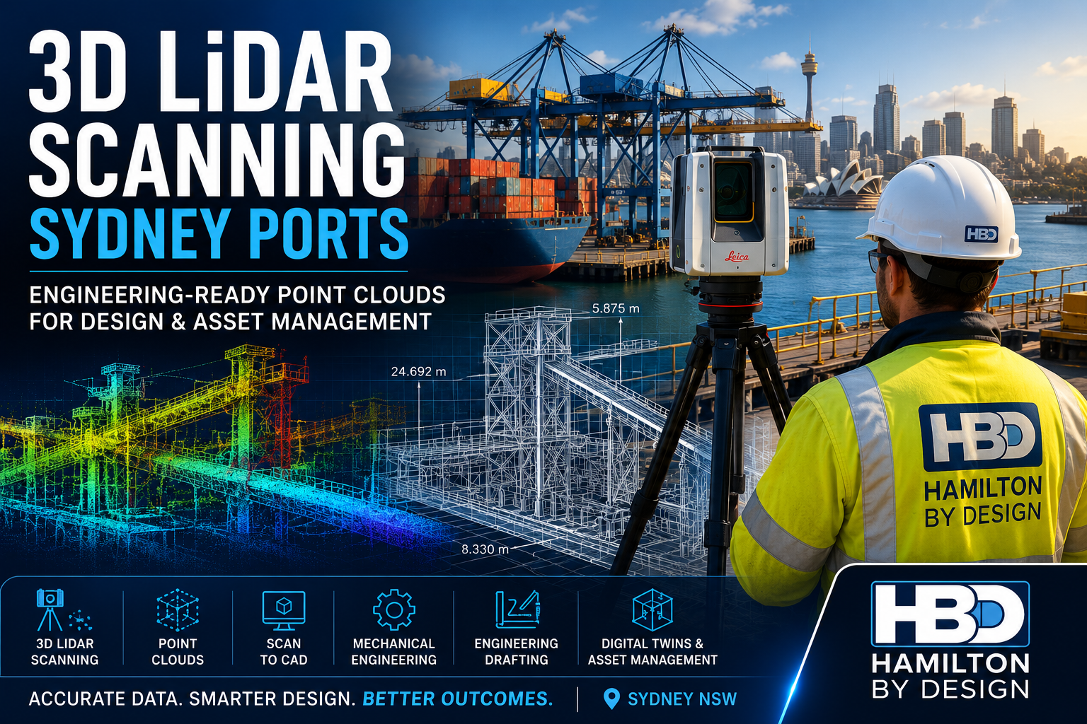
Hamilton By Design provides engineering-grade 3D LiDAR scanning services for Sydney ports, delivering highly accurate point cloud data for engineering design, drafting, asset management, digital twins and brownfield infrastructure projects.
Using advanced terrestrial LiDAR technology, we capture millions of measurement points across complex operating environments, creating detailed digital records that allow engineers, asset owners and project teams to make informed decisions with confidence.
What is 3D LiDAR Scanning?
LiDAR (Light Detection and Ranging) uses laser technology to accurately measure and record physical assets.
The result is a highly detailed point cloud, representing existing infrastructure in three dimensions. This digital dataset can be used for:
- Mechanical engineering
- Structural engineering
- Engineering drafting
- Scan to CAD workflows
- Asset management
- Digital twin development
- BIM modelling
- Shutdown planning
- As-built verification
For ports and marine facilities, LiDAR scanning provides an efficient method of capturing accurate site information while reducing the need for repeat site visits.
Why Sydney Ports Use LiDAR Scanning
Many port facilities have evolved over decades through multiple upgrade projects, equipment replacements and operational modifications.
As a result, common challenges include:
- Missing drawings
- Outdated documentation
- Inaccessible areas
- Congested infrastructure
- Unknown clearances
- Limited shutdown windows
- Safety restrictions
LiDAR scanning creates a complete digital record of the facility, allowing project teams to design around actual site conditions rather than assumptions.
Typical Sydney Port Assets We Scan
Container Terminals
We capture:
- Container crane structures
- Storage yards
- Maintenance workshops
- Container handling equipment
- Access roads and infrastructure
Bulk Materials Handling Facilities
Our scanning services support:
- Conveyors
- Transfer stations
- Ship loaders
- Stackers
- Reclaimers
- Chutes and hoppers
- Stockpile systems
Marine Infrastructure
LiDAR scanning is ideal for:
- Wharves
- Jetties
- Berths
- Loading facilities
- Access walkways
- Marine structures
Industrial Plant Assets
We regularly scan:
- Pipework systems
- Pump stations
- Mechanical equipment
- Structural steelwork
- Maintenance platforms
- Process infrastructure
Benefits of LiDAR Scanning for Port Engineering Projects
Accurate Site Capture
LiDAR scanning captures millions of survey-grade measurements to create a highly accurate representation of existing conditions.
Engineering-Ready Point Clouds
Data is delivered in formats suitable for engineering workflows including:
- E57
- RCP
- RCS
- LAS
- LGS
Reduced Project Risk
Accurate site information reduces:
- Design clashes
- Installation issues
- Site rework
- Construction delays
Faster Engineering Design
Engineering teams can begin modelling and drafting immediately using accurate site information.
Improved Shutdown Planning
Detailed reality capture allows project teams to:
- Plan work before mobilisation
- Reduce site measurements
- Minimise downtime
- Improve installation efficiency
Engineering Applications
Mechanical Engineering
LiDAR scanning supports:
- Equipment upgrades
- Conveyor modifications
- Plant expansions
- Equipment replacement projects
- Retrofit engineering
By designing around actual site conditions, engineers can reduce uncertainty and improve installation outcomes.
Engineering Drafting
Point cloud data can be converted into:
- General arrangement drawings
- Plant layouts
- Fabrication drawings
- Structural steel models
- Equipment drawings
- Installation documentation
Scan to CAD
Hamilton By Design can convert point cloud data into:
- AutoCAD models
- SolidWorks models
- Inventor models
- STEP files
- As-built CAD documentation
This is particularly valuable when original drawings are unavailable or no longer accurate.
Asset Management & Digital Twins
Many port operators are implementing digital asset management systems.
LiDAR scanning provides the foundation for:
- Digital twins
- Asset registers
- BIM models
- Maintenance planning
- Future upgrade projects
Engineering Deliverables
Depending on project requirements, Hamilton By Design can provide:
Point Cloud Deliverables
- E57
- RCP
- RCS
- LAS
- LGS
CAD Deliverables
- DWG
- DXF
- AutoCAD Models
- Engineering Layouts
3D Models
- SolidWorks
- Inventor
- STEP
- Parasolid
- SAT
BIM Deliverables
- Revit Models
- IFC Models
- Scan to BIM Models
- Asset Information Models
Why Choose Hamilton By Design?
Unlike many reality capture providers, Hamilton By Design combines:
- 3D LiDAR Scanning
- Mechanical Engineering
- Engineering Drafting
- Scan to CAD
- Reverse Engineering
- Structural Design Support
- Digital Engineering Workflows
This engineering-first approach ensures that the information captured on site directly supports practical project outcomes.
Our team understands how point cloud data is used during engineering, design, fabrication and construction, enabling us to deliver solutions that reduce risk and improve project efficiency.
Sydney Port Locations We Support
We provide services throughout:
- Port Botany
- White Bay
- Glebe Island
- Sydney Harbour Industrial Facilities
- Container Terminals
- Bulk Handling Facilities
- Intermodal Freight Terminals
- Marine Infrastructure Assets
We also support projects throughout:
- Sydney
- Newcastle
- Central Coast
- Wollongong
- Regional NSW
- Australia-wide

Need a 3D LiDAR Scanning Quote for a Sydney Port Project?
Whether you’re planning a brownfield upgrade, shutdown project, asset management program or engineering design activity, Hamilton By Design can provide accurate, engineering-grade reality capture services tailored to your project requirements.
Our Sydney Port Services Include:
✔ 3D LiDAR Scanning
✔ Terrestrial Laser Scanning
✔ Scan to CAD
✔ Mechanical Engineering
✔ Engineering Drafting
✔ Reverse Engineering
✔ Scan to BIM
✔ Digital Twin Development
Contact Hamilton By Design to discuss your Sydney port infrastructure project and obtain a tailored proposal.
Talk to Us – Contact Us
Our clients:


Frequently Asked Questions – 3D LiDAR Scanning Sydney Ports
1. What is 3D LiDAR scanning and how is it used in Sydney ports?
3D LiDAR scanning uses laser technology to capture millions of accurate measurements of existing infrastructure. In Sydney ports, it is used to document container terminals, wharves, conveyors, ship loaders, pipework and marine facilities for engineering, maintenance and upgrade projects.
2. What are the benefits of LiDAR scanning for port infrastructure projects?
LiDAR scanning provides accurate as-built information, reduces site visits, improves engineering design accuracy, minimises project risk and helps prevent costly rework during construction and shutdown activities.
3. What types of Sydney port assets can be scanned?
Hamilton By Design can scan a wide range of infrastructure including:
- Container terminals
- Wharves and jetties
- Ship loaders
- Conveyors
- Chutes and hoppers
- Pipework systems
- Structural steelwork
- Pump stations
- Marine loading facilities
- Maintenance platforms
4. How accurate is 3D LiDAR scanning?
Engineering-grade LiDAR scanning can achieve millimetre-level accuracy. Typical registered point cloud datasets for industrial facilities are suitable for mechanical engineering, drafting, Scan to CAD and BIM workflows.
5. Can LiDAR scanning be performed while a port remains operational?
Yes. Many scanning projects are completed during normal operations, maintenance periods or scheduled shutdowns. The scanning process is non-contact and can often be completed with minimal disruption to operations.
6. What deliverables can be produced from a LiDAR scanning project?
Deliverables may include:
- E57 Point Clouds
- RCP and RCS Files
- AutoCAD Drawings
- SolidWorks Models
- STEP Files
- General Arrangement Drawings
- Scan to BIM Models
- Asset Information Models
7. How does LiDAR scanning support mechanical engineering projects?
LiDAR scanning provides accurate dimensional data that engineers can use to design replacement equipment, upgrade conveyors, modify structures, assess clearances and plan brownfield engineering projects with confidence.
8. Can point cloud data be converted into CAD models?
Yes. Hamilton By Design provides Scan to CAD services, converting point cloud data into accurate 2D drawings and 3D models suitable for engineering design, drafting, fabrication and asset management.
9. Is LiDAR scanning suitable for digital twin and asset management projects?
Absolutely. LiDAR scanning forms the foundation of many digital twin initiatives by creating accurate digital representations of physical assets that can be used for maintenance planning, inspections, upgrades and future development projects.
10. Why choose Hamilton By Design for Sydney port LiDAR scanning?
Hamilton By Design combines:
- 3D LiDAR Scanning
- Mechanical Engineering
- Engineering Drafting
- Scan to CAD
- Reverse Engineering
- Digital Twin Development
Unlike survey-only providers, we understand how scan data is used throughout the engineering lifecycle, delivering practical outcomes for Sydney port operators, engineering consultants and infrastructure asset owners.