Parramatta | Penrith | Liverpool | Greater Western Sydney
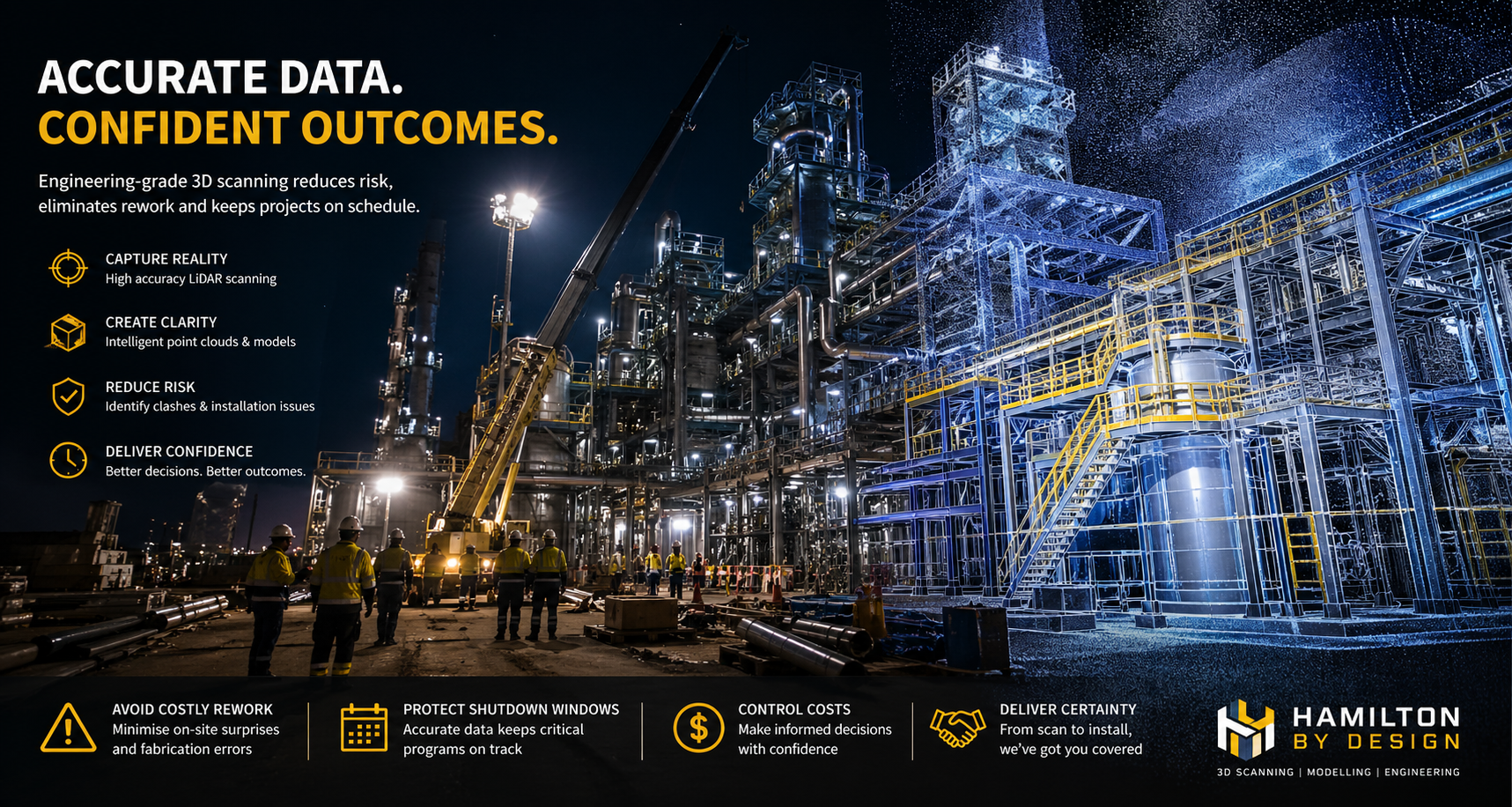
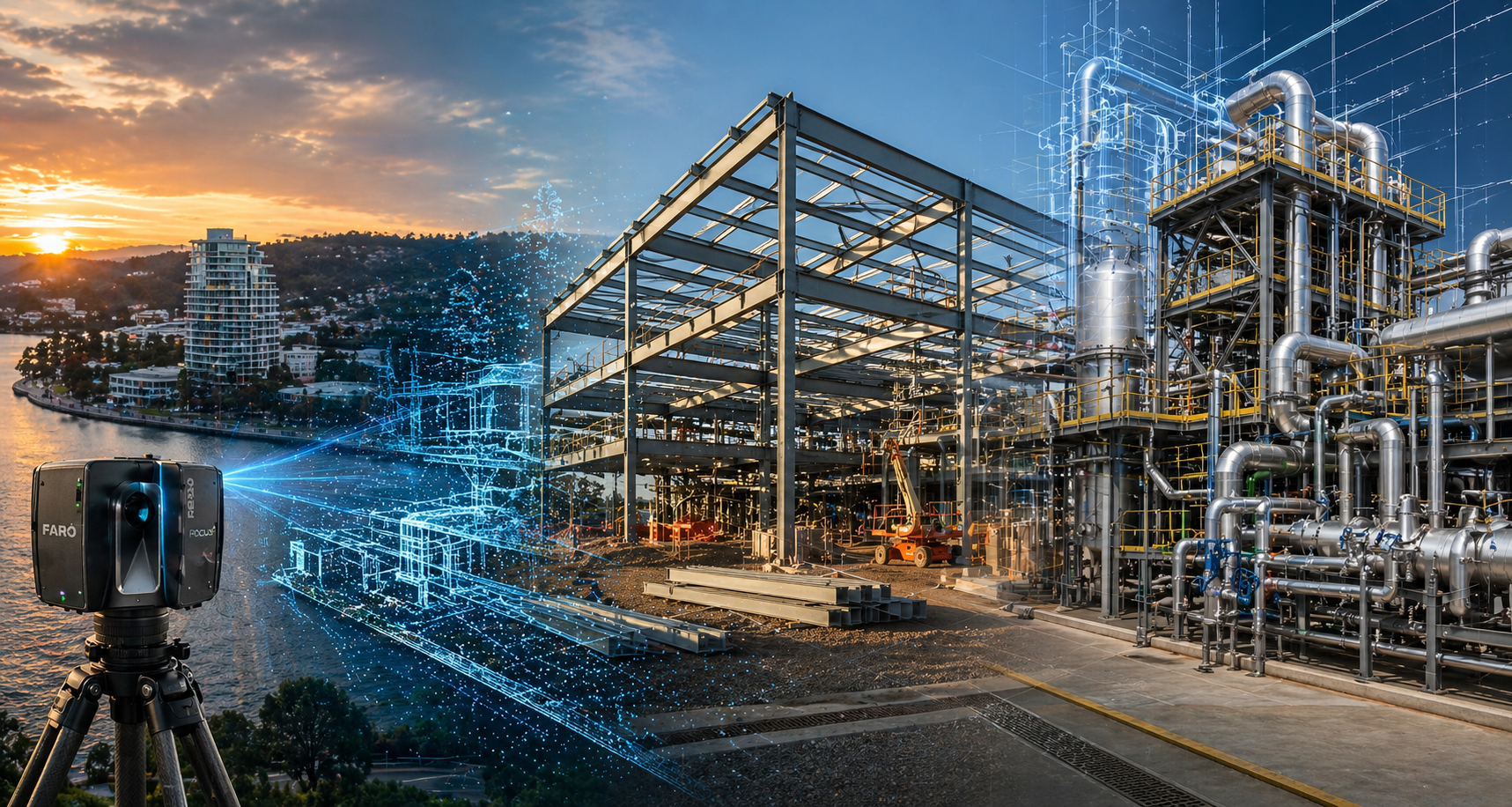
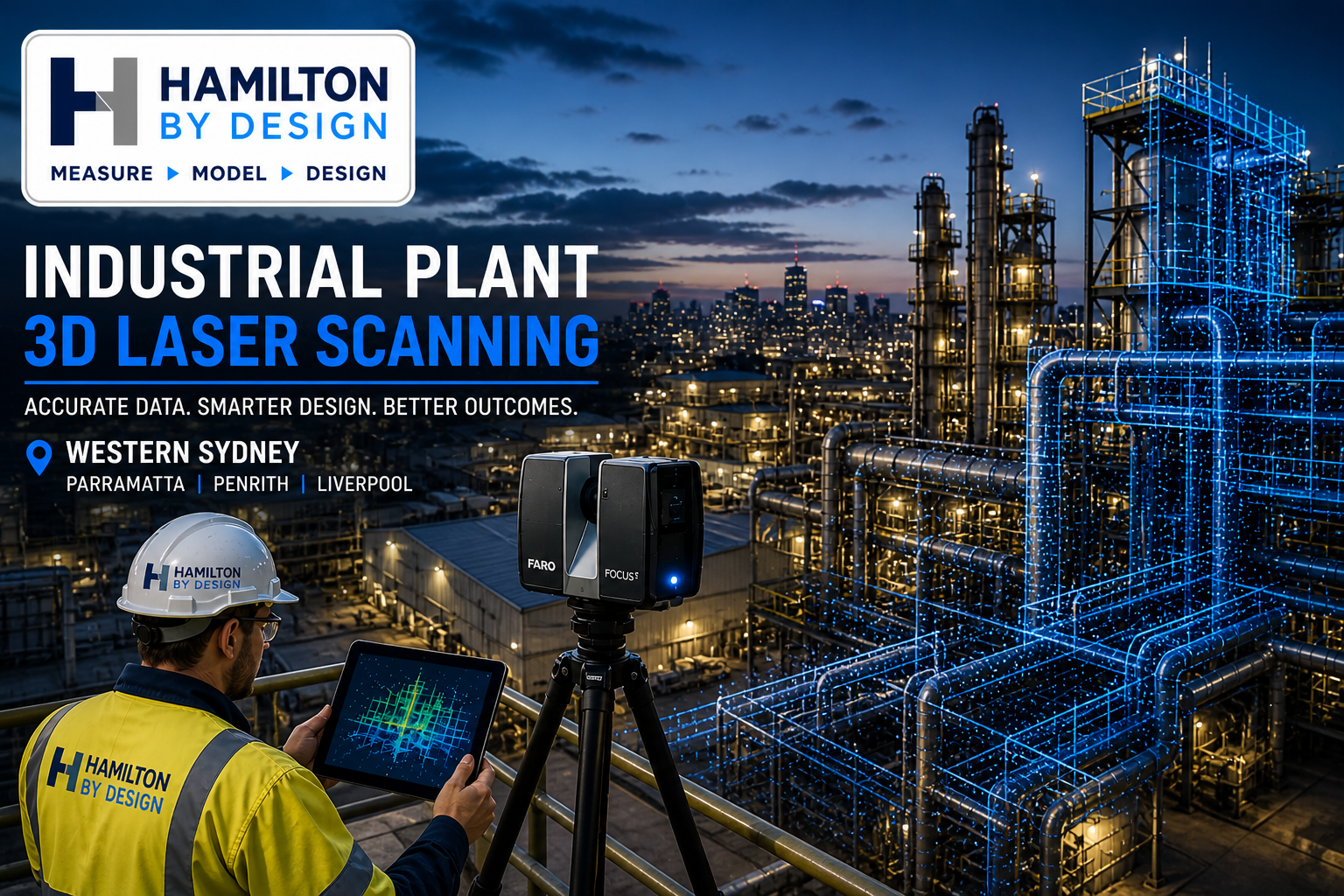
At Hamilton By Design, we provide engineering-grade 3D laser scanning services across Western Sydney’s key industrial regions. Our focus is not just on capturing data, but on delivering accurate, usable models that support real-world engineering outcomes.
Western Sydney continues to grow as one of Australia’s most important industrial corridors. From high-rise developments in Parramatta to manufacturing hubs in Penrith and processing facilities in Liverpool, each region presents unique challenges that require a tailored approach to reality capture and engineering design.
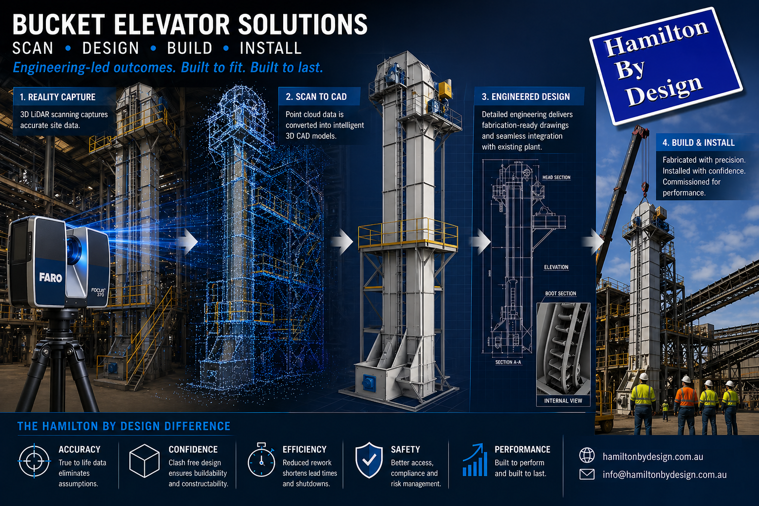
Our services combine LiDAR scanning, point cloud processing, and mechanical engineering expertise to support industrial plants, infrastructure upgrades, and brownfield modifications. Learn more about our core service here:
👉 https://www.hamiltonbydesign.com.au/3d-laser-scanning-for-industrial-plants-in-sydney/
Parramatta – Commercial Infrastructure & Building Services
Parramatta has evolved into Sydney’s second CBD, with a strong concentration of commercial buildings, government facilities, and infrastructure projects. Industrial plant work in this region is typically focused on building services, plant rooms, and refurbishment projects rather than heavy industry.
We support Parramatta-based projects involving:
- Commercial towers and mixed-use developments
- Government and institutional facilities
- Building services and mechanical plant rooms
- Construction and refurbishment works
3D scanning in Parramatta is commonly used to capture existing conditions for upgrades, ensuring accurate integration of new systems within constrained environments. Our scan-to-BIM and point cloud modelling workflows allow engineers and contractors to reduce risk, avoid clashes, and improve coordination across disciplines.


Penrith – Manufacturing & Industrial Operations
Penrith represents one of Western Sydney’s key manufacturing and logistics corridors. The region is home to a wide range of industrial facilities, including production plants, warehouses, and distribution centres.
We work with Penrith-based industries such as:
- Manufacturing facilities and production lines
- Warehousing and logistics operations
- Packaging and processing plants
- Light industrial workshops
In these environments, 3D laser scanning is essential for capturing existing layouts before equipment upgrades or expansions. Whether integrating new machinery or optimising production flow, accurate point cloud data ensures that modifications are designed to fit first time.
Our point cloud to CAD services convert scan data into engineering-ready models, allowing for detailed design, fabrication, and installation planning.
👉 https://www.hamiltonbydesign.com.au/point-cloud-to-cad
Liverpool – Processing Plants & Mixed Industrial Facilities
Liverpool supports a diverse mix of industries, including food processing, light manufacturing, healthcare infrastructure, and commercial facilities. This creates a demand for flexible engineering solutions that can adapt to different operational environments.
Typical industries we support in Liverpool include:
- Food and beverage processing plants
- Mechanical and fabrication workshops
- Healthcare and large-scale facilities
- Mixed-use industrial sites
3D scanning in Liverpool is often used to model complex pipework systems, process equipment, and building layouts. These models form the basis for plant upgrades, maintenance planning, and engineering design.
By combining scanning with mechanical engineering expertise, we ensure that all outputs are not only accurate but also aligned with Australian Standards and operational requirements.
Western Sydney – Heavy Industry & Infrastructure Growth
Across Greater Western Sydney, large-scale infrastructure and industrial developments continue to expand. This includes utilities, transport hubs, bulk handling facilities, and heavy industrial operations.
We support projects across Western Sydney involving:
- Industrial plants and processing facilities
- Infrastructure and utilities
- Transport and logistics hubs
- Bulk materials handling systems
In these environments, 3D laser scanning plays a critical role in supporting shutdown planning, structural upgrades, and mechanical modifications. High-accuracy data capture allows for better decision-making, reduced downtime, and improved project outcomes.
From Scanning to Engineering Outcomes
What sets Hamilton By Design apart is our ability to take projects beyond scanning.
Many providers deliver point clouds or visual models. We deliver:
- Engineering-grade CAD models
- Fabrication-ready drawings
- Mechanical design solutions
- Fit-for-purpose plant upgrades
Our workflow is simple and effective:
Scan → Model → Design → Deliver
This integrated approach ensures that clients receive not just data, but a complete engineering solution.
Supporting Industry Across Western Sydney
Across Parramatta, Penrith, Liverpool, and Greater Western Sydney, we support a wide range of industries including:
Commercial Infrastructure
Manufacturing
Processing Plants
Heavy Industry
Our services are designed to reduce risk, improve accuracy, and deliver reliable engineering outcomes for industrial projects of all sizes.

Get Started
If you are planning an industrial project in Western Sydney and need accurate site data, modelling, or engineering support, we can help.
Explore our services or get in touch:


Related Sydney Services
Hamilton By Design provides engineering-led 3D scanning, LiDAR scanning, mechanical engineering and digital engineering services throughout Sydney and Greater Sydney.
Explore our related Sydney services:
- 3D Scanning Sydney – Engineering-grade terrestrial laser scanning, as-built surveys and point cloud capture for industrial, infrastructure and commercial projects.
- Reality Capture Sydney – High-accuracy reality capture, digital twins, asset documentation and engineering-grade site verification.
- Scan to CAD Sydney – Convert point cloud data into AutoCAD, SolidWorks, Inventor and other engineering-ready CAD deliverables.
- Point Cloud Modelling Sydney – Engineering-grade point cloud processing, clash detection, as-built verification and 3D modelling.
- Mechanical Engineering Sydney – Mechanical design, plant upgrades, materials handling systems, conveyors, chutes, platforms and engineering support.
- Structural Drafting Sydney – Structural steel drafting, fabrication drawings, GA drawings, workshop detailing and as-built documentation.
Hamilton By Design supports projects throughout Sydney CBD, Parramatta, Liverpool, Penrith, Blacktown, Chatswood, Alexandria, Mascot, Newcastle and the Central Coast.
Mechanical Engineering | Structural Engineering