Industrial facilities are built around more than machinery and production systems. Personnel require safe and reliable access to equipment, maintenance areas, inspection locations, and operational assets. Whether within mining operations, manufacturing facilities, timber processing plants, or industrial processing environments, access systems play an important role in both safety and productivity.
Poorly designed access systems can create operational inefficiencies, increase maintenance time, and introduce unnecessary risk. Access systems designed around practical engineering requirements can improve not only safety outcomes but also long-term operational performance.
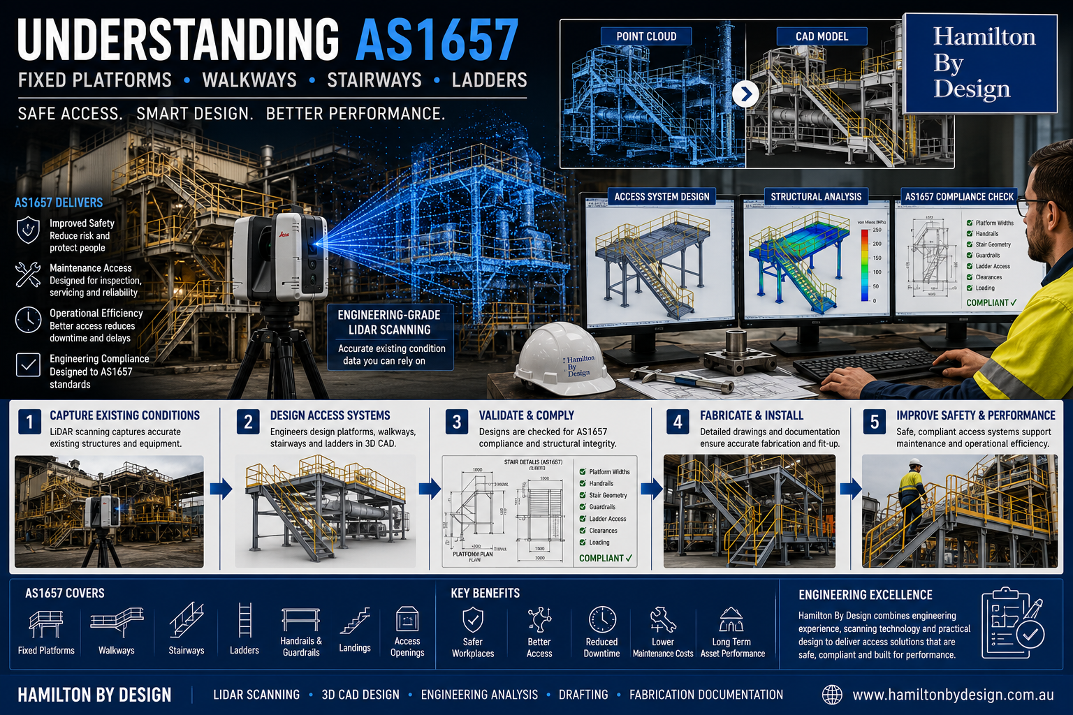
In Australia, one of the key standards governing these systems is AS1657 – Fixed Platforms, Walkways, Stairways and Ladders – Design, Construction and Installation.
Understanding the purpose of AS1657 helps organisations design access systems that support safer operations, maintenance efficiency, and engineering compliance.
What is AS1657?
AS1657 establishes requirements and guidance for the design, construction, and installation of fixed access systems within industrial facilities.
The standard applies to systems including:
- Fixed platforms
- Walkways
- Stairways
- Fixed ladders
- Handrails
- Guardrails
- Landings
- Access openings
The objective of the standard is providing safe and practical access throughout industrial facilities while reducing hazards associated with working at heights and movement around equipment.
AS1657 is commonly applied across:
- Mining operations
- Processing plants
- Manufacturing facilities
- Bulk materials handling facilities
- Timber processing operations
- Infrastructure projects
- Industrial processing sites


Why Proper Access Design Matters
Access systems are often viewed as secondary structures supporting primary equipment.
In practice, access systems influence:
- Worker safety
- Equipment accessibility
- Maintenance efficiency
- Shutdown performance
- Operational productivity
- Long-term operating costs
Poor access design can create:
- Restricted access zones
- Congestion around equipment
- Increased manual handling risks
- Longer shutdown activities
- Reduced maintenance efficiency
- Higher maintenance costs
Well-designed systems can improve operational performance while supporting safer working conditions.
Fixed Platforms and Walkways
Fixed platforms and walkways provide safe movement and work areas around equipment and operational assets.
Typical design considerations include:
- Platform dimensions
- Walkway widths
- Surface materials
- Guardrail systems
- Toe plates
- Access clearances
- Slip resistance requirements
- Structural loading considerations
Effective access design supports maintenance teams by improving movement around equipment and reducing access difficulties.
Stairways and Ladder Requirements
Stairways and ladders require practical engineering consideration beyond simply connecting two elevations.
Important design factors may include:
Stairways
- Rise and going dimensions
- Stair angles
- Handrail requirements
- Intermediate landings
- Head clearances
- User movement requirements
Ladders
- Ladder height limitations
- Cage requirements
- Fall protection systems
- Landing arrangements
- Access openings
The frequency of use and maintenance requirements often influence whether ladders or stairways provide the most suitable solution.
Maintenance Access Considerations
Maintenance activities often represent one of the most frequent interactions personnel have with industrial assets.
Access systems should support:
- Inspection activities
- Equipment removal
- Maintenance tasks
- Shutdown work
- Routine servicing
Poor maintenance access can lead to:
- Extended downtime
- Increased labour requirements
- Manual handling issues
- Higher operational costs
Designing around maintenance requirements during early project stages can reduce ongoing operational challenges.
Brownfield Applications Create Additional Challenges
Brownfield facilities rarely reflect original design documentation.
Industrial sites commonly contain:
- Historical modifications
- Existing structural steel
- Congested layouts
- Pipework interferences
- Equipment additions
- Legacy infrastructure
Designing new access systems in these environments can become challenging without accurate existing information.
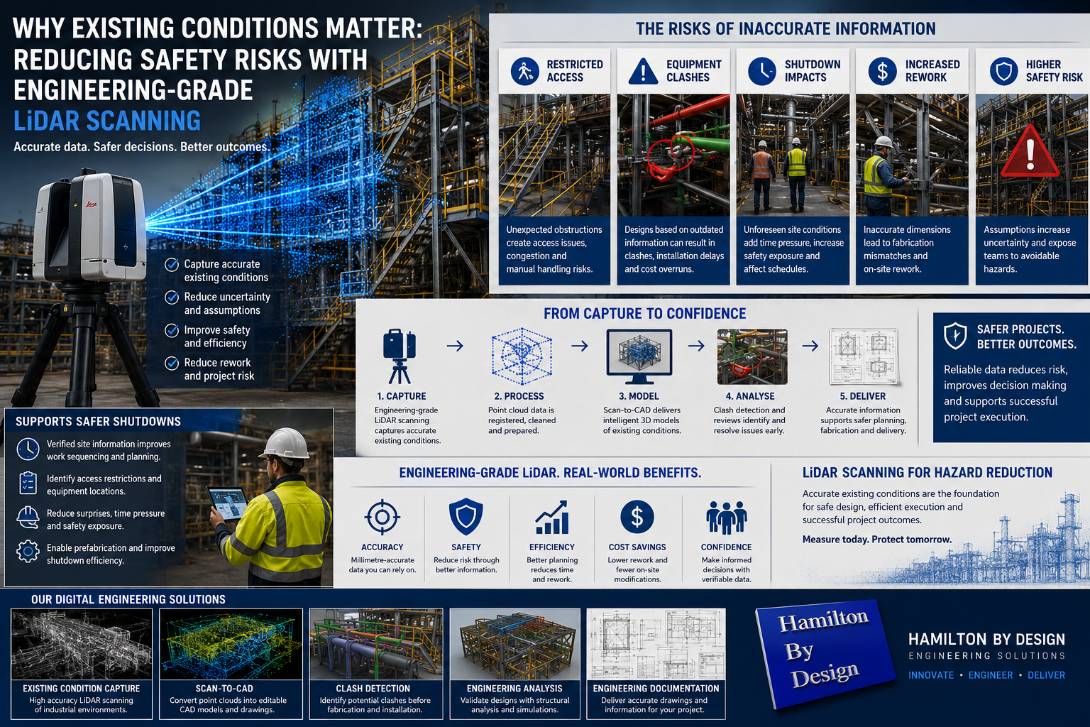
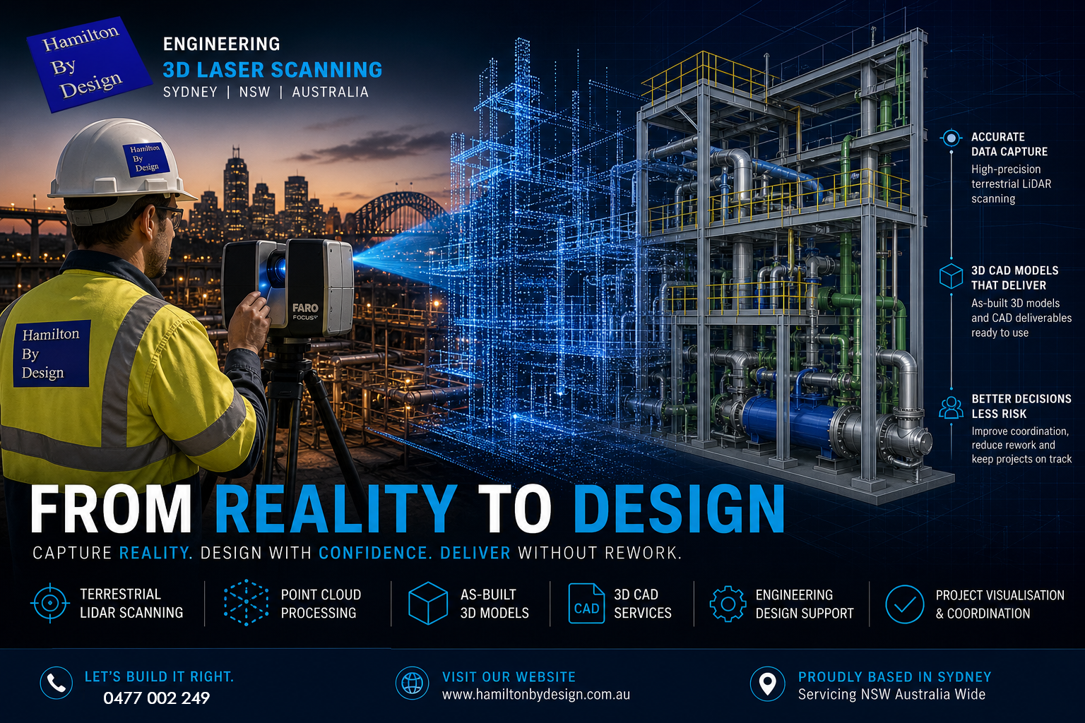
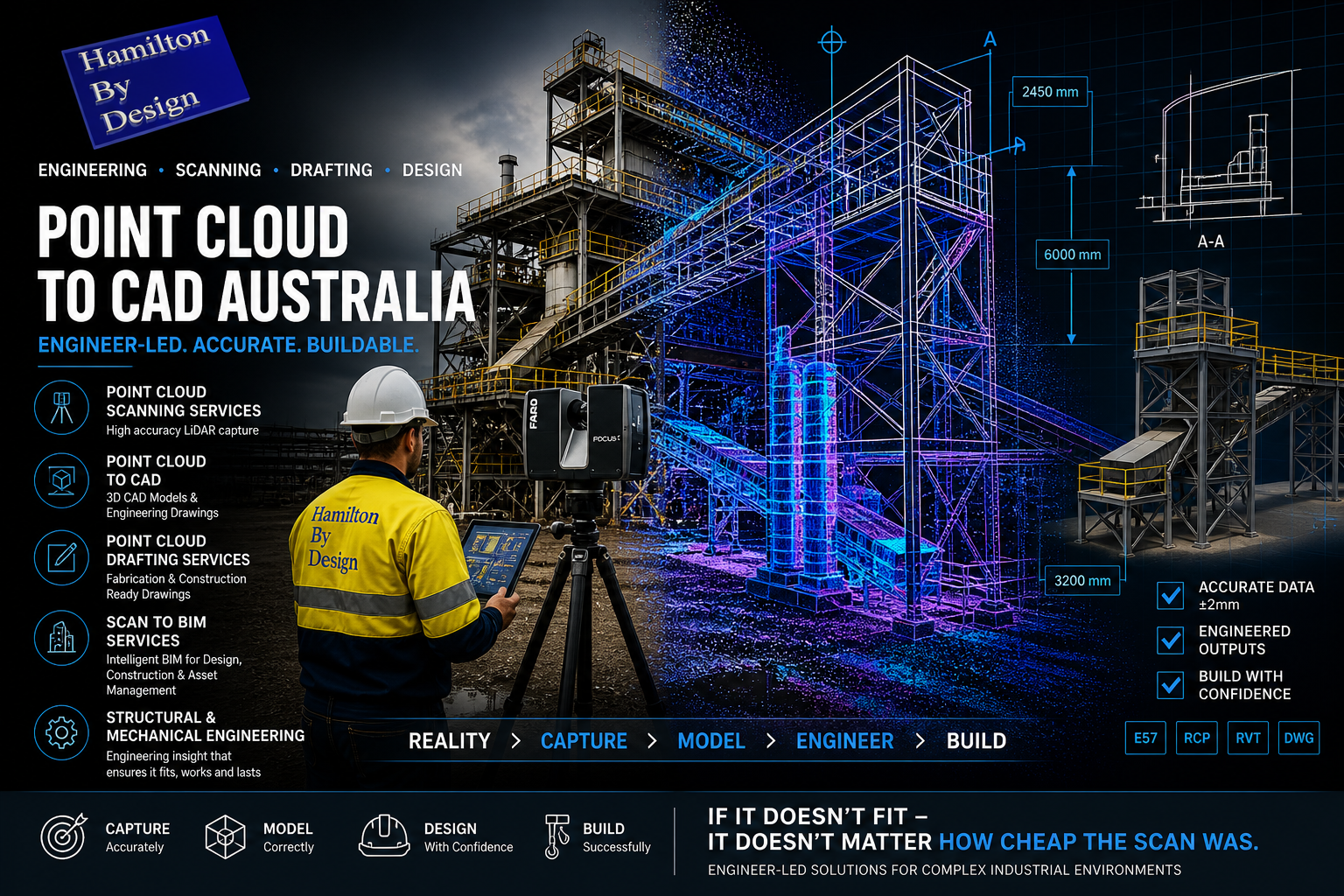
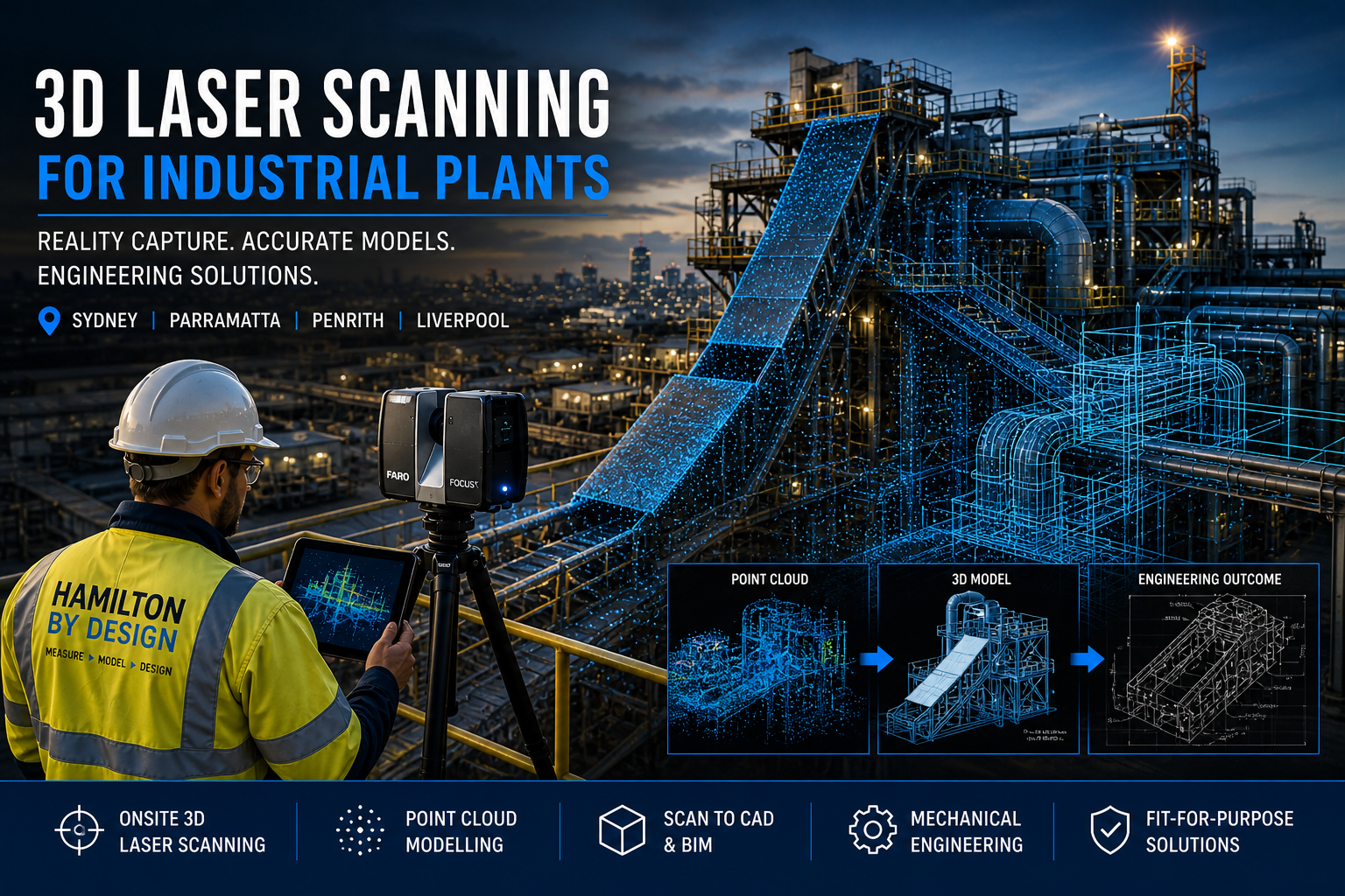
Hamilton By Design supports brownfield projects using engineering-grade 3D LiDAR scanning to capture:
- Existing structures
- Platforms
- Walkways
- Equipment
- Pipework
- Access systems
Existing condition capture allows engineering decisions to be based on measured information rather than assumptions.
Supporting Engineering Compliance
Engineering compliance extends beyond simply meeting dimensional requirements.
Good engineering practice should also consider:
- Safety outcomes
- Practical useability
- Constructability
- Maintenance efficiency
- Future modifications
- Long-term operational performance
Compliance should support functionality rather than becoming a checklist exercise.
How Hamilton By Design Supports Industrial Access Projects
Hamilton By Design combines practical engineering experience with digital engineering workflows to support industrial access projects through:
- Engineering-grade 3D LiDAR scanning
- Existing condition capture
- Scan-to-CAD workflows
- Mechanical design
- Structural assessment
- Engineering analysis and simulation
- CAD modelling
- Fabrication documentation
Our approach supports projects from initial site capture through to fabrication-ready deliverables.


Moving Beyond Minimum Compliance
AS1657 exists to support safer and more effective industrial access systems.
However, successful access systems do more than satisfy compliance requirements.
They improve:
- Safety performance
- Maintenance efficiency
- Operational productivity
- Long-term asset performance
Well-designed access systems help people interact safely and effectively with industrial assets every day.
Better access systems support better operational outcomes.

Our Clients: