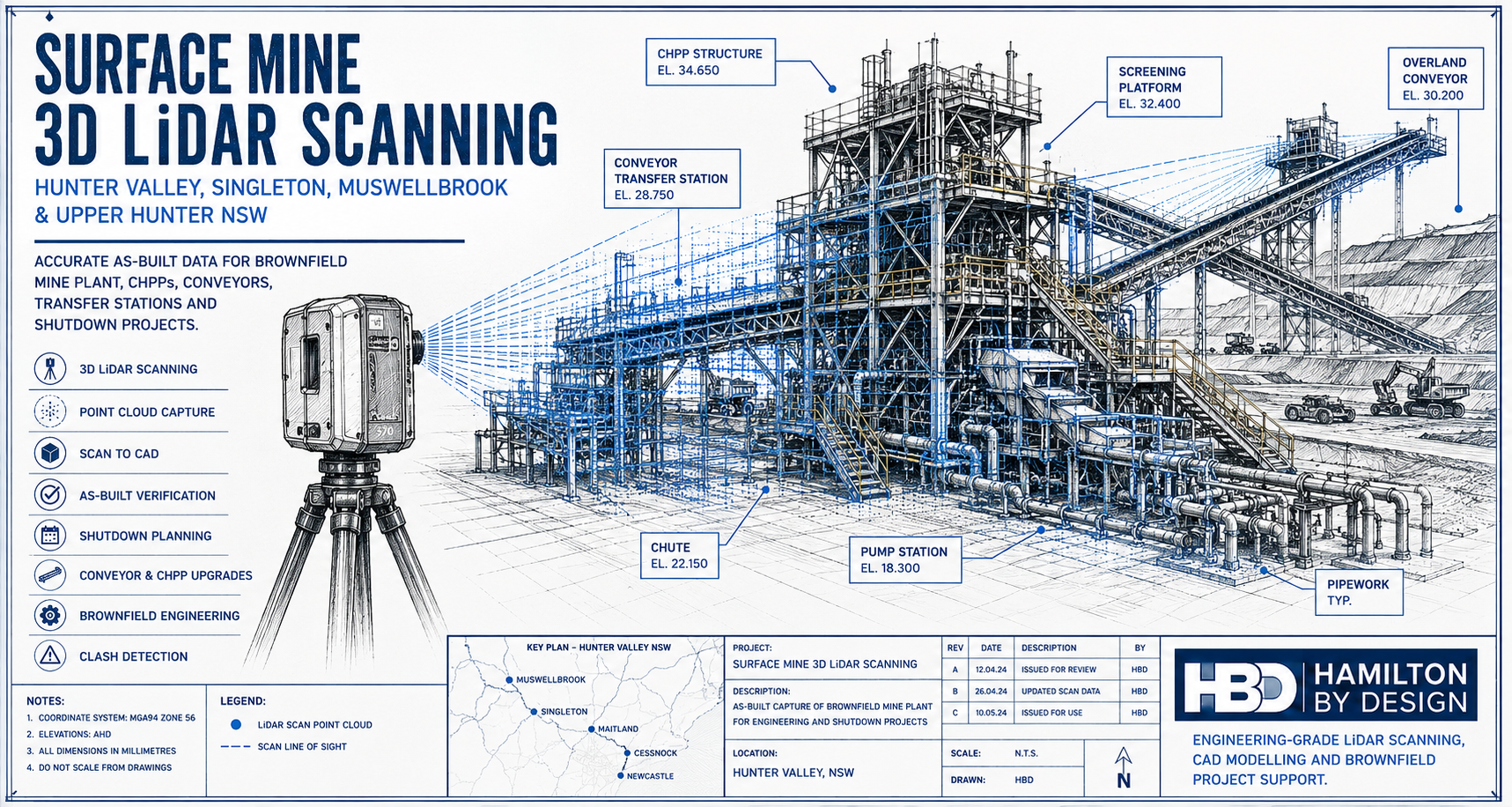
Surface Mine 3D LiDAR Scanning for Hunter Valley, Singleton, Muswellbrook & Upper Hunter NSW

Technical drawing style hero image showing a 3D LiDAR scanner capturing a Hunter Valley surface mine processing plant with conveyors, CHPP structure, pipework, pump station and brownfield mining infrastructure.

Surface Mine 3D LiDAR Scanning for Brownfield Mine Sites

Blue 3D LiDAR scanner icon on a tripod with scanning waves

Surface mines across the Hunter Valley and Upper Hunter are constantly changing. Coal handling plants, conveyors, transfer stations, pump stations, workshops, access platforms, pipework, chutes, bins and rail load-out areas are regularly modified to keep production moving. Some changes are part of planned capital upgrades. Others happen during shutdowns, maintenance windows or urgent repair work.

After years of brownfield modifications, the problem becomes simple: the plant on site no longer matches the drawings.

For surface mine operators, outdated drawings create real engineering and shutdown risk. Engineers may design around old information. Fabricators may manufacture parts that do not fit. Shutdown planners may miss access restrictions, clashes or tie-in issues. Installation crews may arrive on site only to discover that pipework, steelwork, guards, walkways or equipment are not where the drawings say they are.

This is where 3D laser scanning provides real value. By capturing accurate existing-condition data of the installed plant, mine operators and engineering teams can make decisions based on what is actually on site, not what was originally drawn years ago.

Hamilton By Design provides engineering-grade 3D LiDAR scanning, point cloud processing, scan-to-CAD modelling and as-built verification for Hunter Valley surface mines and brownfield industrial sites.

Locations Supported Across the Hunter Valley and Upper Hunter

Hamilton By Design supports surface mine and heavy industrial projects across the Hunter Valley, Upper Hunter and surrounding mining support regions, including:

Singleton, Muswellbrook, Ravensworth, Lemington, Warkworth, Mount Thorley, Broke, Bulga, Camberwell, Hebden, Jerrys Plains, Rixs Creek, Glennies Creek, Maison Dieu, Whittingham, Liddell, Bayswater, Aberdeen, Denman, Scone, Maitland, Cessnock, Lake Macquarie, Newcastle and the Port of Newcastle corridor.

These locations are affected by the same brownfield engineering problem. Mine plant is modified over time, but the drawing register does not always keep up. A conveyor transfer station may have extra guarding. A pump station may have replacement pipework. A CHPP may have modified chutes, platforms, cable trays and access stairs. A rail load-out area may have structural or mechanical changes that are not fully documented.

Hamilton By Design also supports industrial and mining clients beyond the Hunter Valley through 3D laser scanning across Australia, helping project teams capture reliable as-built data for plant upgrades, shutdown planning, fabrication checks and engineering verification.

Why Existing Surface Mine Drawings Become Outdated

Surface mine infrastructure rarely stays the same for long. Production requirements change. Maintenance teams improve access. Process engineers adjust layouts. Shutdown crews replace equipment. Fabricators install revised steelwork. Emergency repairs become permanent. Over time, these small changes create a large difference between the original drawings and the actual plant.

Common causes of outdated drawings include:

Brownfield ChangeResulting Risk
Conveyor upgradesNew chutes, guards or drives may not match old layouts
CHPP modificationsPipework, platforms and equipment positions may change
Pump station changesFlanges, valves and pipe supports may not be in the documented location
Structural access upgradesStairs, ladders, handrails and platforms may have been added or replaced
Shutdown repairsTemporary supports or modifications may become permanent
Replacement equipmentNew motors, pumps, screens or gearboxes may have different footprints
Rail load-out changesStructural and mechanical interfaces may no longer match original drawings
Site services modificationsCable trays, water lines, air lines and drainage may be undocumented

When drawings are unreliable, engineering design becomes slower and riskier. More time is spent checking dimensions, confirming interfaces and resolving clashes. In a shutdown environment, that uncertainty can become expensive very quickly.

What 3D LiDAR Scanning Captures

3D LiDAR scanning captures the existing mine plant as a measured 3D point cloud. The scanner records millions of points from multiple positions, creating a detailed digital record of the installed site condition.

For surface mining projects, LiDAR scanning can capture:

  • Conveyor transfer stations
  • CHPP areas
  • Crusher stations
  • Screens and bins
  • Chutes and hoppers
  • Pump stations
  • Pipework and valve stations
  • Structural steelwork
  • Platforms, stairs, ladders and handrails
  • Workshops and maintenance bays
  • Rail load-out structures
  • Stockpile conveyor systems
  • Water management infrastructure
  • Electrical rooms and cable tray support areas
  • Brownfield tie-in zones

The point cloud can then be used for engineering review, CAD modelling, clash detection, as-built documentation, shutdown planning and fabrication support.

Turning Scan Data into Engineering Information

The scan is only the first step. The real value comes from turning point cloud data into information engineers, fabricators and project teams can use.

Hamilton By Design can convert captured site data into 3D CAD modelling outputs suitable for mechanical layouts, plant upgrades, fabrication planning, clash checking and as-built documentation.

For example, if a mine is planning to replace a chute, the scan can capture the surrounding steelwork, conveyor geometry, access platforms, guards and nearby equipment. The design team can then model the new chute around the actual site conditions. This reduces the chance of a clash during installation.

If a pump station is being modified, LiDAR scanning can confirm the true location of pipework, flanges, valves, supports and access clearances. This helps fabricators produce more accurate spools and reduces the need for site rework.

If a CHPP area has been modified many times, scanning can provide an updated as-built record that engineers can use for future upgrades.

For shutdown projects, the value is even greater. Shutdown windows are limited. Mistakes are costly. If parts do not fit, access is blocked or tie-in points are wrong, the project can lose valuable time. 3D LiDAR scanning helps reduce those unknowns before the shutdown begins.

Typical Deliverables

Hamilton By Design can support surface mine scanning projects with practical engineering deliverables, including:

DeliverablePurpose
Registered point cloudAccurate 3D record of the existing plant
E57 / RCP / RCS / LAS filesPoint cloud formats for CAD and review workflows
3D CAD modelEngineering model of selected plant, equipment or structure
2D GA drawingsPlans, elevations and sections for design and review
Scan-to-CAD modelConverts point cloud data into usable CAD geometry
Clash reviewChecks proposed equipment against existing site conditions
Tie-in verificationConfirms exact positions before fabrication
Shutdown work pack supportHelps planners, engineers and installers understand the site
As-built documentationUpdates records after years of brownfield change

The deliverable should match the engineering problem. Some projects only need a point cloud. Others need a detailed CAD model, fabrication drawings or clash detection review.

Example Project Applications

Surface mine 3D LiDAR scanning is useful for many common Hunter Valley mining projects, including:

  • Conveyor transfer station upgrades
  • Chute replacement and redesign
  • CHPP brownfield modifications
  • Pump station upgrades
  • Pipework replacement and spool verification
  • Access platform and stair upgrades
  • Structural steel verification
  • Crusher and screen area modifications
  • Rail load-out upgrades
  • Workshop and maintenance bay layout changes
  • Shutdown planning and installation checks
  • Reverse engineering of obsolete components
  • As-built documentation for undocumented plant

For worn, modified or undocumented mining equipment, Hamilton By Design can also support reverse engineering for mining and industrial equipment. This is useful where existing parts, structures or assemblies need to be captured, modelled and converted into practical engineering documentation.

Why Use an Engineering-Led Scanning Approach?

Not all scanning is the same. For surface mine projects, the scan needs to support engineering decisions. That means the scanner operator must understand what matters to the design team: tie-in points, access clearances, structural interfaces, equipment footprints, maintenance envelopes, lifting paths and shutdown constraints.

An engineering-led scanning approach focuses on the areas that affect design, fabrication and installation. It is not just about capturing a large point cloud. It is about capturing the right information so the project team can reduce risk.

Hamilton By Design combines 3D LiDAR scanning with mechanical engineering, CAD modelling, drafting and brownfield project experience. This allows the scan data to be turned into practical engineering outputs that support real site work.

Hamilton By Design logo displayed on a blue tilted rectangle with a grey gradient background

Conclusion

Surface mines across the Hunter Valley, Singleton, Muswellbrook and Upper Hunter region often operate with plant that has changed significantly over many years. Drawings may be incomplete, outdated or inconsistent with what is installed on site.

For brownfield mining projects, this creates risk. New equipment can clash with existing plant. Fabricated parts may not fit. Shutdown work can be delayed. Engineering teams may spend too much time checking dimensions manually.

Surface Mine 3D LiDAR Scanning helps solve this problem by capturing accurate as-built data of the existing plant. The point cloud can then be used for CAD modelling, clash checking, shutdown planning, fabrication support and engineering verification.

For Hunter Valley surface mine operators, the message is clear:

If the drawings are no longer reliable, scan the plant before designing, fabricating or installing the next modification.

Talk to Us – Contact Us

Name
Would you like us to arrange a phone consultation for you?
Address

Our clients:
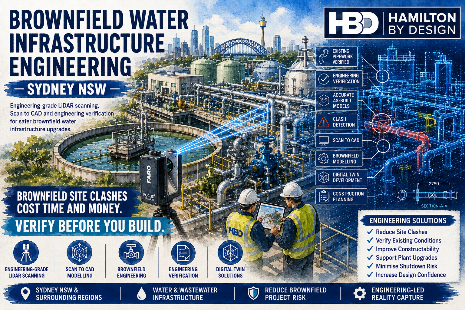


Brownfield Water Infrastructure Engineering in Sydney NSW โ€“ Reduce Risk Before Construction Begins

Engineering-grade LiDAR scanning of Sydney brownfield water infrastructure, capturing existing pipework, tanks, pumps and structural assets to support engineering verification, Scan to CAD and digital twin development.

Sydney’s water infrastructure is constantly evolving. Ageing water treatment plants, wastewater treatment facilities, pumping stations, reservoirs and transfer pipelines require ongoing upgrades to meet increasing demand, improve reliability and comply with changing environmental regulations.

Unlike greenfield projects where engineers begin with an empty site, brownfield projects involve modifying existing operational infrastructure. Every new pipe, pump, platform or structural support must integrate seamlessly with equipment that may have been installed decades ago.

The greatest challenge with brownfield engineering is simple:

Existing infrastructure rarely matches the available drawings.

Over many years, maintenance activities, emergency repairs, plant expansions and operational improvements alter facilities in ways that are often never fully documented. As a result, engineering teams frequently encounter unknown pipework, relocated equipment, modified structural steel and outdated as-built drawings.

These discrepancies create one of the biggest risks in industrial engineering:

Brownfield modifications causing costly site clashes.

Hamilton By Design provides Brownfield Water Infrastructure Engineering Services throughout Sydney NSW, combining engineering-grade LiDAR scanning, Scan to CAD, mechanical engineering and engineering verification to reduce project risk before construction begins.


Why Brownfield Projects Are More Complex Than Greenfield Projects

A greenfield project starts with a clean site.

Engineers control every dimension, every structural member and every equipment location.

Brownfield projects are completely different.

Existing facilities already contain:

  • Operating equipment
  • Underground services
  • Congested pipework
  • Electrical infrastructure
  • Instrumentation
  • Structural steel
  • Maintenance platforms
  • Access walkways
  • Cable trays
  • Temporary modifications
  • Legacy equipment

Every new design must fit around existing infrastructure while maintaining safe operation.

That is why accurate existing-condition data is essential.


The Hidden Cost of Site Clashes

A site clash occurs when newly designed equipment conflicts with existing infrastructure.

Typical clashes include:

  • Pipework intersecting structural steel
  • Pumps fouling maintenance platforms
  • Valves becoming inaccessible
  • Cable trays blocking pipe routing
  • Pipe supports interfering with existing equipment
  • Motors conflicting with overhead beams
  • Access ladders blocking maintenance paths
  • Concrete foundations overlapping underground services

Many of these issues are only discovered during construction.

By that stage:

  • fabrication is complete
  • contractors are mobilised
  • shutdowns have commenced
  • installation crews are waiting

The result is expensive redesign, fabrication changes and extended project durations.


Engineering-Grade LiDAR Scanning Eliminates Guesswork

Hamilton By Design uses professional terrestrial LiDAR scanning to accurately capture existing water infrastructure.

Rather than relying on tape measures or outdated drawings, millions of survey points are recorded across the entire facility.

This captures:

  • Pumps
  • Pipework
  • Valves
  • Tanks
  • Structural steel
  • Pipe bridges
  • Clarifiers
  • Digesters
  • Access platforms
  • Stairways
  • Handrails
  • Electrical equipment
  • Cable trays
  • Instrumentation
  • Concrete structures

The resulting point cloud becomes the single source of truth for engineering design.


Accurate Existing Conditions Lead to Better Engineering

Reliable engineering begins with reliable information.

Accurate point cloud data enables engineers to:

  • Verify dimensions
  • Confirm pipe routing
  • Check equipment locations
  • Validate maintenance access
  • Measure structural geometry
  • Review installation clearances
  • Detect clashes before construction
  • Plan shutdown activities

Instead of making assumptions, engineers work from the actual plant.


Supporting Water Infrastructure Projects Across Sydney

Hamilton By Design supports a wide range of brownfield water infrastructure projects.

These include:

Water Treatment Plant Upgrades

Treatment plants require continual investment to maintain water quality and increase capacity.

LiDAR scanning provides accurate existing-condition data before detailed engineering begins.


Wastewater Treatment Plant Modifications

Wastewater facilities often involve highly congested process pipework.

Accurate point clouds reduce installation risk during process upgrades.


Pump Station Engineering

Pump replacements frequently require:

  • new baseplates
  • pipework modifications
  • motor upgrades
  • structural changes

Scanning ensures replacement equipment integrates correctly.


Reservoir Infrastructure

Reservoir facilities require accurate engineering for:

  • inlet pipework
  • outlet manifolds
  • valve chambers
  • overflow systems
  • maintenance platforms

Reality capture improves design certainty.


Transfer Pipeline Connections

Tie-ins to existing pipelines require precise dimensional verification.

LiDAR scanning allows engineers to accurately model connection points before fabrication.


Scan to CAD Services

Point clouds are valuable, but engineering projects generally require CAD models.

Hamilton By Design converts point cloud data into:

  • Intelligent 3D models
  • General Arrangement drawings
  • Pipework models
  • Structural steel models
  • Equipment layouts
  • Sections
  • Elevations
  • Fabrication drawings
  • As-built documentation

These deliverables integrate with:

  • SOLIDWORKS
  • Autodesk Inventor
  • AutoCAD
  • Navisworks
  • Autodesk ReCap

Engineering Verification Before Construction

Engineering verification is one of the most valuable outcomes of reality capture.

Before fabrication begins, proposed designs can be compared against existing infrastructure.

Verification includes:

  • Equipment fit
  • Pipe routing
  • Structural interfaces
  • Maintenance access
  • Installation clearances
  • Lifting paths
  • Serviceability
  • Constructability

Resolving these issues during design significantly reduces project risk.


Supporting Digital Twin Development

Many Sydney water authorities are developing digital twins to improve long-term asset management.

LiDAR scanning provides the accurate geometric foundation required for these systems.

Digital twins assist with:

  • Asset management
  • Maintenance planning
  • Shutdown coordination
  • Future upgrades
  • Operator training
  • Lifecycle management
  • Engineering studies
  • Capital planning

Because the model reflects actual site conditions, future projects begin with reliable information.


Reducing Shutdown Risk

Brownfield water infrastructure projects often occur during tightly controlled shutdowns.

Unexpected site clashes can quickly extend shutdown durations.

LiDAR scanning helps engineers:

  • Detect clashes early
  • Validate fabrication
  • Optimise installation sequences
  • Improve access planning
  • Confirm equipment clearances

Many construction problems are therefore resolved before anyone arrives on site.


Typical Brownfield Engineering Workflow

Hamilton By Design follows an engineering-led workflow designed specifically for operational infrastructure.

1. Project Definition

Understand project objectives, operational constraints and shutdown requirements.

2. Engineering LiDAR Scanning

Capture existing infrastructure using terrestrial laser scanning.

3. Point Cloud Registration

Register scans into one accurate engineering dataset.

4. Quality Assurance

Verify scan completeness and registration accuracy.

5. Scan to CAD

Develop engineering-ready models from the point cloud.

6. Engineering Design

Complete mechanical, structural and pipework design using verified site information.

7. Engineering Verification

Compare proposed modifications against existing infrastructure before fabrication.

8. Construction Support

Provide engineering assistance during installation if required.


Why Choose Hamilton By Design?

Hamilton By Design combines practical engineering knowledge with advanced reality capture technology.

Our capabilities include:

  • Engineering-grade LiDAR scanning
  • Brownfield engineering support
  • Mechanical engineering
  • Reverse engineering
  • Scan to CAD
  • Engineering drafting
  • Structural modelling
  • Pipework modelling
  • As-built documentation
  • Digital twin development
  • Engineering verification
  • Construction support

Unlike traditional survey-only providers, we understand how engineering models will be used throughout the project lifecycle.

Our reality capture services are designed to produce information engineers can immediately use for design, verification and construction planning.


Supporting Sydney’s Essential Water Infrastructure

Sydney’s water infrastructure supports millions of residents, businesses and industries every day. As assets continue to age, brownfield engineering projects will become increasingly important to maintain reliable services and improve operational performance.

Successful brownfield engineering depends on one critical factor:

Accurate existing-condition information.

Without reliable data, unknown infrastructure creates unnecessary engineering risk, costly site clashes and expensive construction delays.

Hamilton By Design provides engineering-grade LiDAR scanning, Scan to CAD modelling and engineering verification services that replace uncertainty with confidence. By accurately capturing existing water infrastructure before design begins, we help engineering consultants, utilities and contractors reduce project risk, improve constructability and deliver successful brownfield upgrades.

Whether your project involves a water treatment plant, wastewater treatment facility, pumping station, reservoir or pipeline connection, our engineering-led approach ensures every design decision is based on the facility as it exists todayโ€”not outdated drawings or assumptions.

Talk to Us – Contact Us

Name
Would you like us to arrange a phone consultation for you?
Address

Our clients:
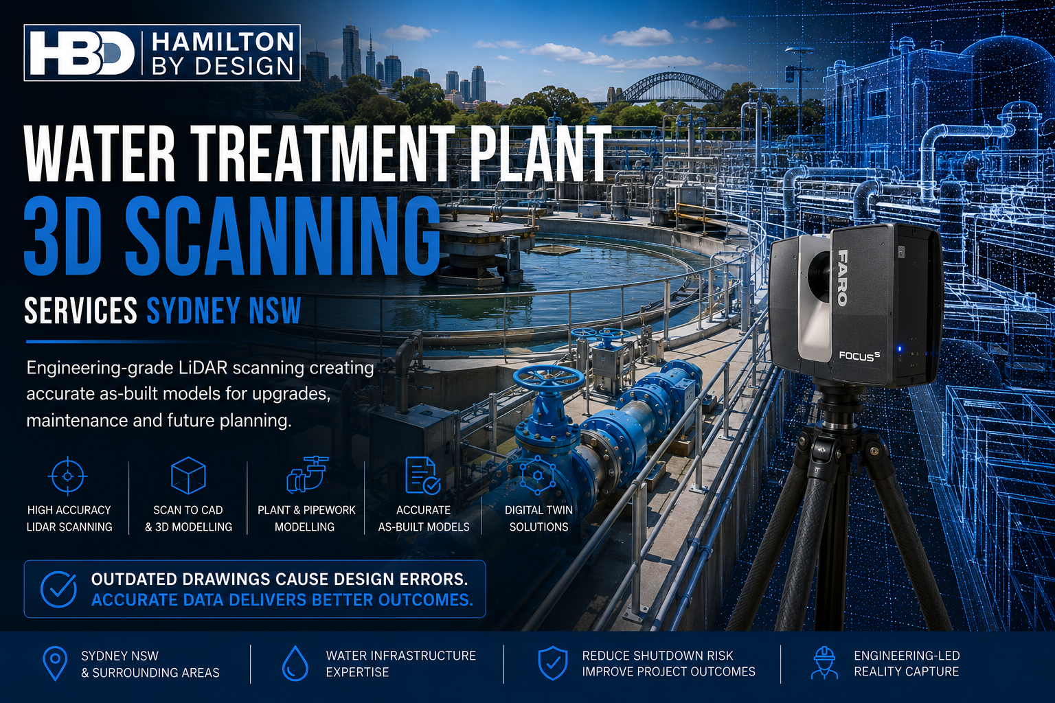


Water Treatment Plant 3D Scanning Services in Sydney NSW โ€“ Accurate As-Built Data for Smarter Engineering

Engineering-grade LiDAR scanning at a Sydney water treatment plant, capturing tanks, pipework and process infrastructure to create accurate As-Built models for plant upgrades, Scan to CAD and digital twin development.

Water treatment plants are among Australia’s most critical infrastructure assets. They operate continuously to deliver safe, reliable drinking water to millions of people while meeting stringent regulatory and environmental requirements. As Sydney continues to invest in expanding and modernising its water infrastructure, engineering teams are increasingly faced with a common challenge:

The existing as-built drawings no longer reflect what is actually installed on site.

Over decades of operation, treatment plants undergo numerous modifications. Pumps are replaced, pipework is rerouted, valves are upgraded, electrical equipment is relocated, and structural steel is modified to suit operational requirements. Unfortunately, these changes are not always captured in the engineering documentation.

When engineers begin designing upgrades using outdated drawings, errors quickly emerge. Pipework clashes with existing infrastructure, replacement equipment fails to fit, structural supports require redesign, and shutdown schedules are extended while unexpected site modifications are completed.

Hamilton By Design provides engineering-grade Water Treatment Plant 3D Scanning Services throughout Sydney NSW, using terrestrial LiDAR scanning to create highly accurate digital representations of existing facilities. By replacing outdated drawings with reliable reality capture, engineering teams can design with confidence, reduce project risk and improve construction outcomes.


The Problem with Outdated As-Built Drawings

Many of Sydney’s water treatment facilities have been operating for several decades. During this time, numerous maintenance activities and capital upgrades have altered the original plant configuration.

Typical undocumented changes include:

  • Replacement pumps with different footprints
  • Pipework rerouted around new equipment
  • Additional valves and instrumentation
  • Modified pipe supports
  • Structural strengthening
  • New cable trays
  • Electrical switchboard upgrades
  • Temporary modifications that became permanent
  • Altered maintenance platforms
  • Relocated access ladders

Although each modification may have been appropriate at the time, the cumulative effect is that original drawings often no longer represent actual site conditions.

Engineering projects based on these outdated documents carry significant risk.


Why Accurate Existing Conditions Matter

Every brownfield engineering project begins with one critical question:

What is actually installed today?

Without accurate existing information, designers are forced to rely on assumptions or undertake extensive manual site measurements.

Both approaches introduce unnecessary risk.

Common design issues include:

  • Pipework that does not align during installation
  • Pump discharge flanges requiring on-site modification
  • Structural steel interfering with new equipment
  • Insufficient maintenance access
  • Cable trays clashing with pipe supports
  • Valve actuators becoming inaccessible
  • Equipment foundations requiring redesign
  • Lifting clearances being overlooked

These problems typically become apparent during construction, when the cost of correcting them is significantly higher.


Engineering LiDAR Scanning Removes Uncertainty

Hamilton By Design uses professional terrestrial LiDAR scanners to capture millions of highly accurate measurement points throughout a water treatment facility.

Rather than recording selected dimensions using conventional survey methods, laser scanning captures the complete geometry of the plant.

Typical assets captured include:

  • Process pipework
  • Pumps
  • Motors
  • Valves
  • Tanks
  • Clarifiers
  • Filters
  • Chemical dosing systems
  • Structural steel
  • Pipe bridges
  • Walkways
  • Stairways
  • Handrails
  • Electrical switchrooms
  • MCC rooms
  • Cable trays
  • Instrumentation
  • Concrete structures

The result is a comprehensive point cloud representing the true existing condition of the facility.

Engineers can measure any feature directly from the scan throughout the design process without repeatedly returning to site.


Supporting Water Treatment Plant Upgrades

Sydney’s treatment plants require continual investment to maintain reliability, increase capacity and improve operational efficiency.

LiDAR scanning supports projects such as:

Pump Replacements

Replacement pumps frequently differ from the original equipment.

Accurate scanning ensures:

  • baseplates align correctly
  • suction and discharge pipework matches
  • maintenance clearances are maintained
  • lifting access is preserved

Pipework Modifications

Process improvements often require:

  • larger diameter pipework
  • bypass systems
  • additional isolation valves
  • flow meters
  • chemical dosing lines

Accurate point clouds allow new spool pieces to be designed around existing infrastructure before fabrication begins.


Structural Modifications

New equipment installations commonly require:

  • equipment platforms
  • maintenance walkways
  • lifting beams
  • pipe supports
  • access ladders
  • handrails

Scanning captures every structural member to ensure new steel integrates correctly.


Electrical and Instrumentation Upgrades

Electrical upgrades benefit significantly from reality capture.

Designers can accurately model:

  • cable trays
  • conduits
  • MCC rooms
  • switchboards
  • instrument locations
  • communication systems

This improves installation planning while reducing field modifications.


Creating Accurate As-Built Models

One of the greatest advantages of engineering-grade LiDAR scanning is the ability to create reliable as-built models.

These models provide:

  • current equipment locations
  • verified pipe routing
  • structural layouts
  • equipment dimensions
  • maintenance clearances
  • plant configuration

Unlike historic drawings, as-built models reflect the facility exactly as it exists today.

They become the foundation for future engineering projects.


Scan to CAD for Engineering Design

Point clouds are extremely valuable, but engineering projects often require intelligent CAD models.

Hamilton By Design converts point cloud data into engineering deliverables including:

  • 3D CAD models
  • General Arrangement drawings
  • Equipment layouts
  • Pipe routing models
  • Structural steel models
  • Plant sections
  • Elevations
  • Fabrication drawings
  • As-built documentation

These models integrate directly into engineering workflows using software such as Autodesk, SOLIDWORKS and Navisworks.


Supporting Digital Twin Development

Many water authorities are now investing in digital twins to improve long-term asset management.

LiDAR scanning forms the foundation of these digital assets.

A digital twin can support:

  • maintenance planning
  • shutdown coordination
  • asset lifecycle management
  • operator training
  • future upgrades
  • capital works planning
  • condition assessments
  • engineering analysis

Rather than relying on outdated information, the digital twin represents actual plant conditions.


Reducing Shutdown Risk

Water treatment plants often operate continuously, making shutdown planning critical.

Unexpected design errors during shutdowns can result in:

  • extended outages
  • contractor delays
  • increased labour costs
  • emergency fabrication
  • delayed commissioning

Accurate 3D scanning identifies potential issues before work begins.

Engineers can perform visual clash detection, verify clearances and optimise installation sequences during the design stage.

This significantly reduces project risk.


Brownfield Engineering Expertise

Unlike greenfield facilities, brownfield projects require engineers to work around existing assets.

Hamilton By Design specialises in engineering support for brownfield infrastructure, including:

  • water treatment plants
  • wastewater treatment plants
  • pumping stations
  • reservoirs
  • chemical dosing facilities
  • filtration plants
  • process buildings

Engineering-grade reality capture provides confidence that new infrastructure will integrate successfully with existing operations.


Typical Project Workflow

Our engineering workflow has been developed specifically for operational infrastructure.

1. Project Planning

Review plant access requirements, shutdown windows and engineering objectives.

2. Site LiDAR Scanning

Capture complete facility geometry using terrestrial laser scanning.

3. Scan Registration

Combine individual scans into one accurate point cloud.

4. Quality Assurance

Verify registration accuracy and confirm complete site coverage.

5. Engineering Modelling

Develop CAD models, equipment layouts and engineering documentation.

6. Design Integration

Use accurate as-built information to complete mechanical, structural and process designs.

7. Construction Verification

Verify proposed upgrades against existing infrastructure before fabrication.


Why Choose Hamilton By Design?

Hamilton By Design provides more than laser scanning.

We combine engineering expertise with advanced reality capture technologies to deliver practical engineering solutions.

Our capabilities include:

  • Engineering-grade terrestrial LiDAR scanning
  • Mechanical engineering design
  • Scan to CAD services
  • Reverse engineering
  • Pipework modelling
  • Structural steel modelling
  • Engineering drafting
  • Digital twin development
  • As-built verification
  • Brownfield engineering support
  • Shutdown engineering planning

Because our engineers understand industrial facilities, we capture the information that designers actually needโ€”not just visually impressive point clouds.


Supporting Sydney’s Water Infrastructure

Sydney’s water treatment plants play a vital role in supplying safe drinking water to millions of residents and businesses. As these facilities continue to expand, modernise and replace ageing assets, engineering accuracy becomes increasingly important.

Outdated as-built drawings should never be the reason a project experiences delays, redesigns or costly construction changes.

Engineering-grade LiDAR scanning provides reliable existing-condition data that supports smarter engineering decisions, reduces construction risk and improves project outcomes.

Whether your project involves replacing pumps, modifying pipework, upgrading process equipment or creating a digital twin, Hamilton By Design delivers accurate 3D scanning, engineering modelling and Scan to CAD services throughout Sydney NSW.

By capturing the plant exactly as it exists today, we help ensure tomorrow’s upgrades fit correctly the first time.

Talk to Us – Contact Us

Name
Would you like us to arrange a phone consultation for you?
Address

Our clients:
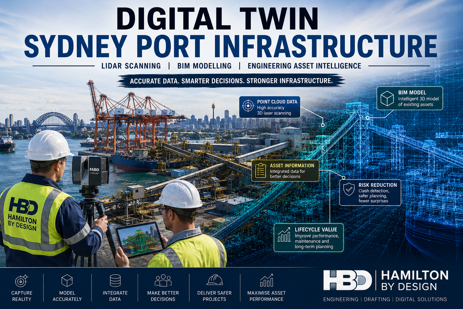


Digital Twin Sydney Port Infrastructure

Digital twin of Sydney port infrastructure showing LiDAR scanning, BIM modelling and engineering asset intelligence used to create accurate digital representations of port facilities for maintenance, upgrades and asset management.

Develop Digital Twins of Sydney Port Infrastructure Using LiDAR Scanning, BIM and Engineering Modelling Workflows

Blue mechanical engineering icon with gear and wrench

Sydney’s ports are among Australia’s most important infrastructure assets, supporting container handling, bulk materials, fuel imports, logistics operations and international trade. As port facilities continue to expand and age, asset owners face increasing challenges managing infrastructure that has often been modified over decades without complete documentation.

Hamilton By Design provides Digital Twin Sydney Port Infrastructure services, combining engineering-grade LiDAR scanning, reality capture, BIM modelling and engineering workflows to create accurate digital representations of existing port assets. These digital twins provide a reliable foundation for maintenance planning, shutdowns, upgrades, asset management and future capital works.

Whether the project involves a container terminal, bulk handling facility, conveyor network, berth structure, ship loader, fuel terminal or rail interface, our team develops accurate digital twins that allow stakeholders to make engineering decisions based on real-world conditions rather than outdated drawings.


What is a Digital Twin?

A digital twin is a detailed digital representation of a physical asset or facility. Unlike traditional CAD drawings, a digital twin combines accurate geometry, engineering information and asset data into a single environment that can be used throughout the asset lifecycle.

For Sydney port operators, a digital twin can include:

  • Existing structural steelwork
  • Conveyors and materials handling systems
  • Ship loaders and unloaders
  • Wharf and berth infrastructure
  • Mechanical equipment
  • Pipework and services
  • Electrical installations
  • Buildings and facilities
  • Road and rail interfaces
  • Underground and above-ground assets

Digital twins allow engineering, maintenance and operations teams to access accurate infrastructure information without needing to physically inspect every asset.


Why Sydney Ports Need Digital Twins

Many port facilities have undergone numerous upgrades, repairs and expansions over several decades. In many cases, original drawings are missing, inaccurate or no longer reflect the actual site conditions.

Common challenges include:

  • Incomplete or outdated as-built documentation
  • Unknown modifications performed during shutdowns
  • Limited visibility of asset condition
  • Difficulty planning future upgrades
  • High costs associated with site rework
  • Engineering clashes during construction
  • Safety risks from inaccurate information
  • Loss of knowledge when personnel retire or move on

Developing a digital twin provides a single source of truth that accurately reflects the current state of the facility.


Engineering-Grade LiDAR Scanning for Port Infrastructure

The foundation of every digital twin is accurate reality capture.

Hamilton By Design uses engineering-grade terrestrial LiDAR scanning technology to capture highly detailed three-dimensional data from existing port infrastructure.

Typical assets scanned include:

  • Container terminals
  • Conveyor systems
  • Transfer towers
  • Bulk handling facilities
  • Storage sheds
  • Fuel infrastructure
  • Structural steelwork
  • Ship loading equipment
  • Wharf structures
  • Marine infrastructure

Using advanced scanning equipment, millions of measurements are collected every second to generate a highly accurate point cloud of the facility.

This point cloud forms the basis of the digital twin development process.


Scan-to-BIM Workflows for Sydney Ports

Once the scanning process is complete, the captured data is processed and registered to create a coordinated digital representation of the facility.

The registered point cloud can then be converted into BIM models using industry-standard software platforms.

Depending on project requirements, digital twin models may include:

  • Structural steel modelling
  • Mechanical equipment modelling
  • Pipework systems
  • Architectural components
  • Electrical infrastructure
  • Access systems and walkways
  • Conveyor systems
  • Material handling equipment

These BIM models provide accurate geometry and can be linked to asset information, maintenance records and operational data.


Supporting Brownfield Port Upgrades

One of the most valuable applications of digital twin technology is supporting brownfield infrastructure upgrades.

Port facilities rarely provide the luxury of starting with an empty site. Most projects must be designed around existing equipment and infrastructure while maintaining operational requirements.

Digital twins help project teams:

  • Identify potential clashes before construction
  • Verify available space
  • Confirm existing dimensions
  • Plan shutdown activities
  • Reduce installation risk
  • Improve fabrication accuracy
  • Minimise site modifications

By working from a verified digital environment, engineers can significantly reduce uncertainty and improve project outcomes.


Improving Shutdown Planning and Execution

Shutdowns represent some of the highest-risk activities undertaken within port environments.

A single delay can impact vessel schedules, cargo handling operations and contractor productivity.

Digital twins support shutdown planning by allowing project teams to:

  • Virtually inspect assets before mobilisation
  • Develop detailed work packages
  • Verify access requirements
  • Confirm lifting clearances
  • Identify construction constraints
  • Plan temporary works
  • Validate installation sequences

This proactive approach helps reduce downtime and improves shutdown efficiency.


Asset Management and Lifecycle Planning

Digital twins also provide substantial long-term value for asset owners.

Instead of relying on scattered drawings and historical records, maintenance teams gain access to an accurate digital representation of their infrastructure.

Benefits include:

  • Improved asset registers
  • Faster maintenance planning
  • Better condition assessments
  • Improved inspection programs
  • Enhanced capital planning
  • Reduced engineering investigation time
  • Improved operational awareness

As infrastructure ages, access to accurate digital information becomes increasingly important for managing risk and maintaining operational reliability.


Typical Digital Twin Development Process

Hamilton By Design follows a structured workflow to ensure high-quality outcomes.

1. Site Assessment

The project begins with a review of existing documentation, operational requirements and access constraints.

2. LiDAR Scanning

Engineering-grade terrestrial laser scanning captures existing infrastructure conditions.

3. Point Cloud Registration

Individual scans are processed and combined into a unified digital dataset.

4. Quality Assurance

Registration accuracy and data coverage are verified to ensure engineering suitability.

5. BIM and Engineering Modelling

The point cloud is converted into intelligent engineering models and BIM environments.

6. Asset Classification

Assets are organised and structured according to project requirements.

7. Digital Twin Development

Engineering information and asset data are integrated into the model environment.

8. Final Delivery

The completed digital twin is delivered in client-specified formats.


Deliverables

Depending on project requirements, Hamilton By Design can provide:

  • Registered E57 point clouds
  • RCP and RCS files
  • Autodesk Revit models
  • Navisworks models
  • AutoCAD drawings
  • General arrangement drawings
  • Structural models
  • Mechanical equipment models
  • Asset registers
  • BIM deliverables
  • Digital twin datasets
  • Engineering reports

Deliverables are tailored to support ongoing operations, maintenance and future engineering projects.


Hamilton By Design logo displayed on a blue tilted rectangle with a grey gradient background

Why Choose Hamilton By Design?

Hamilton By Design combines practical engineering experience with advanced reality capture technology.

Our team understands the challenges associated with operating and upgrading complex industrial facilities, particularly within port and maritime environments.

Our capabilities include:

  • Engineering-led LiDAR scanning
  • Scan-to-BIM services
  • Mechanical engineering
  • Structural engineering support
  • Engineering drafting
  • Brownfield project experience
  • Shutdown planning support
  • Asset capture and verification

We focus on delivering digital twin solutions that provide practical value and support informed decision-making throughout the asset lifecycle.


Digital Twin Services for Sydney Port Infrastructure

If you are planning an upgrade, shutdown, expansion project or asset management initiative, an accurate digital twin can significantly reduce risk and improve project outcomes.

Hamilton By Design provides Digital Twin Sydney Port Infrastructure services throughout Sydney and surrounding regions, helping port operators, engineering teams and asset owners develop accurate digital representations of critical infrastructure.

By combining LiDAR scanning, BIM modelling and engineering expertise, we create digital twins that provide the confidence needed to plan, maintain and upgrade port assets effectively.

Talk to Us – Contact Us

Name
Would you like us to arrange a phone consultation for you?
Address

Our clients:


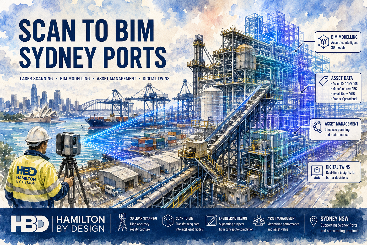
Scan to BIM Services for Sydney Ports

Watercolour illustration of a Sydney port facility undergoing Scan to BIM modelling, showing a Hamilton By Design engineer operating a laser scanner while container terminals, conveyors, industrial structures and marine infrastructure transition into intelligent BIM and digital twin models for asset management and engineering projects.

Hamilton By Design provides engineering-grade Scan to BIM services for Sydney ports, converting laser scan data into accurate Building Information Models (BIM) for asset management, maintenance planning, engineering upgrades and infrastructure development. Using advanced terrestrial laser scanning technology and BIM workflows, we capture existing port facilities and transform them into intelligent digital models that support decision-making throughout the asset lifecycle.

Sydney’s port infrastructure is constantly evolving. Facilities are upgraded, conveyors are modified, buildings are expanded and marine assets are maintained to meet increasing operational demands. Unfortunately, many port facilities rely on outdated drawings or incomplete documentation. Scan to BIM provides an accurate and reliable digital representation of existing conditions, allowing engineers, asset managers and project teams to work from current site data rather than assumptions.

Our services are available throughout Sydney and surrounding port precincts, including container terminals, bulk handling facilities, wharves, warehouses, workshops and industrial infrastructure.


What is Scan to BIM?

Scan to BIM is the process of capturing an existing facility using 3D laser scanning and converting the resulting point cloud data into an intelligent BIM model.

Unlike traditional CAD drawings, BIM models contain both geometric information and asset data. This allows the model to become a valuable asset management tool rather than simply a visual representation of the facility.

The process typically begins with laser scanning and reality capture. Millions of measurement points are collected from the site and registered into a highly accurate point cloud. Engineers and BIM specialists then use this data to develop structured digital models that represent buildings, structures, mechanical equipment and infrastructure assets.

The resulting BIM model can be used for:

  • Asset management
  • Maintenance planning
  • Shutdown preparation
  • Facility upgrades
  • Expansion projects
  • Engineering design
  • Digital twin development
  • Lifecycle management

Why Sydney Ports Require Scan to BIM

Port facilities are among the most complex industrial environments in Australia.

Many Sydney port assets have undergone multiple upgrades over decades of operation. As a result, original drawings may no longer reflect current conditions.

Common challenges include:

  • Missing as-built documentation
  • Outdated drawings
  • Unrecorded modifications
  • Congested plant layouts
  • Limited shutdown windows
  • Complex structural arrangements
  • Legacy infrastructure

Scan to BIM helps eliminate these challenges by providing a current and accurate digital representation of the facility.

Engineering teams can design with confidence, knowing that the model reflects actual site conditions rather than historical assumptions.


Sydney Port Infrastructure Commonly Modelled

Marine Infrastructure

We regularly capture and model:

  • Wharves
  • Berths
  • Jetties
  • Fender systems
  • Mooring facilities
  • Access structures
  • Marine loading equipment

Bulk Materials Handling Facilities

Bulk handling operations often include:

  • Conveyors
  • Transfer towers
  • Chutes
  • Hoppers
  • Ship loaders
  • Storage facilities
  • Dust collection systems

These assets can be accurately modelled to support maintenance and upgrade projects.

Buildings and Facilities

Scan to BIM is commonly used for:

  • Warehouses
  • Workshops
  • Administration buildings
  • Control rooms
  • Maintenance facilities
  • Operational centres

Structural Infrastructure

Port facilities contain extensive structural assets including:

  • Steel platforms
  • Walkways
  • Handrails
  • Access stairs
  • Pipe supports
  • Equipment support structures

These can be modelled to support engineering design and compliance requirements.

Utilities and Services

Models may also include:

  • Fire services
  • Water systems
  • Drainage infrastructure
  • Electrical services
  • Communications systems
  • Compressed air systems

Our Scan to BIM Process

1. Site Inspection and Planning

Every project begins with a detailed review of:

  • Site access requirements
  • Asset priorities
  • Safety procedures
  • Shutdown requirements
  • Deliverable expectations

A scanning strategy is developed to ensure complete coverage of the facility.

2. 3D Laser Scanning

Using professional laser scanning equipment, millions of measurements are collected across the facility.

Typical equipment includes:

  • FARO Focus S70
  • FARO Orbis Mobile Scanner

These systems capture highly detailed spatial information suitable for engineering and BIM applications.

3. Point Cloud Registration

Individual scans are registered into a unified dataset using specialised software.

Common software platforms include:

  • FARO SCENE
  • Autodesk ReCap

The registered point cloud becomes the foundation for all subsequent modelling work.

4. BIM Development

The point cloud is imported into BIM software where intelligent models are created.

Platforms commonly used include:

  • Autodesk Revit
  • Navisworks
  • AutoCAD
  • SolidWorks
  • Autodesk Inventor

Models can be developed to suit the required Level of Development (LOD) and project objectives.

5. Asset Information Integration

Additional asset information can be incorporated into the BIM model including:

  • Asset identification numbers
  • Equipment tags
  • Maintenance schedules
  • Manufacturer information
  • Inspection records
  • Operational data

This transforms the model into a valuable asset management resource.

6. Final Delivery

The completed BIM model is delivered along with supporting files and documentation.


Benefits of Scan to BIM for Sydney Ports

Improved Asset Management

Accurate BIM models provide a centralised source of asset information, improving maintenance and operational planning.

Reduced Project Risk

Engineers can design against verified site conditions, reducing clashes and costly rework.

Better Shutdown Planning

Maintenance activities can be planned using accurate digital representations of equipment and infrastructure.

Faster Engineering Design

Consultants and project teams can begin design work immediately without extensive site re-measurement.

Enhanced Collaboration

BIM models provide a common platform for engineers, contractors, asset managers and operations personnel.

Future Digital Twin Development

Scan to BIM forms the foundation for digital twin initiatives and advanced asset management systems.


Typical Deliverables

Clients typically receive a combination of the following deliverables.

Point Cloud Data

  • E57 files
  • RCP files
  • RCS files
  • LAS files

BIM Models

  • Autodesk Revit (RVT)
  • IFC models
  • Navisworks models
  • Federated BIM models

Engineering Documentation

  • General Arrangement Drawings
  • Floor Plans
  • Sections
  • Elevations
  • Equipment layouts

Asset Information

  • Equipment schedules
  • Asset registers
  • Model metadata
  • Asset management datasets

Industries We Support

Our Scan to BIM services support a wide range of industrial sectors including:

  • Ports and marine infrastructure
  • Bulk materials handling
  • Manufacturing
  • Logistics facilities
  • Mining infrastructure
  • Water treatment facilities
  • Utilities
  • Industrial processing plants

Why Choose Hamilton By Design?

Hamilton By Design combines engineering expertise with advanced reality capture technology to deliver practical BIM solutions for industrial environments.

Unlike survey-only providers, our team understands how the captured data will ultimately be used by engineers, maintenance teams and asset managers. This engineering-focused approach ensures the final BIM model delivers real value beyond simple visualisation.

Our experience across ports, mining operations, manufacturing facilities, utilities and infrastructure projects enables us to deliver accurate models that support maintenance, design, compliance and long-term asset management objectives.

Whether your project involves a single warehouse, a bulk materials handling facility, a marine structure or an entire port precinct, our Scan to BIM services provide the digital foundation needed for informed engineering and asset management decisions.


Need Scan to BIM Services for Sydney Ports?

Hamilton By Design provides engineering-grade laser scanning, point cloud processing, BIM modelling and asset management deliverables for port infrastructure projects throughout Sydney.

Our team can assist with brownfield upgrades, shutdown planning, asset management programs, digital twin development and engineering design projects using accurate reality capture data and intelligent BIM workflows. Contact Hamilton By Design to discuss your Sydney port Scan to BIM requirements.

Talk to Us – Contact Us

Name
Would you like us to arrange a phone consultation for you?
Address

Our clients:


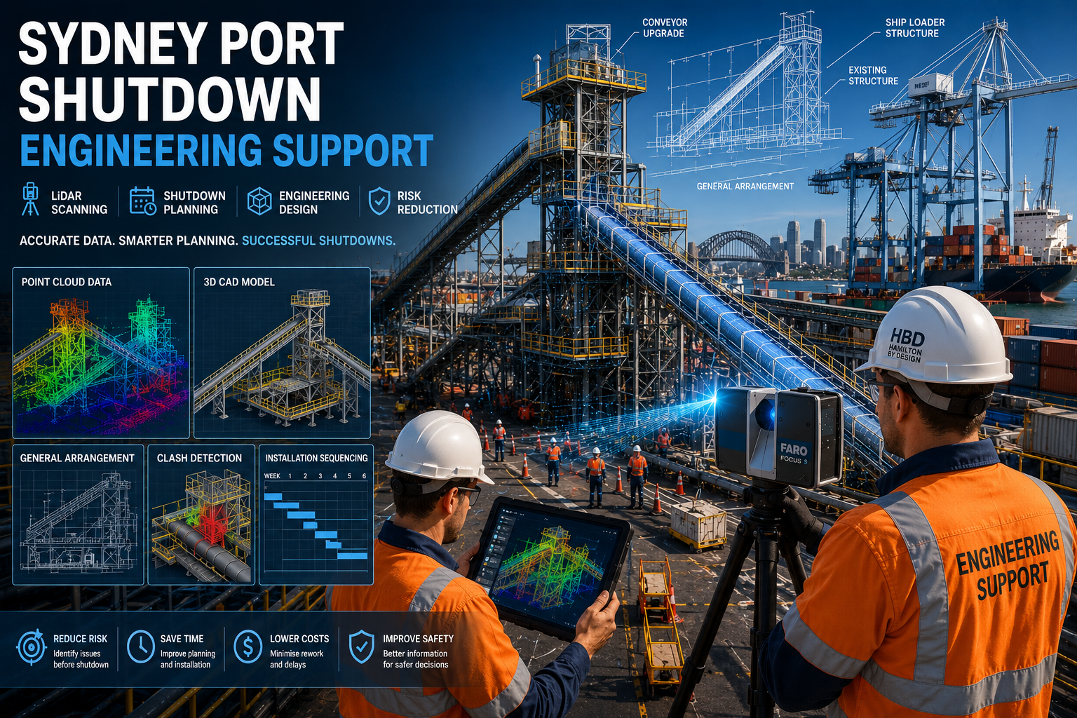
Sydney Port Shutdown Engineering Support

Sydney Port Shutdown Engineering Support engineers performing LiDAR scanning and digital shutdown planning at a Sydney port facility with conveyors, cranes, point cloud models, CAD drawings and engineering design overlays.

Reduce shutdown risk with engineering support, LiDAR scanning and detailed planning for Sydney port facilities.

Blue Gear and Spanner icon

Port shutdowns are some of the most complex engineering activities undertaken within maritime and logistics infrastructure. Whether the project involves conveyor replacements, ship loader upgrades, structural modifications, equipment installations, or brownfield expansion works, a successful shutdown depends on accurate information, detailed planning, and effective engineering support. Hamilton By Design provides Sydney Port Shutdown Engineering Support services, combining engineering-grade LiDAR scanning, Scan-to-CAD modelling, mechanical engineering, structural drafting, and detailed project documentation to help port operators complete shutdowns safely, efficiently, and with minimal disruption to operations.

Our engineering team works across Sydney’s ports, terminals, logistics facilities, and industrial infrastructure, providing the accurate site information and engineering deliverables required to reduce risk, minimise downtime, and improve shutdown outcomes.


Engineering Support for Sydney Port Shutdowns

Shutdowns are typically scheduled maintenance or upgrade periods where operational assets are taken offline to allow inspection, replacement, modification, or installation works. Every hour of shutdown time carries significant operational costs, making planning and execution critical.

Hamilton By Design supports shutdown projects by providing:

  • Engineering-grade 3D LiDAR scanning
  • Existing asset verification
  • Scan-to-CAD modelling
  • Mechanical engineering support
  • Structural engineering support
  • General arrangement drawings
  • Installation planning drawings
  • Fabrication documentation
  • Brownfield engineering services
  • As-built verification
  • Asset capture and documentation
  • Site measurement services

Our objective is to ensure contractors, engineers, maintenance teams, and project managers have accurate information before work begins.


Why Accurate Site Information Matters

Many shutdown projects rely on outdated drawings, incomplete records, or undocumented modifications that have occurred over years of operation.

Common challenges include:

  • Missing as-built drawings
  • Unknown equipment locations
  • Structural modifications not shown on drawings
  • Pipework clashes
  • Conveyor alignment issues
  • Limited access areas
  • Inaccurate dimensions
  • Restricted shutdown windows

Engineering decisions based on inaccurate information can lead to installation delays, rework, safety risks, and costly schedule overruns.

LiDAR scanning eliminates these uncertainties by capturing millions of accurate measurements of the existing facility.


LiDAR Scanning for Sydney Port Shutdown Planning

Hamilton By Design uses engineering-grade terrestrial laser scanning systems to capture highly detailed digital representations of port facilities.

Typical assets scanned include:

  • Ship loaders
  • Conveyors
  • Transfer towers
  • Wharf structures
  • Berths
  • Bulk handling equipment
  • Pipework systems
  • Structural steel
  • Access platforms
  • Stairs and walkways
  • Mechanical equipment
  • Storage facilities

Using FARO Focus laser scanners and mobile reality capture technology, we generate accurate point cloud datasets that provide a complete digital record of existing infrastructure.

This allows engineering teams to work with real-world conditions rather than relying solely on legacy drawings.


Scan-to-CAD and Digital Engineering Workflows

Once site scanning is complete, the captured data is processed into engineering-ready point clouds.

Deliverables can include:

  • E57 files
  • RCP files
  • RCS files
  • LAS files

The point cloud data can then be converted into:

  • AutoCAD models
  • SolidWorks assemblies
  • Inventor models
  • Navisworks coordination models
  • 2D engineering drawings
  • Structural layouts
  • Mechanical layouts

These models become the foundation for shutdown planning and engineering design.

By working within an accurate digital environment, project teams can identify issues before arriving onsite.


Brownfield Engineering for Existing Port Facilities

Most shutdown projects occur within existing operational facilities where space constraints and existing infrastructure present unique challenges.

Brownfield environments often contain:

  • Legacy equipment
  • Historical modifications
  • Congested plant layouts
  • Restricted access
  • Active operational interfaces

Hamilton By Design specialises in engineering solutions for these environments.

By integrating laser scanning with mechanical and structural engineering workflows, we can accurately assess existing conditions and develop practical upgrade solutions that suit the facility.

This approach reduces design assumptions and significantly improves constructability.


Shutdown Planning and Risk Reduction

A well-planned shutdown can save thousands of dollars in labour, equipment hire, and lost production.

Our engineering support services assist with:

Constructability Reviews

Assessing whether new equipment can be installed safely and efficiently within existing conditions.

Clash Detection

Identifying potential conflicts between:

  • Structural steel
  • Pipework
  • Conveyors
  • Mechanical equipment
  • Electrical services

before installation begins.

Installation Sequencing

Developing practical installation methodologies and staging plans.

Site Verification

Confirming dimensions and site conditions before fabrication commences.

Asset Documentation

Creating accurate records for future maintenance and upgrade projects.


Mechanical Engineering Support

Port facilities contain a wide range of mechanical systems requiring specialised engineering support during shutdowns.

Examples include:

  • Conveyor systems
  • Transfer chutes
  • Ship loading systems
  • Pump stations
  • Hydraulic systems
  • Material handling equipment
  • Bulk storage infrastructure

Hamilton By Design provides mechanical engineering services to support equipment upgrades, modifications, replacements, and maintenance activities.

Services can include:

  • Equipment measurement
  • Reverse engineering
  • CAD modelling
  • Design verification
  • Fabrication documentation
  • Engineering calculations

Structural Engineering Support

Shutdowns often involve modifications to structural infrastructure.

Common projects include:

  • Platform upgrades
  • Walkway replacements
  • Handrail modifications
  • Structural strengthening
  • Equipment support frames
  • Maintenance access improvements

Our engineering team develops detailed structural documentation suitable for fabrication and installation.

Designs can be developed in accordance with relevant Australian Standards and site-specific requirements.


Typical Shutdown Deliverables

Depending on project requirements, clients may receive:

Point Cloud Deliverables

  • E57 Point Clouds
  • RCP Files
  • RCS Files
  • LAS Files

CAD Deliverables

  • AutoCAD DWG Files
  • DXF Drawings
  • 3D CAD Models
  • Navisworks Models

Engineering Deliverables

  • General Arrangement Drawings
  • Installation Drawings
  • Fabrication Drawings
  • Structural Drawings
  • Mechanical Drawings
  • Engineering Reports

Asset Documentation

  • Equipment Registers
  • As-Built Drawings
  • Condition Documentation
  • Dimensional Verification Reports

Industries We Support

Hamilton By Design provides shutdown engineering support across a wide range of industries including:

Ports and Maritime

  • Container terminals
  • Bulk handling facilities
  • Export terminals
  • Wharf infrastructure

Mining and Bulk Materials

  • Coal terminals
  • Ore handling facilities
  • Material transfer systems

Manufacturing

  • Processing facilities
  • Industrial plants
  • Production infrastructure

Utilities and Infrastructure

  • Water treatment facilities
  • Pump stations
  • Energy infrastructure

Logistics and Transport

  • Warehousing facilities
  • Intermodal terminals
  • Freight infrastructure

Why Choose Hamilton By Design

Hamilton By Design combines practical engineering experience with advanced reality capture technology to support shutdown projects across Sydney and Australia.

Our team understands the challenges associated with working in operational industrial environments and provides engineering solutions focused on reducing risk and improving project outcomes.

By integrating LiDAR scanning, digital engineering, CAD modelling, and engineering design into a single workflow, we help clients make informed decisions before shutdowns begin.

Whether the project involves a conveyor replacement, structural upgrade, equipment installation, or brownfield expansion, our engineering support services provide the accurate information needed to minimise downtime and maximise productivity.


Hamilton By Design logo displayed on a blue tilted rectangle with a grey gradient background

Need Sydney Port Shutdown Engineering Support?

Hamilton By Design provides engineering-grade LiDAR scanning, Scan-to-CAD modelling, mechanical engineering, structural drafting, and shutdown planning support for Sydney port facilities, logistics terminals, and industrial infrastructure projects.

Contact our team today to discuss your upcoming shutdown and discover how accurate site capture and engineering planning can reduce risk, improve safety, and help keep your project on schedule.


Talk to Us – Contact Us

Name
Would you like us to arrange a phone consultation for you?
Address

Our clients:


3D LiDAR Scanning Darwin for engineering surveys, laser scanning, reality capture and point cloud modelling services
3D LiDAR Scanning Australia engineering services for laser scanning, reality capture, scan-to-CAD, Scan-to-BIM and as-built documentation across Australia
3D LiDAR scanning services on the Central Coast providing engineering-grade laser scanning, point cloud capture, scan-to-CAD modelling and industrial reality capture for infrastructure and industrial projects.