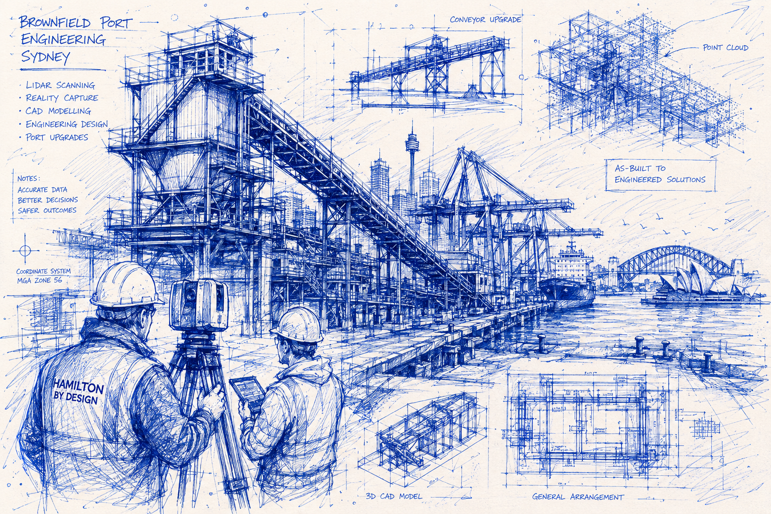
Hamilton By Design provides engineering solutions for brownfield port upgrades throughout Sydney using engineering-grade LiDAR scanning, reality capture, CAD modelling, reverse engineering and mechanical design services. We help port operators, engineering consultants, infrastructure owners and contractors accurately capture existing conditions and develop practical engineering solutions for modifications, upgrades and asset management projects.
Brownfield engineering projects differ significantly from greenfield developments because they involve working within existing operational facilities. Existing infrastructure often contains undocumented modifications, outdated drawings, restricted access areas and complex interfaces between new and existing assets. Our engineering-led approach combines 3D laser scanning, CAD modelling and engineering design to reduce project risk and improve project outcomes.
Whether upgrading a conveyor system, replacing mechanical equipment, modifying a ship loader, installing new pipework or documenting existing infrastructure, Hamilton By Design delivers accurate information that supports successful project execution.
Engineering Solutions for Sydney Port Infrastructure
Sydney is home to a wide range of port and maritime infrastructure including:
- Container terminals
- Bulk material handling facilities
- Fuel terminals
- Storage and logistics facilities
- Wharf structures
- Berths and jetties
- Ship loading facilities
- Conveyor systems
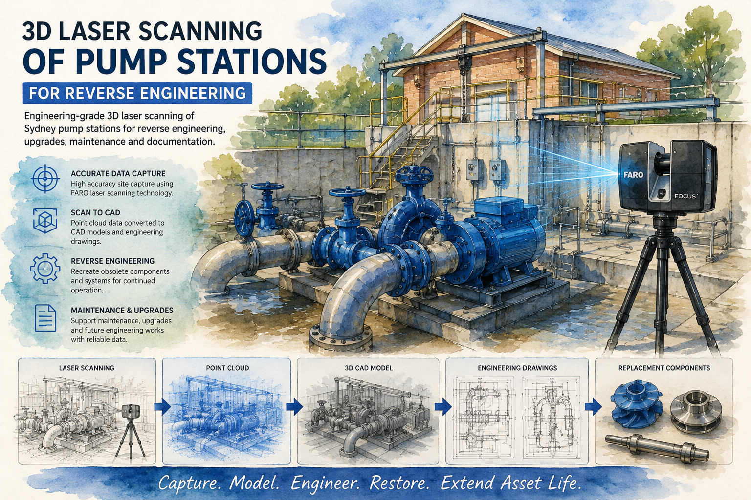
- Pump stations
- Utility infrastructure
- Mechanical handling equipment
Many of these facilities have evolved over decades and contain multiple generations of modifications. Original engineering drawings are often incomplete, inaccurate or unavailable. This creates significant challenges when planning upgrades, shutdown works and asset replacement projects.
Our brownfield port engineering services provide accurate site information and engineering documentation that enables confident design decisions.
Why Brownfield Port Projects Require Accurate Site Data
One of the biggest risks in any brownfield engineering project is relying on outdated information.
Existing drawings frequently fail to reflect:
- Structural modifications
- Equipment replacements
- Pipework rerouting
- Utility relocations
- Maintenance alterations
- Temporary works that became permanent
When engineering decisions are based on inaccurate information, projects can experience:
- Design clashes
- Construction delays
- Increased costs
- Installation difficulties
- Additional shutdown requirements
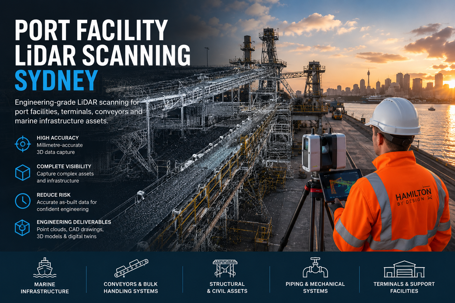
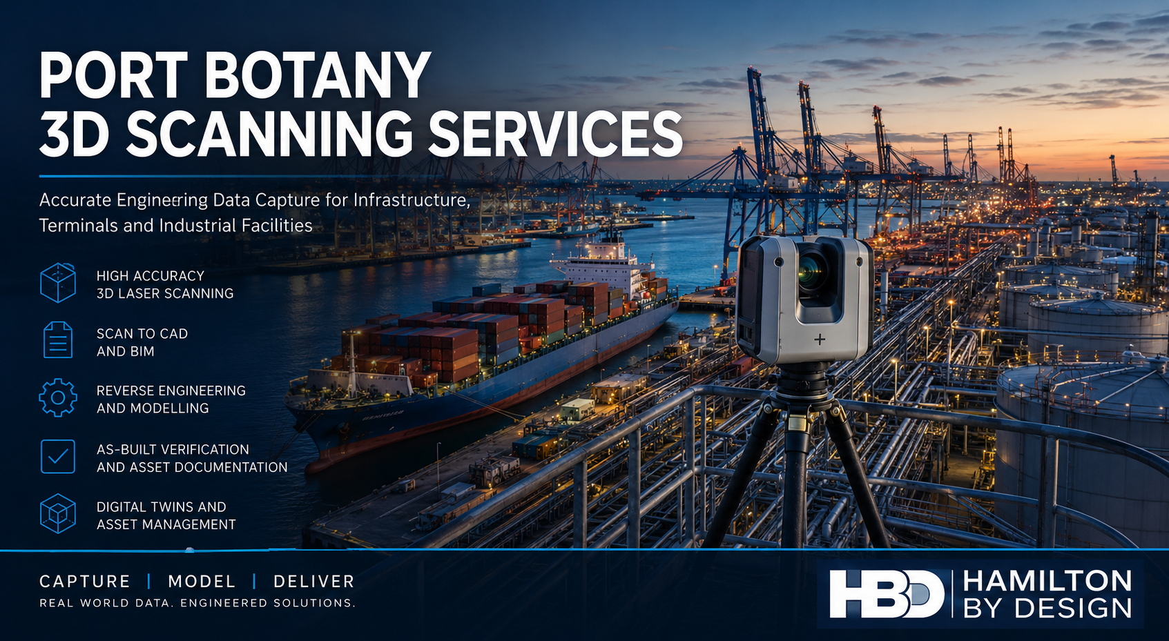
Hamilton By Design uses terrestrial LiDAR scanning to create highly accurate digital representations of existing facilities, allowing engineering teams to work from verified site conditions rather than assumptions.
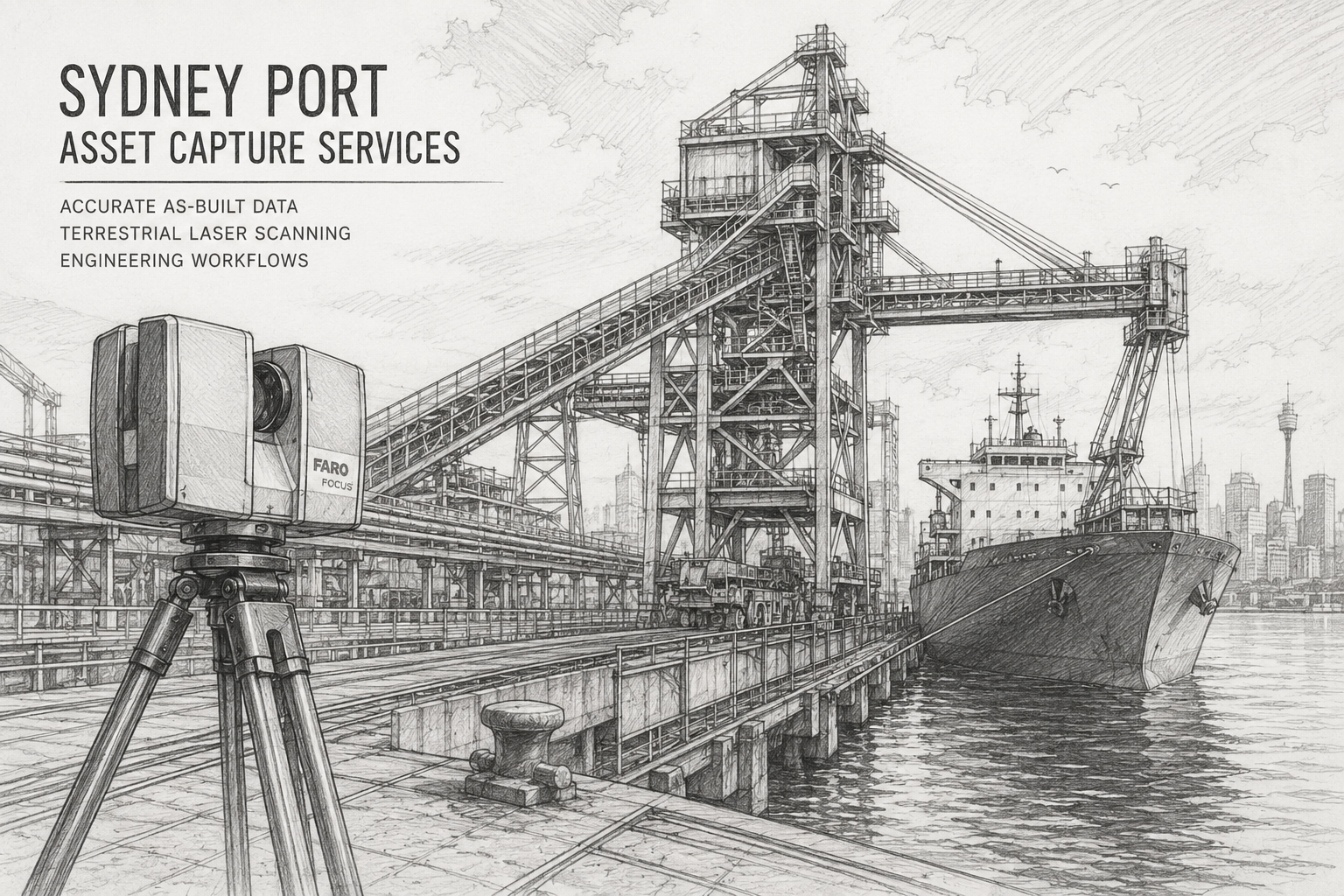
LiDAR Scanning for Brownfield Port Engineering Sydney
LiDAR scanning is typically the first stage of a brownfield port engineering project.
Using advanced terrestrial laser scanners, millions of measurements are captured across an operating facility to generate a detailed 3D point cloud.
Typical Sydney port scanning applications include:
- Conveyor systems
- Ship loaders and unloaders
- Transfer stations
- Structural steelwork
- Wharf infrastructure
- Pipework systems
- Storage facilities
- Marine mechanical equipment
- Maintenance access structures
- Utility corridors
The resulting point cloud becomes a digital twin of the facility that can be used throughout the engineering lifecycle.
Typical LiDAR Deliverables
Clients can receive:
- E57 point cloud files
- RCP and RCS files
- LAS point clouds
- Registered scan datasets
- Site measurements
- Asset verification reports
- As-built documentation
- Clash detection models
These deliverables can be integrated directly into engineering workflows.
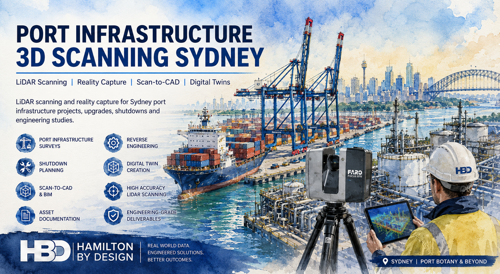
Scan to CAD Modelling for Existing Port Assets
Once scanning is complete, the point cloud can be converted into engineering-ready CAD models.
This process creates accurate representations of:
- Mechanical equipment
- Structural steelwork
- Pipework systems
- Conveyors
- Platforms
- Access systems
- Buildings
- Utility infrastructure
Our engineering team develops models using industry-standard software including:
- SolidWorks
- Autodesk Inventor
- AutoCAD
- Autodesk ReCap
- Navisworks
The resulting models provide an accurate foundation for engineering design and project planning.
Engineering Design for Brownfield Port Upgrades
Hamilton By Design supports a wide range of brownfield engineering projects throughout Sydney’s port and maritime sectors.
Mechanical Engineering Design
Mechanical engineering services may include:
- Conveyor upgrades
- Chute redesigns
- Transfer station modifications
- Equipment replacements
- Maintenance access improvements
- Materials handling improvements
- Mechanical plant modifications
- Pumping systems
Every design is developed using verified site conditions to minimise risk during installation.
Structural Engineering Support
Structural engineering support may include:
- Platform design
- Walkway modifications
- Handrail systems
- Equipment support structures
- Maintenance access systems
- Structural steel modifications
- Wharf equipment support frames
Existing structures can be assessed and modelled to support future upgrade works.
Brownfield Port Upgrade Workflow
Hamilton By Design follows a structured workflow that ensures engineering decisions are based on accurate information.
1. Project Review
We review:
- Existing drawings
- Asset information
- Site requirements
- Operational constraints
- Project objectives
This ensures the capture scope aligns with project requirements.
2. Site Capture
Engineering-grade LiDAR scanning is completed on site.
Data collection may occur during:
- Normal operations
- Maintenance shutdowns
- Restricted access periods
- Staged upgrade projects
3. Point Cloud Processing
Captured scan data is registered and processed to create a unified digital representation of the facility.
Quality checks are performed to verify registration accuracy.
4. Existing Conditions Modelling
The point cloud is converted into:
- As-built CAD models
- General arrangement drawings
- Existing condition layouts
- Structural models
- Mechanical models
5. Engineering Design
Design concepts are developed directly within the verified digital environment.
This allows engineers to identify potential issues before fabrication begins.
6. Clash Detection and Verification
New equipment and structures are checked against existing infrastructure.
This process helps avoid:
- Installation clashes
- Structural conflicts
- Pipework interference
- Access restrictions
7. Final Documentation
Project deliverables are prepared for procurement, fabrication and construction activities.
Deliverables for Brownfield Port Engineering Projects
Depending on project requirements, clients may receive:
Reality Capture Deliverables
- E57 files
- RCP files
- RCS files
- LAS files
- Registered point clouds
CAD Deliverables
- DWG drawings
- DXF drawings
- 3D CAD models
- STEP files
- Parasolid files
- SAT files
Engineering Documentation
- General arrangement drawings
- Fabrication drawings
- Installation drawings
- Structural details
- Mechanical details
- Engineering reports
These deliverables support engineering, construction and asset management activities.
Industries We Support
Hamilton By Design provides brownfield engineering services to a wide range of industries including:
- Ports and marine infrastructure
- Container terminals
- Bulk materials handling facilities
- Logistics operations
- Manufacturing facilities
- Mining export terminals
- Fuel handling facilities
- Water and utility infrastructure
- Government infrastructure assets
Our experience working within operational industrial environments allows us to deliver practical engineering outcomes with minimal disruption to operations.

Why Choose Hamilton By Design for Brownfield Port Engineering Sydney
Brownfield engineering projects require more than traditional design capabilities. They require accurate site information, a strong understanding of existing infrastructure and practical engineering experience.
Hamilton By Design combines:
- Engineering-led LiDAR scanning
- Scan-to-CAD modelling
- Mechanical engineering expertise
- Structural drafting support
- Reverse engineering capabilities
- Reality capture workflows
- Industrial project experience
By integrating site capture and engineering design into a single workflow, we help Sydney port operators and infrastructure owners reduce project risk, improve design accuracy and achieve successful upgrade outcomes.
If you are planning a brownfield port upgrade in Sydney and require accurate site capture, CAD modelling or engineering support, Hamilton By Design can provide the engineering-grade information needed to move your project forward with confidence.
Talk to Us – Contact Us
Our clients: