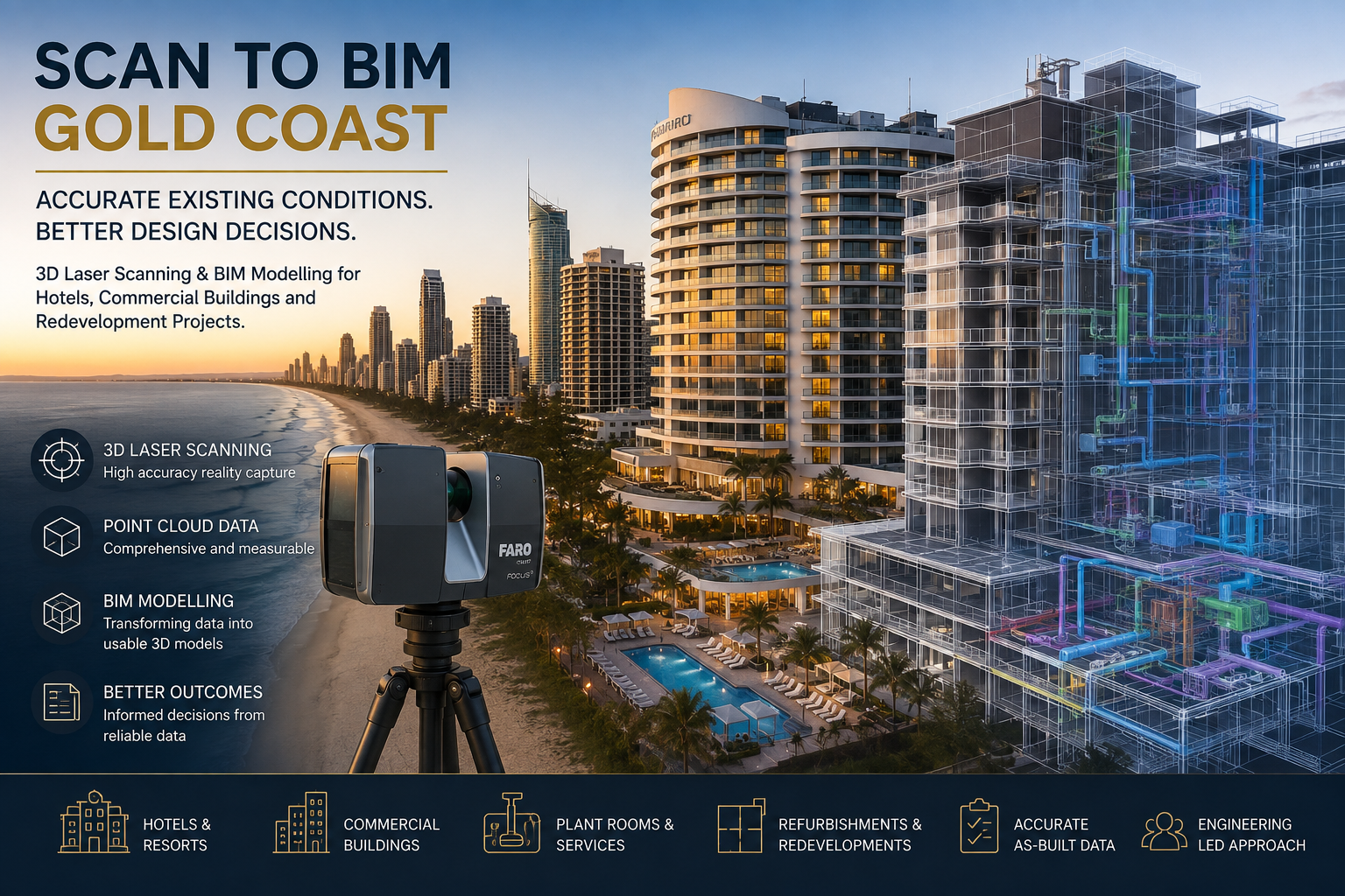
Scan to BIM Gold Coast | Hotels & Commercial Buildings

Scan to BIM Gold Coast for hotels, resorts and commercial buildings using 3D laser scanning, point cloud data and BIM modelling.

Scan to BIM Gold Coast | 3D Laser Scanning for Hotels, Commercial Buildings & Redevelopment

Gold Coast hotels, resorts and commercial buildings are continually being refurbished, upgraded and redeveloped. However, many projects begin with the same fundamental problem: the available drawings no longer accurately represent what exists on site.

Walls may have been relocated, hotel rooms reconfigured, building services rerouted, plant replaced and structural modifications completed without every change being incorporated into the original drawing set.

For architects, engineers, project managers and contractors preparing a refurbishment, that creates uncertainty before design work even begins.

Hamilton By Design provides Scan to BIM Gold Coast services, combining engineering-led 3D laser scanning, LiDAR point-cloud processing and digital modelling to establish an accurate representation of existing building conditions.

Rather than designing around assumptions, project teams can begin with measured information captured directly from the existing building.

Our broader Scan to BIM services across Queensland support commercial, industrial, infrastructure and redevelopment projects where accurate existing-condition information is required before engineering or design work proceeds.

When the Drawings Don’t Match the Building

Existing drawings remain valuable, but buildings change throughout their operating life.

This is particularly relevant to hotels and commercial properties that may have undergone numerous refurbishments, tenancy changes, services upgrades and modifications.

A hotel constructed decades ago may have subsequently experienced:

  • guest-room refurbishments
  • bathroom alterations
  • restaurant upgrades
  • commercial kitchen modifications
  • lobby renovations
  • conference-area changes
  • mechanical plant replacement
  • air-conditioning upgrades
  • electrical modifications
  • fire-system changes
  • faรงade upgrades
  • accessibility improvements
  • structural modifications.

Even relatively minor projects can gradually create significant differences between the original drawings and the physical building.

The problem appears when another refurbishment begins.

Designers may initially rely on existing PDFs, CAD drawings or archived plans, only to discover during construction that columns, walls, ceilings, pipework or services are not where the documentation indicated.

This can lead to additional site visits, design revisions, clashes, fabrication changes and construction delays.

The objective of Scan to BIM is simple:

Capture the building that actually exists today.

What Is Scan to BIM?

Scan to BIM combines reality capture with digital modelling.

A terrestrial 3D laser scanner records millions of individual measurements from the visible surfaces around the building. These measurements form a three-dimensional point cloud representing the existing geometry.

The point cloud can then become the dimensional reference for developing BIM, CAD and engineering models.

Hamilton By Design’s broader 3D laser scanning services support projects where accurate spatial information is needed for design, engineering, verification and existing-condition documentation.

Instead of manually measuring individual walls, columns, rooms or plant items one dimension at a time, laser scanning captures extensive spatial information across the surveyed area.

The result is a measurable digital record that can be reviewed after the site visit.

Scan to BIM for Gold Coast Hotels and Resorts

Hotels and resorts represent a particularly useful application for Scan to BIM.

A refurbishment may involve only a group of rooms, one floor or a restaurant area. Alternatively, the project may involve major redevelopment across multiple levels of an operating property.

Before new work begins, designers need to understand the geometry they are connecting into.

Hamilton By Design provides 3D laser scanning for hospitality projects including hotels, resorts, restaurants, clubs and other hospitality facilities.

Areas that can potentially be captured include:

  • guest rooms
  • bathrooms
  • corridors
  • foyers and lobbies
  • restaurants
  • bars
  • function rooms
  • commercial kitchens
  • back-of-house areas
  • plant rooms
  • service corridors
  • stairways
  • faรงades
  • rooftop plant
  • loading and service areas.

The scan scope should be determined by what information the refurbishment team actually needs.

A hotel room refurbishment may require accurate wall, door, window and bathroom geometry.

A mechanical upgrade may instead require detailed capture of plant rooms, ceiling spaces, services and equipment interfaces.

The scanner is therefore only one part of the process.

The important question is:

What does the project team need to know before design begins?

Commercial Buildings and Gold Coast Redevelopment

The same approach can be applied to offices, retail properties, shopping centres, entertainment facilities, mixed-use developments and other commercial buildings.

Redevelopment projects can become particularly challenging when new construction needs to connect into retained portions of an existing structure.

The project team needs to know the position of existing walls, floors, structural elements and services with enough confidence to develop the new design.

Hamilton By Design’s 3D laser scanning for engineering projects connects reality capture with engineering and design workflows, helping establish reliable existing-condition information before modifications proceed.

This can be particularly valuable where conventional measurement is difficult because the building contains complex geometry, restricted areas or congested plant and services.

From Gold Coast Site to BIM Model

A Scan to BIM project typically follows a structured workflow.

1. Define the Project Requirement

Before scanning begins, the required outcome should be understood.

Does the architect require an architectural Revit model?

Does an engineer require structural geometry?

Does the mechanical contractor need an accurate plant-room model?

Does the developer simply need a reliable existing-condition point cloud?

The required deliverable influences both the scanning strategy and modelling scope.

2. Capture Existing Conditions

The relevant areas of the property are captured using terrestrial or mobile 3D laser scanning technology.

Multiple scanner positions can be used to capture rooms, corridors, external areas and complex building geometry.

3. Register the Point Cloud

Individual scans are aligned into a coordinated point-cloud dataset.

The resulting point cloud creates a measurable three-dimensional reference representing the building at the time it was captured.

For projects extending into the wider South East Queensland region, Hamilton By Design also provides 3D scanning services in Brisbane supporting construction, commercial, infrastructure and engineering projects.

4. Develop the Required BIM or CAD Model

Not everything visible in the point cloud necessarily needs to be modelled.

The modelling scope should reflect the purpose of the project.

Depending on the requirement, this may include:

  • walls
  • floors
  • ceilings
  • columns
  • beams
  • doors
  • windows
  • stairs
  • faรงade geometry
  • plant
  • equipment
  • pipework
  • structural steel
  • building-service interfaces.

For conventional building projects, BIM environments such as Revit may be appropriate.

For mechanical equipment or fabricated components within plant rooms, mechanical CAD may also form part of the workflow.

What Tools Can Assist?

Scan to BIM is not based around one software package or one piece of equipment.

A project may use several technologies throughout the workflow.

These can include:

3D LiDAR scanners for capturing existing geometry.

FARO SCENE for scan registration and processing.

Autodesk ReCap for point-cloud management and CAD integration.

Autodesk Revit for BIM-oriented building models.

AutoCAD for existing-condition plans, sections, elevations and engineering documentation.

Navisworks for coordination and model review.

SolidWorks where detailed mechanical components, equipment or fabricated assemblies need to be developed.

The appropriate combination should be determined by the intended outcome rather than forcing every project into the same modelling environment.

Hamilton By Design’s wider engineering services connect reality capture with mechanical engineering, modelling, drafting and practical project outcomes.

Scan Once โ€“ Use the Information Throughout the Project

One of the major benefits of a well-planned scanning exercise is that the captured information can potentially support several project stages.

The point cloud may assist with:

  • existing-condition verification
  • feasibility studies
  • architectural design
  • mechanical design
  • structural coordination
  • services coordination
  • floor plans
  • sections and elevations
  • plant-room modelling
  • clash reviews
  • construction planning
  • contractor coordination
  • future maintenance projects.

Additional dimensions can also be inspected digitally where the required geometry has been captured clearly.

This can reduce dependence on repeated site measurement visits as the project progresses.

For an operating hotel, this can be particularly valuable because repeated access to guest areas, plant rooms and back-of-house spaces may be disruptive.

Potential Scan to BIM Deliverables

Every project does not need the same deliverables.

Depending on the agreed scope, Hamilton By Design can develop information suitable for a range of downstream engineering and design workflows.

Potential deliverables may include:

  • registered point-cloud datasets
  • E57 files
  • RCP and RCS point clouds
  • Revit models
  • CAD geometry
  • DWG files
  • DXF files
  • STEP or SAT models
  • SolidWorks parts and assemblies
  • floor plans
  • elevations
  • sections
  • general arrangement drawings
  • measurable 3D models
  • PDF engineering drawings.

Hamilton By Design’s national Scan to BIM Australia capability provides the broader framework for converting existing physical assets into usable digital information for engineering, construction and asset-management decisions.

Scan to BIM Across the Gold Coast

Hamilton By Design can support suitable projects throughout the Gold Coast, including areas such as:

Surfers Paradise, Broadbeach, Southport, Main Beach, Mermaid Beach, Burleigh Heads, Miami, Palm Beach, Coolangatta, Robina, Varsity Lakes, Bundall, Nerang, Hope Island and surrounding areas.

For organisations with projects extending north into Brisbane, our dedicated Scan to BIM Brisbane service provides the same fundamental workflow of site capture, point-cloud processing and digital modelling for existing buildings and infrastructure.

This creates an opportunity for developers, asset owners and engineering teams managing multiple properties across South East Queensland to establish a consistent reality-capture methodology.

Why an Engineering-Led Approach Matters

Capturing millions of measurements does not automatically produce useful engineering information.

A successful Scan to BIM project starts by understanding why the information is being captured.

The scan strategy for a general architectural model may differ significantly from a project involving mechanical equipment replacement or structural modification.

Hamilton By Design approaches reality capture from an engineering perspective.

The objective is not simply to create a visually impressive point cloud.

The objective is to produce information that assists the project team in answering practical questions:

What actually exists?

Where is it located?

What will the new design need to connect to?

What geometry needs to be modelled?

What information will designers, engineers and contractors need later?

Establishing those answers early can provide a more reliable basis for refurbishment and redevelopment decisions.

Frequently Asked Questions โ€“ Scan to BIM Gold Coast

What is Scan to BIM?

Scan to BIM is the process of capturing an existing building or facility using 3D laser scanning and using the resulting point cloud as a dimensional reference for creating BIM, CAD or engineering models.

Why use Scan to BIM for a hotel refurbishment?

Hotels frequently undergo multiple renovations and services upgrades during their operating life. Existing drawings may therefore no longer represent current conditions. Laser scanning provides a way to capture the property as it exists before the next refurbishment begins.

Can individual hotel rooms be scanned?

Yes. Depending on the project scope, scanning can focus on selected guest rooms, bathrooms, corridors or specific refurbishment areas rather than necessarily capturing the entire building.

Can you scan plant rooms and building services?

Yes. Plant rooms are well suited to 3D reality capture because they often contain congested mechanical equipment, pipework, structural elements and building services that can be difficult to document using conventional measurement techniques.

Do we need a Revit model?

Not necessarily. The appropriate deliverable depends on what the information will be used for. Some projects require Revit, while others may only require a registered point cloud, AutoCAD drawings, mechanical CAD models or specific sections and elevations.

Can the point cloud be supplied?

Depending on the agreed scope, registered point-cloud data can be supplied in formats suitable for downstream review and modelling, including common formats such as E57, RCP and RCS.

Can Scan to BIM help before redevelopment?

Yes. Reality capture is particularly useful where new construction needs to interface with an existing building. Accurately capturing retained areas provides designers with a more reliable dimensional basis for developing the proposed works.

Does laser scanning eliminate the need for all site verification?

No. Critical design, structural, fabrication or construction information should still be verified in accordance with the requirements of the project. Scan to BIM provides a highly valuable existing-condition reference, but the required accuracy, scope and verification process should always be established for the intended application.

Do you provide Scan to BIM outside the Gold Coast?

Yes. Hamilton By Design provides Scan to BIM and 3D laser scanning support across Queensland and other Australian locations for commercial, industrial, infrastructure, mining and engineering projects.

What information is useful when requesting a quotation?

Useful information includes the project location, approximate building or scan area, number of levels, access requirements, available drawings, intended use of the captured data, required file formats and the type of BIM, CAD or engineering deliverable required.

Discuss Your Gold Coast Scan to BIM Project

If unreliable drawings or uncertain existing conditions are affecting a hotel refurbishment, commercial development or redevelopment project, establishing the actual building geometry can provide a stronger starting point.

Hamilton By Design combines 3D laser scanning, point-cloud processing, BIM and engineering-led modelling to help project teams work from measured existing conditions.

Start with what actually exists. Design the refurbishment from measured information.


Hamilton By Design logo displayed on a blue tilted rectangle with a grey gradient background

Contact Us – Talk To Us

Name
Would you like us to arrange a phone consultation for you?
Address

Our clients:
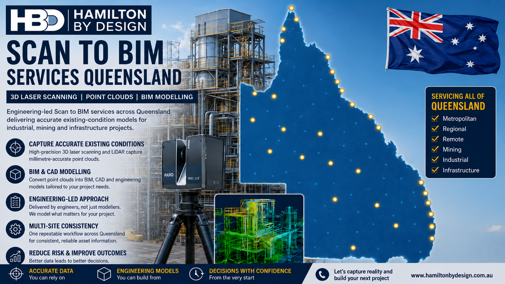


Scan to BIM Services Queensland | 3D Laser Scanning & BIM

Scan to BIM services Queensland using 3D laser scanning, LiDAR point clouds and engineering-led BIM modelling for industrial, mining and infrastructure projects.

Scan to BIM Services Queensland | 3D Laser Scanning & BIM Modelling

Across Queensland, asset owners, engineering teams and project managers are increasingly working with facilities where the available drawings no longer accurately represent what exists on site.

Industrial plants are modified. Structural steel is added or removed. Pipework routes change. Equipment is replaced. Buildings are refurbished. Mining infrastructure develops over decades.

For organisations responsible for multiple facilities, the problem becomes even greater: how do you establish a consistent and reliable digital record of existing conditions across assets located throughout Queensland?

Hamilton By Design provides Scan to BIM services across Queensland, combining engineering-grade 3D laser scanning, LiDAR point-cloud processing and engineering-led 3D modelling to convert existing physical assets into accurate digital information that can support future engineering, construction and asset-management decisions.

Our broader Scan to BIM Australia capability supports projects where existing buildings, industrial plants and infrastructure need to be accurately captured before design work begins.

What Is Scan to BIM?

Scan to BIM is the process of capturing an existing physical environment using 3D laser scanning or LiDAR technology and using that measured information to develop an accurate digital model.

Rather than relying entirely on historical drawings, tape measurements or assumptions about existing construction, a 3D laser scanner captures millions of spatial measurements from the actual asset.

These measurements form a 3D point cloud representing the existing geometry.

The point cloud can then be processed and used as the dimensional reference for developing BIM, CAD and engineering models.

Hamilton By Design approaches this process from an engineering perspective. The objective is not simply to produce an attractive three-dimensional model. The objective is to capture and model the information needed to support the next engineering, construction or asset-management decision.

Our broader 3D laser scanning services support engineering projects throughout Australia, including Queensland and regional industrial centres.

The Queensland Scan to BIM Problem

Queensland presents a particular challenge for organisations managing geographically distributed assets.

A business may have its engineering or project-management team based in Brisbane while operating facilities hundreds or thousands of kilometres away.

Assets may be located across:

Brisbane and South East Queensland, Gladstone, Rockhampton, Emerald, Mackay, the Bowen Basin, Townsville, Mount Isa and other regional or remote areas.

The documentation available for these facilities can also vary significantly.

One site may have relatively current CAD information, while another may rely on drawings produced decades earlier. Modifications undertaken during shutdowns or maintenance campaigns may never have been incorporated into the original drawings.

This creates uncertainty.

When a new conveyor, pipe route, platform, piece of machinery, building service or structural modification needs to be designed, the engineering team first needs to establish:

What is actually there?

Scan to BIM provides a method of answering that question consistently.

One Reality-Capture Workflow Across Queensland

For multi-site asset owners, one of the major advantages of Scan to BIM is the ability to establish a repeatable process.

Instead of every project beginning with a different measurement method, Hamilton By Design can use a common workflow:

Site capture โ†’ scan registration โ†’ point-cloud processing โ†’ engineering interpretation โ†’ BIM/CAD modelling โ†’ verification โ†’ project deliverables.

In Brisbane and South East Queensland, our LiDAR scanning Brisbane services support industrial facilities, infrastructure, manufacturing plants and other engineering environments requiring accurate point-cloud data.

The same fundamental process can then be applied to regional facilities, providing organisations with greater consistency between projects and sites.

Step 1 โ€“ Define What the Model Needs to Achieve

A successful Scan to BIM project should begin before the scanner is switched on.

The first question should be:

What will the captured information ultimately be used for?

The answer affects both the scan strategy and the modelling requirements.

Potential applications include:

  • brownfield plant modifications
  • equipment replacement
  • structural upgrades
  • refurbishment projects
  • construction planning
  • shutdown engineering
  • clash detection
  • fabrication
  • pipework modifications
  • building refurbishment
  • asset documentation
  • digital engineering
  • development of digital twins.

A model intended to document the general arrangement of a facility does not necessarily require the same information as one being used to design fabrication interfaces.

This is why engineering involvement at the beginning of the scanning process can be important.

Hamilton By Design’s wider engineering services integrate LiDAR capture with modelling, engineering and fabrication-oriented outcomes rather than treating reality capture as an isolated survey activity.

Step 2 โ€“ Capture Existing Conditions with 3D LiDAR

Once the required outcome is understood, the existing facility can be captured.

Terrestrial 3D laser scanning can rapidly record complex geometry that would otherwise require extensive manual measurement.

Depending on the project, this may include:

  • structural columns and beams
  • buildings
  • floor levels
  • equipment
  • conveyors
  • transfer stations
  • chutes
  • tanks
  • pipework
  • access platforms
  • stairs
  • handrails
  • machinery
  • surrounding infrastructure.

This is particularly valuable in congested industrial environments where conventional measurement can become difficult.

The scanner records the physical geometry visible from each scan position. Multiple scan positions are subsequently combined to create a coordinated representation of the facility.

For projects specifically located in the Queensland capital, our existing Scan to BIM Brisbane service provides a dedicated Brisbane-focused pathway from LiDAR capture through point-cloud modelling and engineering-led documentation.

Step 3 โ€“ Register and Process the Point Cloud

Individual scanner positions need to be aligned or registered into a common coordinate system.

The result is a measurable three-dimensional point-cloud dataset.

Depending on project requirements, processing may include:

  • scan registration
  • removal of unnecessary data
  • coordinate alignment
  • establishing project datums
  • checking scan coverage
  • segmentation of areas
  • preparation for CAD or BIM modelling.

Point clouds may subsequently be supplied in formats such as E57, RCP or RCS depending on the client’s required workflow.

This registered dataset becomes the measured reference against which the digital model can be developed.

Step 4 โ€“ Convert Required Geometry into BIM or CAD

The next stage is where Scan to BIM becomes more than reality capture.

Not everything visible in a point cloud necessarily needs to be modelled.

The question should instead be:

What information does the project team actually need?

For a commercial building, Revit may provide the appropriate BIM environment.

For an industrial plant, however, the solution may involve a combination of BIM and mechanical CAD.

Hamilton By Design’s SolidWorks Brisbane capability, for example, allows LiDAR information to feed into detailed mechanical modelling, reverse engineering and fabrication-oriented workflows.

This can be particularly important for Queensland mining, mineral-processing and industrial facilities where the existing environment contains significant mechanical equipment rather than conventional building elements alone.

Revit Is Not Always the Whole Answer

Scan to BIM is frequently associated with Autodesk Revit, but industrial facilities can require several modelling environments.

A useful Queensland industrial workflow might include:

Revit for buildings and BIM-oriented structural information.

SolidWorks for mechanical equipment, machinery and fabricated assemblies.

AutoCAD for 2D engineering documentation.

Navisworks for coordination and model review.

FARO SCENE and Autodesk ReCap for point-cloud registration, management and preparation.

The final deliverable should therefore be selected according to the project requirement rather than forcing every captured asset into a single software environment.

Supporting Brownfield and Shutdown Projects

One of the strongest applications for Scan to BIM is brownfield engineering.

Unlike greenfield projects, existing facilities contain constraints that cannot simply be moved because they conflict with a new design.

Existing steelwork, conveyors, services, pipework and operating equipment all need to be considered.

Accurate reality capture therefore gives designers an opportunity to identify potential conflicts before fabrication or construction begins.

This becomes particularly important where access to the plant is restricted or site attendance must occur during limited shutdown windows.

Hamilton By Design also provides 3D scanning for mining shutdown projects, where captured site information can support mechanical upgrades, structural verification, Scan-to-CAD modelling and plant-layout assessment.

Scan Once โ€“ Use the Data for Multiple Engineering Tasks

A well-planned scan can support more than one immediate project.

The point cloud may provide a reference for:

  • existing-condition verification
  • concept development
  • mechanical design
  • structural drafting
  • fabrication planning
  • clash checking
  • accessibility reviews
  • equipment replacement
  • future maintenance planning.

This is particularly valuable for remote Queensland assets.

Returning to a regional or remote site simply because one critical dimension was missed can be expensive and disruptive.

The scan strategy should therefore consider not only what is immediately obvious but also what information the engineering team may reasonably need later in the project.

Hamilton By Design applies this approach to SMP project delivery using 3D laser scanning, where reality capture establishes a reliable baseline of structural, mechanical and piping conditions for subsequent engineering activities.

Scan to BIM Deliverables

Deliverables can be configured around the needs of the client’s software environment and project team.

These may include:

  • registered point clouds
  • E57 files
  • RCP/RCS datasets
  • Revit models
  • IFC models
  • SolidWorks parts and assemblies
  • STEP or SAT geometry
  • DWG and DXF files
  • general arrangement drawings
  • sections and elevations
  • PDF engineering drawings
  • measurable digital models.

The objective is to deliver information that the engineering, construction or asset-management team can actually use.

Scan to BIM Services Across Queensland

Hamilton By Design supports Queensland projects where reliable existing-condition information is required before engineering work proceeds.

Projects may range from commercial and infrastructure facilities in Brisbane through to industrial, mining and processing assets in regional Queensland.

The common objective remains the same:

Capture the existing condition accurately, convert the required information into usable digital geometry, and provide the project team with a more reliable basis for engineering decisions.

For multi-site organisations, that also creates an opportunity to establish a consistent reality-capture and modelling methodology across facilities rather than beginning every project with a different approach.


Frequently Asked Questions โ€“ Scan to BIM Queensland

What is Scan to BIM?

Scan to BIM combines 3D laser scanning with digital modelling. Existing buildings, structures, plant and equipment are captured as a point cloud, which is then used as the dimensional reference for developing BIM or CAD models.

Does Scan to BIM always mean Revit?

No. Revit is commonly used for BIM, particularly for buildings and building services, but industrial projects may also require SolidWorks, AutoCAD, IFC, STEP or other CAD formats. The appropriate deliverable depends on how the information will ultimately be used.

Can Scan to BIM be used for mining and industrial facilities?

Yes. Reality capture can be particularly valuable for brownfield mining and industrial environments containing structural steel, conveyors, machinery, pipework, platforms and other complex existing infrastructure.

Can you provide the point cloud as well as the model?

Yes. Depending on the agreed project scope, deliverables can include registered point-cloud datasets as well as CAD, BIM and engineering documentation.

Why use laser scanning instead of existing drawings?

Existing drawings can be incomplete, outdated or may not include modifications made during the operating life of an asset. Laser scanning captures the physical conditions present at the time of the survey, providing the design team with a current dimensional reference.

Can Scan to BIM help reduce site revisits?

Yes. A properly planned scan captures extensive dimensional information during the initial site visit. This can allow engineers and designers to take additional measurements digitally from the point cloud later, although critical project dimensions and coverage requirements should always be identified before scanning.

Can the same process be used across several Queensland facilities?

Yes. This is one of the strongest applications for multi-site asset owners. A consistent scanning, registration and modelling methodology can be applied across metropolitan, regional and remote facilities, helping standardise the digital information available to engineering teams.

What Queensland projects are suitable for Scan to BIM?

Suitable projects can include industrial facilities, mining infrastructure, mineral-processing plants, manufacturing facilities, commercial buildings, utilities, transport infrastructure, brownfield upgrades and major refurbishment projects.

What should we determine before requesting a Scan to BIM quotation?

The most useful starting point is to establish what the final information will be used for. Providing the site location, approximate area, required model format, intended engineering application and expected level of modelling detail helps determine the appropriate scanning and modelling scope.

Talk to Hamilton By Design

If outdated drawings, inaccessible dimensions or inconsistent site information are creating uncertainty for an engineering project, Scan to BIM can provide a reliable starting point.

Hamilton By Design provides engineering-led Scan to BIM services across Queensland, connecting 3D LiDAR reality capture with point-cloud processing, CAD modelling, BIM and engineering documentation for industrial, mining, infrastructure and brownfield projects.

Start with the existing condition. Build the engineering from measured information.


Hamilton By Design logo displayed on a blue tilted rectangle with a grey gradient background

Contact Us – Talk To Us

Name
Would you like us to arrange a phone consultation for you?
Address

Our clients:
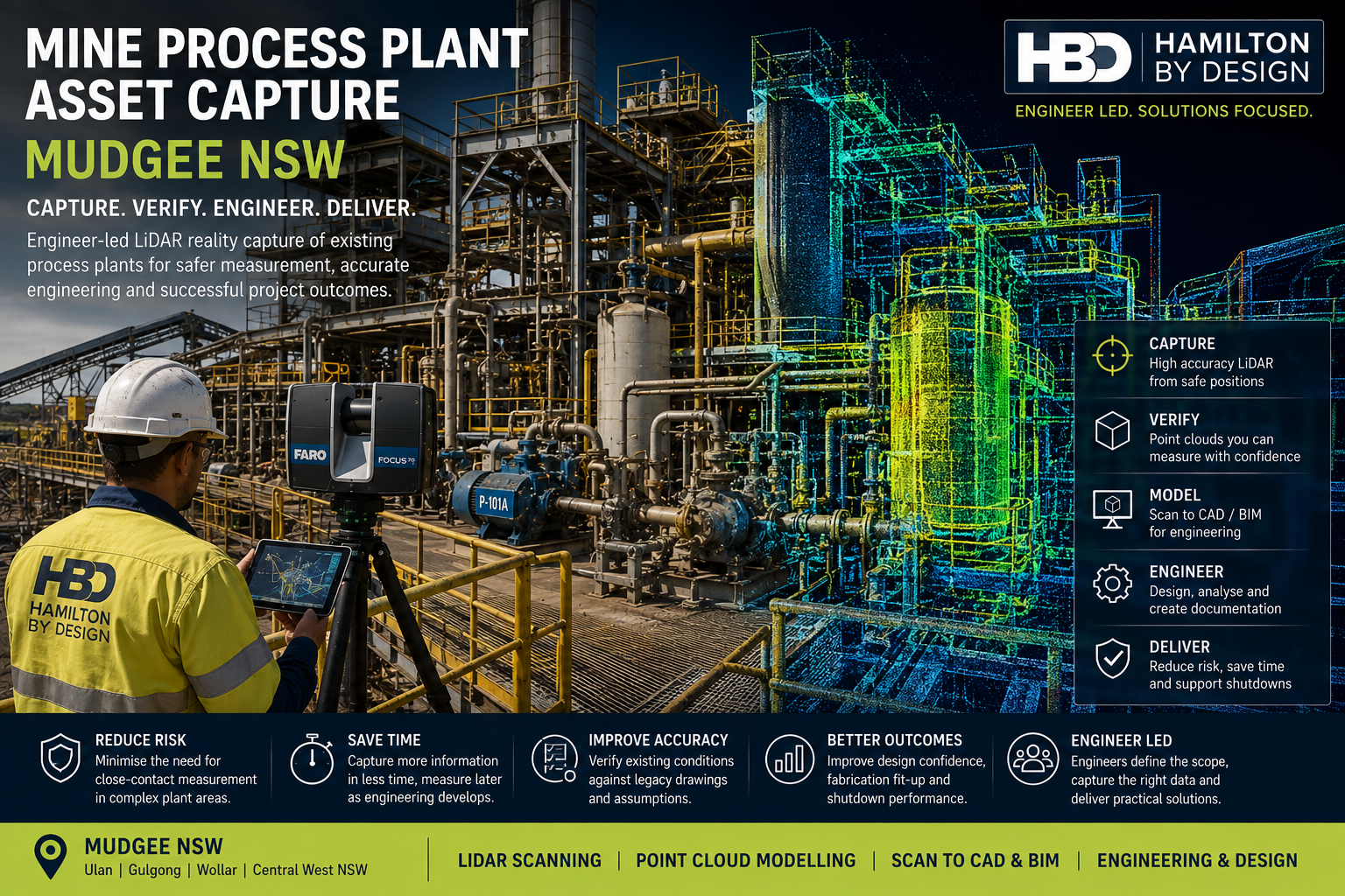


Mine Process Plant Asset Capture Mudgee NSW | Hamilton By Design

Mine process plant asset capture in Mudgee NSW using engineer-led LiDAR scanning and point-cloud modelling

Mine Process Plant Asset Capture Mudgee NSW

Existing mine process plants are complex engineering environments. Mechanical equipment, pipework, structural steel, conveyors, chutes, access platforms, guarding and services are frequently installed within constrained spaces and across multiple elevations.

Over the operating life of a mine, these assets may also be modified, replaced or extended during maintenance programs, shutdowns and plant-expansion projects. As a result, the physical plant can progressively differ from the engineering drawings and models originally produced for the facility.

For engineers planning brownfield modifications, this creates a practical challenge:

How can existing process equipment be captured accurately when direct manual measurement is difficult, restricted or potentially exposes personnel to unnecessary plant hazards?

Hamilton By Design provides engineer-led mine process plant asset capture in Mudgee NSW and surrounding Central West mining areas, using terrestrial LiDAR scanning, registered point clouds and engineering CAD workflows to establish reliable existing-condition information.

The purpose is not simply to generate a visually impressive point cloud. The objective is to produce measurable engineering information that can support plant modifications, equipment replacement, shutdown preparation, fabrication and future asset management.

The Engineering Problem: Existing Plant Can Be Difficult to Measure Safely

Traditional field measurement remains valuable for many engineering activities. However, process plants often contain areas where comprehensive manual measurement becomes inefficient or difficult to undertake safely.

Existing equipment may be:

  • elevated above operating plant;
  • located behind guarding;
  • surrounded by pipework and services;
  • installed within congested structural framing;
  • positioned close to moving equipment;
  • accessible only during limited shutdown periods;
  • surrounded by hot or process-sensitive surfaces;
  • located beneath conveyors or transfer structures; or
  • difficult to view from conventional measuring positions.

A mechanical engineer may need the location of a flange, equipment centreline, shaft position or support interface but find that direct physical access is restricted.

The engineering problem becomes more significant when the project requires an understanding of the complete three-dimensional relationship between several assets, rather than a single isolated dimension.

Hamilton By Design’s approach to engineering 3D scanning for mining and process plants uses reality capture as part of the engineering process, allowing structures, mechanical equipment, piping and surrounding plant to be recorded as measurable spatial data.

Why Engineer-Led Asset Capture Matters

Reality capture should ideally begin with an understanding of the engineering problem.

A scanning technician may ask:

Where can the scanner obtain coverage?

An engineer must also ask:

What information will be required to design the modification?

That distinction influences the quality and usefulness of the final dataset.

An engineer considering an equipment replacement may recognise the importance of capturing:

  • equipment mounting interfaces;
  • flange faces;
  • pipework connections;
  • shaft or pulley centres;
  • equipment removal routes;
  • surrounding structural steel;
  • maintenance clearances;
  • access platforms; and
  • nearby services that could interfere with installation.

Hamilton By Design’s engineer-led approach is therefore intended to connect site capture directly with downstream engineering requirements.

The workflow can extend beyond point-cloud delivery into CAD modelling, equipment design, structural interfaces, drawings and fabrication-support information.

The value is not merely obtaining more scan data. It is capturing the right engineering information for the project.

What Mine Process Plant Assets Can Be Captured?

Engineering-grade reality capture can be applied to a broad range of mining and processing infrastructure.

Typical assets may include:

  • crushers and screens;
  • pumps and pump skids;
  • tanks and vessels;
  • bins and hoppers;
  • chutes and transfer points;
  • conveyors;
  • pipework and valves;
  • flanges and nozzles;
  • structural steel;
  • equipment supports;
  • platforms and walkways;
  • stairs and handrails;
  • machine guarding;
  • ducts;
  • cable trays;
  • concrete plinths;
  • foundations; and
  • interfaces between existing and proposed equipment.

The ability to capture surrounding context is particularly important.

A replacement pump, for example, does not exist independently. Its position may be constrained by foundations, pipework, structural members, walkways, lifting access and surrounding equipment.

A point cloud provides a digital reference to these relationships.

How Does LiDAR Asset Capture Reduce Personnel Exposure?

The objective of LiDAR scanning is not to replace site safety controls.

Plant isolations, permits, exclusion zones, working-at-height controls and client procedures remain essential.

However, terrestrial LiDAR can reduce the amount of close-contact manual measuring required in some plant environments.

A scanner can record a large volume of dimensional information from an appropriate stand-off position.

This may reduce the need for personnel to repeatedly:

  • approach machinery;
  • climb structures to obtain individual dimensions;
  • work behind guards;
  • access difficult corners of plant; or
  • return to the same area for missing measurements.

Hamilton By Design’s work on engineering-grade 3D laser scanning for mining plant upgrades demonstrates how reality capture can establish existing-condition information before brownfield plant modifications are developed.

The key benefit is therefore not that scanning makes a mine site inherently safe.

It is that well-planned reality capture can reduce unnecessary exposure while improving the quantity of usable dimensional information collected during site access.

Capture Once, Measure as the Engineering Develops

One of the limitations of conventional field measurement is that engineers must anticipate every dimension required before detailed design begins.

This is not always practical.

A project engineer may collect the dimensions believed to be necessary, return to the office and commence modelling. During design, another interface may become important.

This creates the familiar cycle:

Measure โ†’ model โ†’ identify missing information โ†’ return to site โ†’ remeasure โ†’ revise

A registered LiDAR point cloud provides a different approach.

The site environment is captured comprehensively, allowing many additional dimensions to be obtained from the digital dataset after leaving site.

A useful principle is:

Capture comprehensively during the available site access, then measure selectively as the engineering develops.

This can be particularly valuable for Mudgee-region projects where engineering teams, specialist contractors or fabricators may be located considerable distances from the mine site.

Registering the Point Cloud

Terrestrial LiDAR projects generally involve multiple scanner locations.

Each scanner position records a portion of the plant from a different viewpoint.

These individual scans are subsequently processed and registered into a coordinated point-cloud dataset.

The resulting point cloud can provide measurable information including:

  • equipment centres;
  • flange positions;
  • nozzle locations;
  • structural member locations;
  • elevations;
  • equipment footprints;
  • pipe routes;
  • clearances;
  • support geometry;
  • floor levels; and
  • maintenance envelopes.

The point cloud becomes a digital record of the visible plant condition at the time of scanning.

It should not, however, automatically be regarded as the final engineering deliverable.

The point cloud is often the evidence base from which further engineering information is developed.

Verifying Legacy Drawings Against Existing Conditions

Mining process plants may operate for several decades.

During this period, equipment replacement, shutdown repairs and production modifications can progressively alter the plant configuration.

Changes may include:

  • relocated equipment;
  • replacement pumps or motors;
  • rerouted pipework;
  • new supports;
  • modified steelwork;
  • added platforms;
  • additional services; and
  • changed equipment interfaces.

Existing drawings remain important engineering records, but critical dimensions should not necessarily be assumed to represent current conditions without verification.

The point cloud allows project teams to compare historical information with the physical plant.

This can help identify discrepancies before new equipment is designed or fabricated.

From Point Cloud to Engineering CAD

Some projects require only a measurable point-cloud dataset.

Others require selected assets to be reconstructed into CAD geometry.

Hamilton By Design’s Scan to BIM services for mining and industrial facilities provide one pathway for converting existing-condition LiDAR data into usable digital engineering information.

Depending on the project, modelling may include:

  • mechanical equipment;
  • tanks and vessels;
  • structural steel;
  • pipework;
  • platforms;
  • conveyors;
  • chutes;
  • equipment interfaces; and
  • surrounding clearance envelopes.

The modelling strategy should be fit for purpose.

A project involving pump replacement may require detailed flange and support interfaces but only simplified representations of surrounding plant.

A structural modification may require accurate steel geometry while nearby equipment remains within the point cloud.

This avoids unnecessary modelling effort while maintaining the information required for engineering decisions.

Reducing Fabrication and Installation Risk

One of the most important applications of process-plant asset capture is verifying proposed modifications against existing conditions before fabrication.

A component can be manufactured accurately to a drawing and still fail to fit the plant if the original existing-condition information was incorrect.

Potential consequences include:

  • fabrication rework;
  • cutting or welding on site;
  • revised pipe spools;
  • altered structural connections;
  • additional crane time;
  • installation delays; and
  • extended shutdown duration.

By developing the proposed design against registered scan data, engineers can identify many interface problems earlier.

The objective is simple:

Identify the dimensional conflict digitally before discovering it during installation.

Supporting Shutdown Planning

Process-plant modifications are frequently completed during scheduled mine shutdowns.

Shutdown periods may provide only limited access to equipment that cannot otherwise be approached while operating.

This makes preparation particularly important.

Hamilton By Design’s CHPP 3D scanning and shutdown engineering workflows demonstrate how captured site geometry can progress through point-cloud processing, engineering modelling and fabrication documentation before shutdown execution.

Reality capture can assist shutdown preparation by improving:

  • understanding of existing conditions;
  • fabrication confidence;
  • installation planning;
  • interface verification;
  • equipment-removal planning;
  • clash identification; and
  • engineering readiness before the shutdown begins.

Scanning cannot eliminate every shutdown risk.

It can, however, improve the quality of the engineering information available when those risks are assessed and managed.

Mine Process Plant Asset Capture in Mudgee NSW

Mudgee is positioned within an established Central West NSW mining region, with major mining and processing activity around Mudgee, Ulan, Gulgong and Wollar.

Hamilton By Design can provide engineer-led reality capture for mining and industrial projects throughout:

  • Mudgee;
  • Ulan;
  • Gulgong;
  • Wollar; and
  • surrounding Central West NSW mining areas.

The service is particularly relevant for existing brownfield facilities where equipment has been progressively modified, access is restricted or accurate engineering information is required before new plant is designed.

Tools Supporting the Asset-Capture Workflow

Depending on project requirements, Hamilton By Design can combine several technologies.

FARO Focus S70 can provide detailed terrestrial LiDAR capture of process equipment and surrounding infrastructure.

FARO Orbis may provide supplementary mobile capture where appropriate to the project.

FARO SCENE supports scan registration and point-cloud processing.

Autodesk ReCap can prepare point-cloud data for engineering workflows.

SolidWorks supports mechanical equipment modelling, reverse engineering and fabrication-focused design.

Autodesk Inventor and AutoCAD can support plant layouts, mechanical modelling and technical drawings.

Navisworks can assist with large-model coordination and clash review.

Revit may be appropriate where structured BIM information is required.

Potential deliverables can include E57, RCP, RCS and LAS point clouds together with SolidWorks, STEP, SAT, Parasolid, DWG, DXF, eDrawings and PDF engineering information.

The tools are important, but they remain secondary to the engineering purpose.

The principal deliverable is reliable information about the existing plant.

Frequently Asked Questions

What is mine process plant asset capture?

Mine process plant asset capture uses technologies such as terrestrial LiDAR scanning to record the three-dimensional geometry of existing equipment, structures, pipework and surrounding plant.

Why use LiDAR instead of manual measurements?

Manual measurement remains useful, but complex process plants may require hundreds of spatial relationships to be documented. LiDAR can capture much broader existing-condition information from suitable scanner positions.

Can scanning reduce the need to access difficult plant areas?

In some circumstances, yes. LiDAR can capture visible geometry from stand-off positions, potentially reducing the amount of close-contact measurement required. Normal mine-site safety procedures and access controls still apply.

Can measurements be obtained after the scanning is complete?

Yes. Once correctly registered, point-cloud datasets can be measured during later engineering stages, subject to the geometry being visible and adequately captured.

Can old engineering drawings be checked against the scan?

Yes. Point-cloud information can be compared with drawings and models to help identify differences between documented and installed conditions.

Can the point cloud be converted into CAD?

Yes. Selected equipment, structures and interfaces can be reconstructed as CAD or BIM geometry according to the engineering purpose of the project.

Can asset capture help with equipment replacement?

Yes. Existing mounting points, pipe connections, structural interfaces and surrounding clearances can be captured before replacement equipment is designed or selected.

Can LiDAR scanning support shutdown projects?

Yes. Reality capture can improve existing-condition information before or during shutdown access and support subsequent engineering, fabrication and installation planning.

What file formats can Hamilton By Design provide?

Depending on the agreed project scope, deliverables may include E57, RCP, RCS and LAS point clouds, CAD models, STEP, SAT, Parasolid, DWG, DXF, eDrawings and PDF documentation.

What areas around Mudgee can Hamilton By Design support?

Hamilton By Design can support mine and industrial projects throughout Mudgee, Ulan, Gulgong, Wollar and surrounding Central West NSW mining regions.

Mine Process Plant Asset Capture Mudgee NSW

Existing process plants can be difficult to measure comprehensively when equipment is operating, access is constrained or engineering teams have only limited opportunities to enter particular plant areas.

Engineer-led terrestrial LiDAR provides a practical method of capturing equipment, structures and surrounding interfaces as a measurable existing-condition dataset.

Hamilton By Design combines reality capture with point-cloud processing, CAD modelling and mechanical engineering to help project teams progress from site condition to engineering information.

For mine operators and project teams in Mudgee and Central West NSW, the principle is straightforward:

Capture safely where practical. Verify the installed condition. Engineer from measurable reality. Reduce uncertainty before fabrication and shutdown execution.


Hamilton By Design logo displayed on a blue tilted rectangle with a grey gradient background

Contact Us – Talk To Us

Name
Would you like us to arrange a phone consultation for you?
Address

Our clients:
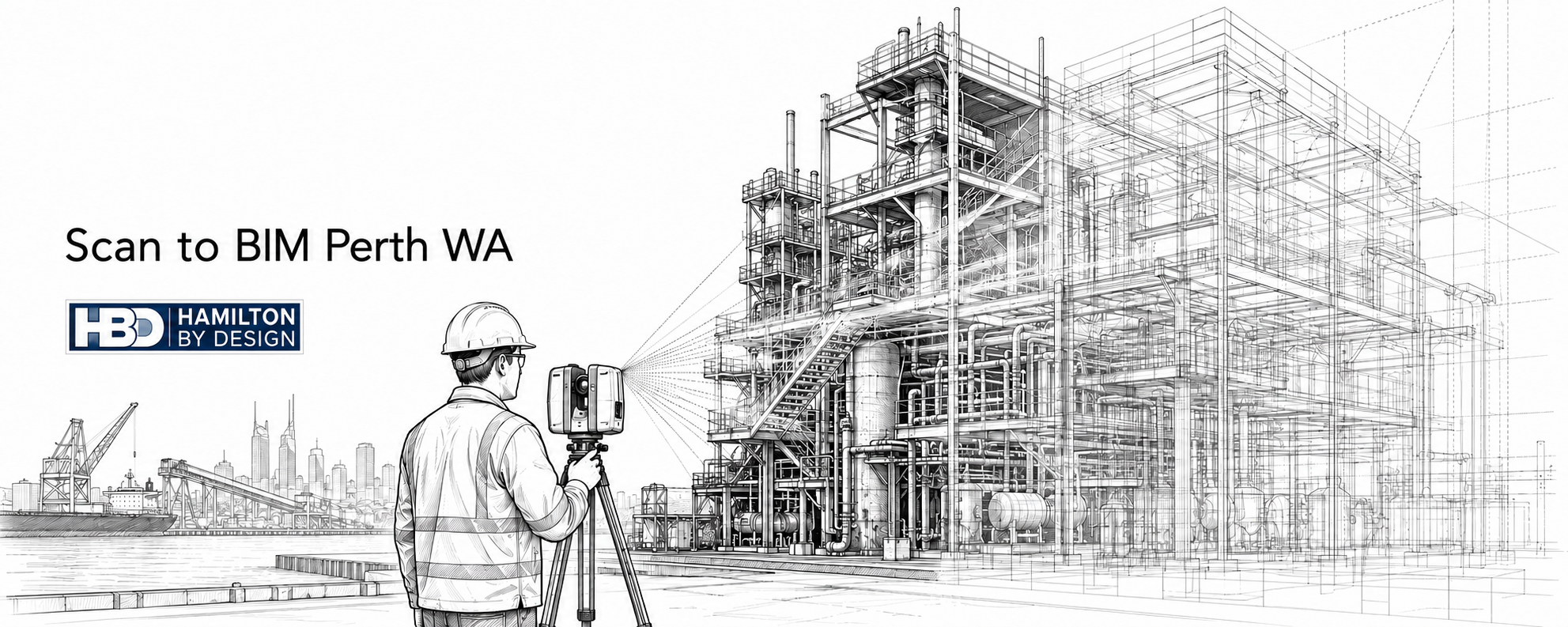


Scan to BIM Perth WA

Ink line drawing of an engineer using a 3D LiDAR scanner to capture an industrial facility in Perth WA, with point cloud lines converting the site into a BIM model.

Scan to BIM Perth WA | LiDAR Scanning & BIM Modelling

Blue 3D LiDAR scanner icon on a tripod with scanning waves

Embracing the idea of Scan to BIM Perth WA would suggest accurate site information is critical for successful engineering, construction, maintenance and upgrade projects. In Perth and across Western Australia, many mining, industrial, commercial and infrastructure assets have changed over time, but the drawings have not always kept up.

Equipment gets replaced. Pipework is modified. Structural steel is strengthened or repaired. Access platforms are changed. Services are rerouted. Buildings are refurbished. Over time, the original drawings may no longer reflect what is actually installed on site.

This is where Scan to BIM Perth becomes valuable.

Scan to BIM is the process of capturing an existing site using 3D laser scanning or LiDAR technology, then converting that point cloud data into an accurate Building Information Model. The result is a usable digital model that helps engineers, project managers, builders, asset owners and maintenance teams make better decisions based on real site conditions.

Hamilton By Design provides engineering-led Scan to BIM services across Perth and Western Australia, supporting mining, industrial, commercial, infrastructure and brownfield upgrade projects.

For projects that require accurate reality capture before design or fabrication begins, Hamilton By Design also provides 3D laser scanning in Perth to capture reliable point cloud data for downstream BIM, CAD and engineering workflows.

The Biggest Problem: Inaccurate or Missing As-Built Information

The biggest problem Scan to BIM solves is the lack of reliable as-built information.

Many Perth and WA sites rely on old drawings, incomplete records or assumptions made from previous projects. In some cases, drawings may exist but do not include later site modifications. In other cases, asset owners may only have PDFs, hand-marked drawings or partial CAD files.

This creates major project risk.

If engineers are designing from inaccurate information, new equipment may not fit. Steelwork may clash with existing structure. Pipe routes may conflict with services. Fabricated parts may arrive on site and require modification. Shutdown work may take longer than planned because the real site does not match the design assumptions.

These issues can lead to:

  • Design clashes
  • Fabrication errors
  • Installation delays
  • Extra site visits
  • Shutdown overruns
  • Safety risks
  • Increased project costs
  • Poor coordination between trades
  • Rework during construction
  • Poor asset records for future maintenance

For brownfield industrial and mining projects, these risks are especially important because work is often carried out around live plant, restricted access zones, shutdown windows and complex existing infrastructure.

Scan to BIM helps reduce this uncertainty by capturing the actual site and turning it into practical digital information.

What Is Scan to BIM?

Scan to BIM combines two key processes: reality capture and Building Information Modelling.

First, the existing site is captured using 3D laser scanning or LiDAR. The scanner records millions of measurement points across the site. These points form a point cloud, which is a highly accurate 3D representation of the existing conditions.

The point cloud can then be used to create a BIM model. Depending on the project, this model may include building elements, structural steel, pipework, mechanical equipment, platforms, conveyors, access systems, services, walls, slabs, columns and other site features.

The final model may be delivered in formats such as Revit, Navisworks, IFC, DWG or other agreed digital formats.

The key value is that the model is based on measured site data, not guesswork.

Who Uses Scan to BIM in Perth?

Scan to BIM is used by a wide range of organisations and project teams across Perth and Western Australia.

Typical users include:

  • Mining companies
  • Industrial plant owners
  • Commercial property owners
  • Infrastructure operators
  • Engineering consultants
  • Mechanical engineers
  • Structural engineers
  • Architects
  • Builders
  • Fabricators
  • Shutdown planners
  • Asset managers
  • Maintenance teams
  • Project managers
  • Facility managers

For asset owners, Scan to BIM provides better records of what is installed.

For engineers, it provides a more reliable base for design.

For builders and fabricators, it helps reduce clashes and installation problems.

For maintenance teams, it supports planning, access review and future asset management.

Where Is Scan to BIM Used in Perth and WA?

Scan to BIM can be used anywhere existing conditions need to be captured accurately.

In Perth, this may include commercial buildings, hospitals, schools, industrial workshops, warehouses, manufacturing sites, processing plants, water infrastructure, ports and transport facilities.

Across Western Australia, Scan to BIM is also valuable for mining and heavy industrial locations, including processing plants, materials handling facilities, port infrastructure, power generation assets, pump stations, treatment plants and regional industrial sites.

Common WA locations and project areas include:

  • Perth CBD
  • Kwinana
  • Henderson
  • Welshpool
  • Canning Vale
  • Fremantle
  • Rockingham
  • Bunbury
  • Geraldton
  • Kalgoorlie
  • Port Hedland
  • Karratha
  • Pilbara
  • Goldfields
  • Regional Western Australia

Hamilton By Design supports broader engineering and scanning work through its Perth WA engineering and 3D scanning services page, which is a useful internal location hub for Perth-based clients.

How the Scan to BIM Process Works

A typical Scan to BIM workflow includes several stages.

1. Project Scope and Capture Planning

Before scanning begins, the project team needs to understand what the model will be used for.

This is important because not every Scan to BIM project needs the same level of detail. A model for architectural refurbishment may require different information compared with a model for conveyor upgrades, pipework modifications, structural access design or plant layout changes.

Key questions include:

  • What area needs to be captured?
  • What level of detail is required?
  • Is the model for design, construction, asset records or maintenance?
  • Are mechanical and structural elements required?
  • Are services and pipework required?
  • What deliverable format is needed?
  • Is the work being used for clash detection?
  • Is the site live, restricted or difficult to access?

Clear scope at the start helps ensure the final model is useful.

2. 3D Laser Scanning or LiDAR Site Capture

The site is captured using professional 3D scanning equipment. The scanner collects accurate spatial data from multiple positions around the site.

For complex industrial facilities, multiple scan positions may be required to capture equipment, steelwork, pipework, access platforms, conveyors and building elements from different angles.

The result is a point cloud that represents the real site geometry.

3. Point Cloud Registration

After site capture, the individual scans are registered together into a single coordinated point cloud.

This stage aligns the scans so the full site can be reviewed as one digital environment.

Typical point cloud formats may include:

  • E57
  • RCP
  • RCS
  • LAS

The registered point cloud becomes the foundation for the BIM model.

4. BIM Model Development

The point cloud is then used to create a BIM model. Depending on the project, this may include modelling architectural, structural, mechanical or services elements.

For industrial and mining projects, modelled items may include:

  • Structural steel
  • Platforms
  • Stairs
  • Handrails
  • Pipework
  • Tanks
  • Pumps
  • Conveyors
  • Chutes
  • Hoppers
  • Mechanical equipment
  • Access areas
  • Building structure
  • Services corridors

The goal is not just to make the model look good. The goal is to create a model that supports real project decisions.

Where CAD deliverables are required rather than a full BIM workflow, Hamilton By Design can also convert point cloud data into engineering models and drawings through its Scan to CAD Perth service.

5. Quality Review Against the Point Cloud

Once the BIM model is created, it should be checked against the point cloud. This helps confirm that the model reflects the captured site conditions and that the required scope has been covered.

Quality review is important because Scan to BIM is only useful if the model is accurate enough for the intended purpose.

A model used for general planning may not require the same detail as a model used for fabrication coordination, clash detection or construction sequencing. The required accuracy and level of detail should match the project outcome.

6. Delivery of BIM and CAD Outputs

Final deliverables depend on the project requirements.

Common deliverables include:

  • Revit model
  • Navisworks model
  • IFC model
  • DWG drawings
  • 2D plans
  • Sections and elevations
  • PDF documentation
  • Registered point cloud
  • E57 files
  • RCP / RCS files
  • Clash detection model
  • As-built documentation

Tools That Assist With Scan to BIM

Scan to BIM relies on a combination of capture equipment, point cloud software, BIM software and engineering review.

Useful tools include:

ToolPurpose
3D laser scanner / LiDARCaptures accurate site geometry
FARO Focus / terrestrial scannerEngineering-grade site capture
FARO SCENEPoint cloud registration and processing
Autodesk ReCapPoint cloud preparation for Autodesk workflows
RevitBIM model development
NavisworksCoordination and clash review
AutoCAD2D drawings and CAD outputs
IFCModel exchange between software platforms
E57 / RCP / RCS / LASPoint cloud delivery formats
SolidWorks / InventorMechanical modelling where required

The right tools depend on the final use of the data. A commercial building project may require a Revit-focused workflow, while an industrial plant upgrade may need a combination of point cloud, CAD, BIM and mechanical modelling outputs.

Why Engineering-Led Scan to BIM Matters

Not all Scan to BIM providers approach the work the same way.

Some providers focus mainly on scanning and visual modelling. That may be enough for some building documentation projects, but industrial and mining sites often need a deeper understanding of how the asset works.

Engineering-led Scan to BIM is different because the model is developed with practical project outcomes in mind.

For example, in a processing plant, the important question may not simply be โ€œwhat does the site look like?โ€ The real questions may be:

  • Will the new equipment fit?
  • Can the conveyor be modified safely?
  • Is there enough access for installation?
  • Will new pipework clash with existing steel?
  • Can the platform support maintenance access?
  • What needs to be removed before shutdown?
  • Can fabrication drawings be developed from the scan data?
  • What existing structure must remain untouched?

Hamilton By Designโ€™s Scan to BIM approach is suited to mechanical, structural, mining and industrial environments where the digital model needs to support real engineering decisions.

For clients working nationally, the broader Scan to BIM Mining and Industrial Facilities page provides additional context around mining, processing plant, materials handling and heavy industrial applications.

Benefits of Scan to BIM Perth

Scan to BIM provides several important benefits for Perth and WA projects.

Better Design Accuracy

Design teams can work from real site data instead of old drawings or assumptions. This reduces the risk of designing around information that no longer reflects the site.

Reduced Site Rework

Accurate existing-condition data helps reduce fabrication and installation problems. This is particularly valuable where fabricated components need to fit into existing plant, structure or services.

Improved Clash Detection

Models can be reviewed before construction to identify conflicts between new and existing elements.

This helps project teams detect problems before labour, materials and equipment are committed to site work.

Faster Project Planning

Teams can review the site digitally without always needing to return to site.

This is useful for remote WA projects where travel, access and site inductions can add time and cost.

Improved Shutdown Confidence

For mining and industrial projects, accurate scan data helps plan work before shutdown begins.

Shutdowns are often expensive and time-sensitive. Scan to BIM helps reduce uncertainty before work starts.

Better Asset Records

Owners receive a more reliable digital record of existing assets.

This can support future maintenance, inspections, upgrades and long-term asset management.

Improved Collaboration

BIM models provide a shared reference point for engineers, builders, contractors, fabricators and asset managers.

When everyone is working from the same accurate information, coordination improves.

Scan to BIM for Brownfield Projects

Brownfield projects are one of the strongest use cases for Scan to BIM.

Unlike greenfield projects, brownfield sites already contain existing plant, structure, services, access restrictions and operational constraints. The site may have been modified many times over decades.

This makes accurate information critical.

Scan to BIM helps brownfield projects by capturing the real conditions before design or fabrication begins. This reduces the chance of clashes, improves planning and gives project teams a more reliable foundation for decision-making.

For Perth and WA mining, resources, port and industrial projects, this can be the difference between a smooth installation and a costly shutdown delay.

SEO ItemSuggested Detail
Page NameScan to BIM Perth WA
URL/scan-to-bim-perth/
Keyword FocusScan to BIM Perth
LocationPerth WA
Meta DescriptionEngineering-led Scan to BIM services in Perth WA. Convert 3D laser scan data into accurate BIM models for mining, industrial, commercial, infrastructure and brownfield upgrade projects.

FAQs

What is Scan to BIM?

Scan to BIM is the process of capturing an existing site using 3D laser scanning or LiDAR, then converting the point cloud data into a Building Information Model. The model can be used for design, construction planning, asset management, clash detection and future maintenance.

Why is Scan to BIM useful for Perth and WA projects?

Scan to BIM is useful because many Perth and WA assets have incomplete or outdated drawings. By capturing the real site conditions, project teams can reduce assumptions, avoid clashes and plan upgrades with greater confidence.

What industries use Scan to BIM in Perth?

Scan to BIM is used across mining, mineral processing, ports, manufacturing, commercial buildings, infrastructure, water treatment, power generation and industrial facilities.

What deliverables can be provided from a Scan to BIM project?

Typical deliverables may include Revit models, Navisworks models, IFC files, DWG drawings, 2D plans, sections, elevations, registered point clouds, E57 files, RCP files, RCS files and PDF documentation.

Is Scan to BIM only for buildings?

No. Scan to BIM can be used for buildings, but it is also valuable for industrial plants, mining infrastructure, processing facilities, pipework, structural steel, conveyors, platforms, equipment and brownfield engineering projects.

Can Scan to BIM help reduce shutdown risk?

Yes. Scan to BIM can help project teams understand existing site conditions before shutdown work begins. This can reduce clashes, improve sequencing and reduce the risk of unexpected site issues during installation.

What is the difference between Scan to BIM and Scan to CAD?

Scan to BIM usually creates an information-rich model, often used in Revit, Navisworks or IFC workflows. Scan to CAD usually focuses on producing CAD models and drawings for engineering, drafting, fabrication or layout work. The right choice depends on the project outcome.

Do I need a full BIM model for every project?

No. Some projects only need a point cloud, 2D drawings or a Scan to CAD model. Other projects need a full BIM model for coordination, asset management or construction planning. The deliverable should match the project need.


Hamilton By Design logo displayed on a blue tilted rectangle with a grey gradient background

Scan to BIM Perth gives project teams a more reliable way to understand existing buildings, plants and infrastructure before design, fabrication or construction begins.

For Perth and Western Australia, where mining, industrial, commercial and infrastructure assets often involve complex existing conditions, accurate digital information can reduce risk, improve coordination and support better long-term asset management.

By combining 3D laser scanning, point cloud processing, BIM modelling and engineering experience, Hamilton By Design helps turn real site conditions into practical digital deliverables that support better project outcomes.

Talk to Us – Contact Us

Name
Would you like us to arrange a phone consultation for you?
Address

Our clients:


https://www.hamiltonbydesign.com.au/scan-to-bim-services-australia-lidar-point-clouds-cad-modelling

Aluminium Smelter Laser Scanning Services in Tomago NSW

Engineering-grade LiDAR laser scanning inside an aluminium smelter in Tomago NSW supporting brownfield upgrades, shutdown planning, Scan-to-CAD modelling and mechanical engineering.

Brownfield engineering projects are among the most technically demanding activities undertaken within an aluminium smelter. Unlike a new (greenfield) facility, every modification inside an operating smelter must integrate with decades of existing infrastructure, often installed during multiple expansion and upgrade phases. Over time, plant layouts evolve, undocumented modifications occur, and original engineering drawings become outdated or incomplete.

For facilities such as Tomago Aluminium in Tomago NSW, accurate existing-condition information is essential before any engineering design, shutdown planning or equipment installation begins. Without reliable dimensional data, project teams risk discovering clashes, incorrect fabrication dimensions and unforeseen site conditions only after installation has commencedโ€”when delays are most costly.

Hamilton By Design provides engineering-grade 3D laser scanning services that create highly accurate digital representations of existing assets. Using advanced LiDAR technology, millions of measurement points are captured in a matter of minutes, producing an engineering-quality point cloud that forms the foundation for mechanical design, structural engineering, Scan-to-CAD workflows and brownfield project delivery.

Whether your project involves replacing conveyors, upgrading process equipment or planning a major shutdown, laser scanning dramatically reduces uncertainty while improving safety, engineering confidence and project outcomes.


Why Accurate Measurement Matters in an Aluminium Smelter

Aluminium smelters operate continuously, twenty-four hours a day, every day of the year. Every hour of lost production has significant financial consequences, making shutdown windows tightly planned and carefully managed.

Unlike manufacturing facilities with spare production capacity, major engineering work often needs to occur within limited shutdown periods where multiple contractors work simultaneously.

This creates several engineering challenges:

  • Existing structures may not match historical drawings.
  • Pipework has often been modified over decades.
  • Equipment relocations are poorly documented.
  • Platforms and walkways have changed.
  • Electrical cable trays have expanded.
  • New services compete for limited installation space.
  • Structural members have been strengthened without drawing revisions.

Traditional surveying techniques simply cannot capture the complexity of these environments efficiently.


The Brownfield Engineering Challenge

Every brownfield project starts with one simple question:

What actually exists today?

Unfortunately, this is rarely easy to answer.

Many aluminium smelters have been operating for forty years or more. During that time, thousands of engineering changes may have occurred.

Common examples include:

  • Emergency repairs
  • Maintenance modifications
  • Temporary installations becoming permanent
  • Equipment replacements
  • Structural strengthening
  • Additional pipe supports
  • New cable routes
  • Instrument upgrades
  • Maintenance access improvements

Many of these modifications were completed under shutdown pressure where updating engineering drawings was understandably not the highest priority.

The result is that engineering teams often begin projects using documentation that no longer accurately reflects the physical plant.


Why Traditional Site Measurement Falls Short

Historically, engineers relied upon:

  • Tape measures
  • Total stations
  • Hand sketches
  • Photographs
  • Manual dimensions

While these methods still have their place, they become increasingly impractical inside large industrial facilities.

Consider attempting to measure:

  • 40 metres of overhead pipework
  • Multiple elevations
  • Congested cable trays
  • Structural steel connections
  • Existing conveyors
  • Crane beams
  • Process vessels

Access alone may require elevated work platforms, confined space permits, scaffolding and isolation procedures.

Even after several days onsite, only selected dimensions have been captured.

If additional information is later required, another site visit becomes necessary.


How Engineering Laser Scanning Changes the Process

Laser scanning fundamentally changes how brownfield engineering projects are delivered.

Instead of recording hundreds of manual dimensions, terrestrial LiDAR scanners collect millions of highly accurate measurements covering the complete work area.

The result is an engineering-grade point cloud that accurately represents existing plant geometry.

This digital environment allows engineers to perform much of their work from the office rather than returning repeatedly to site.

Once captured, the scan data can be converted into accurate Scan-to-CAD models and engineering drawings, enabling mechanical, structural and piping designers to work confidently using verified as-built information.

Typical benefits include:

  • Complete site capture
  • Reduced survey time
  • Improved design accuracy
  • Fewer site visits
  • Better collaboration
  • Improved documentation
  • Reduced engineering risk

Typical Areas Scanned Within an Aluminium Smelter

Engineering projects commonly occur throughout the facility, including:

Potlines

  • Structural modifications
  • Busbar alterations
  • Access platform changes
  • Mechanical equipment installation

Casthouse

  • Furnace upgrades
  • Casting equipment
  • Overhead cranes
  • Hydraulic systems
  • Cooling systems

Carbon Plant

  • Conveyors
  • Crushers
  • Dust extraction
  • Structural supports
  • Material handling systems

Utility Systems

  • Cooling water
  • Compressed air
  • Natural gas
  • Fire services
  • Hydraulic systems
  • Electrical substations

Highly congested service corridors benefit significantly from comprehensive reality capture.


Supporting Shutdown Engineering

Shutdowns represent one of the highest-value applications for engineering laser scanning.

Every task within a shutdown depends upon accurate planning.

When equipment has already been fabricated, there is little tolerance for discovering dimensional discrepancies during installation.

Laser scanning supports shutdown engineering and brownfield project planning by providing:

  • Existing-condition verification
  • Installation planning
  • Crane access studies
  • Temporary works design
  • Pipe spool verification
  • Structural modification planning
  • Clash detection
  • Construction sequencing

The result is improved confidence before shutdown activities begin.


Mechanical Engineering Applications

Mechanical engineering projects commonly include:

  • Pump replacements
  • Conveyor upgrades
  • Chute redesign
  • Tank modifications
  • Ducting replacement
  • Pressure vessel connections
  • Machine foundations

Instead of estimating dimensions from old drawings, engineers can design directly against the current plant geometry.

This greatly improves fabrication accuracy.


Structural Engineering Benefits

Structural engineers frequently encounter undocumented modifications.

Laser scanning enables accurate modelling of:

  • Structural steel
  • Columns
  • Bracing
  • Platforms
  • Stairways
  • Handrails
  • Crane beams
  • Pipe supports

Existing structures can then be verified before additional loads are introduced.


Digital Twins and Asset Management

Laser scanning also provides the foundation for developing digital twins.

Rather than relying solely on historical drawings, operators gain access to an accurate digital representation of the physical plant.

Benefits include:

  • Asset management
  • Maintenance planning
  • Future project planning
  • Condition assessments
  • Engineering verification
  • Operator training
  • Long-term documentation

Where legacy equipment has little or no documentation, Hamilton By Design can also provide reverse engineering services to recreate accurate CAD models and manufacturing drawings directly from laser scan data.


Engineering Software Used

Hamilton By Design supports engineering workflows using industry-recognised software, including:

  • FARO Focus terrestrial laser scanners
  • FARO SCENE
  • Autodesk ReCap
  • Autodesk Navisworks
  • SOLIDWORKS
  • Autodesk Inventor
  • AutoCAD
  • AutoCAD Plant 3D
  • Revit
  • E57 point cloud exchange
  • STEP and Parasolid mechanical models

This enables seamless collaboration with engineering consultants, asset owners and contractors.


Typical Deliverables

Every project is tailored to client requirements, but deliverables may include:

  • Registered point clouds
  • E57 files
  • Autodesk ReCap projects (RCP/RCS)
  • Scan-to-CAD drawings
  • Existing-condition layouts
  • General arrangement drawings
  • Mechanical models
  • Structural steel models
  • Pipework models
  • Equipment verification
  • Clash detection reviews
  • Engineering mark-ups
  • As-built documentation

Why Tomago NSW Is an Ideal Application

Tomago is one of Australia’s most significant heavy industrial precincts, and engineering projects are continually undertaken to improve safety, reliability and production efficiency.

Many upgrades involve integrating modern equipment into infrastructure that has evolved over decades.

This makes accurate existing-condition information invaluable.

Laser scanning enables project teams to:

  • Reduce uncertainty
  • Improve engineering quality
  • Minimise shutdown risk
  • Support prefabrication
  • Improve contractor coordination
  • Reduce costly rework

For brownfield engineering, accurate information at the beginning of the project often determines the success of the entire installation.


Hamilton By Design logo displayed on a blue tilted rectangle with a grey gradient background

Conclusion

Brownfield engineering projects succeed when decisions are based on accurate information. In aluminium smelters operating in Tomago NSW, where infrastructure has evolved over decades, relying on outdated drawings or incomplete measurements introduces unnecessary risk, delays and cost.

Engineering-grade laser scanning provides a reliable foundation for mechanical upgrades, shutdown planning, structural modifications and future asset management. By capturing millions of accurate measurements in a single survey, project teams gain confidence that new equipment will fit, fabrication can proceed with certainty, and installation risks are significantly reduced.

If your next project involves upgrading conveyors, replacing process equipment, modifying structural steel or planning a major shutdown, Hamilton By Design can deliver the accurate reality capture and engineering support needed to reduce uncertainty and keep your project moving forward. By combining advanced LiDAR technology with practical engineering expertise, we help aluminium smelter operators make better decisions, minimise rework and achieve safer, more efficient brownfield project outcomes throughout Tomago NSW.

Talk to Us – Contact Us

Name
Would you like us to arrange a phone consultation for you?
Address

Our clients:
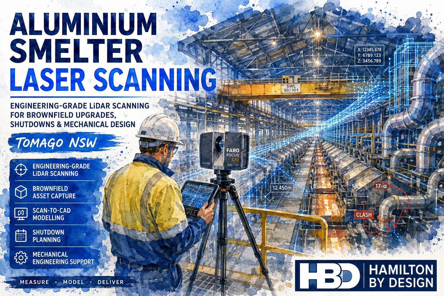

https://www.hamiltonbydesign.com.au/scan-to-bim-services-australia-lidar-point-clouds-cad-modelling

Creating a Digital Source of Truth: Improving Asset Management Through Digital Engineering

Engineering-grade LiDAR scanning and digital engineering workflow showing how a digital source of truth improves long-term asset management.

Industrial assets change over time. Equipment is upgraded, drawings are revised, platforms are modified, components are replaced, and maintenance activities gradually reshape the plant.

When engineering information is spread across old drawings, uncontrolled PDFs, manual mark-ups, spreadsheets, and individual folders, asset management becomes harder than it needs to be.

A digital source of truth helps bring engineering information together so teams can make decisions using reliable, current, and controlled data.

At Hamilton By Design, we support digital engineering asset management by combining LiDAR scanning, CAD modelling, drawing governance, revision control, and digital engineering workflows.

What is a Digital Source of Truth?

A digital source of truth is a controlled location where accurate engineering information can be stored, managed, accessed, and updated.

It may include:

  • Engineering drawings
  • CAD models
  • Point cloud data
  • Asset information
  • Revision history
  • Inspection records
  • Fabrication documentation
  • Engineering reports

The goal is simple:

One reliable place for engineering information.

Why Asset Information Management Matters

Poorly controlled information can create:

  • Outdated drawings
  • Duplicate files
  • Missing revisions
  • Conflicting information
  • Fabrication errors
  • Shutdown delays
  • Maintenance confusion

Good asset information management improves:

  • Decision making
  • Project planning
  • Maintenance efficiency
  • Drawing control
  • Long-term asset performance

Digital Engineering Workflows

Hamilton By Design can support workflows such as:

  • Engineering-grade LiDAR scanning
  • Existing condition capture
  • Point cloud generation
  • Scan-to-CAD conversion
  • CAD modelling
  • Engineering drawings
  • Revision-controlled documentation
  • Digital asset records

This turns real-world site information into usable engineering data.

Drawing Governance and Revision Control

Drawing governance helps ensure the right people are using the right information.

This includes:

  • Controlled drawing revisions
  • Clear document naming
  • Updated engineering records
  • Managed mark-ups
  • Approval workflows
  • Accessible project information
3D CAD Modelling Australia service banner for Hamilton By Design

Without revision control, teams may unknowingly use superseded drawings.

Digital Twins and Long-Term Asset Management

A digital twin does not need to start as a complex system. For many industrial sites, it begins with accurate geometry, controlled drawings, and reliable asset records.

Digital engineering can support:

  • Plant upgrades
  • Maintenance planning
  • Shutdown preparation
  • Reverse engineering
  • Engineering analysis
  • Future modifications

Long-Term Operational Efficiency

A digital source of truth can reduce:

  • Time spent searching for drawings
  • Rework caused by outdated information
  • Repeated site measurements
  • Fabrication errors
  • Project uncertainty

It can improve:

  • Maintenance planning
  • Engineering confidence
  • Asset visibility
  • Operational efficiency
  • Project delivery

How Hamilton By Design Supports This

Hamilton By Design supports digital engineering asset management through:

  • 3D CAD Design & Drafting
  • Engineering Governance
  • LiDAR Scanning Services
  • Industrial Plant Optimisation
  • Engineering Analysis & Simulation
  • Mining Digital Engineering
  • Mechanical Engineering Services
  • Reverse Engineering Services

The objective is not just to create drawings or models.

The objective is to create engineering information that remains useful throughout the asset lifecycle.

3D LiDAR scanning and 3D modelling service button โ€” laser scanner capturing a point cloud for engineering and CAD modelling
Mechanical engineering services

Conclusion

Industrial asset management depends on reliable information.

A digital source of truth helps organisations move from scattered documents and outdated drawings toward controlled, current, and usable engineering data.

Better information supports better asset decisions.

Hamilton By Design logo displayed on a blue tilted rectangle with a grey gradient background

Our Clients:

Name
Would you like us to arrange a phone consultation for you?
Address
3D CAD Modelling Australia service banner for Hamilton By Design
Australian Drafting logo featuring bold white text reading "Australian Drafting" centred on a blue rounded rectangle background.
Engineering Governance title graphic featuring bold white text reading "Engineering Governance" centred on a blue rounded rectangle background.
Mechanical, Structural & Pipework Drafting service banner by Hamilton By Design featuring white text on a blue background.
Mechanical engineering services
Blue rounded button with the text โ€œSolidWorks Designโ€ in white.
Finite Element Analysis (FEA) engineering simulation button
3D LiDAR Scanning Darwin for engineering surveys, laser scanning, reality capture and point cloud modelling services
3D LiDAR Scanning Australia engineering services for laser scanning, reality capture, scan-to-CAD, Scan-to-BIM and as-built documentation across Australia
3D LiDAR scanning services on the Central Coast providing engineering-grade laser scanning, point cloud capture, scan-to-CAD modelling and industrial reality capture for infrastructure and industrial projects.
3D LiDAR Scanning Perth for engineering surveys, laser scanning, reality capture and point cloud modelling services
3D LiDAR Scanning Sydney for engineering surveys, laser scanning, reality capture and point cloud modelling services
3D LiDAR Scanning Brisbane for engineering surveys, laser scanning, reality capture and point cloud modelling services
3D LiDAR Scanning Canberra for engineering surveys, laser scanning, reality capture and point cloud modelling services
3D LiDAR Scanning Newcastle for engineering surveys, laser scanning, reality capture and point cloud modelling services
3D LiDAR Scanning Adelaide for engineering surveys, laser scanning, reality capture and point cloud modelling services