3D Laser Scanning for Industrial Plants | Hamilton By Design
Precision Capture. Smarter Engineering. Reduced Risk.

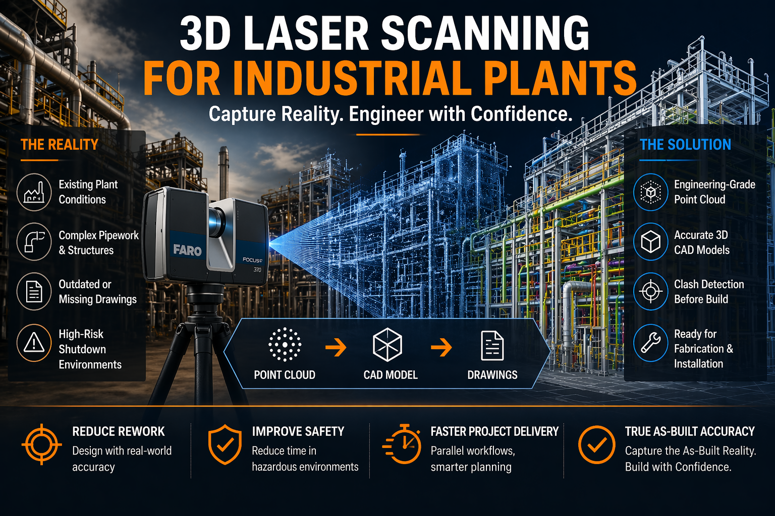
Industrial plants are complex, high-risk environments where accuracy is everything. Whether you’re working in mining, processing, manufacturing, or energy, one incorrect dimension can lead to costly rework, shutdown delays, or safety issues.
At Hamilton By Design, we specialise in 3D laser scanning for industrial plants—capturing real-world conditions with engineering-grade accuracy and turning them into usable models, drawings, and digital assets.


What is 3D Laser Scanning for Industrial Plants?
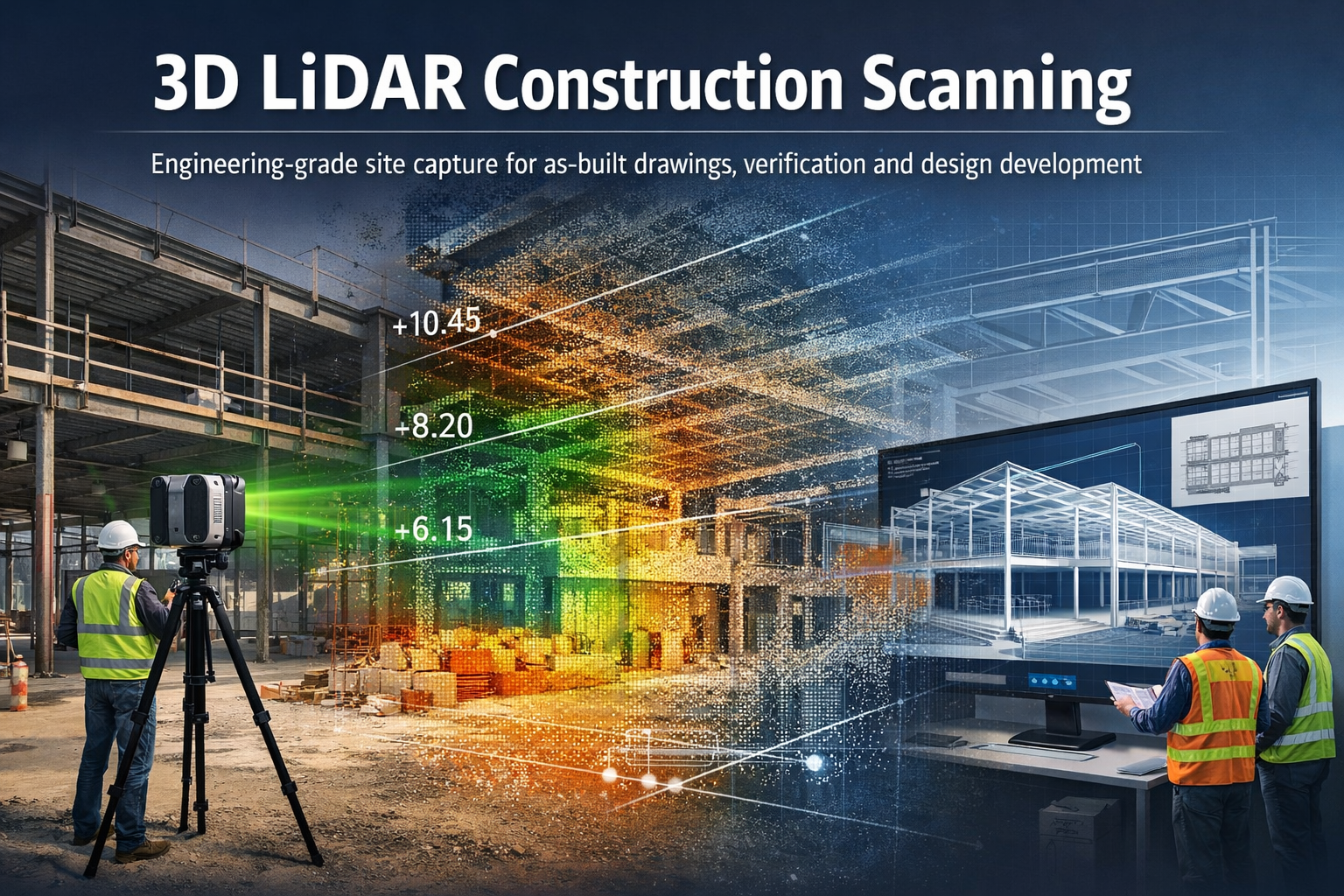
3D laser scanning (LiDAR) uses high-speed laser measurement technology to capture millions of points in space—creating a point cloud that represents the exact geometry of your plant.
Unlike traditional measuring methods:
- No manual tape measurements
- No guesswork or assumptions
- No reliance on outdated drawings
Instead, you get a true digital representation of reality.
Why Industrial Plants Need 3D Laser Scanning
1. Brownfield Accuracy
Most industrial facilities have evolved over time. Drawings rarely reflect what’s actually been built.
3D scanning provides:
- Accurate as-built conditions
- Clash detection before fabrication
- Confidence in design decisions
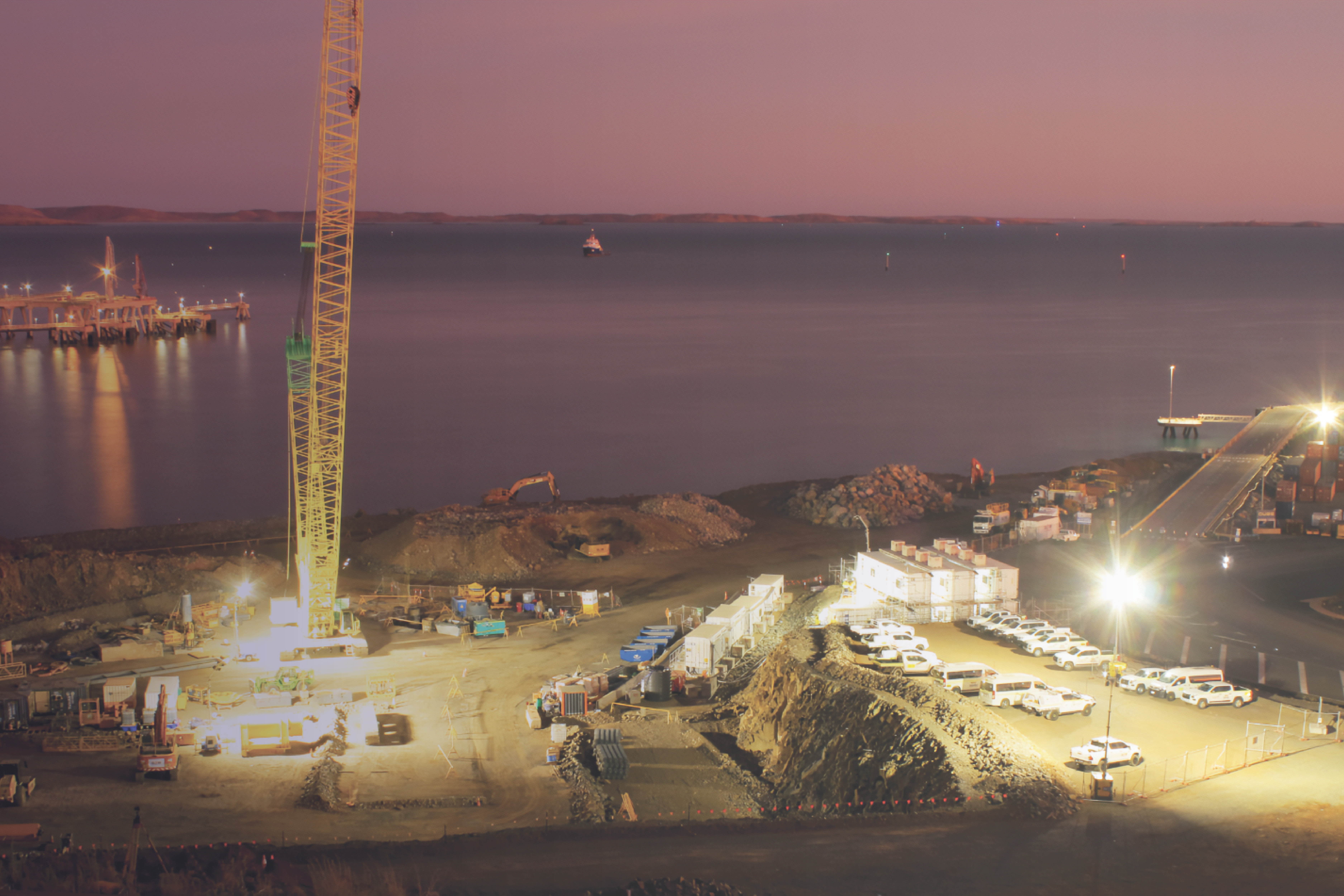
2. Shutdown Planning & Risk Reduction
Shutdowns are expensive. Every hour matters.
With a full point cloud:
- Work can be planned offsite
- Fabrication can occur before shutdown
- Installation becomes faster and safer
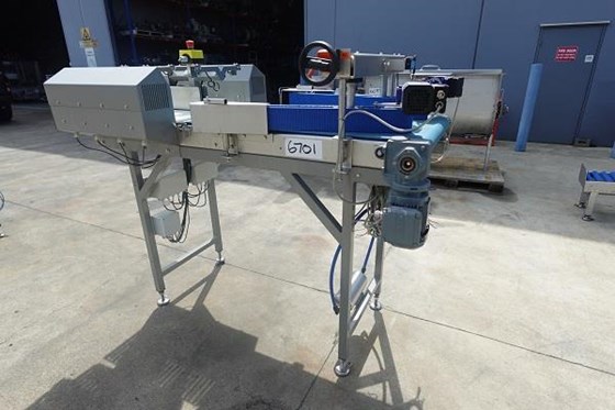
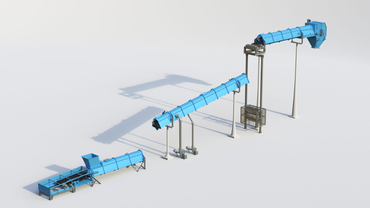
3. Complex Geometry Capture
Industrial plants include:
- Dense pipework
- Structural steel
- Conveyor systems
- Mechanical equipment
3D scanning captures all of it—simultaneously—with millimetre-level detail.
4. Engineering-Ready Deliverables
At Hamilton By Design, we don’t just scan—we engineer.
Typical outputs include:
- Registered point clouds (.E57, .RCP)
- 3D CAD models (STEP, Parasolid)
- 2D drawings (AutoCAD layouts, sections, elevations)
- Simplified models for coordination and fabrication
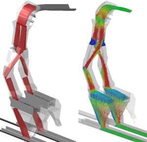
Point Cloud vs STL – Why It Matters
Many scanning providers deliver mesh files (STL), which are often:
- Heavy and difficult to edit
- Not dimensionally reliable
- Not suitable for engineering workflows
We focus on point cloud to CAD workflows, ensuring:
- Traceability back to real-world data
- Editable, parametric models
- Engineering-grade outputs—not just visuals
Our Technology & Workflow
We utilise high-precision scanning systems such as the FARO Focus S70 to capture industrial environments efficiently and accurately.
Our workflow:
- Site scanning (minimal disruption)
- Point cloud registration & validation
- Engineering model development
- Drawing production & issue
We also support integration into platforms like SolidWorks and Autodesk ReCap Pro for seamless design workflows.
Real Benefits for Industrial Clients
- Reduced rework – design with confidence
- Faster project delivery – parallel workflows
- Improved safety – less time in hazardous areas
- Better communication – visual clarity across teams
- Digital asset creation – foundation for digital twins
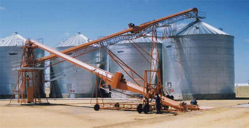
Applications Across Industry
Our 3D laser scanning services are used across:
- Mining and mineral processing plants
- Power stations and utilities
- Manufacturing facilities
- Oil & gas infrastructure
- Water treatment plants
From conveyors and chutes to pump stations and structural steel upgrades—we connect design to reality.
Why Hamilton By Design?
We’re not just scanning technicians—we’re engineers.
That means:
- We understand fabrication tolerances
- We design for real-world installation
- We deliver outputs that your team can actually use
Our focus is simple:
Accurate data → Better decisions → Successful projects


Get Started
If you’re planning an upgrade, shutdown, or new installation within an existing plant, 3D laser scanning is no longer optional—it’s essential.
Hamilton By Design provides reliable, engineering-grade 3D laser scanning for industrial plants across Australia.
Our clients


Contact us today to discuss your project and see how we can support your next job with precision and clarity.