Mine Transfer Station Scanning Muswellbrook NSW | Hamilton By Design

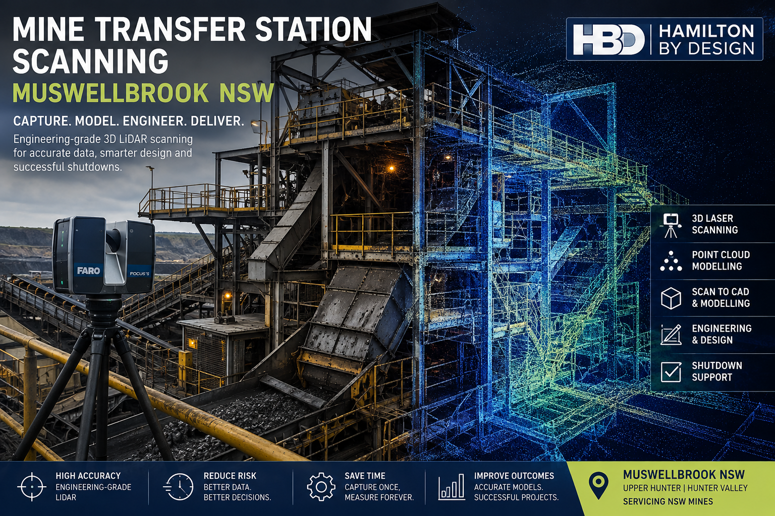
Mine transfer station scanning in Muswellbrook NSW using engineering-grade 3D LiDAR and point-cloud modelling

Mine Transfer Station Scanning Muswellbrook NSW

Engineering-Grade 3D Laser Scanning for Congested Transfer Stations, Chutes and Conveyor Upgrades

Mine transfer stations are among the most spatially complex areas within coal-handling and bulk-material-handling infrastructure.

Within a relatively small footprint, a transfer station may contain conveyors, head pulleys, transfer chutes, structural steel, access platforms, walkways, guarding, dust extraction ducting, pipework, electrical services and maintenance zones. These systems must operate together while remaining accessible for inspection, maintenance and future modification.

For engineering teams, this creates a practical problem:

Transfer stations are highly congested and can be difficult to measure accurately using conventional methods.

Hamilton By Design provides mine transfer station scanning services in Muswellbrook NSW and throughout the Upper Hunter, using engineering-grade terrestrial LiDAR scanning, registered point clouds and CAD modelling to capture the actual installed condition of existing mining infrastructure.

The objective is not simply to create a visual 3D representation. It is to establish a reliable, measurable engineering dataset that can support conveyor modifications, chute replacements, structural upgrades, shutdown planning and brownfield plant development.

Why Transfer Stations Are Difficult to Measure

Transfer stations are different from relatively open conveyor galleries. They are typically vertical, congested structures in which multiple mechanical and structural systems intersect.

An existing transfer station may include:

  • incoming and outgoing conveyors;
  • head and discharge pulleys;
  • transfer chutes;
  • hoppers;
  • structural columns and beams;
  • maintenance platforms;
  • stairs and ladders;
  • handrails;
  • conveyor guarding;
  • pipework;
  • dust extraction systems;
  • cable trays;
  • concrete floors and plinths; and
  • surrounding plant interfaces.

As mining infrastructure is progressively modified, the installed arrangement may also diverge from original drawings.

A chute may have been replaced during a previous shutdown. Steelwork may have been strengthened. Platforms may have been modified. Additional services may have been installed around the original plant.

Hamilton By Design’s work with 3D laser scanning for conveyor transfer towers addresses this problem by capturing the true geometry of conveyors, chutes, structural steel and surrounding plant before engineering modifications are developed.

The Cost of Incomplete Site Information

Traditional field measurement remains useful, but it becomes increasingly difficult when an engineering project depends on hundreds of spatial relationships.

An engineer may visit site, obtain the dimensions considered necessary at the time and then return to the office to begin design.

Once modelling progresses, another critical dimension may be identified.

This can produce a repeated cycle:

Site measure โ†’ design โ†’ discover missing dimension โ†’ return to site โ†’ remeasure โ†’ revise design

For mine sites, repeated access can be costly because site visits may involve inductions, travel, permits, shutdown access and coordination with operations.

The engineering issue is therefore not merely the time required to measure one dimension. It is the uncertainty created when the wider installed environment has not been comprehensively captured.

Terrestrial LiDAR scanning changes that approach by recording millions of spatial measurements throughout the transfer station.

The resulting point cloud can subsequently be interrogated as the engineering develops.

A simple value proposition is:

Capture the transfer station once and continue measuring digitally from the registered point cloud.

Who Can Benefit from Transfer Station Scanning?

Mine transfer station scanning can support a wide range of technical stakeholders, including:

  • mine owners and operators;
  • engineering managers;
  • project engineers;
  • mechanical engineers;
  • structural engineers;
  • maintenance superintendents;
  • reliability teams;
  • shutdown planners;
  • CHPP personnel;
  • conveyor contractors;
  • chute specialists;
  • EPCM organisations;
  • fabrication contractors; and
  • drafting teams.

The important consideration is not who wants a 3D model.

The real question is:

Who requires reliable information about the existing transfer station to make an engineering decision?

For example, a project engineer may need accurate pulley centres before designing a replacement chute. A structural engineer may need existing beam locations before modifying supporting steel. A shutdown planner may need to understand removal paths and maintenance access before work begins.

Each discipline may use the same captured dataset differently.

Define the Engineering Requirement

Before scanning begins, the purpose of the project should be established.

Typical transfer-station projects may involve:

  • new transfer chute installation;
  • chute replacement;
  • conveyor modification;
  • pulley replacement;
  • structural strengthening;
  • new platforms or walkways;
  • guarding upgrades;
  • dust extraction modifications;
  • equipment replacement; or
  • plant expansion.

Understanding the engineering requirement determines the required scan coverage.

The objective is not to collect unnecessary data. It is to ensure that all critical interfaces are captured before the project moves into detailed design.

Capture the Existing Transfer Station

Terrestrial LiDAR scanners are positioned at multiple levels and viewpoints throughout the transfer station.

Each scan records the three-dimensional relationship between visible surfaces.

Because the scanner captures a broad field of view, the resulting dataset can include much more than the component initially being modified.

For example, a scan undertaken for a chute replacement may also capture surrounding beams, existing platforms, maintenance access, adjacent pipework, guarding, floor levels and nearby equipment.

This contextual information may become important later in the project.

For mining transfer points specifically, Hamilton By Design combines scanning with engineering analysis through its work on 3D scanning of chutes, hoppers and mining transfer points, where captured geometry can support retrofit accuracy, chute design and material-flow improvements.

Register the Point Cloud

Individual scans are processed and registered into a coordinated point-cloud dataset.

This creates a measurable digital representation of the transfer station at the time of capture.

Engineering personnel can then review dimensions away from site.

Typical information may include:

  • conveyor centrelines;
  • pulley locations;
  • chute flange positions;
  • structural member coordinates;
  • equipment offsets;
  • platform elevations;
  • available clearances;
  • service locations; and
  • maintenance access envelopes.

This is particularly useful where project teams are geographically separated or where physical access to the transfer station is restricted.

Convert the Scan into Engineering CAD

Point-cloud data may be sufficient for some projects.

For others, selected infrastructure can be reconstructed as engineering CAD geometry.

Depending on the project, the model may include:

  • conveyor centrelines;
  • pulleys;
  • transfer chute geometry;
  • structural steel;
  • platforms;
  • equipment envelopes;
  • maintenance clearances; and
  • surrounding plant interfaces.

The appropriate modelling philosophy is fit for purpose.

It is rarely necessary to model every nut, bolt, bracket and cable tray.

The objective is to represent the geometry required to answer the engineering question accurately.

For brownfield work, Hamilton By Design applies this type of reality-capture workflow through its engineering-led 3D scanning for brownfield industrial upgrades, where existing plant conditions are used as the basis for practical retrofit and shutdown engineering.

Design Against the Actual Installed Condition

Once the existing transfer station has been captured, the proposed modification can be developed directly against the point cloud or CAD model.

This can help engineers assess:

  • equipment clearances;
  • structural interfaces;
  • conveyor alignment;
  • chute fit-up;
  • installation pathways;
  • maintenance access;
  • guarding requirements; and
  • potential clashes.

The objective is straightforward:

Identify the interference during design rather than during the shutdown.

This is particularly important in brownfield mining environments where fabrication may occur off site and components must arrive ready to install.

Unexpected site modifications during a shutdown can affect labour, crane planning, production and overall project schedule.

Transfer Chutes and Material-Flow Problems

Not every transfer-station problem is dimensional.

Some are operational.

Examples include:

  • chute blockages;
  • material buildup;
  • excessive wear;
  • poor trajectory;
  • spillage;
  • dust generation;
  • impact damage; and
  • belt loading problems.

In these cases, scanning provides the actual installed geometry, while engineering analysis can investigate why the transfer point is not performing as intended.

Where appropriate, discrete element modelling can also be used to analyse material behaviour through the chute.

Hamilton By Design’s broader mining engineering services combine LiDAR capture, mechanical design and fabrication-focused engineering for brownfield mining and asset modification projects.

Conveyor Transfer Chute Design

Transfer chute performance is closely connected to conveyor reliability.

Poor chute geometry can contribute to material buildup, excessive wear, impact loading, spillage and belt-tracking problems.

Where the existing transfer point is being modified, the point cloud can be used to establish the installed geometry before a replacement or upgraded chute is developed.

Hamilton By Design provides conveyor transfer chute design for mining, combining practical mechanical engineering with existing-condition capture to support retrofit and brownfield projects.

Coal Chute Design

Coal transfer systems require consideration of more than dimensional fit.

Flow direction, material properties, liner arrangement, wear zones, impact velocity and maintenance access can influence chute performance.

For coal-handling applications, Hamilton By Design’s coal chute design services provide an additional engineering pathway where captured transfer-station geometry can be combined with chute redesign and materials-handling analysis.

Conveyor Reliability and Failure Reduction

Transfer stations are often closely associated with conveyor reliability problems.

Misalignment, wear, spillage, poor transfer geometry and structural movement can all contribute to operational issues.

Hamilton By Design’s technical resource on common conveyor failures in mining plants provides further context on how engineering, inspection and digital modelling can support more reliable conveyor systems.

Bulk Material Handling Engineering

Transfer stations should not always be considered in isolation.

They form part of a wider bulk-material-handling system connecting ROM infrastructure, conveyors, stockpiles, processing plant and product handling systems.

Hamilton By Design’s bulk material handling engineering for mining considers the wider relationship between conveyors, chutes, transfer stations and supporting mine infrastructure.

This broader systems view can be particularly useful when a transfer-station modification affects upstream or downstream equipment.

Mine Transfer Station Scanning in Muswellbrook NSW

Muswellbrook is strategically located within the Upper Hunter mining region and is surrounded by substantial coal-mining and materials-handling infrastructure.

This makes the area particularly relevant for services associated with:

  • conveyor upgrades;
  • CHPP modifications;
  • transfer-station refurbishments;
  • structural upgrades;
  • chute replacement;
  • shutdown engineering; and
  • mine plant life-extension projects.

Hamilton By Design can support projects throughout Muswellbrook, Denman, the Upper Hunter and the wider Hunter Valley region.

The service is particularly valuable where existing infrastructure is ageing, heavily modified or difficult to access.

Tools Supporting the Workflow

A practical mine transfer-station scanning workflow may incorporate several tools.

FARO Focus S70 can provide detailed terrestrial LiDAR capture of transfer towers and surrounding infrastructure.

FARO Orbis may support supplementary mobile capture where appropriate.

FARO SCENE can be used to register individual scans into a coordinated point cloud.

Autodesk ReCap can assist with point-cloud preparation and CAD interoperability.

SolidWorks can support mechanical components, chute geometry and fabrication models.

Autodesk Inventor and AutoCAD can support broader plant modelling, layouts and drafting.

Navisworks can assist with coordination and clash review between existing-condition data and proposed models.

Where material-flow performance is part of the engineering problem, Rocky DEM may assist with analysing particle trajectories, impact locations, wear zones and transfer behaviour.

The technology should, however, remain secondary to the engineering objective.

The primary deliverable is reliable information that supports better engineering decisions.

Typical Project Deliverables

Depending on client requirements, deliverables may include:

  • registered E57 point clouds;
  • RCP and RCS datasets;
  • LAS files;
  • measurable point-cloud data;
  • existing-condition CAD models;
  • SolidWorks models;
  • STEP or Parasolid files;
  • DWG and DXF drawings;
  • general arrangement drawings;
  • sections and elevations;
  • proposed-versus-existing models;
  • clash-review models;
  • eDrawings; and
  • PDF engineering documentation.

Some projects may require only scan data.

Others may progress through:

Scan โ†’ Register โ†’ Model โ†’ Engineer โ†’ Detail โ†’ Fabricate

Frequently Asked Questions

What is mine transfer station scanning?

Mine transfer station scanning uses terrestrial LiDAR to capture the three-dimensional geometry of conveyors, chutes, structural steel, platforms, services and surrounding plant within a transfer station.

Why are transfer stations difficult to measure manually?

Transfer stations are typically congested and multi-level structures. Conveyor systems, chute geometry, steelwork, access platforms, guarding and services can occupy the same restricted space, making comprehensive manual measurement difficult.

Can additional dimensions be obtained after leaving site?

Yes. Once scans are registered into a measurable point cloud, engineering teams can obtain many additional dimensions digitally without necessarily returning to site.

Can transfer station scanning support chute replacement?

Yes. LiDAR can capture existing pulley positions, chute interfaces, structural steel, surrounding equipment and maintenance clearances before a replacement chute is designed.

Can the point cloud be converted into CAD?

Yes. Relevant infrastructure can be reconstructed as CAD geometry according to the engineering requirement. The appropriate level of modelling depends on how the information will ultimately be used.

Can scanning assist with structural modifications?

Yes. Existing structural members, columns, beams, platforms and equipment interfaces can be captured to support brownfield structural modifications and strengthening projects.

Is DEM required for every transfer station project?

No. DEM is most relevant where material-flow behaviour, trajectory, wear, blockage or impact is part of the problem. For dimensional fit-up and structural modifications, LiDAR and CAD may be sufficient.

What areas do you service around Muswellbrook?

Hamilton By Design can support mine and industrial projects throughout Muswellbrook, Denman, the Upper Hunter and the wider Hunter Valley NSW region.

Mine Transfer Station Scanning Muswellbrook NSW

For transfer-station upgrades, reliable knowledge of the existing plant can significantly reduce engineering uncertainty.

Terrestrial LiDAR scanning provides a practical way to capture congested conveyors, chutes, structural steel, platforms and surrounding services as a measurable digital dataset.

That dataset can then support engineering modelling, structural upgrades, conveyor modifications, shutdown planning and fabrication.

For brownfield mine projects in Muswellbrook and the Upper Hunter, the principle is simple:

Capture the congested transfer station accurately. Develop the engineering from measured reality. Verify the modification before it reaches site.


Hamilton By Design logo displayed on a blue tilted rectangle with a grey gradient background

Contact Us – Talk To Us

Name
Would you like us to arrange a phone consultation for you?
Address

Our clients:


Mine Site Digital Twin Services Mudgee NSW | Hamilton By Design

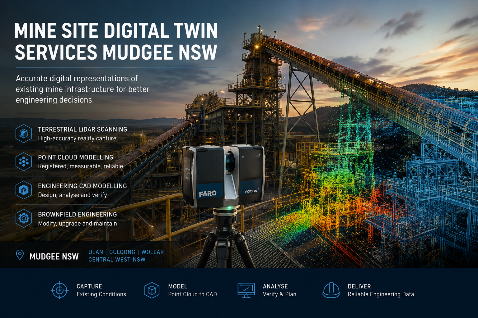
Mine site digital twin services in Mudgee NSW using terrestrial LiDAR scanning, point cloud modelling and engineering CAD

Mine Site Digital Twin Services Mudgee NSW

Engineering Digital Twins Using Terrestrial LiDAR, Point Clouds and CAD Modelling

Mining infrastructure rarely remains exactly as it was originally designed. Over the operational life of a mine, equipment is replaced, conveyors are modified, pipework is rerouted, structures are strengthened, access systems are altered and processing equipment is progressively upgraded.

As these changes accumulate, the physical configuration of a mine or processing facility can diverge significantly from the drawings, models and other engineering records available to project and maintenance teams.

Hamilton By Design provides mine site digital twin services for Mudgee, Ulan, Gulgong, Wollar and the wider Central West NSW region, using terrestrial LiDAR scanning, point-cloud processing and engineering CAD workflows to establish reliable digital representations of existing mine infrastructure.

The objective is not simply to produce a visually impressive 3D model. It is to establish an accurate and measurable engineering record that can support brownfield modifications, shutdown planning, maintenance, equipment replacement, design verification and future asset development.

Put simply:

Capture the existing condition accurately, establish a reliable digital baseline and design around what is actually installed.


The Engineering Problem: When Existing Drawings No Longer Represent the Site

Mining and mineral-processing assets may remain operational for several decades. During this period, individual areas of plant can undergo numerous modifications.

A pipe may be rerouted during a shutdown. A transfer chute may be replaced. Structural steel may be strengthened to accommodate changing loads. Conveyor drives and pulleys may be modified. New cable trays, services, platforms or equipment may be installed around existing infrastructure.

Although engineering change-management systems aim to record these modifications, older facilities can contain areas where available documentation does not fully correspond with the current installed condition.

This creates uncertainty during subsequent engineering projects.

A project team may therefore have drawings showing what was originally designed but insufficient information about what exists today.

Hamilton By Design’s engineering-grade 3D laser scanning for mining and industrial projects addresses this problem by capturing the existing physical environment before detailed engineering decisions are made.

The resulting spatial information can reduce reliance on assumptions and provide engineers with a measurable basis for subsequent design development.


What Is a Mine Site Engineering Digital Twin?

The term digital twin is applied to a broad range of technologies.

At a sophisticated level, a digital twin may integrate physical geometry with operational sensors, process information, maintenance records and real-time asset data.

However, an effective digital-twin strategy does not necessarily need to begin with this level of complexity.

For brownfield mine engineering, one of the most useful foundations is an engineering or geometric digital twin: a reliable digital representation of the existing physical asset.

It may include:

  • conveyors and transfer stations;
  • chutes and hoppers;
  • crushers and screening equipment;
  • structural steel;
  • platforms, stairs and access systems;
  • pumps and mechanical equipment;
  • tanks and vessels;
  • pipework and services;
  • processing plant;
  • buildings and plant rooms; and
  • interfaces between existing and proposed equipment.

A point cloud may provide the underlying evidence of the existing condition, while selected infrastructure is converted into CAD or BIM geometry according to the purpose of the engineering project.

Hamilton By Design’s Scan to BIM services for mining and industrial facilities provide a complementary workflow where captured site information needs to be transformed into structured digital models.


Who Benefits from a Mine Site Digital Twin?

Mine site digital twins can support a broad range of technical and operational stakeholders, including:

  • mine owners and operators;
  • engineering managers;
  • project engineers;
  • mechanical and structural engineers;
  • maintenance and reliability teams;
  • asset managers;
  • shutdown planners;
  • EPCM organisations;
  • fabrication contractors; and
  • drafting and design teams.

The central question is not simply who requires a 3D model.

The more useful question is:

Who needs reliable information about the existing plant to make an engineering decision?

For example, a project engineer modifying a conveyor transfer station may require accurate structural interfaces. A maintenance engineer replacing a pump may need to understand the existing pipework arrangement and mounting geometry. A shutdown planner may need assurance that replacement equipment can physically move through existing access routes and fit within the available space.

Each stakeholder can make different use of the same underlying digital asset.


From Physical Mine Site to Engineering Digital Twin

A practical digital-twin workflow can be divided into several stages.

1. Define the Engineering Requirement

The first stage is to understand how the captured information will ultimately be used.

Questions may include:

  • What infrastructure is being modified?
  • Which interfaces are important?
  • What level of dimensional accuracy is required?
  • Is the objective conceptual engineering, detailed design or fabrication?
  • Does the client require point-cloud information, CAD geometry, drawings or a combination of deliverables?

Defining the engineering purpose helps avoid creating unnecessary information while ensuring critical interfaces are captured.


2. Capture Existing Conditions Using Terrestrial LiDAR

Terrestrial LiDAR scanning captures large quantities of three-dimensional spatial information from positions throughout an industrial environment.

Multiple scanner locations are subsequently combined to represent complex plant areas containing equipment, steelwork, pipework, conveyors and other infrastructure.

For operating mine sites, this approach can provide considerably more spatial information than isolated manual measurements while reducing the need for engineering personnel to repeatedly access difficult or congested areas.

The same methodology is particularly relevant to coal processing facilities. Hamilton By Design’s work relating to 3D scanning for CHPP and coal wash plant shutdowns demonstrates how accurate existing-condition data can support projects where shutdown duration and installation uncertainty are significant considerations.


3. Register and Process the Point Cloud

Individual scans are processed and registered into a coordinated point-cloud dataset.

The registered dataset creates a measurable representation of the environment captured during the survey.

Depending on project requirements, point-cloud deliverables may include formats such as E57, RCP, RCS or LAS.

The point cloud can then become a reference against which existing drawings, proposed equipment and engineering models are compared.

Importantly, the point cloud should not be viewed as the engineering conclusion.

It is the evidence from which engineering decisions can be developed.


Converting Captured Data into Engineering Geometry

For many projects, the next stage is to reconstruct selected infrastructure as engineering CAD geometry.

Not every item visible within a point cloud needs to be modelled.

Instead, an effective digital-twin strategy applies an appropriate level of information to the engineering requirement.

For example, a conveyor modification may require accurate models of the conveyor centreline, pulley positions, supporting steel and adjacent equipment while surrounding infrastructure is retained as point-cloud context.

Hamilton By Design’s 3D CAD modelling services in Australia support this transition from site information into practical engineering geometry suitable for design development, interference checking, drawings and fabrication planning.

This distinction is important because a digital twin should be developed for an engineering purpose rather than simply to maximise model complexity.


Digital Twins for Brownfield Mine Modifications

The value of accurate digital information becomes particularly apparent in brownfield environments.

Unlike greenfield projects, brownfield engineering must integrate new equipment with existing infrastructure, often within restricted spaces and limited shutdown periods.

Common constraints include:

  • legacy drawings;
  • undocumented modifications;
  • restricted physical access;
  • congested pipework and services;
  • existing structural interfaces;
  • limited installation tolerances; and
  • short shutdown windows.

Hamilton By Design’s approach to brownfield industrial upgrades combines reality capture with scan-to-CAD and mechanical engineering to reduce uncertainty before fabrication and installation.

A digital twin can therefore become more than an as-built record. It can provide the spatial framework within which proposed modifications are assessed.


Supporting Mechanical Engineering and Plant Modification

The benefits of digital capture become more significant when the resulting information is integrated directly into engineering.

Hamilton By Design provides mining engineering services for Australian operations that combine existing-condition capture with mechanical design, structural considerations, CAD modelling and fabrication-oriented documentation.

Potential applications include:

  • conveyor modifications;
  • transfer-station upgrades;
  • equipment replacement;
  • new access platforms;
  • pipework alterations;
  • pump and equipment installations;
  • structural modifications;
  • shutdown projects; and
  • plant life-extension works.

In this context, LiDAR determines where the existing assets are, while engineering determines what should change and how the proposed modification can be safely manufactured, installed and maintained.


Digital Twins for Conveyors, Chutes and Materials Handling

Bulk-material-handling infrastructure is particularly suited to digital-twin workflows because conveyor systems, transfer points, chutes, hoppers and structural supports operate as interconnected systems.

Small changes to one component can affect surrounding equipment.

For example, changing chute geometry may influence material trajectory, supporting steel, conveyor loading, maintenance access and surrounding services.

Hamilton By Design’s work in bulk material handling engineering for mining operations demonstrates the importance of considering the relationship between ROM facilities, conveyors, transfer stations, chutes and associated infrastructure.

Accurate digital capture provides an important starting point because engineering modifications can be developed against the actual arrangement rather than an assumed one.


Reverse Engineering Existing Mine Assets

Mine sites frequently contain equipment for which reliable manufacturing information is unavailable.

Original suppliers may no longer exist, documentation may have been lost, or an asset may have undergone multiple modifications during its operating life.

Digital capture can provide the starting geometry for reverse engineering.

Hamilton By Design’s reverse-engineering 3D scanning services combine measured geometry with engineering interpretation to support replacement components, legacy equipment, equipment interfaces and fabrication documentation.

The objective is not always to reproduce an existing component exactly.

In some cases, the captured geometry provides the baseline from which an improved or modified replacement can be engineered.


Mine Site Digital Twin Services for Mudgee and Central West NSW

Mudgee is strategically located within an established mining region encompassing major operations and supporting infrastructure around Ulan, Gulgong, Wollar and the wider Central West NSW area.

These operating environments contain substantial materials-handling, processing, structural and mechanical infrastructure that has developed progressively over time.

For mine operators and engineering contractors, maintaining reliable knowledge of existing conditions can support better decision-making during future projects.

Digital-twin workflows can be particularly valuable where projects involve:

  • ageing infrastructure;
  • repeated plant modifications;
  • incomplete or inconsistent drawings;
  • geographically dispersed engineering teams;
  • difficult-to-access plant areas;
  • short shutdown periods; and
  • complex new-to-existing interfaces.

Once captured, engineering teams can interrogate the digital environment away from site, potentially reducing repeated site visits for routine dimensional verification.


Technology Supporting the Digital-Twin Workflow

Depending on project requirements, Hamilton By Design can combine several technologies.

FARO Focus terrestrial LiDAR scanning can provide detailed spatial capture of mine and industrial infrastructure.

FARO SCENE supports registration and processing of scan data.

Autodesk ReCap provides point-cloud preparation and interoperability with engineering applications.

SolidWorks supports mechanical design, equipment development and reverse-engineering workflows.

Autodesk Inventor and AutoCAD provide additional mechanical modelling and drafting capability.

Navisworks can assist with coordination, model review and larger digital datasets.

Potential client deliverables may include E57, RCP, RCS and LAS point clouds together with SolidWorks files, STEP, SAT, Parasolid, DWG, DXF, eDrawings and PDF engineering documentation.

The technology itself, however, should not be regarded as the final product.

The principal deliverable is reliable engineering information that assists decision-making.


Developing the Digital Twin Progressively

A mine does not necessarily need to create a complete digital representation of every asset during a single project.

For many operating facilities, a progressive strategy may provide greater value.

One conveyor transfer station could be scanned during an initial modification. A processing area could subsequently be captured for another project. Pipework, structural systems and other critical assets could then be incorporated as operational requirements arise.

Future LiDAR surveys can also update areas that have changed.

Over time, individual project datasets can contribute towards a more comprehensive digital engineering record of the facility.

This approach connects expenditure directly with engineering requirements while progressively increasing the quality of available asset information.


Frequently Asked Questions

What is a mine site digital twin?

A mine site digital twin is a digital representation of physical mining infrastructure. For engineering applications, it may combine registered LiDAR point clouds with CAD or BIM geometry to provide measurable information about existing assets and their spatial relationships.

Is a point cloud the same as a digital twin?

Not necessarily. A point cloud records the measured geometry of a physical environment and can provide the foundation for a digital twin. Additional CAD, BIM, engineering or asset information may then be incorporated according to the required application.

Why use LiDAR when existing mine drawings are available?

Existing drawings remain important engineering records. However, on older or progressively modified facilities they may not completely represent current conditions. LiDAR provides independent evidence of the physical configuration present at the time of scanning.

Does the entire mine site need to be modelled?

No. A fit-for-purpose approach generally focuses on the assets and interfaces required for the immediate engineering problem. Additional infrastructure can be captured and modelled progressively.

Can digital twins help with mine shutdowns?

Yes. Existing-condition information can support engineering, interference assessment, equipment fit checks and installation planning before a shutdown begins, reducing the amount of dimensional uncertainty that needs to be resolved during the shutdown period.

What mine infrastructure can be captured?

Potential applications include conveyors, transfer stations, chutes, hoppers, structural steel, platforms, pipework, pumps, tanks, processing equipment, buildings and surrounding infrastructure.

Can point-cloud information be used remotely?

Yes. Once captured and appropriately processed, digital site information can support engineering and project teams operating away from the physical mine site, subject to the client’s data-management and software requirements.

What file formats can be supplied?

Depending on scope and client requirements, deliverables may include registered point clouds in formats such as E57, RCP, RCS and LAS, together with CAD models and engineering information in formats including STEP, SAT, Parasolid, DWG, DXF, eDrawings and PDF.

Do you provide mine site digital twin services around Mudgee?

Hamilton By Design can support mine and industrial projects throughout Mudgee, Ulan, Gulgong, Wollar and Central West NSW, providing engineering-led terrestrial LiDAR scanning, point-cloud processing, CAD modelling and associated mechanical engineering support.


Engineering Digital Twins for Mudgee Mine Infrastructure

Where existing drawings no longer provide sufficient certainty for brownfield engineering, an accurate digital representation of the installed asset can provide a more reliable foundation for decision-making.

Hamilton By Design combines terrestrial LiDAR scanning, point-cloud processing, 3D CAD modelling and practical mechanical engineering to transform existing mine infrastructure into usable digital engineering information.

The objective is not to create a digital model for its own sake.

It is to improve the quality of information available to engineers, maintenance teams and project managers before critical decisions are made.

Capture the existing condition. Establish the digital baseline. Reduce uncertainty. Engineer around what is actually there.


Hamilton By Design logo displayed on a blue tilted rectangle with a grey gradient background

Contact Us – Talk To Us

Name
Would you like us to arrange a phone consultation for you?
Address

Our clients:


,

LiDAR Scanning for Mining and Industrial Shutdowns

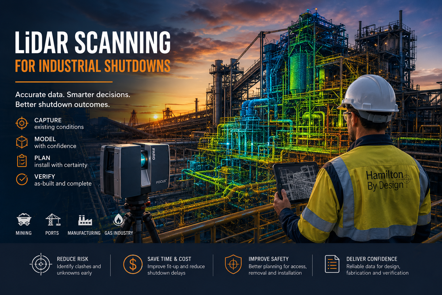
Engineer using a FARO LiDAR scanner to capture an industrial plant during a planned shutdown for design, fabrication and as-built verification.

LiDAR Scanning for Industrial Shutdowns: Reducing Risk Across Mining, Ports, Manufacturing and Gas Facilities

Industrial shutdowns provide a limited opportunity to inspect, modify, repair and replace critical plant and infrastructure. Every activity must be carefully planned because unexpected site conditions, inaccurate drawings or poorly fitting components can delay the restart of an entire operation.

LiDAR scanning can reduce this uncertainty by capturing a detailed three-dimensional record of the plant before or during the shutdown. The resulting point-cloud data can support engineering design, fabrication, installation planning, clash detection and final as-built verification.

Hamilton By Design provides engineering-grade 3D laser scanning for mining and industrial plants, combining site capture with practical mechanical engineering, CAD modelling and fabrication experience.

Rather than treating scanning as a standalone surveying activity, the objective is to collect the right information for the engineering decisions that follow.

Why Accurate Existing-Condition Data Matters During a Shutdown

Shutdown projects often involve brownfield plant that has been modified repeatedly over many years. Existing drawings may be incomplete, outdated or inconsistent with the current installation.

Small dimensional discrepancies can create major problems when replacement equipment, structural steel, pipe spools, platforms or mechanical components arrive on site. Typical problems include:

  • Bolt holes that do not align
  • Pipe flanges with incorrect positions or orientations
  • Structural members that clash with existing services
  • Replacement equipment that cannot pass through the planned access route
  • Platforms or stairs that interfere with nearby plant
  • Insufficient crane, rigging or installation clearances
  • Fabricated components that require modification on site

These problems are particularly costly during a shutdown because labour, cranes, contractors and production schedules have already been committed.

LiDAR scanning helps establish a reliable geometric record of what is actually present. Millions of spatial measurements are collected to form a point cloud representing equipment, structures, pipework, access systems and surrounding plant.

This data can then be referenced during design and reviewed before fabrication begins.

Scanning Before, During and After a Shutdown

LiDAR scanning can be used at several stages of the shutdown lifecycle.

Pre-shutdown scanning

Scanning before the shutdown allows the project team to develop a detailed understanding of the existing plant while there is still time to resolve design issues.

Pre-shutdown scanning can support:

  • Existing-condition verification
  • Scope development
  • Mechanical and structural design
  • Pipework and flange tie-in verification
  • Equipment replacement planning
  • Clash detection
  • Removal and installation studies
  • Crane and rigging access reviews
  • Fabrication of replacement components
  • Constructability reviews

Where the plant remains operational, the scanning plan must consider moving equipment, restricted access, line-of-sight limitations and operational safety requirements.

Scanning during the shutdown

Some areas cannot be captured while the plant is operating. Guards, covers, liners, access panels and equipment components may need to be removed before the relevant geometry becomes visible.

Shutdown scanning can capture:

  • Internal chute geometry
  • Hidden equipment interfaces
  • Wear surfaces
  • Equipment mounting points
  • Flange faces and pipework connections
  • Internal vessel or tank conditions
  • Structural connections
  • Areas normally obstructed by operating equipment

This information can assist with unexpected conditions identified after isolation and disassembly.

Post-installation scanning

A final scan can provide an independent record of completed work. It may be used to verify equipment location, clearances, structural geometry and the final arrangement of modified plant.

Post-installation data can also support drawing updates, asset records and future maintenance planning.

LiDAR Scanning for Mining Shutdowns

Mining and mineral-processing facilities contain complex combinations of conveyors, chutes, crushers, screens, pumps, tanks, pipework and structural steel. These assets may operate continuously, leaving only short periods for major inspections and modifications.

Hamilton By Design provides dedicated 3D scanning for mining shutdown projects where reliable existing-condition information is required for plant upgrades and replacement works.

Typical mining shutdown applications include:

  • Chute and transfer-station replacement
  • Conveyor upgrades and realignment
  • Crusher and screen replacement
  • Pump and piping modifications
  • Hopper and bin refurbishment
  • Wear-liner replacement
  • Structural steel modifications
  • Platform, stair and handrail upgrades
  • Equipment foundation verification
  • Brownfield plant expansions

For a chute replacement, for example, the scan can capture the inlet and discharge interfaces, surrounding structural steel, conveyor geometry, pulley locations, maintenance access and nearby services.

The replacement chute can then be designed within the scanned environment, reducing reliance on isolated manual dimensions or outdated drawings.

LiDAR Scanning for Ports and Bulk Materials Handling

Ports and export terminals often contain large mobile and fixed assets operating around restricted shipping and loading schedules. Access may involve work at height, over water or around active bulk-materials-handling equipment.

LiDAR scanning can support shutdown and maintenance work involving:

  • Ship loaders and unloaders
  • Conveyors and transfer towers
  • Hoppers and loading chutes
  • Gantries and structural frames
  • Wharf infrastructure
  • Rail-mounted equipment
  • Maintenance platforms
  • Access stairs and walkways
  • Hydraulic and mechanical systems
  • Pipework and services

Scanning is particularly useful when a project requires an understanding of the relationship between multiple systems rather than one isolated dimension.

A ship-loader modification, for example, may require verification of structural geometry, conveyor interfaces, maintenance clearances, access routes and the position of nearby equipment. Capturing these elements within one coordinated point cloud gives designers a broader understanding of the installation environment.

It can also reduce repeated site visits and the amount of time personnel need to spend in difficult-access areas.

LiDAR Scanning for Manufacturing Shutdowns

Manufacturing facilities commonly schedule maintenance and installation work over weekends, public holidays or planned production shutdowns. The available period may be extremely limited, and a delayed restart can affect production targets, customers and downstream operations.

Applications include:

  • Production-line modifications
  • New machinery installation
  • Equipment relocation
  • Ducting and extraction upgrades
  • Process-pipework modifications
  • Utility-routing studies
  • Machine guarding
  • Platforms and access systems
  • Equipment foundation verification
  • Factory layout documentation

LiDAR scanning can capture the relationship between machinery, building structures, overhead services, pipework, platforms and access areas.

This is valuable when new equipment is being designed or supplied before the existing machinery is removed. The proposed installation can be modelled within the scanned environment to identify possible clashes and confirm maintenance access.

Scanning can also document areas that become visible only when the production line is shut down, cleaned or partially dismantled.

LiDAR Scanning for Gas and Process Facilities

Gas and process facilities require careful management of brownfield interfaces, hazardous areas, permits, isolation requirements and engineering records.

Common scanning applications include:

  • Pipe-rack documentation
  • Brownfield piping tie-ins
  • Flange-position verification
  • Valve and instrument access studies
  • Vessel and skid replacement
  • Nozzle-position verification
  • Pipe-support modifications
  • Structural framing upgrades
  • Removal and installation-path studies
  • As-built documentation

Where pipe spools are fabricated before a shutdown, accurate tie-in information is essential. The position, angle and orientation of each connection must be correctly understood.

LiDAR scanning can provide a detailed spatial reference for pipework and surrounding plant. However, critical flange faces, bolt patterns and connection details may also require verification using traditional measurement methods or appropriate survey controls.

Scanning should therefore form part of a fit-for-purpose measurement strategy rather than being applied without consideration of the required tolerance.

From Point Cloud to Engineering Deliverables

A point cloud is a valuable source of information, but it is not automatically an engineering solution.

The required deliverables should be established before scanning begins. Hamilton By Design integrates scanning with SMP project delivery and brownfield engineering workflows so that the captured data can be converted into information suited to the project.

Potential deliverables include:

  • Registered E57, RCP, RCS or LAS point clouds
  • Existing-condition CAD models
  • SolidWorks or Inventor assemblies
  • STEP, SAT or Parasolid geometry
  • AutoCAD plans and layouts
  • General arrangement drawings
  • Plans, sections and elevations
  • Fabrication-reference models
  • Pipe and flange interface records
  • Clash-detection models
  • Existing-condition reports
  • Redline and as-built drawing updates

The required modelling level should reflect the intended use. A broad plant-layout study may only require simplified geometry, while a shutdown-critical fabricated component may require more detailed modelling and verification of specific interfaces.

Planning a Fit-for-Purpose Shutdown Scan

A successful scan begins with a clear understanding of the project problem.

Before mobilising, the scanning team should consider:

  • What is being designed, replaced or inspected?
  • Which dimensions and interfaces are critical?
  • What equipment will be operating?
  • What becomes accessible only during the shutdown?
  • What scan density and coverage are required?
  • Are survey controls required?
  • Are there hazardous-area restrictions?
  • Will dust, steam, rain or reflective surfaces affect capture?
  • What file formats are required?
  • What CAD or drawing deliverables will be produced?

The scanning envelope should include more than the immediate component. Surrounding structures, services, access routes and potential clash points may be equally important.

Hamilton By Designโ€™s broader engineering services allow scanning information to be reviewed in the context of mechanical design, plant modifications, constructability and fabrication requirements.

Frequently Asked Questions

Can LiDAR scanning be completed while the plant is operating?

Yes, in many situations. However, moving machinery, mobile equipment, dust, restricted access and safety requirements must be considered. Some areas may need to be captured after isolation or during the shutdown.

How accurate is industrial LiDAR scanning?

Accuracy depends on the scanner, distance, environment, registration method, surface condition and required deliverable. The project tolerance should be established before scanning. Critical interfaces may require additional verification.

Can scanning prevent fabricated components from not fitting?

Scanning can significantly reduce fit-up risk by providing accurate existing-condition geometry. It cannot eliminate every risk, particularly where surfaces are hidden or project tolerances have not been properly defined.

What can be scanned during a mining shutdown?

Typical assets include conveyors, chutes, crushers, screens, hoppers, pipework, tanks, equipment bases, platforms, stairs, handrails and structural steel.

Can point-cloud data be converted into CAD?

Yes. Relevant geometry can be converted into SolidWorks, Inventor or AutoCAD models and drawings. The amount of modelling required depends on the intended engineering use.

Does every part of the point cloud need to be modelled?

No. Modelling the entire environment may add unnecessary cost and time. A fit-for-purpose model should focus on the equipment, structures and interfaces needed for the project.

Can scanning be used for pipework tie-ins?

Yes. It can capture pipe routes, surrounding structures, supports and connection locations. Critical flange and tie-in details should be verified to the accuracy required for fabrication.

When is the best time to complete the scan?

Where possible, an initial scan should be completed early enough to support design and fabrication. Additional scanning may be undertaken during the shutdown when hidden areas become accessible.

Reduce Shutdown Uncertainty with Engineering-Led LiDAR Scanning

The primary value of LiDAR scanning during a shutdown is not simply the speed of measurement. Its value comes from reducing uncertainty before fabrication and installation begin.

By capturing the plant accurately, project teams can identify clashes, verify interfaces, plan access and develop modifications against the actual site environment.

For mining, ports, manufacturing and gas facilities, engineering-led LiDAR scanning can support safer planning, improved fit-up and a more controlled return to operation.

Contact Hamilton By Design to discuss the scanning envelope, required accuracy, site conditions and engineering deliverables for your next shutdown project.

Hamilton By Design logo displayed on a blue tilted rectangle with a grey gradient background

Contact Us – Talk To Us

Name
Would you like us to arrange a phone consultation for you?
Address

Our clients:


3D Laser Scanning for Hunter Valley CHPP Engineering

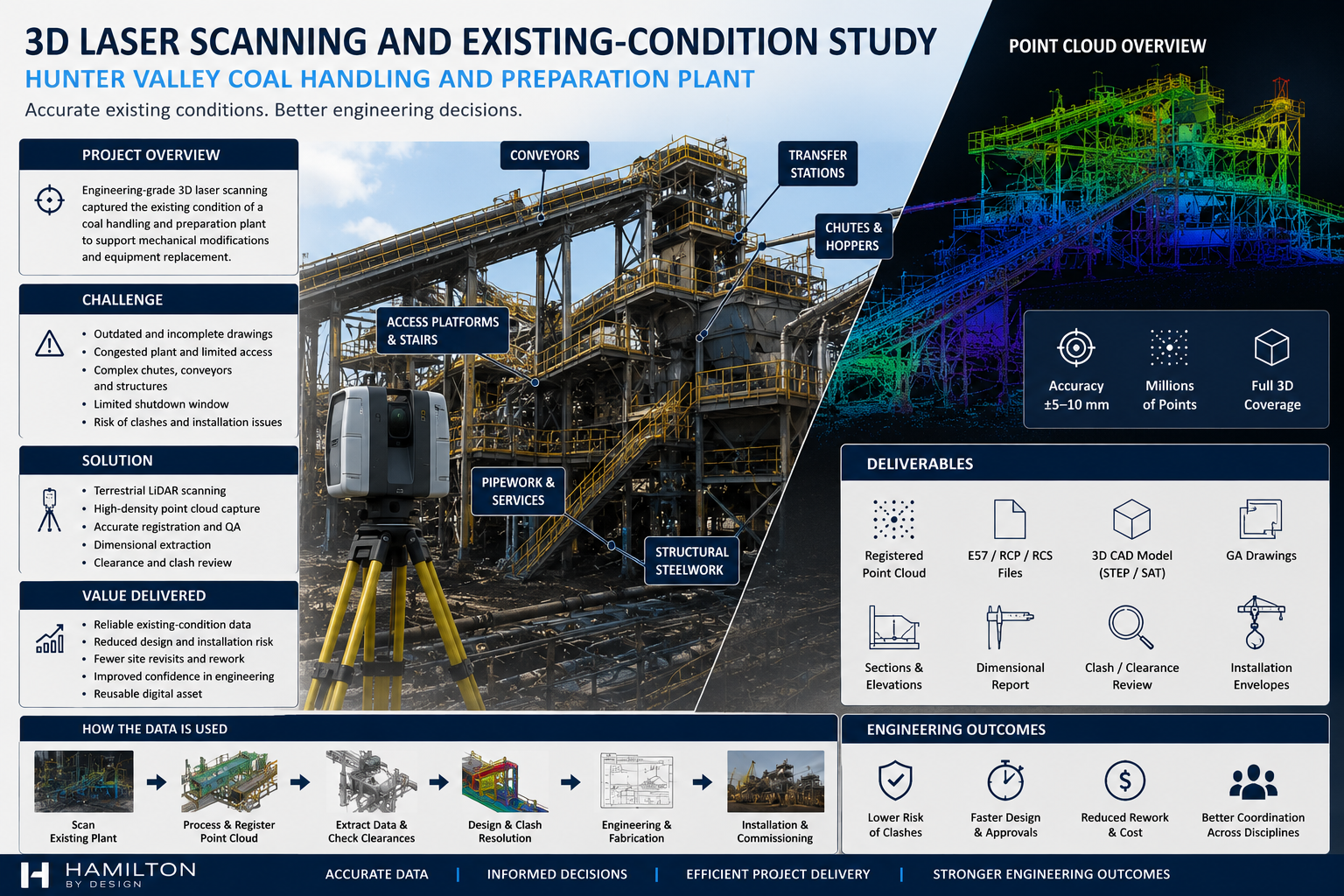
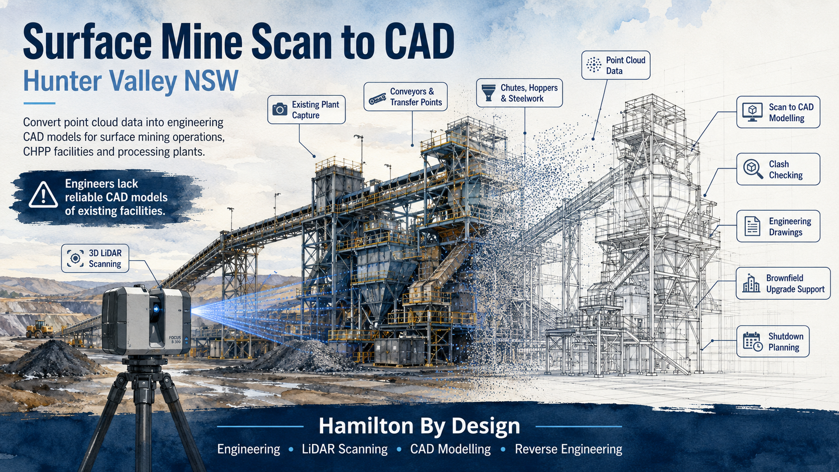
Infographic titled โ€œ3D Laser Scanning and Existing-Condition Study โ€“ Hunter Valley Coal Handling and Preparation Plant,โ€ showing an industrial CHPP with conveyors, transfer stations, chutes, platforms and pipework, alongside a LiDAR scanner, a colour point-cloud view, key project challenges, deliverables, workflow steps and engineering outcomes.

3D Laser Scanning and Existing-Condition Study for a Hunter Valley CHPP

Project Overview

Blue line icon of a tripod-mounted LiDAR scanner capturing the side profile of a mining haul truck.

Hamilton By Design completed an engineering-grade 3D laser scanning and existing-condition study for a coal handling and preparation plant in the Hunter Valley, New South Wales.

The study was undertaken to capture the installed condition of the plant before proposed mechanical and structural modifications were developed.

The scanning area included conveyors, transfer stations, chutes, structural steelwork, access platforms, pipework and surrounding equipment.

The plant had undergone changes over time, and the available drawings did not fully represent the current installed condition.

The Engineering Challenge

Coal handling and preparation plants contain complex mechanical, structural and materials-handling systems.

Equipment is often installed within congested areas where conveyors, pipework, platforms, structural supports and electrical services pass through the same working space.

The proposed modifications needed to connect accurately with the existing plant.

The main project risks included:

  • incomplete or outdated drawings
  • restricted access around operating equipment
  • complex chute and conveyor geometry
  • elevated plant structures
  • limited shutdown periods
  • difficult-to-measure equipment interfaces
  • uncertainty around existing clearances
  • potential clashes with structural steelwork and services
  • fabrication errors caused by incorrect dimensions

A conventional site measure would have captured only selected dimensions and could have missed important obstructions or plant interfaces.

Scope of Work

Hamilton By Design completed the following work:

  • reviewed the available plant drawings and project information
  • defined the required scanning envelope
  • planned suitable scanner positions
  • completed terrestrial 3D laser scanning throughout the nominated CHPP area
  • captured conveyors, chutes, transfer stations and supporting structures
  • captured platforms, stairs, handrails, pipework and surrounding services
  • registered and quality-checked the scan data
  • prepared a coordinated existing-condition point cloud
  • extracted critical equipment and structural dimensions
  • reviewed clearances and installation constraints
  • supported the development of the proposed mechanical modifications

3D Laser Scanning Methodology

The plant area was reviewed before scanning to identify the most important mechanical, structural and installation interfaces.

Multiple scanner positions were used to capture the plant from different directions and reduce hidden areas within the point cloud.

The scan coverage included:

  • conveyor head and tail sections
  • transfer chutes
  • discharge points
  • hoppers and bins
  • support frames
  • platforms and walkways
  • stairs and handrails
  • pipework and services
  • floor and structural levels
  • surrounding mechanical equipment
  • maintenance-access areas
  • proposed installation paths

The individual scans were registered into a single coordinated point cloud.

The completed dataset was checked for alignment, coverage and suitability for engineering use before detailed design work commenced.

Existing-Condition Information Captured

Blue 3D LiDAR scanner icon on a tripod with scanning waves

The registered point cloud provided a detailed three-dimensional record of the CHPP area.

The scan data allowed the engineering team to confirm:

  • installed conveyor positions
  • chute and hopper geometry
  • structural support locations
  • platform and walkway arrangements
  • pipework routes
  • equipment connection points
  • floor and structural elevations
  • maintenance clearances
  • removal and installation envelopes
  • potential clashes with existing plant

This information provided a reliable basis for developing the proposed modifications.

Engineering Deliverables

The project deliverables included:

  • a registered engineering-grade point cloud
  • E57 point-cloud files
  • Autodesk-compatible point-cloud files
  • extracted site dimensions
  • existing-condition geometry
  • equipment interface locations
  • structural interface locations
  • clearance and clash-review information
  • supporting views for mechanical design and drafting

The point-cloud data could also be used to prepare:

  • SolidWorks models
  • Autodesk Inventor models
  • STEP and SAT files
  • general arrangement drawings
  • sections and elevations
  • fabrication drawings
  • installation drawings
  • demolition drawings
  • shutdown work packs

Engineering Outcome

The completed existing-condition study gave the project team a reliable spatial reference for the proposed CHPP modifications.

Differences between the available drawings and the actual installed plant could be identified before detailed design and fabrication progressed.

The point cloud allowed the mechanical design to be developed around the real plant condition rather than assumed dimensions.

The scan data supported:

  • conveyor modification design
  • chute replacement and redesign
  • transfer-point upgrades
  • structural support modifications
  • new platform and access design
  • pipework rerouting
  • equipment replacement planning
  • clash detection
  • mechanical fit-up verification
  • maintenance-access reviews
  • fabrication planning
  • shutdown installation sequencing

Benefits to the Client

The use of engineering-grade 3D laser scanning provided several practical benefits:

  • reduced reliance on outdated drawings
  • faster capture of complex CHPP geometry
  • fewer manual measurements
  • reduced need for return site visits
  • improved confidence in the mechanical design
  • earlier identification of potential clashes
  • lower risk of fabrication errors
  • reduced risk of shutdown installation delays
  • improved coordination between engineering and site teams
  • better planning of equipment removal and installation
  • creation of a reusable digital record of the plant

Why 3D Laser Scanning Was Suitable

3D laser scanning was well suited to the project because the engineering work depended on an accurate understanding of the existing plant arrangement.

A CHPP can contain hundreds of interacting mechanical, structural and service components within a relatively small area.

The point cloud allowed a large amount of spatial information to be captured during a controlled site visit.

Engineers and designers could then review the plant remotely, inspect equipment interfaces and take additional measurements without repeatedly returning to site.

This provided a more complete engineering reference than a limited set of manually recorded dimensions.

Conclusion

The project demonstrated the value of 3D laser scanning for brownfield engineering within Hunter Valley coal handling and preparation plants.

By capturing the existing plant before detailed design and fabrication, Hamilton By Design reduced uncertainty and improved the quality of the engineering information available to the project team.

Engineering-grade LiDAR can provide a reliable foundation for:

  • conveyor upgrades
  • chute and transfer-station modifications
  • equipment replacement
  • structural modifications
  • platform and access upgrades
  • pipework modifications
  • reverse engineering
  • as-built verification
  • mechanical fit-up
  • shutdown planning
  • digital-twin development

Accurate existing-condition data allows CHPP modifications to proceed with greater confidence and a lower risk of site-related design changes.


Hamilton By Design logo displayed on a blue tilted rectangle with a grey gradient background

Contact Us – Talk To Us

Name
Would you like us to arrange a phone consultation for you?
Address

Our clients:


Shiploader 3D Scanning Perth

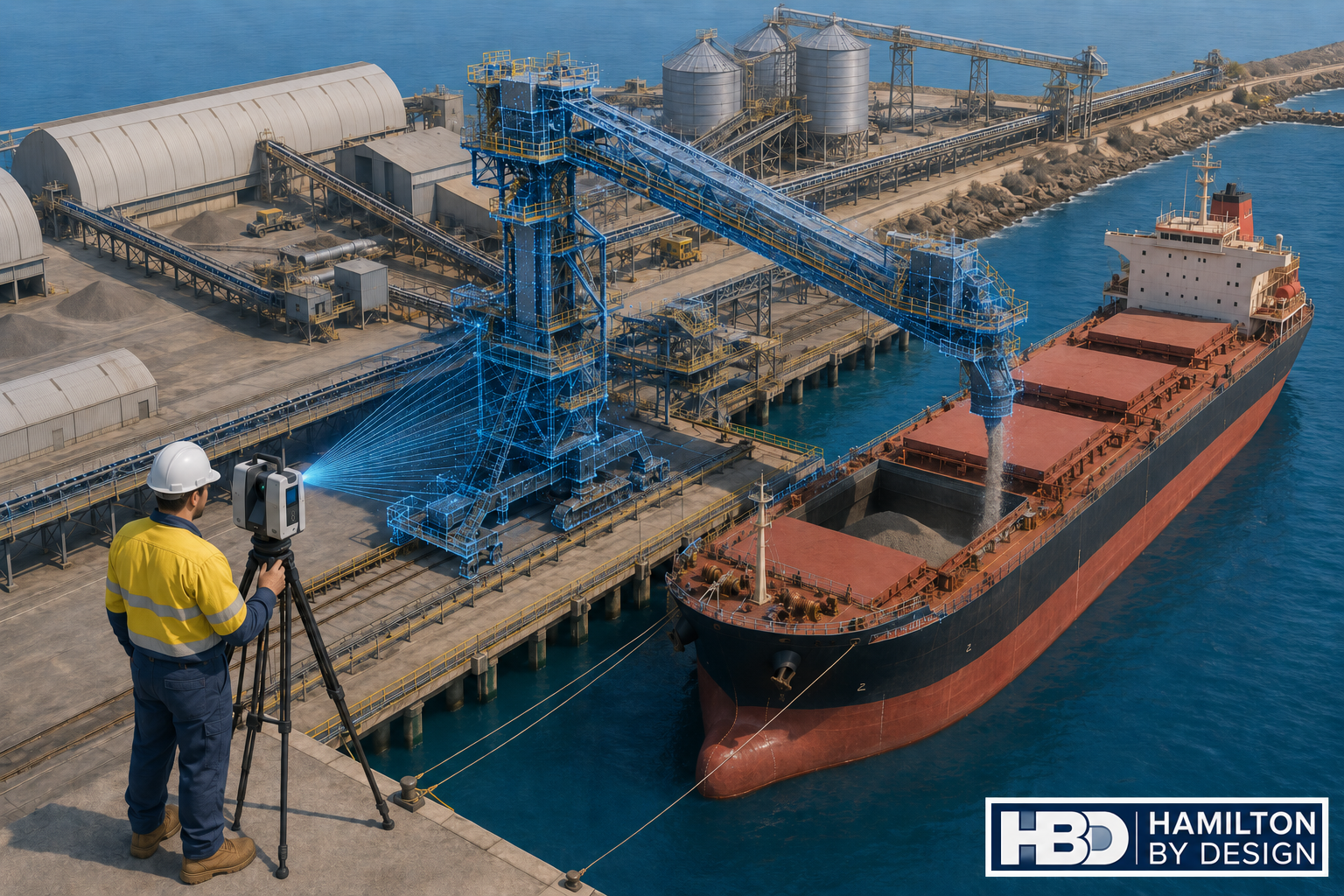
Engineer using a LiDAR scanner to capture a shiploader, conveyor system and bulk carrier at a Perth port.

Engineering-Grade LiDAR Scanning for Ports, Bulk Handling and Brownfield Shiploader Upgrades

Hamilton By Design provides shiploader 3D scanning in Perth for port operators, bulk handling facilities, engineers, fabricators and maintenance teams working with ageing shiploaders, conveyors, chutes, booms, wharf structures and access platforms.

Shiploaders are large, complex and difficult assets to modify safely. They operate in harsh marine environments, often handling abrasive bulk materials such as minerals, grain, fertiliser, alumina, coal, ore or other export products. Over time, these machines are repaired, strengthened, modified and upgraded. The problem is that the drawings do not always keep up with the real asset.

That creates risk.

When a port operator needs to replace a chute, modify a conveyor, inspect a boom, upgrade access platforms, install guarding, check clearances or plan a shutdown, the team needs accurate existing-condition data. If the project starts with old drawings or incomplete site measurements, the risk of fabrication errors, installation clashes and shutdown delays increases quickly.

Hamilton By Design uses engineering-grade LiDAR scanning to capture accurate site geometry before design, fabrication or shutdown work begins. The scan data can then be used for point cloud review, Scan-to-CAD modelling, clash checking, general arrangement drawings, fabrication support and as-built documentation.

For broader Western Australian site capture and engineering support, see our 3D Scanning Perth services.

Why Shiploader 3D Scanning Matters

A shiploader is not a simple conveyor. It is a complete mechanical, structural and operational system. A typical shiploader may include boom structures, conveyor galleries, transfer chutes, hoppers, skirts, drives, pulleys, take-up systems, dust control equipment, hydraulic systems, electrical routes, access platforms, walkways, stairs, handrails, guarding, rails, wharf interfaces and surrounding port infrastructure.

Many of these areas are difficult to measure manually. Some areas are elevated. Some are close to operating plant. Some are affected by corrosion, impact damage, product build-up, wear or previous modifications. Manual measurement may be suitable for small items, but it is often not enough when the design team needs to understand how the whole asset fits together.

3D scanning captures millions of measured points across the shiploader and surrounding infrastructure. The result is a digital point cloud that can be measured, reviewed and converted into usable engineering deliverables.

This is especially valuable for brownfield port environments where the installed condition often differs from the original drawings.

The Biggest Problem: Inaccurate As-Built Data

The biggest problem for port operators and engineers is that ageing shiploaders often do not have accurate as-built data.

Original drawings may exist, but they may no longer reflect the current condition of the machine. Over many years, shiploaders are maintained, repaired and modified. Chutes are replaced. Guards are added. Platforms are changed. Steelwork is strengthened. Conveyor components are adjusted. Services are rerouted. Dust control systems are modified. Access systems are upgraded.

Each change may make sense at the time, but unless the drawings are updated properly, the asset slowly drifts away from the documentation.

This creates problems when new work is planned.

An engineer may design a replacement chute based on old drawings, only to find that the surrounding structure has changed. A fabricator may manufacture a component that clashes with existing steelwork. A shutdown team may plan an installation sequence without knowing that access is restricted. A maintenance team may discover during the shutdown that the lifting path is blocked.

For a shiploader, these problems can become expensive quickly. Shutdown windows are limited. Port operations are time-sensitive. Fabrication rework can delay installation. A small measurement error can become a major site issue.

3D scanning helps reduce this risk by capturing the real installed condition before design and fabrication decisions are made.

Who Uses Shiploader 3D Scanning?

Shiploader 3D scanning is useful for several project groups.

Port operators use scan data to understand existing assets, plan maintenance and reduce shutdown risk.

Mechanical engineers use point clouds and CAD models to design chute modifications, conveyor interfaces, guards, brackets, transfer points and replacement components.

Structural engineers use scan data to review steelwork, access platforms, stairs, handrails, supports, boom structures and wharf interfaces.

Fabricators use accurate geometry to reduce site fit-up problems and improve confidence before manufacturing.

Maintenance planners use scan data to plan access, lifting, removal sequences and installation work before the asset is taken offline.

EPCM contractors use point cloud information for design coordination, clash checking and constructability review.

Bulk handling operators use scan data to support conveyors, transfer towers, shiploaders, wharf structures and associated plant.

What Can Be Scanned?

Hamilton By Design can scan shiploader and port infrastructure elements including:

  • Shiploader boom structures
  • Conveyor galleries
  • Transfer chutes
  • Hoppers and skirts
  • Belt feeders
  • Drive stations
  • Pulley areas
  • Take-up systems
  • Dust extraction systems
  • Spray systems
  • Access platforms
  • Walkways and stairs
  • Handrails and guarding
  • Wharf structures
  • Rail interfaces
  • Structural supports
  • Pipework and services
  • Cable trays and equipment routes
  • Maintenance access zones
  • Adjacent conveyors and transfer points

The aim is not just to create a visual record. The aim is to produce engineering information that can support real project decisions.

Where We Support Shiploader 3D Scanning

Hamilton By Design supports shiploader 3D scanning and port infrastructure projects across Perth and Western Australia, including Perth, Fremantle, Kwinana, Henderson, Cockburn Sound, Rockingham, Bunbury, Geraldton, Port Hedland, Karratha and regional WA bulk handling facilities.

The page focus is Shiploader 3D Scanning Perth, but the same workflow can support port and bulk handling infrastructure across Western Australia.

Perth is a practical engineering base for this work because many WA port, mining, processing and bulk handling projects are planned, managed and engineered from Perth, even when the assets themselves are located across regional WA.

How the 3D Scanning Process Works

1. Project Review

The first step is understanding why the scan is required.

A scan for chute replacement is different from a scan for access platform upgrades. A scan for shutdown planning is different from a scan for fabrication verification. Before scanning begins, Hamilton By Design reviews the project objective, required deliverables, areas of interest and level of detail required.

This helps make sure the scan captures the information that the engineering, maintenance or fabrication team actually needs.

2. Site Walkdown and Scan Planning

The shiploader and surrounding work areas are reviewed to identify key scan locations. The aim is to capture the asset with enough coverage and overlap to produce a reliable point cloud.

Important areas may include transfer points, boom sections, conveyor routes, access platforms, drive areas, structural supports, wharf interfaces and installation paths.

Safety and access requirements are also considered, especially around live plant, elevated work areas, marine environments and shutdown conditions.

3. LiDAR Site Capture

Hamilton By Design uses terrestrial LiDAR scanning to capture the asset. The scanner records millions of measured points, creating a detailed point cloud of the shiploader and surrounding infrastructure.

This method is faster and more complete than relying on manual measurements for large and complex brownfield assets.

4. Point Cloud Registration

After scanning, the scan data is registered into a coordinated point cloud. This creates a single usable dataset that can be opened, reviewed, measured and used for downstream modelling.

Typical point cloud deliverables may include E57, RCP, RCS or LAS files.

These files can support engineering review, CAD modelling, coordination and documentation.

5. Engineering Review

Once the point cloud is prepared, engineers and designers can review the captured asset. They can check clearances, confirm interfaces, measure existing geometry and identify areas that may affect design, fabrication or installation.

This is where engineering-led scanning becomes valuable. Hamilton By Design understands how scan data is used for design, fabrication, maintenance and brownfield modification work.

6. Scan-to-CAD Modelling

Where required, the point cloud can be converted into CAD models or drawings. This may include mechanical components, structural steel, platforms, chutes, guards, conveyor interfaces or general arrangement layouts.

For more detailed point cloud conversion support, see our Scan to CAD Perth services.

7. Drawings and Deliverables

Depending on the project, Hamilton By Design can provide registered point clouds, 2D plans, sections, elevations, general arrangement drawings, 3D CAD models, STEP files, SAT files, Parasolid files, DWG drawings, fabrication drawings, as-built documentation and clash review models.

The deliverables are selected based on the project need. Some clients only require point cloud data. Others require a full scan-to-CAD workflow with engineering drawings and fabrication support.

Tools That Assist Shiploader 3D Scanning

Hamilton By Design uses practical digital engineering tools suitable for industrial, port and bulk handling environments.

These may include FARO Focus terrestrial LiDAR scanning, FARO SCENE point cloud registration, Autodesk ReCap for RCP and RCS workflows, AutoCAD for plans and sections, SolidWorks for mechanical modelling, Autodesk Inventor for mechanical assemblies and Navisworks for coordination and clash checking.

Deliverable formats may include E57, RCP, RCS, LAS, DWG, STEP, SAT and Parasolid.

The purpose of these tools is to move the project from site capture to usable engineering information.

Services Hamilton By Design Can Provide

Hamilton By Design can support shiploader and port infrastructure projects with engineering-grade 3D laser scanning, point cloud registration, Scan-to-CAD modelling, mechanical engineering support, structural drafting, as-built documentation, fabrication drawings and shutdown planning support.

Our work can assist with chute modifications, conveyor interfaces, guarding, brackets, access platforms, walkways, stairs, handrails, support frames, replacement components and surrounding infrastructure.

For broader design and engineering capability in Western Australia, see our Perth engineering services page.

Common Shiploader Project Problems We Help Solve

Hamilton By Design can assist when existing drawings are missing, outdated or unreliable.

We can also assist when a chute needs to be replaced, a conveyor interface needs to be checked, a boom structure needs to be documented, access platforms need modification, new guarding is being installed, fabricated parts need accurate site geometry or shutdown work needs better planning.

Shiploader projects often fail because the project team discovers the real site condition too late. A point cloud gives engineers, fabricators and maintenance teams a better understanding before work moves too far into design or fabrication.

Example Use Case: Chute and Conveyor Upgrade

A common shiploader problem is a transfer chute or conveyor interface that needs modification.

The original drawing may show the design intent, but the installed condition may have changed. There may be additional steelwork, modified guards, worn liners, dust control equipment, services or access restrictions.

By scanning the area first, Hamilton By Design can capture the surrounding geometry and provide accurate information for the design team.

This helps engineers confirm available space, model replacement components, check access, reduce clashes and improve fabrication accuracy.

The result is a better chance that the new work will fit during the planned shutdown.

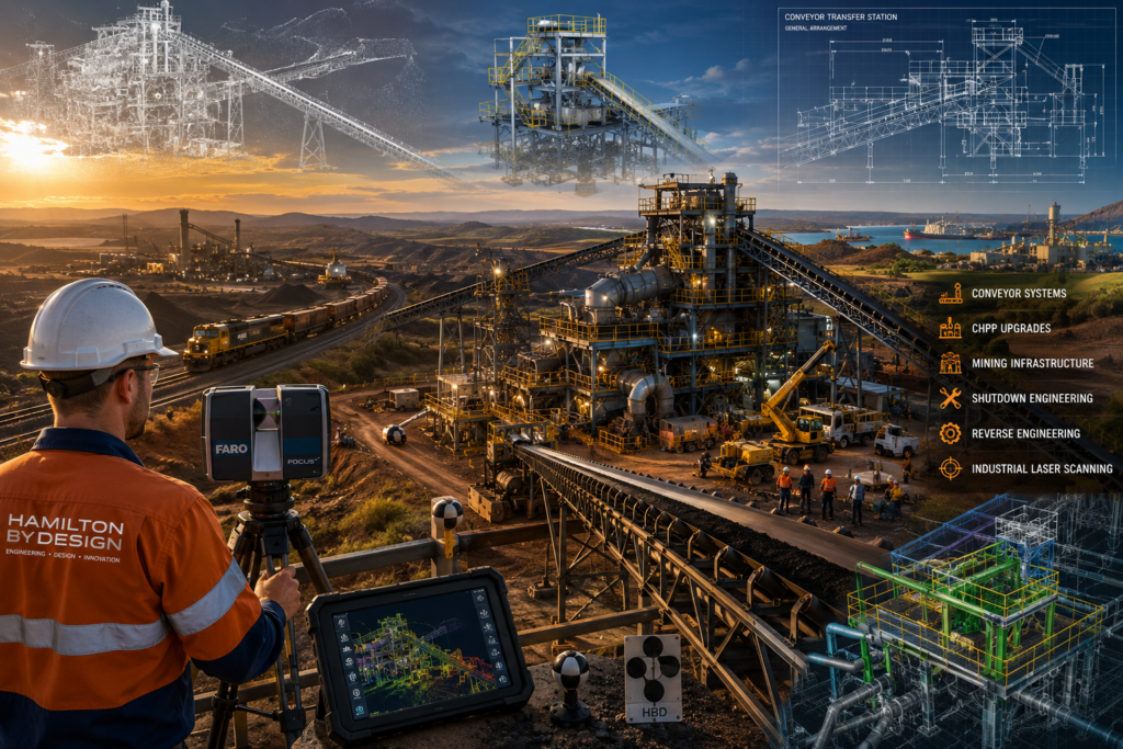
Engineering-grade 3D laser scanning and mining infrastructure project in Central Queensland, showing a conveyor transfer station, CHPP facility, coal train, industrial laser scanner, point cloud modelling and reverse engineering workflows supporting shutdown engineering and mining operations.

Example Use Case: Access Platform Modification

Shiploaders often require access improvements for inspection, maintenance and safety. This may involve stairs, platforms, handrails, ladders, guards or local structural modifications.

A scan can capture the existing structure and surrounding obstructions so that new access systems can be designed around real site conditions.

This is particularly useful when the asset has been modified over many years and the original access drawings are no longer reliable.

Example Use Case: Shutdown Planning

Shutdown time is expensive. Every hour matters.

By scanning the shiploader before the shutdown, project teams can inspect the asset digitally, measure key areas, plan removal paths, check lifting constraints, model replacement components and identify potential clashes before work begins.

This does not remove every risk, but it gives the project team better information before the asset is taken offline.

Why Engineering-Led Scanning Is Different

Not all 3D scanning is the same.

For a shiploader project, the value is not just in capturing a point cloud. The value is in understanding what the point cloud is needed for.

A survey-only approach may capture the site, but an engineering-led approach considers how the information will be used for design, fabrication, installation and maintenance.

Hamilton By Design combines LiDAR scanning with mechanical engineering, drafting and fabrication-aware modelling. That means the scan is planned around the downstream engineering outcome, not just the visual capture.

This is important for port assets because the cost of getting it wrong can be high. A small clash, incorrect bracket location, missed access constraint or outdated drawing can create real shutdown delays.

For broader mechanical design support, see our Mechanical Engineering Perth page.

FAQs

What is shiploader 3D scanning?

Shiploader 3D scanning is the process of using LiDAR scanning equipment to capture accurate three-dimensional data of a shiploader and its surrounding infrastructure. The scan creates a point cloud that can be measured, reviewed and converted into CAD models or drawings.

Why scan a shiploader before an upgrade?

A shiploader should be scanned before an upgrade because existing drawings are often outdated or incomplete. Scanning captures the real installed condition, helping engineers reduce assumptions before design, fabrication and shutdown work begins.

What parts of a shiploader can be scanned?

Hamilton By Design can scan boom structures, conveyors, transfer chutes, hoppers, guards, access platforms, stairs, handrails, wharf interfaces, drives, pulleys, services, dust control systems and surrounding port infrastructure.

Can scan data be converted into CAD drawings?

Yes. Point cloud data can be converted into 2D drawings, 3D CAD models, general arrangement drawings, sections, elevations and fabrication drawings, depending on the project requirements.

What file formats can be supplied?

Typical deliverables may include E57, RCP, RCS, LAS, DWG, STEP, SAT and Parasolid formats. The final format depends on the clientโ€™s software and required workflow.

Is shiploader scanning useful for shutdown planning?

Yes. Scanning before a shutdown helps teams check clearances, plan installation paths, identify clashes, review access and reduce the risk of discovering problems after the asset is offline.

Can 3D scanning help with chute replacement?

Yes. Chute replacement is one of the best uses for 3D scanning. The scan captures the surrounding structure, conveyor interfaces, access restrictions and existing geometry so the replacement chute can be designed with better information.

Does Hamilton By Design only work in Perth?

No. Hamilton By Design supports projects across Perth and Western Australia, including Fremantle, Kwinana, Henderson, Bunbury, Geraldton, Port Hedland, Karratha and regional bulk handling sites.

Hamilton By Design logo displayed on a blue tilted rectangle with a grey gradient background

Shiploader 3D Scanning Perth

If you are planning a shiploader upgrade, chute replacement, conveyor modification, access platform change, shutdown project or port infrastructure review, accurate as-built information is the best place to start.

Hamilton By Design provides shiploader 3D scanning Perth services for port operators, engineers, fabricators and maintenance teams working across Perth and Western Australia.

By combining engineering-grade LiDAR scanning, point cloud registration, Scan-to-CAD modelling, mechanical engineering and drafting support, Hamilton By Design helps project teams reduce assumptions, improve fabrication accuracy and plan brownfield work with greater confidence.

Contact Hamilton By Design to discuss your shiploader, conveyor, chute, wharf or port infrastructure scanning requirements.

Talk to Us – Contact Us

Name
Would you like us to arrange a phone consultation for you?
Address

Our clients:


https://www.hamiltonbydesign.com.au/scan-to-bim-services-australia-lidar-point-clouds-cad-modelling

Surface Mine Scan to CAD Hunter Valley NSW

Watercolour hero image showing a Hunter Valley surface mine processing plant being captured by 3D LiDAR scanning and converted from point cloud data into a CAD model.

Convert Point Cloud Data into Engineering CAD Models for Surface Mining Operations and Processing Plants

Blue 3D LiDAR scanner icon on a tripod with scanning waves

Engineers working in surface mining operations across the Hunter Valley are often expected to design upgrades, replacement parts, access structures, chute modifications, conveyor changes and plant improvements without a reliable CAD model of the existing facility. In many cases, the drawings available to the project team are outdated, incomplete, unavailable from the OEM, or no longer match the real site.

That creates a serious problem.

When engineers do not have accurate CAD models of existing plant, every brownfield project begins with uncertainty. A chute may look correct on an old drawing but be different on site. A conveyor support may have been modified during a shutdown. A platform may have been extended. Pipework may have been rerouted. Guards, stairs, handrails, access points and maintenance clearances may no longer match the original design.

For surface mining and processing plant environments, this is where Surface Mine Scan to CAD becomes valuable.

Hamilton By Design supports Hunter Valley mining and industrial operations by converting 3D laser scan and LiDAR point cloud data into practical engineering CAD models. These models help engineers, maintenance teams, shutdown planners and fabricators work from the real condition of the site instead of relying on assumptions.

For broader mining-related engineering support, Hamilton By Design also provides Hunter Valley Mining Engineering & 3D Laser Scanning Services for brownfield plant, CHPP facilities, conveyor infrastructure, structural steelwork and heavy industrial assets.

The Problem: Engineers Lack Reliable CAD Models of Existing Facilities

The biggest issue in many surface mining operations is not always the lack of engineering skill. It is the lack of reliable existing information.

Engineering teams may be highly capable, but if the base model is wrong, the new design can be wrong before it starts. This is a common challenge in brownfield mining environments where plant has been modified, repaired, patched, upgraded and maintained over many years.

Old drawings are often treated as the starting point for a project, but they may not show what is actually installed. In some cases, the OEM will not provide the drawings. In other cases, the equipment has been altered so many times that the original drawing is no longer useful. The plant may have had structural modifications, replacement components, temporary repairs, maintenance improvements or shutdown changes that were never captured in CAD.

This creates risk for:

  • Project engineers
  • Mechanical engineers
  • Structural engineers
  • Drafting teams
  • Maintenance planners
  • Shutdown planners
  • Fabricators
  • Installation contractors
  • Asset owners
  • CHPP and processing plant managers

The result is often the same: more site measuring, more assumptions, more rework and more pressure during installation.

What Is Surface Mine Scan to CAD?

Surface Mine Scan to CAD is the process of capturing existing mining infrastructure using 3D laser scanning or LiDAR, then converting the point cloud into usable engineering CAD models.

A point cloud is a highly detailed digital capture of the physical environment. It records the real position and shape of steelwork, conveyors, platforms, chutes, hoppers, bins, tanks, pumps, pipework, handrails, access stairs, guarding and surrounding plant.

However, a point cloud by itself is not always enough.

Engineers usually need the scan data converted into a CAD format they can use for design, checking, fabrication or installation planning. That may include SolidWorks models, Inventor models, AutoCAD drawings, Navisworks coordination files, STEP files, SAT files, DWG files, DXF files, general arrangement drawings, sections, elevations or fabrication drawings.

The value is not just the scan. The value is turning the scan into engineering information.

Hamilton By Designโ€™s 3D CAD Modelling Australia service supports this exact problem by creating practical 3D models from point clouds, existing drawings, PDFs, sketches, marked-up plans and site measurements.

Why Surface Mining Operations Need Scan to CAD

Surface mining operations are full of existing assets that are difficult to measure accurately by hand. These facilities often include conveyors, transfer stations, crushers, screens, bins, hoppers, CHPP structures, workshops, pump systems, tanks, pipe racks, platforms, walkways and access structures.

Many of these assets are large, complex, elevated, corroded, modified or hard to access safely.

Traditional site measuring can be slow and risky. It may also miss important details. Measuring one beam, one chute or one platform may not capture the full context around the design. A modification may need to clear existing steelwork, match an existing conveyor, avoid pipework, maintain access, fit within guarding and be installed during a short shutdown window.

A 3D laser scan captures the surrounding environment so the design team can work with a much better understanding of the real plant.

For surface mine engineers, Scan to CAD can assist with:

  • Brownfield upgrades
  • Chute replacement and redesign
  • Conveyor modifications
  • Transfer station upgrades
  • Structural steel checks
  • Access platform upgrades
  • Pump and pipework changes
  • Plant layout verification
  • Clash detection
  • Shutdown planning
  • Reverse engineering
  • Fabrication support
  • As-built documentation
  • Replacement parts where OEM drawings are unavailable

Location Focus: Hunter Valley NSW

The Hunter Valley is one of the most important mining and industrial regions in New South Wales. For engineering teams working around surface mining operations, coal handling plants, processing facilities and associated infrastructure, the need for accurate site information is ongoing.

Hamilton By Design supports engineering-led Scan to CAD workflows across the Hunter Valley and surrounding NSW mining regions.

Towns and regional areas serviced

The following town and regional names are relevant to the Hunter Valley surface mining and industrial service area:

  • Muswellbrook
  • Singleton
  • Maitland
  • Cessnock
  • Newcastle
  • Rutherford
  • Kurri Kurri
  • Branxton
  • Greta
  • Denman
  • Aberdeen
  • Scone
  • Warkworth
  • Mount Thorley
  • Ravensworth
  • Camberwell
  • Broke
  • Pokolbin
  • Bulga
  • Jerryโ€™s Plains
  • Liddell
  • Wybong
  • Upper Hunter
  • Lower Hunter
  • Hunter Valley NSW

These locations are listed as service-region references only and are not intended to connect any individual mine to a specific town.

Mine and operation names in the broader region

The following mine and operation names are relevant when discussing surface mining, coal handling, processing plant and engineering activity in the Hunter Valley and surrounding NSW coal regions:

  • Hunter Valley Operations / HVO
  • HVO North
  • HVO South
  • Mount Arthur Coal Mine
  • Mangoola Open Cut
  • Mount Pleasant Operation
  • Bengalla Mine
  • Ravensworth Operations
  • Mount Owen Complex
  • Glendell Mine
  • Rixโ€™s Creek Mine
  • Bulga Coal
  • Warkworth Mine
  • Mount Thorley Mine
  • United Wambo
  • United Mine
  • Wambo Mine
  • Ashton Coal
  • Integra Underground
  • Maxwell Underground Mine
  • Dartbrook Mine
  • Liddell Open Cut
  • Muswellbrook Coal
  • Muswellbrook No. 2

These mine names are listed separately from the town names. They are included to help describe the broader regional mining context and the type of industrial infrastructure that may require Scan to CAD, LiDAR scanning, reverse engineering and brownfield design support.

Why Old Drawings Are Often Not Enough

In many surface mining and processing plant environments, the old drawings may not be reliable enough for engineering design.

There are several reasons for this.

First, the original equipment manufacturer may not release drawings. This is common when dealing with proprietary equipment, old plant, imported components or equipment that has changed ownership. Even when drawings exist, the asset owner may not have access to the detailed fabrication or design files.

Second, the drawings may be outdated. A plant may have been modified many times since the original installation. A chute may have been replaced, a support may have been strengthened, a platform may have been moved, or guards may have been added after safety reviews.

Third, the drawings may not include the surrounding context. A drawing of a single chute or conveyor may not show the nearby pipework, steelwork, access platforms or obstructions that matter during installation.

Fourth, site conditions may have changed. Steel structures in mining environments are exposed to dust, water, vibration, corrosion, impact, wear and maintenance activity. Even small differences between the drawing and the site can cause problems during fabrication or installation.

This is why Scan to CAD is useful. It gives the engineering team a current digital reference of the actual facility.

Where missing drawings, worn components or unavailable OEM information are part of the problem, Hamilton By Design can also support Reverse Engineering for Mining and Industrial Equipment using 3D LiDAR scanning, CAD modelling, engineering review and fabrication-ready documentation.

How the Scan to CAD Process Works

The process normally starts with understanding the engineering problem. The scan should be planned around the design outcome, not just the physical area.

For example, if the purpose is to replace a chute, the scan needs to capture the chute, the conveyor, transfer points, access platforms, support steel, guards and nearby services. If the purpose is to modify a pump system, the scan should capture pipework, flanges, valves, supports, access clearances and surrounding structure.

Once the scope is understood, the site is captured using 3D laser scanning or LiDAR equipment. Multiple scan positions may be used to capture the area from different angles. This helps reduce blind spots and improves the quality of the final point cloud.

The scan data is then registered into a single point cloud. This creates a digital representation of the existing plant.

From there, the relevant assets are modelled in CAD. The model does not always need to include everything. The level of detail should match the engineering purpose. For some projects, a simplified envelope model may be enough for clash checking. For other projects, more detailed modelling may be required for fabrication or reverse engineering.

The final deliverables may include:

  • Point cloud files
  • 3D CAD models
  • 2D general arrangement drawings
  • Sections and elevations
  • Fabrication drawings
  • STEP files
  • SAT files
  • DWG files
  • DXF files
  • SolidWorks models
  • Inventor models
  • AutoCAD drawings
  • Navisworks coordination files

The goal is to provide the engineering team with usable information, not just raw data.

Tools That Assist Surface Mine Scan to CAD

A strong Scan to CAD workflow uses a combination of site capture tools, point cloud processing software, CAD modelling software and engineering review tools.

3D laser scanning and LiDAR

Terrestrial 3D laser scanners are well suited to surface mine infrastructure, CHPP areas, conveyors, transfer stations, workshops and processing plants. They capture accurate geometry from multiple positions and create a dense point cloud of the existing facility.

Mobile scanning tools can also assist where larger areas need to be captured quickly. These can be useful for walk-through scans, access routes, large plant areas and early-stage planning.

For projects where accurate existing site capture is the starting point, Hamilton By Designโ€™s 3D Laser Scanning services support engineering-grade LiDAR capture for mining, industrial, construction and brownfield plant environments.

Point cloud processing software

Point cloud processing software is used to register, clean, organise and export scan data. This is where multiple scans are aligned into one usable dataset.

Common point cloud formats include:

  • E57
  • LAS
  • RCP
  • RCS

These formats allow the scan data to be used in different CAD, BIM and engineering environments.

CAD modelling software

Once the point cloud is ready, CAD software is used to model the existing plant. The model may include structural steel, platework, chutes, conveyors, pipework, mechanical equipment, access platforms, stairs, ladders, guards and maintenance clearances.

SolidWorks is useful for mechanical design, fabrication parts, reverse engineering and detailed modelling. AutoCAD is useful for 2D drafting, general arrangements, sections and layouts. Inventor can support mechanical modelling workflows. Navisworks can assist with coordination and clash checking.

Engineering verification tools

Where required, engineering analysis tools may be used to check loads, stresses, deflection or structural performance. Simulation tools can assist when a scanned or modelled component needs to be reviewed for strength, fatigue or serviceability.

For bulk materials handling problems, DEM tools can assist with chute design, flow behaviour and transfer performance.

Practical Use Cases for Hunter Valley Surface Mining

Surface Mine Scan to CAD can support many different project types across mining and processing plant environments.

Chute and transfer point upgrades

Chutes are often modified or replaced due to wear, blockages, flow problems, liner changes or maintenance issues. Scan to CAD helps capture the existing transfer area so the new design can be checked before fabrication.

A useful scan may capture the chute body, feed conveyor, receiving conveyor, head pulley, discharge zone, liner arrangement, surrounding steelwork, guarding, access platforms and maintenance clearances.

Conveyor modifications

Conveyors are central to surface mining operations. When conveyors are extended, modified or upgraded, engineers need reliable information about existing supports, pulleys, drives, take-up areas, guarding, walkways and transfer points.

Scan to CAD helps reduce the risk of designing new conveyor components from old information that no longer reflects the site.

CHPP and processing plant upgrades

Coal handling and preparation plants are complex brownfield environments. Scan to CAD can assist with upgrades involving screens, crushers, bins, hoppers, tanks, pipework, access platforms and structural steel.

These areas are often congested. A small modelling error can create a large site issue when equipment is fabricated and brought to site.

Structural steel and access upgrades

Surface mining facilities often require changes to platforms, stairs, ladders, handrails, walkways and maintenance access. Scan to CAD helps engineers understand the existing steelwork before designing new access structures.

This can be especially useful when checking platform clearances, stair locations, maintenance access, handrail alignment, equipment removal paths and safe working zones.

Pump and pipework modifications

Pump systems, pipe racks, valves, tanks and process pipework are often modified over time. Scanning allows the design team to capture flange positions, pipe routes, support locations and access constraints.

This helps when designing replacement pipework, pump skid modifications, valve access improvements or new support steel.

Replacement parts and reverse engineering

Where OEM drawings are unavailable, scanning and CAD modelling can help recreate existing components or provide a basis for replacement parts.

This is particularly valuable for older mining infrastructure where the plant is still operational but documentation is incomplete.

Why This Reduces Brownfield Project Risk

The main benefit of Scan to CAD is risk reduction.

When engineers work from accurate site geometry, they can identify issues earlier. This reduces the chance of discovering clashes during installation. It also helps fabricators work from better information, which can reduce rework and site modification.

Scan to CAD can help reduce:

  • Incorrect assumptions
  • Site clashes
  • Fabrication errors
  • Installation delays
  • Shutdown overruns
  • Rework
  • Unsafe access issues
  • Poor fit-up
  • Emergency design changes
  • Cost blowouts

In brownfield mining projects, finding a clash in CAD is far better than finding it during a shutdown.

Engineering-Led Scan to CAD

Not all scanning services are the same.

For surface mining operations, the scanner operator needs to understand the engineering purpose behind the capture. A scan that misses the key interface points may not solve the problem. The final CAD model also needs to be useful for engineers, not just visually impressive.

Hamilton By Design approaches Scan to CAD from an engineering and drafting perspective. The focus is on capturing the right information, converting the point cloud into practical CAD data, and supporting the design or fabrication outcome.

This is especially important when working around:

  • Heavy industrial plant
  • Mining conveyors
  • Transfer points
  • Chutes and hoppers
  • Existing steelwork
  • Access structures
  • Mechanical equipment
  • Brownfield shutdowns
  • Sites with missing drawings
  • Assets where OEM drawings are unavailable

Surface Mine Scan to CAD for Hunter Valley NSW

Surface Mine Scan to CAD gives Hunter Valley mining and processing plant teams a better way to manage brownfield engineering risk.

Instead of relying on outdated drawings, incomplete OEM information or manual measurements, engineers can work from current point cloud data and accurate CAD models of the existing facility.

This helps project teams design with confidence, check clashes before fabrication, plan shutdown work more effectively and produce practical deliverables for maintenance, engineering and construction.

For surface mining operations across the Hunter Valley, including the broader regions around Muswellbrook, Singleton, Newcastle, Maitland, Mount Thorley, Warkworth, Ravensworth, Denman, Scone and the Upper Hunter, Scan to CAD provides a practical bridge between the real plant and the engineering design environment.

Hamilton By Design logo displayed on a blue tilted rectangle with a grey gradient background

Conclusion

The key problem for many Hunter Valley surface mining operations is simple: engineers lack reliable CAD models of existing facilities.

That problem creates risk across design, fabrication, installation and shutdown planning. Old drawings may not match the plant. OEM drawings may not be available. Site modifications may never have been captured. Manual measurement may not provide enough context.

Surface Mine Scan to CAD solves this by converting point cloud data into usable engineering CAD models.

For mining operations, CHPP facilities, processing plants, conveyors, transfer stations, pump systems, structural steel and access platforms, this workflow provides a stronger foundation for brownfield design.

Hamilton By Design supports Surface Mine Scan to CAD services across Hunter Valley NSW, helping engineering teams move from uncertain site information to practical CAD models, drawings and design data that can be used for real project decisions.

Talk to Us – Contact Us

Name
Would you like us to arrange a phone consultation for you?
Address

Our clients:


https://www.hamiltonbydesign.com.au/scan-to-bim-services-australia-lidar-point-clouds-cad-modelling