


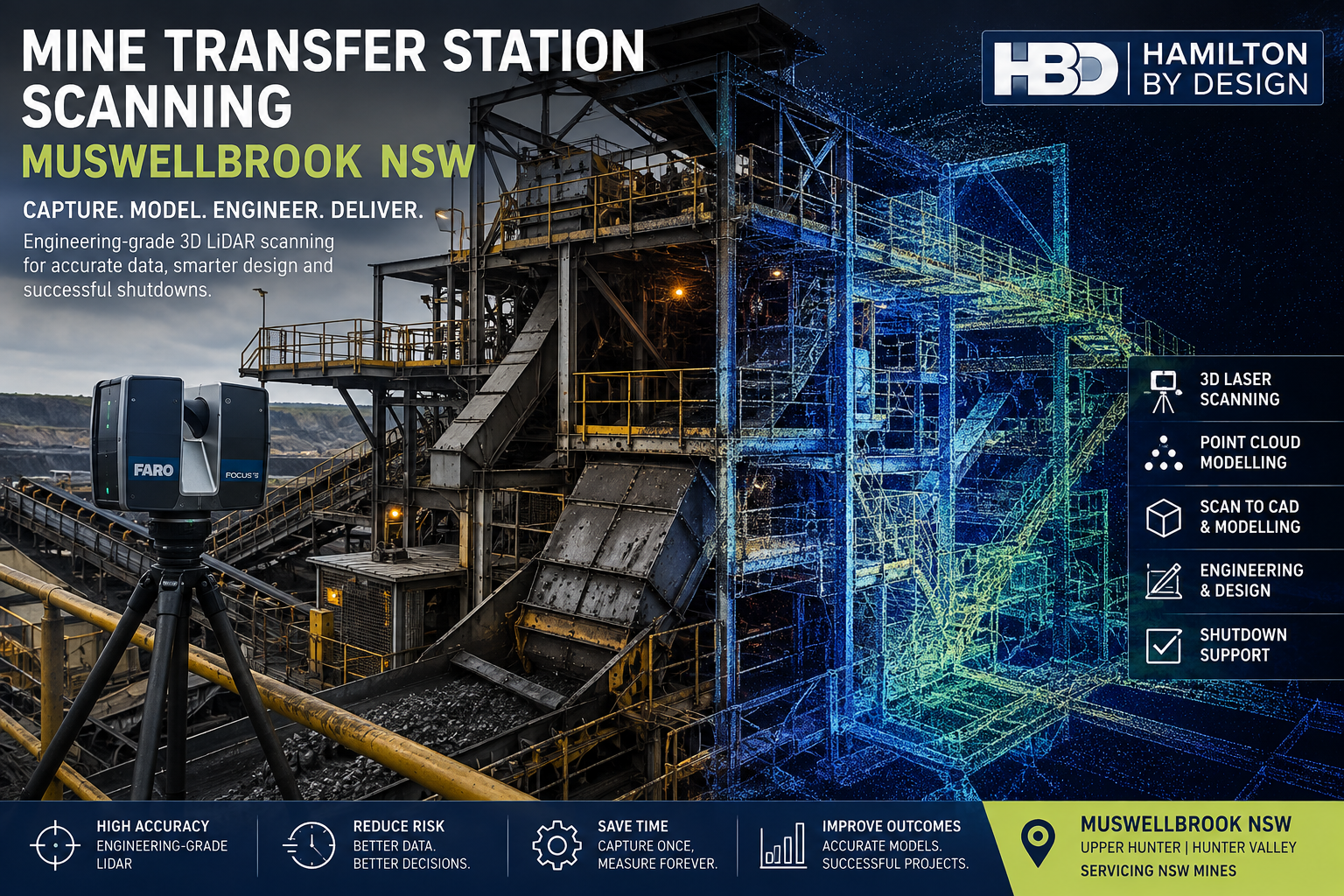
Mine Transfer Station Scanning Muswellbrook NSW
Engineering-Grade 3D Laser Scanning for Congested Transfer Stations, Chutes and Conveyor Upgrades
Mine transfer stations are among the most spatially complex areas within coal-handling and bulk-material-handling infrastructure.
Within a relatively small footprint, a transfer station may contain conveyors, head pulleys, transfer chutes, structural steel, access platforms, walkways, guarding, dust extraction ducting, pipework, electrical services and maintenance zones. These systems must operate together while remaining accessible for inspection, maintenance and future modification.
For engineering teams, this creates a practical problem:
Transfer stations are highly congested and can be difficult to measure accurately using conventional methods.
Hamilton By Design provides mine transfer station scanning services in Muswellbrook NSW and throughout the Upper Hunter, using engineering-grade terrestrial LiDAR scanning, registered point clouds and CAD modelling to capture the actual installed condition of existing mining infrastructure.
The objective is not simply to create a visual 3D representation. It is to establish a reliable, measurable engineering dataset that can support conveyor modifications, chute replacements, structural upgrades, shutdown planning and brownfield plant development.
Why Transfer Stations Are Difficult to Measure
Transfer stations are different from relatively open conveyor galleries. They are typically vertical, congested structures in which multiple mechanical and structural systems intersect.
An existing transfer station may include:
- incoming and outgoing conveyors;
- head and discharge pulleys;
- transfer chutes;
- hoppers;
- structural columns and beams;
- maintenance platforms;
- stairs and ladders;
- handrails;
- conveyor guarding;
- pipework;
- dust extraction systems;
- cable trays;
- concrete floors and plinths; and
- surrounding plant interfaces.
As mining infrastructure is progressively modified, the installed arrangement may also diverge from original drawings.
A chute may have been replaced during a previous shutdown. Steelwork may have been strengthened. Platforms may have been modified. Additional services may have been installed around the original plant.
Hamilton By Design’s work with 3D laser scanning for conveyor transfer towers addresses this problem by capturing the true geometry of conveyors, chutes, structural steel and surrounding plant before engineering modifications are developed.
The Cost of Incomplete Site Information
Traditional field measurement remains useful, but it becomes increasingly difficult when an engineering project depends on hundreds of spatial relationships.
An engineer may visit site, obtain the dimensions considered necessary at the time and then return to the office to begin design.
Once modelling progresses, another critical dimension may be identified.
This can produce a repeated cycle:
Site measure → design → discover missing dimension → return to site → remeasure → revise design
For mine sites, repeated access can be costly because site visits may involve inductions, travel, permits, shutdown access and coordination with operations.
The engineering issue is therefore not merely the time required to measure one dimension. It is the uncertainty created when the wider installed environment has not been comprehensively captured.
Terrestrial LiDAR scanning changes that approach by recording millions of spatial measurements throughout the transfer station.
The resulting point cloud can subsequently be interrogated as the engineering develops.
A simple value proposition is:
Capture the transfer station once and continue measuring digitally from the registered point cloud.
Who Can Benefit from Transfer Station Scanning?
Mine transfer station scanning can support a wide range of technical stakeholders, including:
- mine owners and operators;
- engineering managers;
- project engineers;
- mechanical engineers;
- structural engineers;
- maintenance superintendents;
- reliability teams;
- shutdown planners;
- CHPP personnel;
- conveyor contractors;
- chute specialists;
- EPCM organisations;
- fabrication contractors; and
- drafting teams.
The important consideration is not who wants a 3D model.
The real question is:
Who requires reliable information about the existing transfer station to make an engineering decision?
For example, a project engineer may need accurate pulley centres before designing a replacement chute. A structural engineer may need existing beam locations before modifying supporting steel. A shutdown planner may need to understand removal paths and maintenance access before work begins.
Each discipline may use the same captured dataset differently.
Define the Engineering Requirement
Before scanning begins, the purpose of the project should be established.
Typical transfer-station projects may involve:
- new transfer chute installation;
- chute replacement;
- conveyor modification;
- pulley replacement;
- structural strengthening;
- new platforms or walkways;
- guarding upgrades;
- dust extraction modifications;
- equipment replacement; or
- plant expansion.
Understanding the engineering requirement determines the required scan coverage.
The objective is not to collect unnecessary data. It is to ensure that all critical interfaces are captured before the project moves into detailed design.
Capture the Existing Transfer Station
Terrestrial LiDAR scanners are positioned at multiple levels and viewpoints throughout the transfer station.
Each scan records the three-dimensional relationship between visible surfaces.
Because the scanner captures a broad field of view, the resulting dataset can include much more than the component initially being modified.
For example, a scan undertaken for a chute replacement may also capture surrounding beams, existing platforms, maintenance access, adjacent pipework, guarding, floor levels and nearby equipment.
This contextual information may become important later in the project.
For mining transfer points specifically, Hamilton By Design combines scanning with engineering analysis through its work on 3D scanning of chutes, hoppers and mining transfer points, where captured geometry can support retrofit accuracy, chute design and material-flow improvements.
Register the Point Cloud
Individual scans are processed and registered into a coordinated point-cloud dataset.
This creates a measurable digital representation of the transfer station at the time of capture.
Engineering personnel can then review dimensions away from site.
Typical information may include:
- conveyor centrelines;
- pulley locations;
- chute flange positions;
- structural member coordinates;
- equipment offsets;
- platform elevations;
- available clearances;
- service locations; and
- maintenance access envelopes.
This is particularly useful where project teams are geographically separated or where physical access to the transfer station is restricted.
Convert the Scan into Engineering CAD
Point-cloud data may be sufficient for some projects.
For others, selected infrastructure can be reconstructed as engineering CAD geometry.
Depending on the project, the model may include:
- conveyor centrelines;
- pulleys;
- transfer chute geometry;
- structural steel;
- platforms;
- equipment envelopes;
- maintenance clearances; and
- surrounding plant interfaces.
The appropriate modelling philosophy is fit for purpose.
It is rarely necessary to model every nut, bolt, bracket and cable tray.
The objective is to represent the geometry required to answer the engineering question accurately.
For brownfield work, Hamilton By Design applies this type of reality-capture workflow through its engineering-led 3D scanning for brownfield industrial upgrades, where existing plant conditions are used as the basis for practical retrofit and shutdown engineering.
Design Against the Actual Installed Condition
Once the existing transfer station has been captured, the proposed modification can be developed directly against the point cloud or CAD model.
This can help engineers assess:
- equipment clearances;
- structural interfaces;
- conveyor alignment;
- chute fit-up;
- installation pathways;
- maintenance access;
- guarding requirements; and
- potential clashes.
The objective is straightforward:
Identify the interference during design rather than during the shutdown.
This is particularly important in brownfield mining environments where fabrication may occur off site and components must arrive ready to install.
Unexpected site modifications during a shutdown can affect labour, crane planning, production and overall project schedule.
Transfer Chutes and Material-Flow Problems
Not every transfer-station problem is dimensional.
Some are operational.
Examples include:
- chute blockages;
- material buildup;
- excessive wear;
- poor trajectory;
- spillage;
- dust generation;
- impact damage; and
- belt loading problems.
In these cases, scanning provides the actual installed geometry, while engineering analysis can investigate why the transfer point is not performing as intended.
Where appropriate, discrete element modelling can also be used to analyse material behaviour through the chute.
Hamilton By Design’s broader mining engineering services combine LiDAR capture, mechanical design and fabrication-focused engineering for brownfield mining and asset modification projects.
Conveyor Transfer Chute Design
Transfer chute performance is closely connected to conveyor reliability.
Poor chute geometry can contribute to material buildup, excessive wear, impact loading, spillage and belt-tracking problems.
Where the existing transfer point is being modified, the point cloud can be used to establish the installed geometry before a replacement or upgraded chute is developed.
Hamilton By Design provides conveyor transfer chute design for mining, combining practical mechanical engineering with existing-condition capture to support retrofit and brownfield projects.
Coal Chute Design
Coal transfer systems require consideration of more than dimensional fit.
Flow direction, material properties, liner arrangement, wear zones, impact velocity and maintenance access can influence chute performance.
For coal-handling applications, Hamilton By Design’s coal chute design services provide an additional engineering pathway where captured transfer-station geometry can be combined with chute redesign and materials-handling analysis.
Conveyor Reliability and Failure Reduction
Transfer stations are often closely associated with conveyor reliability problems.
Misalignment, wear, spillage, poor transfer geometry and structural movement can all contribute to operational issues.
Hamilton By Design’s technical resource on common conveyor failures in mining plants provides further context on how engineering, inspection and digital modelling can support more reliable conveyor systems.
Bulk Material Handling Engineering
Transfer stations should not always be considered in isolation.
They form part of a wider bulk-material-handling system connecting ROM infrastructure, conveyors, stockpiles, processing plant and product handling systems.
Hamilton By Design’s bulk material handling engineering for mining considers the wider relationship between conveyors, chutes, transfer stations and supporting mine infrastructure.
This broader systems view can be particularly useful when a transfer-station modification affects upstream or downstream equipment.
Mine Transfer Station Scanning in Muswellbrook NSW
Muswellbrook is strategically located within the Upper Hunter mining region and is surrounded by substantial coal-mining and materials-handling infrastructure.
This makes the area particularly relevant for services associated with:
- conveyor upgrades;
- CHPP modifications;
- transfer-station refurbishments;
- structural upgrades;
- chute replacement;
- shutdown engineering; and
- mine plant life-extension projects.
Hamilton By Design can support projects throughout Muswellbrook, Denman, the Upper Hunter and the wider Hunter Valley region.
The service is particularly valuable where existing infrastructure is ageing, heavily modified or difficult to access.
Tools Supporting the Workflow
A practical mine transfer-station scanning workflow may incorporate several tools.
FARO Focus S70 can provide detailed terrestrial LiDAR capture of transfer towers and surrounding infrastructure.
FARO Orbis may support supplementary mobile capture where appropriate.
FARO SCENE can be used to register individual scans into a coordinated point cloud.
Autodesk ReCap can assist with point-cloud preparation and CAD interoperability.
SolidWorks can support mechanical components, chute geometry and fabrication models.
Autodesk Inventor and AutoCAD can support broader plant modelling, layouts and drafting.
Navisworks can assist with coordination and clash review between existing-condition data and proposed models.
Where material-flow performance is part of the engineering problem, Rocky DEM may assist with analysing particle trajectories, impact locations, wear zones and transfer behaviour.
The technology should, however, remain secondary to the engineering objective.
The primary deliverable is reliable information that supports better engineering decisions.
Typical Project Deliverables
Depending on client requirements, deliverables may include:
- registered E57 point clouds;
- RCP and RCS datasets;
- LAS files;
- measurable point-cloud data;
- existing-condition CAD models;
- SolidWorks models;
- STEP or Parasolid files;
- DWG and DXF drawings;
- general arrangement drawings;
- sections and elevations;
- proposed-versus-existing models;
- clash-review models;
- eDrawings; and
- PDF engineering documentation.
Some projects may require only scan data.
Others may progress through:
Scan → Register → Model → Engineer → Detail → Fabricate
Frequently Asked Questions
What is mine transfer station scanning?
Mine transfer station scanning uses terrestrial LiDAR to capture the three-dimensional geometry of conveyors, chutes, structural steel, platforms, services and surrounding plant within a transfer station.
Why are transfer stations difficult to measure manually?
Transfer stations are typically congested and multi-level structures. Conveyor systems, chute geometry, steelwork, access platforms, guarding and services can occupy the same restricted space, making comprehensive manual measurement difficult.
Can additional dimensions be obtained after leaving site?
Yes. Once scans are registered into a measurable point cloud, engineering teams can obtain many additional dimensions digitally without necessarily returning to site.
Can transfer station scanning support chute replacement?
Yes. LiDAR can capture existing pulley positions, chute interfaces, structural steel, surrounding equipment and maintenance clearances before a replacement chute is designed.
Can the point cloud be converted into CAD?
Yes. Relevant infrastructure can be reconstructed as CAD geometry according to the engineering requirement. The appropriate level of modelling depends on how the information will ultimately be used.
Can scanning assist with structural modifications?
Yes. Existing structural members, columns, beams, platforms and equipment interfaces can be captured to support brownfield structural modifications and strengthening projects.
Is DEM required for every transfer station project?
No. DEM is most relevant where material-flow behaviour, trajectory, wear, blockage or impact is part of the problem. For dimensional fit-up and structural modifications, LiDAR and CAD may be sufficient.
What areas do you service around Muswellbrook?
Hamilton By Design can support mine and industrial projects throughout Muswellbrook, Denman, the Upper Hunter and the wider Hunter Valley NSW region.
Mine Transfer Station Scanning Muswellbrook NSW
For transfer-station upgrades, reliable knowledge of the existing plant can significantly reduce engineering uncertainty.
Terrestrial LiDAR scanning provides a practical way to capture congested conveyors, chutes, structural steel, platforms and surrounding services as a measurable digital dataset.
That dataset can then support engineering modelling, structural upgrades, conveyor modifications, shutdown planning and fabrication.
For brownfield mine projects in Muswellbrook and the Upper Hunter, the principle is simple:
Capture the congested transfer station accurately. Develop the engineering from measured reality. Verify the modification before it reaches site.

Contact Us – Talk To Us
Our clients:

























Mine Transfer Station Scanning Across Muswellbrook & the Hunter Valley
Explore related Hamilton By Design services supporting mine transfer stations, CHPPs, conveyors, bulk materials handling, shutdown engineering, LiDAR scanning and Scan-to-CAD projects across Muswellbrook, Singleton, the Upper Hunter, Hunter Valley and mining operations throughout NSW.
Mechanical Engineering Muswellbrook NSW
Mechanical engineering support for Muswellbrook mines, CHPP facilities, conveyor systems, transfer towers, coal handling infrastructure and brownfield plant modifications.
Hunter Valley Mining Engineering & 3D Laser Scanning
Engineering-grade LiDAR scanning, mechanical engineering and reverse engineering for Hunter Valley mines, CHPPs, conveyors and materials-handling infrastructure.
Mining NSW – 3D LiDAR Scanning & Engineering
3D LiDAR scanning, Scan-to-CAD, reverse engineering and brownfield engineering support for mining operations throughout NSW.
3D LiDAR Scanning Hunter Valley
Capture conveyors, transfer towers, chutes, bins, hoppers, structural steel and operating plant using engineering-grade terrestrial LiDAR scanning.
3D Laser Scanning Singleton & Hunter Valley
Existing-condition capture supporting mines, CHPPs, conveyor upgrades, fabrication, shutdown planning and heavy industrial projects throughout Singleton and the Hunter Valley.
CHPP 3D Scanning Services Singleton NSW
LiDAR scanning for coal handling and preparation plants, including conveyors, transfer points, chutes, screens, structural steel and shutdown-critical infrastructure.
3D Laser Scanning for Conveyor Transfer Towers
Capture complex conveyor transfer towers containing chutes, structural steel, platforms, guarding and surrounding equipment before modification or replacement.
Bulk Material Handling in Mining
Engineering support for ROM systems, conveyors, transfer points, chutes, bins, hoppers and associated mining and materials-handling infrastructure.
Surface Mine Scan to CAD Hunter Valley NSW
Convert mine-site LiDAR point clouds into practical CAD geometry for conveyor modifications, structural interfaces, equipment upgrades and brownfield engineering.
Engineer-Led Scan to CAD Singleton NSW
Transform measured mining and industrial site conditions into practical engineering CAD models for brownfield upgrades, equipment replacement and fabrication.
Mine Machinery Reverse Engineering Muswellbrook
Reverse engineering and CAD modelling for worn, obsolete or undocumented open-cut mine machinery and fixed-plant components across Muswellbrook and the Upper Hunter.
3D Scanning for Mining Shutdown Projects
Engineering-led 3D scanning for shutdown preparation, mechanical upgrades, Scan-to-CAD modelling, structural verification and plant-layout assessment.