


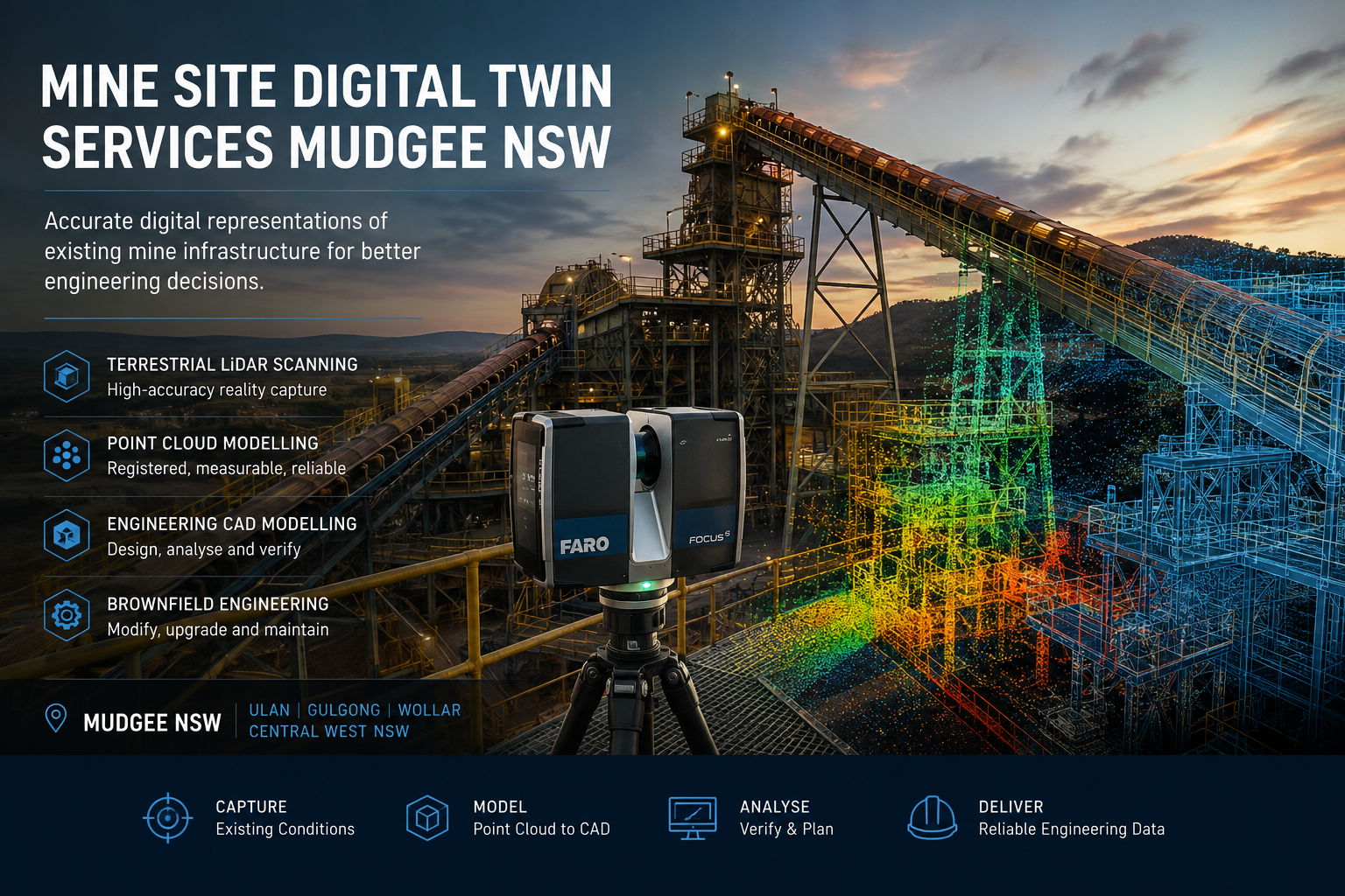
Mine Site Digital Twin Services Mudgee NSW
Engineering Digital Twins Using Terrestrial LiDAR, Point Clouds and CAD Modelling
Mining infrastructure rarely remains exactly as it was originally designed. Over the operational life of a mine, equipment is replaced, conveyors are modified, pipework is rerouted, structures are strengthened, access systems are altered and processing equipment is progressively upgraded.
As these changes accumulate, the physical configuration of a mine or processing facility can diverge significantly from the drawings, models and other engineering records available to project and maintenance teams.
Hamilton By Design provides mine site digital twin services for Mudgee, Ulan, Gulgong, Wollar and the wider Central West NSW region, using terrestrial LiDAR scanning, point-cloud processing and engineering CAD workflows to establish reliable digital representations of existing mine infrastructure.
The objective is not simply to produce a visually impressive 3D model. It is to establish an accurate and measurable engineering record that can support brownfield modifications, shutdown planning, maintenance, equipment replacement, design verification and future asset development.
Put simply:
Capture the existing condition accurately, establish a reliable digital baseline and design around what is actually installed.
The Engineering Problem: When Existing Drawings No Longer Represent the Site
Mining and mineral-processing assets may remain operational for several decades. During this period, individual areas of plant can undergo numerous modifications.
A pipe may be rerouted during a shutdown. A transfer chute may be replaced. Structural steel may be strengthened to accommodate changing loads. Conveyor drives and pulleys may be modified. New cable trays, services, platforms or equipment may be installed around existing infrastructure.
Although engineering change-management systems aim to record these modifications, older facilities can contain areas where available documentation does not fully correspond with the current installed condition.
This creates uncertainty during subsequent engineering projects.
A project team may therefore have drawings showing what was originally designed but insufficient information about what exists today.
Hamilton By Design’s engineering-grade 3D laser scanning for mining and industrial projects addresses this problem by capturing the existing physical environment before detailed engineering decisions are made.
The resulting spatial information can reduce reliance on assumptions and provide engineers with a measurable basis for subsequent design development.
What Is a Mine Site Engineering Digital Twin?
The term digital twin is applied to a broad range of technologies.
At a sophisticated level, a digital twin may integrate physical geometry with operational sensors, process information, maintenance records and real-time asset data.
However, an effective digital-twin strategy does not necessarily need to begin with this level of complexity.
For brownfield mine engineering, one of the most useful foundations is an engineering or geometric digital twin: a reliable digital representation of the existing physical asset.
It may include:
- conveyors and transfer stations;
- chutes and hoppers;
- crushers and screening equipment;
- structural steel;
- platforms, stairs and access systems;
- pumps and mechanical equipment;
- tanks and vessels;
- pipework and services;
- processing plant;
- buildings and plant rooms; and
- interfaces between existing and proposed equipment.
A point cloud may provide the underlying evidence of the existing condition, while selected infrastructure is converted into CAD or BIM geometry according to the purpose of the engineering project.
Hamilton By Design’s Scan to BIM services for mining and industrial facilities provide a complementary workflow where captured site information needs to be transformed into structured digital models.
Who Benefits from a Mine Site Digital Twin?
Mine site digital twins can support a broad range of technical and operational stakeholders, including:
- mine owners and operators;
- engineering managers;
- project engineers;
- mechanical and structural engineers;
- maintenance and reliability teams;
- asset managers;
- shutdown planners;
- EPCM organisations;
- fabrication contractors; and
- drafting and design teams.
The central question is not simply who requires a 3D model.
The more useful question is:
Who needs reliable information about the existing plant to make an engineering decision?
For example, a project engineer modifying a conveyor transfer station may require accurate structural interfaces. A maintenance engineer replacing a pump may need to understand the existing pipework arrangement and mounting geometry. A shutdown planner may need assurance that replacement equipment can physically move through existing access routes and fit within the available space.
Each stakeholder can make different use of the same underlying digital asset.
From Physical Mine Site to Engineering Digital Twin
A practical digital-twin workflow can be divided into several stages.
1. Define the Engineering Requirement
The first stage is to understand how the captured information will ultimately be used.
Questions may include:
- What infrastructure is being modified?
- Which interfaces are important?
- What level of dimensional accuracy is required?
- Is the objective conceptual engineering, detailed design or fabrication?
- Does the client require point-cloud information, CAD geometry, drawings or a combination of deliverables?
Defining the engineering purpose helps avoid creating unnecessary information while ensuring critical interfaces are captured.
2. Capture Existing Conditions Using Terrestrial LiDAR
Terrestrial LiDAR scanning captures large quantities of three-dimensional spatial information from positions throughout an industrial environment.
Multiple scanner locations are subsequently combined to represent complex plant areas containing equipment, steelwork, pipework, conveyors and other infrastructure.
For operating mine sites, this approach can provide considerably more spatial information than isolated manual measurements while reducing the need for engineering personnel to repeatedly access difficult or congested areas.
The same methodology is particularly relevant to coal processing facilities. Hamilton By Design’s work relating to 3D scanning for CHPP and coal wash plant shutdowns demonstrates how accurate existing-condition data can support projects where shutdown duration and installation uncertainty are significant considerations.
3. Register and Process the Point Cloud
Individual scans are processed and registered into a coordinated point-cloud dataset.
The registered dataset creates a measurable representation of the environment captured during the survey.
Depending on project requirements, point-cloud deliverables may include formats such as E57, RCP, RCS or LAS.
The point cloud can then become a reference against which existing drawings, proposed equipment and engineering models are compared.
Importantly, the point cloud should not be viewed as the engineering conclusion.
It is the evidence from which engineering decisions can be developed.
Converting Captured Data into Engineering Geometry
For many projects, the next stage is to reconstruct selected infrastructure as engineering CAD geometry.
Not every item visible within a point cloud needs to be modelled.
Instead, an effective digital-twin strategy applies an appropriate level of information to the engineering requirement.
For example, a conveyor modification may require accurate models of the conveyor centreline, pulley positions, supporting steel and adjacent equipment while surrounding infrastructure is retained as point-cloud context.
Hamilton By Design’s 3D CAD modelling services in Australia support this transition from site information into practical engineering geometry suitable for design development, interference checking, drawings and fabrication planning.
This distinction is important because a digital twin should be developed for an engineering purpose rather than simply to maximise model complexity.
Digital Twins for Brownfield Mine Modifications
The value of accurate digital information becomes particularly apparent in brownfield environments.
Unlike greenfield projects, brownfield engineering must integrate new equipment with existing infrastructure, often within restricted spaces and limited shutdown periods.
Common constraints include:
- legacy drawings;
- undocumented modifications;
- restricted physical access;
- congested pipework and services;
- existing structural interfaces;
- limited installation tolerances; and
- short shutdown windows.
Hamilton By Design’s approach to brownfield industrial upgrades combines reality capture with scan-to-CAD and mechanical engineering to reduce uncertainty before fabrication and installation.
A digital twin can therefore become more than an as-built record. It can provide the spatial framework within which proposed modifications are assessed.
Supporting Mechanical Engineering and Plant Modification
The benefits of digital capture become more significant when the resulting information is integrated directly into engineering.
Hamilton By Design provides mining engineering services for Australian operations that combine existing-condition capture with mechanical design, structural considerations, CAD modelling and fabrication-oriented documentation.
Potential applications include:
- conveyor modifications;
- transfer-station upgrades;
- equipment replacement;
- new access platforms;
- pipework alterations;
- pump and equipment installations;
- structural modifications;
- shutdown projects; and
- plant life-extension works.
In this context, LiDAR determines where the existing assets are, while engineering determines what should change and how the proposed modification can be safely manufactured, installed and maintained.
Digital Twins for Conveyors, Chutes and Materials Handling
Bulk-material-handling infrastructure is particularly suited to digital-twin workflows because conveyor systems, transfer points, chutes, hoppers and structural supports operate as interconnected systems.
Small changes to one component can affect surrounding equipment.
For example, changing chute geometry may influence material trajectory, supporting steel, conveyor loading, maintenance access and surrounding services.
Hamilton By Design’s work in bulk material handling engineering for mining operations demonstrates the importance of considering the relationship between ROM facilities, conveyors, transfer stations, chutes and associated infrastructure.
Accurate digital capture provides an important starting point because engineering modifications can be developed against the actual arrangement rather than an assumed one.
Reverse Engineering Existing Mine Assets
Mine sites frequently contain equipment for which reliable manufacturing information is unavailable.
Original suppliers may no longer exist, documentation may have been lost, or an asset may have undergone multiple modifications during its operating life.
Digital capture can provide the starting geometry for reverse engineering.
Hamilton By Design’s reverse-engineering 3D scanning services combine measured geometry with engineering interpretation to support replacement components, legacy equipment, equipment interfaces and fabrication documentation.
The objective is not always to reproduce an existing component exactly.
In some cases, the captured geometry provides the baseline from which an improved or modified replacement can be engineered.
Mine Site Digital Twin Services for Mudgee and Central West NSW
Mudgee is strategically located within an established mining region encompassing major operations and supporting infrastructure around Ulan, Gulgong, Wollar and the wider Central West NSW area.
These operating environments contain substantial materials-handling, processing, structural and mechanical infrastructure that has developed progressively over time.
For mine operators and engineering contractors, maintaining reliable knowledge of existing conditions can support better decision-making during future projects.
Digital-twin workflows can be particularly valuable where projects involve:
- ageing infrastructure;
- repeated plant modifications;
- incomplete or inconsistent drawings;
- geographically dispersed engineering teams;
- difficult-to-access plant areas;
- short shutdown periods; and
- complex new-to-existing interfaces.
Once captured, engineering teams can interrogate the digital environment away from site, potentially reducing repeated site visits for routine dimensional verification.
Technology Supporting the Digital-Twin Workflow
Depending on project requirements, Hamilton By Design can combine several technologies.
FARO Focus terrestrial LiDAR scanning can provide detailed spatial capture of mine and industrial infrastructure.
FARO SCENE supports registration and processing of scan data.
Autodesk ReCap provides point-cloud preparation and interoperability with engineering applications.
SolidWorks supports mechanical design, equipment development and reverse-engineering workflows.
Autodesk Inventor and AutoCAD provide additional mechanical modelling and drafting capability.
Navisworks can assist with coordination, model review and larger digital datasets.
Potential client deliverables may include E57, RCP, RCS and LAS point clouds together with SolidWorks files, STEP, SAT, Parasolid, DWG, DXF, eDrawings and PDF engineering documentation.
The technology itself, however, should not be regarded as the final product.
The principal deliverable is reliable engineering information that assists decision-making.
Developing the Digital Twin Progressively
A mine does not necessarily need to create a complete digital representation of every asset during a single project.
For many operating facilities, a progressive strategy may provide greater value.
One conveyor transfer station could be scanned during an initial modification. A processing area could subsequently be captured for another project. Pipework, structural systems and other critical assets could then be incorporated as operational requirements arise.
Future LiDAR surveys can also update areas that have changed.
Over time, individual project datasets can contribute towards a more comprehensive digital engineering record of the facility.
This approach connects expenditure directly with engineering requirements while progressively increasing the quality of available asset information.
Frequently Asked Questions
What is a mine site digital twin?
A mine site digital twin is a digital representation of physical mining infrastructure. For engineering applications, it may combine registered LiDAR point clouds with CAD or BIM geometry to provide measurable information about existing assets and their spatial relationships.
Is a point cloud the same as a digital twin?
Not necessarily. A point cloud records the measured geometry of a physical environment and can provide the foundation for a digital twin. Additional CAD, BIM, engineering or asset information may then be incorporated according to the required application.
Why use LiDAR when existing mine drawings are available?
Existing drawings remain important engineering records. However, on older or progressively modified facilities they may not completely represent current conditions. LiDAR provides independent evidence of the physical configuration present at the time of scanning.
Does the entire mine site need to be modelled?
No. A fit-for-purpose approach generally focuses on the assets and interfaces required for the immediate engineering problem. Additional infrastructure can be captured and modelled progressively.
Can digital twins help with mine shutdowns?
Yes. Existing-condition information can support engineering, interference assessment, equipment fit checks and installation planning before a shutdown begins, reducing the amount of dimensional uncertainty that needs to be resolved during the shutdown period.
What mine infrastructure can be captured?
Potential applications include conveyors, transfer stations, chutes, hoppers, structural steel, platforms, pipework, pumps, tanks, processing equipment, buildings and surrounding infrastructure.
Can point-cloud information be used remotely?
Yes. Once captured and appropriately processed, digital site information can support engineering and project teams operating away from the physical mine site, subject to the client’s data-management and software requirements.
What file formats can be supplied?
Depending on scope and client requirements, deliverables may include registered point clouds in formats such as E57, RCP, RCS and LAS, together with CAD models and engineering information in formats including STEP, SAT, Parasolid, DWG, DXF, eDrawings and PDF.
Do you provide mine site digital twin services around Mudgee?
Hamilton By Design can support mine and industrial projects throughout Mudgee, Ulan, Gulgong, Wollar and Central West NSW, providing engineering-led terrestrial LiDAR scanning, point-cloud processing, CAD modelling and associated mechanical engineering support.
Engineering Digital Twins for Mudgee Mine Infrastructure
Where existing drawings no longer provide sufficient certainty for brownfield engineering, an accurate digital representation of the installed asset can provide a more reliable foundation for decision-making.
Hamilton By Design combines terrestrial LiDAR scanning, point-cloud processing, 3D CAD modelling and practical mechanical engineering to transform existing mine infrastructure into usable digital engineering information.
The objective is not to create a digital model for its own sake.
It is to improve the quality of information available to engineers, maintenance teams and project managers before critical decisions are made.
Capture the existing condition. Establish the digital baseline. Reduce uncertainty. Engineer around what is actually there.

Contact Us – Talk To Us
Our clients:

























,