Mechanical Engineering | 3D Scanning | 3D Modelling
Tag: LiDAR
Posts covering engineering-grade LiDAR scanning and point cloud workflows used to capture accurate site conditions for design, retrofit and fabrication in industrial and infrastructure environments.
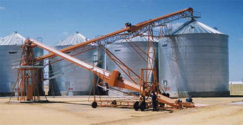
The Yorke Peninsula is home to some of South Australia’s most important agricultural and industrial operations — from grain handling and bulk material processing to regional infrastructure and maintenance-driven facilities.
At Hamilton By Design, we provide engineering-led mechanical solutions, 3D LiDAR scanning, and drafting services to support businesses across the Yorke Peninsula and regional South Australia.
🌾 Supporting Regional Industry Across the Yorke Peninsula
From towns like Minlaton, Maitland, and Yorketown, local operations rely on efficient, reliable infrastructure to keep production moving.
Common challenges we see across the region include:
Ageing plant and equipment
Limited or outdated drawings
Conveyor and transfer inefficiencies
Shutdown-based upgrades and modifications
Lack of access to specialised engineering services
These are exactly the types of challenges our services are built to solve.
📐 Engineering-Led 3D LiDAR Scanning
We provide high-accuracy 3D laser scanning (LiDAR) to capture existing assets and environments.
But more importantly — we do this as engineers.
That means:
Scanning is completed with design and fabrication outcomes in mind
Data is captured with sufficient density and coverage
Outputs are suitable for CAD modelling, retrofit design, and construction
👉 You get more than a point cloud — you get usable, engineering-grade information.
🛠️ Mechanical Engineering Services
We support Yorke Peninsula projects with practical, fit-for-purpose engineering solutions, including:
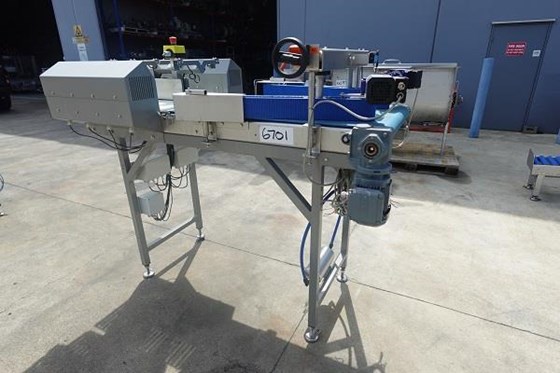
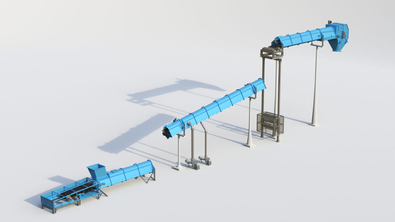
Conveyor and chute design
Structural and mechanical upgrades
Reverse engineering of existing plant
Design for fabrication and installation
Brownfield modification support
Our focus is always on real-world outcomes — designs that work on site, not just on paper.
📊 Mechanical & Structural Drafting
We deliver clear, build-ready documentation:
2D AutoCAD drawings (plans, elevations, sections)
3D CAD models for coordination and fabrication
Scan-to-CAD conversion
Bill of materials and fabrication detailing
👉 Helping contractors and fabricators build with confidence.
🚧 Built for Regional Projects
Projects across the Yorke Peninsula often involve:
Brownfield upgrades
Tight shutdown windows
Remote site access
Limited existing documentation
We work within these constraints to deliver:
Efficient site capture
Accurate modelling
Reliable turnaround aligned with project timelines
🌏 Supporting All Australians — Wherever You Operate
At Hamilton By Design, we support projects across Australia — from major cities to regional locations like the Yorke Peninsula.
Our goal is simple:
Deliver accurate data, practical engineering, and reliable outcomes — no matter where you are.
If you’re operating on the Yorke Peninsula and require:
Mechanical engineering support
3D LiDAR scanning
Mechanical or structural drafting
contact Hamilton By Design to discuss how we can support your next project.
🏷️ Labels
yorke peninsula engineering, 3d scanning south australia, lidar scanning australia, mechanical engineering services australia, point cloud to cad, grain handling engineering, conveyor design australia, regional engineering support
🔍 Search Description
Mechanical engineering, 3D LiDAR scanning, and drafting services for the Yorke Peninsula, South Australia. Supporting regional industry with accurate reality capture and practical design solutions.
Sydney industrial sites often involve tight shutdown windows, congested plant areas, ageing infrastructure and limited tolerance for error. Our industrial 3D scanning Sydney service helps project teams capture accurate site conditions before design, fabrication and installation begin.
At Hamilton By Design Co., we provide 3D scanning services in Sydney for mining infrastructure, conveyors, transfer chutes, processing plants, workshops and heavy industrial assets. By converting existing conditions into reliable point cloud data, we help reduce rework, improve fit-up accuracy and support better engineering decisions.
Learn more about our core Sydney scanning capability here:
Engineering-grade scanning delivers measurable geometry — not just visuals — enabling confident decision-making across design, fabrication and construction workflows.
Industrial facilities evolve over time. Steelwork is modified, equipment is relocated, and plant layouts drift away from original drawings. This creates significant risk when new components must fit within existing infrastructure.
Our scanning process captures real-world site geometry so engineers and project teams can work from current conditions.
This is especially valuable where:
shutdown durations are limited
access is restricted
plant environments are congested
existing drawings are outdated or unreliable
fabrication accuracy is critical
For a broader overview of how this applies across Sydney projects:
This page is specifically positioned for mining, bulk materials handling and heavy industrial applications in Sydney.
Typical systems include:
conveyor systems
transfer chutes
processing infrastructure
maintenance shutdown zones
structural interfaces for upgrades
Hamilton By Design combines engineering expertise with LiDAR scanning and 3D modelling to support plant design, retrofits and digital engineering workflows.
Supporting Shutdowns and Plant Upgrades
Shutdown work carries high risk and tight time constraints. Accurate as-built data reduces uncertainty before fabrication and installation.
Our industrial 3D scanning Sydney service helps teams:
Industrial 3D scanning uses laser scanners to capture accurate measurements of plant, structures and equipment, creating a point cloud for engineering use.
Can you scan conveyors and transfer chutes?
Yes — conveyors, chutes and bulk materials handling systems are a core application.
Is this useful for shutdowns?
Yes — scanning allows capture during shutdown and continued engineering work afterwards.
Can the data be used for CAD?
Yes — scan data supports 2D drawings, 3D models and fabrication workflows.
Hamilton By Design provides engineering-led 3D scanning, LiDAR scanning, mechanical engineering and digital engineering services throughout Sydney and Greater Sydney.
Explore our related Sydney services:
3D Scanning Sydney – Engineering-grade terrestrial laser scanning, as-built surveys and point cloud capture for industrial, infrastructure and commercial projects.
Reality Capture Sydney – High-accuracy reality capture, digital twins, asset documentation and engineering-grade site verification.
Scan to CAD Sydney – Convert point cloud data into AutoCAD, SolidWorks, Inventor and other engineering-ready CAD deliverables.
Point Cloud Modelling Sydney– Engineering-grade point cloud processing, clash detection, as-built verification and 3D modelling.
Mechanical Engineering Sydney – Mechanical design, plant upgrades, materials handling systems, conveyors, chutes, platforms and engineering support.
Structural Drafting Sydney– Structural steel drafting, fabrication drawings, GA drawings, workshop detailing and as-built documentation.
Hamilton By Design supports projects throughout Sydney CBD, Parramatta, Liverpool, Penrith, Blacktown, Chatswood, Alexandria, Mascot, Newcastle and the Central Coast.
Point cloud to CAD services in Sydney are essential for turning raw scan data into usable engineering deliverables.
At Hamilton By Design, we convert 3D laser scans and LiDAR data into accurate AutoCAD and 3D models, enabling engineering design, plant upgrades, and construction planning.
If you already have scan data — or need scanning completed — we provide a complete workflow from site capture through to fabrication-ready models.
Deliverables Issued Drawings and models ready for design, fabrication or construction
Why Accurate Modelling Matters
Poor modelling from point cloud data can lead to:
Misalignment during installation
Fabrication errors
Costly rework
Project delays
Our engineering-led approach ensures models are:
Fit-for-purpose
Accurate to required tolerances
Suitable for real-world application
Deliverables We Provide
Depending on your project requirements, we can deliver:
2D AutoCAD drawings
3D CAD models
Structural steel models
Plant layouts and equipment models
As-built documentation
BIM-compatible outputs
We tailor deliverables to suit your engineering and project needs.
Applications Across Sydney Projects
Point cloud to CAD is widely used in:
Industrial plant upgrades
Structural steel design and verification
Construction planning and coordination
Refurbishments and fit-outs
Infrastructure projects
For complex environments, accurate modelling reduces risk and improves project outcomes.
Why Choose Hamilton By Design
We are not just modellers — we are engineers.
✔ Engineering-led modelling approach ✔ Experience in industrial and construction environments ✔ Focus on accuracy and real-world application ✔ Understanding of fabrication and installation requirements
We deliver models that work in the field — not just on screen.
Point Cloud to CAD Sydney — Get Started
If you have scan data and need accurate models — or require a full scan-to-model service — we can help.
👉 Contact Hamilton By Design to discuss your project and modelling requirements.
Or learn more about how we capture data through Reality Capture Sydney:
Hamilton By Design provides engineering-led 3D scanning, LiDAR scanning, mechanical engineering and digital engineering services throughout Sydney and Greater Sydney.
Explore our related Sydney services:
3D Scanning Sydney – Engineering-grade terrestrial laser scanning, as-built surveys and point cloud capture for industrial, infrastructure and commercial projects.
Reality Capture Sydney – High-accuracy reality capture, digital twins, asset documentation and engineering-grade site verification.
Scan to CAD Sydney – Convert point cloud data into AutoCAD, SolidWorks, Inventor and other engineering-ready CAD deliverables.
Point Cloud Modelling Sydney– Engineering-grade point cloud processing, clash detection, as-built verification and 3D modelling.
Mechanical Engineering Sydney – Mechanical design, plant upgrades, materials handling systems, conveyors, chutes, platforms and engineering support.
Structural Drafting Sydney– Structural steel drafting, fabrication drawings, GA drawings, workshop detailing and as-built documentation.
Hamilton By Design supports projects throughout Sydney CBD, Parramatta, Liverpool, Penrith, Blacktown, Chatswood, Alexandria, Mascot, Newcastle and the Central Coast.
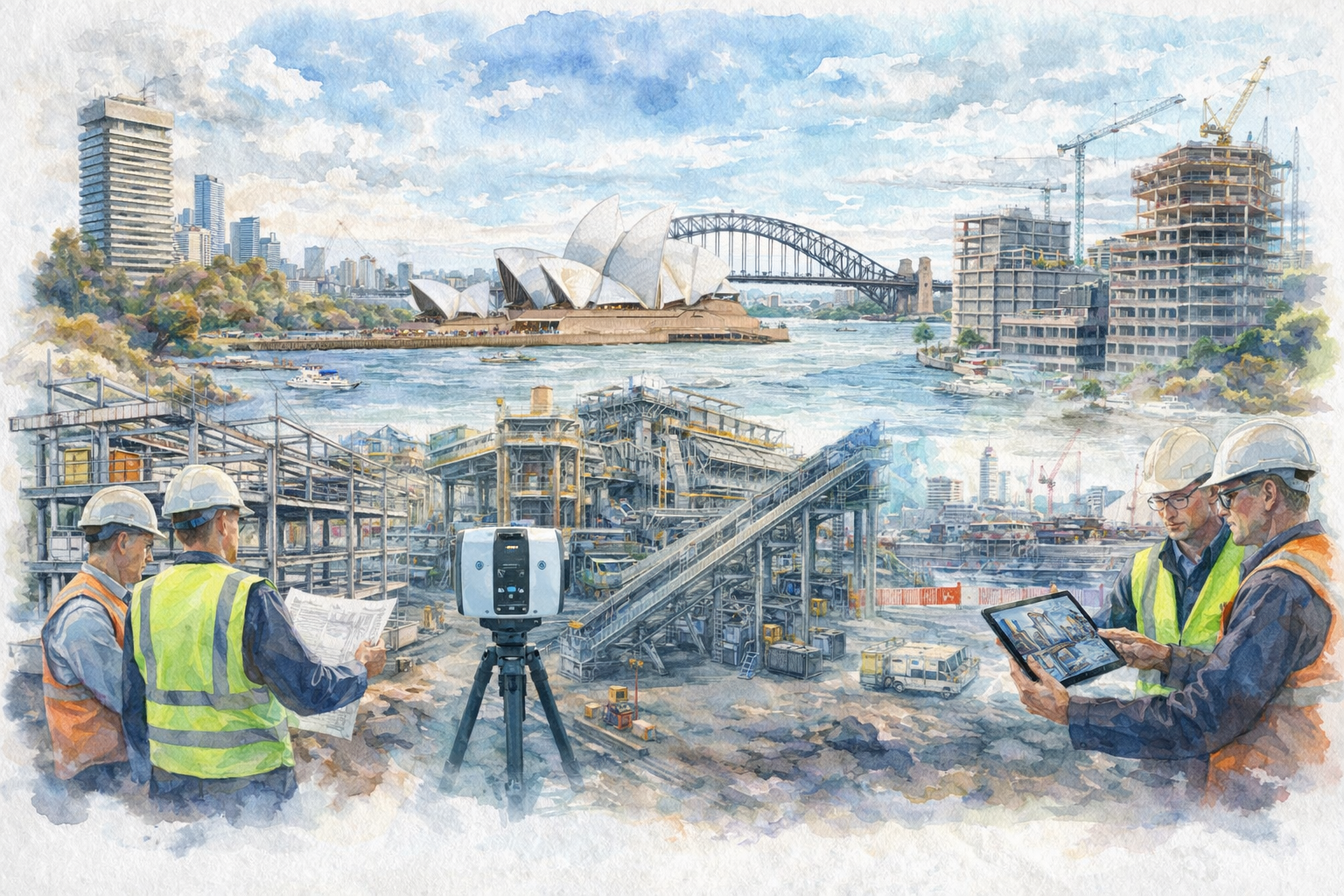
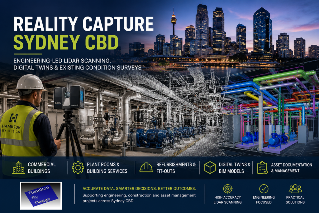
Reality Capture for Sydney CBD Commercial Buildings
Reality Capture Sydney CBD
Sydney CBD contains some of Australia’s most complex commercial buildings, infrastructure assets and operational facilities. From high-rise office towers and hotels to hospitals, transport infrastructure and critical building services, accurate existing-condition information is essential for successful project delivery.
Hamilton By Design provides engineering-led reality capture services throughout Sydney CBD, combining terrestrial LiDAR scanning, digital engineering and practical industry experience to create accurate digital representations of existing environments.
Reality capture enables project teams to document buildings, plant rooms, building services, infrastructure and operational facilities with a level of detail that traditional measurement methods cannot achieve efficiently. The resulting data can support refurbishment projects, services upgrades, asset management programs, digital twin development, engineering design and construction planning.
By capturing measured reality rather than relying on outdated drawings or assumptions, project teams can reduce risk, improve coordination and make better-informed decisions throughout the project lifecycle.
Reality Capture for Sydney CBD Plant Rooms
Plant rooms within Sydney CBD buildings often contain decades of modifications, undocumented services and limited access for traditional measurement methods.
Reality capture provides a fast and accurate method of documenting mechanical services, pipework, structural steel, cable trays and equipment layouts before engineering design begins.
The resulting point cloud allows project teams to work from measured site conditions, reducing uncertainty and improving coordination throughout the design and construction process.
Many Sydney CBD projects involve HVAC upgrades, chiller replacements, pump room modifications, fire service upgrades and electrical infrastructure improvements where accurate existing-condition information is critical. Engineering-grade reality capture provides a reliable foundation for these projects while minimising the need for repeated site visits.
Plant Rooms, Building Services & Infrastructure
Many Sydney CBD buildings contain complex mechanical, hydraulic, electrical and fire services installed over decades of operation.
Reality capture allows these environments to be documented quickly and accurately, providing engineers and contractors with reliable information for future modifications, equipment replacements and capacity upgrades.
Applications include:
HVAC plant rooms
Chiller installations
Pump rooms
Fire services
Electrical services
Building services coordination
Vertical risers
Roof plant installations
Existing Conditions for Refurbishment Projects
Accurate existing-condition information is critical when undertaking refurbishment projects within occupied commercial buildings.
Reality capture allows consultants and contractors to understand structural constraints, service routes, equipment locations and access requirements before design begins.
This reduces project risk, improves coordination and helps minimise costly site modifications during construction.
Heritage & Existing Building Documentation
Sydney CBD contains many historically significant buildings and structures that require accurate documentation before modification or restoration works can proceed.
Reality capture provides a non-invasive method of recording existing conditions while preserving important architectural and structural details.
The resulting datasets can support heritage studies, refurbishment planning, restoration projects and long-term asset management.
Digital Twins for Building Owners
Reality capture forms the foundation of many digital twin initiatives by providing an accurate digital representation of an existing building or facility.
For Sydney CBD asset owners, digital twins can assist with:
Facility management
Future upgrades
Asset lifecycle planning
Space management
Maintenance planning
Building information management
A well-developed digital twin provides a single source of truth for future engineering, maintenance and operational decision-making.
Reality Capture Applications Across Sydney CBD
Reality capture provides value wherever accurate existing-condition information is required before design, construction or asset management decisions are made.
Commercial Office Towers
Sydney CBD contains a large concentration of commercial office buildings that undergo continual refurbishment, tenancy fit-outs and building services upgrades.
Reality capture provides accurate existing-condition information that allows project teams to understand available space, identify constraints and develop coordinated engineering solutions before work reaches site.
Building Services Upgrades
Mechanical, hydraulic, fire and electrical services within operational buildings often evolve over many years, resulting in undocumented modifications and incomplete records.
Reality capture enables engineers and contractors to accurately document existing services and develop upgrade solutions with confidence.
Hotels, Hospitals and Critical Facilities
Hotels, hospitals and critical facilities require detailed planning before modifications can be undertaken.
Reality capture provides a comprehensive digital record of existing conditions, reducing uncertainty and helping project teams minimise disruption to operations during construction activities.
Data Centres and Technology Infrastructure
Sydney CBD continues to experience significant growth in data centre and technology infrastructure projects.
Reality capture supports equipment upgrades, cable routing studies, cooling system modifications and future expansion planning by providing accurate spatial information for engineering and construction teams.
Asset Management and Facility Operations
Accurate digital records support long-term asset management strategies by providing building owners with reliable information about equipment, infrastructure and building services.
Reality capture forms the foundation for future maintenance planning, facility upgrades and digital engineering initiatives throughout the asset lifecycle.
Engineering-Led Reality Capture
Hamilton By Design combines practical engineering experience with advanced reality capture technologies to deliver information that is suitable for engineering, design and construction applications.
Unlike many scanning providers, our team understands how captured data will ultimately be used for mechanical design, structural modifications, services coordination, drafting and project delivery.
This engineering-led approach ensures reality capture data becomes a practical project tool rather than simply a collection of scan files.
Deliverables
Depending on project requirements, deliverables may include:
Registered point clouds (E57, RCP, RCS and LAS)
AutoCAD drawings
Existing-condition plans, sections and elevations
Mechanical CAD models
Structural models and drafting
Building services layouts
General Arrangement drawings
Asset documentation
Digital engineering models
Construction support information
Related Sydney Services
Hamilton By Design also provides:
3D Scanning Sydney
Sydney 3D LiDAR Scanning
Scan to CAD Sydney
Point Cloud Modelling Sydney
Mechanical Drafting Sydney
Structural Drafting Sydney
Reverse Engineering Sydney
Reality Capture Sydney CBD
Whether your project involves a commercial office tower, hotel, hospital, plant room, data centre or critical infrastructure facility, Hamilton By Design provides engineering-led reality capture services throughout Sydney CBD.
Our combination of terrestrial LiDAR scanning, digital engineering and practical project experience delivers accurate information that supports better engineering, construction and asset management outcomes.
Hamilton By Design provides engineering-led 3D scanning, LiDAR scanning, mechanical engineering and digital engineering services throughout Sydney and Greater Sydney.
Explore our related Sydney services:
3D Scanning Sydney – Engineering-grade terrestrial laser scanning, as-built surveys and point cloud capture for industrial, infrastructure and commercial projects.
Reality Capture Sydney – High-accuracy reality capture, digital twins, asset documentation and engineering-grade site verification.
Scan to CAD Sydney – Convert point cloud data into AutoCAD, SolidWorks, Inventor and other engineering-ready CAD deliverables.
Point Cloud Modelling Sydney– Engineering-grade point cloud processing, clash detection, as-built verification and 3D modelling.
Mechanical Engineering Sydney – Mechanical design, plant upgrades, materials handling systems, conveyors, chutes, platforms and engineering support.
Structural Drafting Sydney– Structural steel drafting, fabrication drawings, GA drawings, workshop detailing and as-built documentation.
Hamilton By Design supports projects throughout Sydney CBD, Parramatta, Liverpool, Penrith, Blacktown, Chatswood, Alexandria, Mascot, Newcastle and the Central Coast.
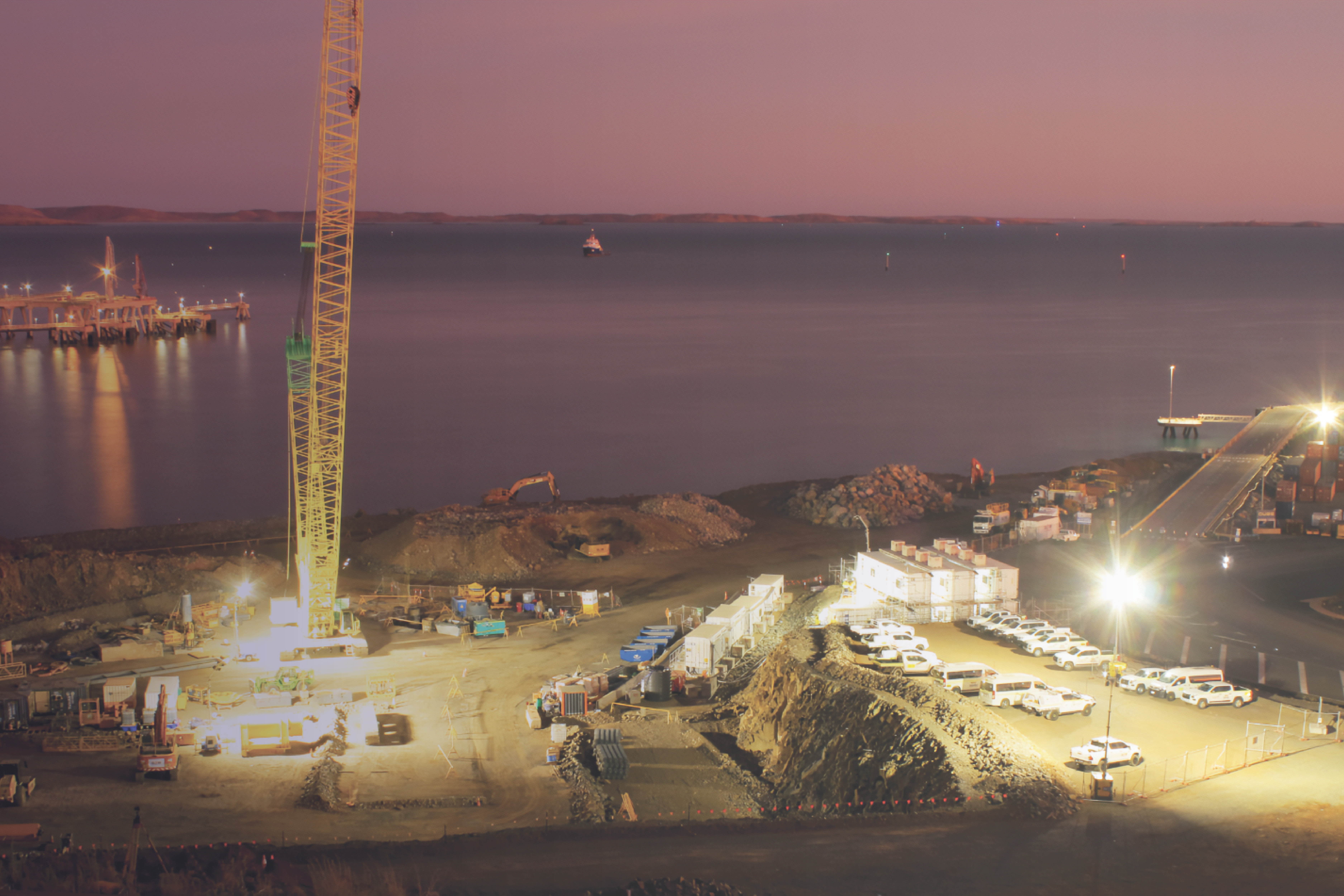
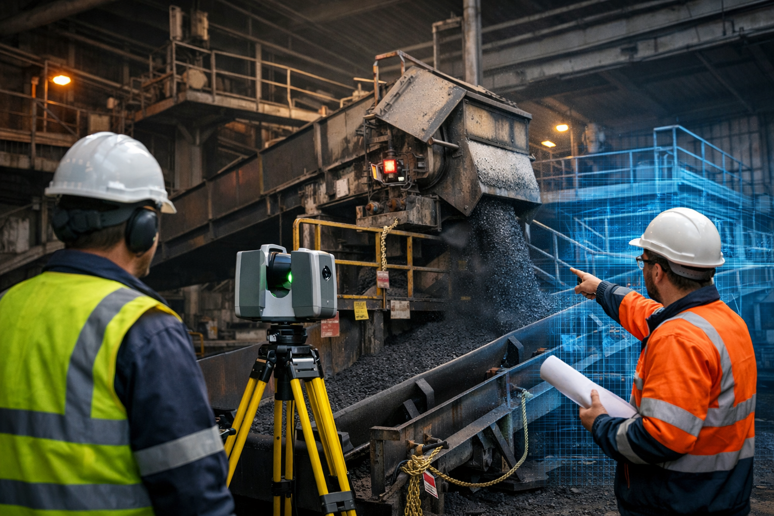
Planned shutdowns are a critical part of maintaining reliability in coal handling plants, port infrastructure, and large industrial facilities. During these scheduled outages, engineers must inspect, upgrade, or replace equipment across complex mechanical systems including conveyors, transfer chutes, crushers, and structural infrastructure.
Effective coal plant shutdown engineering focuses on preparation before the shutdown begins. Accurate plant data, detailed engineering models, and well-planned maintenance activities allow shutdown teams to complete work safely and within tight time windows.
Shutdown planning is essential because many maintenance activities must be performed while equipment is offline, often under strict time constraints with multiple trades working simultaneously. Without careful planning, shutdowns can quickly become unsafe, inefficient, or costly.
Why Engineering Preparation Matters
Coal processing plants operate continuously for long periods. Over time equipment is modified, upgraded, or repaired during multiple shutdown cycles. As a result, the original plant drawings often no longer represent the true layout of the facility.
Before a shutdown begins, engineering teams must confirm:
Existing conveyor alignments
Transfer chute geometry
Structural steel clearances
Access platforms and walkways
Equipment interfaces and installation areas
Modern engineering teams increasingly rely on laser scanning and digital modelling to capture the exact geometry of existing infrastructure. This produces a high-resolution point cloud of the plant that can be used to develop accurate engineering models before modifications begin.
These models allow engineers to validate equipment installations and reduce risk during the shutdown window.
The Role of Engineering Scanning Services
Engineering scanning services are now widely used across mining and industrial sectors to support shutdown planning.
Laser scanning technology can capture millions of measurement points across a facility, creating a detailed digital model of conveyors, chutes, structural steel and equipment installations.
Coal handling plant conveyors and transfer stations
Ship loader infrastructure at export terminals
Port stockpile systems and stacker reclaimers
Manufacturing production lines
Industrial processing plants
These digital datasets can then be converted into engineering-grade CAD models, enabling detailed design work to be completed before the shutdown occurs.
This approach significantly reduces installation risk and allows fabrication work to begin before the plant outage.
For a deeper explanation of shutdown preparation workflows see:
Coal plants contain some of the most complex materials handling systems in heavy industry. Conveyors move thousands of tonnes of material per hour through crushers, screens, transfer chutes, and stockpiles.
Common shutdown engineering tasks include:
Transfer chute redesign
Conveyor upgrades
Structural steel modifications
Dust control improvements
Maintenance access upgrades
These areas are typically congested with equipment and structural supports. Engineering teams must therefore confirm clearances and installation access before shutdown work begins.
Laser scanning and digital modelling allow engineers to identify clashes and installation constraints early in the design phase.
Learn more about mechanical engineering support for these systems:
Transfer chutes are often a major focus of shutdown engineering work. Poorly designed chutes can cause:
Conveyor belt wear
Blockages and carryback
Excessive dust generation
Reduced throughput
Because chutes are located at conveyor transfer points, modifications must often be installed during shutdown windows when conveyors are offline.
Engineering models developed from site scans allow designers to develop improved chute geometries that optimise material flow and reduce maintenance issues.
Although coal handling plants are a major focus, the same engineering preparation methods apply across many industries.
Shutdown engineering scanning is increasingly used in:
Mining processing plants
Bulk material handling facilities
Manufacturing plants
Power stations
Port infrastructure
Industrial processing facilities
By developing accurate digital models before shutdowns occur, engineering teams can plan work packages, confirm installation sequences, and minimise delays during the outage period.
Proper shutdown planning improves safety, reduces downtime, and helps ensure maintenance projects are completed efficiently.
The Future of Shutdown Engineering
As mining and industrial infrastructure becomes more complex, shutdown preparation is increasingly relying on digital engineering workflows.
Technologies such as:
3D laser scanning
point cloud modelling
digital twins
engineering simulation
are transforming the way shutdowns are planned and executed.
For operators of coal plants, ports, and manufacturing facilities, investing in accurate engineering data before a shutdown begins is one of the most effective ways to reduce project risk and improve plant reliability.
Engineering-Grade Reality Capture for Construction Projects
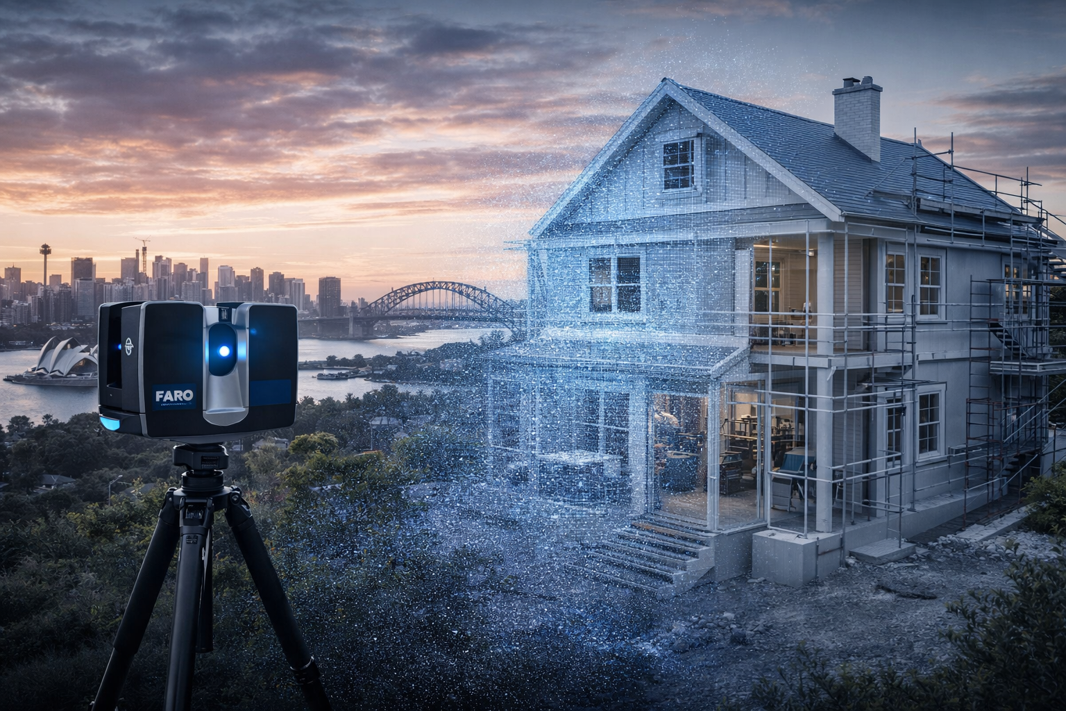
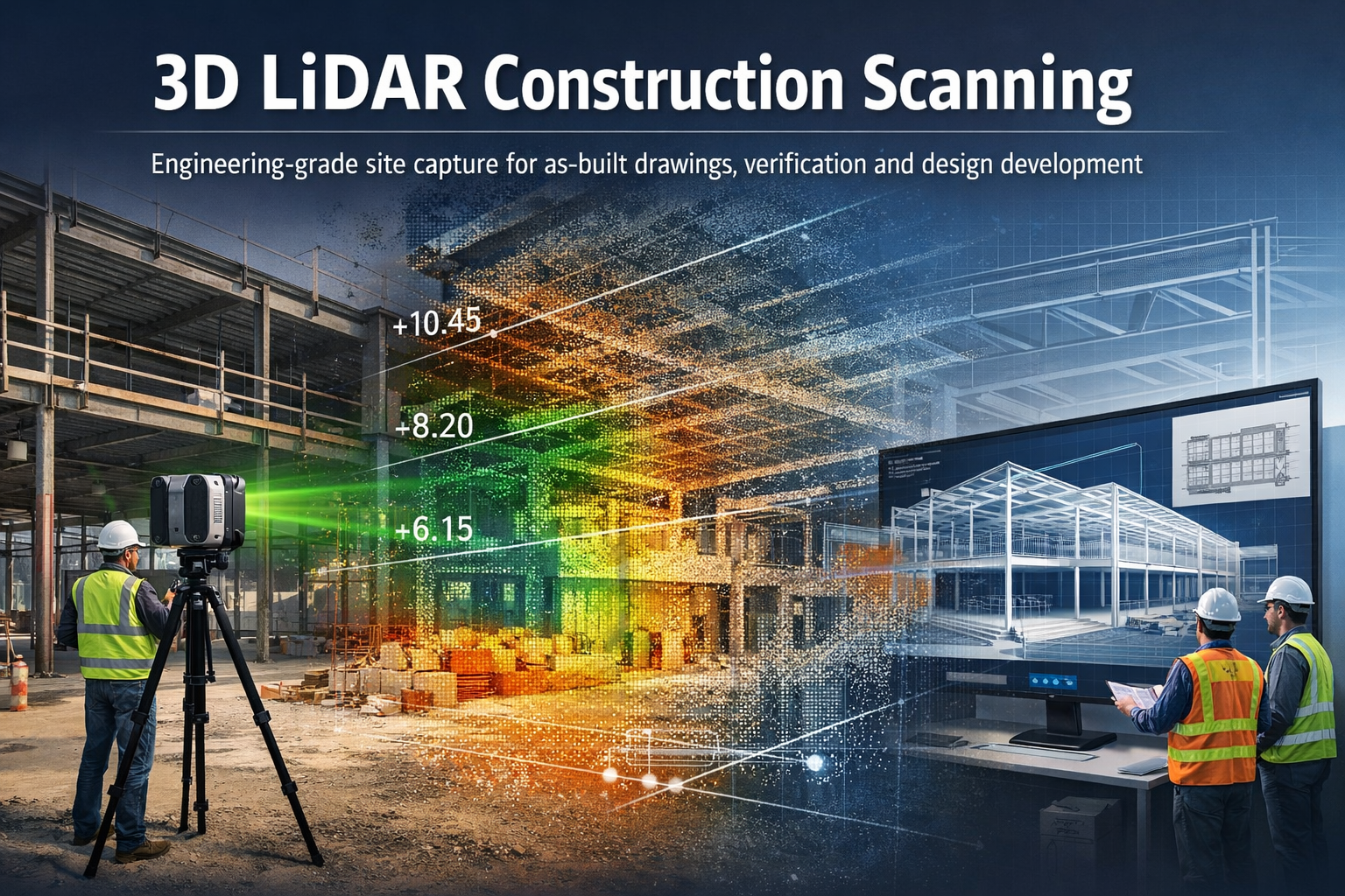
3D LiDAR construction scanning is transforming how engineers, builders, and project teams capture and understand existing site conditions.
Hamilton By Design provides engineering-grade 3D LiDAR scanning services for construction projects, helping capture accurate digital models of buildings, structures, and construction sites before, during, and after construction works. Using advanced laser scanning technology, millions of precise measurements can be captured within minutes to produce detailed 3D point clouds and digital models of real-world structures. These models provide reliable information for planning, design, verification and as-built documentation.
Our scanning workflows allow project teams to move from existing construction conditions to accurate engineering models, helping reduce uncertainty and improve project outcomes.
What is 3D LiDAR Construction Scanning?
3D LiDAR scanning uses laser-based sensors to measure distances between the scanner and surrounding surfaces. The system records millions of measurements which form a point cloud representing the exact geometry of the construction environment.
These point clouds create highly detailed digital representations of buildings, infrastructure and construction sites that can be measured, analysed and modelled in engineering software.
For construction projects this provides a powerful way to:
capture existing building geometry
verify construction progress
generate accurate as-built drawings
support design coordination
analyse levels, clearances and spatial constraints
Modern LiDAR scanning allows engineers to capture entire buildings and construction sites quickly and accurately, creating reliable digital data for planning and engineering workflows.
Applications of LiDAR Scanning in Construction
3D LiDAR scanning supports a wide range of construction and engineering tasks.
As-Built Documentation
Construction drawings often become outdated as projects evolve. LiDAR scanning provides accurate as-built documentation of structures, capturing the exact conditions present on site.
Scanning can be used during construction to verify that structures match the design intent.
Point cloud data can be compared against design models to identify:
structural deviations
alignment issues
level variations
installation conflicts
This helps project teams identify problems early before they become costly construction errors.
Renovation and Refurbishment Projects
Older buildings often have incomplete or inaccurate drawings.
3D LiDAR scanning provides a reliable way to capture existing conditions before renovation works begin. Engineers and designers can then develop new designs directly from the scanned data.
This reduces risk and ensures that new components fit correctly within existing structures.
Construction scanning can also be used to analyse structural geometry and building profiles, including:
roof profiles and screed levels
slab levels and floor flatness
façade alignment
structural steel positioning
drainage and fall verification
These measurements allow engineers to identify geometry problems early and support accurate construction planning.
The Scan to Engineering Model Workflow
Hamilton By Design integrates LiDAR scanning with engineering modelling workflows.
Typical project workflow:
Existing Construction Site ↓ 3D LiDAR Scanning ↓ Point Cloud Processing ↓ Scan-to-CAD Modelling ↓ Engineering Analysis and Design
This workflow allows engineers to work from accurate digital representations of real-world conditions, reducing the need for repeated site visits and manual measurements.
Benefits of LiDAR Scanning for Construction Projects
3D LiDAR scanning provides several advantages compared with traditional measurement methods.
Accurate Site Data
Laser scanners capture millions of measurements quickly, producing detailed datasets that accurately represent site conditions.
Reduced Project Risk
Accurate site data reduces the risk of design errors, construction conflicts and unexpected site conditions.
Faster Site Surveys
Entire buildings and construction areas can be captured in a short time, reducing the need for multiple survey visits.
Improved Project Coordination
Point cloud data can be shared between architects, engineers and contractors, ensuring everyone works from the same information.
Support for Digital Engineering Workflows
LiDAR scanning supports modern design processes such as:
scan-to-CAD modelling
digital twins
BIM coordination
construction verification
Engineering-Grade 3D Laser Scanning
Hamilton By Design provides professional scanning services focused on engineering and industrial applications, not just visualisation.
When is LiDAR Construction Scanning Most Valuable?
3D scanning is particularly useful in situations where accurate geometry is critical.
Examples include:
building renovations
structural modifications
plant installations within buildings
roof level and drainage analysis
verifying construction tolerances
documenting existing conditions before construction
In many cases the cost of scanning is small compared with the potential cost of construction errors.
Talk With Hamilton By Design
If you require 3D LiDAR construction scanning for engineering or building projects, Hamilton By Design can help capture accurate digital models of your site.
Our team specialises in scanning workflows that support engineering analysis, design development and construction planning.
Contact Hamilton By Design to discuss your project requirements.
To provide the best experiences, we use technologies like cookies to store and/or access device information. Consenting to these technologies will allow us to process data such as browsing behaviour or unique IDs on this site. Not consenting or withdrawing consent, may adversely affect certain features and functions.
Functional
Always active
The technical storage or access is strictly necessary for the legitimate purpose of enabling the use of a specific service explicitly requested by the subscriber or user, or for the sole purpose of carrying out the transmission of a communication over an electronic communications network.
Preferences
The technical storage or access is necessary for the legitimate purpose of storing preferences that are not requested by the subscriber or user.
Statistics
The technical storage or access that is used exclusively for statistical purposes.The technical storage or access that is used exclusively for anonymous statistical purposes. Without a subpoena, voluntary compliance on the part of your Internet Service Provider, or additional records from a third party, information stored or retrieved for this purpose alone cannot usually be used to identify you.
Marketing
The technical storage or access is required to create user profiles to send advertising, or to track the user on a website or across several websites for similar marketing purposes.