Mining Infrastructure Design Discussions โ€“ SolidWorks and Industrial Engineering

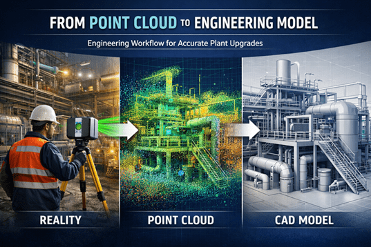
Engineering workflow showing industrial laser scanning, point cloud data, and a CAD model used for plant upgrade design.

Modern mining and industrial infrastructure projects increasingly rely on advanced digital engineering tools to support plant design, equipment upgrades, and infrastructure development. Engineers working in mining environments must often design and model complex systems including materials handling equipment, processing plant infrastructure, and structural steel frameworks.
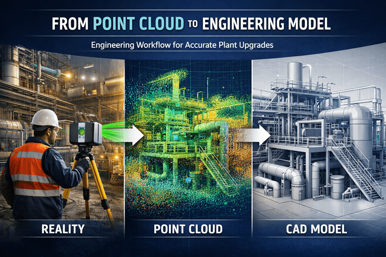
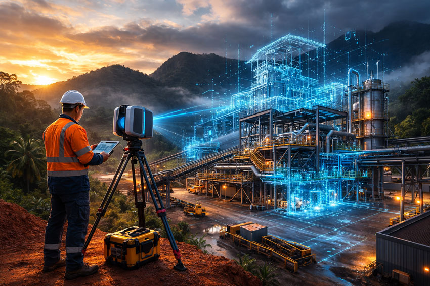
Engineer using a laser scanner capturing an industrial facility, converting scan data into a point cloud and engineering CAD model.

One of the most commonly used design platforms for mechanical engineering and plant infrastructure modelling is SolidWorks, which allows engineers to develop detailed 3D assemblies and fabrication-ready engineering drawings.

At Hamilton By Design, many projects involve the integration of modern digital engineering workflows with practical industry experience. These workflows often include:

  • Mechanical design for mining infrastructure
  • Bulk materials handling system design
  • Industrial plant layout modelling
  • Point cloud modelling from laser scanning
  • Engineering design for plant upgrades and shutdown projects

Engineering Design in Mining Infrastructure

Mining infrastructure often includes complex systems such as conveyors, transfer stations, processing equipment, and plant structures. Designing or upgrading these systems requires accurate modelling of both existing infrastructure and proposed modifications.

Modern engineering teams frequently combine several technologies during the design process, including:

  • 3D laser scanning to capture existing plant conditions
  • Point cloud modelling to represent real-world infrastructure
  • CAD modelling using platforms such as SolidWorks
  • Engineering drawings and documentation for fabrication and construction

These tools allow engineers to develop more accurate designs and reduce risks when implementing plant modifications or shutdown upgrades.


Engineering Discussions and SolidWorks Design Examples

Engineering professionals often share practical insights, modelling approaches, and design workflows through technical blogs and engineering discussion platforms.

For those interested in SolidWorks modelling techniques, mining infrastructure design concepts, and materials handling engineering, additional discussions can be found on the following engineering blog:

Mining Infrastructure โ€“ SolidWorks Design
https://mininginfrastructuresolidworksdesign.blogspot.com/

The blog explores various topics including mechanical design workflows, industrial equipment modelling, and practical engineering approaches used when designing plant infrastructure.


Supporting Mining Engineering Projects

Hamilton By Design supports mining and industrial operators with engineering services that include mechanical design, infrastructure modelling, and reality capture technologies such as laser scanning.

Learn more about our engineering-grade scanning and modelling services:

Engineering-Grade 3D Laser Scanning for Mining and Industrial Projects
https://www.hamiltonbydesign.com.au/home/engineering-grade-3d-laser-scanning-mining-industrial/

3D Laser Scanning Across Australia
https://www.hamiltonbydesign.com.au/home/engineering-services/3d-laser-scanning/3d-laser-scanning-across-australia/

Capturing Existing Conditions Before Plant Upgrades
https://www.hamiltonbydesign.com.au/capture-existing-conditions-before-plant-upgrades/



3D LiDAR scanning and 3D modelling service button โ€” laser scanner capturing a point cloud for engineering and CAD modelling
Mechanical engineering services

Engineering Knowledge Sharing

Engineering blogs and technical discussion platforms provide an opportunity for engineers, designers, and industry professionals to share knowledge about real-world engineering challenges.

By combining practical industry experience with modern digital engineering tools, the mining and industrial sectors continue to improve the way infrastructure is designed, documented, and upgraded.

For more engineering discussions on SolidWorks design and mining infrastructure modelling, visit:

https://mininginfrastructuresolidworksdesign.blogspot.com

3D CAD Modelling Australia service banner for Hamilton By Design
Australian Drafting logo featuring bold white text reading "Australian Drafting" centred on a blue rounded rectangle background.
Engineering Governance title graphic featuring bold white text reading "Engineering Governance" centred on a blue rounded rectangle background.
Mechanical, Structural & Pipework Drafting service banner by Hamilton By Design featuring white text on a blue background.
Mechanical engineering services
Blue rounded button with the text โ€œSolidWorks Designโ€ in white.
Finite Element Analysis (FEA) engineering simulation button
3D LiDAR Scanning Darwin for engineering surveys, laser scanning, reality capture and point cloud modelling services
3D LiDAR Scanning Australia engineering services for laser scanning, reality capture, scan-to-CAD, Scan-to-BIM and as-built documentation across Australia
3D LiDAR scanning services on the Central Coast providing engineering-grade laser scanning, point cloud capture, scan-to-CAD modelling and industrial reality capture for infrastructure and industrial projects.
3D LiDAR Scanning Perth for engineering surveys, laser scanning, reality capture and point cloud modelling services
3D LiDAR Scanning Sydney for engineering surveys, laser scanning, reality capture and point cloud modelling services
3D LiDAR Scanning Brisbane for engineering surveys, laser scanning, reality capture and point cloud modelling services
3D LiDAR Scanning Canberra for engineering surveys, laser scanning, reality capture and point cloud modelling services
3D LiDAR Scanning Newcastle for engineering surveys, laser scanning, reality capture and point cloud modelling services
3D LiDAR Scanning Adelaide for engineering surveys, laser scanning, reality capture and point cloud modelling services

From Point Cloud to Engineering Model Workflow

Engineering workflow showing industrial laser scanning, point cloud data, and a CAD model used for plant upgrade design.

Modern industrial facilitiesโ€”especially in mining, processing plants, and heavy infrastructureโ€”are complex environments where accurate site information is essential. Before engineers can design upgrades, modifications, or shutdown works, they must understand exactly what exists in the field today.

This is where the point cloud to engineering model workflow becomes critical.

Using engineering-grade 3D laser scanning, engineers can capture millions of spatial measurements in minutes, creating a highly accurate digital representation of existing plant conditions. These measurements form what is known as a point cloud, which becomes the foundation for accurate CAD models, engineering design, and upgrade planning.

Hamilton By Design specialises in this process through engineering-grade reality capture and modelling services across mining and industrial facilities.

Learn more about our scanning services here:
https://www.hamiltonbydesign.com.au/home/engineering-grade-3d-laser-scanning-mining-industrial/


Engineer using a laser scanner capturing an industrial facility, converting scan data into a point cloud and engineering CAD model.

What is a Point Cloud?

A point cloud is a dense collection of spatial coordinates captured by a 3D laser scanner. Each point represents a precise location on a surface such as steelwork, piping, equipment, or structures.

Modern scanners can capture millions of points per second, creating a digital snapshot of the real environment with millimetre-level accuracy.

Once captured, the point cloud becomes the digital foundation used by engineers to reconstruct existing plant geometry.

3D LiDAR scanning and 3D modelling service button โ€” laser scanner capturing a point cloud for engineering and CAD modelling
Mechanical engineering services

Hamilton By Design logo displayed on a blue tilted rectangle with a grey gradient background

The Point Cloud to Engineering Model Workflow

Turning raw scan data into usable engineering information involves several structured steps.

1. Project Planning and Site Preparation

Before scanning begins, engineers define:

  • Required accuracy
  • Project scope
  • Areas to be captured
  • Level of modelling detail required

This ensures the captured data supports downstream engineering tasks such as pipe routing, structural modifications, or equipment installations.

If you are planning a plant modification or shutdown project, capturing accurate field conditions early is essential.

Related article:
https://www.hamiltonbydesign.com.au/capture-existing-conditions-before-plant-upgrades/


2. Laser Scanning and Data Capture

During the field phase, laser scanners are positioned throughout the facility to capture overlapping scans of the plant.

Typical captured elements include:

  • Structural steel
  • Pipework
  • Mechanical equipment
  • Cable trays
  • Platforms and access ways
  • Tanks and vessels

Each scan records millions of measurements to create a complete 3D dataset of the site.


3. Scan Registration and Point Cloud Processing

After scanning, the raw scans must be processed. This includes:

  • Aligning multiple scans together (registration)
  • Removing noise or unwanted points
  • Optimising the dataset for modelling

This processing stage converts raw scan files into a coherent, usable point cloud model ready for engineering analysis.


4. Importing the Point Cloud into CAD Software

Once processed, the point cloud is imported into engineering software such as:

  • SolidWorks
  • AutoCAD
  • Revit
  • Plant design platforms

Within the design environment, the point cloud becomes a reference model that accurately represents real-world conditions. Engineers can rotate, section, and inspect the data to understand plant geometry before any design begins.


5. Engineering Model Creation

Using the point cloud as a guide, engineers begin creating intelligent CAD models of plant assets.

Typical modelling tasks include:

  • Pipe routing and spool modelling
  • Structural steel modelling
  • Equipment placement
  • Conveyor and mechanical system modelling
  • Access platforms and maintenance areas

The result is a clean engineering model derived directly from the scanned environment.

This process converts raw spatial data into parametric engineering objects, enabling design teams to work with accurate plant geometry.


6. Design Coordination and Clash Detection

Once the engineering model exists, it becomes a powerful tool for project planning.

Engineers can:

  • Test upgrade concepts
  • Perform clash detection
  • Evaluate maintenance access
  • Design shutdown modifications
  • Prepare fabrication drawings

Because the model reflects real site conditions, design errors and rework can be significantly reduced.


Why This Workflow Matters in Mining and Industrial Projects

Mining plants and processing facilities often evolve over decades. Drawings may be outdated, incomplete, or inaccurate.

Laser scanning solves this problem by capturing what actually exists today, not what legacy drawings suggest.

Benefits include:

  • Reduced design risk
  • Accurate retrofit engineering
  • Faster shutdown planning
  • Better contractor coordination
  • Improved safety planning

Point cloud modelling also allows engineers to handle complex plant geometries that would be difficult to measure manually.


3D Laser Scanning Across Australia

Hamilton By Design provides engineering-grade 3D laser scanning services across Australia, supporting mining operations, processing plants, and industrial facilities.

Our workflow focuses on delivering engineering-ready models, not just scan data.

Learn more here:
https://www.hamiltonbydesign.com.au/home/engineering-services/3d-laser-scanning/3d-laser-scanning-across-australia/


From Reality Capture to Engineering Insight

The transition from point cloud to engineering model is more than a technical workflowโ€”it is the bridge between physical infrastructure and digital engineering design.

By combining precise laser scanning with engineering modelling expertise, projects can move forward with confidence, knowing that designs are based on accurate site conditions.

At Hamilton By Design, we specialise in helping industrial operators convert reality capture into practical engineering outcomes for plant upgrades, shutdowns, and infrastructure projects.


If you would like to discuss how point cloud modelling can support your next project, explore our engineering scanning services here:

Name
Would you like us to arrange a phone consultation for you?
Address
3D CAD Modelling Australia service banner for Hamilton By Design
Australian Drafting logo featuring bold white text reading "Australian Drafting" centred on a blue rounded rectangle background.
Engineering Governance title graphic featuring bold white text reading "Engineering Governance" centred on a blue rounded rectangle background.
Mechanical, Structural & Pipework Drafting service banner by Hamilton By Design featuring white text on a blue background.
Mechanical engineering services
Blue rounded button with the text โ€œSolidWorks Designโ€ in white.
Finite Element Analysis (FEA) engineering simulation button
3D LiDAR Scanning Darwin for engineering surveys, laser scanning, reality capture and point cloud modelling services
3D LiDAR Scanning Australia engineering services for laser scanning, reality capture, scan-to-CAD, Scan-to-BIM and as-built documentation across Australia
3D LiDAR scanning services on the Central Coast providing engineering-grade laser scanning, point cloud capture, scan-to-CAD modelling and industrial reality capture for infrastructure and industrial projects.
3D LiDAR Scanning Perth for engineering surveys, laser scanning, reality capture and point cloud modelling services
3D LiDAR Scanning Sydney for engineering surveys, laser scanning, reality capture and point cloud modelling services
3D LiDAR Scanning Brisbane for engineering surveys, laser scanning, reality capture and point cloud modelling services
3D LiDAR Scanning Canberra for engineering surveys, laser scanning, reality capture and point cloud modelling services
3D LiDAR Scanning Newcastle for engineering surveys, laser scanning, reality capture and point cloud modelling services
3D LiDAR Scanning Adelaide for engineering surveys, laser scanning, reality capture and point cloud modelling services

How Engineers Capture Existing Conditions Before Plant Upgrades

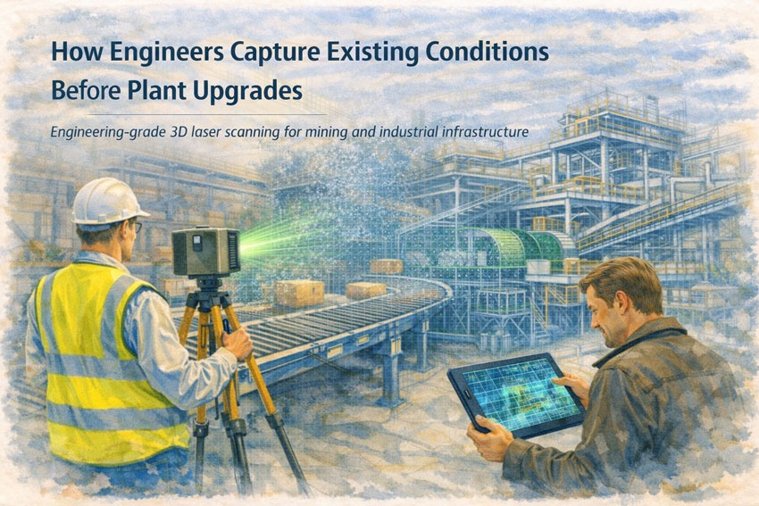
Engineer using a 3D laser scanner to capture existing conditions of mining plant infrastructure before upgrade engineering.

Mining and industrial processing plants are rarely static environments. Over time, equipment upgrades, maintenance modifications, structural repairs, and operational improvements result in plant infrastructure that no longer matches the original engineering drawings.

Before engineers can design plant upgrades, install new equipment, or modify existing infrastructure, they must first understand the true geometry of the existing plant environment.

Capturing accurate existing conditions is therefore one of the most important steps in any plant upgrade project.

Engineering teams commonly use 3D laser scanning, LiDAR surveying, and digital modelling techniques to create accurate representations of existing infrastructure before design work begins.

At Hamilton By Design, engineering-grade scanning technology is used to capture precise plant geometry and convert it into digital engineering models used for upgrade planning and design.

For an overview of how scanning supports mining and industrial infrastructure projects, see:

๐Ÿ‘‰ https://www.hamiltonbydesign.com.au/home/engineering-grade-3d-laser-scanning-mining-industrial/


3D laser scanning of mining conveyor and processing infrastructure to document existing plant geometry before upgrades.

Why Existing Conditions Matter in Plant Upgrade Projects

Plant upgrades often involve installing new equipment within complex existing infrastructure. This may include:

โ€ข upgrading conveyors and transfer towers
โ€ข installing new processing equipment
โ€ข modifying structural steel frameworks
โ€ข improving maintenance access and safety systems
โ€ข expanding plant throughput capacity

If the existing plant geometry is not accurately understood, installation work can become difficult or even impossible during shutdown periods.

Small dimensional differences between drawings and the real plant environment can lead to major installation challenges.

For this reason, capturing accurate existing conditions has become a critical step in modern mining infrastructure engineering.

Learn more about the broader engineering services supporting mining and mineral processing projects here:

๐Ÿ‘‰ https://www.hamiltonbydesign.com.au/home/mining-mineral-processing/


Traditional Methods of Capturing Existing Conditions

Historically, engineers relied on manual measurements and traditional surveying techniques to capture plant geometry.

These methods often involved:

โ€ข tape measurements
โ€ข total station surveys
โ€ข manual sketching and documentation
โ€ข physical inspections of plant infrastructure

While these methods can still be useful for small tasks, they are often slow and limited when working in large and complex industrial environments.

Mining plants frequently contain tightly packed infrastructure such as conveyors, structural steel, pipework, platforms, and maintenance equipment. Capturing this complexity using manual methods can be difficult and time-consuming.


Modern Approach: 3D Laser Scanning

Today, engineers increasingly rely on 3D laser scanning technology to capture existing plant conditions.

Laser scanning uses LiDAR technology to collect millions of spatial measurements of plant infrastructure. These measurements are combined into a point cloud dataset representing the exact geometry of the environment.

This digital dataset allows engineers to create highly accurate models of existing plant infrastructure before design work begins.

You can learn more about these services here:

๐Ÿ‘‰ https://www.hamiltonbydesign.com.au/home/engineering-services/3d-laser-scanning/


From Point Cloud to Engineering Model

Once laser scanning data has been captured, the point cloud dataset can be processed and converted into engineering models used for design and analysis.

Typical workflow includes:

  1. Planning scan locations within the plant
  2. Capturing infrastructure using LiDAR scanners
  3. Registering scan positions to create a unified point cloud
  4. Extracting structural and equipment geometry
  5. Creating CAD models for engineering analysis

These digital models allow engineers to analyse plant layouts, verify clearances, and design upgrade solutions before work begins on site.


Supporting Mining Plant Upgrade Engineering

Accurate digital models created from laser scanning are commonly used in projects involving:

โ€ข conveyor system upgrades
โ€ข transfer chute redesign
โ€ข structural modifications
โ€ข plant expansion projects
โ€ข installation of new processing equipment

By analysing the existing plant environment digitally, engineers can detect potential clashes and plan installation work before shutdown periods.

To learn more about engineering-grade scanning used for plant upgrade projects, visit:

๐Ÿ‘‰ https://www.hamiltonbydesign.com.au/engineering-grade-3d-laser-scanning-mining-plant-upgrades/


Reducing Risk During Shutdown Work

Many plant upgrades must be completed during planned shutdown periods, where time is limited and installation delays can be costly.

Capturing existing conditions before shutdown work begins allows engineers to develop upgrade designs and installation strategies in advance.

Digital models created from scan data allow engineering teams to:

โ€ข verify equipment clearances
โ€ข plan installation procedures
โ€ข identify potential conflicts between structures
โ€ข reduce unexpected installation challenges

This significantly improves the reliability of plant upgrade projects.


Engineering-Led Scanning for Mining Infrastructure

At Hamilton By Design, laser scanning is integrated directly with mechanical engineering workflows.

Rather than simply capturing survey data, scanning is performed with the goal of supporting engineering design and infrastructure upgrades.

This approach allows scan data to be converted into practical engineering solutions including:

โ€ข mechanical design models
โ€ข plant upgrade engineering
โ€ข structural analysis models
โ€ข digital infrastructure documentation

By combining engineering expertise with advanced scanning technology, accurate plant data can be used to develop reliable engineering outcomes.


Hamilton By Design logo displayed on a blue tilted rectangle with a grey gradient background

Learn More

If you would like to learn more about how engineers capture existing conditions before plant upgrades, explore the following resources:

Engineering-grade scanning overview:
๐Ÿ‘‰ https://www.hamiltonbydesign.com.au/home/engineering-grade-3d-laser-scanning-mining-industrial/

Mining and mineral processing engineering services:
๐Ÿ‘‰ https://www.hamiltonbydesign.com.au/home/mining-mineral-processing/

3D laser scanning engineering services:
๐Ÿ‘‰ https://www.hamiltonbydesign.com.au/home/engineering-services/3d-laser-scanning/

Mining plant upgrade engineering:
๐Ÿ‘‰ https://www.hamiltonbydesign.com.au/engineering-grade-3d-laser-scanning-mining-plant-upgrades/


Anthony Hamilton
Principal Engineer
Hamilton By Design


3D LiDAR scanning and 3D modelling service button โ€” laser scanner capturing a point cloud for engineering and CAD modelling
Mechanical engineering services
Name
Would you like us to arrange a phone consultation for you?
Address

3D CAD Modelling Australia service banner for Hamilton By Design

Scan for Conveyor Transfers

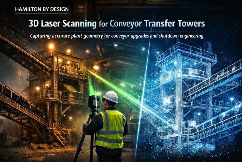
3D laser scanning of a mining conveyor transfer tower capturing point cloud data for engineering modelling.

Conveyor transfer towers are critical components within mining and bulk material handling operations. These structures control the movement of material between conveyors and often contain complex arrangements of chutes, structural steel, maintenance platforms, and access walkways.

Over time, many transfer towers are modified as production requirements change. Equipment upgrades, chute redesigns, and maintenance improvements can result in plant infrastructure that no longer matches the original engineering drawings.

For engineers planning upgrades or maintenance projects, accurate existing condition data is essential. One of the most effective ways to capture this information is through 3D laser scanning.

At Hamilton By Design, engineering-grade scanning is used to capture precise geometry of conveyor transfer towers and surrounding plant infrastructure. This data can then be converted into accurate digital models used for mechanical design, plant upgrades, and engineering analysis.

Engineer performing LiDAR scanning of a conveyor transfer tower in a mining processing plant.

Learn more about our engineering scanning capabilities here:
๐Ÿ‘‰ https://www.hamiltonbydesign.com.au/home/engineering-services/3d-laser-scanning/


Why Conveyor Transfer Towers Are Difficult to Measure

Transfer towers are often some of the most complex areas within a processing plant. They typically contain multiple systems operating within a confined structure including conveyors, transfer chutes, structural supports, and maintenance platforms.

These environments can include:

โ€ข multiple conveyors entering and exiting the structure
โ€ข chute systems with wear liners
โ€ข structural steel frames and supports
โ€ข maintenance walkways and access platforms
โ€ข dust control and service equipment

Because of the tight layout and elevation changes within these structures, traditional measurement methods can be slow and prone to error.

In many facilities, the original engineering drawings may also be outdated due to years of plant modifications.

Accurate measurement is therefore essential when designing upgrades or modifications to conveyor transfer systems.


Using 3D Laser Scanning to Capture Transfer Tower Geometry

Engineering-grade 3D laser scanning uses LiDAR technology to capture millions of spatial measurements of plant infrastructure.

The resulting dataset forms a point cloud model representing the exact geometry of conveyors, structural steel, chutes, and surrounding plant equipment.

This digital model allows engineers to analyse plant layouts and develop accurate engineering designs before physical work begins.

Laser scanning provides several advantages when working in conveyor transfer towers.

Accurate Existing Conditions

Scanning captures the true geometry of plant infrastructure, allowing engineers to design modifications based on reliable data rather than outdated drawings.

Improved Design Planning

Digital models generated from scan data allow engineers to verify clearances and identify potential clashes before installation.

Reduced Shutdown Risk

Engineering teams can plan installation work more effectively using digital models created from scan data.

Faster Data Capture

Laser scanning can capture complex structures quickly compared with traditional measurement methods.


3D Scanning for Mining Shutdown Projects

Many conveyor transfer tower upgrades are performed during planned mining shutdowns, where engineering teams must complete inspections, modifications, and installations within tight timeframes.

Laser scanning provides a fast and reliable way to capture accurate plant geometry before shutdown work begins. Engineers can then analyse the digital model and develop upgrade designs in advance.

This approach reduces the risk of unexpected installation issues during shutdown periods.

You can learn more about scanning applications during plant shutdowns here:

๐Ÿ‘‰ https://www.hamiltonbydesign.com.au/home/engineering-grade-3d-laser-scanning-mining-industrial/3d-scanning-mining-shutdown-projects/


From Laser Scan to Engineering Model

The laser scanning workflow for conveyor transfer towers typically follows a structured process.

  1. Planning scan locations within the transfer tower
  2. Capturing plant geometry using LiDAR scanners
  3. Registering scan positions to create a unified point cloud
  4. Extracting geometry from the point cloud dataset
  5. Creating engineering CAD models for design analysis

These models allow engineers to analyse plant infrastructure and design upgrade solutions with greater confidence.


Reverse Engineering Conveyor Infrastructure

In many mining plants, original equipment drawings are missing or no longer reflect the current infrastructure. In these cases, laser scanning can be used to reverse engineer existing equipment and structures.

By capturing the geometry of conveyors, chutes, and supporting structures, engineers can recreate accurate CAD models used for redesign, replacement components, or plant upgrades.

Hamilton By Design provides reverse engineering services using high-accuracy scanning technology.

Learn more about this process here:

๐Ÿ‘‰ https://www.hamiltonbydesign.com.au/reverse-engineer-3d-scanning/


Digital Engineering for Conveyor Transfer Towers

Digital models created from laser scanning allow engineers to analyse plant infrastructure in a controlled environment before work begins on site.

These models support engineering tasks such as:

โ€ข chute design and optimisation
โ€ข conveyor upgrade planning
โ€ข structural modifications
โ€ข clash detection and layout verification
โ€ข maintenance planning and documentation

For mining operations, this approach improves the reliability of plant upgrade projects and reduces engineering risk.


Engineering Support from Hamilton By Design

Hamilton By Design provides engineering-led 3D laser scanning and mechanical design services supporting mining and industrial infrastructure projects across Australia.

Our services include:

โ€ข conveyor transfer tower scanning
โ€ข plant upgrade engineering
โ€ข mechanical design and modelling
โ€ข reverse engineering of plant infrastructure
โ€ข digital engineering models and inspections

By combining scanning technology with engineering expertise, we help mining and industrial clients capture accurate plant geometry and convert it into practical engineering solutions.


Hamilton By Design logo displayed on a blue tilted rectangle with a grey gradient background

Learn More About Engineering-Grade Laser Scanning

For a full overview of engineering-grade laser scanning and its applications in mining and industrial plants, visit:

๐Ÿ‘‰ https://www.hamiltonbydesign.com.au/home/engineering-grade-3d-laser-scanning-mining-industrial/


Anthony Hamilton
Principal Engineer
Hamilton By Design


Name
Would you like us to arrange a phone consultation for you?
Address

3D CAD Modelling Australia service banner for Hamilton By Design

Mechanical Engineering Design Companies on the Central Coast

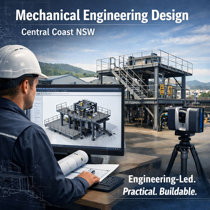
Mechanical engineer reviewing 3D CAD model beside industrial steel platform and 3D laser scanner on the Central Coast NSW

Mechanical Engineering Design Companies | Central Coast | Hamilton By Design

Engineering-led design. Practical outcomes. Built for industry.

If youโ€™re searching for mechanical engineering design companies on the Central Coast, youโ€™re likely trying to solve a real operational problem โ€” upgrading equipment, replacing worn assets, improving maintainability, or getting compliant documentation for a project that needs to move.

Hamilton By Design provides mechanical engineering design services for industrial and mining-linked businesses across the Central Coast and NSW, delivering practical, buildable solutions backed by strong engineering governance.


Mechanical engineering design company on the Central Coast developing industrial steel structures using 3D modelling

What a Mechanical Engineering Design Company Should Deliver

A capable mechanical design partner doesnโ€™t just โ€œdraw it up.โ€ They help you reduce risk and get outcomes that work in the field. That includes:

  • Engineering-grade design documentation (GA drawings, fabrication details, BOMs)
  • Site verification and measurement to confirm real-world geometry and constraints
  • Fit-for-purpose design focused on access, maintenance, and safe operation
  • Design verification aligned to the relevant Australian Standards (as required)
  • Revision control and traceability so your team always works from the correct set

Mechanical Design Services We Provide

Hamilton By Design supports projects from concept through to issued-for-fabrication documentation, including:

1) Industrial Mechanical Design & Drafting

  • Steelwork and platforms
  • Guards, access ways, and maintenance improvements
  • Equipment supports, skids, frames, and brackets
  • Conveyor and transfer component detailing (where required)

2) Site Verification and โ€œAs-Builtโ€ Engineering Support

For many Central Coast sites, legacy assets exist with limited documentation. We help establish the current geometry and constraints so design decisions are based on facts, not assumptions.

3) 3D Laser Scanning and Digital Capture

Where access is difficult or accuracy matters, 3D scanning helps reduce rework and speed up design development.

Learn more:

4) Mining and Heavy Industry Experience

Even if youโ€™re based on the Central Coast, your systems and standards may be โ€œmining-grade.โ€ Weโ€™re used to high-consequence environments where design clarity, traceability, and constructability matter.

Explore our engineering services:


3D LiDAR scanning services on the Central Coast providing engineering-grade laser scanning, point cloud capture, scan-to-CAD modelling and industrial reality capture for infrastructure and industrial projects.
Drafting services on the Central Coast providing engineering drawings, fabrication detailing, as-built documentation, reverse engineering and CAD drafting for industrial and infrastructure projects.
Mechanical engineering services on the Central Coast providing industrial design, plant inspections, pump calculations, reverse engineering and engineering support for manufacturing, infrastructure and heavy industry projects.

Why Central Coast Businesses Choose Hamilton By Design

When youโ€™re comparing mechanical engineering design companies, consider what you really need: speed, accuracy, practicality, and confidence the design will work once itโ€™s built.

Our approach is:

  • Engineering-first: design decisions supported by solid reasoning and verification
  • Practical deliverables: drawings and models that fabricators and maintainers can use
  • Responsive communication: clear scope, staged delivery, and predictable outputs
  • Governance: revision control, structured documentation, and quality-focused process

Common Project Types We Support

If youโ€™re on the Central Coast and need mechanical design, we commonly assist with:

  • Plant upgrades and maintenance projects
  • Replacement design for worn components
  • Access and maintainability improvements
  • Structural/mechanical support design for equipment changes
  • Documentation upgrades for compliance and operations

Hamilton By Design logo displayed on a blue tilted rectangle with a grey gradient background

3D LiDAR scanning and 3D modelling service button โ€” laser scanner capturing a point cloud for engineering and CAD modelling
Mechanical engineering services

Talk to a Mechanical Engineering Design Team on the Central Coast

If you need an engineering partner who can verify conditions, develop practical mechanical designs, and issue clear fabrication-ready documentation, we can help.

Visit our Mechanical Engineering services page:

Or contact Hamilton By Design to discuss your scope and timing.


Name
Would you like us to arrange a phone consultation for you?
Address
3D CAD Modelling Australia service banner for Hamilton By Design
Finite Element Analysis (FEA) engineering simulation button
Mechanical engineering services

Engineering-Grade 3D Scanning in Papua New Guinea

3D laser scanner capturing point cloud data of remote processing plant.

Papua New Guinea presents some of the most demanding industrial environments in the Asia-Pacific region. Remote terrain, ageing infrastructure, complex plant layouts and tight shutdown windows demand precision, efficiency and engineering certainty.

Hamilton By Design delivers engineering-grade 3D scanning services in Papua New Guinea, supporting mining, processing, infrastructure and industrial projects with accurate digital capture and practical engineering outcomes.

If you are planning a plant expansion, shutdown upgrade, brownfield modification or condition assessment in PNG, high-resolution laser scanning provides the clarity your project needs.

๐Ÿ‘‰ Learn more about our dedicated PNG services here:
https://www.hamiltonbydesign.com.au/3d-scanning-papua-new-guinea/


Industrial mining facility in PNG captured with engineering-grade 3D scanning technology.

Why 3D Laser Scanning Matters in PNG

Traditional measurement methods are time-consuming and prone to error โ€” especially in remote or operational sites. 3D laser scanning eliminates guesswork by capturing millions of precise data points in a matter of hours.

The result is a complete and reliable as-built digital record of your asset.

This enables:

  • Accurate retrofit and tie-in design
  • Reduced site revisits
  • Improved shutdown planning
  • Clash detection before fabrication
  • Safer project execution

In remote PNG environments, reducing mobilisation and rework is not just convenient โ€” it is critical to project success.


From Point Cloud to Engineering Outcome

At Hamilton By Design, we go beyond scanning.

We transform raw point cloud data into usable engineering outputs including:

  • SolidWorks-ready 3D models
  • Structural and mechanical layouts
  • Fabrication drawings
  • Design verification data
  • Digital asset records

Our difference is simple: we are engineers first. Scanning is integrated directly into mechanical and structural design workflows, ensuring data captured onsite translates into practical, buildable solutions.

For a broader overview of our national capability, explore our full 3D laser scanning services here:
https://www.hamiltonbydesign.com.au/home/engineering-services/3d-laser-scanning/


Supporting Mining & Industrial Projects Across Papua New Guinea

Our PNG capability supports:

  • Mining processing plants
  • Conveyors and transfer stations
  • Pump stations and pipework systems
  • Structural steel and platforms
  • Smelter and refinery infrastructure
  • Brownfield plant upgrades

Whether your site is operational, remote or in early planning stages, we deliver data accuracy that reduces risk and accelerates decision-making.


Reduce Risk. Increase Certainty.

In complex industrial environments, uncertainty drives cost.

3D laser scanning provides:

  • Accurate geometry
  • Faster design cycles
  • Reduced fabrication errors
  • Improved stakeholder confidence

When combined with Hamilton By Designโ€™s engineering capability, it becomes a powerful project delivery tool.


Delivering Engineering Certainty in Papua New Guinea

If your organisation is undertaking upgrades, expansions or asset assessments in Papua New Guinea, we are ready to support your project.

Explore our dedicated PNG scanning capability:
๐Ÿ‘‰ https://www.hamiltonbydesign.com.au/3d-scanning-papua-new-guinea/

Or view our broader engineering-led 3D laser scanning services:
๐Ÿ‘‰ https://www.hamiltonbydesign.com.au/home/engineering-services/3d-laser-scanning/


3D LiDAR scanning and 3D modelling service button โ€” laser scanner capturing a point cloud for engineering and CAD modelling
Mechanical engineering services
Name
Would you like us to arrange a phone consultation for you?
Address

3D CAD Modelling Australia service banner for Hamilton By Design
Australian Drafting logo featuring bold white text reading "Australian Drafting" centred on a blue rounded rectangle background.
Engineering Governance title graphic featuring bold white text reading "Engineering Governance" centred on a blue rounded rectangle background.
Mechanical, Structural & Pipework Drafting service banner by Hamilton By Design featuring white text on a blue background.
Mechanical engineering services
Blue rounded button with the text โ€œSolidWorks Designโ€ in white.
Finite Element Analysis (FEA) engineering simulation button
3D LiDAR Scanning Darwin for engineering surveys, laser scanning, reality capture and point cloud modelling services
3D LiDAR Scanning Australia engineering services for laser scanning, reality capture, scan-to-CAD, Scan-to-BIM and as-built documentation across Australia
3D LiDAR scanning services on the Central Coast providing engineering-grade laser scanning, point cloud capture, scan-to-CAD modelling and industrial reality capture for infrastructure and industrial projects.
3D LiDAR Scanning Perth for engineering surveys, laser scanning, reality capture and point cloud modelling services
3D LiDAR Scanning Sydney for engineering surveys, laser scanning, reality capture and point cloud modelling services
3D LiDAR Scanning Brisbane for engineering surveys, laser scanning, reality capture and point cloud modelling services
3D LiDAR Scanning Canberra for engineering surveys, laser scanning, reality capture and point cloud modelling services
3D LiDAR Scanning Newcastle for engineering surveys, laser scanning, reality capture and point cloud modelling services
3D LiDAR Scanning Adelaide for engineering surveys, laser scanning, reality capture and point cloud modelling services