Forestry Industry & Timber Processing: Engineering Machinery for Productivity and Long-Term Value

Engineering-grade LiDAR scanning and FEA simulation workflow for forestry and timber processing equipment design.

The forestry and timber processing industries operate in demanding environments where productivity, reliability, and equipment performance directly influence profitability. Whether processing logs, handling timber products, operating sawmills, or managing materials handling systems, machinery downtime and inefficiencies can significantly affect production output and operating costs.

Modern engineering is moving beyond traditional design approaches and increasingly using digital engineering tools to optimise equipment before fabrication and installation begins.

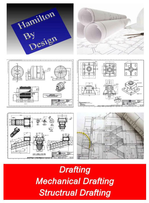
At Hamilton By Design, we combine engineering-grade 3D LiDAR scanning, 3D modelling, and Finite Element Analysis (FEA) to support forestry and timber processing operations by delivering machinery and engineered systems designed for productivity, reliability, and long-term return on investment.

Designing for More Than Initial Cost

The lowest purchase price does not always provide the lowest operating cost.

Machinery and processing systems can incur substantial ongoing costs through:

  • Excessive wear
  • Unplanned maintenance
  • Downtime
  • Energy consumption
  • Material build-up
  • Inefficient layouts
  • Reduced production capacity
  • Premature equipment failure

Engineering decisions made during the design stage can influence the total lifecycle cost of equipment for many years after installation.

The objective is not simply designing machinery that works.

The objective is designing machinery that continues to perform efficiently throughout its operational life.

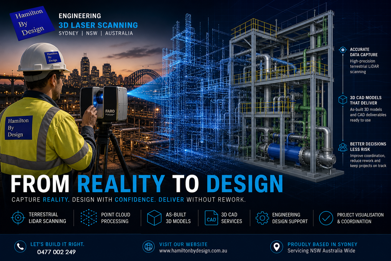
Engineering-Grade 3D LiDAR Scanning

For existing timber processing plants and brownfield facilities, one of the biggest challenges is understanding current conditions accurately.

Many facilities contain:

  • Existing conveyors
  • Timber processing machinery
  • Structural steel
  • Pipework
  • Platforms and access systems
  • Building constraints
  • Historical modifications

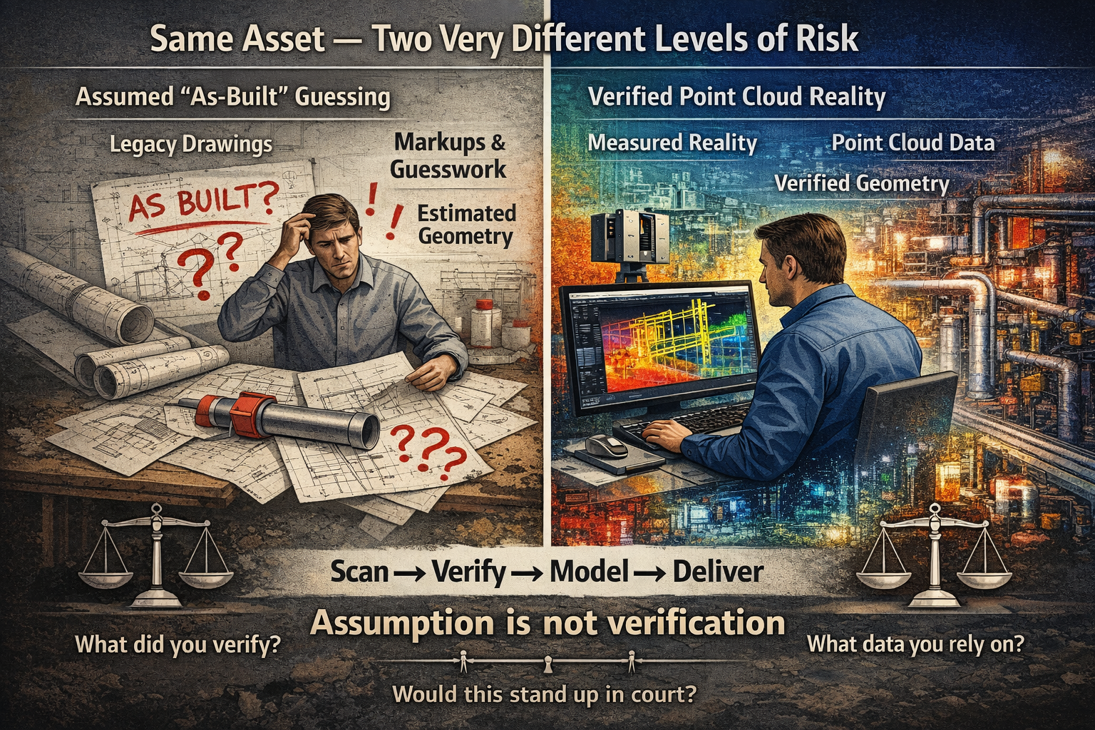
Outdated drawings or manual measurements can introduce risk into engineering projects.

Hamilton By Design uses engineering-grade 3D LiDAR scanning to capture accurate existing conditions and generate high-quality point cloud data.

This provides:

  • Accurate plant geometry
  • Existing condition verification
  • Reduced design assumptions
  • Improved fit-up accuracy
  • Reduced installation risk
  • Faster project development

Rather than designing around assumptions, engineering decisions can be based on actual site information.

3D Modelling for Better Project Outcomes

Once site information has been captured, point cloud data can be converted into editable engineering models.

3D CAD Modelling Australia service banner for Hamilton By Design

3D modelling provides benefits including:

  • Improved visualisation
  • Clash detection
  • Layout optimisation
  • Equipment integration
  • Fabrication planning
  • Improved communication

For forestry and timber processing projects this may include:

  • Log handling systems
  • Conveyors
  • Transfer systems
  • Chutes
  • Processing equipment
  • Access platforms
  • Structural modifications
  • Production upgrades

Digital models help identify issues before they become site problems.

Finite Element Analysis (FEA)

Engineering performance extends beyond appearance and fit-up.

Equipment must withstand:

  • Dynamic loading
  • Material impacts
  • Fatigue
  • Wear
  • Structural loading
  • Operational forces

Hamilton By Design can support projects through Finite Element Analysis (FEA) to evaluate equipment and structural performance before fabrication begins.

FEA can assist with:

  • Stress assessment
  • Deflection analysis
  • Structural performance
  • Design optimisation
  • Weight reduction opportunities
  • Reliability improvements

Rather than overdesigning equipment or relying on assumptions, designs can be refined using measurable engineering information.

Maximising Return on Investment

A successful project should not simply focus on reducing initial capital cost.

The real value often comes from:

  • Increased production rates
  • Reduced maintenance costs
  • Improved reliability
  • Reduced downtime
  • Improved safety
  • Lower lifecycle costs
  • Longer equipment life
  • Improved operational efficiency
3D LiDAR scanning and 3D modelling service button โ€” laser scanner capturing a point cloud for engineering and CAD modelling
Mechanical engineering services

Engineering decisions made early in a project often have long-term financial impacts.

How Hamilton By Design Supports Forestry and Timber Processing

Hamilton By Design combines digital engineering tools with practical engineering experience to support projects from concept through to delivery.

Our services include:

  • Engineering-grade 3D LiDAR scanning
  • Scan-to-CAD workflows
  • 3D modelling
  • Mechanical engineering design
  • Finite Element Analysis (FEA)
  • Engineering drawings
  • Fabrication documentation
  • Existing condition verification
  • Brownfield project support

By integrating reality capture, digital modelling, and engineering analysis, projects can move from assumptions toward measurable engineering outcomes.

The goal is simple:

Design machinery and systems that maximise productivity while delivering stronger long-term returns on investment.

From Reality to Design: How 3D Scanning Powers Engineering Outcomes in Sydney

Engineer performing terrestrial LiDAR scanning on a Sydney construction site with point cloud transitioning into 3D CAD model

In todayโ€™s construction and industrial environment, the gap between what was designed and what actually exists on site is where most project risk lives.

Blue 3D LiDAR scanner icon on a tripod with scanning waves

Steel doesnโ€™t sit where drawings say it should. Pipework clashes with new installs. Structural tolerances stack up. And when projects move fast, those risks become expensive.

This is where engineering-led 3D scanning and design changes everything.

At Hamilton By Design, we donโ€™t just capture data โ€” we convert reality into accurate, buildable engineering outcomes.


The Shift from Measuring to Reality Capture

Traditional site measurement methods rely on tape measures, total stations, and assumptions. They work โ€” but they introduce risk.

Modern projects are moving toward terrestrial LiDAR scanning, using high-accuracy laser-based systems to capture millions of data points across a site.

A terrestrial LiDAR scanner works by emitting laser pulses and measuring the return time to build a precise 3D representation of the environment โ€” known as a point cloud.

This process, often referred to as a terrestrial scan, creates a true digital record of:

  • Structural steel
  • Pipework systems
  • Equipment layouts
  • Buildings and facades
  • Complex plant geometry

The result is not an interpretation โ€” it is reality.


From Point Cloud to As-Built 3D Model

Capturing data is only the first step.

The real value comes from converting that scan into an as-built 3D model that engineers, designers, and fabricators can actually use.

This is where many providers fall short.

At Hamilton By Design, we deliver:

  • Engineering-grade 3D CAD services
  • Parametric models (not mesh files)
  • Fabrication-ready geometry
  • Drawings aligned to Australian standards

We donโ€™t produce STL or OBJ files that sit unused.
We produce editable 3D engineering design models that integrate directly into your workflow.

Because ultimately โ€” scanning is not the deliverable.

Design is.


3D Scanning on Construction Sites

The use of 3D scanning on construction sites is growing rapidly โ€” and for good reason.

Projects across Sydney are using LiDAR to:

  • Verify structural installation before fit-up
  • Coordinate mechanical and piping systems
  • Reduce rework during shutdowns
  • Validate contractor work against design intent
  • Capture existing conditions for upgrades

Whether itโ€™s a building scan, plant upgrade, or infrastructure project, the ability to see the full site in 3D changes how teams make decisions.

Instead of relying on drawings โ€” teams work from reality.


Top 3D Scanning Platforms for Project Coordination

Not all scanning workflows are equal.

The top 3D scanning platforms for construction site visualisation and project coordination combine accurate capture with accessible data environments.

Typical platforms include:

  • FARO SCENE for registration and processing
  • Autodesk ReCap for cloud-based coordination
  • 3DEXPERIENCE for engineering governance and collaboration

However, the platform is only part of the equation.

Without engineering understanding, even the best software becomes a viewer โ€” not a solution.

Thatโ€™s why our workflow is built around:

Scan โ†’ Model โ†’ Design โ†’ Deliver


Engineering-Led 3D Design

What sets Hamilton By Design apart is simple:

We are a mechanical engineering business first โ€” not a scanning company.

Our team uses LiDAR to support:

  • 3D design engineering
  • Structural modifications
  • Conveyor and chute design
  • Pipework upgrades
  • Equipment integration

We scan with the intent of answering one question:

๐Ÿ‘‰ Will it fit?

Because in engineering โ€” thatโ€™s what matters.


Why โ€œ3D Scanner Service Near Meโ€ Isnโ€™t Enough

Many clients search for a โ€œ3D scanner service near meโ€ or look at 3D scanner hire as a cost-saving measure.

But scanning hardware alone does not solve engineering problems.

Without:

  • Proper scan planning (line of sight, density, coverage)
  • Registration accuracy
  • Engineering interpretation
  • CAD modelling capability

โ€ฆthe result is just raw data.

We often see projects where scanning was completed โ€” but nothing usable was produced.

Thatโ€™s why we offer both:

  • Full 3D scan services
  • 3D scanner hire (with guidance)
  • End-to-end modelling and design support

Applications Across Buildings and Industry

Our 3D scanning building services and industrial workflows support a wide range of sectors across Sydney and NSW:

Construction & Buildings

  • As-built verification
  • Facade capture
  • Structural coordination
  • Scan-to-BIM workflows

Industrial Plants

  • Brownfield upgrades
  • Shutdown planning
  • Equipment replacement
  • Pipe routing and clash detection

Infrastructure

  • Rail and transport assets
  • Utilities and pump stations
  • Structural assessments

Whether itโ€™s a commercial building or a complex processing plant, the principle is the same:

Capture reality. Design with confidence. Deliver without rework.


The Future: Digital Engineering Driven by LiDAR

LiDAR is not just a tool โ€” it is the foundation of modern digital engineering design.

As projects become more complex, the ability to:

  • Capture accurate site data
  • Build reliable 3D models
  • Coordinate across teams
  • Maintain a single source of truth

โ€ฆwill define successful delivery.

At Hamilton By Design, we combine:

  • Terrestrial LiDAR scanning
  • 3D CAD services
  • Engineering design expertise

to ensure that what gets built โ€” matches what was intended.


3D LiDAR scanning and 3D modelling service button โ€” laser scanner capturing a point cloud for engineering and CAD modelling
Mechanical engineering services

Work With an Engineer-Led 3D Scanning Team

If youโ€™re planning a project in Sydney or across NSW and need:

  • A 3D scan service
  • An as-built 3D model
  • 3D engineering design support

weโ€™re ready to help.

Because the difference between scanning and engineering is simple:

๐Ÿ‘‰ One captures data.
๐Ÿ‘‰ The other delivers outcomes.

Hamilton By Design logo displayed on a blue tilted rectangle with a grey gradient background

Related Sydney Services

Hamilton By Design provides engineering-led 3D scanning, LiDAR scanning, mechanical engineering and digital engineering services throughout Sydney and Greater Sydney.

Explore our related Sydney services:


  • 3D Scanning Sydney โ€“ Engineering-grade terrestrial laser scanning, as-built surveys and point cloud capture for industrial, infrastructure and commercial projects.
  • Reality Capture Sydney โ€“ High-accuracy reality capture, digital twins, asset documentation and engineering-grade site verification.
  • Scan to CAD Sydney โ€“ Convert point cloud data into AutoCAD, SolidWorks, Inventor and other engineering-ready CAD deliverables.
  • Point Cloud Modelling Sydney โ€“ Engineering-grade point cloud processing, clash detection, as-built verification and 3D modelling.
  • Mechanical Engineering Sydney โ€“ Mechanical design, plant upgrades, materials handling systems, conveyors, chutes, platforms and engineering support.
  • Structural Drafting Sydney โ€“ Structural steel drafting, fabrication drawings, GA drawings, workshop detailing and as-built documentation.

Hamilton By Design supports projects throughout Sydney CBD, Parramatta, Liverpool, Penrith, Blacktown, Chatswood, Alexandria, Mascot, Newcastle and the Central Coast.


Our Clients

Contact Us – Talk to Us – Work with Us

Name
Would you like us to arrange a phone consultation for you?
Address

The High Court Just Changed Engineering Liability โ€” Why โ€œAs-Built Guessingโ€ Is No Longer Enough

Split-screen engineering graphic comparing assumed as-built drawings with verified point cloud scanning data, highlighting the difference between estimated geometry and measured reality.

The recent High Court decision in Pafburn Pty Ltd v The Owners โ€“ Strata Plan No 84674 has been widely discussed across the construction and legal sectors. Most commentary has focused on developers and builders, particularly the finding that they can be held fully liable for defects and cannot rely on proportionate liability to distribute responsibility.

But for engineers, designers, and anyone working in brownfield environments, the real impact runs deeper.

This case signals a clear shift in expectation โ€” away from assumption, and toward verified reality.


3D LiDAR scanning and 3D modelling service button โ€” laser scanner capturing a point cloud for engineering and CAD modelling
Mechanical engineering services

The Hidden Risk in โ€œAs-Builtโ€ Drawings

Across many projects, particularly in retrofit, maintenance, and upgrade work, design offices rely on what are commonly referred to as โ€œas-builtโ€ drawings.

In theory, these drawings represent what has actually been constructed on site.

In practice, however, that is not always the case.

Many โ€œas-builtsโ€ are produced through:

  • Manual markups during construction
  • Redline drawings updated after installation
  • Verbal confirmation from site teams
  • Interpretation of incomplete or outdated information

In some cases, they are never formally verified at all.

This creates a fundamental problem.

The design office is making decisions based on information that may be:

  • Incomplete
  • Inaccurate
  • Or in the worst case โ€” assumed

The Question That Is Now Being Asked

Following this High Court decision, the legal environment is changing.

It is no longer sufficient to say:

โ€œI worked from the drawings provided.โ€

Instead, the question is becoming:

What should a competent engineer have verified?

This is a significant shift.

It places responsibility not just on what information was used โ€” but on whether that information should have been trusted in the first place.


Assumption vs Measured Reality

At its core, this issue comes down to a simple comparison:

Does guessing what has been built offer the same level of coverage as measured data?

The answer is increasingly clear โ€” it does not.

When geometry is assumed:

  • Tolerances are unknown
  • Deviations from design are hidden
  • Errors compound as projects progress
  • Rework risk increases

More importantly, from a legal standpoint:

There is no defensible evidence of what actually existed at the time decisions were made.


The Role of Point Cloud Scanning

This is where point cloud scanning and reality capture fundamentally change the workflow.

Rather than relying on interpretation, point cloud data provides a direct measurement of site conditions.

A properly captured scan:

  • Records millions of measured points across the asset
  • Captures geometry exactly as installed
  • Provides a timestamped dataset of site conditions
  • Can be referenced, rechecked, and validated at any time

Most importantly, it creates a feedback loop between site and design.

Instead of guessing what has been built, the design office receives:

  • Accurate geometry
  • Verified spatial relationships
  • Real-world constraints

This allows models and drawings to be developed based on reality, not assumption.


Feeding Reality Back Into the Design Office

One of the most overlooked issues in engineering workflows is the disconnect between site and design.

Information typically flows in one direction:

  • Design โ†’ Construction

But the return flow:

  • Construction โ†’ Design

Is often inconsistent or incomplete.

Point cloud scanning closes this gap.

By scanning installed conditions and feeding that data back into the design environment, engineers can:

  • Align models with actual site geometry
  • Identify clashes before fabrication or installation
  • Validate clearances and fitment
  • Reduce the risk of downstream errors

This is not just about accuracy โ€” it is about confidence.


Why This Matters More After the High Court Decision

The implications of Pafburn Pty Ltd v The Owners โ€“ Strata Plan No 84674 go beyond contractual structures.

They influence how engineering decisions are evaluated.

When something goes wrong, the question is no longer simply:

โ€œWho was responsible for the design?โ€

It becomes:

  • What information was relied upon?
  • Was it reasonable to rely on that information?
  • Could the actual conditions have been verified?

If the tools to verify existed โ€” and were not used โ€” that becomes part of the discussion.


From Design Intent to Verified Condition

The industry is moving through a transition.

Historically, projects were driven by:

  • Design intent
  • Nominal dimensions
  • Idealised geometry

Today, the expectation is shifting toward:

  • Verified condition
  • Measured data
  • Real-world constraints

This shift is particularly important in:

  • Brownfield upgrades
  • Industrial plants
  • Mining infrastructure
  • Retrofit and modification projects

Where existing conditions rarely match original design documentation.


Practical Implications for Engineers

For engineers and designers, this means a change in approach.

Relying solely on drawings โ€” particularly for existing assets โ€” introduces risk.

A more robust workflow includes:

  • Verification of critical geometry
  • Clear documentation of data sources
  • Separation of assumed vs measured information
  • Use of reality capture where accuracy matters

This is not about replacing engineering judgement.

It is about supporting that judgement with evidence.


Conclusion: Coverage, Confidence, and Accountability

At the centre of this discussion is a simple idea:

Not all information offers the same level of coverage.

โ€œAs-builtโ€ drawings based on interpretation provide one level of confidence.

Measured point cloud data provides another.

As legal expectations evolve, the difference between the two becomes more significant.

Guessing what has been built โ€” even when done carefully โ€” does not offer the same level of coverage as data that can be measured, verified, and defended.


How We Approach It

At Hamilton By Design, our workflow is built around this principle:

Scan โ†’ Verify โ†’ Model โ†’ Deliver

By capturing real-world conditions and feeding that data back into the design process, we reduce uncertainty and provide a clear basis for engineering decisions.

Not just for better outcomes โ€” but for greater accountability.


If your next project relies on โ€œas-builtโ€ drawings alone, it is worth asking:

Are they measuredโ€ฆ or assumed?

3D CAD Modelling Australia service banner for Hamilton By Design

Our clients

3D Laser Scanning for Conveyor Transfer Towers

3D laser scanning of a mining conveyor transfer tower capturing point cloud data for engineering modelling.

Conveyor transfer towers are critical components within mining and bulk material handling operations. These structures control the movement of material between conveyors and often contain complex arrangements of chutes, structural steel, maintenance platforms, and access walkways.

Over time, many transfer towers are modified as production requirements change. Equipment upgrades, chute redesigns, and maintenance improvements can result in plant infrastructure that no longer matches the original engineering drawings.

For engineers planning upgrades or maintenance projects, accurate existing condition data is essential. One of the most effective ways to capture this information is through 3D laser scanning.

At Hamilton By Design, engineering-grade scanning is used to capture precise geometry of conveyor transfer towers and surrounding plant infrastructure. This data can then be converted into accurate digital models used for mechanical design, plant upgrades, and engineering analysis.

Engineer performing LiDAR scanning of a conveyor transfer tower in a mining processing plant.

Learn more about our engineering scanning capabilities here:
๐Ÿ‘‰ https://www.hamiltonbydesign.com.au/home/engineering-services/3d-laser-scanning/


Why Conveyor Transfer Towers Are Difficult to Measure

Transfer towers are often some of the most complex areas within a processing plant. They typically contain multiple systems operating within a confined structure including conveyors, transfer chutes, structural supports, and maintenance platforms.

These environments can include:

โ€ข multiple conveyors entering and exiting the structure
โ€ข chute systems with wear liners
โ€ข structural steel frames and supports
โ€ข maintenance walkways and access platforms
โ€ข dust control and service equipment

Because of the tight layout and elevation changes within these structures, traditional measurement methods can be slow and prone to error.

In many facilities, the original engineering drawings may also be outdated due to years of plant modifications.

Accurate measurement is therefore essential when designing upgrades or modifications to conveyor transfer systems.


Using 3D Laser Scanning to Capture Transfer Tower Geometry

Engineering-grade 3D laser scanning uses LiDAR technology to capture millions of spatial measurements of plant infrastructure.

The resulting dataset forms a point cloud model representing the exact geometry of conveyors, structural steel, chutes, and surrounding plant equipment.

This digital model allows engineers to analyse plant layouts and develop accurate engineering designs before physical work begins.

Laser scanning provides several advantages when working in conveyor transfer towers.

Accurate Existing Conditions

Scanning captures the true geometry of plant infrastructure, allowing engineers to design modifications based on reliable data rather than outdated drawings.

Improved Design Planning

Digital models generated from scan data allow engineers to verify clearances and identify potential clashes before installation.

Reduced Shutdown Risk

Engineering teams can plan installation work more effectively using digital models created from scan data.

Faster Data Capture

Laser scanning can capture complex structures quickly compared with traditional measurement methods.


3D Scanning for Mining Shutdown Projects

Many conveyor transfer tower upgrades are performed during planned mining shutdowns, where engineering teams must complete inspections, modifications, and installations within tight timeframes.

Laser scanning provides a fast and reliable way to capture accurate plant geometry before shutdown work begins. Engineers can then analyse the digital model and develop upgrade designs in advance.

This approach reduces the risk of unexpected installation issues during shutdown periods.

You can learn more about scanning applications during plant shutdowns here:

๐Ÿ‘‰ https://www.hamiltonbydesign.com.au/home/engineering-grade-3d-laser-scanning-mining-industrial/3d-scanning-mining-shutdown-projects/


From Laser Scan to Engineering Model

The laser scanning workflow for conveyor transfer towers typically follows a structured process.

  1. Planning scan locations within the transfer tower
  2. Capturing plant geometry using LiDAR scanners
  3. Registering scan positions to create a unified point cloud
  4. Extracting geometry from the point cloud dataset
  5. Creating engineering CAD models for design analysis

These models allow engineers to analyse plant infrastructure and design upgrade solutions with greater confidence.


Reverse Engineering Conveyor Infrastructure

In many mining plants, original equipment drawings are missing or no longer reflect the current infrastructure. In these cases, laser scanning can be used to reverse engineer existing equipment and structures.

By capturing the geometry of conveyors, chutes, and supporting structures, engineers can recreate accurate CAD models used for redesign, replacement components, or plant upgrades.

Hamilton By Design provides reverse engineering services using high-accuracy scanning technology.

Learn more about this process here:

๐Ÿ‘‰ https://www.hamiltonbydesign.com.au/reverse-engineer-3d-scanning/


Digital Engineering for Conveyor Transfer Towers

Digital models created from laser scanning allow engineers to analyse plant infrastructure in a controlled environment before work begins on site.

These models support engineering tasks such as:

โ€ข chute design and optimisation
โ€ข conveyor upgrade planning
โ€ข structural modifications
โ€ข clash detection and layout verification
โ€ข maintenance planning and documentation

For mining operations, this approach improves the reliability of plant upgrade projects and reduces engineering risk.


Engineering Support from Hamilton By Design

Hamilton By Design provides engineering-led 3D laser scanning and mechanical design services supporting mining and industrial infrastructure projects across Australia.

Our services include:

โ€ข conveyor transfer tower scanning
โ€ข plant upgrade engineering
โ€ข mechanical design and modelling
โ€ข reverse engineering of plant infrastructure
โ€ข digital engineering models and inspections

By combining scanning technology with engineering expertise, we help mining and industrial clients capture accurate plant geometry and convert it into practical engineering solutions.


Hamilton By Design logo displayed on a blue tilted rectangle with a grey gradient background

Learn More About Engineering-Grade Laser Scanning

For a full overview of engineering-grade laser scanning and its applications in mining and industrial plants, visit:

๐Ÿ‘‰ https://www.hamiltonbydesign.com.au/home/engineering-grade-3d-laser-scanning-mining-industrial/


Anthony Hamilton
Principal Engineer
Hamilton By Design


Name
Would you like us to arrange a phone consultation for you?
Address

3D CAD Modelling Australia service banner for Hamilton By Design

AURA, SolidWorks AI, and 3D Scanning: Why Automated Drawings Just Got Effortless

3D Scanning Meets SolidWorks AI: AURA & Automated Drawings

If youโ€™ve spent any time in SolidWorks, you know the truth: the real work doesnโ€™t start at modelling โ€” it starts at documentation. Drawings, dimensions, revisions, and change control are where hours disappear.

Thatโ€™s exactly where AURA โ€” the AI Virtual Assistant inside 3DEXPERIENCE platform and SolidWorks Connected is quietly changing the game โ€” especially when itโ€™s paired with engineering-grade 3D scanning and LiDAR data.

For engineers, asset owners, and project teams working in brownfield or live environments, this combination is moving work from painful to almost effortless.


What Is AURA in SolidWorks?

AURA is the AI assistant embedded into the 3DEXPERIENCE ecosystem. Itโ€™s not a chatbot bolted on the side โ€” itโ€™s context-aware AI that understands what youโ€™re doing inside SolidWorks and helps automate repetitive, high-friction tasks.

AURA is already leading the way in:

  • Automated drawing creation
  • Intelligent dimension and view suggestions
  • Faster annotation and documentation workflows
  • Reduced manual clean-up during revisions

In short, AURA reduces the time between a finished model and a usable drawing set.


Why 3D Scanning Changes Everything

On its own, AI automation is powerful.
But when you feed it accurate real-world geometry from 3D scanning, it becomes transformational.

Traditional Workflow (The Old Pain)

  1. Manual site measurement
  2. Assumptions about whatโ€™s โ€œsquareโ€ or โ€œlevelโ€
  3. Rework when drawings hit site reality
  4. Revisions, RFIs, delays

Modern Workflow with 3D Scanning + AURA

  1. Site captured with 3D LiDAR scanning
  2. Dense, accurate point clouds imported into SolidWorks
  3. Models built from reality, not assumptions
  4. AURA automates drawing views, dimensions, and documentation
  5. Faster sign-off, fewer clashes, less rework

This is where 3D scanning stops being โ€œnice to haveโ€ and becomes mission-critical.


Automated Drawings Built on Reality

When point cloud data drives the model, AURA has something incredibly valuable to work with: truth.

That means:

  • Drawings reflect as-built conditions, not legacy CAD
  • Dimensions align with real geometry
  • Hidden clashes are identified earlier
  • Fabrication drawings match site conditions the first time

For shutdowns, upgrades, and brownfield projects, this is huge.

The result:
๐Ÿ‘‰ Fewer site variations
๐Ÿ‘‰ Fewer fabrication surprises
๐Ÿ‘‰ Faster approvals
๐Ÿ‘‰ Lower project risk


Why Engineers Are Leaning Into AI + 3D Scanning

Once teams experience this workflow, itโ€™s hard to go back.

Engineers quickly notice:

  • Drawing creation time drops dramatically
  • Less mental load managing repetitive documentation
  • More time spent on engineering decisions, not drafting chores
  • Greater confidence that drawings reflect reality

When 3D scanning feeds SolidWorks and AURA handles the busywork, engineering becomes cleaner, calmer, and far more predictable.


Where Hamilton By Design Fits In

At Hamilton By Design, we sit at the intersection of:

  • Engineering-led 3D scanning
  • Point cloud to SolidWorks modelling
  • Real-world industrial and building services projects
  • Practical deployment of AI-enabled workflows

We donโ€™t just scan โ€” we engineer with the data.

That means:

  • LiDAR scans captured with downstream modelling in mind
  • Clean, structured point clouds optimised for SolidWorks
  • Models built to support AURA-driven automated drawings
  • Outputs that fabrication teams and contractors can actually use

Hamilton By Design logo displayed on a blue tilted rectangle with a grey gradient background

The Rise of the โ€œAURA + LiDAR Consultantโ€

This is a new role emerging in modern engineering teams:
someone who understands 3D scanning, SolidWorks, and how AI like AURA fits into real project delivery.

Thatโ€™s exactly the conversation weโ€™re having every day.

If youโ€™re:

  • Struggling with drawing production time
  • Managing upgrades in complex existing facilities
  • Tired of site conditions not matching drawings
  • Curious how AI and 3D scanning actually work together (not just in marketing slides)

๐Ÿ‘‰ Check in at www.hamiltonbydesign.com.au
Weโ€™re always happy to chat with you as your AURA + LiDAR consultant.


Final Thought: This Isnโ€™t the Future โ€” Itโ€™s Already Here

AI-assisted design isnโ€™t replacing engineers.
Itโ€™s removing the friction that slows good engineers down.

When AURA automates drawing creation and 3D scanning ensures models are grounded in reality, the result is simple:

โœ” Better drawings
โœ” Faster delivery
โœ” Fewer surprises
โœ” More time spent engineering

And once you work this way, thereโ€™s no going back.

3D LiDAR scanning and 3D modelling service button โ€” laser scanner capturing a point cloud for engineering and CAD modelling
Mechanical engineering services
Name
Would you like us to arrange a phone consultation for you?
Address
3D LiDAR scanning and 3D modelling service button โ€” laser scanner capturing a point cloud for engineering and CAD modelling
Mechanical engineering services
Finite Element Analysis (FEA) engineering simulation button
Mechanical engineering services

Beyond Assumptions: Why Accurate Geometry and LiDAR Scanning are the Gold Standard for Modern Projects

Engineering-grade LiDAR scanning infographic showing a FARO laser scanner capturing an industrial plant and converting site data into point clouds, scan-to-CAD models, and engineering-ready drawings to reduce rework and improve project outcomes.

In the world of industrial engineering and brownfield upgrades, there is a dangerous word: Assumption.

Whether you are upgrading a CHPP, modifying a conveyor system, or retrofitting a processing plant, your project is only as strong as the data itโ€™s built on. At Hamilton By Design, weโ€™ve seen how “near enough” measurements lead to costly rework, extended shutdowns, and safety risks.

The solution? Moving from manual estimation to Engineering-Led LiDAR Scanning.

The High Cost of Inaccurate Information

Traditional “manual” documentationโ€”using tape measures, spirit levels, and old 2D drawingsโ€”is prone to human error. In complex industrial environments, missing a single pipe interference or a slight structural lean by even 20mm can mean a prefabricated component wonโ€™t fit during a critical shutdown.

When site data is inaccurate:

  • Fabrication fails: Parts arrive on-site but don’t clear existing structures.
  • Costs skyrocket: Emergency “hot works” and on-site modifications blow out budgets.
  • Safety is compromised: Forced fits can create structural stress and unforeseen hazards.

Why Geometry is the Foundation of Engineering

Geometry isn’t just about shapes; it’s about the spatial relationship between every asset on your site. Accurate geometry is critical because:

  1. Clash Detection: It allows us to identify “soft” and “hard” clashes in a digital environment before a single bolt is turned.
  2. Structural Integrity: Precise angles and load-path documentation ensure that new modifications integrate safely with legacy steelwork.
  3. Efficiency: Understanding the exact volume, pitch, and clearance of a site allows for “First-Time-Fit” engineering.

LiDAR Scanning: The Simple Solution for Complex Reality

LiDAR (Light Detection and Ranging) removes the guesswork. A LiDAR scanner emits millions of laser pulses per second to create a Point Cloudโ€”a highly accurate 3D digital “twin” of your facility.

Why itโ€™s a game-changer:

  • Speed: Capture entire plant rooms or structural towers in minutes, not days.
  • Safety: We can scan hazardous or hard-to-reach areas from a safe distance, removing the need for scaffolding just to take a measurement.
  • Completeness: Unlike a manual survey that only measures what you think is important, LiDAR captures everything in its line of sight, providing context you might need later.

The “Silent Witness”: Point Clouds in Legal and Insurance Cases

Beyond design, point cloud data serves as an indisputable “source of truth” in legal and insurance contexts. Because a scan is a timestamped, millimeter-accurate record of reality, it is increasingly used in:

  • Construction Disputes: Providing evidence of “as-built” conditions vs. “as-designed” plans to settle variations or defect claims.
  • Incident Investigation: In the event of a structural failure or site accident, a pre-existing or post-incident scan provides an objective 3D map for forensic analysis.
  • Asset Accountability: Scans serve as a permanent record of site conditions before a contractor begins work, protecting owners and contractors alike from liability.

The Hamilton By Design Difference

We don’t just provide “data.” We provide engineering-led reality capture. Because we are engineers and fabricators ourselves, we know what to look for when we scan. We don’t just give you a cloud of dots; we translate that data into usable CAD models and fabrication-ready drawings that respect Australian Standards (like AS 4324.1).

Stop guessing and start building with confidence. [Contact the Hamilton By Design team today] to discuss how our LiDAR scanning services can de-risk your next project.

Hamilton By Design logo displayed on a blue tilted rectangle with a grey gradient background
3D LiDAR scanning and 3D modelling service button โ€” laser scanner capturing a point cloud for engineering and CAD modelling
Mechanical engineering services
3D LiDAR scanning and 3D modelling service button โ€” laser scanner capturing a point cloud for engineering and CAD modelling
Mechanical engineering services
Finite Element Analysis (FEA) engineering simulation button
Mechanical engineering services