LiDAR Scanning vs Handheld Scanning for Engineering Projects
When clients first look at 3D scanning solutions, one of the most common questions is whether they need a tripod-based LiDAR scanner or a handheld scanner. Both technologies have a place, but the right choice depends on the outcome required.
At Hamilton By Design, we focus on engineering-led reality capture. That means selecting the scanning method that best supports accurate design, fabrication, brownfield upgrades, and reliable project delivery.
What is the difference?
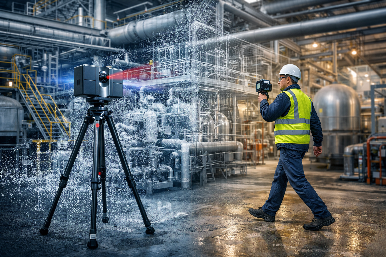
A tripod-based LiDAR scanner captures highly accurate point cloud data from fixed scan positions. This method is ideal when projects require dependable geometry, repeatable measurements, and engineering-grade outputs.
A handheld scanner is typically used to move quickly through a space and capture data on the go. It can be useful for general visualisation, rapid site understanding, and concept-level work, but it is not always the best fit where tight tolerances or fabrication-ready information is required.
Benefits of tripod-based LiDAR scanning
Higher accuracy
Tripod-based LiDAR scanning is better suited to projects where dimensional accuracy matters. This is particularly important for:
plant upgrades
tie-in design
structural modifications
pipework alterations
reverse engineering
fabrication support
Reliable fixed-position data
Because scans are captured from known stationary positions, the data can be registered into a stable point cloud. This gives engineers, designers, and project teams greater confidence in the model and the measurements taken from it.
Better for engineering and design
Where a project needs scan-to-CAD modelling, design development, clash checking, or digital twin support, tripod LiDAR scanning generally provides the more dependable base dataset.
Stronger project governance
Engineering projects need traceable and reviewable information. LiDAR scanning supports this by providing a robust record of existing conditions that can be referenced throughout the project lifecycle.
Benefits of handheld scanning
Faster capture over large areas
Handheld scanning can be useful where speed is more important than precision, or where the objective is to quickly understand a space.
Flexible for walkthrough-style capture
These systems can help capture general layouts, access routes, and broader site context in areas where rapid movement is an advantage.
Useful for concept and visualisation work
For early-stage planning or non-critical site representation, handheld scanning can sometimes provide a suitable outcome.
Which one is right for your project?
If your project involves fabrication, engineering design, plant modification, shutdown planning, or accurate as-built records, tripod-based LiDAR scanning is usually the better choice.
If your priority is speed, general layout capture, or conceptual understanding, handheld scanning may have a role.
In many cases, the best result comes from an engineering-led approach, where the required deliverables drive the capture method.
Why Hamilton By Design?
Hamilton By Design provides engineering-grade 3D laser scanning and reality capture services for industrial, mining, mechanical, and brownfield environments. Our focus is not just on collecting data, but on delivering data that supports real engineering outcomes.
We understand that a point cloud is only valuable if it helps reduce uncertainty, improve design confidence, and support practical decision-making.
Learn more
To explore our broader scanning and engineering services, visit:
If you need accurate site data for design, drafting, reverse engineering, or plant upgrades, Hamilton By Design can help you choose the right scanning approach for your project.
Contact us to discuss your site, deliverables, and required level of detail.
In industrial and mechanical projects, one of the most common — and costly — client concerns is simple:
“I don’t trust the design… and I don’t really know what I’m going to get.”
It usually starts with an existing asset.
Old drawings that don’t match reality
Missing documentation
Modifications made over time
Conflicting information between teams
At that point, every decision becomes a risk.
The Real Problem Isn’t the Design — It’s the Data
Most design issues don’t come from bad engineers.
They come from bad inputs.
If your base information is wrong:
Models won’t fit
Steel won’t align
Pipework clashes on install
Fabrication needs rework
And suddenly, what looked like a solid design becomes a site problem.
What Clients Are Actually Searching For
When clients say they don’t trust the design, they’re usually looking for:
point cloud to CAD conversion services
reverse engineering services
mechanical engineering models
engineering-grade verification
What they really mean is:
“I need to know this will fit before I spend money building it.”
Step 1: Capture Reality — Not Assumptions
The first step is removing uncertainty completely.
Using engineering-grade LiDAR scanning, you capture the real-world geometry of your asset — not what the drawings say, but what actually exists on site.
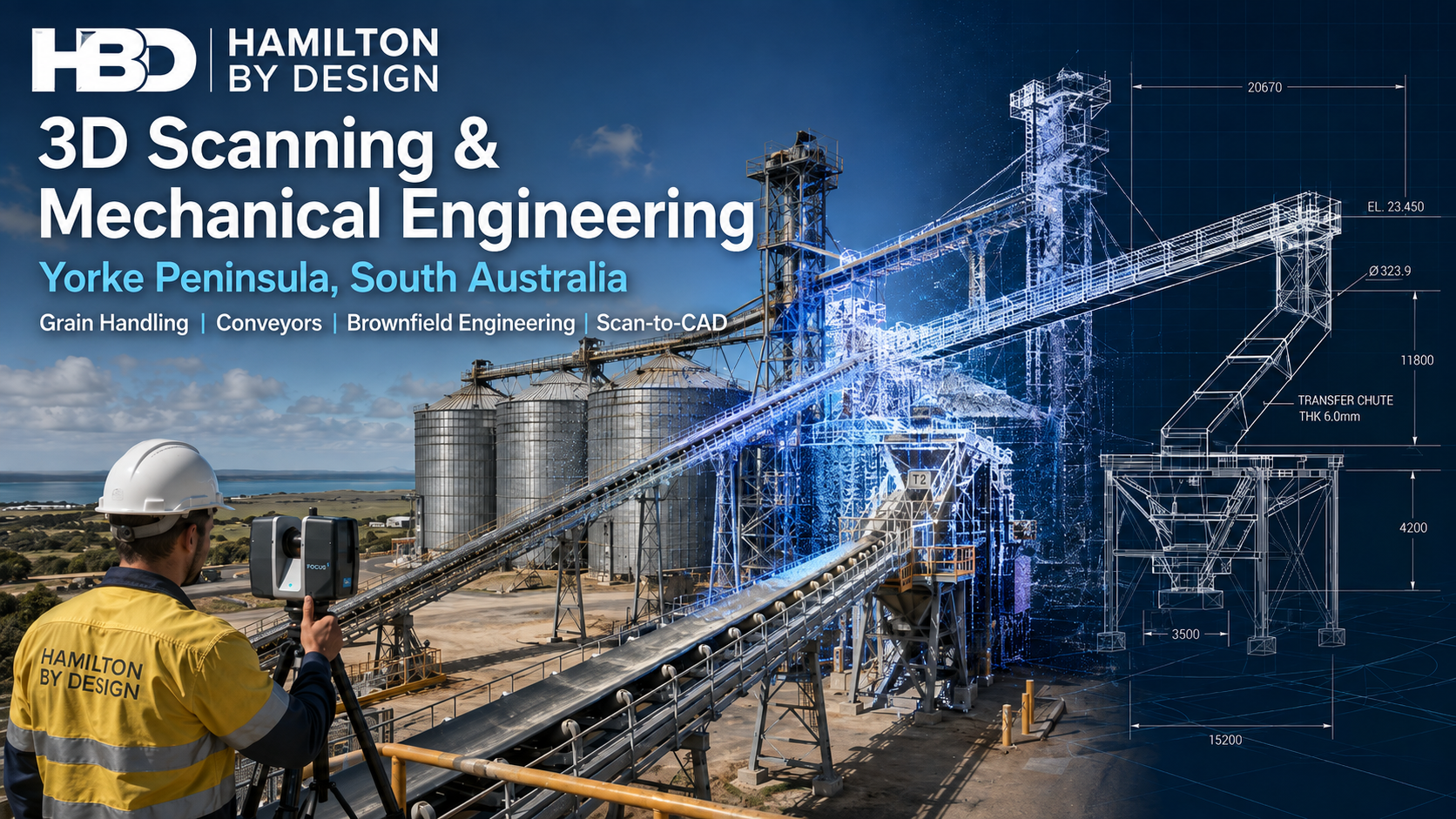
The Yorke Peninsula is an important regional area of South Australia, supporting agriculture, grain handling, bulk storage, transport infrastructure, manufacturing, maintenance activities and a wide range of regional businesses. When existing facilities require modification, replacement equipment, additional structures or improved documentation, one of the biggest challenges is often understanding exactly what is already installed.
Hamilton By Design provides 3D scanning, mechanical engineering, CAD modelling and drafting services across the Yorke Peninsula and regional South Australia, helping project teams capture existing conditions and convert that information into practical engineering deliverables.
Our approach combines site-based reality capture with engineering and design. Rather than treating scanning as an isolated surveying activity, the captured information can become the starting point for plant modifications, equipment replacement, fabrication, structural detailing, reverse engineering and brownfield project development.
For projects requiring accurate existing-condition information, our broader 3D LiDAR scanning services in Adelaide and South Australia support industrial, infrastructure, manufacturing and regional engineering projects throughout the state.
Engineering Support for Existing Yorke Peninsula Facilities
Regional facilities often develop progressively over many years. Equipment may have been replaced, conveyors extended, platforms modified, pipework rerouted or structural steel added without every change being accurately reflected in the original drawings.
This creates a problem when another modification is required.
A drawing may show what was originally designed, but not necessarily what exists today.
For brownfield engineering projects, Hamilton By Design uses engineering-grade 3D laser scanning to capture existing structures, mechanical equipment, access systems and surrounding infrastructure before detailed design begins.
The resulting point cloud provides a three-dimensional record of the site that can be reviewed and measured after the fieldwork has been completed.
This can reduce the need for repeated site visits and allows designers to work with existing geometry rather than assumptions.
What Can Be Captured Using 3D LiDAR Scanning?
3D scanning can be applied to individual pieces of equipment or large sections of an industrial facility.
Typical Yorke Peninsula applications may include:
grain handling equipment
conveyors and conveyor galleries
transfer stations
chutes and hoppers
silos and storage structures
structural steel
platforms, stairs and handrails
machinery and equipment
pipework and service routes
equipment foundations
building interiors
plant rooms
access areas
existing fabrication
equipment interfaces.
For engineering projects, accurate capture of the surrounding area can be just as important as capturing the equipment being replaced.
Our 3D laser scanning for engineering projects workflow provides engineers and designers with a digital representation of existing plant and structures that can then be used as the basis for engineering development.
This is particularly useful when a new component has to fit between existing structures, connect to established equipment or be installed during a limited shutdown period.
Grain Handling and Bulk Materials Engineering
Grain and bulk-material facilities present their own engineering challenges.
Conveyors, chutes, hoppers, transfer points and supporting structures operate as connected systems. A modification made to one part of the plant can affect material flow, maintenance access, clearances and the performance of equipment further downstream.
Hamilton By Design’s experience with bulk material handling systems can support projects where existing equipment needs to be modified, replaced or integrated with new plant.
While individual industries and materials differ, many of the engineering principles remain similar.
The objective is not simply to produce a CAD model. It is to understand how the equipment fits into the complete operating environment.
3D scanning can help establish:
existing conveyor positions
belt centre lines
chute geometry
support locations
surrounding structural steel
head and tail pulley arrangements
maintenance clearances
access requirements
equipment interfaces
available installation space.
Having this information available during design can significantly improve the coordination of modifications.
Conveyor, Chute and Transfer Station Projects
Transfer points can become maintenance-intensive areas when material flow, equipment geometry or operating conditions are not properly considered.
Excessive wear, spillage, dust, blockages and difficult maintenance access can all create operational problems.
Hamilton By Design provides engineering and design support for conveyor transfer chute design, including projects where existing structures and equipment need to be captured before new components can be developed.
For a Yorke Peninsula brownfield project, the process may begin by scanning the conveyor, chute, support structure and surrounding area.
The point cloud can then be imported into the engineering environment, allowing proposed equipment to be positioned relative to the actual plant.
This approach is particularly valuable where site access is difficult or where measuring individual components manually would require numerous dimensions to be recorded.
Scan-to-CAD for Brownfield Engineering
Capturing a point cloud is only the first stage.
The information can then be converted into engineering geometry suitable for design, documentation and coordination.
Depending on the project, Hamilton By Design can develop:
3D CAD models
existing-condition models
general arrangement drawings
sections and elevations
mechanical layouts
structural layouts
fabrication drawings
equipment models
interface geometry
installation concepts.
This allows the physical site to become part of the CAD design environment.
New equipment can be modelled around existing structures, and potential interference can be investigated before fabrication or installation.
For brownfield work, this creates an important connection between site capture and engineering design.
Reverse Engineering Existing Equipment
Regional facilities can contain machinery that has been operating for many years.
In some cases, original manufacturing drawings may no longer be available. Equipment may also have been repaired, modified or altered during its operating life.
When components require replacement, scanning can provide an effective starting point.
Hamilton By Design’s reverse engineering using 3D scanning workflow uses captured geometry together with engineering assessment, CAD modelling and dimensional verification.
Applications may include:
replacement components
obsolete machinery
worn equipment
guards and covers
fabricated structures
chutes and hoppers
equipment interfaces
legacy plant.
Importantly, reverse engineering does not necessarily mean blindly copying an existing component.
The existing geometry provides information about what fits the plant, while engineering review can consider whether the replacement can be improved for manufacture, installation, maintenance or service life.
Digital Verification and Quality Assurance
3D scanning can also be useful after fabrication or installation.
A scan of installed equipment can be compared with the design model to identify potential differences and confirm important geometry.
Hamilton By Design’s 3D LiDAR digital quality assurance services can assist project teams with dimensional verification and existing-condition documentation.
This may be useful where a project requires confidence that equipment, structures or interfaces have been installed as expected before the next stage of work proceeds.
For regional projects, having a permanent digital record can also reduce uncertainty during future modifications.
Supporting Shutdowns and Plant Upgrades
Shutdown projects often provide only a limited period in which existing equipment can be removed and replacement components installed.
Discovering an unexpected obstruction after fabrication has begun can create significant problems.
Capturing the existing plant before detailed design allows the project team to investigate many potential fit-up issues earlier.
The scanned environment can assist with:
checking equipment clearances
planning replacement components
developing installation concepts
identifying surrounding obstructions
reviewing access
coordinating structural and mechanical work
developing fabrication drawings.
This does not remove every risk associated with brownfield work, but it provides significantly more information than relying solely on old drawings and isolated manual dimensions.
Mechanical Engineering and Drafting From the Same Digital Dataset
A major advantage of engineering-led scanning is that the data does not have to stop at the point-cloud stage.
Hamilton By Design can use the captured information as part of a broader engineering workflow incorporating mechanical design, CAD modelling, drafting and fabrication documentation.
Our national 3D laser scanning services support projects where accurate site capture needs to connect directly with subsequent engineering work.
Depending on project requirements, deliverables can include registered point clouds, CAD models, drawings and engineering information suitable for continued project development.
This integrated approach is particularly useful for smaller and regional projects where having multiple companies separately responsible for site measurement, modelling and drafting can create unnecessary handover points.
3D Scanning Across the Yorke Peninsula
Hamilton By Design can support projects across the Yorke Peninsula and surrounding regional areas.
Projects do not necessarily need to involve an entire facility.
A scanning assignment may involve one conveyor transfer, an individual piece of machinery, a structural modification or a small area where accurate measurements are required.
For larger projects, scanning can be expanded to capture an entire working area and provide project teams with a broader existing-condition dataset.
The appropriate scope depends on what the client needs to design, modify, replace or document.
Why Use 3D Scanning Before Starting a Brownfield Design?
The greatest benefit is simple: designing around what actually exists.
Brownfield projects frequently involve compromises imposed by existing structures, equipment, access and operating requirements.
A point cloud provides engineers and designers with significantly more spatial information than a collection of individual measurements.
That can assist project teams in making better-informed decisions earlier in the project and can help reduce the risk of discovering dimensional problems during fabrication or installation.
For Yorke Peninsula businesses planning plant upgrades, equipment replacements or facility modifications, the objective is not simply to create a sophisticated 3D image.
The objective is to turn accurate existing-condition information into practical engineering decisions and buildable outcomes.
Frequently Asked Questions
What is 3D LiDAR scanning?
3D LiDAR scanning uses a laser scanner to capture large numbers of spatial measurement points around an existing environment. These measurements form a three-dimensional point cloud representing the geometry of the captured plant, structure or building.
Can you provide 3D scanning services on the Yorke Peninsula?
Yes. Hamilton By Design supports regional projects and can provide engineering-led 3D scanning, CAD modelling and drafting for suitable projects across the Yorke Peninsula and South Australia.
Can you scan grain handling equipment?
Yes. Depending on access and project requirements, equipment such as conveyors, chutes, transfer points, structural steel, platforms, silos and surrounding plant can be captured.
Can the scan data be converted into CAD?
Yes. Point-cloud information can be used to develop CAD geometry, general arrangement drawings, sections, equipment layouts and other engineering documentation depending on project requirements.
Is 3D scanning useful for conveyor modifications?
Yes. Scanning can capture the conveyor, support structure, transfer equipment and surrounding geometry, allowing proposed modifications to be developed relative to actual site conditions.
Can 3D scanning help with reverse engineering?
Yes. Existing equipment can be scanned and used as the basis for CAD modelling and engineering review where original drawings are unavailable, unreliable or no longer representative of the installed asset.
Is scanning suitable for shutdown projects?
Yes. Capturing existing conditions before a shutdown can help engineers investigate equipment fit-up, access, interfaces and potential clashes before fabricated components arrive on site.
What project deliverables can Hamilton By Design provide?
Depending on the agreed scope, deliverables may include registered point-cloud information, 3D CAD models, general arrangement drawings, sections, elevations, fabrication information and other engineering documentation.
Do you only undertake large scanning projects?
No. 3D scanning can be appropriate for anything from an individual component or transfer station through to large sections of an industrial facility. The scanning scope should be based on the information required for the engineering task.
Why combine 3D scanning with mechanical engineering?
Combining scanning with engineering allows the captured site information to become part of the design process. Instead of producing a point cloud and handing it over without engineering context, the information can be used to develop modifications, models and drawings around verified existing conditions.
Engineering-Led 3D Scanning for Yorke Peninsula Projects
For Yorke Peninsula businesses planning equipment upgrades, conveyor modifications, grain-handling improvements, structural changes, reverse engineering or brownfield plant work, accurate information at the beginning of the project can make a significant difference.
Hamilton By Design provides a connected workflow from 3D LiDAR site capture through to CAD modelling, mechanical engineering and drafting, helping regional project teams understand existing conditions and develop solutions that are designed around the plant that is actually there.
Whether the requirement involves one difficult-to-measure component or a larger industrial facility, 3D scanning provides a practical digital foundation for better-informed engineering and project development.
If you’re operating on the Yorke Peninsula and require:
Mechanical engineering support
3D LiDAR scanning
Mechanical or structural drafting
contact Hamilton By Design to discuss how we can support your next project.
🏷️ Labels
yorke peninsula engineering, 3d scanning south australia, lidar scanning australia, mechanical engineering services australia, point cloud to cad, grain handling engineering, conveyor design australia, regional engineering support
🔍 Search Description
Mechanical engineering, 3D LiDAR scanning, and drafting services for the Yorke Peninsula, South Australia. Supporting regional industry with accurate reality capture and practical design solutions.
Explore additional Hamilton By Design resources covering 3D LiDAR scanning,
mechanical engineering, Scan-to-CAD, reverse engineering, conveyors,
materials handling and brownfield industrial projects across South Australia
and regional Australia.
Engineering-grade LiDAR reality capture, point-cloud processing,
Scan-to-CAD and as-built documentation for industrial and infrastructure
projects throughout Adelaide and South Australia.
Engineer-led mechanical engineering support for South Australian
industrial, manufacturing and brownfield projects where constructability
and accurate existing-condition information matter.
Regional South Australian 3D scanning for ports, processing facilities,
conveyors, structural steel, pipework and space-constrained industrial
environments.
Engineering-focused terrestrial LiDAR scanning for brownfield,
industrial, mining and infrastructure projects across metropolitan,
regional and remote Australia.
Hamilton By Design’s core engineering-grade 3D laser scanning capability
for industrial facilities, processing plants, infrastructure and complex
existing assets.
Use accurate scan data to recreate worn, modified or undocumented
equipment and develop practical CAD models and drawings for replacement
and fabrication.
See how registered LiDAR point clouds can progress from site capture
through CAD modelling and engineering development for plant upgrades
and brownfield projects.
Understand the differences between point-cloud data and mesh files and
why engineering projects often require more than a visual representation
of existing plant.
Mechanical engineering support for conveyors, transfer stations,
hoppers, chutes and associated structural steel used throughout
bulk-material-handling facilities.
Use high-accuracy LiDAR scanning for dimensional verification,
installation checking, existing-condition documentation and digital QA
across industrial projects.
Convert point clouds, drawings, sketches and existing site information
into practical mechanical and industrial CAD models for design,
fabrication and plant modification.
Mechanical drafting and engineering documentation for plant upgrades,
fabrication, maintenance projects and brownfield modifications across
industrial facilities.
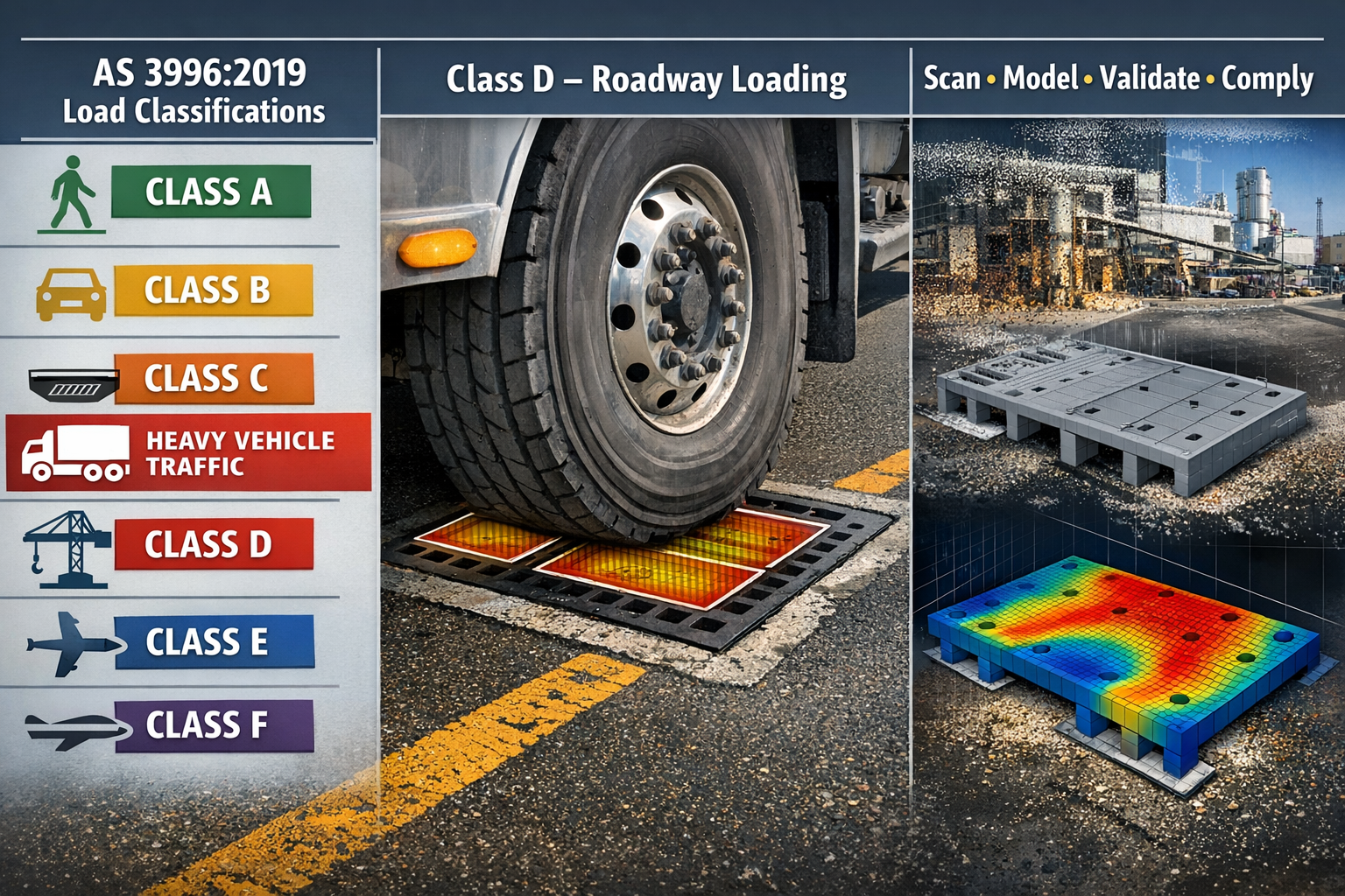
When designing access covers and grates for roads, industrial facilities, and infrastructure projects, compliance with AS 3996:2019 is critical.
At Hamilton By Design, we provide engineering-led design, validation, and documentation to ensure access covers and grate systems meet real-world loading conditions—not just theoretical requirements.
We combine:
3D laser scanning (LiDAR)
Mechanical and structural engineering
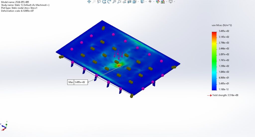
Finite Element Analysis (FEA)
Fabrication-ready drafting
to deliver compliant, buildable, and reliable solutions.
What is AS 3996 and Why It Matters
AS 3996 defines the requirements for:
Access covers (manholes)
Drainage grates
Frames and supporting structures
It ensures these systems can safely withstand loads from:
Pedestrians
Passenger vehicles
Heavy trucks
Industrial and extreme loading conditions
Failure to properly design to AS 3996 can result in:
Structural failure
Safety risks
Non-compliance with approvals
Costly rework
AS 3996 Load Classifications Explained
Class A – Pedestrian Areas
Footpaths, parks, landscaped areas
Light-duty applications
Class B – Light Vehicles
Car parks and low-speed traffic zones
Class C – Road Edges & Gutters
Kerbside and non-primary load zones
Class D – Roadways (Most Common)
Public roads and industrial access roads
Designed for heavy vehicle traffic
Class E – Heavy Industrial
Freight terminals, ports, and logistics hubs
Class F – Extreme Loads
Airports and specialised heavy load zones
Class D Design – The Industry Standard
Most infrastructure projects require Class D compliance, covering:
B-double and heavy vehicle traffic
Waste collection vehicles
Construction and service vehicles
Engineering Considerations for Class D
Tyre load distribution (dual tyres, contact patches)
Plate thickness and stiffness
Support frame design
Fatigue under repeated loading
Localised stress concentrations
Designing to Class D is not just about selecting a rating—it requires engineering validation.
Our Engineering Approach (What Sets Us Apart)
1. Capture Existing Conditions (Critical Step)
In brownfield environments, assumptions are risky.
We use engineering-grade 3D laser scanning to:
Capture exact pit and frame geometry
Identify misalignment or deformation
Reduce design risk before fabrication
👉 Capture first. Design second.
2. Design to Suit Real Conditions
We don’t force standard products into non-standard environments.
If an environment is uncomfortable, poorly lit, or outdated — people will choose to work from home.
But when a workplace is well-designed, functional, and comfortable:
People actually want to be there.
One of the most overlooked factors in this shift is lighting design.
Lighting Directly Impacts Performance
Lighting is not just about visibility — it directly impacts how people feel and perform.
Poor lighting can lead to:
Eye strain
Fatigue
Reduced concentration
Increased safety risks
Whereas well-designed lighting delivers:
Consistent illumination
Reduced glare
Improved visibility of screens and equipment
A more comfortable and professional environment
Engineering the Outcome with AGi32
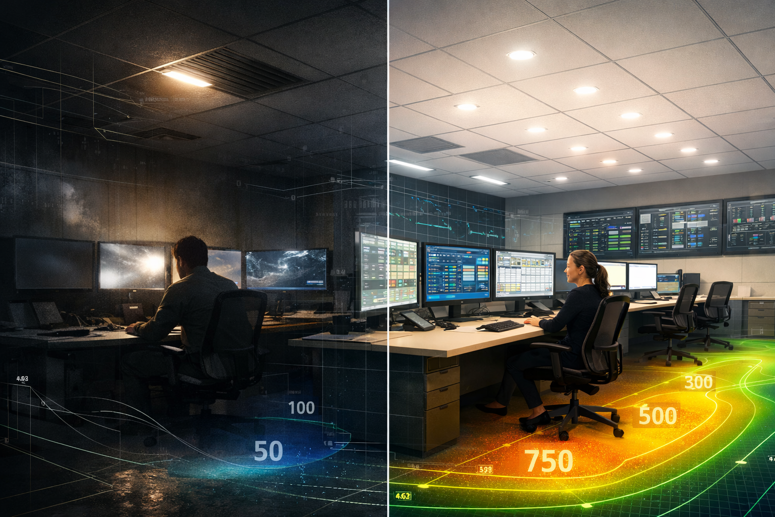
At Hamilton By Design, we support lighting designers using AGi32 to simulate and validate lighting performance before installation.
This allows us to:
Predict light levels across the entire space
Identify dark zones and over-lit areas
Optimise fixture placement
Validate compliance with lighting standards
👉 Instead of guessing — we engineer the outcome.
Real-World Application: Control Room Upgrade
In a recent Brisbane project, we developed a 3D AutoCAD model from LiDAR scan data to support lighting design in AGi32 .
The objective was not just compliance — but improving the working environment inside a live operational space.
This included:
Accurate modelling of walls, desks, and equipment
Providing a clean, lightweight model for simulation
Supporting lighting redesign based on how the space is actually used today
This workflow typically starts with engineering-grade 3D laser scanning, ensuring the environment is captured accurately before any design work begins.
Designing for How People Work Today
Many facilities haven’t changed structurally — but the way people use them has.
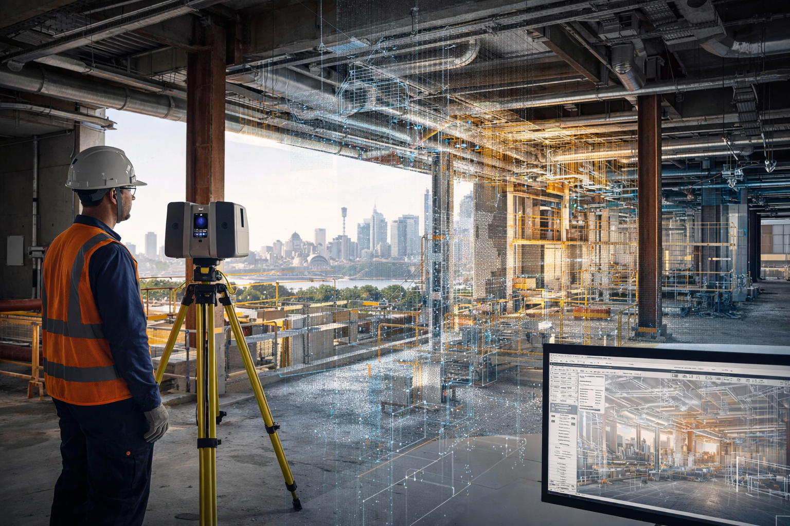
3D laser scanning is being used across Sydney projects to capture accurate existing conditions before design, construction, upgrades, and maintenance work begins. In construction and industrial environments, this technology helps reduce guesswork by providing a reliable digital record of what is actually on site.
For project teams working in live buildings, industrial plants, infrastructure corridors, and brownfield environments, 3D laser scanning can support safer planning, faster design development, and more accurate engineering decisions.
Why 3D Laser Scanning Matters
Many Sydney projects take place in environments where existing information is incomplete, outdated, or missing altogether. Legacy drawings may not reflect years of modifications, and manual site measurements often miss the detail needed for confident design and drafting.
3D laser scanning helps solve that problem by capturing large areas quickly and turning real site conditions into digital information that can be reviewed, measured, modelled, and referenced during project delivery.
This is especially useful where:
access is difficult
shutdown windows are short
geometry is complex
services are congested
existing drawings are unreliable
rework risk needs to be reduced
How 3D Laser Scanning is Used in Sydney Construction Projects
In construction, 3D laser scanning is commonly used to capture existing buildings, structures, and services before new work begins. This helps design teams understand the actual site condition rather than relying only on old plans or assumptions.
Typical construction uses include:
existing building surveys
façade and structural capture
service coordination
refurbishment and fitout planning
steelwork measurement
as-built verification
clash checking before installation
scanning of plant rooms, roof spaces, basements, and service risers
For Sydney construction projects, this can be particularly valuable in older buildings, confined plant areas, and staged redevelopment works where accuracy matters.
How 3D Laser Scanning is Used in Industrial Projects
3D laser scanning is also widely used in industrial and engineering projects across Sydney. This includes manufacturing facilities, processing plants, utilities infrastructure, materials handling systems, and brownfield upgrade works.
Common industrial applications include:
capturing conveyors, chutes, tanks, pipework, and steel structures
documenting existing plant before modifications
scan-to-CAD modelling
drafting support for upgrades and shutdowns
tie-in planning for new equipment
layout verification before fabrication
structural and mechanical design support
point cloud capture for engineering review
For industrial sites, one of the biggest advantages is being able to capture the true geometry of operating plant areas before mechanical or structural work begins.
Use in Brownfield and Upgrade Projects
Brownfield projects often involve uncertainty. Existing assets may have changed over time, undocumented modifications may exist, and available drawings may not reflect current conditions.
In these cases, 3D laser scanning helps teams capture a reliable baseline before design starts. That information can then be used for:
design development
as-built documentation
drafting updates
interference checks
equipment replacement planning
shutdown preparation
fabrication support
This is one of the main reasons laser scanning continues to grow as a practical tool across Sydney engineering and construction work.
Supporting Better Design and Drafting
Laser scanning does not replace engineering or drafting, but it gives those services a much stronger starting point.
Once the site is scanned, the information can be used to support:
2D drafting
3D CAD modelling
engineering layouts
concept development
fabrication drawings
plant modification design
digital coordination between disciplines
This improves confidence in the next stage of the project and can reduce costly errors caused by poor site information.
Industries Using 3D Laser Scanning in Sydney
3D laser scanning is now used across a wide range of Sydney industries, including:
construction
commercial buildings
manufacturing
utilities
mining support facilities
ports and bulk materials handling
infrastructure
industrial processing
plant maintenance and shutdown work
The value is not limited to one sector. Wherever site accuracy is important, scanning can improve project visibility and reduce risk.
Why Sydney Projects Benefit from 3D Laser Scanning
Sydney projects often involve busy sites, limited access, complex existing infrastructure, and tight project windows. In these conditions, accurate site capture can save time and improve decision-making across the full project lifecycle.
Benefits can include:
better visibility of existing conditions
reduced reliance on outdated drawings
improved coordination between disciplines
fewer surprises during fabrication or installation
stronger support for engineering and drafting workflows
better preparation for upgrades and shutdowns
From Site Capture to Engineering Use
The real value of 3D laser scanning is not just in collecting data. It is in how that data is used.
When integrated into drafting, modelling, and engineering workflows, scanning becomes a practical project tool. It helps bridge the gap between what is on site and what needs to be designed, checked, fabricated, or installed.
For businesses working on Sydney-based construction and industrial projects, this can support better outcomes from the earliest planning stages through to delivery.
Related Service
To learn more about engineering-grade scanning support, visit our pillar page:
3D laser scanning is being used across Sydney projects to improve accuracy, support better planning, and reduce project risk. From construction and building upgrades to industrial plant modifications and engineering design, it provides a reliable way to capture real site conditions before important decisions are made.
As more projects move toward digital engineering and better site verification, 3D laser scanning is becoming an increasingly valuable part of the workflow.
Related Sydney Services
Hamilton By Design provides engineering-led 3D scanning, LiDAR scanning, mechanical engineering and digital engineering services throughout Sydney and Greater Sydney.
Explore our related Sydney services:
3D Scanning Sydney – Engineering-grade terrestrial laser scanning, as-built surveys and point cloud capture for industrial, infrastructure and commercial projects.
Reality Capture Sydney – High-accuracy reality capture, digital twins, asset documentation and engineering-grade site verification.
Scan to CAD Sydney – Convert point cloud data into AutoCAD, SolidWorks, Inventor and other engineering-ready CAD deliverables.
Point Cloud Modelling Sydney– Engineering-grade point cloud processing, clash detection, as-built verification and 3D modelling.
Mechanical Engineering Sydney – Mechanical design, plant upgrades, materials handling systems, conveyors, chutes, platforms and engineering support.
Structural Drafting Sydney– Structural steel drafting, fabrication drawings, GA drawings, workshop detailing and as-built documentation.
Hamilton By Design supports projects throughout Sydney CBD, Parramatta, Liverpool, Penrith, Blacktown, Chatswood, Alexandria, Mascot, Newcastle and the Central Coast.
To provide the best experiences, we use technologies like cookies to store and/or access device information. Consenting to these technologies will allow us to process data such as browsing behaviour or unique IDs on this site. Not consenting or withdrawing consent, may adversely affect certain features and functions.
Functional
Always active
The technical storage or access is strictly necessary for the legitimate purpose of enabling the use of a specific service explicitly requested by the subscriber or user, or for the sole purpose of carrying out the transmission of a communication over an electronic communications network.
Preferences
The technical storage or access is necessary for the legitimate purpose of storing preferences that are not requested by the subscriber or user.
Statistics
The technical storage or access that is used exclusively for statistical purposes.The technical storage or access that is used exclusively for anonymous statistical purposes. Without a subpoena, voluntary compliance on the part of your Internet Service Provider, or additional records from a third party, information stored or retrieved for this purpose alone cannot usually be used to identify you.
Marketing
The technical storage or access is required to create user profiles to send advertising, or to track the user on a website or across several websites for similar marketing purposes.