Scan to BIM Services for Industrial and Engineering Projects

Hamilton By Design provides engineering-led Scan to BIM services, combining accurate 3D laser scanning, point-cloud processing and BIM modelling to document existing buildings, industrial plants, infrastructure and engineering assets.
Our services help engineers, asset owners, architects, contractors, fabricators and project managers work from reliable existing-condition information rather than relying solely on outdated drawings, incomplete asset records or manual site measurements.
From the initial site survey through to the completed digital model, Hamilton By Design can provide an integrated workflow covering:
- 3D laser scanning
- LiDAR reality capture
- Point-cloud registration and processing
- Existing-condition surveys
- Scan to CAD conversion
- Scan to BIM modelling services
- Mechanical and structural modelling
- As-built verification
- Design coordination
- Engineering documentation
- Asset information development
Our practical industrial and engineering experience allows us to capture and model complicated environments where access, safety, accuracy and constructability are critical.
What Are Scan to BIM Services?
Scan to BIM is the process of capturing an existing building, facility or industrial asset using terrestrial LiDAR or 3D laser scanning and converting the resulting point cloud into a structured Building Information Model.
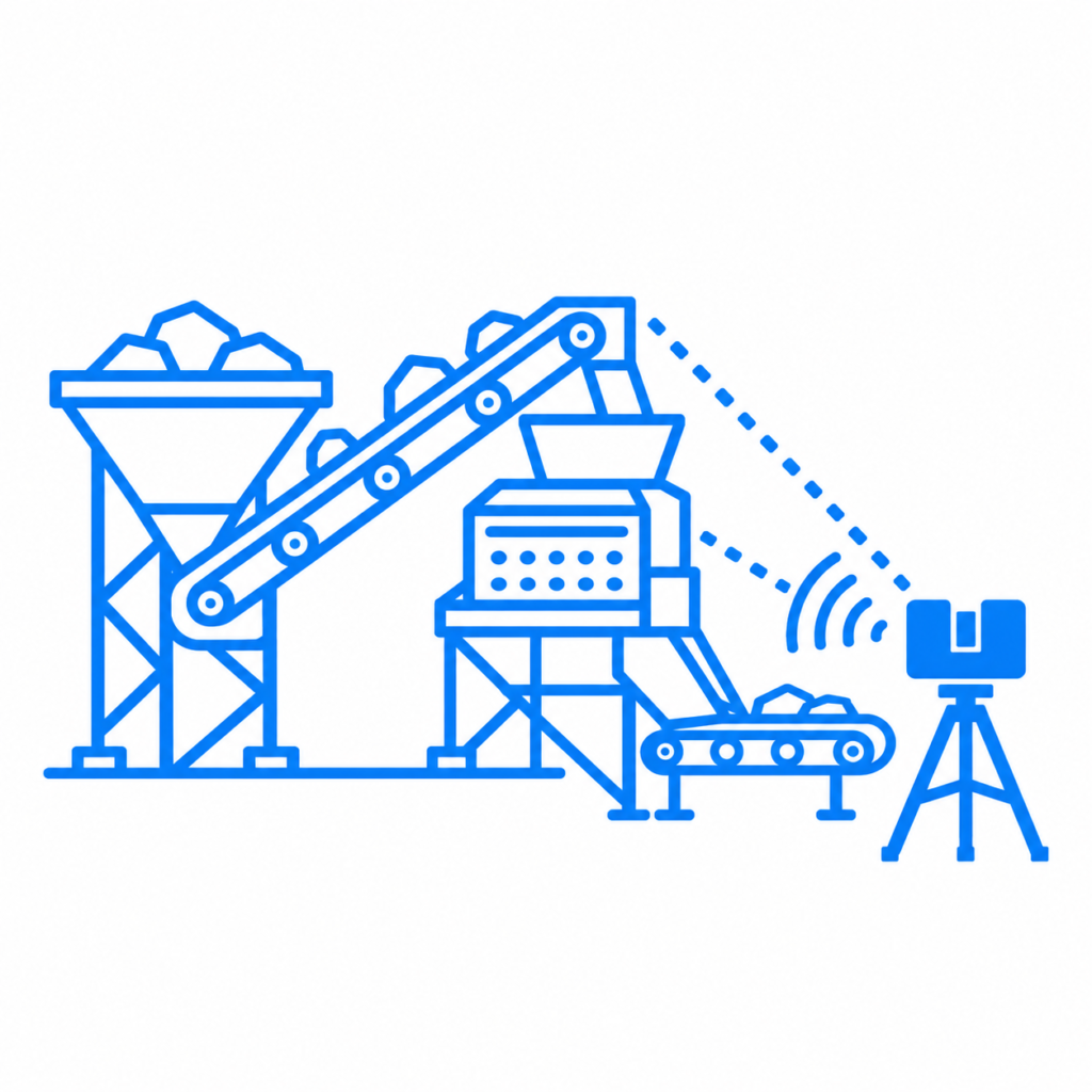
A laser scanner records millions of measurable points across the surfaces visible from each scanning position. These individual scans are registered together to produce a coordinated three-dimensional point cloud representing the existing site.
The point cloud can then be used to develop an appropriate digital model containing architectural, structural, mechanical or building-services elements.
Depending on the requirements of the project, the completed BIM model may include:
- Building structures and architectural elements
- Structural steel framing
- Platforms, stairs and access structures
- Industrial equipment
- Conveyors, chutes and transfer stations
- Tanks, vessels and pump systems
- Pipework and ductwork
- Plant rooms and service routes
- Electrical and mechanical equipment locations
- Existing penetrations and connection points
- Access restrictions and physical obstructions
The required model content, accuracy and level of detail should be established before modelling begins. This helps ensure that the final model is suitable for its intended engineering, construction, coordination or asset-management purpose.
Hamilton By Design provides Scan to BIM services across Australia for industrial, infrastructure, commercial and engineering projects requiring accurate existing-condition information.
Engineering-Led 3D Laser Scanning
Our 3D laser scanning services are delivered with an understanding of how the captured information will be used during design, fabrication, installation and maintenance.
A visually impressive point cloud is not enough. The scanning plan must capture the interfaces that matter to the project.
These interfaces may include:
- Equipment mounting points
- Structural connections
- Pipe and duct routes
- Flange locations and orientations
- Existing steel members
- Floor and platform levels
- Clearances around machinery
- Fabrication interfaces
- Potential installation paths
- Areas where clashes could occur
Scanning from multiple coordinated positions reduces shadows and improves coverage around complicated geometry. The resulting registered point cloud can then be reviewed before modelling begins.
This approach is particularly valuable for brownfield projects, where the existing installation may no longer match the original drawings.
Professional 3D Laser Scanning Services
Professional 3D laser scanning services provide a faster and more comprehensive method of documenting complicated facilities than relying solely on tape measures, photographs and manually recorded dimensions.
Laser scanning can support:
- Existing-condition documentation
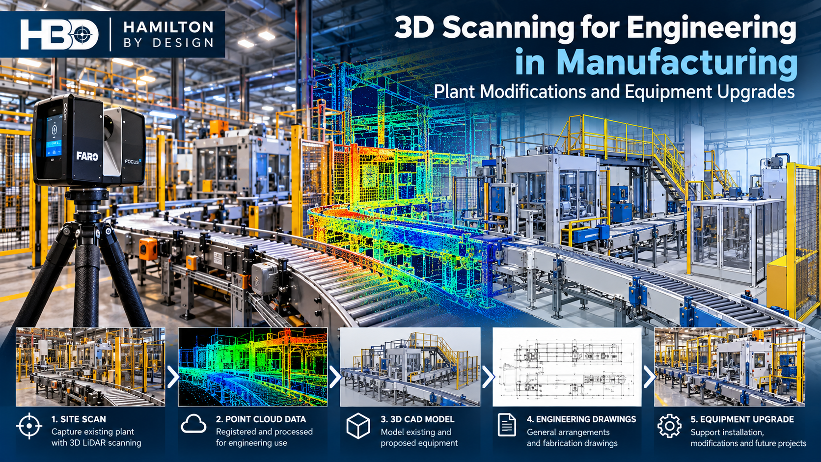
- Brownfield plant upgrades
- Equipment replacement
- Structural modifications
- Shutdown planning
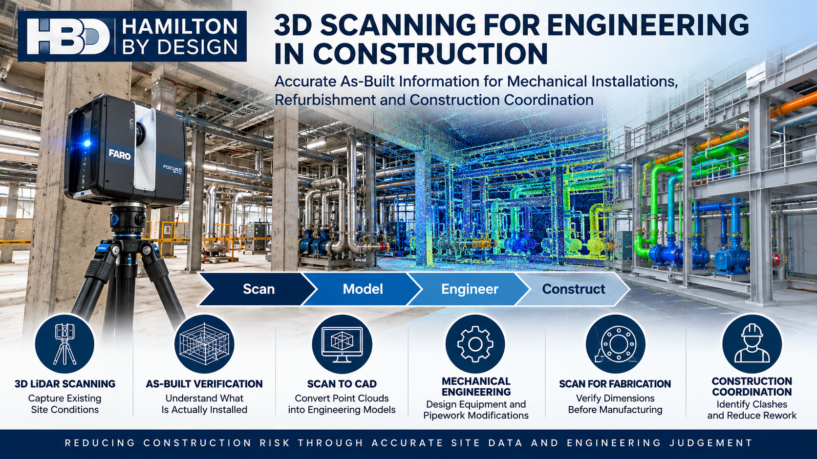
- Construction coordination
- Fabrication verification
- Clash detection
- Reverse engineering
- Asset-management projects
- Refurbishment and redevelopment
- Digital engineering workflows
The scanner captures surrounding geometry rather than only the dimensions initially identified during the site visit. This provides a more complete digital record that can be reviewed after the survey and may reduce the need for repeated site measurements.
However, appropriate planning remains important. Areas hidden behind equipment, insulation, cladding or other obstructions cannot automatically be captured. Critical interfaces should therefore be identified during the planning stage so that suitable scanner positions can be selected.
Industrial 3D Scanning Service
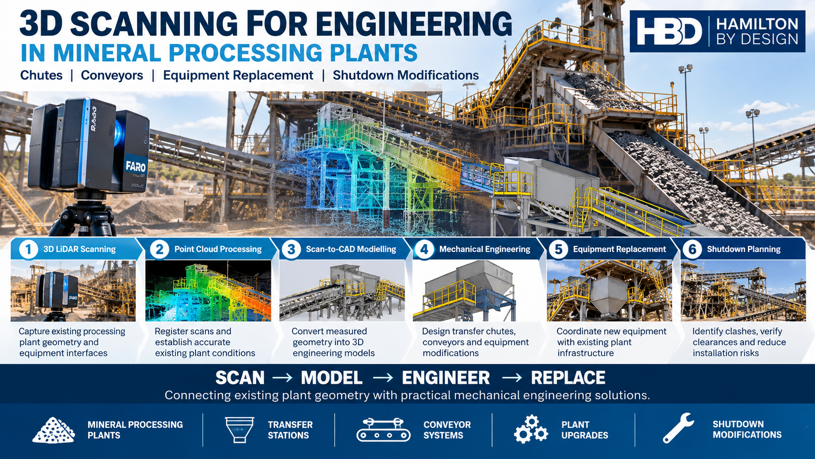
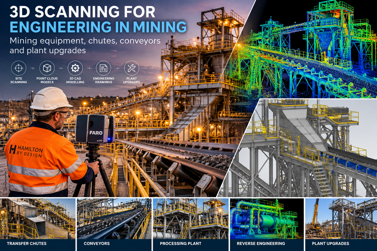
Hamilton By Design provides an industrial 3D scanning service for mining, manufacturing, processing, materials-handling, utilities and infrastructure environments throughout Australia.
Industrial sites present different challenges from conventional building surveys. They often contain congested equipment, restricted access, elevated structures, moving machinery, reflective surfaces and complicated interconnecting services.
Our industrial 3D scanning services can be used to capture:
- Processing plants
- Manufacturing facilities
- Conveyor systems
- Transfer stations
- Chutes and hoppers
- Pump stations
- Tanks and vessels
- Pipe racks
- Structural steel
- Platforms and walkways
- Plant rooms
- Workshops and warehouses
- Ports and terminals
- Water and wastewater infrastructure
- Mining and mineral-processing facilities
The captured data can support mechanical engineering, structural modifications, replacement-equipment design, fabrication detailing, site coordination and future maintenance planning.
Because Hamilton By Design combines reality capture with engineering and drafting capability, the point cloud can be developed into practical project deliverables rather than being supplied only as raw scanning data.
Scan to BIM Modelling Services
Our Scan to BIM modelling services convert registered point-cloud information into usable digital models that reflect the existing asset.

The modelling scope can be adjusted to suit the intended project outcome.
For example, a building-services coordination project may require walls, floors, columns, ceilings, ducts, pipes and major equipment. An industrial modification project may instead require detailed modelling around structural steel, mechanical equipment and fabrication interfaces.
Not every visible object needs to be modelled. Creating unnecessary geometry increases cost, model size and processing requirements without necessarily improving the project outcome.
Before beginning the modelling process, we work with the client to establish:
- The intended use of the model
- The required project coordinate system
- Areas to be included
- Critical interfaces
- Required model accuracy
- Required level of information
- Appropriate level of detail
- File formats and software requirements
- Naming and information-management requirements
- Quality-assurance and verification procedures
This purpose-driven approach helps ensure that the model is detailed where accuracy matters without adding unnecessary information.
Our Scan to BIM Workflow
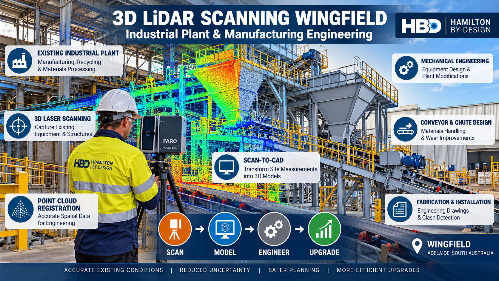
1. Define the Project Requirements
The first step is to understand how the scan data and BIM model will be used.
The scope should identify the survey area, critical interfaces, accuracy expectations, modelling content and final deliverables.
For industrial projects, it is also important to identify operational restrictions, site-access requirements, shutdown periods and areas containing moving equipment.
2. Plan the Site Survey
Scanner positions are planned around physical access, line of sight, safety requirements and the complexity of the facility.
Additional scan positions may be required around congested machinery, structural connections, pipework and building services.
Where project coordinates or survey control are required, these requirements should be identified before scanning begins.
3. Complete the 3D Laser Scanning
The project area is captured using terrestrial LiDAR scanning equipment.
Site photographs, reference dimensions, survey control or additional field information may also be collected where required.
Scanning can be completed across individual rooms, buildings, industrial equipment, process areas or complete facilities.
4. Register and Process the Point Cloud
Individual scans are aligned into a coordinated point-cloud dataset.
The registration is reviewed, unnecessary information can be removed, and the completed dataset is prepared for modelling or engineering use.
The registered point cloud may also be issued as a standalone project deliverable.
5. Develop the BIM Model
The required architectural, structural, mechanical or building-services elements are modelled from the point cloud.
Model development is focused on the elements and interfaces relevant to the project requirements.
The project may require a complete BIM model or a more targeted model covering only the areas affected by the proposed work.
6. Verify the Model
The completed model is checked against the registered point cloud to identify departures from the captured geometry.
Critical dimensions, connection points and fabrication interfaces can receive additional attention during this stage.
Model verification helps establish confidence that the digital information represents the captured site conditions.
7. Issue the Deliverables
Depending on the project, deliverables may include:
- Registered point clouds
- E57 files
- RCP or RCS files
- LAS files
- BIM models
- Revit models
- Navisworks coordination files
- SolidWorks or Inventor models
- STEP, SAT or Parasolid files
- AutoCAD drawings
- General arrangement drawings
- Sections and elevations
- As-built documentation
- Clash-detection reports
- Equipment and asset layouts
Benefits of Scan to BIM Services
More Reliable Existing-Condition Information
Scan to BIM provides a measurable digital record of the existing asset, reducing dependence on drawings that may no longer reflect site conditions.
Reduced Design Assumptions
Engineering and design teams can review actual geometry before developing new equipment, structures or services.
This can be particularly important where new components must connect to existing steelwork, pipework, ducting or mechanical equipment.
Improved Project Coordination
A coordinated digital model allows architectural, structural, mechanical and building-services teams to review the same existing-condition information.
Proposed designs can be incorporated into the model and reviewed against the captured site conditions.
Lower Rework Risk
Potential clashes, restricted clearances and access problems can be identified before fabrication or site installation begins.
Identifying these issues during the design stage can reduce costly changes during construction or shutdown work.
Better Shutdown Planning
Project teams can remotely review congested areas and prepare installation activities before a shutdown commences.
The point cloud can support planning for demolition, lifting, access, installation sequencing and new equipment positioning.
Improved Asset Information
The completed model can contribute to future maintenance planning, facility management and asset-information systems.
It can also provide a reliable starting point for future modifications and engineering investigations.
Reduced Site Measurement Requirements
Once the site has been captured, designers and engineers can inspect and measure many features remotely from the registered point cloud.
Although additional site verification may still be required for hidden or critical features, the digital dataset can substantially reduce repeated site visits.
Scan to BIM for Brownfield Projects
Brownfield industrial facilities frequently contain equipment and structures installed across several generations of modifications.
Original drawings may not show:
- Later plant modifications
- Replacement machinery
- Rerouted pipework
- Strengthened structural members
- Added platforms
- Temporary alterations
- Changed access arrangements
- Existing damage or deformation
- Equipment installed during previous shutdowns
Using 3D laser scanning before design provides a reliable geometric reference for planning modifications around the facility as it currently exists.
Scan to BIM can be particularly valuable where new equipment must fit between existing structures, connect to existing systems or be installed during a limited shutdown period.
Rather than developing a design around assumed dimensions, the project team can use captured site geometry to improve coordination and constructability.
Scan to BIM for Industrial Facilities
Industrial Scan to BIM projects often require a different modelling approach from conventional architectural projects.
An industrial model may need to represent:
- Mechanical equipment
- Structural steel
- Process pipework
- Conveyors and chutes
- Tanks and vessels
- Platforms and access systems
- Crane rails
- Building structures
- Electrical equipment
- Ductwork and extraction systems
- Existing fabrication interfaces
The importance of individual elements will depend on the purpose of the project.
For example, a conveyor modification may require detailed geometry around the conveyor structure, transfer chute, head pulley, supporting steelwork and access platform. Objects elsewhere in the building may only require simplified representation.
Defining the intended use of the model before scanning and modelling helps direct effort towards the areas that will influence the engineering outcome.
Scan to BIM and Point Cloud to CAD
A complete BIM model is not necessary for every engineering project.
For mechanical design, reverse engineering or fabrication work, a point-cloud-to-CAD workflow may be more appropriate.
Hamilton By Design provides Point Cloud to CAD services that convert captured site information into engineering-ready models and drawings.
Point Cloud to CAD deliverables may include:
- Solid models
- Surface models
- Mechanical assemblies
- Structural models
- General arrangement drawings
- Fabrication drawings
- Interface geometry
- Two-dimensional CAD documentation
- Equipment layouts
- Replacement-component models
Scan to BIM is generally more appropriate where the project requires structured building information, multidisciplinary coordination, model-based construction or lifecycle information management.
Point Cloud to CAD is often more suitable where the primary outcome is mechanical design, fabrication, replacement-equipment modelling or engineering documentation.
Hamilton By Design can help establish which approach is most appropriate for the required project outcome.
Scan to BIM Applications
Our Scan to BIM modelling services can support:
Industrial Plant Upgrades
Capture existing plant, equipment and supporting structures before designing modifications or replacement systems.
Mechanical Equipment Replacement
Record equipment interfaces, mounting points, service connections and available installation clearances.
Structural Modifications
Capture existing structural steel, platforms, access systems and connection locations before new structural elements are designed.
Building Refurbishment
Document existing building geometry, services and structural elements before refurbishment or redevelopment work begins.
Shutdown Projects
Create a digital record of the work area that can be used for remote planning, design coordination and installation preparation.
Fabrication Projects
Capture critical interfaces before fabrication drawings and workshop models are developed.
Asset Documentation
Create accurate existing-condition information to support ongoing maintenance, inspections and future engineering work.
Clash Detection
Coordinate proposed structures, equipment and services against the existing-condition model before construction begins.
Why Choose Hamilton By Design?
Hamilton By Design combines practical engineering experience with advanced reality-capture and three-dimensional modelling capability.
Our services are suitable for projects that require more than a basic visual survey. We focus on producing accurate, usable information that can support engineering decisions, fabrication, construction and asset management.
Our capability includes:
- Engineering-led site capture
- Terrestrial LiDAR scanning
- Industrial point-cloud processing
- Mechanical and structural modelling
- Scan to CAD
- Scan to BIM
- Reverse engineering
- SolidWorks and Inventor modelling
- AutoCAD and engineering drafting
- As-built verification
- Fabrication-focused documentation
- Engineering design support
We support projects throughout Sydney, Newcastle, the Central Coast, Hunter Valley, Brisbane, Melbourne, Perth, Adelaide, Darwin, Mount Isa and regional Australia.
Frequently Asked Questions
What are Scan to BIM services?
Scan to BIM services involve capturing an existing building, industrial facility or infrastructure asset using 3D laser scanning and converting the resulting point cloud into a structured Building Information Model.
The model can include architectural, structural, mechanical and building-services elements according to the requirements of the project.
What is the difference between 3D laser scanning and Scan to BIM?
3D laser scanning captures the existing asset and produces a measurable point cloud.
Scan to BIM takes the point-cloud information and converts the required existing elements into a structured digital model that can support design, coordination, construction or asset management.
What is included in a 3D laser scanning service?
A typical service may include site planning, LiDAR scanning, scan registration, point-cloud processing, data verification and delivery of the registered point cloud.
BIM modelling, CAD modelling, drawings and engineering documentation can be added according to the project requirements.
Can Hamilton By Design provide scanning without BIM modelling?
Yes. Registered point-cloud data can be supplied for use by the client’s own engineering, architectural, drafting or BIM team.
Point clouds may be provided in formats such as E57, RCP, RCS or LAS, depending on the intended software and workflow.
Can you convert an existing point cloud into a BIM model?
Yes, provided the point cloud has sufficient coverage, suitable accuracy and an accessible coordinate system.
The existing data should be reviewed before the modelling scope, cost and deliverables are confirmed.
What can be included in an industrial BIM model?
Industrial BIM models may include structural steel, platforms, stairs, equipment, conveyors, chutes, tanks, pipework, ductwork, buildings and other elements required for coordination or engineering design.
The modelling scope should focus on the elements that affect the project rather than attempting to model every visible object.
How accurate is Scan to BIM?
Accuracy depends on the scanning equipment, survey control, scan registration, site conditions, line of sight and modelling requirements.
The required accuracy and intended use of the model should be agreed before scanning and modelling commence.
Can Scan to BIM support fabrication?
Yes. Scan-derived models can establish existing interfaces, available clearances, structural locations and connection points.
Fabrication models and drawings can then be developed using verified existing-condition information.
Can Scan to BIM be used for clash detection?
Yes. Proposed equipment, structures, pipework, ductwork and services can be coordinated against the existing-condition model to identify potential spatial conflicts before construction or installation.
Is Scan to BIM suitable for brownfield industrial sites?
Yes. Scan to BIM is particularly useful for brownfield facilities where original drawings may be incomplete or may not reflect later modifications.
The point cloud provides a current geometric record of the accessible and visible site conditions.
Does laser scanning capture hidden objects?
No. Laser scanners capture surfaces that are visible from the scanner positions.
Objects hidden behind equipment, walls, insulation or cladding cannot be directly captured. Additional scanner positions, access openings or supplementary measurements may be required for critical concealed features.
Can the scan data be used in SolidWorks or Autodesk Inventor?
Yes. Point-cloud information can be used to develop mechanical models and assemblies for use in SolidWorks, Autodesk Inventor and other engineering CAD systems.
The most suitable conversion process depends on the type of equipment, the required model detail and the intended engineering outcome.
How long does a Scan to BIM project take?
The timeframe depends on the size and complexity of the site, access conditions, number of scans, required model detail and final deliverables.
A small project area may require a single day of scanning, while a complete industrial facility may require several days of site capture followed by point-cloud processing and modelling.
Do you provide Scan to BIM services throughout Australia?
Yes. Hamilton By Design supports industrial, engineering, infrastructure and commercial projects throughout metropolitan, regional and remote Australia.
Discuss Your Scan to BIM Project
Accurate existing-condition information can reduce uncertainty before design, fabrication and construction begin.
Hamilton By Design provides integrated Scan to BIM services, 3D laser scanning, 3D laser scanning services, industrial 3D scanning services and Scan to BIM modelling services for projects throughout Australia.
Contact Hamilton By Design to discuss:
- The location and size of the site
- The areas that need to be captured
- The intended use of the model
- Critical equipment and interfaces
- Accuracy requirements
- Required file formats
- Project timeframes
- Site-access and induction requirements
- The most appropriate project deliverables
By defining the required outcome before scanning begins, we can develop a practical reality-capture and modelling workflow suited to your engineering, construction or asset-management requirements.
Related 3D Scanning and Digital Engineering Services
3D Laser Scanning Services
Hamilton By Design provides engineering-grade 3D laser scanning services for industrial plants, buildings, infrastructure and brownfield project environments. Our terrestrial LiDAR scanning captures accurate existing conditions to support design coordination, as-built documentation, fabrication planning and engineering modifications.
Explore our 3D Laser Scanning Services
Industrial 3D Scanning Services
Our industrial 3D scanning services are developed for complicated operational environments, including manufacturing plants, mining facilities, conveyors, chutes, structural steel, pipework, platforms and mechanical equipment. The captured point-cloud data can support plant upgrades, shutdown planning and replacement-equipment design.
Learn More About Industrial 3D Scanning Services
Point Cloud to CAD Australia
Hamilton By Design converts registered point-cloud data into practical engineering models and drawings. Deliverables can include SolidWorks models, Inventor models, AutoCAD drawings, general arrangements, sections, elevations and fabrication-ready interface geometry.
View Our Point Cloud to CAD Services
Mechanical and Digital Engineering Services
Our engineering services connect reality capture with mechanical design, structural modelling, engineering drafting and fabrication documentation. This integrated approach helps ensure that captured site information is converted into useful project deliverables rather than remaining as an isolated point-cloud dataset.
Explore Hamilton By Design Engineering Services