


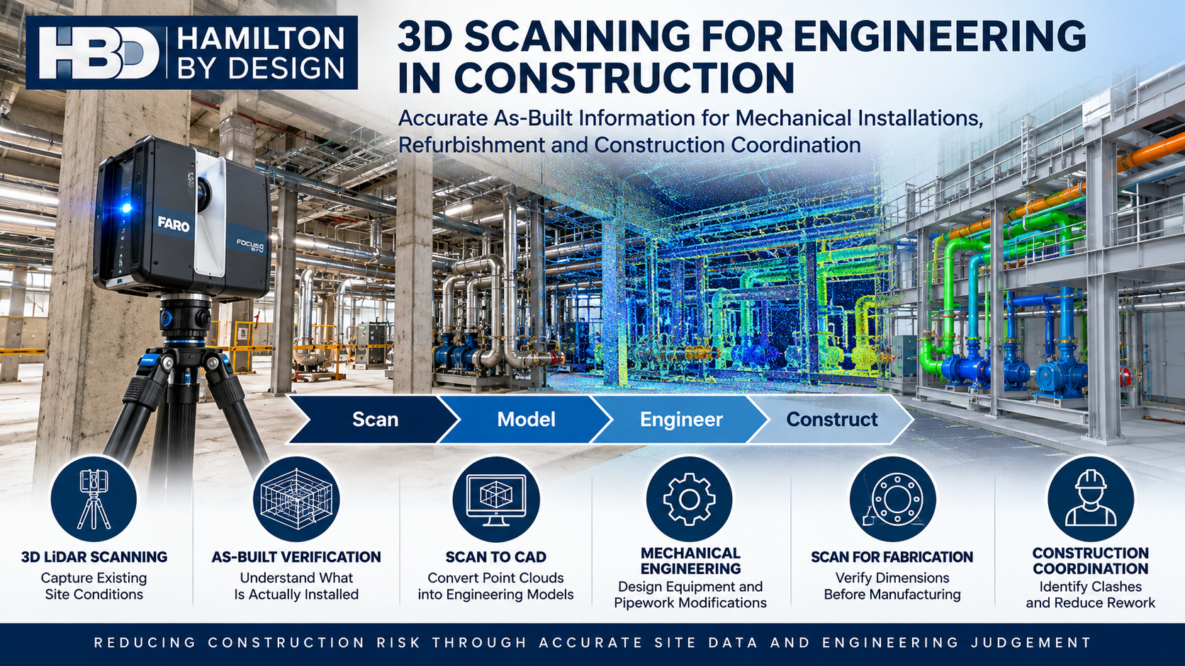
3D LiDAR Scanning | Mechanical Engineering | Construction Coordination | Scan to CAD | Refurbishment and Plant Upgrades
Accurate Existing-Condition Information Before Construction Begins

Construction projects frequently involve working around existing structures, mechanical equipment, pipework, services and building infrastructure.
Whether installing new equipment, modifying an industrial facility or refurbishing an existing building, one of the greatest engineering challenges is understanding what is actually present on site.
Original construction drawings may be incomplete, outdated or inconsistent with the installed arrangement. Equipment may have been relocated, pipework modified and structures altered over many years.
These uncertainties can lead to dimensional conflicts, fabrication errors, installation delays and expensive rework.
3D scanning for engineering in construction provides a practical method of capturing existing site geometry before design, fabrication and installation activities begin.
At Hamilton By Design, we combine 3D LiDAR scanning, point cloud processing, mechanical engineering and 3D CAD modelling to help construction and engineering teams make better-informed decisions.
Our approach follows a straightforward engineering workflow:
Scan → Model → Engineer → Upgrade
Rather than treating scanning as an isolated surveying activity, we use captured site information to support practical engineering outcomes.
1. How Is 3D Scanning Used for Engineering in Construction Projects?
3D scanning is used in construction to capture the geometry of existing buildings, industrial facilities, mechanical installations and structural interfaces.
A terrestrial 3D LiDAR scanner records millions of spatial measurements to generate a three-dimensional point cloud representing visible site conditions.
This information can support:
- Existing-condition and as-built documentation.
- Mechanical equipment installation and replacement.
- Pipework modifications and routing.
- Conveyor and materials-handling upgrades.
- Plant refurbishment and brownfield construction.
- Equipment access and maintenance planning.
- Construction coordination and clash identification.
- Development of 2D drawings and 3D engineering models.
For example, when installing a new pump skid inside an operating industrial facility, the project team may need to establish available floor space, pipework connection locations, structural clearances and maintenance access.
A registered point cloud provides a common spatial reference for developing and checking the proposed installation.
This can reduce reliance on repeated manual measurements and assumptions about existing site geometry.
Engineering Application: Mechanical Equipment Installation
Consider a construction project involving the replacement of existing mechanical equipment.
Before the new equipment is fabricated or delivered, engineers may need to confirm:
- Equipment footprint and mounting locations.
- Existing pipework connections and flange positions.
- Structural obstructions.
- Available lifting and installation clearances.
- Access for operation and maintenance.
3D scanning provides geometric information that can be incorporated into a CAD environment to support these assessments.
However, scanning does not replace engineering verification of loading, structural capacity, tolerances or installation requirements.
2. What Are the Benefits of 3D Laser Scanning for Accurate As-Built Information in Construction?
One of the principal benefits of 3D laser scanning is the ability to establish a detailed digital record of existing site conditions.
Traditional drawings often represent the original design intent rather than the actual installed arrangement.
During construction, small differences between drawings and site conditions can become significant when equipment, pipework or prefabricated components must fit within constrained spaces.
Benefits of 3D Scanning for Construction
| Construction challenge | 3D scanning contribution |
|---|---|
| Outdated construction drawings | Captures visible existing geometry for comparison and documentation |
| Limited access to existing equipment | Records accessible surfaces and surrounding spatial relationships |
| Pipework installation conflicts | Supports identification of routing and clearance constraints |
| Mechanical equipment replacement | Helps establish existing interfaces and installation envelopes |
| Fabrication dimensional uncertainty | Provides reference geometry for design and dimensional checks |
| Restricted maintenance access | Supports assessment of equipment removal and maintenance envelopes |
| Multiple construction disciplines | Provides a common spatial reference for coordination |
| Brownfield modifications | Helps identify existing obstructions before construction |
Understanding Scanning Accuracy
Accuracy should always be considered in the context of the engineering application.
A scanner’s individual measurement specification is not necessarily the accuracy of a complete registered point cloud.
For industrial scanning projects, overall accuracy depends on factors including:
- Scanner capability and calibration.
- Distance to the measured surfaces.
- Surface characteristics and visibility.
- Scan registration methodology.
- Site geometry and environmental conditions.
- Control survey arrangements where required.
For typical industrial projects, Hamilton By Design may work with registered datasets having practical accuracy expectations in the order of several millimetres, depending on site conditions and the scanning methodology.
Critical fabrication interfaces, machined surfaces, bolt-hole patterns and tight-tolerance connections may require additional dimensional verification using appropriate measurement equipment.
This distinction is important because reliable engineering outcomes depend on selecting a measurement method appropriate to the required tolerance.
3. How Does 3D Scanning Improve Mechanical Installation and Construction Coordination?
Mechanical installation projects frequently require new equipment to interface with existing structures and services.
These interfaces can become particularly challenging in operating factories, processing plants, warehouses and other established facilities.
3D scanning improves construction coordination by allowing engineers and contractors to assess proposed equipment arrangements against captured existing geometry.
Mechanical Equipment and Pipework
Point cloud information can be used to develop or position 3D CAD models of:
- Pump skids and mechanical equipment.
- Pipework and supporting structures.
- Conveyors and transfer stations.
- Mechanical platforms and access arrangements.
- Industrial ventilation equipment.
- Equipment guarding and maintenance access.
- Structural support interfaces.
The proposed equipment model can then be reviewed alongside the point cloud to identify potential geometric conflicts.
Construction Coordination and Clash Detection
For construction projects involving several disciplines, a shared digital model can improve communication between mechanical engineers, structural engineers, building contractors and installation teams.
For example, a proposed pipework route may conflict with an existing beam, cable tray, ventilation duct or maintenance access zone.
Identifying these conflicts during design is generally preferable to discovering them during installation.
Hamilton By Design can develop CAD models from point cloud data and provide model information suitable for coordination workflows using software such as Autodesk Navisworks.
The objective is not simply to create a digital model. It is to identify construction constraints before they become site problems.
Example: Installing New Equipment in an Existing Factory
Consider a project requiring the installation of a new production machine.
The design team may need to coordinate the machine footprint, access requirements, existing services, mechanical connections and supporting infrastructure.
By scanning the installation area and incorporating the proposed equipment model, the team can review the installation arrangement before fabrication and mobilisation.
This supports more informed decisions about equipment positioning, service modifications and construction sequencing.
4. Can 3D LiDAR Scanning Reduce Construction Errors During Refurbishment and Plant Upgrades?
Yes. When appropriately planned and verified, 3D LiDAR scanning can help reduce construction errors associated with inaccurate existing-condition information.
Refurbishment and brownfield construction projects are particularly exposed to dimensional uncertainty because the original facility may have undergone numerous undocumented modifications.
Refurbishment and Brownfield Construction
Typical applications include:
Industrial Plant Upgrades
Capturing existing mechanical equipment, conveyors, platforms, pipework and supporting infrastructure before modifications are designed.
Commercial Building Refurbishment
Recording existing plantrooms, mechanical service spaces and building interfaces to assist with proposed equipment replacements.
Mechanical Services Modifications
Supporting the development of new pipework routes, ventilation arrangements and equipment layouts within existing facilities.
Construction of Equipment Supports
Establishing existing interface geometry before new mechanical support arrangements are designed and detailed.
Shutdown and Installation Planning
Providing dimensional information to help plan equipment removal, replacement and installation activities.
Reducing Rework Through Better Engineering Information
Construction rework can occur when fabricated components do not match existing site conditions.
For example, a prefabricated pipe spool may be manufactured using outdated dimensions.
When the spool arrives on site, the existing connection points may not align with the assumed arrangement.
A properly scoped 3D scanning and dimensional verification process can help identify these discrepancies before fabrication.
However, the point cloud must be sufficiently complete and accurate for the intended engineering purpose.
Where critical dimensions cannot be reliably established from the scan, additional site measurements should be undertaken.
3D scanning helps reduce geometric uncertainty, but it does not eliminate the need for engineering judgement, appropriate tolerances and construction verification.
5. Who Provides 3D Scanning and Mechanical Engineering Services for Construction Projects in Australia?
Hamilton By Design provides 3D LiDAR scanning, point cloud processing, 3D CAD modelling and mechanical engineering services for industrial and commercial construction projects across Australia.
Our services are particularly relevant where construction activities involve existing mechanical equipment, plant modifications, industrial refurbishment and coordination between new and existing infrastructure.
Unlike workflows that stop at the delivery of a point cloud, Hamilton By Design can assist with subsequent mechanical design and drafting activities.
Our Construction Engineering Services
| Service | Engineering application |
|---|---|
| 3D LiDAR scanning | Capture existing site conditions |
| Point cloud registration | Combine individual scans into a coordinated dataset |
| Scan to CAD | Develop CAD geometry from captured information |
| Mechanical engineering design | Develop equipment modifications and mechanical arrangements |
| 3D CAD modelling | Model equipment, pipework and installation interfaces |
| General arrangement drawings | Communicate proposed equipment layouts and interfaces |
| Fabrication drawings | Detail mechanical components for manufacture where included in scope |
| Construction coordination | Review proposed installations against existing geometry |
| Reverse engineering | Reconstruct existing components or equipment geometry |
| Engineering design review | Assess relevant mechanical constraints and design requirements |
Our mechanical engineering services can support projects involving industrial facilities, manufacturing plants, materials-handling systems and commercial mechanical installations.
Where structural design, certification or specialist engineering services are required, these should be undertaken or verified by appropriately qualified professionals within the relevant discipline.
From Point Cloud to Construction-Ready Engineering Information
A successful scanning project should begin with an understanding of the engineering decision the information must support.
At Hamilton By Design, we approach construction scanning through five stages.
Stage 1 – Define the Engineering Requirements
Identify the proposed construction activity, required deliverables, critical interfaces, accuracy expectations and access constraints.
Stage 2 – Capture Existing Site Conditions
Undertake 3D LiDAR scanning of the relevant installation area, including visible equipment, pipework, structural interfaces and surrounding obstructions.
Stage 3 – Register and Process the Point Cloud
Process the captured scans into a coordinated point cloud dataset suitable for engineering review and modelling.
Stage 4 – Develop Engineering Models and Drawings
Use the point cloud as a reference to develop 3D CAD models, equipment arrangements, general arrangement drawings and other agreed engineering deliverables.
Stage 5 – Support Construction and Installation
Provide the agreed engineering information to assist fabrication planning, installation coordination and construction review.
Where required, additional dimensional checks can be incorporated before critical fabrication or installation activities.
This workflow helps connect digital site capture with practical engineering outcomes.
3D Scanning Compared with Traditional Site Measurement
Both traditional measurement and 3D scanning have important roles in construction engineering.
| Consideration | Traditional site measurement | 3D LiDAR scanning |
|---|---|---|
| Data capture | Selected individual dimensions | Dense spatial measurements of visible surfaces |
| Complex geometry | May require numerous measurements | Can capture extensive geometric detail |
| Site documentation | Notes, sketches and photographs | Registered point clouds and associated imagery where available |
| Design coordination | Based on recorded dimensions | Supports spatial review with CAD models |
| Repeat measurements | May require additional site visits | Existing scan data may permit later measurements where geometry was adequately captured |
| Critical tolerances | Precision tools can directly verify features | Additional verification may still be necessary |
| Engineering deliverables | Drawings and dimensional records | Point clouds, CAD models and drawings as scoped |
The most effective approach is often a combination of both methods.
3D scanning captures the broader installation environment, while conventional dimensional measurement verifies critical interfaces.
Where Is 3D Scanning Most Valuable in Construction?
3D scanning can be particularly valuable when a project involves:
- An existing facility with incomplete or outdated drawings.
- Installation of equipment within restricted spaces.
- Multiple mechanical and structural interfaces.
- Complex pipework routing.
- Prefabricated components requiring accurate site interfaces.
- Construction activities during limited shutdown periods.
- Brownfield modifications and equipment replacement.
- Coordination between engineering disciplines.
The value of scanning increases when the captured information is used early enough to influence engineering design and construction planning.
Scanning after a dimensional conflict has already occurred may help diagnose the problem, but scanning before fabrication provides an opportunity to avoid it.
Frequently Asked Questions About 3D Scanning in Construction
Is 3D scanning suitable for existing industrial buildings?
Yes. 3D LiDAR scanning can capture visible geometry within factories, warehouses, mechanical plantrooms and industrial facilities to support refurbishment and modification projects.
Can a point cloud be converted into a SolidWorks or AutoCAD model?
Yes. Point cloud data can be used as a reference for developing CAD models in software such as SolidWorks and AutoCAD. The level of modelling detail depends on the engineering scope and intended deliverables.
Does 3D scanning replace construction drawings?
No. A point cloud represents measured site geometry. Engineering drawings communicate design intent, dimensions, materials, tolerances and fabrication or installation requirements. The two serve different purposes.
Can 3D scanning help with prefabricated pipework?
Yes. Scanning can support the identification of existing pipework routes, surrounding obstructions and connection locations. Critical flange dimensions, orientations and fabrication tolerances should be independently verified as required.
Can 3D scanning identify construction clashes?
Yes. By reviewing proposed CAD geometry against a suitably complete and registered point cloud, engineers can identify potential spatial conflicts. This does not guarantee detection of every clash, particularly where existing features are concealed or insufficiently captured.
Is 3D scanning suitable for small construction projects?
Yes. The value depends on the complexity of the existing conditions, dimensional risks and intended engineering deliverables rather than project size alone.
Does Hamilton By Design provide both scanning and engineering?
Yes. Hamilton By Design provides 3D LiDAR scanning, point cloud processing, mechanical engineering design, CAD modelling and drafting services, allowing captured site information to support subsequent engineering activities.
Supporting Construction Projects Across Australia
Hamilton By Design is based on the NSW Central Coast and provides engineering and 3D scanning services for projects across New South Wales and interstate.
Our services support clients in locations including Sydney, Newcastle, the Hunter Valley, regional NSW and other Australian industrial centres.
Projects may include industrial facilities, manufacturing plants, mechanical installations, processing facilities and commercial refurbishment works.
The scope of each engagement is developed around the site’s access conditions, engineering requirements and deliverables.
Why Choose Hamilton By Design?
Construction projects require more than dimensional information.
They require engineering decisions based on reliable existing-condition data.
Hamilton By Design combines practical industrial experience with 3D scanning and mechanical engineering capabilities to support the transition from site measurement to design development.
Our focus is on:
- Understanding the intended engineering application before scanning.
- Capturing the geometry relevant to the proposed modification.
- Recognising the limitations of point cloud accuracy and visibility.
- Developing practical mechanical engineering models and drawings.
- Identifying potential construction and installation constraints.
- Supporting informed decisions before fabrication and installation.
The objective is to reduce uncertainty between what exists on site, what is designed and what must ultimately be constructed.
Planning a Construction Project or Mechanical Installation?
If your project involves mechanical equipment installation, plant refurbishment, pipework modifications or construction coordination, accurate existing-condition information can help establish a more reliable starting point.
Hamilton By Design can assist with 3D LiDAR scanning, point cloud processing, mechanical engineering and CAD modelling to support your project requirements.
Contact Hamilton By Design to discuss your construction scanning and engineering requirements.
Hamilton By Design – Scan → Model → Engineer → Upgrade

Contact Us – Talk To Us
Our clients:
























