Why Point Cloud Data Beats STL for Real Engineering Work

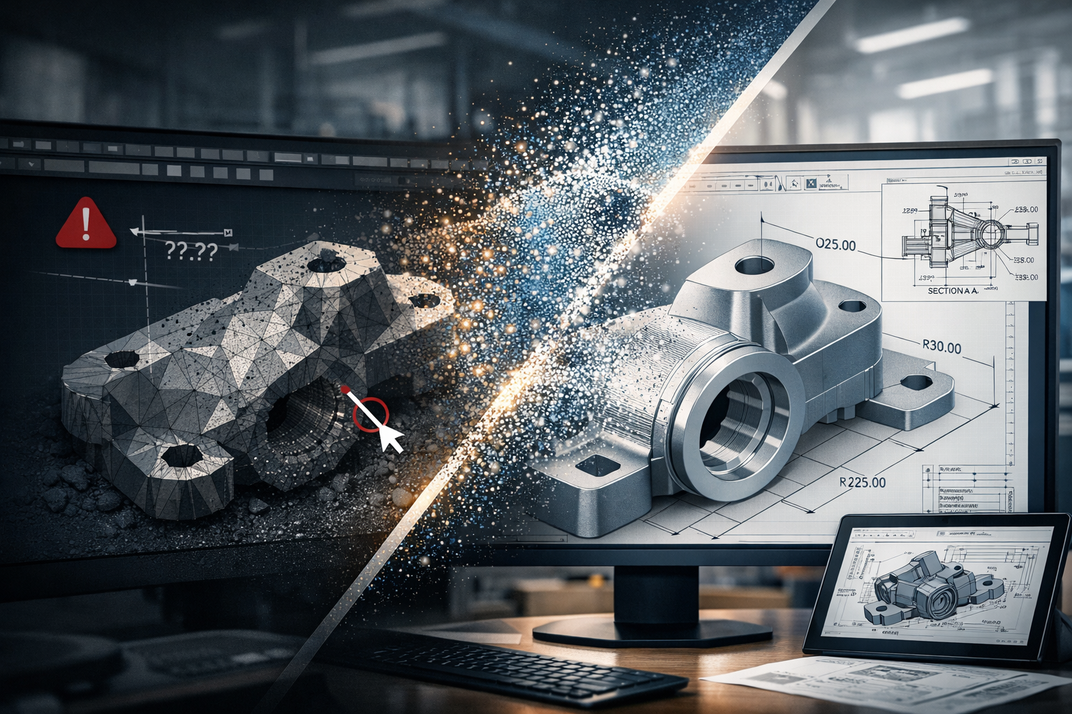
Point cloud to CAD workflow showing transition from STL mesh to engineering-ready parametric model with dimensions and drawings

In the world of 3D scanning, there is often confusion around what type of data is actually useful for engineering. Many providers offer high-accuracy scanning using metrology-grade equipment, yet the final deliverable is often limited to STL or OBJ files.

The question is simple:
If the data cannot be used inside your CAD system, what is its real value?


The Rise of Metrology-Grade Scanning

Modern handheld scanners are incredibly capable. They can capture fine detail, achieve high accuracy, and generate dense surface representations of components. These systems are often used in reverse engineering, product design, and inspection workflows.

They are frequently marketed as โ€œmetrology-grade,โ€ and in terms of capture capability, that claim is valid. These scanners can measure to very tight tolerances and produce highly detailed digital representations.

However, the real issue is not how the data is captured.
It is how the data is delivered and how it integrates into engineering workflows.

Capturing accurate data is only the first step. The true value lies in whether that data can be used to design, modify, verify, and manufacture real-world components.


STL and OBJ โ€“ A Surface, Not a Solution

STL and OBJ files are mesh-based formats. They represent the surface of an object using thousands or millions of triangles stitched together to form a 3D shape.

These files are useful for:

  • Visualisation
  • 3D printing
  • Basic reference and communication

They are fast to generate and easy to share, which is why many scanning providers stop at this stage.

However, they come with significant limitations:

  • No parametric geometry
  • No selectable engineering features
  • No design intent
  • Difficult to dimension accurately
  • Cannot drive CAD models effectively

A mesh file is essentially a visual representation, not an engineering model.

In simple terms:

An STL file shows what something looks like, but not how to design, modify, or manufacture it.

Once the data is converted into a mesh, it is often smoothed, simplified, and processed. This means the original measured data is no longer fully preserved, and any measurements taken from the mesh are based on an interpreted surface rather than raw coordinates.


Engineering Happens in CAD

Real engineering work takes place inside platforms such as SolidWorks, Autodesk Inventor, Autodesk Fusion, and Onshape.

These tools are built around:

  • Parametric modelling
  • Feature-based design
  • Relationships and constraints
  • Editable geometry

They rely on identifiable features such as:

  • Planes
  • Cylinders
  • Holes
  • Edges and faces

Mesh files do not contain this level of intelligence. As a result, they cannot be easily used to:

  • Modify or optimise designs
  • Perform engineering calculations or simulations
  • Generate fabrication-ready drawings
  • Maintain consistency across revisions

This creates a disconnect:

You can measure on the scanner, but you cannot effectively design in CAD.

And if design cannot happen in CAD, the workflow breaks down.


The Advantage of Point Cloud Data

Point cloud data, typically delivered in formats such as E57 or RCP, captures real-world coordinates directly from the scan. Each point represents a measurable location in 3D space.

This is fundamentally different from a mesh.

Point clouds provide:

  • True measured data (not interpreted surfaces)
  • High-density spatial accuracy
  • Full capture of the environment or component
  • The ability to revisit and re-measure at any time

This enables engineers to:

  • Extract accurate dimensions directly from real-world data
  • Fit geometry (planes, cylinders, centre lines) inside CAD
  • Validate designs against existing conditions
  • Maintain traceability and confidence in the data

Point clouds form the foundation for engineering-grade modelling, not just visual representation.


From Scan to Engineering Outcome

At Hamilton By Design, the focus is not just on capturing data, but on delivering usable engineering outcomes.

Our workflow is:

Scan โ†’ Point Cloud โ†’ CAD Model โ†’ Engineering Drawings

This ensures the data can be:

  • Measured inside CAD
  • Verified and checked against real conditions
  • Modified to suit design requirements
  • Used for fabrication, installation, and real-world implementation

This approach bridges the gap between reality and design.

It turns captured data into something that engineers, fabricators, and project teams can actually use.


Like-for-Like vs Design Flexibility

If your requirement is a like-for-like digital representation of an object, mesh files such as STL or OBJ may be sufficient.

They provide a quick and effective way to visualise shape and form.

However, if your goal is to:

  • Modify a design
  • Integrate with existing infrastructure
  • Produce engineering drawings
  • Support fabrication or installation

Then flexibility becomes critical.

If youโ€™re looking for like-for-like, mesh will get you there.
If youโ€™re looking for a flexible design tool, point cloud is the answer.


The Bottom Line

Metrology-grade scanners can capture extremely accurate data. But if that data is delivered only as an STL or OBJ file, its value is significantly limited within an engineering context.

True value comes from transforming scan data into something that works inside CAD and supports real-world outcomes.

Mesh files deliver a shape.
Point clouds deliver a foundation for engineering.

3D CAD Modelling Australia service banner for Hamilton By Design
Finite Element Analysis (FEA) engineering simulation button
Mechanical engineering services

Mechanical Engineering | Structural Engineering


Why FARO Laser Scanners Deliver the Best Outcomes for Mining and Manufacturing Sites

ARO laser scanning workflow showing point cloud processing, SOLIDWORKS modelling, and fabrication drawings for a mining and manufacturing plant

In mining and manufacturing, the difference between success and rework comes down to one thing:

The quality of your dataโ€”and how you use it.

While many providers can โ€œcapture a scan,โ€ not all can deliver usable engineering outcomes. This is where FARO laser scanners and the FARO software ecosystem stand apart.


Engineer-Led Scanning vs Generic Data Capture

Most scanning providers deliver:

  • Raw point clouds
  • Mesh files (STL, OBJ)
  • Limited usability for engineering

At Hamilton By Design, we take a different approach:

Engineering-led scanning using FARO tools, built for design, modelling, and fabrication.

The real advantage of FARO is not just the hardwareโ€”itโ€™s the software ecosystem that turns scan data into engineering decisions.


The Real Advantage: FARO SCENE Software

At the core of the FARO workflow is FARO SCENE, purpose-built for point cloud processing, registration, and validation.

Unlike generic tools, SCENE allows:

1. Hybrid Registration (Accuracy You Can Trust)

  • Combine cloud-to-cloud, targets, and survey control
  • Validate alignment visually and numerically
  • Eliminate stitching errors before they reach design

โžก๏ธ This ensures engineering-grade accuracy, not just visual alignment

FARO SCENE enables flexible registration workflows that combine multiple methods for precise alignment of complex sites


2. On-Site Registration (No Return Visits)

  • Register scans in the field
  • Identify gaps immediately
  • Confirm coverage before leaving site

โžก๏ธ Critical for:

  • Shutdowns
  • Remote mine sites
  • High-cost mobilisation environments

SCENE supports real-time, on-site registration and validation, allowing immediate data verification and reducing the need for rework


3. Clean, Usable Point Clouds (Not Just Raw Data)

  • Automatic filtering of noise
  • Colour balancing
  • Duplicate point removal
  • Density optimisation

โžก๏ธ Result:
Clean datasets ready for CAD, not bloated unusable files

SCENE includes filtering, validation, and optimisation tools to improve data quality and usability for downstream workflows


4. Full Workflow Integration (Scan โ†’ CAD โ†’ Engineering)

FARO integrates directly into engineering workflows:

  • Export to CAD and BIM platforms
  • Compatible with tools like:
    • SOLIDWORKS
    • Revit
    • Navisworks

โžก๏ธ This is the key difference:

FARO data is built to be engineered, not just viewed

SCENE enables export into multiple CAD and point cloud formats for modelling and engineering applications


5. Visual Validation (What You See Is What You Build)

  • 3D visualisation
  • VR inspection
  • Flythrough and walkthrough capability

โžก๏ธ Engineers and stakeholders can:

  • Verify design intent
  • Identify clashes early
  • Reduce construction risk

SCENE supports immersive 2D, 3D, and VR visualisation for detailed project evaluation


6. Scalable for Large Industrial Sites

Mining and manufacturing sites are:

  • Large
  • Complex
  • Often poorly documented

FARO SCENE allows:

  • Management of thousands of scans
  • Structured project organisation
  • Fast visualisation of large datasets

โžก๏ธ This is critical for:

  • CHPP plants
  • Smelters
  • Conveyor systems
  • Brownfield upgrades

Why This Matters for Mining & Manufacturing

Reduce Rework

Accurate, validated data reduces:

  • Site clashes
  • Fabrication errors
  • Installation delays

Improve Shutdown Efficiency

  • Capture once
  • Model correctly
  • Execute without surprises

Enable Brownfield Engineering

Most sites are not โ€œgreenfieldโ€:

  • Legacy assets
  • Unknown geometry
  • Modifications over time

โžก๏ธ FARO enables:
True as-built modelling, not assumptions


Support Fabrication-Level Detail

With the right workflow (FARO + engineering):

  • Steel detailing
  • Mechanical integration
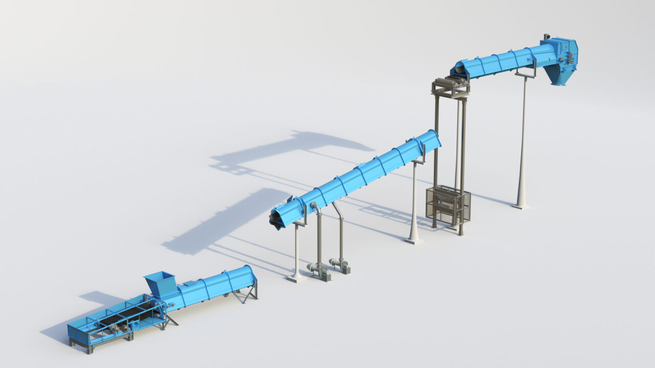
  • Conveyor and chute design
  • Retrofit design

โžก๏ธ Deliverables become:
Fabrication-readyโ€”not conceptual


FARO vs โ€œOther Scanning Solutionsโ€

Many alternatives focus on:

  • Speed over accuracy
  • Visual outputs over engineering use
  • Meshes instead of parametric models

FARO, combined with SCENE, delivers:

  • Controlled accuracy
  • Transparent registration
  • Engineering-ready outputs

The Hamilton By Design Approach

We donโ€™t just use FARO toolsโ€”we use them properly.

  • Engineer-led scanning
  • Structured workflows
  • Point cloud to CAD conversion
  • SOLIDWORKS-based modelling
  • Fabrication-ready deliverables

Our focus is on outcomesโ€”not just data.


Anyone can scan.

Very few can:

  • Validate the data
  • Convert it into engineering models
  • Deliver drawings that can be built

Thatโ€™s why FARO, when used correctly, is not just a scanning toolโ€”

Itโ€™s a complete engineering data solution for mining and manufacturing.



3D LiDAR scanning and 3D modelling service button โ€” laser scanner capturing a point cloud for engineering and CAD modelling
Mechanical engineering services

Our Clients


Name
Would you like us to arrange a phone consultation for you?
Address
3D CAD Modelling Australia service banner for Hamilton By Design
3D LiDAR Scanning Darwin for engineering surveys, laser scanning, reality capture and point cloud modelling services
3D LiDAR Scanning Australia engineering services for laser scanning, reality capture, scan-to-CAD, Scan-to-BIM and as-built documentation across Australia
3D LiDAR scanning services on the Central Coast providing engineering-grade laser scanning, point cloud capture, scan-to-CAD modelling and industrial reality capture for infrastructure and industrial projects.
3D LiDAR Scanning Perth for engineering surveys, laser scanning, reality capture and point cloud modelling services
3D LiDAR Scanning Sydney for engineering surveys, laser scanning, reality capture and point cloud modelling services
3D LiDAR Scanning Brisbane for engineering surveys, laser scanning, reality capture and point cloud modelling services
3D LiDAR Scanning Canberra for engineering surveys, laser scanning, reality capture and point cloud modelling services
3D LiDAR Scanning Newcastle for engineering surveys, laser scanning, reality capture and point cloud modelling services
3D LiDAR Scanning Adelaide for engineering surveys, laser scanning, reality capture and point cloud modelling services

3D Laser Scanning Port Macquarie | Engineering-Grade LiDAR by Mechanical Engineers

3D Laser Scanning Port Macquarie โ€“ Why Accuracy Matters for Engineering Projects

If you’re planning a plant upgrade, fabrication project, or site modification in Port Macquarie, the quality of your 3D scan data directly impacts the success of your project.

At Hamilton By Design, we provide engineering-grade 3D laser scanning services led by mechanical engineers, ensuring the data captured is not only accurate, but also suitable for real-world design, fabrication, and construction outcomes.

Not All 3D Scanning Is the Same

With the rise of low-cost scanning technology, many providers now offer handheld scanning solutions as a fast and affordable option.

While these systems can be useful for general visualisation, they often rely on SLAM-based positioning, which estimates location as the operator moves through a site.

This can introduce:

  • positional drift over distance
  • reduced dimensional accuracy
  • inconsistencies in large or complex environments

In many cases, these services are delivered by non-qualified operators using handheld equipment without a clear understanding of engineering requirements.

Why Mechanical Engineers Deliver Better Outcomes

3D scanning is only one part of the process. The real value comes from how the data is understood and applied.

A mechanical engineer-led scanning approach ensures:

  • critical areas are prioritised during capture
  • scan density aligns with fabrication requirements
  • line-of-sight limitations are identified and managed
  • downstream modelling and design risks are reduced
  • data is validated against real engineering constraints

Rather than simply collecting data, mechanical engineers focus on what the data needs to achieve.

The Risk of Handheld โ€œCowboyโ€ Scanning

While handheld scanning has its place, relying solely on it โ€” particularly when carried out by inexperienced or non-qualified operators โ€” often leads to poor engineering outcomes.

These โ€œfast and cheapโ€ approaches can produce point clouds and 3D models that look correct visually but are not dimensionally reliable.

Typical issues include:

  • accumulated positional drift across the model
  • misalignment of structural and mechanical elements
  • missing critical geometry due to poor capture planning
  • inconsistent scaling across large areas

The result is 3D models that cannot be trusted for fabrication, retrofit design, or installation.

Why Tripod-Based LiDAR Scanning Is Different

Tripod-mounted LiDAR scanners capture data from fixed, controlled positions, delivering a stable and repeatable dataset.

This is critical when your project requires:

  • accurate tie-in points
  • fabrication-ready measurements
  • structural or mechanical design
  • clash detection and modelling
  • confidence in as-built conditions

For engineering projects, the difference is clear:

Handheld scanning shows you what it looks like.
LiDAR scanning โ€” guided by mechanical engineers โ€” tells you what it actually is.

The Risk of Low-Accuracy Data

Choosing the wrong scanning method โ€” or the wrong provider โ€” can lead to:

  • rework during fabrication
  • misalignment on installation
  • increased project costs
  • delays during shutdowns or upgrades

In industrial environments, even small dimensional errors can have significant downstream impacts.

A Smarter Approach to Reality Capture

At Hamilton By Design, we take an engineering-led approach to 3D scanning, combining the right technology with real engineering expertise.

Where required, we may use multiple capture methods โ€” but critical areas are always captured using high-accuracy LiDAR scanning guided by mechanical engineering judgement.

Supporting Port Macquarie and Regional NSW

We support clients across Port Macquarie and regional New South Wales, delivering professional 3D laser scanning services for industrial facilities, manufacturing plants, infrastructure upgrades, and mechanical and structural projects.

Talk to Hamilton By Design – Contact Us

If you need accurate, engineering-grade site data in Port Macquarie, backed by mechanical engineering expertise, get in touch to discuss your project.


Name
Would you like us to arrange a phone consultation for you?
Address

Our clients

Mechanical Engineers

3D Lidar Scanning

3D CAD Modelling Australia service banner for Hamilton By Design

LiDAR Scanning vs Handheld Scanning for Engineering Projects | Hamilton By Design

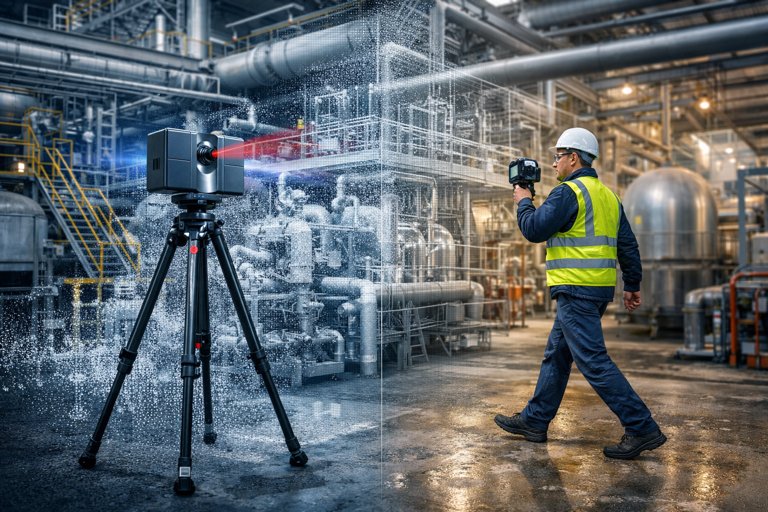
Tripod LiDAR scanner and handheld 3D scanner capturing an industrial plant with point cloud overlay for engineering design

LiDAR Scanning vs Handheld Scanning for Engineering Projects

When clients first look at 3D scanning solutions, one of the most common questions is whether they need a tripod-based LiDAR scanner or a handheld scanner. Both technologies have a place, but the right choice depends on the outcome required.

At Hamilton By Design, we focus on engineering-led reality capture. That means selecting the scanning method that best supports accurate design, fabrication, brownfield upgrades, and reliable project delivery.

3D LiDAR scanning and 3D modelling service button โ€” laser scanner capturing a point cloud for engineering and CAD modelling
Mechanical engineering services

What is the difference?

A tripod-based LiDAR scanner captures highly accurate point cloud data from fixed scan positions. This method is ideal when projects require dependable geometry, repeatable measurements, and engineering-grade outputs.

A handheld scanner is typically used to move quickly through a space and capture data on the go. It can be useful for general visualisation, rapid site understanding, and concept-level work, but it is not always the best fit where tight tolerances or fabrication-ready information is required.

Benefits of tripod-based LiDAR scanning

Higher accuracy

Tripod-based LiDAR scanning is better suited to projects where dimensional accuracy matters. This is particularly important for:

  • plant upgrades
  • tie-in design
  • structural modifications
  • pipework alterations
  • reverse engineering
  • fabrication support

Reliable fixed-position data

Because scans are captured from known stationary positions, the data can be registered into a stable point cloud. This gives engineers, designers, and project teams greater confidence in the model and the measurements taken from it.

Better for engineering and design

Where a project needs scan-to-CAD modelling, design development, clash checking, or digital twin support, tripod LiDAR scanning generally provides the more dependable base dataset.

Stronger project governance

Engineering projects need traceable and reviewable information. LiDAR scanning supports this by providing a robust record of existing conditions that can be referenced throughout the project lifecycle.

Benefits of handheld scanning

Faster capture over large areas

Handheld scanning can be useful where speed is more important than precision, or where the objective is to quickly understand a space.

Flexible for walkthrough-style capture

These systems can help capture general layouts, access routes, and broader site context in areas where rapid movement is an advantage.

Useful for concept and visualisation work

For early-stage planning or non-critical site representation, handheld scanning can sometimes provide a suitable outcome.

Which one is right for your project?

If your project involves fabrication, engineering design, plant modification, shutdown planning, or accurate as-built records, tripod-based LiDAR scanning is usually the better choice.

If your priority is speed, general layout capture, or conceptual understanding, handheld scanning may have a role.

In many cases, the best result comes from an engineering-led approach, where the required deliverables drive the capture method.

Why Hamilton By Design?

Hamilton By Design provides engineering-grade 3D laser scanning and reality capture services for industrial, mining, mechanical, and brownfield environments. Our focus is not just on collecting data, but on delivering data that supports real engineering outcomes.

We understand that a point cloud is only valuable if it helps reduce uncertainty, improve design confidence, and support practical decision-making.

Learn more

To explore our broader scanning and engineering services, visit:

Talk to Hamilton By Design

If you need accurate site data for design, drafting, reverse engineering, or plant upgrades, Hamilton By Design can help you choose the right scanning approach for your project.

Contact us to discuss your site, deliverables, and required level of detail.


Name
Would you like us to arrange a phone consultation for you?
Address


3D CAD Modelling Australia service banner for Hamilton By Design
Reality Capture Brisbane title graphic with white text on a blue background promoting reality capture, LiDAR scanning and digital engineering services in Brisbane, Queensland.
3D Scanning Brisbane text graphic on a blue background promoting engineering-led laser scanning and reality capture services in Brisbane.

LiDAR Scanning Brisbane title graphic with white text on a blue background promoting terrestrial LiDAR scanning, point cloud capture and reality capture services in Brisbane, Queensland.
SolidWorks Brisbane title graphic with white text on a blue background promoting SolidWorks mechanical design, 3D CAD modelling and engineering drafting services in Brisbane, Queensland.


Mechanical Engineering | Structural Engineering


Mechanical Engineering & 3D Scanning Services โ€“ Yorke Peninsula, South Australia

The Yorke Peninsula is home to some of South Australiaโ€™s most important agricultural and industrial operations โ€” from grain handling and bulk material processing to regional infrastructure and maintenance-driven facilities.

At Hamilton By Design, we provide engineering-led mechanical solutions, 3D LiDAR scanning, and drafting services to support businesses across the Yorke Peninsula and regional South Australia.


3D LiDAR scanning and 3D modelling service button โ€” laser scanner capturing a point cloud for engineering and CAD modelling
Mechanical engineering services

๐ŸŒพ Supporting Regional Industry Across the Yorke Peninsula

From towns like Minlaton, Maitland, and Yorketown, local operations rely on efficient, reliable infrastructure to keep production moving.

Common challenges we see across the region include:

  • Ageing plant and equipment
  • Limited or outdated drawings
  • Conveyor and transfer inefficiencies
  • Shutdown-based upgrades and modifications
  • Lack of access to specialised engineering services

These are exactly the types of challenges our services are built to solve.


๐Ÿ“ Engineering-Led 3D LiDAR Scanning

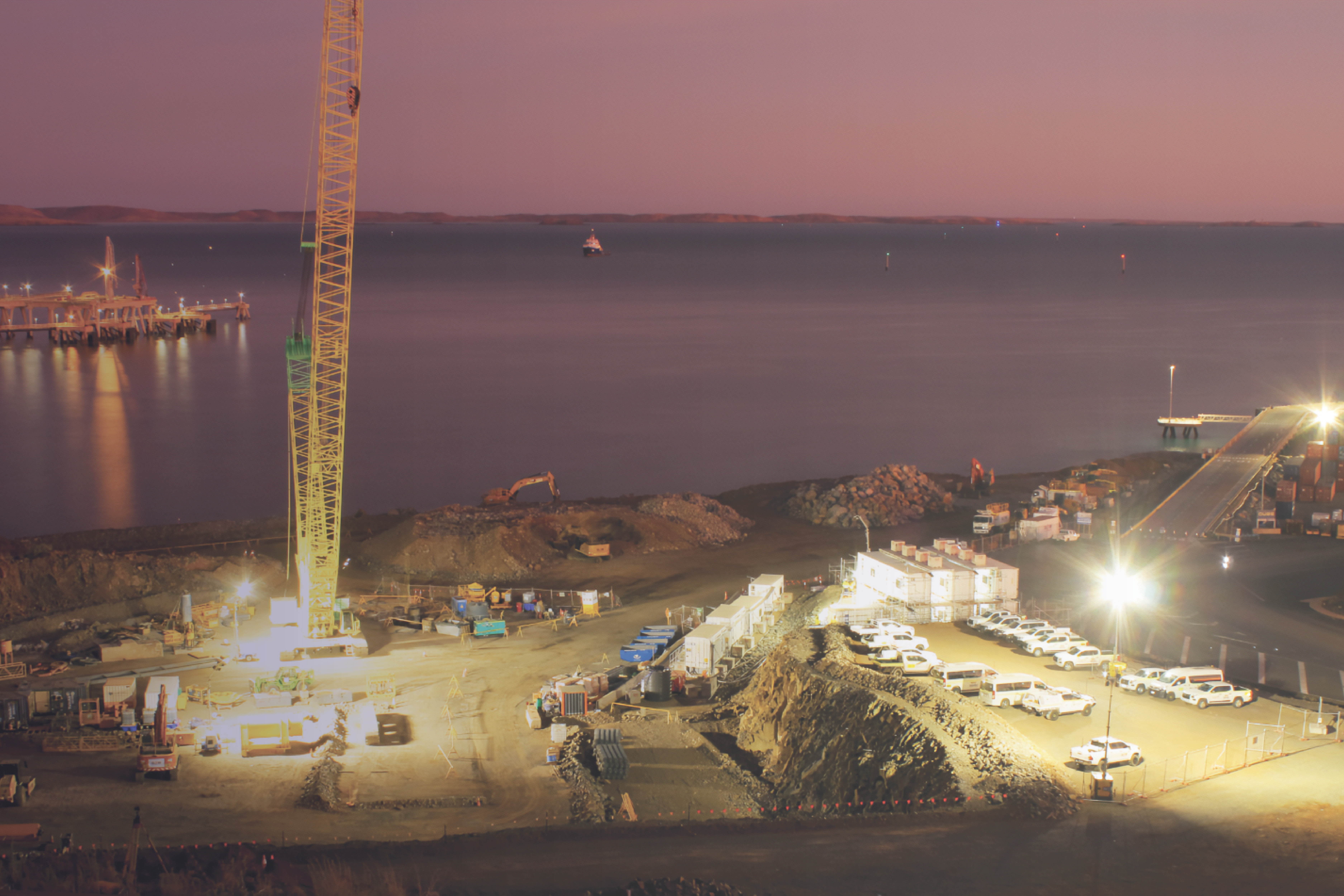
Image
Image
Image
Image

We provide high-accuracy 3D laser scanning (LiDAR) to capture existing assets and environments.

But more importantly โ€” we do this as engineers.

That means:

  • Scanning is completed with design and fabrication outcomes in mind
  • Data is captured with sufficient density and coverage
  • Outputs are suitable for CAD modelling, retrofit design, and construction

๐Ÿ‘‰ You get more than a point cloud โ€”
you get usable, engineering-grade information.


๐Ÿ› ๏ธ Mechanical Engineering Services

We support Yorke Peninsula projects with practical, fit-for-purpose engineering solutions, including:

  • Conveyor and chute design
  • Structural and mechanical upgrades
  • Reverse engineering of existing plant
  • Design for fabrication and installation
  • Brownfield modification support

Our focus is always on real-world outcomes โ€” designs that work on site, not just on paper.


๐Ÿ“Š Mechanical & Structural Drafting

We deliver clear, build-ready documentation:

  • 2D AutoCAD drawings (plans, elevations, sections)
  • 3D CAD models for coordination and fabrication
  • Scan-to-CAD conversion
  • Bill of materials and fabrication detailing

๐Ÿ‘‰ Helping contractors and fabricators build with confidence.


๐Ÿšง Built for Regional Projects

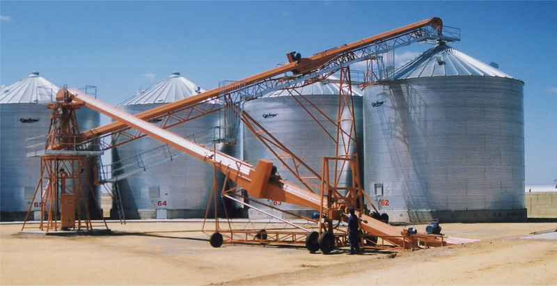
Image
Image
Image

Projects across the Yorke Peninsula often involve:

  • Brownfield upgrades
  • Tight shutdown windows
  • Remote site access
  • Limited existing documentation

We work within these constraints to deliver:

  • Efficient site capture
  • Accurate modelling
  • Reliable turnaround aligned with project timelines

๐ŸŒ Supporting All Australians โ€” Wherever You Operate

At Hamilton By Design, we support projects across Australia โ€” from major cities to regional locations like the Yorke Peninsula.

Our goal is simple:

Deliver accurate data, practical engineering, and reliable outcomes โ€” no matter where you are.


๐Ÿ”— Learn More About Our Services

Explore our engineering and 3D scanning capabilities here:
๐Ÿ‘‰ https://www.hamiltonbydesign.com.au/home/engineering-services/3d-scanning-sydney/


๐Ÿ“ž Get in Touch

If youโ€™re operating on the Yorke Peninsula and require:

  • Mechanical engineering support
  • 3D LiDAR scanning
  • Mechanical or structural drafting

contact Hamilton By Design to discuss how we can support your next project.


๐Ÿท๏ธ Labels

yorke peninsula engineering, 3d scanning south australia, lidar scanning australia, mechanical engineering services australia, point cloud to cad, grain handling engineering, conveyor design australia, regional engineering support


๐Ÿ” Search Description

Mechanical engineering, 3D LiDAR scanning, and drafting services for the Yorke Peninsula, South Australia. Supporting regional industry with accurate reality capture and practical design solutions.

Name
Would you like us to arrange a phone consultation for you?
Address
3D CAD Modelling Australia service banner for Hamilton By Design
Australian Drafting logo featuring bold white text reading "Australian Drafting" centred on a blue rounded rectangle background.
Engineering Governance title graphic featuring bold white text reading "Engineering Governance" centred on a blue rounded rectangle background.
Mechanical, Structural & Pipework Drafting service banner by Hamilton By Design featuring white text on a blue background.
Mechanical engineering services
Blue rounded button with the text โ€œSolidWorks Designโ€ in white.
Finite Element Analysis (FEA) engineering simulation button
3D LiDAR Scanning Darwin for engineering surveys, laser scanning, reality capture and point cloud modelling services
3D LiDAR Scanning Australia engineering services for laser scanning, reality capture, scan-to-CAD, Scan-to-BIM and as-built documentation across Australia
3D LiDAR scanning services on the Central Coast providing engineering-grade laser scanning, point cloud capture, scan-to-CAD modelling and industrial reality capture for infrastructure and industrial projects.
3D LiDAR Scanning Perth for engineering surveys, laser scanning, reality capture and point cloud modelling services
3D LiDAR Scanning Sydney for engineering surveys, laser scanning, reality capture and point cloud modelling services
3D LiDAR Scanning Brisbane for engineering surveys, laser scanning, reality capture and point cloud modelling services
3D LiDAR Scanning Canberra for engineering surveys, laser scanning, reality capture and point cloud modelling services
3D LiDAR Scanning Newcastle for engineering surveys, laser scanning, reality capture and point cloud modelling services
3D LiDAR Scanning Adelaide for engineering surveys, laser scanning, reality capture and point cloud modelling services

How 3D Laser Scanning is Used in Sydney Projects

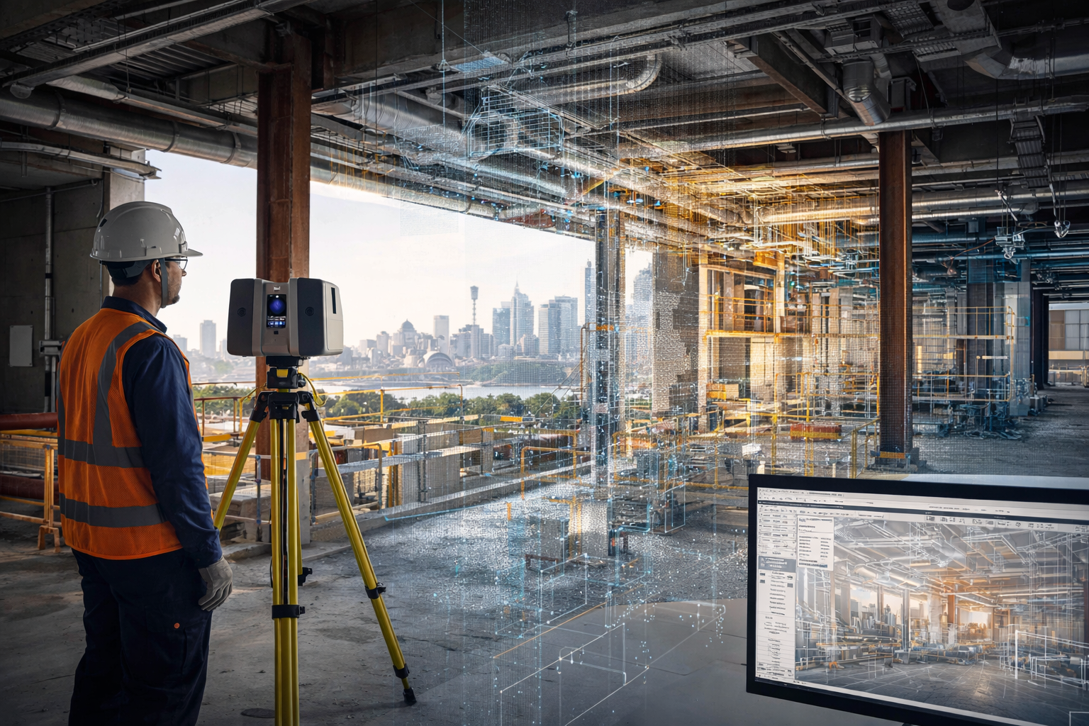
Technician using a tripod-mounted 3D laser scanner inside a Sydney building project with digital scan data visible.
Blue 3D LiDAR scanner icon on a tripod with scanning waves

3D laser scanning is being used across Sydney projects to capture accurate existing conditions before design, construction, upgrades, and maintenance work begins. In construction and industrial environments, this technology helps reduce guesswork by providing a reliable digital record of what is actually on site.

For project teams working in live buildings, industrial plants, infrastructure corridors, and brownfield environments, 3D laser scanning can support safer planning, faster design development, and more accurate engineering decisions.

Why 3D Laser Scanning Matters

Many Sydney projects take place in environments where existing information is incomplete, outdated, or missing altogether. Legacy drawings may not reflect years of modifications, and manual site measurements often miss the detail needed for confident design and drafting.

3D laser scanning helps solve that problem by capturing large areas quickly and turning real site conditions into digital information that can be reviewed, measured, modelled, and referenced during project delivery.

This is especially useful where:

  • access is difficult
  • shutdown windows are short
  • geometry is complex
  • services are congested
  • existing drawings are unreliable
  • rework risk needs to be reduced

How 3D Laser Scanning is Used in Sydney Construction Projects

In construction, 3D laser scanning is commonly used to capture existing buildings, structures, and services before new work begins. This helps design teams understand the actual site condition rather than relying only on old plans or assumptions.

Typical construction uses include:

  • existing building surveys
  • faรงade and structural capture
  • service coordination
  • refurbishment and fitout planning
  • steelwork measurement
  • as-built verification
  • clash checking before installation
  • scanning of plant rooms, roof spaces, basements, and service risers

For Sydney construction projects, this can be particularly valuable in older buildings, confined plant areas, and staged redevelopment works where accuracy matters.

How 3D Laser Scanning is Used in Industrial Projects

3D laser scanning is also widely used in industrial and engineering projects across Sydney. This includes manufacturing facilities, processing plants, utilities infrastructure, materials handling systems, and brownfield upgrade works.

Common industrial applications include:

  • capturing conveyors, chutes, tanks, pipework, and steel structures
  • documenting existing plant before modifications
  • scan-to-CAD modelling
  • drafting support for upgrades and shutdowns
  • tie-in planning for new equipment
  • layout verification before fabrication
  • structural and mechanical design support
  • point cloud capture for engineering review

For industrial sites, one of the biggest advantages is being able to capture the true geometry of operating plant areas before mechanical or structural work begins.

Use in Brownfield and Upgrade Projects

Brownfield projects often involve uncertainty. Existing assets may have changed over time, undocumented modifications may exist, and available drawings may not reflect current conditions.

In these cases, 3D laser scanning helps teams capture a reliable baseline before design starts. That information can then be used for:

  • design development
  • as-built documentation
  • drafting updates
  • interference checks
  • equipment replacement planning
  • shutdown preparation
  • fabrication support

This is one of the main reasons laser scanning continues to grow as a practical tool across Sydney engineering and construction work.

Supporting Better Design and Drafting

Laser scanning does not replace engineering or drafting, but it gives those services a much stronger starting point.

Once the site is scanned, the information can be used to support:

  • 2D drafting
  • 3D CAD modelling
  • engineering layouts
  • concept development
  • fabrication drawings
  • plant modification design
  • digital coordination between disciplines

This improves confidence in the next stage of the project and can reduce costly errors caused by poor site information.

Industries Using 3D Laser Scanning in Sydney

3D laser scanning is now used across a wide range of Sydney industries, including:

  • construction
  • commercial buildings
  • manufacturing
  • utilities
  • mining support facilities
  • ports and bulk materials handling
  • infrastructure
  • industrial processing
  • plant maintenance and shutdown work

The value is not limited to one sector. Wherever site accuracy is important, scanning can improve project visibility and reduce risk.

Why Sydney Projects Benefit from 3D Laser Scanning

Sydney projects often involve busy sites, limited access, complex existing infrastructure, and tight project windows. In these conditions, accurate site capture can save time and improve decision-making across the full project lifecycle.

Benefits can include:

  • better visibility of existing conditions
  • reduced reliance on outdated drawings
  • improved coordination between disciplines
  • fewer surprises during fabrication or installation
  • stronger support for engineering and drafting workflows
  • better preparation for upgrades and shutdowns

From Site Capture to Engineering Use

The real value of 3D laser scanning is not just in collecting data. It is in how that data is used.

When integrated into drafting, modelling, and engineering workflows, scanning becomes a practical project tool. It helps bridge the gap between what is on site and what needs to be designed, checked, fabricated, or installed.

For businesses working on Sydney-based construction and industrial projects, this can support better outcomes from the earliest planning stages through to delivery.

To learn more about engineering-grade scanning support, visit our pillar page:

Conclusion

3D laser scanning is being used across Sydney projects to improve accuracy, support better planning, and reduce project risk. From construction and building upgrades to industrial plant modifications and engineering design, it provides a reliable way to capture real site conditions before important decisions are made.

As more projects move toward digital engineering and better site verification, 3D laser scanning is becoming an increasingly valuable part of the workflow.

Hamilton By Design logo displayed on a blue tilted rectangle with a grey gradient background

Hamilton By Design provides engineering-led 3D scanning, LiDAR scanning, mechanical engineering and digital engineering services throughout Sydney and Greater Sydney.

Explore our related Sydney services:


  • 3D Scanning Sydney โ€“ Engineering-grade terrestrial laser scanning, as-built surveys and point cloud capture for industrial, infrastructure and commercial projects.
  • Reality Capture Sydney โ€“ High-accuracy reality capture, digital twins, asset documentation and engineering-grade site verification.
  • Scan to CAD Sydney โ€“ Convert point cloud data into AutoCAD, SolidWorks, Inventor and other engineering-ready CAD deliverables.
  • Point Cloud Modelling Sydney โ€“ Engineering-grade point cloud processing, clash detection, as-built verification and 3D modelling.
  • Mechanical Engineering Sydney โ€“ Mechanical design, plant upgrades, materials handling systems, conveyors, chutes, platforms and engineering support.
  • Structural Drafting Sydney โ€“ Structural steel drafting, fabrication drawings, GA drawings, workshop detailing and as-built documentation.

Hamilton By Design supports projects throughout Sydney CBD, Parramatta, Liverpool, Penrith, Blacktown, Chatswood, Alexandria, Mascot, Newcastle and the Central Coast.


3D LiDAR scanning and 3D modelling service button โ€” laser scanner capturing a point cloud for engineering and CAD modelling
Mechanical engineering services

Name
Would you like us to arrange a phone consultation for you?
Address
3D Scanning Sydney banner promoting engineering-grade 3D laser scanning, LiDAR scanning, and reality capture services by Hamilton By Design.
Mechanical Engineering Sydney banner with white text on a blue background representing Hamilton By Design's mechanical engineering services in Sydney.
Mechanical Drafting and 3D Modelling Sydney banner highlighting Hamilton By Design's CAD drafting, 3D modelling, and engineering design services in Sydney.

Mechanical Engineering | Structural Engineering


3D CAD Modelling Australia service banner for Hamilton By Design
3D LiDAR Scanning Darwin for engineering surveys, laser scanning, reality capture and point cloud modelling services
3D LiDAR Scanning Australia engineering services for laser scanning, reality capture, scan-to-CAD, Scan-to-BIM and as-built documentation across Australia
3D LiDAR scanning services on the Central Coast providing engineering-grade laser scanning, point cloud capture, scan-to-CAD modelling and industrial reality capture for infrastructure and industrial projects.