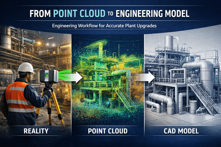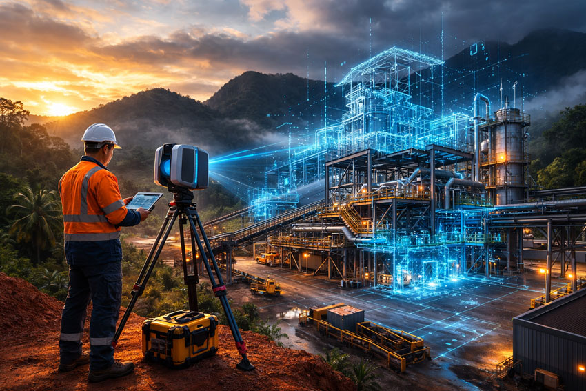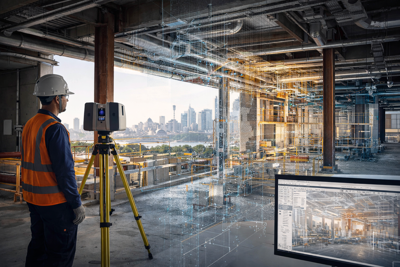

3D laser scanning is being used across Sydney projects to capture accurate existing conditions before design, construction, upgrades, and maintenance work begins. In construction and industrial environments, this technology helps reduce guesswork by providing a reliable digital record of what is actually on site.
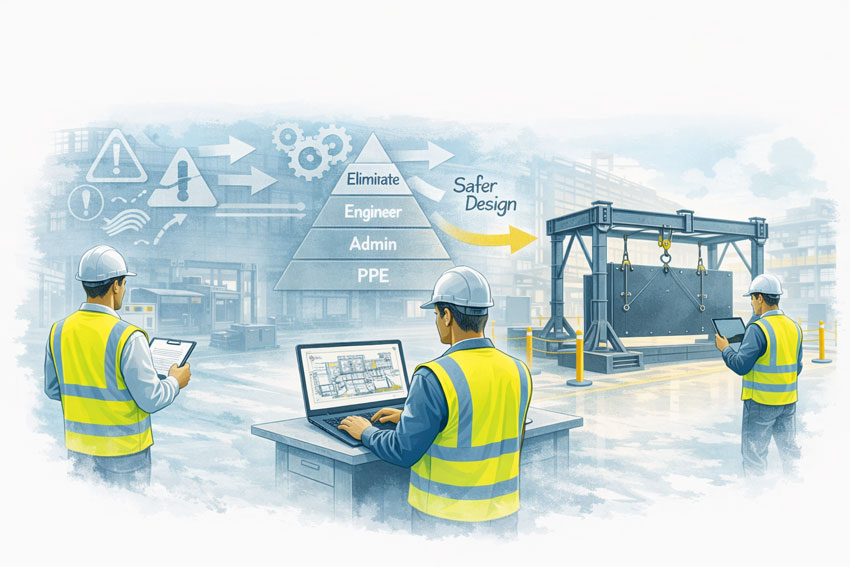
For project teams working in live buildings, industrial plants, infrastructure corridors, and brownfield environments, 3D laser scanning can support safer planning, faster design development, and more accurate engineering decisions.
Why 3D Laser Scanning Matters
Many Sydney projects take place in environments where existing information is incomplete, outdated, or missing altogether. Legacy drawings may not reflect years of modifications, and manual site measurements often miss the detail needed for confident design and drafting.
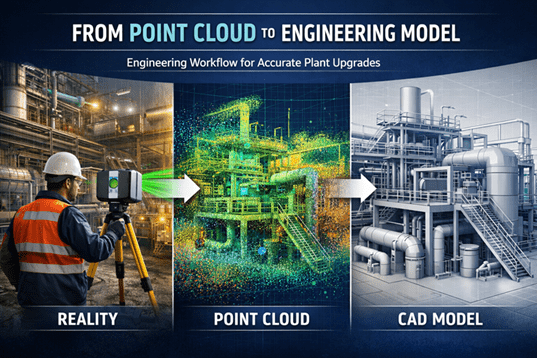
3D laser scanning helps solve that problem by capturing large areas quickly and turning real site conditions into digital information that can be reviewed, measured, modelled, and referenced during project delivery.
This is especially useful where:
- access is difficult
- shutdown windows are short
- geometry is complex
- services are congested
- existing drawings are unreliable
- rework risk needs to be reduced
How 3D Laser Scanning is Used in Sydney Construction Projects
In construction, 3D laser scanning is commonly used to capture existing buildings, structures, and services before new work begins. This helps design teams understand the actual site condition rather than relying only on old plans or assumptions.
Typical construction uses include:
- existing building surveys
- façade and structural capture
- service coordination
- refurbishment and fitout planning
- steelwork measurement
- as-built verification
- clash checking before installation
- scanning of plant rooms, roof spaces, basements, and service risers
For Sydney construction projects, this can be particularly valuable in older buildings, confined plant areas, and staged redevelopment works where accuracy matters.
How 3D Laser Scanning is Used in Industrial Projects
3D laser scanning is also widely used in industrial and engineering projects across Sydney. This includes manufacturing facilities, processing plants, utilities infrastructure, materials handling systems, and brownfield upgrade works.
Common industrial applications include:
- capturing conveyors, chutes, tanks, pipework, and steel structures
- documenting existing plant before modifications
- scan-to-CAD modelling
- drafting support for upgrades and shutdowns
- tie-in planning for new equipment
- layout verification before fabrication
- structural and mechanical design support
- point cloud capture for engineering review
For industrial sites, one of the biggest advantages is being able to capture the true geometry of operating plant areas before mechanical or structural work begins.
Use in Brownfield and Upgrade Projects
Brownfield projects often involve uncertainty. Existing assets may have changed over time, undocumented modifications may exist, and available drawings may not reflect current conditions.
In these cases, 3D laser scanning helps teams capture a reliable baseline before design starts. That information can then be used for:
- design development
- as-built documentation
- drafting updates
- interference checks
- equipment replacement planning
- shutdown preparation
- fabrication support
This is one of the main reasons laser scanning continues to grow as a practical tool across Sydney engineering and construction work.
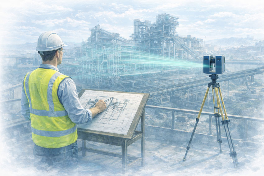
Supporting Better Design and Drafting
Laser scanning does not replace engineering or drafting, but it gives those services a much stronger starting point.
Once the site is scanned, the information can be used to support:
- 2D drafting
- 3D CAD modelling
- engineering layouts
- concept development
- fabrication drawings
- plant modification design
- digital coordination between disciplines
This improves confidence in the next stage of the project and can reduce costly errors caused by poor site information.
Industries Using 3D Laser Scanning in Sydney
3D laser scanning is now used across a wide range of Sydney industries, including:
- construction
- commercial buildings
- manufacturing
- utilities
- mining support facilities
- ports and bulk materials handling
- infrastructure
- industrial processing
- plant maintenance and shutdown work
The value is not limited to one sector. Wherever site accuracy is important, scanning can improve project visibility and reduce risk.
Why Sydney Projects Benefit from 3D Laser Scanning
Sydney projects often involve busy sites, limited access, complex existing infrastructure, and tight project windows. In these conditions, accurate site capture can save time and improve decision-making across the full project lifecycle.
Benefits can include:
- better visibility of existing conditions
- reduced reliance on outdated drawings
- improved coordination between disciplines
- fewer surprises during fabrication or installation
- stronger support for engineering and drafting workflows
- better preparation for upgrades and shutdowns
From Site Capture to Engineering Use
The real value of 3D laser scanning is not just in collecting data. It is in how that data is used.
When integrated into drafting, modelling, and engineering workflows, scanning becomes a practical project tool. It helps bridge the gap between what is on site and what needs to be designed, checked, fabricated, or installed.
For businesses working on Sydney-based construction and industrial projects, this can support better outcomes from the earliest planning stages through to delivery.
Related Service
To learn more about engineering-grade scanning support, visit our pillar page:
Conclusion
3D laser scanning is being used across Sydney projects to improve accuracy, support better planning, and reduce project risk. From construction and building upgrades to industrial plant modifications and engineering design, it provides a reliable way to capture real site conditions before important decisions are made.
As more projects move toward digital engineering and better site verification, 3D laser scanning is becoming an increasingly valuable part of the workflow.

Related Sydney Services
Hamilton By Design provides engineering-led 3D scanning, LiDAR scanning, mechanical engineering and digital engineering services throughout Sydney and Greater Sydney.
Explore our related Sydney services:
- 3D Scanning Sydney – Engineering-grade terrestrial laser scanning, as-built surveys and point cloud capture for industrial, infrastructure and commercial projects.
- Reality Capture Sydney – High-accuracy reality capture, digital twins, asset documentation and engineering-grade site verification.
- Scan to CAD Sydney – Convert point cloud data into AutoCAD, SolidWorks, Inventor and other engineering-ready CAD deliverables.
- Point Cloud Modelling Sydney – Engineering-grade point cloud processing, clash detection, as-built verification and 3D modelling.
- Mechanical Engineering Sydney – Mechanical design, plant upgrades, materials handling systems, conveyors, chutes, platforms and engineering support.
- Structural Drafting Sydney – Structural steel drafting, fabrication drawings, GA drawings, workshop detailing and as-built documentation.
Hamilton By Design supports projects throughout Sydney CBD, Parramatta, Liverpool, Penrith, Blacktown, Chatswood, Alexandria, Mascot, Newcastle and the Central Coast.


Mechanical Engineering | Structural Engineering