Point Cloud to CAD | Mechanical Engineering | Western Sydney Specialists
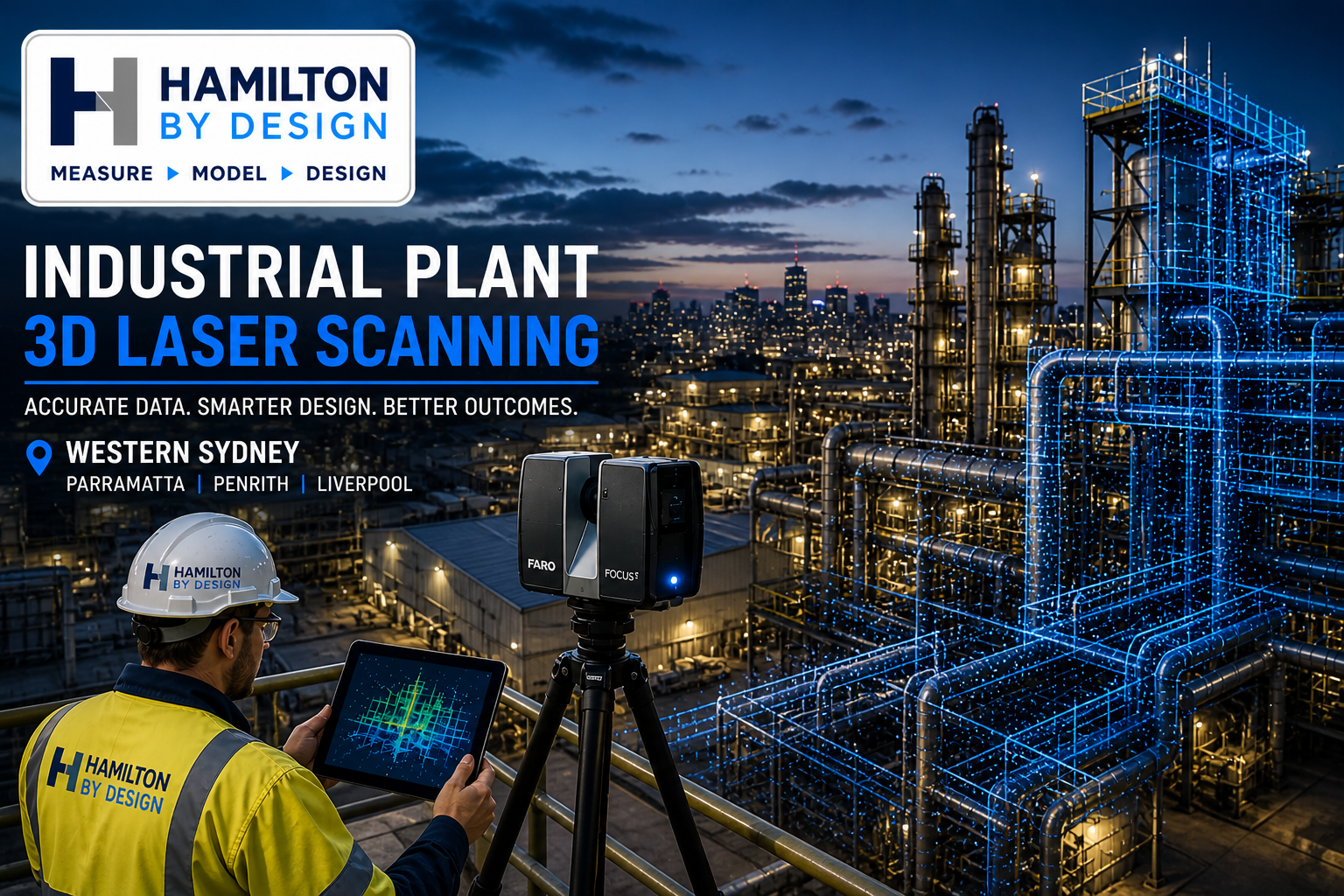
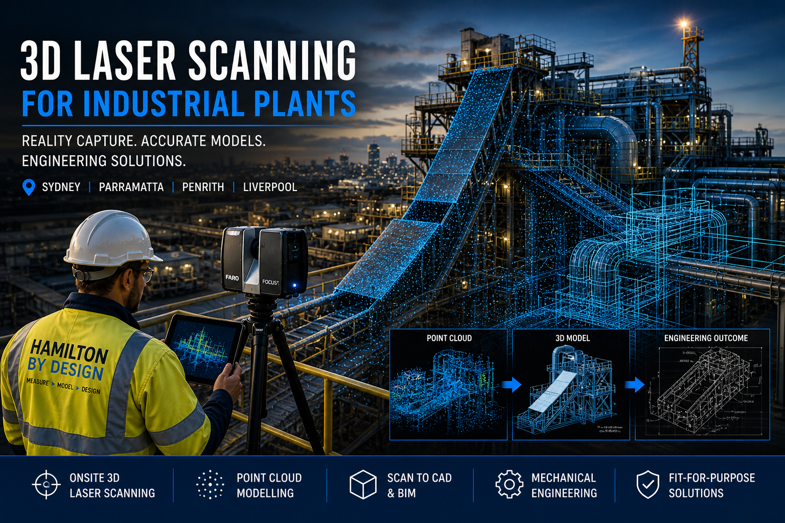
At Hamilton By Design, we provide engineering-grade 3D laser scanning for industrial plants, delivering accurate site data, detailed CAD models, and fit-for-purpose mechanical design solutions across Sydney, Parramatta, Penrith, and Liverpool.
Unlike typical 3D scanning companies, we are mechanical engineers first. That means every scan is captured with the end goal in mind — design, fabrication, and real-world application.
3D Laser Scanning Services (Sydney & Western Sydney)
We offer onsite and mobile 3D scanning services across:
- Parramatta
- Penrith
- Liverpool
- Greater Western Sydney
Our LiDAR scanning services are ideal for:
- Industrial plants
- Manufacturing facilities
- Processing plants
- Construction and building upgrades
If you’re searching for a “3D scanning company near me”, we deliver fast, accurate, and engineering-ready results.


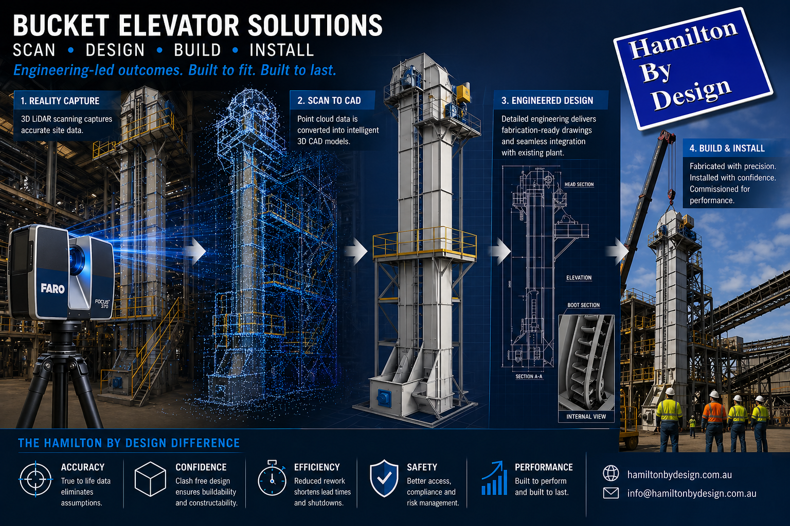
From Point Cloud to CAD (Engineering-Ready Models)
Scanning is only the first step.
We convert scan data into:
- Point cloud modelling
- 3D CAD models (SolidWorks, STEP, Parasolid)
- 2D AutoCAD drawings
- Scan-to-BIM models
This allows for:
- Accurate design modifications
- Clash detection
- Fabrication-ready outputs
Mechanical Engineering Services
Hamilton By Design provides full mechanical engineering support, including:
- Process equipment design
- Structural and mechanical upgrades
- Preventative maintenance design
- Fit-for-purpose engineering solutions
All work is aligned with relevant Australian Standards, including AS 4991 where applicable.
Mining & Bulk Handling (High-Value Applications)
We specialise in mining and bulk materials handling systems, including:
- Coal chutes and transfer stations
- Conveyor systems
- Outbye mining infrastructure
- Header transition chutes
Custom Design vs Off-the-Shelf
Off-the-shelf chute designs often lead to:
- Poor fit
- Increased wear
- High maintenance costs
Our approach:
- Scan existing plant conditions
- Develop custom designs based on real data
- Deliver solutions that reduce downtime and improve performance
Building & Construction Scanning
We also support:
- Building scanning services
- Construction site verification
- Scan-to-BIM for refurbishment projects
Ideal for commercial, industrial, and infrastructure upgrades.
Industries We Support
- Industrial plants
- Manufacturing facilities
- Food processing plants
- Mining and bulk handling
- Construction and infrastructure
Locations We Service
We provide 3D laser scanning and engineering services across:
Sydney
Parramatta
Penrith
Liverpool
Western Sydney
With project capability across NSW and Australia.
Common Questions
What are the best 3D scanning platforms?
We use industry-leading LiDAR systems such as FARO and Leica. However, the real value comes from how the data is used in engineering design.


Do I need scan-to-CAD or just scanning?
Most industrial projects require CAD models and engineering input — not just raw scan data.
Who provides professional 3D scanning near me?
Engineering-led companies like Hamilton By Design provide usable outcomes, not just visual data.

Get Started
If you need accurate site data, modelling, or engineering support for an industrial project, contact Hamilton By Design today.


Mechanical Engineering | Structural Engineering
Related Sydney Services
Hamilton By Design provides engineering-led 3D scanning, LiDAR scanning, mechanical engineering and digital engineering services throughout Sydney and Greater Sydney.
Explore our related Sydney services:
- 3D Scanning Sydney – Engineering-grade terrestrial laser scanning, as-built surveys and point cloud capture for industrial, infrastructure and commercial projects.
- Reality Capture Sydney – High-accuracy reality capture, digital twins, asset documentation and engineering-grade site verification.
- Scan to CAD Sydney – Convert point cloud data into AutoCAD, SolidWorks, Inventor and other engineering-ready CAD deliverables.
- Point Cloud Modelling Sydney – Engineering-grade point cloud processing, clash detection, as-built verification and 3D modelling.
- Mechanical Engineering Sydney – Mechanical design, plant upgrades, materials handling systems, conveyors, chutes, platforms and engineering support.
- Structural Drafting Sydney – Structural steel drafting, fabrication drawings, GA drawings, workshop detailing and as-built documentation.
Hamilton By Design supports projects throughout Sydney CBD, Parramatta, Liverpool, Penrith, Blacktown, Chatswood, Alexandria, Mascot, Newcastle and the Central Coast.