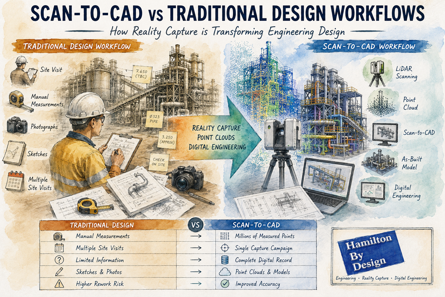
Scan-to-CAD vs Traditional Design Workflows: How Reality Capture is Transforming Engineering Design
For decades, engineering and drafting companies have relied on traditional design workflows to create new assets, modify existing facilities and develop construction documentation. These methods typically involve site visits, manual measurements, photographs, sketches and extensive assumptions about existing conditions.
While traditional design processes have successfully delivered countless projects, modern reality capture technologies are changing how engineering data is collected and utilised.
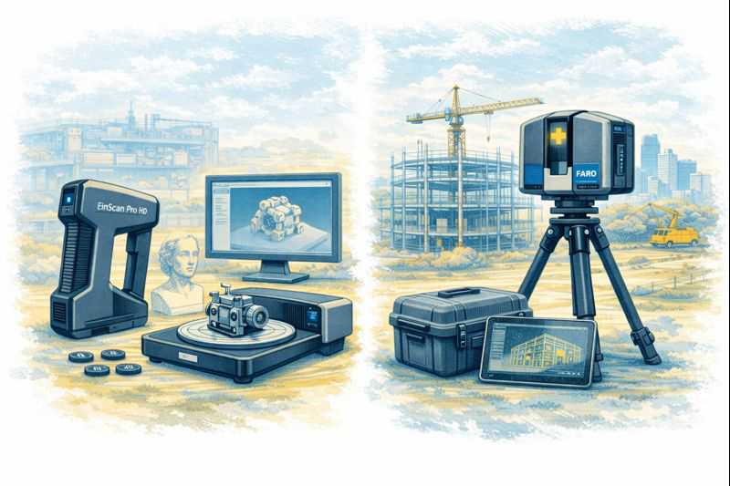
The introduction of terrestrial LiDAR scanning, engineering-grade reality capture and point cloud modelling has given design companies access to highly accurate representations of existing facilities. Rather than starting with assumptions and limited measurements, engineers can now begin with a digital copy of reality.
This approach is commonly known as Scan-to-CAD.
At Hamilton By Design, we have seen first-hand how Scan-to-CAD workflows can improve project accuracy, reduce site visits and provide better information for engineering decision-making. However, traditional design methods still have an important role to play.
The key is understanding where each approach provides the greatest value.
What is a Traditional Design Workflow?
Traditional design workflows generally begin with a site inspection and manual data collection process.
An engineer, designer or draftsperson visits the facility and records information such as:
- Dimensions
- Levels
- Equipment locations
- Structural arrangements
- Pipe routing
- Building layouts
- Photographs
- Sketches
The collected information is then used to develop drawings and 3D models.
A typical workflow may include:
- Site visit
- Manual measurements
- Photographic survey
- Sketch preparation
- CAD model creation
- Design development
- Drawing production
- Construction issue
This process has been the backbone of engineering design for many years.
Challenges with Traditional Design Methods
Although effective, traditional workflows present several challenges.
Limited Data Collection
No matter how experienced the survey team is, it is impossible to measure everything.
Often only dimensions considered important at the time are collected.
If additional information is required later, another site visit may be necessary.
Human Error
Manual measurements introduce opportunities for error.
Common issues include:
- Incorrect dimensions
- Missed measurements
- Recording errors
- Inconsistent datum references
These errors can propagate throughout the project.
Access Restrictions
Industrial facilities often contain:
- Confined spaces
- Elevated structures
- Operational equipment
- Hazardous environments
Obtaining measurements in these areas can be difficult and expensive.
Multiple Site Visits
Many projects require repeated visits to verify dimensions and resolve discrepancies.
This increases:
- Project costs
- Travel expenses
- Programme duration
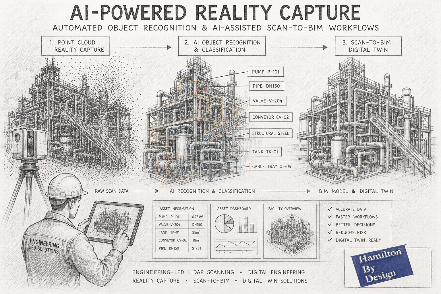
What is Scan-to-CAD?
Scan-to-CAD is the process of using reality capture technologies to create engineering drawings and models.
The workflow begins with a terrestrial LiDAR scan of the facility.
Millions or billions of measured points are captured to create a highly detailed point cloud.
The point cloud then becomes the foundation for:
- CAD models
- BIM models
- General arrangement drawings
- Structural models
- Pipework layouts
- Reverse engineering projects
- Asset documentation
Rather than manually measuring selected features, Scan-to-CAD captures the entire environment.
How Scan-to-CAD Works
Step 1 – Reality Capture
A LiDAR scanner records the existing facility.
This may include:
- Buildings
- Process plants
- Pipework
- Conveyors
- Tanks
- Structural steel
- Mechanical equipment
Step 2 – Point Cloud Registration
Individual scans are combined into a unified coordinate system.
The result is a complete digital representation of the site.
Step 3 – Engineering Review
Engineers review the point cloud and determine project requirements.
Step 4 – CAD Modelling
Relevant assets are modelled from the point cloud.
Outputs may include:
- 2D drawings
- 3D CAD models
- BIM models
- Fabrication drawings
- Construction documentation
Step 5 – Design Development
The design team develops modifications directly against existing conditions.
Comparing Scan-to-CAD and Traditional Design Workflows
Accuracy
Traditional Workflow
Accuracy depends on:
- Measurement methods
- Survey coverage
- Site conditions
- Human interpretation
Typically, only selected dimensions are recorded.
Scan-to-CAD
Millions of measured points create a detailed digital representation.
Engineering-grade terrestrial LiDAR scanning can provide highly accurate spatial information across entire facilities.
Winner: Scan-to-CAD
Site Time
Traditional Workflow
Complex facilities may require several site visits.
Scan-to-CAD
Most information is captured during a single scanning campaign.
Winner: Scan-to-CAD
Data Availability
Traditional Workflow
Only measured dimensions are available.
Scan-to-CAD
The entire captured environment remains available for future reference.
Winner: Scan-to-CAD
Upfront Cost
Traditional Workflow
Lower initial survey costs.
Scan-to-CAD
Requires specialised scanning equipment and processing.
Winner: Traditional Workflow
Long-Term Value
Traditional Workflow
Information is often project-specific.
Scan-to-CAD
Point clouds become long-term digital assets.
Winner: Scan-to-CAD
Why Design Companies Are Adopting Scan-to-CAD
Increasingly, engineering consultancies and drafting companies are integrating reality capture into their workflows.
Benefits include:
Reduced Rework
Designs can be developed against actual site conditions.
Improved Clash Detection
Existing assets can be modelled accurately.
Better Stakeholder Communication
Point clouds and digital models improve project visualisation.
Enhanced Project Planning
Engineers can assess access and constructability earlier.
Faster Design Iterations
Additional measurements are often available without returning to site.
Applications Across Industries
Mining
Mining facilities contain extensive:
- Conveyors
- Chutes
- Crushers
- Tanks
- Pipework
Scan-to-CAD can significantly improve brownfield modification projects.
Manufacturing
Production facilities frequently evolve over time.
Reality capture provides accurate documentation of current conditions.
Water and Wastewater
Pump stations and treatment plants often contain complex mechanical layouts.
Scan-to-CAD improves upgrade planning and documentation.
Commercial Buildings
Architects and engineers can generate accurate as-built documentation.
Energy
Power stations and industrial utilities benefit from detailed digital asset records.
When Traditional Workflows Still Make Sense
Despite the advantages of reality capture, traditional methods remain valuable.
Examples include:
Concept Design
Early-stage feasibility studies may not require detailed site data.
Greenfield Projects
When designing on vacant land, no existing assets exist to scan.
Small Modifications
Minor changes may not justify scanning costs.
Budget-Constrained Projects
Some projects require a lower-cost approach.
The most successful engineering organisations understand that both approaches have their place.
The Rise of AI-Assisted Scan-to-CAD
Artificial Intelligence is introducing new capabilities into reality capture workflows.
Emerging technologies can:
- Identify pipework
- Classify equipment
- Recognise structural steel
- Generate preliminary BIM models
- Accelerate modelling workflows
Although engineering verification remains essential, AI-assisted modelling is expected to become increasingly common.
Digital Twins and Future Design Workflows
The future of engineering design is likely to combine:
- Reality capture
- Scan-to-CAD
- Scan-to-BIM
- Digital twins
- Artificial intelligence
- Cloud collaboration
Rather than creating drawings from limited measurements, engineering teams will increasingly work from comprehensive digital representations of existing assets.
This shift has the potential to improve project quality, reduce risk and accelerate project delivery.
How Hamilton By Design Supports Scan-to-CAD Projects
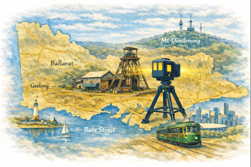
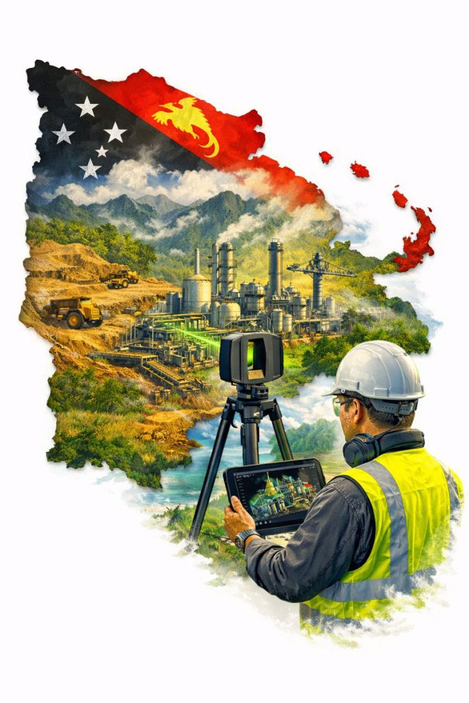
Hamilton By Design provides engineering-led reality capture and Scan-to-CAD services throughout Australia.
Our capabilities include:
- Terrestrial LiDAR scanning
- Engineering-grade reality capture
- Point cloud registration
- Scan-to-CAD
- Scan-to-BIM
- Reverse engineering
- Mechanical design
- Structural drafting
- Asset documentation
- Digital engineering support
We work across:
- Mining
- Manufacturing
- Infrastructure
- Energy
- Commercial buildings
- Water and wastewater
Our approach combines practical engineering experience with modern reality capture technology to deliver accurate and usable engineering information.

Traditional design workflows have served the engineering industry well for decades and continue to play an important role in many projects.
However, the emergence of Scan-to-CAD workflows has fundamentally changed how existing facilities can be documented and modelled.
By capturing measured reality rather than relying solely on manual measurements, engineering teams gain access to more complete information, improved accuracy and greater flexibility throughout the design process.
For brownfield projects, industrial facilities and complex infrastructure, Scan-to-CAD is increasingly becoming the preferred method for developing accurate engineering deliverables.
Rather than replacing traditional design workflows, reality capture enhances them, providing engineers and designers with a richer foundation from which to make informed decisions.
Frequently Asked Questions (FAQ)
What is Scan-to-CAD?
Scan-to-CAD is the process of converting LiDAR scan data or point clouds into CAD drawings and 3D models. It allows engineers to develop designs using accurate representations of existing assets.
How accurate is Scan-to-CAD?
Accuracy depends on the scanning equipment and workflow used. Engineering-grade terrestrial LiDAR scanning can provide highly accurate spatial information suitable for engineering and drafting applications.
What industries benefit most from Scan-to-CAD?
Mining, manufacturing, infrastructure, energy, commercial buildings, water treatment facilities and industrial processing plants all benefit from Scan-to-CAD workflows.
Is Scan-to-CAD better than traditional surveying?
Both approaches have value. Scan-to-CAD generally provides more comprehensive site information, while traditional surveying may be appropriate for smaller or less complex projects.
Can point clouds be used directly in CAD software?
Yes. Many CAD platforms can reference point cloud data directly, allowing engineers to model against real-world measurements.
What is the difference between Scan-to-CAD and Scan-to-BIM?
Scan-to-CAD focuses on creating engineering drawings and CAD models, while Scan-to-BIM creates Building Information Models containing both geometry and asset information.
Does Scan-to-CAD reduce site visits?
In many cases, yes. Capturing comprehensive scan data can significantly reduce the need for repeat measurement visits.
Can AI automatically create CAD models from point clouds?
AI-assisted modelling tools are becoming increasingly capable, but engineering review and verification remain essential for accurate project outcomes.
What deliverables can be produced from a Scan-to-CAD project?
Deliverables may include point clouds, CAD models, BIM models, fabrication drawings, as-built drawings, general arrangement drawings and digital twin models.
Why choose Hamilton By Design for Scan-to-CAD projects?
Hamilton By Design combines engineering-led reality capture, practical industry experience and advanced digital engineering workflows to deliver accurate and usable engineering information for industrial and infrastructure projects throughout Australia.
Mechanical Engineering | Structural Engineering