Structural Drafting Sydney | Engineering-Grade CAD & Steel Detailing
Engineering-Grade Detailing for Real-World Construction
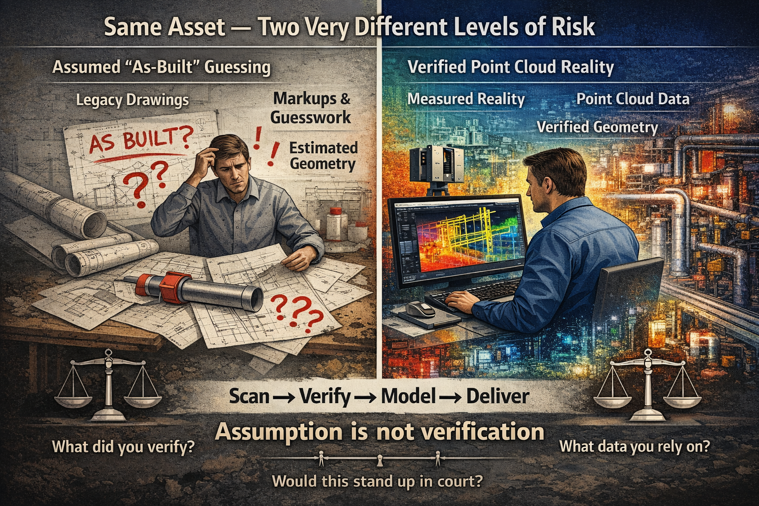
Structural drafting in Sydney is often treated as a documentation exercise — but in reality, it sits at the critical junction between design intent and construction reality.
At Hamilton By Design, we approach structural drafting as an engineering-led process, not just linework. By combining 3D LiDAR scanning, SolidWorks modelling, and practical site experience, we ensure drawings reflect what is actually built — not what was assumed.
Why Structural Drafting Matters in Sydney
Sydney presents unique challenges:
- Dense urban environments
- Brownfield upgrades and legacy infrastructure
- Tight construction tolerances
- Multi-disciplinary coordination (mechanical, civil, structural)
Traditional drafting methods often rely on:
- Outdated drawings
- Manual measurements
- Assumptions based on design models
This creates risk.


The Problem with Traditional Drafting
In many projects, structural drawings are created without verifying real-world conditions. This leads to:
- Misaligned steelwork
- Rework on-site
- Fabrication errors
- Cost overruns
- Delays during installation
The issue is simple:
Design models ≠ As-built reality
Our Approach: Scan → Model → Detail
We solve this using an engineering-grade workflow:
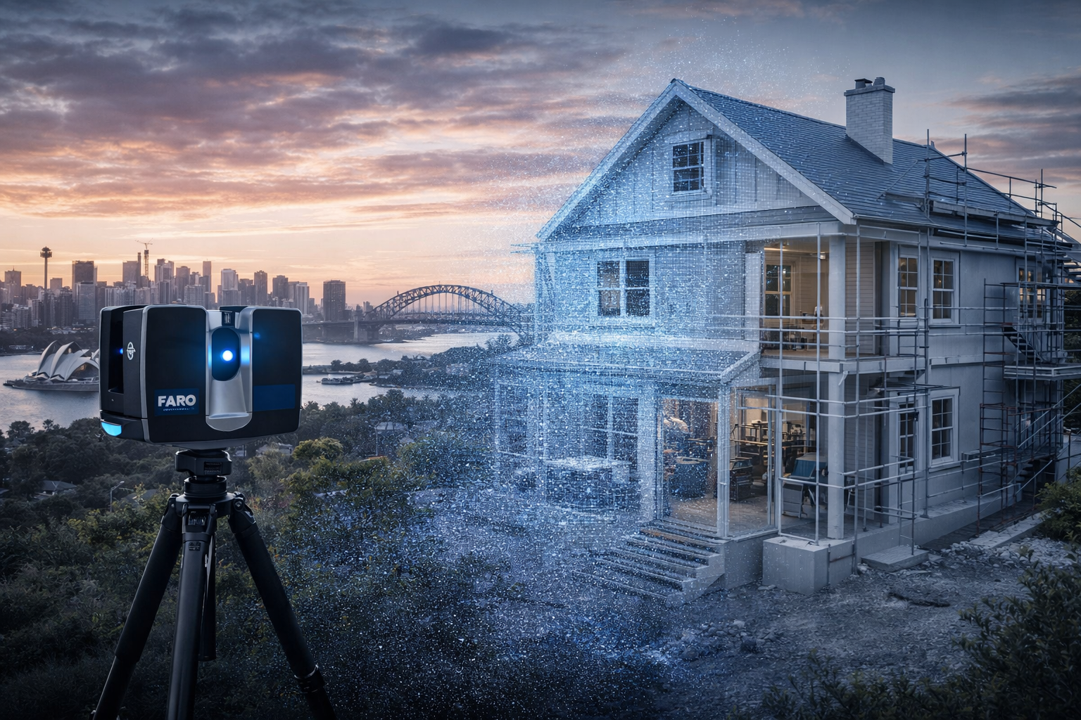
1. 3D Laser Scanning (LiDAR)
Using FARO terrestrial scanners, we capture accurate site geometry:
- Steel structures
- Concrete interfaces
- Existing services
- Connection points
Deliverables:
- Registered point clouds (.E57, .RCP)
- Full site coverage with traceable accuracy
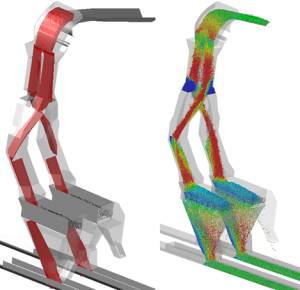
2. Point Cloud to CAD Modelling
We convert reality into usable engineering models:
- Clean, simplified geometry
- Fabrication-ready references
- Clash-aware modelling
3. Structural Drafting & Detailing
We produce:
- GA drawings
- Shop drawings
- Sections and elevations
- Connection details
- Platework and steel member detailing
All drawings are structured for:
- Fabrication
- Installation
- Compliance
Why Engineering-Led Drafting Wins
Most drafting services are CAD-driven.
We are engineering-driven.
This means:
- Load paths are understood
- Connections are practical
- Fabrication methods are considered
- Site constraints are built into the design
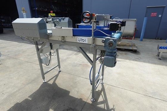
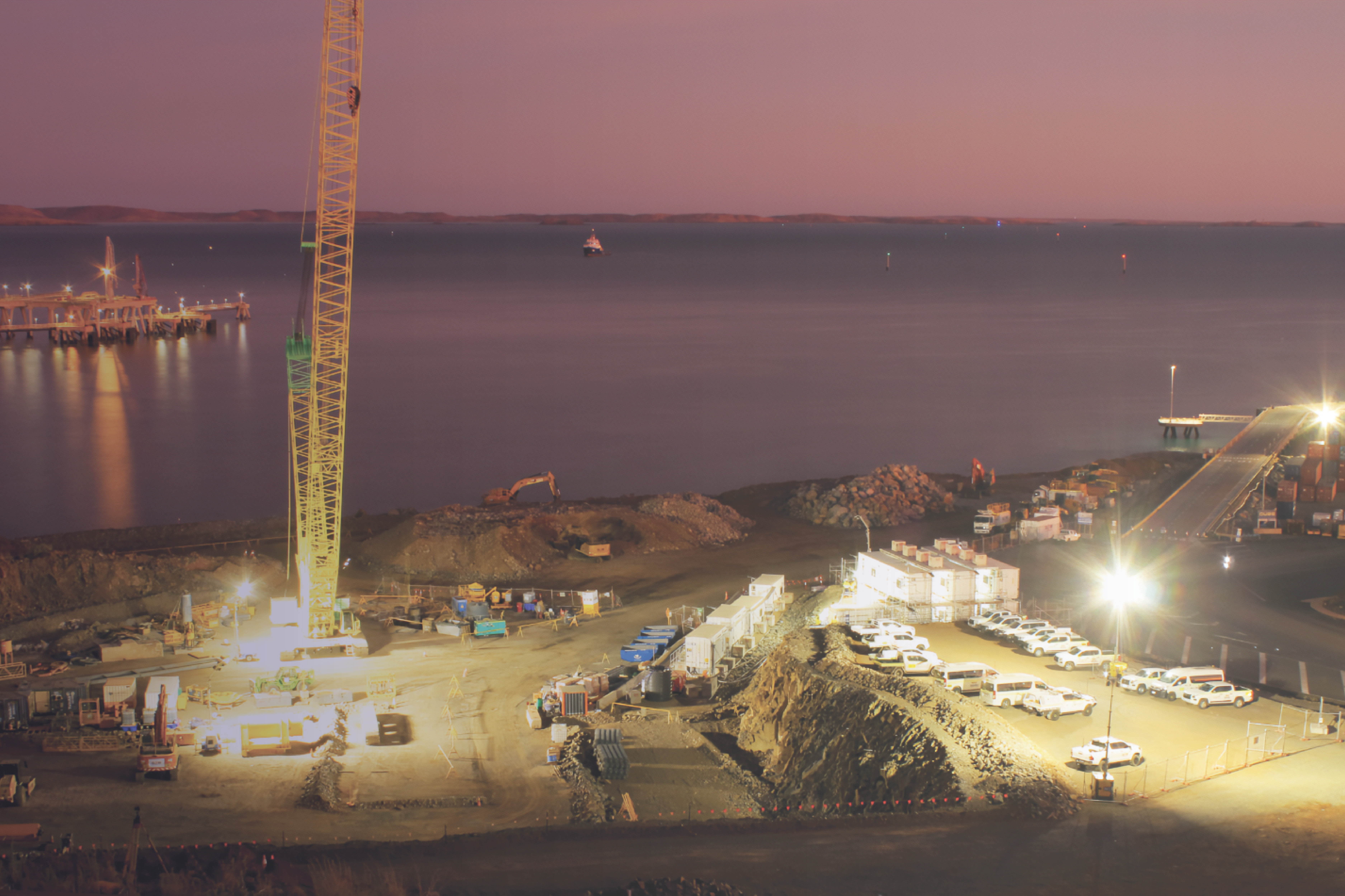
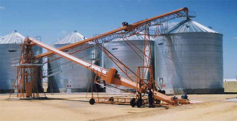
Sydney Project Applications
Our structural drafting services are ideal for:
- Industrial plants
- Mining infrastructure
- Structural upgrades
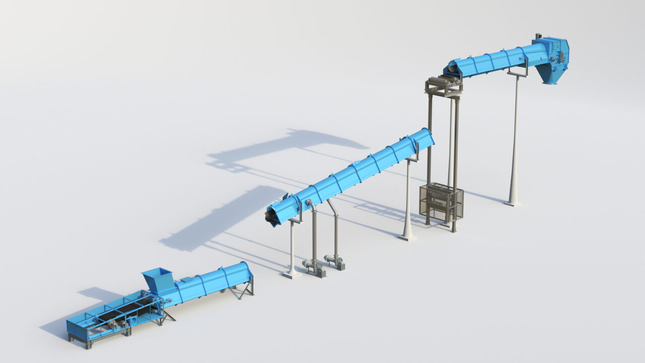
- Conveyor systems and transfer stations
- Platforms, walkways, and access systems
- Retrofit steelwork in existing buildings
The Role of Digital Engineering & Governance
By integrating with the 3DEXPERIENCE platform, we provide:
- Version-controlled drawings
- Full revision history
- Chain of custody for engineering data
- 24/7 access for stakeholders
This ensures:
- One source of truth
- Reduced miscommunication
- Audit-ready documentation
Key Benefits
- Reduced rework and site delays
- Accurate fabrication first time
- Faster project delivery
- Improved safety and compliance
- Better coordination across disciplines

Hamilton By Design
Structural drafting in Sydney should not rely on guesswork.
By combining:
- Reality capture (LiDAR scanning)
- Engineering modelling
- Practical drafting experience
Hamilton By Design delivers drawings that match reality — not assumptions.
Industries We Support
Our structural drafting services support manufacturing facilities, industrial plants, commercial buildings, rail infrastructure, water treatment facilities and resource sector projects throughout Sydney.
Hamilton By Design prepares structural steel drawings, fabrication details, general arrangement drawings and as-built documentation to support construction, maintenance and asset improvement projects.
Hamilton By Design provides structural drafting services throughout Sydney CBD, Parramatta, Liverpool, Penrith, Chatswood, Alexandria, Mascot, Newcastle and the Central Coast. We prepare structural steel drawings, fabrication details, general arrangement drawings and as-built documentation for industrial, infrastructure and commercial projects.
Call to Action
If your project requires accurate, buildable structural drawings, contact:
Hamilton By Design
Engineering-led drafting and 3D scanning services across Sydney
Our clients


Talk to Us – Contact Us


Mechanical Engineering | Structural Engineering
Related Sydney Services
Hamilton By Design provides engineering-led 3D scanning, LiDAR scanning, mechanical engineering and digital engineering services throughout Sydney and Greater Sydney.
Explore our related Sydney services:
- 3D Scanning Sydney – Engineering-grade terrestrial laser scanning, as-built surveys and point cloud capture for industrial, infrastructure and commercial projects.
- Reality Capture Sydney – High-accuracy reality capture, digital twins, asset documentation and engineering-grade site verification.
- Scan to CAD Sydney – Convert point cloud data into AutoCAD, SolidWorks, Inventor and other engineering-ready CAD deliverables.
- Point Cloud Modelling Sydney – Engineering-grade point cloud processing, clash detection, as-built verification and 3D modelling.
- Mechanical Engineering Sydney – Mechanical design, plant upgrades, materials handling systems, conveyors, chutes, platforms and engineering support.
- Structural Drafting Sydney – Structural steel drafting, fabrication drawings, GA drawings, workshop detailing and as-built documentation.
Hamilton By Design supports projects throughout Sydney CBD, Parramatta, Liverpool, Penrith, Blacktown, Chatswood, Alexandria, Mascot, Newcastle and the Central Coast.