Mechanical Engineering | 3D Scanning | 3D Modelling
Tag: dimensional-inspection-reports
Hamilton By Design prepares dimensional inspection reports using 3D scanning, CAD models and conventional measurement techniques.
Dimensional inspection can be used to verify manufactured components, document existing parts and compare scanned geometry against an approved CAD model or drawing. This can help identify dimensional variation, deformation, wear and areas that may require further investigation.
Our dimensional inspection services can support machined components, castings, fabricated parts, pump components, tooling, replacement parts and mechanical assemblies. Depending on the project, the inspection process may include:
Metrology-grade 3D scanning
Dimensional checks against drawings
Scan-to-CAD comparison
Colour deviation maps
Critical-feature measurements
Identification of maximum and minimum deviations
Photographic and visual documentation
Inspection findings and limitations
Reports can present the reference geometry, inspection method, measurement results, specified tolerances and identified deviations. Supporting files may include point clouds, polygon meshes, deviation maps, annotated images and compatible CAD data.
The required accuracy, tolerances, datum structure, surface preparation and acceptance criteria should be agreed before inspection begins. Where formal traceability or certified measurement is required, the equipment, calibration records, environmental controls and inspection procedure must meet the client’s quality requirements.
Learning From Mining Industry Incidents | Engineering Insight
Why Engineers Study Failures Without Assigning Blame
In engineering, learning does not come only from success.
Some of the most valuable improvements in safety, reliability, and design practice come from studying incidents after they occur — not to assign blame, but to better understand how systems behave under real-world conditions.
At Hamilton By Design, our interest in industry incidents is purely educational. We do not provide legal opinions, and we do not involve ourselves in litigation. Our focus is engineering learning and risk reduction.
Why Engineers Study Incidents
Engineering is a discipline built on:
Understanding failure modes
Learning from unintended outcomes
Improving designs so similar events are less likely to occur again
Courts determine liability. Engineers determine how systems can be made safer.
These are very different roles.
An Example From the Mining Fabrication Sector
A recent court-reported incident in the Australian mining fabrication sector involved a serious worker injury during the handling of a large steel plate.
This event has been widely reported in industry safety communications and regulator summaries. The matter has been dealt with by the courts.
Our interest is not who was responsible — but what can be learned from an engineering and design perspective.
Separating Legal Outcomes From Engineering Lessons
When incidents are discussed publicly, it is easy for conversations to drift toward:
Fault
Error
Individual actions
Compliance outcomes
From an engineering standpoint, a more useful question is:
“Why was this failure mode possible in the first place?”
This shifts the focus from people to systems.
The Engineering Perspective: Systems, Not Individuals
In fabrication, mining, and heavy industry environments, engineers routinely work with:
Large masses
Stored energy
Gravity-driven hazards
Tight workspaces
Time pressure
In these environments, safe outcomes should not rely on:
Perfect timing
Continuous vigilance
People always being in the right place
Good engineering design assumes:
Humans make mistakes
Conditions change
Equipment can fail
Distractions occur
And it designs accordingly.
Learning Through the Hierarchy of Controls
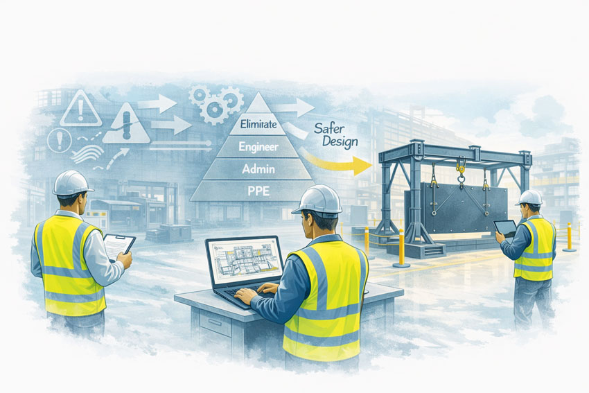
One of the most useful tools engineers have for learning from incidents is the hierarchy of controls.
From a learning perspective, incidents often highlight opportunities to move risk higher up the hierarchy:
Can the hazard be eliminated?
Can the task be re-designed so people are not exposed?
Can engineering controls prevent a single failure from becoming an injury?
Are procedures being used where physical controls could exist instead?
These are design questions, not legal ones.
Why This Matters for Engineering Practice
Studying incidents like this helps engineers:
Identify hidden assumptions in workshop layouts
Improve material handling design
Reduce reliance on administrative controls
Design processes that are more tolerant of variation
Prevent “normalised” risk from becoming invisible
Importantly, these lessons apply well beyond a single incident or company.
The Link to Broader Engineering Failures
The same learning approach is used when engineers study:
Structural failures
Mining incidents
Equipment damage
Tailings dam collapses
Process plant upsets
In each case, the goal is the same:
Understand how design decisions influence risk over time.
Not to judge — but to improve.
Our Position at Hamilton By Design
To be clear:
We do not comment on legal responsibility
We do not provide expert opinions on prosecutions
We do not participate in legal proceedings
Our interest is strictly:
Engineering learning
Design improvement
Risk reduction
Better outcomes for industry
We believe that open, professional learning from incidents strengthens engineering practice and improves safety across the sector.
Final Thought
Engineering advances when professionals are willing to say:
“What can we learn from this?”
Without blame. Without legal positioning. Without hindsight judgement.
Just better design, informed by real-world experience.
📩 Engineering-Led Design Matters
If you’re working in mining, fabrication, or heavy industry and want to reduce risk through better design decisions, Hamilton By Design supports engineering-led thinking that prioritises:
Hamilton By Design is committed to delivering high-quality engineering services that meet client requirements, applicable standards, and regulatory obligations.
Our Quality Policy ensures that all work is performed with technical integrity, accuracy, accountability, and consistency, supporting safe, reliable, and fit-for-purpose outcomes across all projects.
2. Our Commitment to Quality
Hamilton By Design is committed to:
Delivering engineering solutions that are accurate, defensible, and fit for purpose
Applying sound engineering judgement, not blind replication
Meeting or exceeding client, regulatory, and contractual requirements
Continually improving our systems, processes, and services
Maintaining professional integrity and accountability in all work undertaken
3. Scope
This policy applies to all activities undertaken by Hamilton By Design, including:
Mechanical engineering and design
Engineering-grade LiDAR and 3D laser scanning
3D CAD modelling and drafting
Structural and mechanical analysis
Fabrication-ready documentation
Engineering support for construction, mining, manufacturing, and industrial assets
The policy applies to employees, directors, contractors, and consultants working on behalf of Hamilton By Design.
4. Quality Objectives
Hamilton By Design achieves quality outcomes by:
Understanding client requirements and project objectives before commencing work
Defining scope, assumptions, and limitations clearly
Applying appropriate standards, codes, and best-practice engineering methods
Ensuring drawings, models, and deliverables are checked and reviewed
Delivering documentation suitable for construction, fabrication, and site use
Maintaining traceability of design decisions and changes
5. Engineering-Led Quality Approach
Quality at Hamilton By Design is underpinned by an engineering-led workflow, including:
Engineering-grade data capture suitable for downstream design and fabrication
Design intent based on function, safety, and service life—not just geometry
Integration of scanning, modelling, analysis, and documentation under single-source accountability
Professional judgement informed by experience, standards, and site conditions
6. Continuous Improvement
Hamilton By Design is committed to continuous improvement through:
Regular review of processes and project outcomes
Learning from lessons identified during project delivery
Incorporating client feedback
Updating systems to reflect industry best practice and technological advancements
Opportunities for improvement are actively encouraged and supported.
7. Compliance and Standards
Hamilton By Design will:
Comply with applicable Australian Standards, codes, and legislation
Align quality processes with ISO 9001 quality management principles
Meet client-specific quality and documentation requirements
Ensure records are maintained to demonstrate compliance and traceability
8. Roles and Responsibilities
Management
Management is responsible for:
Establishing and maintaining this Quality Policy
Providing resources to support quality outcomes
Promoting a culture of accountability and continuous improvement
Workers and Contractors
All workers are responsible for:
Performing work in accordance with agreed procedures and standards
Identifying and reporting quality issues or risks
Taking ownership of the quality of their work
9. Review of Policy
This Quality Policy will be reviewed periodically to ensure it remains current, effective, and aligned with:
Business objectives
Client expectations
Legislative and industry requirements
10. Quality Commitment Statement
Hamilton By Design is committed to delivering engineering services you can rely on—accurate, accountable, and fit for purpose—every time.
3D Scanning for Structural Drafting Darwin | Engineer-Led
Accurate As-Built Data for Structural Drafting in the Northern Territory — No Guesswork
At Hamilton By Design, we provide 3D LiDAR scanning for structural drafting in Darwin and across the Northern Territory, supporting projects in construction, ports, defence, energy, mining, and government infrastructure.
In Darwin and remote NT environments, inaccurate or missing as-built documentation creates significant risk—particularly where access is limited, shutdown windows are short, and compliance requirements are high. Our approach removes uncertainty by capturing real site conditions and converting them into engineering-ready structural drafting.
Why 3D Scanning Matters for Structural Drafting in Darwin
Projects in Darwin and the NT often involve:
Remote or regionally supported assets
Live operational facilities with limited access
Defence, port, and government infrastructure
Harsh environmental conditions
Tight construction and maintenance schedules
High compliance and audit requirements
Relying on manual measurements or legacy drawings introduces risk. Engineering-grade 3D scanning provides a reliable foundation for structural drafting, ensuring new works integrate accurately with existing structures.
3D Scanning as the Foundation for Structural Drafting
We use 3D scanning as a data capture tool that enables better structural drafting.
Our integrated workflow includes:
3D LiDAR scanning → 3D modelling → structural engineering → FEA (where required) → structural drafting
This ensures:
Structural drawings are based on verified site geometry
Clash risk for fabricated steel is reduced
Engineering decisions are supported by accurate data
Drafting reflects constructability and installation reality
One Accountable Engineering Partner
Rather than separating scanning, modelling, and drafting across multiple vendors, we deliver the complete service:
3D LiDAR scanning in Darwin and regional NT
3D as-built model development
Structural engineering input
Finite Element Analysis (FEA), where required
Structural drafting and fabrication documentation
One contact. One accountable team. One integrated workflow.
This approach is particularly valuable for remote and regionally supported projects where coordination and communication are critical.
Supporting Darwin, Regional NT & Remote Sites
We support projects across:
Darwin and surrounding industrial areas
Ports and marine infrastructure
Defence facilities and government assets
Energy and utilities infrastructure
Remote and regionally supported NT sites
Operating in these environments requires careful planning, accurate data capture, and documentation that can be relied upon without repeated site visits.
All structural drafting is developed in accordance with:
The National Construction Code (NCC)
Relevant Australian Standards
Client-specific, defence, and government requirements
Our deliverables provide defensible, data-backed documentation suitable for engineering review, fabrication, and construction in regulated environments.
Designed for Engineers, Contractors & Asset Owners
This service is suited to:
Project engineers managing Darwin and NT works
Contractors and fabricators requiring accurate drawings
Consulting engineers supporting upgrades
Government and defence asset owners
Organisations operating remote or hard-to-access sites
We work collaboratively with existing project teams, fitting into established delivery models rather than forcing new ones.
Talk to Us About 3D Scanning for Structural Drafting in Darwin
If you’re working on a Darwin-based or NT project and need accurate as-built data to support structural drafting, we’d welcome the opportunity to help.
Reality Capture Sydney | Property & Real Estate Services
Engineering-Grade LiDAR & Digital Reality Capture for the Built Environment
As Sydney’s construction, infrastructure, and industrial assets become more complex, traditional measurement methods are no longer sufficient. Reality capture has become a critical enabler for accurate planning, risk reduction, and confident project delivery across the built environment in Sydney.
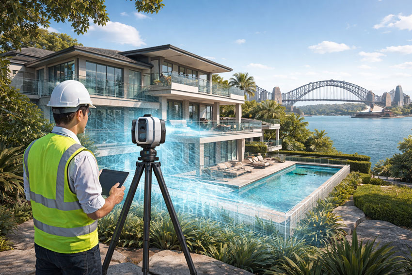
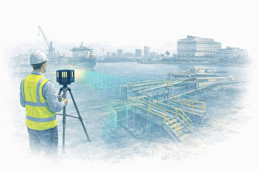
Hamilton By Design provides engineering-grade reality capture services in Sydney, combining high-accuracy LiDAR laser scanning with practical engineering workflows to deliver reliable as-built data, digital twins, and construction-ready models.
Digital Twin Development
Reality capture is often the first step in creating a digital twin of an existing asset, facility or infrastructure network.
Using engineering-grade terrestrial LiDAR scanning, Hamilton By Design captures highly detailed existing-condition data that can be used to develop accurate digital representations of buildings, industrial facilities and infrastructure assets throughout Sydney.
Digital twins provide a valuable foundation for planning upgrades, maintenance activities, asset management programs and future engineering projects by ensuring decision-makers have access to accurate and current information.
Asset Documentation & Existing Conditions
Many facilities operate with incomplete, outdated or missing drawings. Reality capture provides a reliable method of documenting existing conditions and creating an accurate record of an asset at a specific point in time.
Hamilton By Design supports asset owners, engineers and project teams by delivering comprehensive documentation of industrial facilities, manufacturing plants, infrastructure assets and commercial buildings throughout Sydney.
This information can be used for engineering design, maintenance planning, compliance assessments and future capital works projects.
Heritage & Existing Condition Surveys
Reality capture technology provides a non-invasive method of documenting heritage structures, existing buildings and architecturally significant assets.
High-density LiDAR scanning can capture detailed geometric information without disturbing the asset, creating an accurate digital record suitable for preservation, restoration and future reference.
This approach is particularly valuable where traditional measurement methods are impractical or where maintaining a permanent digital archive is important.
Infrastructure Corridor Capture
Reality capture is widely used to document transport corridors, utility networks and linear infrastructure projects.
Hamilton By Design can capture roads, rail corridors, processing facilities, pipelines and utility infrastructure to provide accurate spatial information for planning, design and asset management purposes.
The resulting datasets assist engineering teams in identifying constraints, verifying existing conditions and reducing uncertainty during project development.
Construction Verification & Progress Monitoring
Reality capture can be used throughout construction projects to verify installed works and monitor project progress.
By comparing captured data against design models, project teams can identify deviations, verify installation accuracy and document construction milestones.
This process helps reduce rework, improve project certainty and provide objective records of completed work.
Building Envelope Surveys
Reality capture provides an efficient method of documenting building facades, roof structures and external architectural features.
The resulting data can be used for refurbishment projects, façade upgrades, structural assessments and redevelopment planning.
Building envelope surveys provide accurate measurements and spatial information without requiring extensive manual site measurement activities.
Facility Management & Asset Registers
Reality capture data can support facility management programs by providing accurate information about buildings, equipment and infrastructure assets.
Digital asset records allow facility owners to improve maintenance planning, track asset changes and maintain up-to-date documentation throughout the asset lifecycle.
For many organisations, reality capture forms an important component of broader digital engineering and asset management strategies.
What Is Reality Capture?
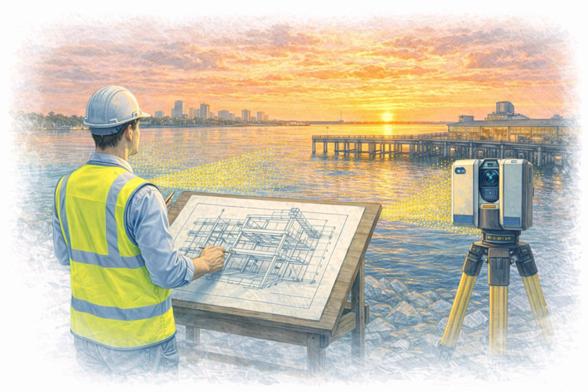
Reality capture is the process of digitally recording real-world assets using technologies such as:
LiDAR laser scanning
High-resolution spatial data capture
Registered point clouds
3D models aligned to real geometry
The result is an accurate digital representation of existing conditions — enabling engineers, designers, and constructors to work from a single source of truth rather than assumptions or outdated drawings.
Why Reality Capture Matters in Sydney
Sydney projects frequently involve:
Live operational assets
Brownfield construction and upgrades
Tight construction tolerances
Complex interfaces between structural, mechanical, and architectural systems
Reality capture enables project teams to:
✔ Verify existing conditions before design ✔ Reduce rework and construction clashes ✔ Improve coordination across disciplines ✔ Accelerate approvals and decision-making ✔ Improve safety by minimising site re-visits
This is particularly valuable across commercial buildings, transport infrastructure, industrial facilities, utilities, and large refurbishment projects.
Engineering-Led Reality Capture — The Hamilton By Design Difference
At Hamilton By Design, reality capture is not treated as a standalone surveying task. Our services are engineer-led, ensuring the data captured is fit for downstream use in:
Mechanical and structural design
Construction coordination
Retrofit and upgrade works
Fabrication and installation planning
Our Sydney reality capture services integrate directly with CAD, BIM, and engineering documentation workflows — ensuring accountability from scan through to design and delivery.
Typical Reality Capture Applications in Sydney
As-Built Documentation
Capture accurate as-built conditions for compliance, certification, handover, or future upgrades.
Construction & Refurbishment Projects
Scan existing buildings and structures prior to modifications, extensions, or adaptive reuse.
Industrial & Infrastructure Assets
Capture complex geometry such as plant rooms, pipework, platforms, and structural steel.
Digital Twins & Asset Records
Create reliable digital records that support ongoing asset management and lifecycle planning.
Deliverables Tailored to Project Needs
Depending on your scope, Hamilton By Design can provide:
Registered LiDAR point clouds
CAD-ready geometry
BIM-compatible models
Section views and reference drawings
Engineering drawings derived from scan data
All deliverables are issued to suit engineers, builders, asset owners, and project managers working across Sydney.
Reality Capture Applications Across Sydney Industries
Reality capture provides value wherever accurate existing-condition information is required before design, construction or asset management decisions are made.
Commercial Buildings
Reality capture assists building owners, consultants and contractors by documenting existing conditions before refurbishment, fit-outs, services upgrades and redevelopment projects.
Industrial Facilities
Manufacturing plants, processing facilities and operational sites often contain undocumented modifications accumulated over many years. Reality capture provides an accurate digital record that supports future upgrades and maintenance planning.
Transport Infrastructure
Rail facilities, stations, maintenance depots, tunnels and transport corridors can be accurately captured to support planning, coordination and construction activities while minimising disruption to operations.
Utilities & Water Infrastructure
Reality capture supports pump stations, treatment plants, pipelines and utility infrastructure where accurate spatial information is required for maintenance, expansion and compliance projects.
Construction & Refurbishment
Capturing existing site conditions before construction begins reduces uncertainty, improves coordination and helps identify potential clashes before work reaches site.
Asset Management
Reality capture provides a reliable foundation for digital asset registers, facility management programs and long-term lifecycle planning.
Reality Capture Sydney — Build with Confidence
Reality capture removes uncertainty from complex projects. By accurately capturing what exists today, project teams can design, coordinate, and construct with confidence tomorrow.
Hamilton By Design supports Sydney-based projects with engineering-grade reality capture, practical deliverables, and a deep understanding of how digital data is used in real construction and industrial environments.
Industries We Support
Hamilton By Design provides reality capture services throughout Sydney for manufacturing facilities, rail infrastructure, water treatment plants, commercial buildings, hospitals, data centres and industrial facilities.
Using engineering-grade LiDAR scanning and digital reality capture workflows, we help project teams accurately document existing assets, improve project planning and reduce risk during design, construction and asset management activities.
Contact Hamilton By Design to discuss your Sydney reality capture requirements or arrange a site scan.
Related Sydney Reality Capture Services
Hamilton By Design provides specialised reality capture and 3D scanning services across Sydney, including:
3D Scanning Sydney for point clouds, scan-to-CAD and engineering-ready existing-condition data.
By combining reality capture, LiDAR scanning, engineering design and drafting under one team, Hamilton By Design helps Sydney projects move from existing conditions to construction-ready deliverables with confidence.
Hamilton By Design provides reality capture services throughout Sydney CBD, Parramatta, Liverpool, Penrith, Chatswood, Alexandria, Mascot, Newcastle and the Central Coast. Our engineering-led approach helps project teams accurately capture existing conditions, create digital asset records and support design, construction and asset management activities.
Engineering-Grade LiDAR for Accurate As-Built & Construction Delivery
Construction projects in Darwin operate in a demanding environment — tropical weather, remote logistics, accelerated schedules, and complex interfaces between structural, mechanical, and architectural elements. 3D construction scanning provides a reliable digital foundation to reduce risk, eliminate rework, and support confident decision-making throughout the project lifecycle.
Hamilton By Design delivers engineering-grade 3D construction scanning in Darwin, supporting contractors, engineers, builders, and asset owners with accurate spatial data, as-built models, and construction-ready documentation.
3D construction scanning uses high-accuracy LiDAR laser scanners to capture the real-world geometry of construction sites, partially completed works, and existing assets. The output is a dense, survey-grade point cloud that can be used to create:
Accurate as-built drawings
BIM and digital twin models
Clash detection and coordination models
Verification of construction tolerances
Retrofit and upgrade designs
Unlike traditional tape or total-station methods, LiDAR captures millions of points per second, ensuring complex geometry is recorded correctly the first time.
Why 3D Construction Scanning Matters in Darwin
Construction in Darwin often involves:
Live brownfield sites
Remote or logistically constrained projects
Tight shutdown or installation windows
High consequences of dimensional errors
3D construction scanning enables:
✔ Reduced rework and RFIs ✔ Improved trade coordination ✔ Accurate verification before fabrication ✔ Faster design and approval cycles ✔ Safer site data capture with minimal disruption
This is particularly valuable for industrial buildings, ports, power generation facilities, defence infrastructure, and commercial developments across the Northern Territory.
Typical Construction Applications
As-Built Verification
Confirm what has actually been built — not what was assumed — before handover, certification, or the next construction stage.
Construction Progress Capture
Document progress at key milestones to support planning, claims, and coordination.
Retrofit & Upgrade Projects
Capture existing structures accurately before mechanical, electrical, or structural upgrades commence.
Clash Detection & Coordination
Overlay scanned data with design models to identify clashes early and avoid costly site changes.
Engineering-Led Scanning — Not Just Data Capture
At Hamilton By Design, 3D construction scanning is delivered by engineers, not just scanning technicians. This means:
Scan strategies aligned to engineering outcomes
Data captured at appropriate accuracy for construction tolerances
Deliverables tailored for CAD, BIM, and fabrication workflows
Clear accountability from scan to design to documentation
Our scanning integrates directly with mechanical design, structural analysis, and construction documentation services — providing a single source of truth for your project.
Deliverables to Suit Construction Teams
Depending on your requirements, we can provide:
Registered point clouds
CAD-ready models
Revit / BIM outputs
Section views and construction references
Engineering drawings derived from scan data
All deliverables are tailored to suit builders, engineers, subcontractors, and asset owners.
Our clients:
3D Construction Scanning Darwin — Partner with Confidence
Whether you are delivering a new build, managing a complex refurbishment, or upgrading an existing facility, 3D construction scanning in Darwin provides the clarity and accuracy needed to build with confidence.
Hamilton By Design supports construction projects across Darwin and the Northern Territory with engineering-grade LiDAR scanning, practical deliverables, and real-world construction experience.
Let Connect us to discuss your project requirements or arrange a site scan.
3D Engineering Scanning Wyong | Power, Manufacturing & Construction
Hamilton By Design provides 3D engineering scanning services in Wyong, delivering engineering-grade LiDAR scanning for power and electricity infrastructure, manufacturing facilities, and building & construction projects across the northern Central Coast.
We specialise in capturing accurate as-built conditions and converting them into design-ready engineering information, supporting upgrades, refurbishments, brownfield works, and construction coordination with reduced risk and rework.
Power & electricity infrastructure
Wyong and the surrounding Central Coast region support a range of energy, utilities, and electrical infrastructure, where reliable as-built data is critical.
We provide 3D engineering scanning for:
Power stations, substations, and electrical compounds
Switchrooms, cable routes, and services corridors
Turbine halls, generator rooms, and balance-of-plant areas
Structural steel, platforms, walkways, and access systems
Brownfield upgrades and retrofit works
LiDAR scanning allows engineering and construction teams to design off-site with confidence, reducing shutdown durations and installation risk.
Manufacturing & industrial facilities
Wyong is a key industrial hub on the Central Coast, with active manufacturing and logistics facilities that benefit from accurate digital capture.
We support:
Equipment upgrades and machinery replacement
Production line modifications and layout changes
Structural steel additions and mezzanines
Pipework, conveyors, ducting, and services coordination
Engineering records for maintenance and asset planning
Our engineer-led approach ensures scanning outputs are suitable for CAD modelling, fabrication drawings, and installation planning.
Building & construction projects
For builders, contractors, and consultants in Wyong, 3D engineering scanning supports:
Existing building documentation and verification
As-built capture for refurbishments and extensions
Clash detection between structure, services, and new works
Plant rooms, roof spaces, risers, and tight access zones
Construction QA and record documentation
Scanning removes assumptions early and improves coordination across disciplines.
Digital QA documentation supporting installation and sign-off
Why engineer-led scanning matters
In power, manufacturing, and construction environments, poor as-built data leads to:
Rework during installation
Delays during shutdown windows
Increased safety and coordination risks
By integrating 3D scanning with mechanical engineering and CAD expertise, Hamilton By Design delivers outputs that are accurate, usable, and construction-ready.
Wyong & Central Coast coverage
We service Wyong and surrounding Central Coast locations including: Tuggerah, Warnervale, Ourimbah, Somersby, Lake Haven, Erina, Gosford, Woy Woy, Umina, and Terrigal.
We also support projects extending into Newcastle, the Hunter Valley, and Greater Sydney, enabling consistent delivery across multiple sites.
Typical workflow
Engineering-led scoping discussion
On-site LiDAR scanning planned around live operations
Registration and verification of scan data
CAD, drawing, and QA deliverables issued
Ongoing engineering and fabrication support if required
Get started
If you’re planning power, manufacturing, or construction works in Wyong and need accurate as-built engineering data, we can help.
Request a quote or book a site scan to discuss the right 3D engineering scanning solution for your project.
To provide the best experiences, we use technologies like cookies to store and/or access device information. Consenting to these technologies will allow us to process data such as browsing behaviour or unique IDs on this site. Not consenting or withdrawing consent, may adversely affect certain features and functions.
Functional
Always active
The technical storage or access is strictly necessary for the legitimate purpose of enabling the use of a specific service explicitly requested by the subscriber or user, or for the sole purpose of carrying out the transmission of a communication over an electronic communications network.
Preferences
The technical storage or access is necessary for the legitimate purpose of storing preferences that are not requested by the subscriber or user.
Statistics
The technical storage or access that is used exclusively for statistical purposes.The technical storage or access that is used exclusively for anonymous statistical purposes. Without a subpoena, voluntary compliance on the part of your Internet Service Provider, or additional records from a third party, information stored or retrieved for this purpose alone cannot usually be used to identify you.
Marketing
The technical storage or access is required to create user profiles to send advertising, or to track the user on a website or across several websites for similar marketing purposes.