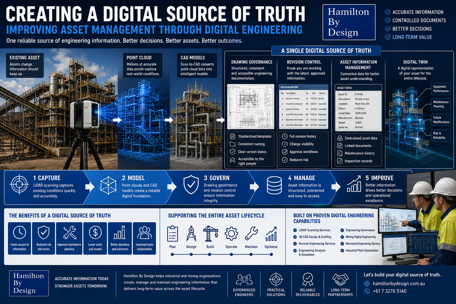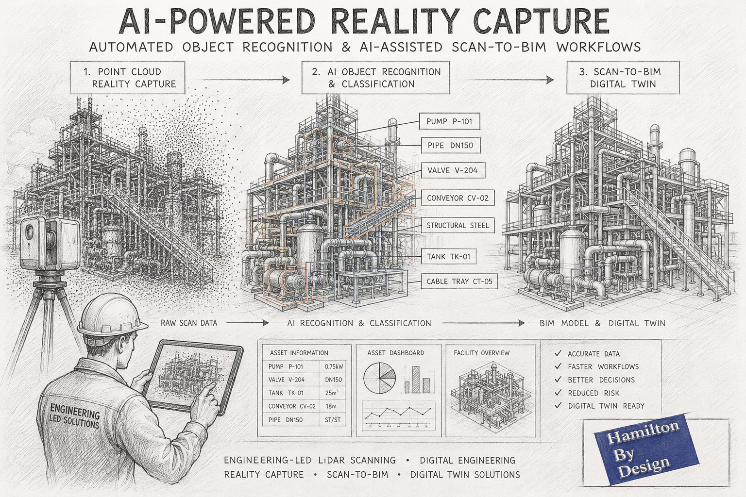
Automated Object Recognition from Point Clouds and AI-Assisted Scan-to-BIM Workflows
How Artificial Intelligence is Transforming Reality Capture and Digital Engineering
The reality capture industry is experiencing a significant transformation. While terrestrial LiDAR scanning, laser scanning and photogrammetry have been widely adopted across mining, manufacturing, construction and infrastructure sectors for many years, the emergence of Artificial Intelligence (AI) is fundamentally changing how point cloud data is processed and utilised.
Traditionally, converting a point cloud into useful engineering information required substantial manual effort. Engineers, designers and BIM technicians would spend hundreds of hours identifying equipment, tracing pipework, modelling structures and generating asset information from raw scan data.
Today, advances in automated object recognition and AI-assisted Scan-to-BIM workflows are reducing these manual processes and opening new opportunities for asset owners, engineering consultants and project teams.
At Hamilton By Design, we continue to monitor and evaluate emerging AI technologies while combining them with engineering-led reality capture workflows to deliver practical outcomes for industrial and infrastructure projects throughout Australia.
What is Automated Object Recognition?
Automated object recognition refers to the ability of software systems to identify and classify objects within a point cloud automatically.
Instead of manually examining millions or billions of points, AI algorithms analyse geometric patterns, spatial relationships, colours and textures to determine what each object represents.
For example, AI systems may automatically identify:
- Structural steel members
- Pipework systems
- Valves
- Pumps
- Conveyors
- Electrical equipment
- Cable trays
- Tanks and vessels
- Building columns
- Walls and floors
- Doors and windows
- Handrails and platforms
- Mechanical equipment
The objective is to transform unstructured point cloud data into structured engineering information.
This allows project teams to move from raw scan data to usable digital assets much faster than traditional modelling methods.
Understanding Point Clouds
A point cloud is a collection of millions or billions of measured points captured using:
- Terrestrial LiDAR scanners
- Mobile mapping systems
- Drone LiDAR systems
- Photogrammetry
- Structured light scanners
- Handheld scanning systems
Each point contains spatial coordinates representing a physical location in the real world.
Modern scanners can capture:
- Plant rooms
- Industrial facilities
- Processing plants
- Mining infrastructure
- Commercial buildings
- Manufacturing equipment
- Transport infrastructure
- Refineries and smelters
The challenge has never been collecting data.
The challenge is turning that data into engineering information.
This is where AI is beginning to provide significant value.
Why Traditional Point Cloud Processing is Time Consuming
Historically, engineering teams have relied on manual modelling workflows.
A typical process might involve:
- Capturing scan data
- Registering point clouds
- Cleaning noise
- Importing into CAD or BIM software
- Identifying equipment manually
- Modelling structures
- Modelling pipework
- Generating asset information
- Producing drawings and deliverables
For complex facilities such as mines, smelters, power stations and manufacturing plants, this work can require hundreds or even thousands of engineering hours.
Although highly accurate, these workflows can be expensive and time intensive.
How AI is Changing Reality Capture
Artificial Intelligence is introducing a new layer of automation.
Modern AI systems can learn from vast datasets of industrial and architectural objects.
Rather than simply displaying a point cloud, AI attempts to understand what the data represents.
Examples include:
Pipe Recognition
AI algorithms can automatically identify cylindrical features and classify them as pipework.
Software can estimate:
- Pipe centre lines
- Pipe diameters
- Connections
- Elbows
- Tees
- Reducers
Structural Steel Recognition
Machine learning systems can identify:
- Universal beams
- Columns
- Channels
- Angles
- Bracing members
This can accelerate structural modelling workflows.
Equipment Classification
AI systems are increasingly capable of identifying:
- Pumps
- Motors
- Gearboxes
- Tanks
- Vessels
- Heat exchangers
Although verification is still required, the process can dramatically reduce manual modelling time.
Building Element Recognition
For architectural and BIM applications, AI can automatically detect:
- Walls
- Floors
- Ceilings
- Doors
- Windows
- Roof systems
This enables faster generation of BIM models.
What is AI-Assisted Scan-to-BIM?
Scan-to-BIM is the process of converting reality capture data into Building Information Models.
Traditionally, BIM technicians manually created geometry based on point cloud information.
AI-assisted Scan-to-BIM introduces automated recognition tools that accelerate this process.
The workflow generally follows:
Step 1 – Reality Capture
A facility is scanned using terrestrial LiDAR technology.
Hamilton By Design typically captures:
- Industrial facilities
- Manufacturing plants
- Mining infrastructure
- Commercial buildings
- Mechanical plant rooms
- Process facilities
Step 2 – Point Cloud Registration
Individual scans are combined into a single registered dataset.
The result becomes a complete digital representation of the facility.
Step 3 – AI Object Recognition
Artificial Intelligence analyses the point cloud.
Potential objects are automatically identified and classified.
Step 4 – BIM Generation
Recognised objects are converted into BIM components.
This may include:
- Structural members
- Architectural features
- Mechanical equipment
- Pipework
- Services
Step 5 – Engineering Verification
Engineers and BIM specialists verify the results.
This remains one of the most important stages.
AI can accelerate workflows, but engineering judgement remains essential.
Step 6 – Digital Twin Development
The resulting BIM model can support:
- Asset management
- Facility upgrades
- Maintenance planning
- Shutdown planning
- Construction sequencing
- Digital twin initiatives
Applications in Mining and Heavy Industry
Mining operations generate enormous quantities of asset information.
Facilities often contain:
- Conveyors
- Crushers
- Chutes
- Screens
- Tanks
- Pipework
- Structural steel
- Electrical infrastructure
AI-assisted recognition has the potential to significantly improve the efficiency of:
Brownfield Modifications
Existing assets can be scanned and classified more rapidly.
Shutdown Planning
Equipment and access areas can be documented more efficiently.
Asset Registers
Physical assets can be linked to digital asset management systems.
Digital Twin Creation
AI can accelerate the development of operational digital twins.
Condition Assessment
Automated recognition may eventually support condition monitoring and defect identification.
Current Limitations of AI Recognition
Despite impressive progress, AI is not yet capable of fully replacing experienced engineers.
Several challenges remain.
Complex Industrial Environments
Industrial facilities contain:
- Congested pipework
- Obstructions
- Corrosion
- Dust accumulation
- Non-standard equipment
These conditions can confuse automated systems.
Unique Equipment
Mining and manufacturing plants often contain custom-built equipment.
AI systems trained on generic datasets may struggle to identify these assets accurately.
Data Quality
Recognition performance depends heavily on:
- Scan quality
- Resolution
- Registration accuracy
- Coverage
Poor quality input data typically produces poor quality output.
Engineering Intent
AI can identify geometry.
Understanding engineering intent remains much more difficult.
An experienced engineer can determine:
- Why a system was designed a certain way
- Potential maintenance issues
- Access requirements
- Structural concerns
- Process constraints
This knowledge is difficult to automate.
Why Engineering Expertise Still Matters
At Hamilton By Design, we believe AI should be viewed as an engineering productivity tool rather than a replacement for engineering expertise.
The highest quality outcomes are achieved when:
- High-quality scan data is captured
- AI assists with recognition
- Engineers validate results
- Designers refine models
- Project teams apply practical experience
This hybrid approach combines automation with engineering judgement.
For industrial facilities, this remains the most reliable pathway to accurate digital deliverables.
The Future of AI in Reality Capture
Over the next decade we expect to see:
Faster Model Creation
Many routine modelling tasks will become increasingly automated.
Improved Asset Classification
AI systems will recognise a broader range of industrial equipment.
Automated Drawing Generation
Point clouds may eventually generate engineering drawings automatically.
Predictive Asset Management
Digital twins may combine scan data with operational data to predict failures.
Real-Time Facility Updates
Facilities may continuously update digital models as changes occur.
Intelligent Maintenance Planning
AI systems could identify maintenance requirements before failures occur.
How Hamilton By Design Uses Reality Capture Today
Hamilton By Design provides engineering-led reality capture services throughout Australia.
Our services include:
- Terrestrial LiDAR scanning
- Engineering-grade reality capture
- Point cloud registration
- Scan-to-CAD
- Scan-to-BIM
- Reverse engineering
- Mechanical design
- Structural modelling
- Digital engineering support
- Asset documentation
We work across:
- Mining
- Manufacturing
- Energy
- Infrastructure
- Commercial buildings
- Water and wastewater facilities
Our focus remains on delivering practical engineering outcomes from accurate measured data.
As AI-assisted workflows continue to mature, we expect these technologies to further enhance project efficiency while maintaining the engineering oversight required for complex industrial environments.

Automated object recognition and AI-assisted Scan-to-BIM workflows represent one of the most exciting developments in the reality capture industry.
The ability to automatically identify equipment, classify assets and accelerate BIM creation has the potential to significantly reduce modelling time while improving access to engineering information.
However, successful implementation still depends on high-quality scan data, robust workflows and experienced engineering oversight.
The future of digital engineering is unlikely to be fully manual or fully automated.
Instead, it will combine advanced reality capture technologies, artificial intelligence and practical engineering expertise to create smarter, more efficient project delivery.
For organisations looking to develop accurate digital representations of existing assets, AI-assisted reality capture is rapidly becoming an important part of the engineering toolkit.
Contact Us – Talk to Us
Mechanical Engineering | Structural Engineering