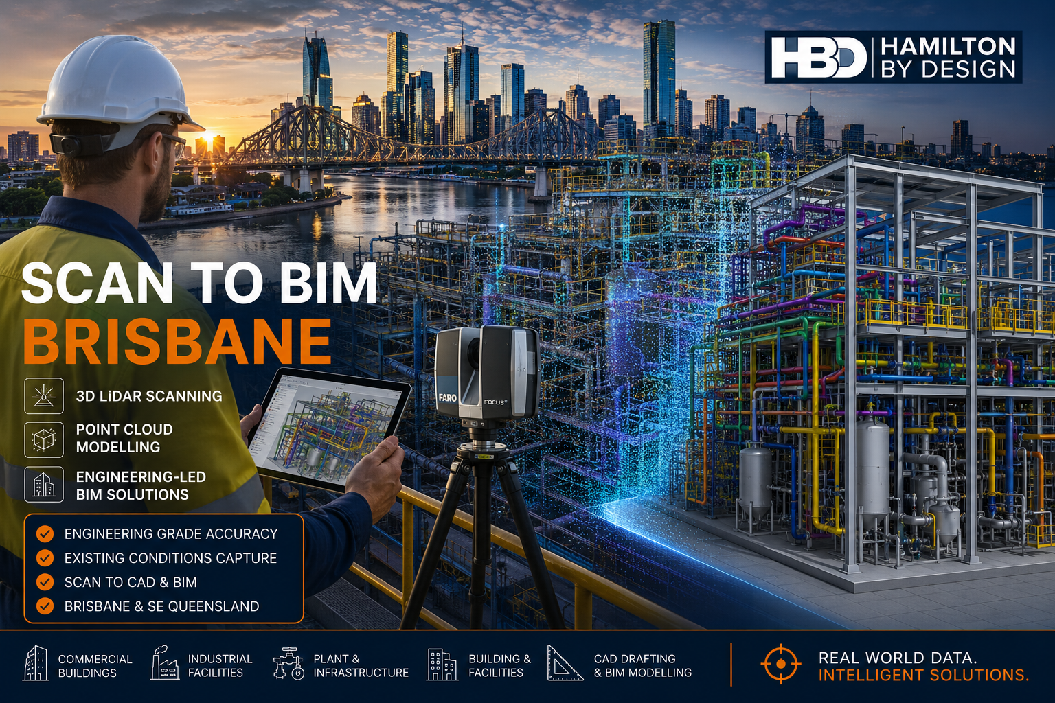
Scan to BIM Brisbane | 3D LiDAR Scanning & BIM Modelling
Engineering-led Scan to BIM services for Brisbane buildings, plants, infrastructure and industrial sites.
Hamilton By Design provides Scan to BIM Brisbane services for projects that need accurate existing-condition information before design, construction, upgrade or refurbishment work begins.
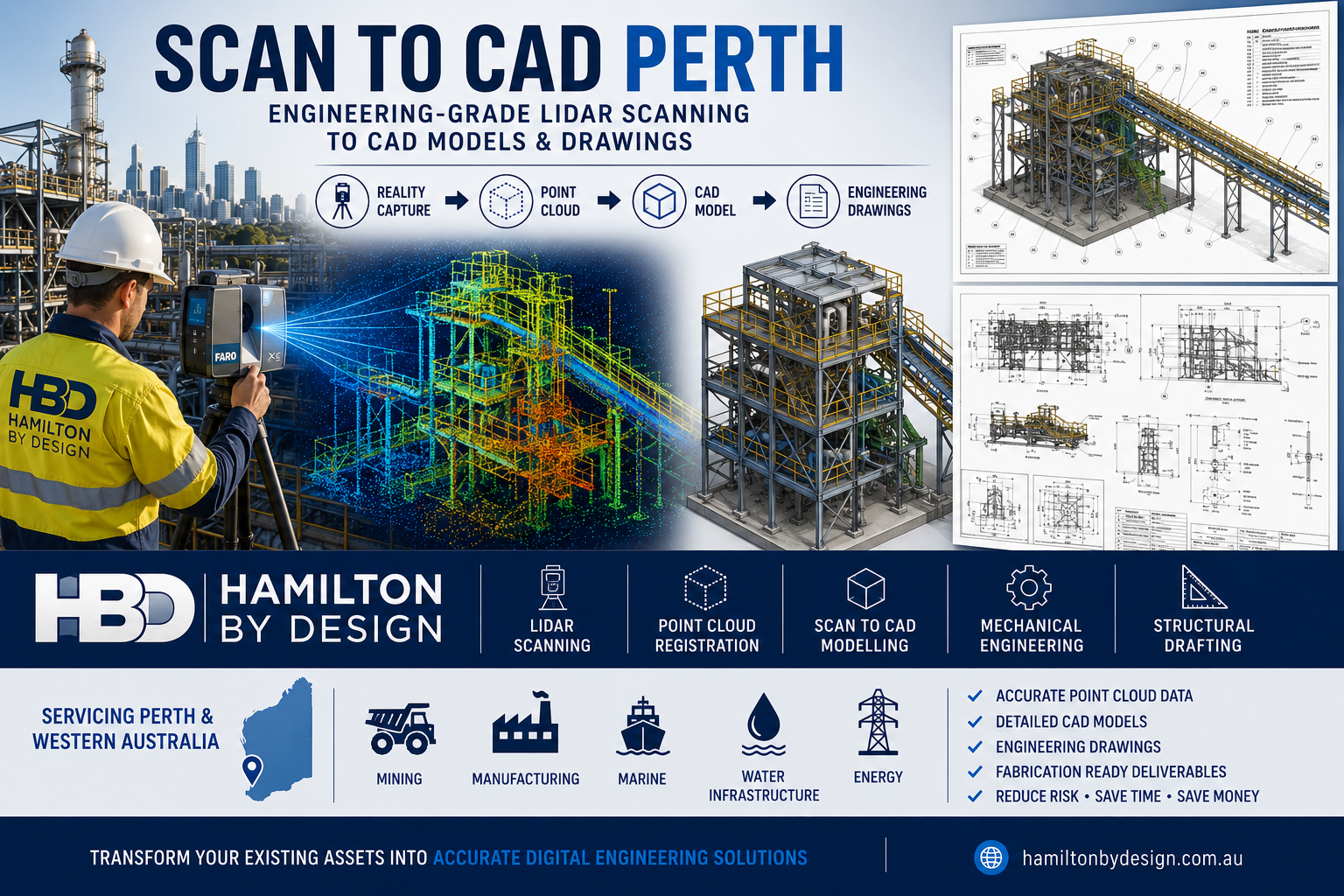
Using 3D LiDAR scanning, point cloud processing and CAD/BIM modelling workflows, we help turn real-world site conditions into practical digital information that engineers, architects, builders, asset owners and project teams can use with confidence.
Scan to BIM Services in Brisbane
Brisbane continues to grow across commercial construction, infrastructure, manufacturing, health, education, water, transport and industrial sectors. Many projects begin with one major challenge:
The existing drawings are incomplete, outdated or do not match site conditions.
Scan to BIM helps solve this problem by capturing the real site in 3D and converting that data into a usable digital model.
Hamilton By Design supports Brisbane projects with:
- 3D LiDAR scanning
- Point cloud registration
- Scan to BIM modelling
- Existing-condition BIM models
- As-built verification
- Mechanical and structural CAD support
- Plant room and services modelling
- Scan to CAD deliverables
- Engineering-grade site capture
Why Scan to BIM Matters
Before starting design or construction work, it is important to understand what is already there.
Poor existing information can lead to:
- Rework
- Design clashes
- Site delays
- Incorrect measurements
- Fabrication errors
- Safety risks
- Cost overruns
A Scan to BIM workflow gives project teams a clearer understanding of the site before decisions are made.
This is especially useful for Brisbane projects involving brownfield sites, operating facilities, plant upgrades, building refurbishments and complex service areas.
Brisbane Projects We Support
Hamilton By Design can support Scan to BIM projects across Brisbane and South East Queensland, including:
- Commercial buildings
- Plant rooms
- Industrial facilities
- Processing plants
- Pump stations
- Water and wastewater assets
- Hospitals and health facilities
- Schools and universities
- Warehouses
- Manufacturing sites
- Mining support facilities
- Mechanical services areas
- Structural steel and access platforms
Our background is not just scanning. We understand engineering, drafting, mechanical design, plant layout and construction documentation.
That means the point cloud is not treated as just a visual file. It becomes part of a practical engineering workflow.
What Is Scan to BIM?
Scan to BIM is the process of capturing an existing site using 3D laser scanning or LiDAR technology, then using that point cloud data to create a digital BIM model.
The process generally includes:
- Site scanning
- Point cloud registration
- Data cleaning and checking
- BIM or CAD modelling
- Review against project requirements
- Issue of model files, drawings or as-built documentation
The final deliverables can support design coordination, construction planning, asset management, clash detection and future maintenance.
Scan to BIM for Brownfield Sites
Many Brisbane projects are not greenfield projects. They involve existing buildings, existing services, operating plants or older facilities where drawings may not be reliable.
This is where Scan to BIM becomes valuable.
For brownfield projects, we can capture:
- Pipework
- Ductwork
- Structural steel
- Platforms and stairs
- Plant equipment
- Machinery layouts
- Electrical and service zones
- Building geometry
- Slab and wall locations
- Existing access constraints
This helps engineers and contractors design around real conditions, not assumptions.
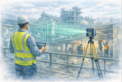
Engineering-Led Site Capture
Hamilton By Design provides an engineering-led approach to 3D scanning and BIM modelling.
We understand that a model needs to be useful, not just visually impressive.
A good Scan to BIM model should help answer practical questions such as:
- Will the new equipment fit?
- Is there enough access?
- Where are the existing services?
- Are there clashes with structure or pipework?
- Can the fabrication drawings be developed from this information?
- What needs to be checked before construction starts?
This is why our Scan to BIM Brisbane service is suited to engineering, construction and industrial projects where accuracy and practical site knowledge matter.
Deliverables
Depending on the project, we can provide:
- Registered point cloud data
- E57 files
- RCP / RCS files
- Revit BIM models
- DWG files
- 2D plans, sections and elevations
- 3D CAD models
- STEP / SAT files
- Existing-condition drawings
- As-built verification reports
- Mechanical and structural drafting support
Deliverables can be tailored to suit the design team, builder, engineer or asset owner.
Scan to BIM Brisbane for Design Coordination
Scan to BIM can improve design coordination by helping project teams compare proposed design work against existing site conditions.
This is useful for:
- Refurbishment projects
- Plant upgrades
- Building services upgrades
- Mechanical installations
- Structural modifications
- Access platform design
- Equipment replacement
- Pipework routing
- Shutdown planning
By starting with better existing information, the project team can reduce uncertainty before work begins on site.
Benefits of Scan to BIM
The key benefits include:
- Better understanding of existing conditions
- Reduced site measurement errors
- Improved design coordination
- Better clash detection
- Faster decision-making
- Reduced rework
- Better project planning
- Improved confidence before fabrication or construction
- More accurate as-built records
For complex Brisbane sites, Scan to BIM can be a practical investment that reduces risk early in the project.
Why Hamilton By Design?
Hamilton By Design combines 3D scanning, mechanical engineering, drafting and CAD modelling experience.
We support projects where the final outcome needs to be more than a scan.
Our experience includes:
- Mechanical engineering
- Structural drafting
- Plant layout
- Reverse engineering
- Scan to CAD
- Scan to BIM
- Industrial site capture
- Mining and processing facilities
- Building and infrastructure projects
This gives clients a single point of support from site capture through to usable engineering documentation.
Brisbane and South East Queensland Support
Hamilton By Design can support projects across:
- Brisbane CBD
- South Brisbane
- Fortitude Valley
- Eagle Farm
- Pinkenba
- Rocklea
- Acacia Ridge
- Logan
- Ipswich
- Redcliffe
- Moreton Bay
- Gold Coast
- Sunshine Coast
- Toowoomba
- Regional Queensland
We can also support interstate clients managing Queensland-based assets.

Call to Action
Need accurate existing-condition information for a Brisbane project?
Hamilton By Design can help with Scan to BIM Brisbane, 3D LiDAR scanning, point cloud modelling, CAD drafting and engineering-led documentation.
Contact Hamilton By Design to discuss your Brisbane Scan to BIM project.
Talk to Us – Contact Us
Our clients: