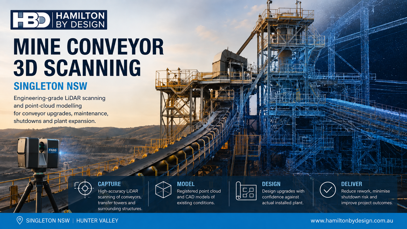
Mine Conveyor 3D Scanning Singleton NSW | Hamilton By Design

Mine conveyor 3D scanning in Singleton NSW using engineering-grade LiDAR, point-cloud modelling and CAD design

Mine Conveyor 3D Scanning Singleton NSW

Engineering-Grade LiDAR Scanning for Conveyor Upgrades, Maintenance and Plant Expansion

Mine conveyor systems are rarely static assets. Over their operating life, conveyors may be extended, shortened, re-aligned, reinforced or modified to suit changing production requirements. Transfer chutes are replaced, drives are upgraded, supporting structures are altered and access platforms are added around existing plant.

As these modifications accumulate, the physical conveyor system can progressively differ from the original engineering drawings.

This creates a practical problem for project and maintenance teams:

Conveyor upgrades can require repeated field measurements because available drawings do not always represent the installed condition accurately.

Hamilton By Design provides mine conveyor 3D scanning services in Singleton NSW and throughout the Hunter Valley, using engineering-grade terrestrial LiDAR scanning, registered point clouds and CAD modelling to capture existing conveyor systems and surrounding mine infrastructure.

The objective is to reduce repeated site measuring and provide engineers with a measurable digital representation of the actual installed plant before modification work begins.

For broader open-cut mining environments, Hamilton By Design also provides surface mine 3D LiDAR scanning across the Hunter Valley NSW, supporting existing-condition capture of mining, processing and materials-handling infrastructure.


The Problem: Repeated Field Measurements During Conveyor Upgrades

Brownfield conveyor projects frequently begin with incomplete information.

Existing drawings may show the original plant layout, but subsequent modifications may not have been fully incorporated into the available engineering documentation.

Typical discrepancies can include:

  • altered chute geometry;
  • modified structural steel;
  • replacement pulleys;
  • relocated equipment;
  • additional pipework and services;
  • changes to access platforms;
  • revised guarding;
  • undocumented shutdown modifications; and
  • differences between nominal and installed dimensions.

A project engineer may initially visit site to measure a conveyor upgrade area, return to the office and begin modelling, only to discover that another dimension is required.

This can produce an inefficient cycle:

Measure โ†’ design โ†’ identify missing information โ†’ return to site โ†’ remeasure โ†’ revise design.

Engineering-grade LiDAR scanning changes this process by capturing the wider plant environment rather than relying solely on isolated manual measurements.

The resulting registered point cloud allows additional measurements to be obtained digitally as the design develops.

A simple way to express the value is:

Capture once on site. Measure repeatedly from the point cloud.


What Mine Conveyor Infrastructure Can Be Scanned?

A conveyor scanning project can include much more than the belt itself.

Depending on the scope, terrestrial LiDAR can capture:

  • conveyor gantries;
  • stringers;
  • head pulleys;
  • tail pulleys;
  • take-up systems;
  • drive stations;
  • transfer towers;
  • chutes;
  • hoppers;
  • feeders;
  • idler arrangements;
  • structural steel;
  • walkways;
  • platforms;
  • stairs;
  • guards;
  • pipework;
  • cable trays;
  • concrete structures; and
  • adjacent equipment.

This wider capture is important because conveyor modification projects depend on the spatial relationship between multiple assets.

For example, a replacement chute must fit between the conveyor discharge point, receiving equipment, supporting steel and surrounding maintenance access.

The engineering problem is therefore not simply measuring one component.

It is understanding the complete installed environment around the component being modified.


Who Can Benefit from Mine Conveyor 3D Scanning?

Mine conveyor 3D scanning can assist:

  • mine owners and operators;
  • engineering managers;
  • project engineers;
  • mechanical engineers;
  • maintenance superintendents;
  • reliability teams;
  • shutdown planners;
  • CHPP engineers;
  • conveyor maintenance contractors;
  • EPCM organisations;
  • structural engineers;
  • fabricators; and
  • drafting teams.

For companies working across NSW coal operations, Hamilton By Design’s wider mining engineering and 3D scanning services in NSW can support projects beyond individual conveyor systems, including processing plant, structural and mechanical infrastructure.

The common requirement is reliable information about the existing plant before engineering decisions are made.


From Conveyor to Registered Point Cloud

1. Define the Engineering Requirement

Before scanning begins, the project team should establish the intended modification.

This may include:

  • chute replacement;
  • conveyor extension;
  • drive upgrade;
  • pulley replacement;
  • conveyor re-alignment;
  • transfer-station modification;
  • structural strengthening;
  • walkway modification; or
  • installation of new conveyor equipment.

Understanding the engineering requirement determines the scan coverage and level of detail required.


2. Capture the Existing Conveyor System

Terrestrial LiDAR scanners are positioned around the conveyor and surrounding infrastructure.

Each scan records a large number of three-dimensional spatial measurements.

Multiple scan positions allow equipment to be captured from different viewpoints and reduce areas hidden by surrounding structures.

This approach is particularly useful in complex brownfield environments where manual measurement would require numerous individual dimensions.


3. Register the Scan Data

Individual scans are processed and combined into a coordinated point-cloud dataset.

The resulting point cloud becomes a measurable record of the plant condition at the time of scanning.

Engineering personnel can then interrogate the dataset away from site and obtain additional dimensions as required.

This is particularly valuable where physical access is limited or where repeated measuring trips would interrupt engineering progress.


From Point Cloud to Engineering CAD

The point cloud may be sufficient for some projects, but other conveyor upgrades require selected infrastructure to be converted into CAD geometry.

Hamilton By Design provides surface mine Scan-to-CAD services throughout the Hunter Valley NSW to convert captured existing conditions into practical engineering models for brownfield design and plant modification.

Depending on the project, CAD geometry may include:

  • conveyor centreline;
  • pulley centres;
  • belt path;
  • structural steel;
  • chute geometry;
  • equipment interfaces;
  • support frames;
  • floor levels;
  • access structures; and
  • surrounding plant envelopes.

The objective is not to model every visible component unnecessarily.

Instead, the digital model should contain the information required to solve the engineering problem.


Designing Conveyor Upgrades Against Existing Conditions

Once the conveyor environment has been captured, proposed equipment can be developed directly against the existing point-cloud or CAD geometry.

This can support:

  • clearance assessment;
  • clash detection;
  • structural interfaces;
  • installation planning;
  • equipment positioning;
  • maintenance access;
  • conveyor alignment;
  • chute fit-up;
  • fabrication interfaces; and
  • shutdown preparation.

This allows potential problems to be identified before fabrication.

A strong engineering objective is therefore:

Find the interference digitally before finding it during installation.

This becomes increasingly important during mine shutdowns where installation windows may be short and delays can affect plant availability.


Conveyor and CHPP Projects in Singleton NSW

Singleton is located within one of Australia’s most significant coal-mining regions, with extensive materials-handling and coal-processing infrastructure throughout the surrounding Hunter Valley.

Conveyors form critical connections between mining, ROM handling, crushing, stockpiling and coal preparation systems.

Hamilton By Design’s CHPP 3D scanning services in Singleton NSW provide a closely related application where conveyor systems, transfer stations, chutes, structural steel and surrounding processing infrastructure can be captured to support shutdowns and brownfield modifications.

This makes conveyor scanning particularly relevant for:

  • CHPP upgrades;
  • transfer-station modifications;
  • new chute installations;
  • conveyor extensions;
  • structural changes;
  • equipment replacement; and
  • plant-expansion projects.

Reverse Engineering Existing Conveyor and Mining Equipment

Mining operations can also contain equipment for which reliable manufacturing information is no longer available.

Components may have been modified during previous shutdowns, suppliers may no longer support older equipment, or drawings may not reflect current configurations.

In these cases, reality capture can provide the starting geometry for reverse engineering.

Hamilton By Design’s open-cut mine machinery reverse-engineering services in Muswellbrook NSW demonstrate how LiDAR and engineering modelling can support legacy mining equipment and replacement-component development.

For conveyor projects, this approach may be useful for:

  • guards;
  • frames;
  • supports;
  • chute components;
  • equipment interfaces;
  • access structures; and
  • other existing mechanical assemblies.

The objective is not necessarily to copy an existing component exactly. Captured geometry can also provide the basis for a modified or improved replacement.


Practical Tools for Conveyor 3D Scanning

A mine conveyor 3D scanning project may involve several complementary technologies.

FARO Focus S70

Terrestrial LiDAR scanning can provide dense spatial capture of conveyor systems, transfer stations and surrounding infrastructure.

FARO Orbis

Mobile scanning may provide supplementary capture where rapid coverage is beneficial and appropriate to the engineering requirement.

FARO SCENE

Scan data can be processed and registered into coordinated point-cloud datasets.

Autodesk ReCap

Point clouds can be prepared for use within CAD and engineering software.

SolidWorks

Mechanical components, chute systems, equipment and fabrication models can be developed from captured geometry.

Autodesk Inventor and AutoCAD

These tools can support plant modelling, layouts, engineering drawings and mechanical design.

Navisworks

Large point clouds and proposed design models can be reviewed together for coordination and clash checking.

Rocky DEM

Where a project involves chute or transfer-point performance, discrete element modelling can assist with analysing material flow, trajectories, wear zones and impact behaviour.

Rocky DEM is not required for every conveyor project, but it can become valuable when the engineering problem extends beyond dimensional fit-up into bulk-material behaviour.


Typical Deliverables

Depending on the scope, mine conveyor scanning deliverables may include:

  • registered E57 point clouds;
  • RCP and RCS datasets;
  • LAS files;
  • measurable point-cloud datasets;
  • existing-condition CAD models;
  • SolidWorks models;
  • STEP files;
  • Parasolid files;
  • DWG and DXF drawings;
  • general arrangement drawings;
  • sections and elevations;
  • existing-versus-proposed models;
  • clash-review models;
  • eDrawings; and
  • PDF engineering documentation.

Some projects may require only a registered point cloud.

Others may extend through:

Scan โ†’ Register โ†’ Model โ†’ Engineer โ†’ Draw โ†’ Fabricate.


Mine Conveyor 3D Scanning Singleton NSW

For conveyor upgrades, one of the greatest sources of engineering uncertainty is incomplete knowledge of the existing plant.

Repeated site visits may provide additional dimensions, but they can also interrupt design progress, increase travel requirements and still leave important spatial relationships undocumented.

Engineering-grade terrestrial LiDAR provides an alternative approach.

By capturing the conveyor and surrounding infrastructure as a registered point cloud, project teams can obtain a reusable digital record of the installed condition.

This information can then support CAD modelling, brownfield engineering, fabrication planning, shutdown preparation and future plant modifications.

For mine operators and contractors working throughout Singleton and the Hunter Valley NSW, the principle is straightforward:

Capture the conveyor once. Measure digitally as the engineering develops. Design against what is actually installed.


Hamilton By Design logo displayed on a blue tilted rectangle with a grey gradient background

Contact Us – Talk To Us

Name
Would you like us to arrange a phone consultation for you?
Address

Our clients:


LiDAR Scanning and SolidWorks for Kinematic Studies

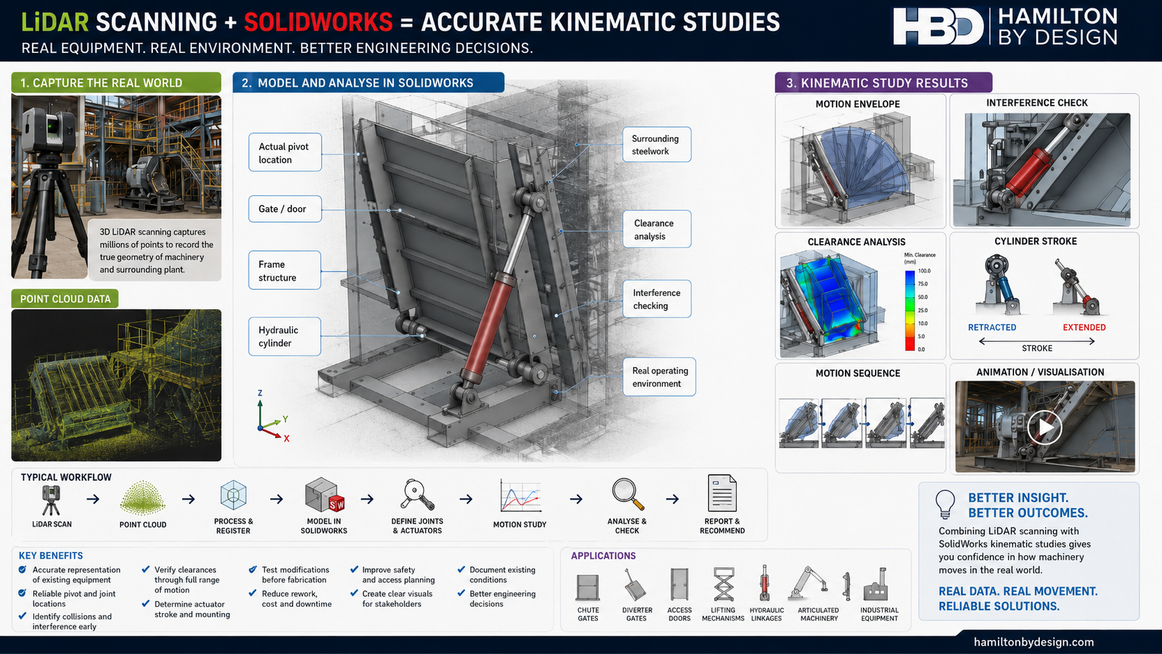
Infographic showing how LiDAR scanning and SOLIDWORKS are combined to create accurate kinematic studies, including point cloud capture, CAD modelling, motion analysis, interference checking, clearance analysis and actuator stroke review.

Combining LiDAR Scanning and SolidWorks for Kinematic Studies

Understanding how machinery moves within an existing industrial environment can be difficult when drawings are unavailable, outdated or do not reflect site modifications.

By combining 3D LiDAR scanning with SolidWorks, engineers can create kinematic studies based on the actual installed geometry of machinery, structures and surrounding plant. This provides a more reliable foundation for assessing movement, clearances, interference risks and proposed mechanical modifications.

What Is a Kinematic Study?

A kinematic study examines the movement of mechanical components without initially focusing on the forces that create that movement.

It may assess:

  • component position;
  • direction of movement;
  • travel distance;
  • angular rotation;
  • velocity;
  • acceleration;
  • linkage behaviour;
  • actuator stroke;
  • motion envelopes;
  • clearances between components;
  • potential collisions or interference.

Kinematic studies are commonly used for mechanical linkages, hydraulic cylinders, access doors, gates, chutes, diverters, lifting systems, articulated equipment and other moving machinery.

Why Existing Geometry Matters

A motion study is only as reliable as the geometry used to create it.

Many industrial machines have been modified, repaired or repositioned over time. Original drawings may no longer represent the actual equipment. Manual measurements may also be difficult where machinery is large, complex, elevated or surrounded by operating plant.

LiDAR scanning provides a detailed three-dimensional record of the equipment and its surroundings. The resulting point cloud can be used as a reference for developing an accurate SolidWorks model.

How LiDAR Scanning Supports the Study

A terrestrial LiDAR scanner records millions of measurement points across the visible surfaces of machinery, structures and plant.

The scan can help establish:

  • shaft and pivot locations;
  • hinge centres;
  • actuator mounting positions;
  • linkage lengths;
  • equipment orientation;
  • machine-frame geometry;
  • surrounding structural steel;
  • guards and access platforms;
  • nearby pipework;
  • operating clearances;
  • fixed obstructions.

This reduces reliance on assumptions and provides an engineering record of the existing condition at the time of capture.

How SolidWorks Is Used

Once the LiDAR data has been processed, the point cloud can be used to develop simplified or detailed SolidWorks models of the relevant machinery.

SolidWorks can then be used to:

  • create individual parts and assemblies;
  • locate pivots, shafts and mounting points;
  • define mechanical mates and joints;
  • simulate rotational and linear movement;
  • represent hydraulic-cylinder extension;
  • evaluate linkage positions;
  • calculate displacement, velocity and acceleration;
  • check component interference;
  • assess minimum clearances;
  • determine the swept path of moving equipment;
  • test proposed modifications before fabrication.

The surrounding plant can also be included as reference geometry so the machinery is analysed within its actual operating environment.

Typical LiDAR-to-SolidWorks Workflow

A typical workflow may include:

  1. Capture the machinery and surrounding plant using a LiDAR scanner.
  2. Register and process the scan data into a coordinated point cloud.
  3. Import or reference the point cloud within the CAD workflow.
  4. Identify the equipment required for the kinematic study.
  5. Create simplified SolidWorks models of the moving components.
  6. Position the models using the scanned geometry.
  7. Define mates, joints, travel limits and actuator movement.
  8. Run the SolidWorks motion study.
  9. Review clearances, collisions and movement envelopes.
  10. Develop recommendations, modifications or fabrication drawings.

Example: Hydraulic Chute Gate

A hydraulic chute gate may include a gate plate, pivot shaft, support frame and hydraulic cylinder.

A LiDAR scan can capture:

  • the existing chute geometry;
  • the gate position;
  • the pivot-shaft location;
  • upper and lower cylinder mounts;
  • surrounding structural steel;
  • platforms, guards and walkways;
  • nearby services and obstructions.

The geometry can then be recreated in SolidWorks to assess:

  • the gate opening angle;
  • the required cylinder stroke;
  • the relationship between cylinder travel and gate rotation;
  • potential dead-centre positions;
  • interference with the chute or surrounding steelwork;
  • clearances through the full operating cycle;
  • whether a proposed replacement cylinder will fit;
  • whether revised mounting points will improve movement.

This allows potential problems to be identified before components are manufactured or installed.

Collision and Interference Assessment

One of the main advantages of combining LiDAR with SolidWorks is the ability to assess moving machinery against the real site environment.

A standalone CAD model may show that a mechanism operates correctly. However, it may not reveal that the moving equipment could contact:

  • an existing handrail;
  • a structural beam;
  • electrical cable trays;
  • nearby pipework;
  • a maintenance platform;
  • machine guarding;
  • adjacent equipment.

By modelling the mechanism within the scanned environment, these conflicts can be identified before shutdown, fabrication or installation.

Evaluating Hydraulic Cylinders and Actuators

SolidWorks motion studies can assist with assessing actuator geometry, including:

  • extended and retracted cylinder lengths;
  • required stroke;
  • cylinder mounting angles;
  • connection-point movement;
  • mechanical advantage;
  • actuator alignment;
  • over-travel;
  • end-of-stroke position;
  • potential side loading;
  • approach to dead-centre conditions.

Where forces and loads must also be evaluated, the kinematic model may be expanded into a dynamic motion or structural assessment using suitable engineering inputs.

Benefits for Brownfield Engineering

LiDAR and SolidWorks are particularly valuable for brownfield projects where machinery must be modified within an existing facility.

The combined workflow can provide:

  • improved confidence in existing dimensions;
  • reduced dependence on outdated drawings;
  • fewer manual site measurements;
  • improved identification of site constraints;
  • better interference detection;
  • more reliable actuator selection;
  • improved design coordination;
  • reduced fabrication rework;
  • better shutdown planning;
  • clearer communication with stakeholders;
  • visual animations of proposed movement;
  • a documented digital record of existing conditions.

Static Scanning and Multiple Equipment Positions

A conventional terrestrial LiDAR scanner generally captures static geometry rather than continuously recording fast mechanical movement.

For this reason, equipment may be scanned in several controlled positions, such as:

  • fully closed;
  • partially open;
  • fully open;
  • maintenance position;
  • parked position.

These positions can be compared and used to confirm the geometry and range of movement.

Where actual operating speed or time-dependent behaviour is required, LiDAR data may be combined with:

  • video footage;
  • shaft encoders;
  • linear displacement sensors;
  • accelerometers;
  • control-system data;
  • hydraulic pressure records;
  • machine operating logs.

From Kinematic Study to Engineering Deliverables

The SolidWorks model developed from the LiDAR data can support more than the motion study itself.

Potential deliverables may include:

  • existing-condition 3D models;
  • kinematic study reports;
  • movement-envelope drawings;
  • interference reports;
  • clearance assessments;
  • actuator-stroke calculations;
  • SolidWorks motion animations;
  • general arrangement drawings;
  • modification concepts;
  • fabrication drawings;
  • installation planning models;
  • shutdown work packs;
  • stakeholder presentation images.

Applications

LiDAR-supported kinematic studies may be suitable for:

  • chute gates;
  • diverter gates;
  • conveyor take-up systems;
  • hydraulic linkages;
  • access doors;
  • lifting mechanisms;
  • maintenance hatches;
  • articulated machinery;
  • robotic systems;
  • positioning equipment;
  • stackers and reclaimers;
  • mobile plant attachments;
  • mechanical dampers;
  • valve-actuation systems;
  • machine guarding;
  • equipment relocation projects.

A More Reliable Basis for Mechanical Design

Combining LiDAR scanning with SolidWorks allows a kinematic study to be developed around the actual machine and the actual site environment.

LiDAR captures the existing geometry. SolidWorks converts that information into an intelligent mechanical model that can be moved, tested and reviewed.

Together, these tools can help engineers identify movement restrictions, confirm actuator requirements, assess clearances and test proposed modifications before work reaches fabrication or site installation.

LiDAR Scanning and SolidWorks Support

Hamilton By Design provides engineer-led 3D LiDAR scanning, point-cloud processing, SolidWorks modelling and mechanical design support for existing industrial machinery and brownfield facilities.

Our services can assist with:

  • existing-condition capture;
  • reverse engineering;
  • SolidWorks assembly modelling;
  • kinematic studies;
  • motion-envelope assessments;
  • interference checking;
  • actuator and linkage reviews;
  • mechanical modifications;
  • fabrication drawings;
  • installation planning.

For assistance with a kinematic study, machinery modification or LiDAR-based SolidWorks model, contact Hamilton By Design to discuss the equipment, required movement and project objectives.

Hamilton By Design logo displayed on a blue tilted rectangle with a grey gradient background

Contact Us – Talk To Us

Name
Would you like us to arrange a phone consultation for you?
Address

Our clients:


LiDAR Scanning for Council Infrastructure and Public Assets on the Central Coast NSW

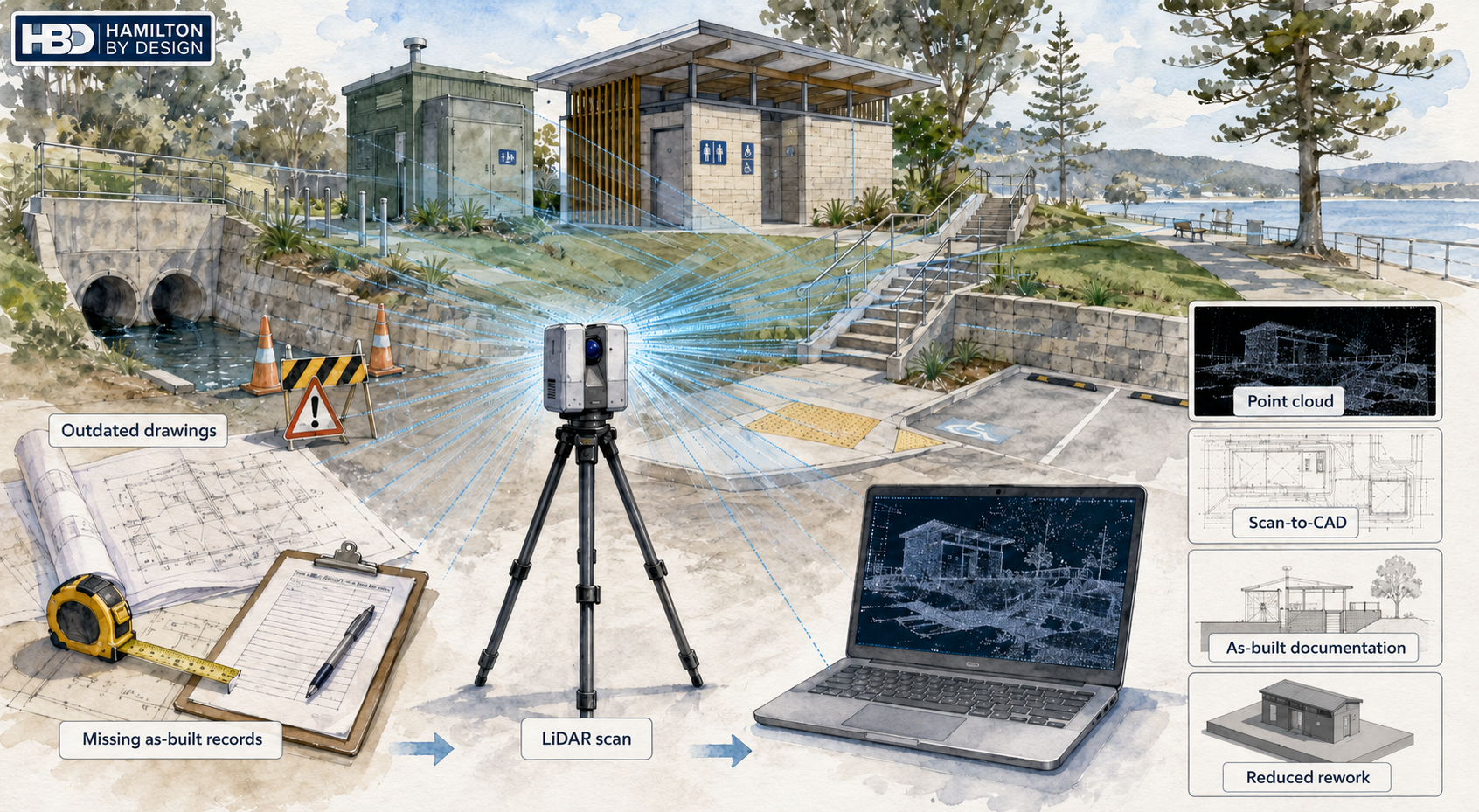
Watercolour illustration showing LiDAR scanning of council infrastructure, including stormwater culverts, public amenities, access stairs, carpark and point cloud outputs for scan-to-CAD and as-built documentation.
Blue 3D LiDAR scanner icon on a tripod with scanning waves

Councils manage a wide range of public infrastructure. This includes stormwater assets, pump stations, amenities buildings, carparks, parks, depots, retaining walls, roads, footpaths, coastal assets, water infrastructure and community facilities.

Many of these assets have been modified over time. Drawings may be outdated, site conditions may have changed, and important details may be missing from the original records.

Before a council, consultant or contractor can confidently plan an upgrade, maintenance project or renewal program, they need accurate existing-condition information.

This is where LiDAR scanning for council infrastructure can help.

LiDAR scanning captures accurate 3D site data and converts the real-world environment into a digital point cloud. From that point cloud, useful engineering outputs can be created, including CAD drawings, sections, elevations, 3D models and as-built documentation.

For councils, this means better information before design, procurement, construction and long-term asset management decisions are made.

Why Councils Need Accurate Existing-Condition Data

Public assets are often difficult to document properly using manual measurement alone.

A stormwater outlet may have irregular geometry. A pump station may contain pipework, valves, platforms and access constraints. A public amenities building may have been altered several times. A depot or workshop may have services, equipment and structures that are not shown correctly on old drawings.

When project teams rely on incomplete information, the risk increases.

Common problems include:

  • Design assumptions based on outdated drawings
  • Contractors needing repeated site visits
  • Fabrication errors caused by incorrect measurements
  • Poor tender information
  • Unexpected clashes during construction
  • Missing as-built records
  • Difficulty planning maintenance or renewals
  • Higher risk of rework and delay

LiDAR scanning helps reduce these problems by capturing the existing asset before work begins.

Where LiDAR Scanning Helps Council Projects

Council AssetHow LiDAR Scanning Helps
Stormwater pits, culverts and outletsCaptures existing geometry, levels, surrounding constraints and access conditions
Pump stations and water assetsDocuments pipework, valves, platforms, equipment, clearances and structures
Public amenities buildingsSupports refurbishment, accessibility upgrades and as-built plans
Carparks and access roadsCaptures kerbs, ramps, barriers, drainage and layout constraints
Parks and open space assetsHelps with renewal planning, pathways, ramps and public access improvements
Depots and workshopsRecords existing layouts, equipment zones, services and structures
Retaining walls and access stairsSupports condition review, replacement planning and design checks
Coastal and foreshore assetsUseful for localised structure, access and public asset documentation
Bridges and small structuresCaptures visible geometry for upgrade planning and design coordination

What Hamilton By Design Delivers

Hamilton By Design provides engineering-led LiDAR scanning and scan-to-CAD services for councils, consultants and contractors working on public infrastructure and asset renewal projects.

Depending on the project, deliverables may include:

  • Registered point cloud data
  • 2D CAD plans
  • Sections and elevations
  • 3D CAD models
  • Existing-condition drawings
  • As-built documentation
  • Mechanical and structural layout models
  • Site constraint records
  • Design verification data
  • Fabrication and upgrade support

The value is not just in capturing the scan. The real value is turning the point cloud into information that engineers, asset managers, designers and contractors can actually use.

Choosing the Right Scanning Method

Not every LiDAR method suits every council project.

Some projects need detailed terrestrial scanning of a pump station, public building, depot or stormwater structure. Other projects may need drone survey, mobile mapping, broad topographic data or input from a registered surveyor.

Hamilton By Design focuses on selecting the right capture method for the project outcome, rather than forcing one scanning approach onto every site.

Best Fit for LiDAR Scanning

Best FitMay Need Another Method
Pump station upgradesWhole-catchment flood mapping
Public amenities refurbishmentsLegal boundary survey
Stormwater outlet replacementsUnderground service locating
Depot and workshop layoutsLarge road corridor mapping
Small bridges and culvertsFull cadastral survey
Retaining walls and stairsDeep geotechnical investigation
Brownfield facility upgradesBroad aerial terrain mapping

LiDAR scanning is best used where accurate visible existing conditions matter.

It is not a replacement for every survey method, but it is a powerful tool for reducing uncertainty before design and construction begin.

Advantages of LiDAR Scanning for Councils

AdvantageCouncil Benefit
Better existing-condition dataReduces assumptions before design starts
Fewer site revisitsSaves time for council staff, consultants and contractors
Improved tender informationHelps contractors price from clearer site data
Reduced reworkHelps avoid clashes, wrong dimensions and incorrect fabrication
Better asset recordsSupports future maintenance and asset management
Safer site captureReduces manual measuring in difficult or awkward areas
Faster design coordinationAllows multiple stakeholders to work from the same site record
Stronger project evidenceCreates a digital record of what existed at the time of capture

Quick Project Matching Guide

If You Are PlanningAsk About
A pump station upgradeLiDAR scanning and scan-to-CAD modelling
A stormwater outlet replacementExisting-condition capture and sections
A public amenities refurbishmentAs-built plans and 3D building capture
A depot layout changePoint cloud modelling and clearance checks
A retaining wall replacementExisting geometry and access documentation
A contractor tender packageScan data, CAD drawings and site constraints
A council asset renewal programRepeatable asset capture workflow

LiDAR Scanning for Central Coast Council-Style Projects

Central Coast Council already publishes references to LiDAR in areas such as flood studies, coastal monitoring and dredging programs. This shows that LiDAR is already part of modern infrastructure, environmental and asset-related work.

The opportunity now is to apply the same digital capture thinking to smaller, asset-level projects such as pump stations, public buildings, stormwater assets, depots, carparks, retaining walls and local infrastructure upgrades.

For council-style projects, accurate site data can help answer important questions early:

  • What is actually on site?
  • Do the old drawings match reality?
  • Where are the access constraints?
  • What will the contractor need to work around?
  • Can the proposed design fit the existing asset?
  • What information should be included in the tender package?
  • What should be recorded for future asset management?

FAQs

What is LiDAR scanning for council infrastructure?
LiDAR scanning captures accurate 3D site data that can be used to create point clouds, CAD drawings, models and as-built documentation for public assets.

Can LiDAR scanning replace a registered surveyor?
No. LiDAR scanning can support engineering and asset documentation, but cadastral boundaries, legal survey and certified survey work must be completed by an appropriately qualified surveyor.

What council assets can be scanned?
Stormwater assets, pump stations, public buildings, amenities, depots, retaining walls, carparks, pathways, access structures and brownfield infrastructure can often be scanned.

Is LiDAR useful for stormwater works-as-executed records?
Yes. LiDAR can help capture existing drainage geometry and surrounding site conditions, although final works-as-executed requirements should match the relevant council specification.

What is the difference between LiDAR scanning and scan-to-CAD?
LiDAR scanning captures the site. Scan-to-CAD converts the point cloud into useful drawings, models, sections or design-ready geometry.

When is LiDAR scanning not the right tool?
It may not be the best option for simple measurements, legal boundaries, buried services, whole-region mapping or very large open terrain projects unless combined with other survey methods.

Need LiDAR Scanning for a Council Infrastructure Project?

Hamilton By Design provides engineering-led LiDAR scanning, point cloud modelling and scan-to-CAD services for council infrastructure, public assets and brownfield upgrade projects across the Central Coast, Hunter, Sydney and regional NSW.

If your project needs accurate existing-condition data before design, tendering or construction, we can help turn the real site into usable engineering information.

Talk to Us – Contact Us

Name
Would you like us to arrange a phone consultation for you?
Address

Our clients:


https://www.hamiltonbydesign.com.au/scan-to-bim-services-australia-lidar-point-clouds-cad-modelling

Scan to BIM Perth WA

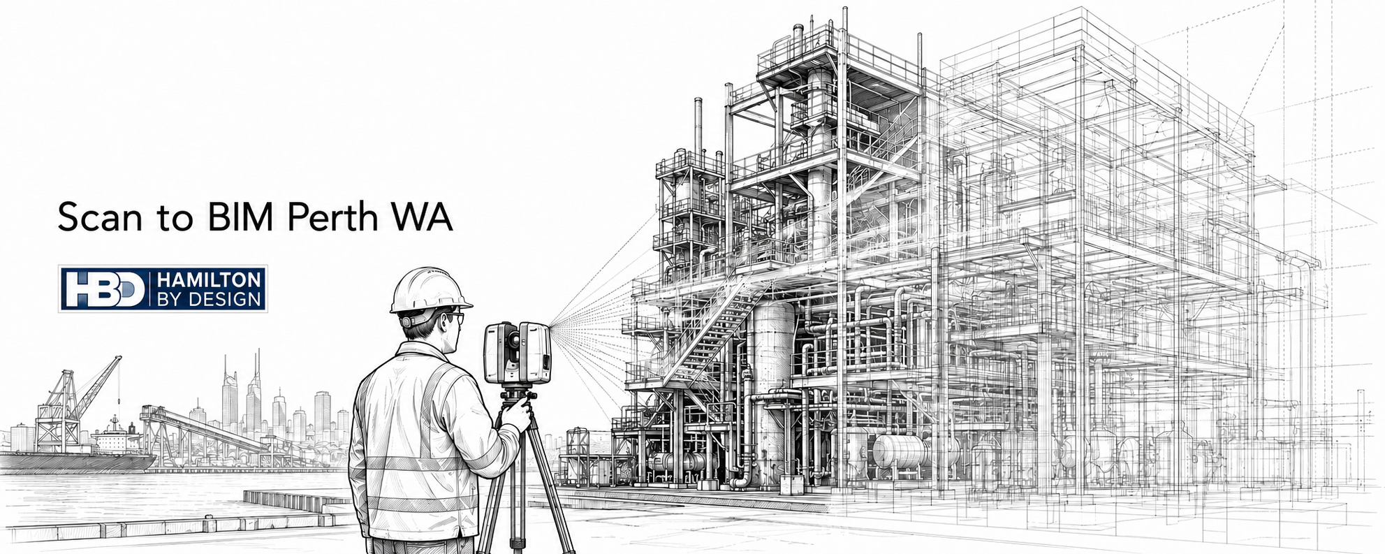
Ink line drawing of an engineer using a 3D LiDAR scanner to capture an industrial facility in Perth WA, with point cloud lines converting the site into a BIM model.

Scan to BIM Perth WA | LiDAR Scanning & BIM Modelling

Blue 3D LiDAR scanner icon on a tripod with scanning waves

Embracing the idea of Scan to BIM Perth WA would suggest accurate site information is critical for successful engineering, construction, maintenance and upgrade projects. In Perth and across Western Australia, many mining, industrial, commercial and infrastructure assets have changed over time, but the drawings have not always kept up.

Equipment gets replaced. Pipework is modified. Structural steel is strengthened or repaired. Access platforms are changed. Services are rerouted. Buildings are refurbished. Over time, the original drawings may no longer reflect what is actually installed on site.

This is where Scan to BIM Perth becomes valuable.

Scan to BIM is the process of capturing an existing site using 3D laser scanning or LiDAR technology, then converting that point cloud data into an accurate Building Information Model. The result is a usable digital model that helps engineers, project managers, builders, asset owners and maintenance teams make better decisions based on real site conditions.

Hamilton By Design provides engineering-led Scan to BIM services across Perth and Western Australia, supporting mining, industrial, commercial, infrastructure and brownfield upgrade projects.

For projects that require accurate reality capture before design or fabrication begins, Hamilton By Design also provides 3D laser scanning in Perth to capture reliable point cloud data for downstream BIM, CAD and engineering workflows.

The Biggest Problem: Inaccurate or Missing As-Built Information

The biggest problem Scan to BIM solves is the lack of reliable as-built information.

Many Perth and WA sites rely on old drawings, incomplete records or assumptions made from previous projects. In some cases, drawings may exist but do not include later site modifications. In other cases, asset owners may only have PDFs, hand-marked drawings or partial CAD files.

This creates major project risk.

If engineers are designing from inaccurate information, new equipment may not fit. Steelwork may clash with existing structure. Pipe routes may conflict with services. Fabricated parts may arrive on site and require modification. Shutdown work may take longer than planned because the real site does not match the design assumptions.

These issues can lead to:

  • Design clashes
  • Fabrication errors
  • Installation delays
  • Extra site visits
  • Shutdown overruns
  • Safety risks
  • Increased project costs
  • Poor coordination between trades
  • Rework during construction
  • Poor asset records for future maintenance

For brownfield industrial and mining projects, these risks are especially important because work is often carried out around live plant, restricted access zones, shutdown windows and complex existing infrastructure.

Scan to BIM helps reduce this uncertainty by capturing the actual site and turning it into practical digital information.

What Is Scan to BIM?

Scan to BIM combines two key processes: reality capture and Building Information Modelling.

First, the existing site is captured using 3D laser scanning or LiDAR. The scanner records millions of measurement points across the site. These points form a point cloud, which is a highly accurate 3D representation of the existing conditions.

The point cloud can then be used to create a BIM model. Depending on the project, this model may include building elements, structural steel, pipework, mechanical equipment, platforms, conveyors, access systems, services, walls, slabs, columns and other site features.

The final model may be delivered in formats such as Revit, Navisworks, IFC, DWG or other agreed digital formats.

The key value is that the model is based on measured site data, not guesswork.

Who Uses Scan to BIM in Perth?

Scan to BIM is used by a wide range of organisations and project teams across Perth and Western Australia.

Typical users include:

  • Mining companies
  • Industrial plant owners
  • Commercial property owners
  • Infrastructure operators
  • Engineering consultants
  • Mechanical engineers
  • Structural engineers
  • Architects
  • Builders
  • Fabricators
  • Shutdown planners
  • Asset managers
  • Maintenance teams
  • Project managers
  • Facility managers

For asset owners, Scan to BIM provides better records of what is installed.

For engineers, it provides a more reliable base for design.

For builders and fabricators, it helps reduce clashes and installation problems.

For maintenance teams, it supports planning, access review and future asset management.

Where Is Scan to BIM Used in Perth and WA?

Scan to BIM can be used anywhere existing conditions need to be captured accurately.

In Perth, this may include commercial buildings, hospitals, schools, industrial workshops, warehouses, manufacturing sites, processing plants, water infrastructure, ports and transport facilities.

Across Western Australia, Scan to BIM is also valuable for mining and heavy industrial locations, including processing plants, materials handling facilities, port infrastructure, power generation assets, pump stations, treatment plants and regional industrial sites.

Common WA locations and project areas include:

  • Perth CBD
  • Kwinana
  • Henderson
  • Welshpool
  • Canning Vale
  • Fremantle
  • Rockingham
  • Bunbury
  • Geraldton
  • Kalgoorlie
  • Port Hedland
  • Karratha
  • Pilbara
  • Goldfields
  • Regional Western Australia

Hamilton By Design supports broader engineering and scanning work through its Perth WA engineering and 3D scanning services page, which is a useful internal location hub for Perth-based clients.

How the Scan to BIM Process Works

A typical Scan to BIM workflow includes several stages.

1. Project Scope and Capture Planning

Before scanning begins, the project team needs to understand what the model will be used for.

This is important because not every Scan to BIM project needs the same level of detail. A model for architectural refurbishment may require different information compared with a model for conveyor upgrades, pipework modifications, structural access design or plant layout changes.

Key questions include:

  • What area needs to be captured?
  • What level of detail is required?
  • Is the model for design, construction, asset records or maintenance?
  • Are mechanical and structural elements required?
  • Are services and pipework required?
  • What deliverable format is needed?
  • Is the work being used for clash detection?
  • Is the site live, restricted or difficult to access?

Clear scope at the start helps ensure the final model is useful.

2. 3D Laser Scanning or LiDAR Site Capture

The site is captured using professional 3D scanning equipment. The scanner collects accurate spatial data from multiple positions around the site.

For complex industrial facilities, multiple scan positions may be required to capture equipment, steelwork, pipework, access platforms, conveyors and building elements from different angles.

The result is a point cloud that represents the real site geometry.

3. Point Cloud Registration

After site capture, the individual scans are registered together into a single coordinated point cloud.

This stage aligns the scans so the full site can be reviewed as one digital environment.

Typical point cloud formats may include:

  • E57
  • RCP
  • RCS
  • LAS

The registered point cloud becomes the foundation for the BIM model.

4. BIM Model Development

The point cloud is then used to create a BIM model. Depending on the project, this may include modelling architectural, structural, mechanical or services elements.

For industrial and mining projects, modelled items may include:

  • Structural steel
  • Platforms
  • Stairs
  • Handrails
  • Pipework
  • Tanks
  • Pumps
  • Conveyors
  • Chutes
  • Hoppers
  • Mechanical equipment
  • Access areas
  • Building structure
  • Services corridors

The goal is not just to make the model look good. The goal is to create a model that supports real project decisions.

Where CAD deliverables are required rather than a full BIM workflow, Hamilton By Design can also convert point cloud data into engineering models and drawings through its Scan to CAD Perth service.

5. Quality Review Against the Point Cloud

Once the BIM model is created, it should be checked against the point cloud. This helps confirm that the model reflects the captured site conditions and that the required scope has been covered.

Quality review is important because Scan to BIM is only useful if the model is accurate enough for the intended purpose.

A model used for general planning may not require the same detail as a model used for fabrication coordination, clash detection or construction sequencing. The required accuracy and level of detail should match the project outcome.

6. Delivery of BIM and CAD Outputs

Final deliverables depend on the project requirements.

Common deliverables include:

  • Revit model
  • Navisworks model
  • IFC model
  • DWG drawings
  • 2D plans
  • Sections and elevations
  • PDF documentation
  • Registered point cloud
  • E57 files
  • RCP / RCS files
  • Clash detection model
  • As-built documentation

Tools That Assist With Scan to BIM

Scan to BIM relies on a combination of capture equipment, point cloud software, BIM software and engineering review.

Useful tools include:

ToolPurpose
3D laser scanner / LiDARCaptures accurate site geometry
FARO Focus / terrestrial scannerEngineering-grade site capture
FARO SCENEPoint cloud registration and processing
Autodesk ReCapPoint cloud preparation for Autodesk workflows
RevitBIM model development
NavisworksCoordination and clash review
AutoCAD2D drawings and CAD outputs
IFCModel exchange between software platforms
E57 / RCP / RCS / LASPoint cloud delivery formats
SolidWorks / InventorMechanical modelling where required

The right tools depend on the final use of the data. A commercial building project may require a Revit-focused workflow, while an industrial plant upgrade may need a combination of point cloud, CAD, BIM and mechanical modelling outputs.

Why Engineering-Led Scan to BIM Matters

Not all Scan to BIM providers approach the work the same way.

Some providers focus mainly on scanning and visual modelling. That may be enough for some building documentation projects, but industrial and mining sites often need a deeper understanding of how the asset works.

Engineering-led Scan to BIM is different because the model is developed with practical project outcomes in mind.

For example, in a processing plant, the important question may not simply be โ€œwhat does the site look like?โ€ The real questions may be:

  • Will the new equipment fit?
  • Can the conveyor be modified safely?
  • Is there enough access for installation?
  • Will new pipework clash with existing steel?
  • Can the platform support maintenance access?
  • What needs to be removed before shutdown?
  • Can fabrication drawings be developed from the scan data?
  • What existing structure must remain untouched?

Hamilton By Designโ€™s Scan to BIM approach is suited to mechanical, structural, mining and industrial environments where the digital model needs to support real engineering decisions.

For clients working nationally, the broader Scan to BIM Mining and Industrial Facilities page provides additional context around mining, processing plant, materials handling and heavy industrial applications.

Benefits of Scan to BIM Perth

Scan to BIM provides several important benefits for Perth and WA projects.

Better Design Accuracy

Design teams can work from real site data instead of old drawings or assumptions. This reduces the risk of designing around information that no longer reflects the site.

Reduced Site Rework

Accurate existing-condition data helps reduce fabrication and installation problems. This is particularly valuable where fabricated components need to fit into existing plant, structure or services.

Improved Clash Detection

Models can be reviewed before construction to identify conflicts between new and existing elements.

This helps project teams detect problems before labour, materials and equipment are committed to site work.

Faster Project Planning

Teams can review the site digitally without always needing to return to site.

This is useful for remote WA projects where travel, access and site inductions can add time and cost.

Improved Shutdown Confidence

For mining and industrial projects, accurate scan data helps plan work before shutdown begins.

Shutdowns are often expensive and time-sensitive. Scan to BIM helps reduce uncertainty before work starts.

Better Asset Records

Owners receive a more reliable digital record of existing assets.

This can support future maintenance, inspections, upgrades and long-term asset management.

Improved Collaboration

BIM models provide a shared reference point for engineers, builders, contractors, fabricators and asset managers.

When everyone is working from the same accurate information, coordination improves.

Scan to BIM for Brownfield Projects

Brownfield projects are one of the strongest use cases for Scan to BIM.

Unlike greenfield projects, brownfield sites already contain existing plant, structure, services, access restrictions and operational constraints. The site may have been modified many times over decades.

This makes accurate information critical.

Scan to BIM helps brownfield projects by capturing the real conditions before design or fabrication begins. This reduces the chance of clashes, improves planning and gives project teams a more reliable foundation for decision-making.

For Perth and WA mining, resources, port and industrial projects, this can be the difference between a smooth installation and a costly shutdown delay.

SEO ItemSuggested Detail
Page NameScan to BIM Perth WA
URL/scan-to-bim-perth/
Keyword FocusScan to BIM Perth
LocationPerth WA
Meta DescriptionEngineering-led Scan to BIM services in Perth WA. Convert 3D laser scan data into accurate BIM models for mining, industrial, commercial, infrastructure and brownfield upgrade projects.

FAQs

What is Scan to BIM?

Scan to BIM is the process of capturing an existing site using 3D laser scanning or LiDAR, then converting the point cloud data into a Building Information Model. The model can be used for design, construction planning, asset management, clash detection and future maintenance.

Why is Scan to BIM useful for Perth and WA projects?

Scan to BIM is useful because many Perth and WA assets have incomplete or outdated drawings. By capturing the real site conditions, project teams can reduce assumptions, avoid clashes and plan upgrades with greater confidence.

What industries use Scan to BIM in Perth?

Scan to BIM is used across mining, mineral processing, ports, manufacturing, commercial buildings, infrastructure, water treatment, power generation and industrial facilities.

What deliverables can be provided from a Scan to BIM project?

Typical deliverables may include Revit models, Navisworks models, IFC files, DWG drawings, 2D plans, sections, elevations, registered point clouds, E57 files, RCP files, RCS files and PDF documentation.

Is Scan to BIM only for buildings?

No. Scan to BIM can be used for buildings, but it is also valuable for industrial plants, mining infrastructure, processing facilities, pipework, structural steel, conveyors, platforms, equipment and brownfield engineering projects.

Can Scan to BIM help reduce shutdown risk?

Yes. Scan to BIM can help project teams understand existing site conditions before shutdown work begins. This can reduce clashes, improve sequencing and reduce the risk of unexpected site issues during installation.

What is the difference between Scan to BIM and Scan to CAD?

Scan to BIM usually creates an information-rich model, often used in Revit, Navisworks or IFC workflows. Scan to CAD usually focuses on producing CAD models and drawings for engineering, drafting, fabrication or layout work. The right choice depends on the project outcome.

Do I need a full BIM model for every project?

No. Some projects only need a point cloud, 2D drawings or a Scan to CAD model. Other projects need a full BIM model for coordination, asset management or construction planning. The deliverable should match the project need.


Hamilton By Design logo displayed on a blue tilted rectangle with a grey gradient background

Scan to BIM Perth gives project teams a more reliable way to understand existing buildings, plants and infrastructure before design, fabrication or construction begins.

For Perth and Western Australia, where mining, industrial, commercial and infrastructure assets often involve complex existing conditions, accurate digital information can reduce risk, improve coordination and support better long-term asset management.

By combining 3D laser scanning, point cloud processing, BIM modelling and engineering experience, Hamilton By Design helps turn real site conditions into practical digital deliverables that support better project outcomes.

Talk to Us – Contact Us

Name
Would you like us to arrange a phone consultation for you?
Address

Our clients:

https://www.hamiltonbydesign.com.au/scan-to-bim-services-australia-lidar-point-clouds-cad-modelling

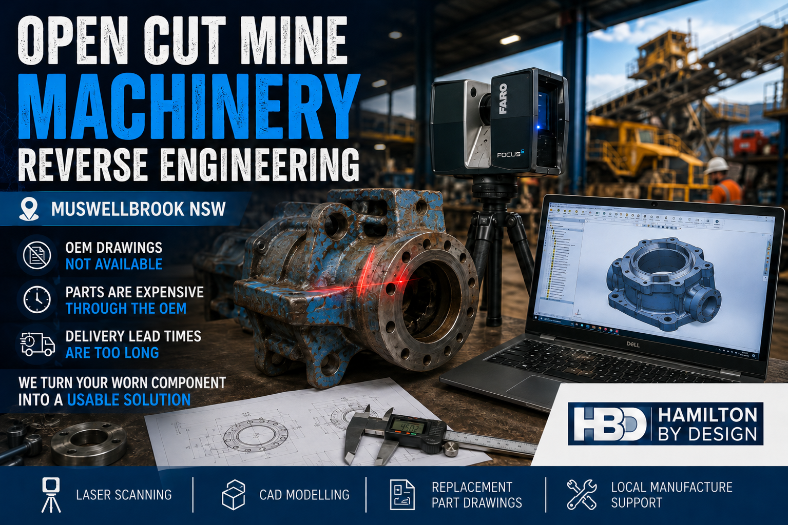
Open Cut Mine Machinery Reverse Engineering Muswellbrook NSW

Open cut mine machinery reverse engineering image showing a worn mining component being laser scanned beside a CAD model, with Hamilton By Design branding and Muswellbrook NSW text.

Replacement Parts Without OEM Drawings, Long Lead Times or Excessive OEM Costs

Open cut mining operations around Muswellbrook NSW rely on heavy machinery, fixed plant, conveyors, crushers, feeders, pumps, screens, chutes, hoppers, guards, frames and access systems to keep production moving.

When a critical machinery component wears out, cracks, fails or becomes obsolete, the first option is often to contact the original equipment manufacturer.

But for many mining maintenance teams, that creates a serious problem.

The OEM may not provide detailed drawings.
The replacement part may be expensive.
The delivery lead time may be too long.
The machine may be older, modified or no longer fully supported.

This can leave mine operators, maintenance teams and shutdown planners with limited options when they need a replacement part quickly.

Hamilton By Design supports open cut mining operations, maintenance teams, fabricators and repair workshops with engineering-grade 3D laser scanning and mining plant upgrade support, reverse engineering, CAD modelling and engineering documentation for mine machinery components.

Our focus is not open cut pit scanning or mine survey work. Our focus is machinery, fixed plant, replacement parts and brownfield equipment support.

If a component can be removed, measured, scanned or inspected, it may be possible to develop a 3D CAD model, manufacturing drawing or replacement part design that supports local manufacture, repair or redesign.


The Real Problem: OEM Drawings Are Not Available

For many mining assets, the biggest problem is not always that old site drawings are outdated. The larger problem is that the equipment owner often does not have access to the detailed OEM drawings required to reproduce or repair the part.

The mine may own the machine.

The maintenance team may own the worn component.

The workshop may be able to manufacture a replacement.

But without the correct drawings, dimensions, tolerances, materials and fit-up information, the replacement process becomes difficult.

This is a common problem with:

  • Older mining machinery
  • Imported equipment
  • Obsolete parts
  • Proprietary OEM components
  • Modified equipment
  • Worn mechanical assemblies
  • Shutdown-critical replacement parts
  • Components with long supply lead times
  • Parts that are too expensive through the OEM supply chain

When a part is urgently needed, waiting weeks or months for an imported OEM replacement may not be practical. In some cases, the part cost may also be difficult to justify, especially when a local fabrication or machining solution may be possible.

Reverse engineering provides another pathway.


What Is Mine Machinery Reverse Engineering?

Mine machinery reverse engineering is the process of capturing the geometry, features and function of an existing component so that a usable CAD model, drawing or replacement design can be created.

This may involve laser scanning, manual measurement, inspection, CAD modelling and engineering review.

The aim is to understand the part well enough to support repair, manufacture, fit-up or redesign.

Depending on the component, this may include:

  • Measuring critical diameters
  • Capturing bolt hole patterns
  • Checking shaft, bush and bearing fits
  • Modelling flanges, brackets and housings
  • Recording wear surfaces
  • Capturing complex cast shapes
  • Creating 3D CAD models
  • Producing 2D manufacturing drawings
  • Identifying practical fabrication methods
  • Supporting local machining, fabrication or casting

Reverse engineering is especially useful where the original drawings are not available from the OEM, or where the part has been modified during its service life.

Hamilton By Design also provides replacement part reverse engineering where OEM drawings are unavailable, helping asset owners move from a physical component to usable manufacturing information.


Why This Matters for Muswellbrook Mining Operations

Muswellbrook and the surrounding Upper Hunter region support major mining, industrial maintenance and heavy equipment operations. Open cut mine machinery is exposed to harsh operating conditions, heavy loads, vibration, dust, impact, abrasion and constant production pressure.

When machinery components fail, the issue is rarely simple.

A replacement part may be required urgently.

The part may need to fit into an existing machine.

The equipment may be old or modified.

The OEM may have a long delivery time.

The replacement price may be high.

The mine may need a local repair or manufacturing option.

This is where laser scanning and reverse engineering can assist. Instead of relying only on unavailable OEM drawings, the existing component can be captured, measured and converted into usable engineering information.

That information can then support local manufacturing, repair, redesign or future asset documentation.

For mining operators, contractors and industrial clients across the region, Hamilton By Design provides Hunter Valley mining engineering and 3D laser scanning services focused on practical brownfield plant, machinery and materials handling problems.


Common Machinery Parts That May Be Reverse Engineered

Hamilton By Design can assist with reverse engineering and CAD documentation for a range of mine machinery and fixed plant components.

Examples include:

  • Pump components
  • Bearing housings
  • Drive components
  • Couplings
  • Guards and covers
  • Conveyor components
  • Chute components
  • Hopper parts
  • Wear liners
  • Brackets and mounts
  • Structural frames
  • Shafts and sleeves
  • Flanges and adaptors
  • Fabricated assemblies
  • Cast components
  • Obsolete machine parts
  • Modified equipment parts

Some parts require high-detail measurement. Others require practical engineering judgement to determine which features are critical and which features can be simplified for manufacture.

The goal is not always to create a perfect visual copy of the original part. The goal is to create useful engineering information that allows the replacement part to be manufactured, fitted and used safely.


How Laser Scanning Helps

Laser scanning is useful when a component has complex geometry, difficult-to-measure surfaces or no existing CAD model.

A laser scanner captures the visible surfaces of the part as a point cloud. This data can then be used as a reference for CAD modelling and dimensional checking.

Laser scanning can be especially useful for:

  • Castings
  • Worn parts
  • Complex housings
  • Curved surfaces
  • Irregular shapes
  • Large fabricated items
  • Assemblies with multiple interfaces
  • Parts where manual measurement alone is slow or difficult

However, laser scanning is only one part of the process.

For machinery reverse engineering, critical dimensions still need to be understood. Bearing fits, shaft fits, bolt holes, machined faces, threads, splines, sealing surfaces and alignment features may require additional measurement and engineering review.

That is why Hamilton By Design combines laser scanning with practical mechanical design and CAD modelling experience.


The Reverse Engineering Workflow

A typical reverse engineering workflow may include the following steps.

1. Identify the Part and the Problem

The first step is to understand what the part does and why it needs to be replaced.

Questions may include:

  • Is the part worn, cracked, broken or obsolete?
  • Is the part required for a shutdown?
  • Is the OEM replacement too expensive?
  • Is the lead time too long?
  • Is the part being repaired, copied or improved?
  • Does the replacement need to match the original exactly?
  • Are there known fit-up issues with the existing machine?

Understanding the problem helps determine the correct level of measurement and modelling.

2. Inspect and Measure the Component

The component is inspected and measured. This may include laser scanning, manual measurement, photographs, sketches and notes.

Critical features may include:

  • Bolt hole centres
  • Mounting faces
  • Shaft diameters
  • Bearing locations
  • Overall envelope size
  • Mating faces
  • Wear surfaces
  • Clearance areas
  • Welded or machined details
  • Material thicknesses
  • Assembly interfaces

Where a part is worn, care is needed. The worn shape may not represent the original working geometry. In these cases, engineering judgement may be required to determine the intended size or fit.

3. Create a 3D CAD Model

The measured data is used to create a 3D CAD model.

This model may be developed in SolidWorks, Inventor or another suitable CAD platform. The model can be used to check geometry, confirm fit-up and prepare manufacturing information.

Depending on the job, the model may represent:

  • A single component
  • A machined part
  • A fabricated assembly
  • A casting
  • A guard or cover
  • A chute section
  • A pump component
  • A machine frame
  • A modified replacement design

Hamilton By Design provides 3D CAD modelling for mining, heavy industry and mechanical plant projects, helping convert site measurements, scans, sketches and physical components into practical engineering models.

The model can also be exported in common formats such as STEP, SAT or Parasolid for use by fabricators, machinists or other engineering teams.

4. Produce Manufacturing Drawings

Once the model is complete, 2D drawings can be created for manufacture.

These drawings may include:

  • General dimensions
  • Critical fit dimensions
  • Hole patterns
  • Machined faces
  • Material notes
  • Weld details
  • Fabrication notes
  • Assembly details
  • Tolerance requirements
  • Surface finish requirements where needed

The level of drawing detail should suit the manufacturing process. A fabricated guard does not need the same detail as a machined bearing housing. A cast component may require different information again.

5. Review Fit-Up and Future Use

The replacement part can then be checked against the original component, mating parts or surrounding machine geometry.

Where needed, the CAD data can also be stored for future use. This gives the asset owner better control over future replacement, repair or redesign work.

Once the part has been reverse engineered, the mine is no longer starting from zero the next time that component is required.


Benefits of Reverse Engineering Mine Machinery Parts

Reverse engineering can provide several practical benefits for mine operators, maintenance teams and fabrication workshops.

Reduced Dependence on OEM Drawings

When the OEM will not provide drawings, reverse engineering can create the missing technical information needed to support local manufacture or repair.

Shorter Lead Times

If a local fabricator or machine shop can manufacture the part, the project may avoid long OEM supply delays.

Better Cost Control

OEM replacement parts can be expensive. Reverse engineering can help identify whether local manufacture, repair or redesign is a practical alternative.

Support for Obsolete Equipment

Older machinery may no longer be fully supported. Reverse engineering helps extend the life of useful assets where replacement parts are difficult to obtain.

Improved Shutdown Planning

Having drawings and CAD models ready before a shutdown can reduce uncertainty and improve planning.

Future Asset Control

Once the part is modelled and documented, the mine has better information for future maintenance, procurement and engineering decisions.


Not Every Part Should Be Copied Without Review

Reverse engineering does not mean blindly copying every worn or damaged part.

Some parts are safety critical. Some parts are highly loaded. Some parts may have fatigue, wear, material or heat treatment requirements. Some components may be subject to compliance, certification or OEM warranty considerations.

That means each part should be reviewed properly before manufacture.

In some cases, the best approach may be:

  • Direct replacement
  • Repair
  • Redesign
  • Strength improvement
  • Material upgrade
  • Manufacturing process change
  • Additional engineering verification
  • FEA or stress review
  • Supplier review
  • Third-party certification

Hamilton By Design can assist with the engineering documentation and CAD modelling needed to support these decisions.


Tools Used by Hamilton By Design

Hamilton By Design uses a practical mix of scanning, modelling and engineering tools to support machinery reverse engineering projects.

These may include:

  • FARO Focus laser scanning
  • FARO SCENE point cloud processing
  • Manual measurement and inspection
  • SolidWorks CAD modelling
  • Autodesk Inventor modelling
  • AutoCAD drafting
  • STEP, SAT and Parasolid export
  • 2D manufacturing drawings
  • Assembly drawings
  • Fabrication drawings
  • Design verification
  • SolidWorks Simulation or FEA support where required

The right tools depend on the part, the accuracy required and the manufacturing method.


Why Work With Hamilton By Design?

Hamilton By Design combines site measurement, laser scanning, mechanical design, CAD modelling and practical manufacturing experience.

This is important because mine machinery reverse engineering is not just a scanning exercise.

A scan can capture shape.

But the engineering process must also understand fit, function, manufacturing method, tolerances, material selection, access, assembly and maintenance requirements.

Hamilton By Design can support:

  • Mine operators
  • Maintenance teams
  • Shutdown planners
  • Reliability engineers
  • Fabricators
  • Machine shops
  • Repair workshops
  • Industrial contractors

For Muswellbrook and Upper Hunter mining operations, this service is aimed at machinery and fixed plant problems where the OEM pathway is too slow, too expensive or too restrictive.


Open Cut Mine Machinery Reverse Engineering in Muswellbrook NSW

If your mining operation has a worn, damaged or obsolete machinery component and the OEM will not supply drawings, Hamilton By Design can help create practical engineering information from the existing part.

We can assist with laser scanning, reverse engineering, CAD modelling and manufacturing drawings for mine machinery and fixed plant components.

This can help reduce reliance on OEM supply chains, support local manufacture and improve control over future maintenance.


Hamilton By Design logo displayed on a blue tilted rectangle with a grey gradient background

Need Replacement Part Drawings Without OEM Support?

Hamilton By Design provides reverse engineering and CAD modelling support for mine machinery components in Muswellbrook, the Upper Hunter and across NSW.

If the OEM will not provide drawings, the lead time is too long or the replacement part cost is too high, reverse engineering may provide a practical path forward.

Contact Hamilton By Design to discuss machinery laser scanning, reverse engineering, CAD modelling and replacement part documentation for mining equipment and fixed plant components.

Talk to Us – Contact Us

Name
Would you like us to arrange a phone consultation for you?
Address

Our clients:


https://www.hamiltonbydesign.com.au/scan-to-bim-services-australia-lidar-point-clouds-cad-modelling

Smelter Scan to CAD Services in Newcastle NSW

Engineering pencil drawing illustrating Smelter Scan to CAD Services in Newcastle NSW, showing LiDAR laser scanning, point cloud registration and conversion into accurate 3D CAD models for brownfield smelter and heavy industrial facilities.
Blue line-art icon of an industrial smelting furnace pouring molten metal into a ladle, representing engineering-grade 3D LiDAR scanning services for smelters, brownfield plant upgrades and as-built documentation.

Heavy industrial facilities rarely remain unchanged. Smelters are continually upgraded to improve production, replace ageing equipment, meet environmental regulations and increase operational efficiency. Over decades of operation, countless modifications are made, many of which are only partially documented or never recorded at all. As a result, engineering teams are often forced to work with outdated drawings, incomplete documentation or no reliable three-dimensional CAD model of the facility.

Hamilton By Design provides Smelter Scan to CAD Services in Newcastle NSW, transforming high-accuracy terrestrial laser scan data into engineering-grade CAD models that accurately represent existing plant conditions. These models provide a trusted foundation for brownfield engineering projects, shutdown planning, equipment replacements, structural modifications and future asset management.

Whether your project involves replacing conveyors, upgrading process equipment, modifying structural steel, rerouting pipework or expanding a processing facility, having an accurate digital model of the existing plant dramatically reduces project risk while improving engineering confidence.


Why Existing Smelter Drawings Cannot Always Be Trusted

Many smelters operating throughout the Newcastle and Hunter Region have been in service for decades. During this time they have experienced numerous shutdowns, maintenance campaigns and capital improvement projects.

Typical undocumented changes include:

  • Additional platforms and access walkways
  • Modified conveyor systems
  • Pipe rerouting
  • Structural steel alterations
  • Equipment replacements
  • Cable tray additions
  • Temporary modifications becoming permanent
  • New services installed around existing infrastructure

While individual projects may have produced updated drawings, these revisions are not always consolidated into a complete plant model. Over time, engineering documentation becomes fragmented, making it increasingly difficult to determine the true “as-built” condition of the facility.

This creates significant challenges whenever new engineering work is required.


The Cost of Working from Outdated Information

When engineering teams lack an accurate three-dimensional representation of the plant, projects become more complex than necessary.

Common issues include:

  • Unexpected clashes during installation
  • Fabrication errors
  • Incorrect field measurements
  • Delayed shutdowns
  • Increased site rework
  • Additional crane time
  • More site welding and modifications
  • Higher project costs
  • Safety risks associated with unforeseen obstacles

Every incorrect assumption increases project risk.

Accurate Scan to CAD services eliminate much of this uncertainty by providing engineers with an engineering-grade digital representation of the existing facility before design work begins.


What is Scan to CAD?

Scan to CAD is the process of converting terrestrial laser scan data into intelligent engineering models.

Rather than relying solely on old drawings or manual measurements, millions of highly accurate laser measurements are captured throughout the facility to create a complete three-dimensional point cloud.

Experienced engineers then interpret this data to develop accurate CAD models representing existing equipment, structures and plant layouts.

The result is an engineering model that reflects the current state of the facilityโ€”not how it looked twenty years ago.


Our Scan to CAD Workflow

Hamilton By Design follows a structured engineering workflow designed specifically for complex industrial facilities.

1. High-Accuracy Laser Scanning

Using professional terrestrial laser scanners, millions of survey-grade measurements are captured throughout the plant.

Typical assets include:

  • Furnace buildings
  • Material handling systems
  • Pipework
  • Tanks
  • Chutes
  • Hoppers
  • Structural steel
  • Platforms
  • Conveyors
  • Cable trays
  • Mechanical equipment
  • Access structures

Large facilities can be captured with complete overlap to ensure comprehensive coverage and minimal shadowing.


2. Point Cloud Registration

Individual scans are registered into one accurate coordinate system.

This creates a unified digital representation of the entire facility while maintaining engineering-grade accuracy suitable for detailed design work.


3. Engineering Interpretation

Unlike automated modelling software, engineering interpretation identifies:

  • Structural members
  • Mechanical equipment
  • Process pipework
  • Equipment interfaces
  • Critical connection points
  • Existing plant constraints

Engineering judgement ensures the model reflects functional plant assets rather than simply reproducing raw geometry.


4. CAD Model Development

Point cloud data is converted into engineering CAD models suitable for design and documentation.

Depending on project requirements, deliverables may include:

  • Mechanical equipment
  • Structural steel
  • Pipework
  • Access platforms
  • Stairs
  • Handrails
  • Tanks
  • Ducting
  • Buildings
  • Foundations

Models can be produced to the required Level of Detail (LOD) to support conceptual studies, detailed engineering or fabrication.


5. Verification

Critical dimensions are checked against the registered point cloud before project completion.

Verification commonly includes:

  • Flange locations
  • Bolt centres
  • Equipment centres
  • Structural interfaces
  • Pipe elevations
  • Nozzle positions

This verification process gives engineering teams greater confidence that the CAD model accurately reflects existing site conditions.


Typical Smelter Applications

Scan to CAD services support a wide range of engineering activities, including:

Brownfield Plant Modifications

Existing infrastructure is accurately modelled before new equipment is designed.

This significantly reduces installation conflicts.


Shutdown Planning

Shutdown durations are often measured in hours rather than days.

Accurate CAD models enable:

  • Off-site fabrication
  • Installation planning
  • Lift studies
  • Construction sequencing
  • Clash reviews

Better planning helps minimise production downtime.


Conveyor Upgrades

Conveyor replacements frequently require precise integration with existing structures.

Scan to CAD provides engineers with accurate structural interfaces before fabrication begins.


Structural Modifications

Existing platforms, access systems and support structures can be accurately modelled before alterations are designed.

This improves fabrication accuracy while reducing field modifications.


Equipment Replacement

Replacement pumps, tanks, vessels, ductwork and process equipment can be designed to fit existing plant geometry before arriving on site.


Engineering Software Compatible Deliverables

Hamilton By Design can supply deliverables compatible with many common engineering platforms, including:

  • SOLIDWORKS
  • Autodesk Inventor
  • AutoCAD
  • Autodesk Plant 3D
  • Autodesk Revit
  • Navisworks
  • STEP
  • SAT
  • DWG
  • DXF
  • IFC
  • E57
  • RCP
  • LAS

This flexibility allows engineering teams to continue working within their preferred software environment.


Benefits of Accurate Scan to CAD Models

Investing in accurate engineering models provides measurable project benefits:

  • Reduced site measurements
  • Improved design accuracy
  • Lower fabrication risk
  • Fewer installation clashes
  • Reduced shutdown duration
  • Better project planning
  • Faster engineering workflows
  • Improved asset documentation
  • Enhanced maintenance planning
  • Long-term digital asset management

For facilities undertaking ongoing brownfield improvements, a reliable CAD model becomes a valuable engineering asset that continues delivering value long after the initial scanning project is complete.


Supporting Newcastle’s Heavy Industry

Newcastle has long been recognised as one of Australia’s major industrial centres, supporting steel manufacturing, mineral processing, bulk materials handling, port infrastructure and heavy engineering. Many of these facilities have evolved through decades of expansion, leaving engineering teams with incomplete or outdated documentation.

Hamilton By Design specialises in engineering-led Scan to CAD services that bridge this gap. By combining high-accuracy terrestrial laser scanning with mechanical engineering expertise, we produce practical CAD models that support real-world engineering decisions.

Whether your project involves a single process area or an entire smelter, our workflow provides engineering teams with accurate digital information they can rely on for design, fabrication and construction.


Hamilton By Design logo displayed on a blue tilted rectangle with a grey gradient background

Why Choose Hamilton By Design?

Hamilton By Design understands that successful brownfield projects begin with accurate existing-condition information. We combine terrestrial laser scanning with practical engineering experience to deliver CAD models that are not only geometrically accurate but also structured for engineering use.

Our services are tailored to the needs of heavy industry, with experience supporting shutdowns, equipment upgrades, structural modifications, process improvements and long-term asset management. From initial site capture through to verified CAD deliverables, we focus on reducing uncertainty so your engineering team can design with confidence.

If your Newcastle smelter or heavy industrial facility lacks reliable 3D CAD models, Hamilton By Design can help convert reality into accurate engineering dataโ€”providing the digital foundation needed for safer, faster and more cost-effective projects.

Talk to Us – Contact Us

Name
Would you like us to arrange a phone consultation for you?
Address

Our clients:
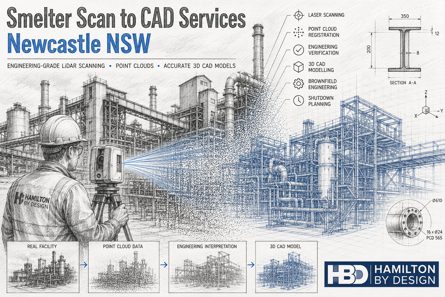

https://www.hamiltonbydesign.com.au/scan-to-bim-services-australia-lidar-point-clouds-cad-modelling