3D Scanning Sydney with Engineering Governance

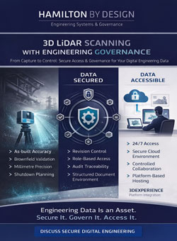
Industrial LiDAR scanning and digital engineering governance model demonstrating secure data capture, revision control and secure platform access.

Reduce Rework. Protect Capital. Deliver Certainty.

In Sydneyโ€™s high-cost construction and industrial market, mistakes are expensive.

With Australian labour rates among the highest in the region โ€” and Sydney operating at premium commercial rates โ€” the cost of rework, design clashes, undocumented variations, and inaccurate site data can quickly exceed the cost of doing things correctly the first time.

Thatโ€™s where 3D scanning combined with engineering governance becomes essential.
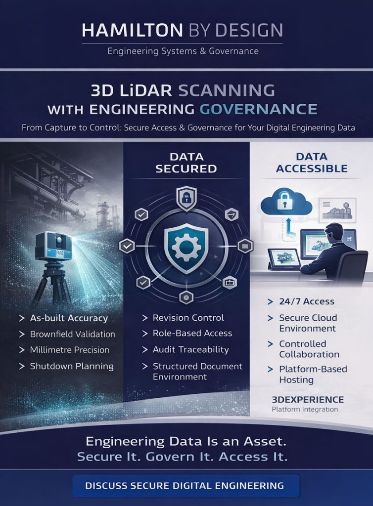

Secure digital engineering workflow showing 3D point cloud capture, governance control and cloud-based 24-hour access.

Why Sydney Projects Need Engineering Governance

Sydney projects are:

  • Brownfield upgrades in live facilities
  • Tight commercial refurbishments
  • Infrastructure constrained by existing services
  • Industrial sites with layered legacy modifications

Without a verified โ€œsingle source of truth,โ€ teams rely on outdated drawings, assumptions, or partial information.

That leads to:

  • On-site clashes
  • Fabrication errors
  • Delays waiting for redesign
  • Contractual disputes
  • Escalating labour costs

In a market where skilled labour can exceed $120โ€“$200+ per hour once overheads and compliance are included, one preventable mistake can cost tens of thousands of dollars.

Rework is not just frustrating โ€” itโ€™s financially destructive.


What 3D Scanning Actually Solves

High-accuracy 3D laser scanning captures:

  • Structural steel
  • Services (mechanical, electrical, hydraulic)
  • Plant and equipment
  • Spatial constraints
  • Floor levels and tolerances

Instead of relying on legacy drawings, you design from reality capture data.

But scanning alone is not enough.


Raw point clouds donโ€™t protect your project.

Governance does.

Engineering governance ensures:

โœ” Controlled data access
โœ” Revision management
โœ” Clear drawing issue status (IFR / IFA / IFC)
โœ” Structured documentation
โœ” Auditability and traceability
โœ” Secure collaboration between contractors

When 3D scanning is integrated into a governed digital environment, your project moves from assumption-based to evidence-based engineering.


The Cost of Rework in Sydney

Letโ€™s be clear:

In Australia, rework costs are amplified by:

  • High skilled labour rates
  • Strict compliance requirements
  • Complex subcontractor structures
  • Extended programme impacts
  • Safety and shutdown penalties

A fabrication error might not just mean remaking steel โ€” it can mean:

  • Crane rebooking
  • Night shift penalties
  • Programme delay claims
  • Supervisor time
  • Engineering redesign

In many Sydney industrial environments, a single clash can cost more than the entire 3D scan.

Thatโ€™s why governance-backed scanning is not an expense โ€” itโ€™s risk insurance.


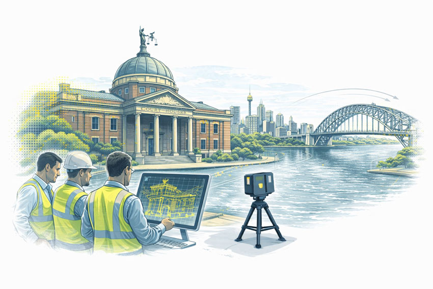
Engineers reviewing BIM documentation while a LiDAR scanner captures a Sydney courthouse with Sydney Harbour and the Harbour Bridge in the background

Sydney Doesnโ€™t Need More Data. It Needs Better Control.

Many projects already collect data.

What they lack is:

  • Structured control
  • Digital discipline
  • Lifecycle governance
  • Clear ownership

3D scanning with engineering governance delivers:

โ€ข A verified existing-conditions model
โ€ข Controlled drawing environments
โ€ข Reduced variation exposure
โ€ข Fewer RFIs
โ€ข Reduced fabrication error
โ€ข Improved contractor coordination


Who Benefits?

  • Industrial facility owners
  • Mining support infrastructure
  • Commercial refurbishments
  • Distribution centres
  • Brownfield automation upgrades
  • Engineering consultancies

If youโ€™re operating in Sydney, where labour is expensive and tolerance for error is low, governance-backed scanning is not optional โ€” itโ€™s strategic.


Hamilton By Design โ€“ Engineering-First Approach

At Hamilton By Design, we donโ€™t just scan.

We:

  • Capture high-accuracy reality data
  • Structure and govern the digital environment
  • Support drawing control and revision management
  • Align engineering documentation with delivery

Because scanning without governance is just a point cloud.

Governed scanning becomes a competitive advantage.


Hamilton By Design logo displayed on a blue tilted rectangle with a grey gradient background

If youโ€™re planning upgrades, expansions, or refurbishment in Sydney โ€”

protect your capital before fabrication begins.

Rework is expensive.

Governed reality capture is predictable.


Name
Would you like us to arrange a phone consultation for you?
Address
3D Scanning Sydney banner promoting engineering-grade 3D laser scanning, LiDAR scanning, and reality capture services by Hamilton By Design.
Mechanical Engineering Sydney banner with white text on a blue background representing Hamilton By Design's mechanical engineering services in Sydney.
Mechanical Drafting and 3D Modelling Sydney banner highlighting Hamilton By Design's CAD drafting, 3D modelling, and engineering design services in Sydney.

Mechanical Engineering | Structural Engineering


Hamilton By Design provides engineering-led 3D scanning, LiDAR scanning, mechanical engineering and digital engineering services throughout Sydney and Greater Sydney.

Explore our related Sydney services:


  • 3D Scanning Sydney โ€“ Engineering-grade terrestrial laser scanning, as-built surveys and point cloud capture for industrial, infrastructure and commercial projects.
  • Reality Capture Sydney โ€“ High-accuracy reality capture, digital twins, asset documentation and engineering-grade site verification.
  • Scan to CAD Sydney โ€“ Convert point cloud data into AutoCAD, SolidWorks, Inventor and other engineering-ready CAD deliverables.
  • Point Cloud Modelling Sydney โ€“ Engineering-grade point cloud processing, clash detection, as-built verification and 3D modelling.
  • Mechanical Engineering Sydney โ€“ Mechanical design, plant upgrades, materials handling systems, conveyors, chutes, platforms and engineering support.
  • Structural Drafting Sydney โ€“ Structural steel drafting, fabrication drawings, GA drawings, workshop detailing and as-built documentation.

Hamilton By Design supports projects throughout Sydney CBD, Parramatta, Liverpool, Penrith, Blacktown, Chatswood, Alexandria, Mascot, Newcastle and the Central Coast.




3D CAD Modelling Australia service banner for Hamilton By Design
Finite Element Analysis (FEA) engineering simulation button
Mechanical engineering services
3D LiDAR Scanning Darwin for engineering surveys, laser scanning, reality capture and point cloud modelling services
3D LiDAR Scanning Australia engineering services for laser scanning, reality capture, scan-to-CAD, Scan-to-BIM and as-built documentation across Australia
3D LiDAR scanning services on the Central Coast providing engineering-grade laser scanning, point cloud capture, scan-to-CAD modelling and industrial reality capture for infrastructure and industrial projects.

3D LiDAR Scanning with Engineering Governance: Securing Your Asset Data for the Long Term

Industrial LiDAR scanning and digital engineering governance model demonstrating secure data capture, revision control and secure platform access.

3D LiDAR Scanning & Engineering Data Governance

3D LiDAR scanning has become a powerful tool in modern mechanical and industrial engineering.

It captures reality with millimetre precision.
It reduces site rework.
It improves brownfield design confidence.
It shortens shutdown risk.

But capturing data is only half the solution.

Without structured engineering governance, even the most accurate point cloud becomes just another unmanaged file sitting on a server.

At Hamilton By Design, we combine 3D LiDAR scanning with controlled digital environments โ€” ensuring your engineering data is not only captured, but secured, governed, and accessible when you need it.


The Risk: Uncontrolled Engineering Data

Across mining, manufacturing and heavy industry, we regularly see:

  • Point cloud files stored on local drives
  • Multiple uncontrolled drawing revisions
  • Contractors working from outdated geometry
  • Large scan files shared via unsecured links
  • No defined ownership of digital assets

When governance is absent, data degrades.

And when data degrades, engineering risk increases.


3D LiDAR Scanning Is the Starting Point โ€” Not the End

LiDAR scanning provides:

  • Accurate as-built geometry
  • Clash detection confidence
  • Brownfield validation
  • Structural and mechanical verification
  • Shutdown planning support

However, once the scan is complete, organisations must answer critical questions:

  • Who controls revision access?
  • Where is the master file stored?
  • How are updates managed after upgrades?
  • Who can access the model โ€” and when?
  • Is the data audit ready?

This is where engineering governance becomes essential.


Secure digital engineering workflow showing 3D point cloud capture, governance control and cloud-based 24-hour access.

Engineering Governance: Protecting Your Digital Assets

Engineering governance ensures:

  • Controlled document environments
  • Structured revision management
  • Defined user access permissions
  • Audit traceability
  • Secure cloud storage
  • Long-term digital asset stewardship

Without governance, digital engineering becomes fragmented.

With governance, it becomes a single source of truth.


Secured Access Through the 3DEXPERIENCE Platform

Hamilton By Design has partnered to support secure data environments through the 3DEXPERIENCE platform.

This allows clients to:

  • Access their 3D models 24 hours per day
  • Review point cloud data securely online
  • Manage drawing revisions in a controlled environment
  • Collaborate with contractors under structured permissions
  • Maintain engineering continuity across upgrades

Your data is not sent around via uncontrolled downloads.

It is hosted, governed, and managed within a structured platform environment.


Why 24/7 Access Matters

Industrial facilities do not operate between 9am and 5pm.

Shutdowns occur overnight.
Maintenance decisions happen urgently.
Capital approvals move quickly.

Having secure, controlled access to your digital engineering data โ€” at any time โ€” provides:

  • Faster decision-making
  • Reduced shutdown risk
  • Improved contractor coordination
  • Greater executive confidence

Engineering data becomes operational infrastructure.


Integrating LiDAR, Governance and Asset Integrity

When 3D LiDAR scanning is combined with structured governance and platform security, organisations gain:

  • A verified as-built model
  • Controlled revision history
  • Secure cloud-based storage
  • Role-based access control
  • Ongoing update capability following upgrades

This is particularly critical in:

  • Brownfield facilities
  • Mining operations
  • Manufacturing plants
  • Utilities infrastructure
  • Long-life industrial assets

Your scan data becomes a living engineering asset โ€” not a static deliverable.


From Capture to Control

At Hamilton By Design, we do not simply provide 3D scanning services.

We provide:

  • Site capture
  • Data processing
  • Model integration
  • Engineering governance
  • Secure platform hosting
  • Ongoing digital stewardship

The objective is simple:

To ensure your engineering data remains accurate, controlled, and accessible for the life of your asset.


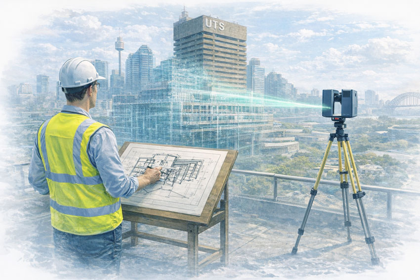
3D laser scanning in Sydney with an engineer capturing as-built conditions using LiDAR technology.

Engineering Data Is Corporate Risk

Unsecured or unmanaged engineering data creates exposure:

  • Design errors
  • Compliance failures
  • Shutdown overruns
  • Contractor disputes
  • Loss of institutional knowledge

Structured governance reduces this exposure.

When supported by secure platform access, your engineering records become resilient.


A Single Source of Truth โ€” Available Anytime

Through the integration of 3D LiDAR scanning and the 3DEXPERIENCE platform, Hamilton By Design enables:

  • 24/7 secure access
  • Controlled collaboration
  • Audit-ready documentation
  • Brownfield upgrade support
  • Digital continuity

Engineering is not just about building systems.

It is about protecting them โ€” physically and digitally.


Hamilton By Design logo displayed on a blue tilted rectangle with a grey gradient background

Hamilton By Design
3D LiDAR Scanning | Engineering Governance | Secure Digital Platforms

If your organisation is investing in digital capture, ensure your data is governed, protected and available whenever you need it.

3D LiDAR scanning and 3D modelling service button โ€” laser scanner capturing a point cloud for engineering and CAD modelling
Mechanical engineering services

Name
Would you like us to arrange a phone consultation for you?
Address

3D CAD Modelling Australia service banner for Hamilton By Design

Mechanical Engineering | Structural Engineering


3D CAD Modelling Australia service banner for Hamilton By Design
Australian Drafting logo featuring bold white text reading "Australian Drafting" centred on a blue rounded rectangle background.
Engineering Governance title graphic featuring bold white text reading "Engineering Governance" centred on a blue rounded rectangle background.
Mechanical, Structural & Pipework Drafting service banner by Hamilton By Design featuring white text on a blue background.
Mechanical engineering services
Blue rounded button with the text โ€œSolidWorks Designโ€ in white.
Finite Element Analysis (FEA) engineering simulation button
3D LiDAR Scanning Darwin for engineering surveys, laser scanning, reality capture and point cloud modelling services
3D LiDAR Scanning Australia engineering services for laser scanning, reality capture, scan-to-CAD, Scan-to-BIM and as-built documentation across Australia
3D LiDAR scanning services on the Central Coast providing engineering-grade laser scanning, point cloud capture, scan-to-CAD modelling and industrial reality capture for infrastructure and industrial projects.
3D LiDAR Scanning Perth for engineering surveys, laser scanning, reality capture and point cloud modelling services
3D LiDAR Scanning Sydney for engineering surveys, laser scanning, reality capture and point cloud modelling services
3D LiDAR Scanning Brisbane for engineering surveys, laser scanning, reality capture and point cloud modelling services
3D LiDAR Scanning Canberra for engineering surveys, laser scanning, reality capture and point cloud modelling services
3D LiDAR Scanning Newcastle for engineering surveys, laser scanning, reality capture and point cloud modelling services
3D LiDAR Scanning Adelaide for engineering surveys, laser scanning, reality capture and point cloud modelling services

Why Projects Fail Before Construction Starts

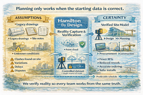
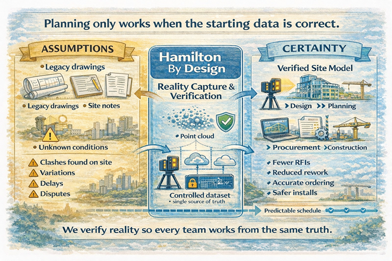
3D scanning reality capture workflow converting legacy drawings into a verified site model for construction planning.

The missing step between site reality and project planning

Most project delays donโ€™t begin during construction.

They begin months earlier โ€” at the planning stage.

Not because engineers lack skill.
Not because contractors lack experience.

But because decisions are made using incomplete or assumed information.


Construction planning comparison between assumed data and verified point-cloud model using laser scanning.

The hidden gap in almost every project

In industrial and brownfield environments, teams typically work from:

  • legacy drawings
  • outdated models
  • partial surveys
  • contractor interpretation
  • verbal site knowledge

Each group fills in the missing details differently.

The result is predictable:

  • clashes discovered during installation
  • materials ordered incorrectly
  • redesign during construction
  • variations and disputes
  • safety risks

The project didnโ€™t fail during construction.
It failed when planning began without verified reality.


Planning systems only work if the starting data is correct

Modern project environments rely heavily on structured planning:

  • scheduling
  • procurement
  • prefabrication
  • shutdown coordination
  • multi-contractor installation

But structured planning requires structured information.

If the starting information is uncertain, the entire workflow becomes an organised way of distributing errors.


The role of a reality-based dataset

Before a project can be planned properly, one thing must exist:

A trusted digital representation of the physical asset

This is not a drawing.
This is not a sketch.
This is not a collection of markups.

It is a measurable, verifiable record of what physically exists.

Once this exists:

  • engineers design accurately
  • planners sequence correctly
  • contractors install confidently
  • procurement orders correctly
  • changes are controlled

What our consultancy provides

Hamilton By Design acts as the bridge between site conditions and project planning.

We provide a structured workflow:

  1. Capture the physical environment using high-accuracy laser scanning
  2. Create a controlled digital model of the asset
  3. Make the data accessible to all project stakeholders
  4. Lock the dataset during design and upgrade phases
  5. Update the dataset following modifications

This creates a single project reference โ€” removing interpretation between disciplines.


The outcome for projects

Instead of discovering problems during installation, they are resolved during planning.

Instead of managing variations, teams manage decisions.

Instead of reacting to site conditions, teams design around verified reality.


The value of independent verification

Our role is not to design the system or build the works.

Our role is to ensure every party begins with the same trusted information.

When reality is agreed, coordination becomes straightforward.


Before planning, establish certainty

Projects do not fail because teams are incapable.
They fail because teams start from different assumptions.

Providing a verified digital record of the site removes those assumptions.

And once assumptions disappear โ€” so do most surprises.


Hamilton By Design
Creating trusted project reality before planning begins.

Name
Would you like us to arrange a phone consultation for you?
Address


3D LiDAR scanning and 3D modelling service button โ€” laser scanner capturing a point cloud for engineering and CAD modelling
Mechanical engineering services
Finite Element Analysis (FEA) engineering simulation button
Mechanical engineering services

Mechanical Engineering | Structural Engineering


Experiencing vibration at your home from nearby construction?

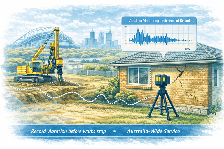
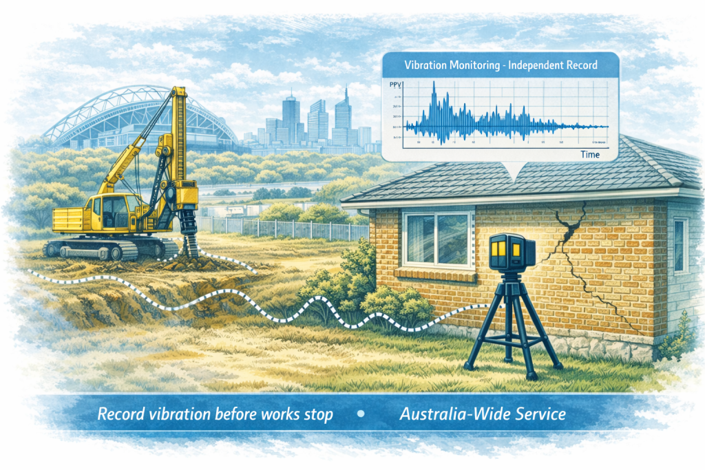
Residential home beside construction works with vibration monitor and recorded vibration graph

Construction activities such as piling, compaction, rock breaking, excavation and heavy vehicle movements can transmit ground vibration well beyond the worksite boundary.
Occupants commonly report rattling windows, shaking floors, or movement felt through walls and ceilings.

This understandably raises a serious concern:

Will this cause damage to my property โ€” and if it does, how will it be proven?

In practice, many property damage disputes are not determined by what occupants experienced, but by what can be objectively demonstrated.
Without measurements taken during the works, it becomes extremely difficult to establish causation later.

Once the construction activity ceases, the opportunity to capture evidence is often permanently lost.


Construction piling rig near a house with cracks and a vibration monitoring device recording ground movement

Why early measurement matters

Vibration is temporary. Structural cracking is permanent.

If vibration is not recorded while it is occurring, later assessments rely heavily on assumption rather than data. In the absence of measured information, the following questions become difficult to answer:

  • Was vibration present at the property?
  • How intense was it?
  • How frequently did it occur?
  • Was it within accepted engineering criteria?
  • Could it reasonably have contributed to observed damage?

By contrast, monitoring performed during the works provides an independent record of actual site conditions at the time events occurred.


Perception vs structural risk

Human perception of vibration does not necessarily correlate with structural damage.

People can feel vibration levels well below those typically associated with building harm.
However, structural response depends on multiple variables:

  • soil type and ground transmission characteristics
  • distance to the works
  • construction methodology and equipment energy
  • building age and condition
  • prior movement or existing cracking
  • structural configuration and materials

Because of these factors, determining risk cannot be based on sensation alone.
It requires measurement and engineering interpretation.


Protecting your position

In many cases, concerns are only raised after visible cracking appears or after works have finished. At that stage, establishing responsibility becomes significantly more complex.

The practical question becomes:

If you do not document the conditions affecting your property while they are occurring โ€” who will?

Contractors monitor works to manage their risk.
Property owners must also protect theirs.

Independent documentation obtained during construction provides a factual reference point for:

  • communication with neighbours or builders
  • engineering review
  • insurance discussion
  • legal or expert assessment if required

Hamilton By Design โ€“ independent vibration monitoring

Hamilton By Design provides independent vibration measurement and documentation for residential and commercial properties affected by nearby construction.

We travel across Australia to install monitoring equipment and record site conditions while works are underway.

Services may include:

  • installation of calibrated vibration monitoring equipment
  • event logging and trend review
  • engineering-grade documentation
  • guidance on next steps based on measured data
  • optional crack mapping or 3D capture where appropriate

Act while the works are active

The reliability of any later assessment depends on evidence captured during the period of activity.

Monitoring after the machinery leaves site cannot reconstruct past conditions โ€” it can only speculate about them.

If construction is occurring near your property and you are concerned about potential damage, early documentation is the most effective way to protect your position.


Contact Hamilton By Design

If your home is experiencing vibration from nearby building activity, contact Hamilton By Design to record site conditions before the construction stops.

3D LiDAR scanning and 3D modelling service button โ€” laser scanner capturing a point cloud for engineering and CAD modelling
Mechanical engineering services

Hamilton By Design Co.
Engineering โ€ข Measurement โ€ข Documentation
Australia-wide service

Name
Would you like us to arrange a phone consultation for you?
Address
3D CAD Modelling Australia service banner for Hamilton By Design
Finite Element Analysis (FEA) engineering simulation button
Mechanical engineering services

Mechanical Engineering | Structural Engineering


3D Laser Scanning Brisbane โ€“ From Site Capture to Engineering Outcomes

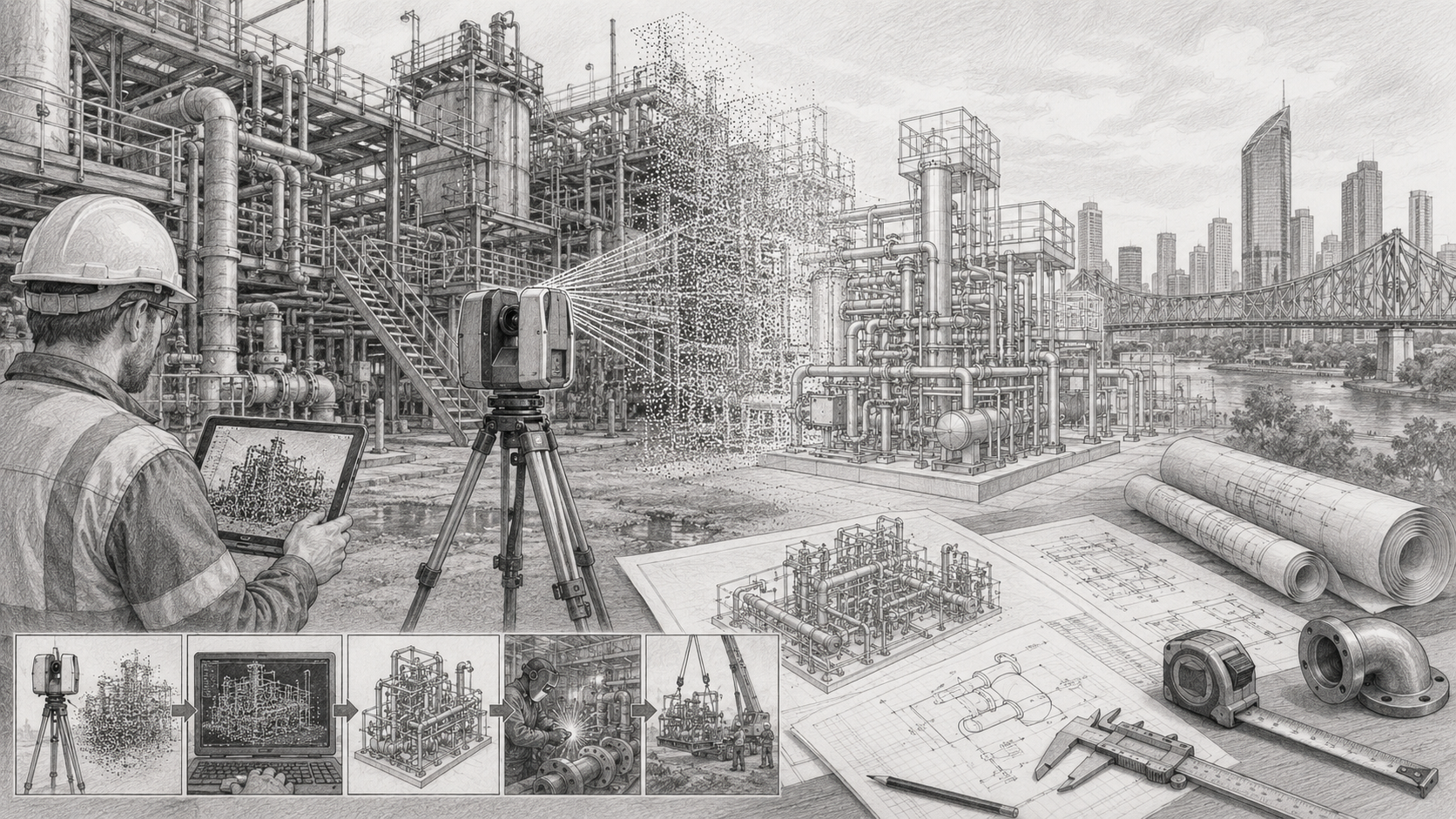
Grey pencil drawing of 3D laser scanning in Brisbane showing an engineer, LiDAR scanner, point cloud data, industrial plant, CAD model workflow and fabrication drawings.

3D Laser Scanning Brisbane | Site Capture to Engineering Outcomes

A Connected Workflow for Reliable Project Delivery

Most projects in Brisbane do not begin with empty space.
They begin with existing buildings, infrastructure and operating facilities.

Over time, equipment is replaced, services are rerouted and structures are modified. Drawings rarely keep pace with reality. When upgrades are designed from outdated information, installation conflicts and construction delays follow.

3D laser scanning allows project teams to start with measured conditions rather than assumptions.

Hamilton By Design provides a connected workflow โ€” from site capture through to engineering modelling โ€” supporting accurate design and predictable installation.


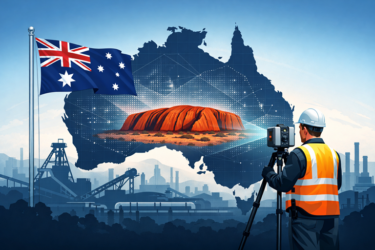
3D LiDAR scanning services across Australia for mining and industrial facilities

Step 1 โ€” Capture the Real Conditions

Start with measured reality

The first step is collecting reliable site data using high-accuracy LiDAR scanning. This creates a spatial record of structures, services and equipment exactly as they exist.

3D Scanning Brisbane
https://www.hamiltonbydesign.com.au/laser-scanning-engineering-brisbane-cbd/3d-scanning-brisbane/

This process replaces manual measurement and reduces uncertainty before design begins.


Step 2 โ€” Apply Engineering Understanding

Turn measurements into decisions

Scan data alone does not solve problems โ€” interpretation does.
Engineering review ensures the captured data supports real project outcomes such as upgrades, replacements and modifications.

3D Scanning Engineering Brisbane
https://www.hamiltonbydesign.com.au/home/engineering-services/3d-laser-scanning/3d-scanning-engineering-brisbane/

This stage identifies constraints, access limitations and constructability issues before fabrication.


Step 3 โ€” Develop Buildable Models

Create fabrication-ready information

Once verified, the measured conditions are converted into coordinated models used by designers, fabricators and contractors.

Scan to CAD Brisbane
https://www.hamiltonbydesign.com.au/scan-to-cad-brisbane/

Accurate models allow components to be designed to fit existing conditions rather than adjusted in the field.


Step 4 โ€” Apply to Real Projects

Support upgrades and modifications

Reliable as-built information improves planning and installation across many sectors:

3D Scanning Services in Brisbane
https://www.hamiltonbydesign.com.au/laser-scanning-engineering-brisbane-cbd/3d-scanning-brisbane/3d-scanning-services-in-brisbane/

Typical applications include industrial upgrades, infrastructure changes and facility modifications.


Why a Connected Workflow Matters

Many project delays occur because measurement, modelling and engineering are treated as separate tasks. When they are integrated, problems are identified earlier and resolved more efficiently.

This approach helps:

  • reduce rework
  • shorten shutdown durations
  • improve installation certainty
  • support accurate fabrication

Instead of reacting to site conditions, projects are planned around them.


Hamilton By Design logo displayed on a blue tilted rectangle with a grey gradient background

Engineering Starts With Reliable Information

The quality of the final outcome depends on the quality of the starting data.
When existing conditions are known, design becomes predictable.

By linking site capture, modelling and engineering decisions, projects can move forward with confidence.

If your project depends on existing assets, accurate measurement is the first step toward reliable delivery.

3D LiDAR scanning and 3D modelling service button โ€” laser scanner capturing a point cloud for engineering and CAD modelling
Mechanical engineering services
Name
Would you like us to arrange a phone consultation for you?
Address

3D CAD Modelling Australia service banner for Hamilton By Design
Reality Capture Brisbane title graphic with white text on a blue background promoting reality capture, LiDAR scanning and digital engineering services in Brisbane, Queensland.
3D Scanning Brisbane text graphic on a blue background promoting engineering-led laser scanning and reality capture services in Brisbane.

LiDAR Scanning Brisbane title graphic with white text on a blue background promoting terrestrial LiDAR scanning, point cloud capture and reality capture services in Brisbane, Queensland.
SolidWorks Brisbane title graphic with white text on a blue background promoting SolidWorks mechanical design, 3D CAD modelling and engineering drafting services in Brisbane, Queensland.


Industrial LiDAR Scanning & Retrofit Engineering โ€“ Pittsburgh, Pennsylvania

Industrial facility captured using 3D laser scanning for brownfield plant upgrade

Engineering Certainty in Legacy Industrial Facilities

Pittsburgh is not a new-build engineering market.

It is a modification market.

Steel mills, manufacturing plants, utilities and infrastructure in the Pittsburgh region have evolved over decades โ€” often across multiple owners, upgrades and undocumented changes. As a result, existing drawings rarely represent real conditions.

Hamilton By Design supports engineering and project teams by capturing accurate as-built data before modification work begins.

Rather than designing around assumptions, projects are developed from measured reality.


Engineer performing industrial LiDAR scan of a processing plant for retrofit design

Why Retrofit Projects in Pittsburgh Require LiDAR Scanning

Legacy facilities typically contain:

  • undocumented plant changes
  • relocated equipment
  • structural distortion over time
  • incomplete or missing drawings
  • congested services and pipework

When upgrades are designed from outdated information, installation conflicts occur and shutdown durations increase.

High-accuracy LiDAR scanning captures millions of measurement points and creates a true digital representation of the operating facility, reducing rework and unexpected site conflicts.


Typical Pittsburgh Projects We Support

Steel & Heavy Manufacturing

  • equipment replacement
  • access platforms and walkways
  • structural refurbishment
  • plant safety upgrades

Utilities & Processing Facilities

  • pipe routing modifications
  • pump and tank replacement
  • tie-in engineering
  • maintenance shutdown planning

Industrial Infrastructure & Brownfield Sites

  • facility upgrades
  • expansion works
  • mechanical retrofits
  • reverse engineering of existing equipment

Hamilton By Design combines engineering knowledge with reality capture to reduce fabrication and installation risk on operating assets.


Our Engineering-Led Workflow

(See full process: Industrial Retrofit LiDAR Scanning)

1 โ€” Site Capture

We collect high-density scan data without interrupting operations.

2 โ€” Digital As-Built Model

Point clouds are converted into coordinated engineering models.

3 โ€” Retrofit Design

Designs are developed directly from actual geometry.

4 โ€” Fabrication & Installation Confidence

Projects install correctly the first time, reducing shutdown risk.

Engineering-grade scanning enables clash detection, brownfield integration and efficient shutdown planning.


What Problems This Solves

For retrofit projects the largest risk is dimensional uncertainty.

Our workflow removes:

  • field modification work
  • fabrication rework
  • installation clashes
  • extended shutdown durations

Hamilton By Design focuses on reducing engineering and fabrication risk on existing industrial assets using accurate scan data and mechanical design integration.


Engineering-Led, Not Survey-Led

Many providers deliver point clouds.

We deliver engineering decisions.

One team is responsible from measurement through to design support โ€” ensuring the data collected is practical and usable for real construction outcomes.


Supporting Pittsburghโ€™s Ongoing Industrial Evolution

Regions like Pittsburgh continue to modernise existing infrastructure rather than replace it. Successful upgrades depend on understanding what is already built.

LiDAR scanning provides the digital foundation for safe modification, accurate fabrication and predictable installation.


Hamilton By Design logo displayed on a blue tilted rectangle with a grey gradient background

3D LiDAR scanning and 3D modelling service button โ€” laser scanner capturing a point cloud for engineering and CAD modelling
Mechanical engineering services

Talk to Hamilton By Design

If your project involves modifying an existing facility, engage scanning before design begins.

Design from reality โ€” not assumption.


Name
Would you like us to arrange a phone consultation for you?
Address

3D CAD Modelling Australia service banner for Hamilton By Design
Australian Drafting logo featuring bold white text reading "Australian Drafting" centred on a blue rounded rectangle background.
Engineering Governance title graphic featuring bold white text reading "Engineering Governance" centred on a blue rounded rectangle background.
Mechanical, Structural & Pipework Drafting service banner by Hamilton By Design featuring white text on a blue background.
Mechanical engineering services
Blue rounded button with the text โ€œSolidWorks Designโ€ in white.
Finite Element Analysis (FEA) engineering simulation button
3D LiDAR Scanning Darwin for engineering surveys, laser scanning, reality capture and point cloud modelling services
3D LiDAR Scanning Australia engineering services for laser scanning, reality capture, scan-to-CAD, Scan-to-BIM and as-built documentation across Australia
3D LiDAR scanning services on the Central Coast providing engineering-grade laser scanning, point cloud capture, scan-to-CAD modelling and industrial reality capture for infrastructure and industrial projects.
3D LiDAR Scanning Perth for engineering surveys, laser scanning, reality capture and point cloud modelling services
3D LiDAR Scanning Sydney for engineering surveys, laser scanning, reality capture and point cloud modelling services
3D LiDAR Scanning Brisbane for engineering surveys, laser scanning, reality capture and point cloud modelling services
3D LiDAR Scanning Canberra for engineering surveys, laser scanning, reality capture and point cloud modelling services
3D LiDAR Scanning Newcastle for engineering surveys, laser scanning, reality capture and point cloud modelling services
3D LiDAR Scanning Adelaide for engineering surveys, laser scanning, reality capture and point cloud modelling services