Mechanical Engineering | 3D Scanning | 3D Modelling
Tag: LiDAR
Posts covering engineering-grade LiDAR scanning and point cloud workflows used to capture accurate site conditions for design, retrofit and fabrication in industrial and infrastructure environments.
3D Scanning Services for CHPP – Reduce Rework, Maximise Uptime
Australian coal operations depend on reliable Coal Handling & Preparation Plants (CHPP), wash facilities, conveyors and mechanical systems. Every shutdown, upgrade and modification must be delivered quickly and safely to protect production. The most effective way to achieve this is through engineering-led 3D scanning services that capture real site conditions before a single component is fabricated.
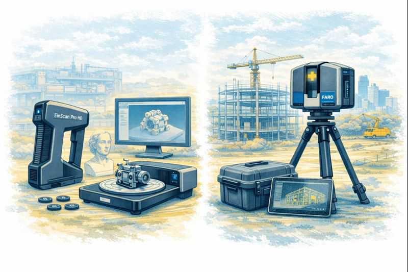
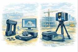
Hamilton By Design specialises in FARO LiDAR and structured-light 3D scanning for the coal sector, turning complex brownfield sites into accurate digital models that drive practical engineering outcomes. Our focus is simple: maximise plant uptime by reducing rework.
Why Shutdowns Need Better Information
Coal wash plants are dynamic environments. Over decades of modifications:
drawings no longer match reality
structures move under load
pipe routes are altered
access becomes restricted
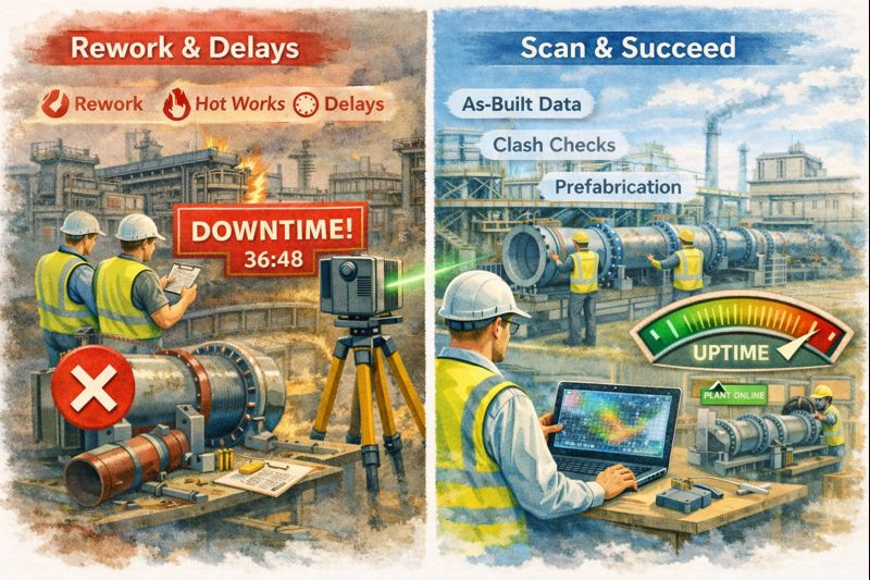
Relying on tape measures and sketches during a shutdown invites risk. A bracket that is 20 mm wrong or a spool that fouls an existing service can cost days of lost production. Accurate 3D scanning before the outage removes those unknowns.
Hamilton By Design 3D Scanning Services
Our scanning services are built specifically for industrial and mining applications:
FARO LiDAR As-Built Capture
full plant and conveyor surveys
transfer stations, bins and pump boxes
structural steel and foundations
tie-in points for new pipework
clearance verification for maintenance
Structured-Light Scanning (EinScan)
motors, gearboxes and legacy parts
guards, covers and small assemblies
reverse engineering for obsolete components
detailed capture for first-time-fit design
Point Cloud to CAD Workflows
modelling in SolidWorks & Fusion
fabrication drawings for local workshops
clash detection and installation planning
digital twins for ongoing maintenance
These services ensure that design decisions are based on measured reality, not assumptions.
FARO LiDAR for CHPP As-Builts
Terrestrial LiDAR creates a high-density point cloud of the entire coal wash facility. Engineers can:
design new chutes and spools directly over site geometry
confirm conveyor alignments
plan access platforms and walkways
test installation sequences digitally
By linking scanning to engineering, components arrive on site ready to install — protecting uptime and reducing rework during critical shutdown windows.
Practical Outcomes for Coal Plants
Conveyor & Transfer Upgrades
accurate chute replacements
skirt and belt line verification
drive and pulley modifications
minimal site adjustments
Pump Boxes & Pipework
prefabricated spools that fit first time
reverse engineering of worn equipment
safe tie-ins without surprises
Structural & Access Works
platform and handrail retrofits
screen support modifications
crane and lifting planning
Every task is driven by 3D scan data so workshops fabricate with confidence.
Engineering-Led, Not Just Surveying
Hamilton By Design treats scanning as part of the engineering process:
3D capture of the live plant
engineering review of critical datums
point cloud modelling in parametric CAD
fabrication drawings for Australian workshops
shutdown planning to ensure first-time fit
This approach directly supports the goal of maximum plant uptime.
Supporting Australian Capability
Scan-driven design keeps work local. Regional fabricators receive accurate models and drawings that reflect the real CHPP environment, enabling:
faster workshop production
fewer site variations
safer installations
reduced dependence on imported components
Committed to the Coal Sector
Hamilton By Design supports coal operations across NSW, the Central Coast, Sydney and regional Queensland including Mount Isa. Our 3D scanning services enhance every stage of shutdown planning and brownfield upgrades by eliminating guesswork and cutting rework.
Our Services
FARO LiDAR scanning for CHPP as-builts
EinScan component capture
Point cloud to CAD modelling
Fabrication drawings & DXF outputs
Clash detection and digital twin support
Maximise your plant uptime by reducing rework — talk to us before your next shutdown.
Terrestrial LiDAR Scanner Price – Buy or Hire Options
When organisations first explore terrestrial LiDAR scanning, the biggest question is usually not technical — it’s commercial: should we buy a scanner or hire one for the project?
Terrestrial LiDAR scanners such as FARO and Leica systems are powerful tools for capturing accurate point clouds of buildings, industrial facilities, infrastructure and construction sites. They support as-built documentation, clash detection, shutdown planning and digital twin workflows. However, the right decision between purchase and hire depends on how often the equipment will be used and the level of in-house expertise available.
Buying a LiDAR Scanner
Purchasing a scanner can make sense for businesses that:
undertake regular surveying or as-built capture
need immediate access on multiple sites
want to build internal reality-capture capability
plan to integrate point clouds into ongoing design workflows
Ownership provides flexibility and control, but also involves training, software, calibration and maintenance considerations.
Hiring a LiDAR Scanner
Hiring is often the smarter option when:
the requirement is project-specific
workloads are seasonal or occasional
specialist software and support are needed
you want to trial the technology before committing
Hire packages can include advice on setup, data management and export formats so the results integrate smoothly with CAD and BIM platforms.
We Support Both Options
Hamilton By Design offers terrestrial LiDAR scanners for both hire and sale, backed by engineering support to ensure the data delivers real value on your project. Whether you need equipment for a short shutdown, a construction survey, or you are considering building your own scanning capability, our team can guide you through the most practical pathway.
Rather than publishing generic prices, we prefer to understand:
the type of site you need to capture
required accuracy and deliverables
software and CAD integration
duration and level of support
This allows us to recommend the right scanner package and commercial model for your specific needs.
Please contact our team for a price and availability. We’ll help you decide whether buy or hire is the best approach for your project.
AS 1100 & LiDAR Scanning: Compliant Engineering Drawings from Point Clouds
If you’ve ever tried to update old plant drawings, verify a brownfield tie-in, or issue “as-built” documentation after a shutdown, you’ll know the pain: the site never matches the drawings, access is limited, and the smallest dimensional miss can cascade into rework, clashes, and schedule blowouts.
That’s where engineering-grade LiDAR scanning and AS 1100 (the Australian Standard for technical drawing) make a powerful combination. LiDAR gives you truth data (reality capture), and AS 1100 gives you a shared language for turning that truth into clear, consistent, contract-ready documentation.
AS 1100 standardises the way we communicate engineering information through drawings: layout, line types, projection methods, dimensioning rules, tolerancing conventions, symbols, notes, and drawing presentation.
In practice, AS 1100 helps you answer questions like:
Which edges are visible vs hidden? (line conventions)
How are views arranged and interpreted? (projection and view layout)
How do we dimension so the fabricator can’t misread it? (dimensioning rules)
How do we document what matters vs what’s “reference only”? (notes and drawing hierarchy)
How do we keep drawing sets consistent across multiple contributors? (formatting + standards)
That consistency is exactly what’s needed after a scan—because point clouds are rich, but they’re not automatically “communicable” in the way a compliant drawing set is.
What LiDAR scanning adds that drawings alone can’t
A LiDAR scanner captures millions (often billions) of spatial points that represent real surfaces—steel, concrete, pipe, equipment, structure—creating a point cloud that can be registered into a unified coordinate system.
In the engineering context, the big advantages are:
Speed: capture complex geometry quickly, often with minimal disruption
Coverage: see what’s hard to measure with tape/total station (overhead services, congested pipe racks, odd geometry)
Context: capture “everything,” not just what someone remembered to measure
Traceability: you can always “go back” to the scan for verification and queries
Clash prevention: scan-to-CAD makes it far easier to design upgrades that actually fit
But here’s the key: a point cloud isn’t a deliverable most trades can fabricate from directly. That’s why AS 1100 becomes the bridge between capture and construction.
The combined workflow: Point cloud → model → AS 1100 drawings
1) Capture the site as it really is
We scan the area of interest and register scans into a coordinated dataset. This becomes the base truth for everything that follows. If the project is shutdown-driven, we plan scanning around access windows and risk controls (often capturing adjacent tie-in zones too, because “nearby” services are where surprises live).
2) Establish intent: “What are we delivering?”
Not every project needs the same output. Typical outcomes include:
As-built drawings for existing assets
As-found models to support new design work
Dimensional verification for fit-up and prefabrication
Digital QA against design intent (scan-vs-model comparison)
3) Convert scan data into engineering geometry (as much as needed)
Sometimes the best output is a controlled 3D model (plant layout, pipe spools, structural members). Other times the project is best served by 2D drawings extracted from a model.
We’ll typically create:
key datums and grids
primary steel / structure
equipment envelopes and critical interfaces
piping runs and connection points (where relevant)
floor levels, platforms, access constraints, clearance zones
4) Document to AS 1100 so the drawing set is unambiguous
This is where AS 1100 shines. We turn geometry into drawings that read cleanly and consistently across teams.
drawing borders, title blocks, revision control, and drawing register discipline
In short: LiDAR gives accuracy, AS 1100 gives clarity.
Where AS 1100 + LiDAR scanning delivers immediate value
Brownfield upgrades and tie-ins
Tie-ins fail when the “as-built” condition is wrong. A scan gives you real geometry; AS 1100 drawings package it so designers, fabricators, and installers share the same reference. This is especially useful when multiple contractors are interfacing.
Fabrication and spool accuracy
If you’re fabricating offsite (pipe spools, platform steel, handrail sections, ducting), you need dependable dimensions and an agreed drawing language. Scan-derived models support accuracy; AS 1100 drawings support fabrication interpretation and QA sign-off.
Shutdown planning and constructability
A point cloud is a brilliant planning tool—access routes, crane clearances, removal paths, temporary works, and “what’s in the way.” But shutdown packages still need compliant drawings for permits, isolations, install workpacks, and handover packs. AS 1100 keeps those packages readable and defensible.
Verification and “what changed?”
Sites evolve. A scan provides a timestamped snapshot. Drawings updated to AS 1100 become the controlled record: what was there, what was installed, and what the current state is. That matters for maintenance, safety, and future projects.
Practical example: Turning a congested pipe rack into a buildable upgrade
Imagine you’re adding a new line through an existing pipe rack:
Scan the rack to capture all existing services, supports, cable trays, and steel
Model critical geometry (existing plus proposed) to check routing and supports
Clash check before fabrication begins
Issue AS 1100 drawings for:
support details
spool isometrics (if applicable)
arrangement drawings showing tie-in locations
sections through congestion zones
installation notes and tolerances where appropriate
Verify post-install with a follow-up scan if required for QA/closeout
That’s the “work together” part: the scan stops guesswork, and AS 1100 stops misinterpretation.
Common mistakes when scanning isn’t tied back to AS 1100
Delivering point clouds without a drawing strategy (stakeholders can’t use them effectively)
Over-modelling everything (time is spent modelling non-critical items instead of delivering useful documentation)
Unclear dimensioning (scan accuracy is wasted if dimensions are presented ambiguously)
No controlled datums (people argue about “where zero is” and models drift between disciplines)
Weak revision control (the drawing set becomes untrustworthy fast)
A standards-led drawing approach prevents most of these.
How we approach it at Hamilton By Design
Our angle is simple: engineering-led scanning—not scanning for its own sake.
We capture reality with LiDAR.
We translate it into the level of model detail the project actually needs.
We document outputs with the discipline and consistency expected in Australian engineering environments.
Closing thought: accuracy is only valuable if it’s understandable
LiDAR scanning can deliver millimetre-grade spatial truth. But in real projects, truth still has to travel through people—engineers, drafters, fabricators, installers, supervisors, and asset owners.
AS 1100 makes that truth readable. LiDAR makes it reliable.
Together, they turn messy real-world geometry into clear, controlled documentation that supports safer installs, faster shutdowns, and fewer surprises.
Engineering-Led 3D Laser Scanning for Industrial Facilities in Sydney
In complex industrial environments, accurate site data is critical — but point clouds alone do not solve engineering problems.
At Hamilton By Design, we provide engineering-led 3D laser scanning services across Sydney’s industrial precincts, delivering not just accurate capture, but build-ready CAD models, verified layouts, and engineering support for plant upgrades, shutdown works, and fabrication projects.
From manufacturing facilities and bulk materials handling plants to port infrastructure and brownfield industrial sites, our scanning workflows are designed to reduce rework, improve constructability, and support safe, compliant engineering outcomes.
Why Engineering-Led Scanning Matters in Industrial Environments
Industrial facilities are rarely documented accurately. Over years of modifications, shutdown changes, and emergency repairs, original drawings quickly become unreliable.
Common issues we see on Sydney industrial sites include:
undocumented structural changes
misaligned conveyors and transfer points
access platforms not matching compliance drawings
equipment upgrades that don’t fit as expected
safety risks during shutdown installation
Traditional survey-only scanning provides geometry — but without engineering interpretation, design risk remains high.
Hamilton By Design integrates engineering verification directly into the scanning and modelling workflow, ensuring captured data supports:
mechanical design
structural verification
fabrication detailing
construction planning
This approach is critical for brownfield upgrades and safety-critical installations.
From Point Cloud to Build-Ready CAD — Not Just Visual Models
Our Sydney scanning projects are delivered as part of a complete scan-to-engineering workflow, including:
high-accuracy terrestrial LiDAR scanning
registered point cloud datasets
engineering-grade CAD and BIM modelling
mechanical and structural integration
fabrication and construction-ready outputs
This allows project teams to move directly from:
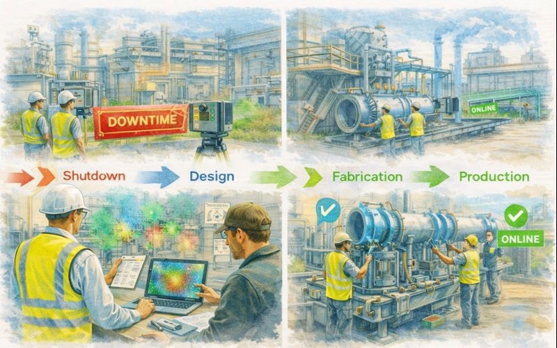
Site capture → engineering design → fabrication → installation
without the delays and risks associated with re-measuring or redesigning due to site conflicts.
For shutdown and live-plant environments, this dramatically reduces:
installation clashes
hot-work exposure
crane and access planning errors
schedule overruns
Industrial Facilities We Support Across Sydney
Hamilton By Design provides industrial scanning and engineering support across:
manufacturing plants
materials handling facilities
recycling and processing plants
port and logistics infrastructure
food and beverage production
utilities and treatment facilities
Our team understands the constraints of:
live plant operations
confined access
safety compliance requirements
short shutdown windows
Scanning is planned to integrate with plant operations and maintenance teams, not disrupt them.
Sydney Industrial Precincts We Regularly Support
We provide 3D laser scanning and engineering modelling across key industrial areas including:
Alexandria and Inner South industrial zones
Port Botany and logistics precincts
Western Sydney manufacturing corridors
North Shore infrastructure and access-restricted sites
Regional NSW industrial and mining-linked facilities
Each location presents different engineering challenges — from heavy materials handling to structural access compliance — which is why engineering involvement during scanning is critical.
Supporting Engineering, Fabrication and Compliance
Unlike scanning companies that deliver only spatial data, Hamilton By Design integrates scanning into broader project delivery, supporting:
mechanical upgrades and replacements
structural strengthening and access platforms
conveyor and chute modifications
guardrail and walkway compliance upgrades
fabrication shop detailing
as-built documentation for asset registers
This ensures scanning outputs are aligned with:
Australian Standards
engineering design requirements
construction tolerances
Not just visual representation.
Why Industrial Clients Choose Hamilton By Design
Industrial clients across Sydney engage Hamilton By Design because we offer:
✔ engineer-led scanning and modelling workflows
✔ mechanical and structural design capability in-house
✔ fabrication-aware CAD modelling
✔ experience in mining and heavy industry environments
✔ practical understanding of shutdown and brownfield projects
This allows us to support projects from initial site verification through to construction and commissioning.
When to Use Engineering-Led 3D Scanning
Our Sydney industrial scanning services are particularly valuable for:
brownfield plant upgrades
conveyor and materials handling modifications
access and safety compliance projects
clash detection before fabrication
replacement of undocumented equipment
retrofit installations in congested areas
If the project requires accurate geometry and engineering accountability, scanning must be part of the engineering workflow — not separate from it.
Talk to an Engineering-Led Scanning Team in Sydney
If you are planning an industrial upgrade, shutdown modification, or facility redevelopment in Sydney, Hamilton By Design can provide:
engineering-led LiDAR scanning
point cloud to CAD modelling
mechanical and structural design support
fabrication-ready documentation
Contact our team to discuss how engineering-driven site capture can reduce project risk and improve construction outcomes.
Hamilton By Design provides engineering-led 3D scanning, LiDAR scanning, mechanical engineering and digital engineering services throughout Sydney and Greater Sydney.
Explore our related Sydney services:
3D Scanning Sydney – Engineering-grade terrestrial laser scanning, as-built surveys and point cloud capture for industrial, infrastructure and commercial projects.
Reality Capture Sydney – High-accuracy reality capture, digital twins, asset documentation and engineering-grade site verification.
Scan to CAD Sydney – Convert point cloud data into AutoCAD, SolidWorks, Inventor and other engineering-ready CAD deliverables.
Point Cloud Modelling Sydney– Engineering-grade point cloud processing, clash detection, as-built verification and 3D modelling.
Mechanical Engineering Sydney – Mechanical design, plant upgrades, materials handling systems, conveyors, chutes, platforms and engineering support.
Structural Drafting Sydney– Structural steel drafting, fabrication drawings, GA drawings, workshop detailing and as-built documentation.
Hamilton By Design supports projects throughout Sydney CBD, Parramatta, Liverpool, Penrith, Blacktown, Chatswood, Alexandria, Mascot, Newcastle and the Central Coast.
3D Laser Scanning Alexandria Sydney | Point Cloud to CAD for Industrial Sites
Alexandria is one of Sydney’s most active industrial and mixed-use precincts, with ongoing refurbishment, services upgrades and plant modifications across manufacturing, logistics and commercial facilities.
Hamilton By Design provides engineering-grade 3D laser scanning and LiDAR services in Alexandria and across Inner Sydney, delivering accurate point cloud data that supports safe, buildable and cost-effective engineering outcomes for brownfield projects.
Why Accurate Site Data Matters in Alexandria
Industrial facilities in Alexandria often involve:
ageing structures and services
congested plant rooms and ceiling spaces
tight access and operational constraints
staged construction in live environments
Traditional survey methods frequently fail to capture:
complex service routes
structural interfaces
equipment clearances
3D laser scanning captures millions of spatial data points, creating a true digital record of existing conditions before design or fabrication begins — significantly reducing design risk and costly site rework.
From Point Cloud to Build-Ready CAD and BIM Models
Our service goes beyond data capture.
We convert scan data into:
engineering CAD models
fabrication and installation drawings
BIM-ready geometry
detailed as-built documentation
This enables reliable design for:
mechanical services upgrades
plant replacements and relocations
structural strengthening works
access and safety system modifications
All deliverables are produced with engineering and construction workflows in mind — not just visualisation.
Typical Applications for 3D Scanning in Alexandria
3D scanning is commonly used for:
manufacturing plant upgrades
food and beverage processing facilities
warehouse mezzanine and conveyor installations
mechanical and electrical services coordination
compliance audits and access upgrades (AS 1657)
Scanning allows data capture to occur with minimal disruption to operations, making it well suited to live industrial environments.
Engineering-Led Scanning for Brownfield Projects
Hamilton By Design is an engineering-led consultancy, not just a scanning provider.
This means:
scans are planned around design requirements
critical mechanical and structural interfaces are prioritised
modelling supports fabrication and construction directly
risk is addressed early in the project lifecycle
This approach is particularly valuable in brownfield facilities where unknown site conditions frequently drive project delays and cost overruns.
Supporting Inner Sydney Industrial and Infrastructure Projects
In addition to Alexandria, we regularly support projects across:
Mascot
Banksmeadow
Port Botany
Zetland
Sydney CBD
And integrate scanning with mechanical, structural and drafting services where required, providing a single point of technical coordination from site capture through to construction-ready documentation.
Supporting Safe Design and Compliance Outcomes
Accurate reality capture enables:
early hazard identification
improved access and egress design
constructability reviews before shutdowns
reduced on-site modifications
This supports Safe Design obligations and improves project certainty in high-risk industrial environments.
Talk to Us About 3D Scanning in Alexandria
If you’re planning refurbishment, compliance upgrades or engineering works in Alexandria or across Inner Sydney, engineering-grade 3D scanning can eliminate costly unknowns before construction begins.
Contact Hamilton By Design to discuss site capture, modelling and engineering support for your project.
Hamilton By Design provides engineering-led 3D scanning, LiDAR scanning, mechanical engineering and digital engineering services throughout Sydney and Greater Sydney.
Explore our related Sydney services:
3D Scanning Sydney – Engineering-grade terrestrial laser scanning, as-built surveys and point cloud capture for industrial, infrastructure and commercial projects.
Reality Capture Sydney – High-accuracy reality capture, digital twins, asset documentation and engineering-grade site verification.
Scan to CAD Sydney – Convert point cloud data into AutoCAD, SolidWorks, Inventor and other engineering-ready CAD deliverables.
Point Cloud Modelling Sydney– Engineering-grade point cloud processing, clash detection, as-built verification and 3D modelling.
Mechanical Engineering Sydney – Mechanical design, plant upgrades, materials handling systems, conveyors, chutes, platforms and engineering support.
Structural Drafting Sydney– Structural steel drafting, fabrication drawings, GA drawings, workshop detailing and as-built documentation.
Hamilton By Design supports projects throughout Sydney CBD, Parramatta, Liverpool, Penrith, Blacktown, Chatswood, Alexandria, Mascot, Newcastle and the Central Coast.
3D Laser Scanning in Kirribilli NSW – Engineering-Grade Reality Capture for Harbour-Side Projects
Harbour-side buildings and infrastructure present unique challenges for refurbishment, compliance and upgrade works. Tight access, ageing structures and complex services make accurate site data critical before design or construction begins.
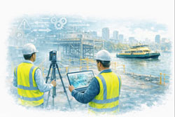
Hamilton By Design provides engineering-grade 3D laser scanning and LiDAR services in Kirribilli and across Sydney’s Lower North Shore, delivering accurate point cloud data that supports safe, buildable and cost-effective engineering outcomes.
Why 3D Scanning Is Critical in Kirribilli and Harbour Precincts
Kirribilli is characterised by:
heritage and character buildings
dense strata developments
limited access for survey and construction
proximity to critical transport and harbour infrastructure
Traditional measurement methods are often inadequate for:
structural modifications
mechanical plant upgrades
access compliance works
fabrication-ready design
3D laser scanning captures millions of accurate spatial data points, creating a true digital record of existing conditions before design begins — reducing rework, RFIs and site clashes.
From Point Cloud to Build-Ready CAD and BIM Models
Our service does not stop at site capture.
We convert scan data into:
engineering CAD models
fabrication drawings
BIM-compatible geometry
detailed as-built documentation
This supports downstream workflows such as:
steel fabrication
mechanical installation
access system upgrades (AS 1657)
structural strengthening designs
Deliverables are tailored to suit engineers, architects and construction teams — not just visualisation.
Typical Applications in Kirribilli and the Lower North Shore
3D scanning is commonly used for:
strata refurbishments and upgrades
heritage façade documentation
lift and stair compliance modifications
plant room reconfiguration
services routing and clash detection
harbour-adjacent infrastructure assessments
Because scanning is non-contact and fast to deploy, it allows data capture in occupied buildings with minimal disruption to residents and businesses.
Engineering-Led Scanning — Not Just Survey Output
Hamilton By Design is an engineering-led consultancy, not just a scanning provider.
This means:
scan planning is driven by design requirements
critical interfaces are prioritised
modelling supports fabrication and construction
risk is addressed early in the project lifecycle
This approach is particularly valuable in brownfield and retrofit environments where unknown conditions often drive cost overruns.
Servicing Kirribilli, North Sydney and Sydney Harbour Precincts
We regularly support projects across:
Kirribilli
Milsons Point
North Sydney
Neutral Bay
Chatswood
Sydney CBD
And integrate scanning with mechanical, structural and drafting services where required.
Whether the project involves refurbishment, compliance or asset documentation, accurate reality capture forms the foundation for reliable engineering decisions.
Supporting Safe Design and Risk Reduction
Accurate site data enables:
early hazard identification
better access system design
improved constructability reviews
reduced site modifications during shutdowns
This aligns with Safe Design principles and reduces downstream safety and scheduling risks.
Talk to Us About 3D Scanning in Kirribilli
If you’re planning refurbishment, compliance upgrades or engineering works in Kirribilli or across Sydney’s harbour precincts, engineering-grade 3D scanning can eliminate costly unknowns before construction begins.
Contact Hamilton By Design to discuss site capture, modelling and design support for your project.
To provide the best experiences, we use technologies like cookies to store and/or access device information. Consenting to these technologies will allow us to process data such as browsing behaviour or unique IDs on this site. Not consenting or withdrawing consent, may adversely affect certain features and functions.
Functional
Always active
The technical storage or access is strictly necessary for the legitimate purpose of enabling the use of a specific service explicitly requested by the subscriber or user, or for the sole purpose of carrying out the transmission of a communication over an electronic communications network.
Preferences
The technical storage or access is necessary for the legitimate purpose of storing preferences that are not requested by the subscriber or user.
Statistics
The technical storage or access that is used exclusively for statistical purposes.The technical storage or access that is used exclusively for anonymous statistical purposes. Without a subpoena, voluntary compliance on the part of your Internet Service Provider, or additional records from a third party, information stored or retrieved for this purpose alone cannot usually be used to identify you.
Marketing
The technical storage or access is required to create user profiles to send advertising, or to track the user on a website or across several websites for similar marketing purposes.