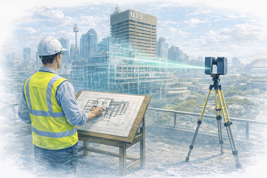
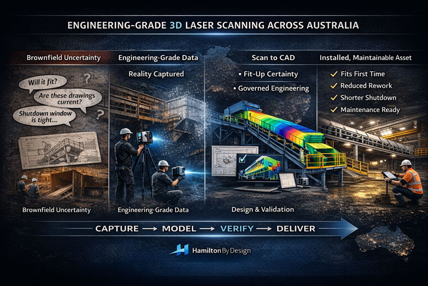
When a project slows down, it’s rarely because the engineering team lacks capability. It’s usually because the site reality is unclear: legacy drawings don’t match what’s installed, shutdown windows are tight, and one wrong assumption can cascade into rework, delays, and variation costs.
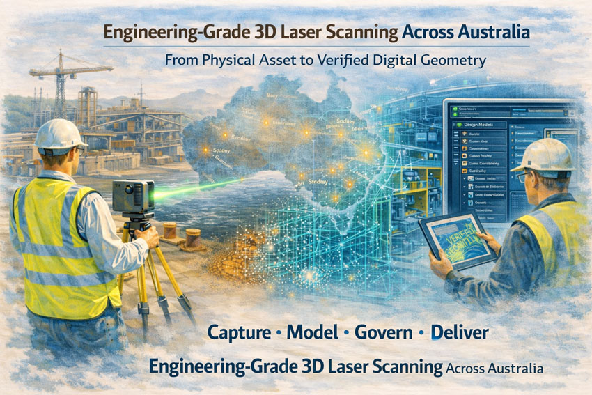
Engineering-grade 3D laser scanning is how you remove uncertainty early and build momentum fast.
At Hamilton By Design, we deliver 3D engineering scans that don’t stop at “capturing points.” We focus on engineering outcomes—accurate as-built evidence, point cloud processing, scan-to-CAD modelling, and fit-for-purpose deliverables that support design, fabrication, and installation across mining and heavy industry.
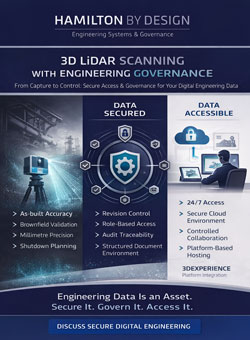
Why “Engineering-Grade” Scanning Matters
Not all scanning services are equal. Scan density alone doesn’t guarantee a usable engineering result—what matters is how the scan is controlled, interpreted, and translated into engineering decisions.
If you’re planning upgrades in brownfield environments (plants, conveyors, chutes, pump skids, steelwork tie-ins), engineering-grade scanning helps you:
- Verify true geometry before you design
- Reduce shutdown risk and rework
- Improve fit-up confidence for fabricated parts
- Create accurate as-built documentation that stays useful over time
To understand what “engineering-grade” really means, start here:
Engineering-Grade LiDAR Scanning (service page)
https://www.hamiltonbydesign.com.au/home/engineering-services/engineering-grade-lidar-scanning/
Engineering-Grade LiDAR Scanning (article/definition page)
https://www.hamiltonbydesign.com.au/engineering-grade-lidar-scanning/
Our Core 3D Engineering Scan Capability
3D Laser Scanning – Service Overview
This is the best “hub” page for prospects who want the full scanning capability and what it supports (engineering models, documentation, project delivery).
https://www.hamiltonbydesign.com.au/home/engineering-services/3d-laser-scanning/
3D Laser Scanning for Engineering
If your audience is engineers, project managers, and maintenance teams, this page speaks directly to engineering use-cases and how scanning reduces risk.
https://www.hamiltonbydesign.com.au/home/engineering-services/3d-laser-scanning/3d-laser-scanning-for-engineering/
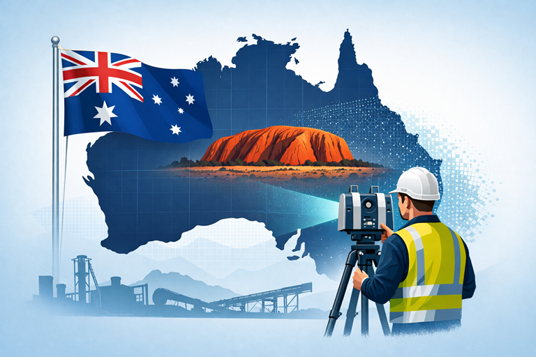
Engineering-Grade 3D Laser Scanning Across Australia
For national capability (remote sites, shutdown support, travel-ready service delivery), use this page as the authority link.
https://www.hamiltonbydesign.com.au/engineering-grade-3d-laser-scanning-australia/
3D Laser Scanning Across Australia
A complementary national service page that reinforces coverage across mining, industry, and infrastructure.
https://www.hamiltonbydesign.com.au/home/engineering-services/3d-laser-scanning/3d-laser-scanning-across-australia/
Turning Point Clouds into Real Project Momentum
A point cloud is evidence—but the value is unlocked when that evidence becomes engineering geometry and fabrication-ready decisions.
Hamilton By Design supports scan-based workflows that typically include:
- Scan control and site capture planning
- Point cloud processing aligned to engineering datums
- Model development for fit-up checks and tie-ins
- Documentation updates and revision control pathways
For scanning + modelling capability in one place:
3D LiDAR Scanning and 3D Modelling (Sydney)
https://www.hamiltonbydesign.com.au/home/3d-lidar-scanning-and-3d-modelling-in-sydney/
For reverse engineering where the goal is better outcomes, not just copying old geometry:
Reverse Engineer 3D Scanning
https://www.hamiltonbydesign.com.au/reverse-engineer-3d-scanning/
Construction & Fit-Out Scanning (Sydney and Greater Metro)
For construction, retrofit, or building services environments, scanning often supports safe coordination, clash reduction, and fast design decisions.
If your audience includes builders, architects, MEP contractors, or refurbishment teams, link these pages:
3D Scanning for Construction in Sydney
https://www.hamiltonbydesign.com.au/home/engineering-services/3d-scanning-sydney/3d-scanning-for-construction-in-sydney/
3D Construction Scan Sydney
https://www.hamiltonbydesign.com.au/home/engineering-services/3d-scanning-sydney/3d-scanning-services-in-sydney/3d-construction-scan-sydney/
3D Scanning & BIM Across Greater Sydney
https://www.hamiltonbydesign.com.au/home/engineering-services/3d-scanning-sydney/3d-scanning-bim-greater-sydney/
3D LiDAR Scanning Chatswood & Greater Sydney
https://www.hamiltonbydesign.com.au/home/engineering-services/3d-scanning-sydney/3d-scanning-services-in-sydney/mechanical-engineers-in-sydney-hamilton-by-design/3d-lidar-scanning-chatswood/
Mining and Process Plant Scanning (CHPP and Heavy Industry)
Mining projects demand more than visual accuracy—they demand engineering judgement around interfaces, access constraints, and shutdown deliverability.
If you want a clear scanning-to-mining outcome page, use:
CHPP Engineering, 3D Scanning & Upgrade Services
https://www.hamiltonbydesign.com.au/home/engineering-services/mining-engineering-services-australia/chpp-engineering-3d-scanning-upgrade-services/
For an educational/insight piece that supports credibility and internal linking:
How LiDAR Scanning is Transforming Mining Process Plants
https://www.hamiltonbydesign.com.au/seeing-the-unseen-how-lidar-scanning-is-transforming-mining-process-plants/
Regional and Project Delivery Pages
These pages are useful for local SEO and converting clients who search by region:
3D Scanning Engineering in Brisbane
https://www.hamiltonbydesign.com.au/home/engineering-services/3d-laser-scanning/3d-scanning-engineering-brisbane/
3D Laser Scanning & Mechanical Engineering in Wyong (NSW Central Coast)
https://www.hamiltonbydesign.com.au/nsw-central-coast/3d-laser-scanning-mechanical-engineering-in-wyong-nsw/
Ready to Start With an Engineering-Grade Scan?
If your project involves brownfield upgrades, shutdown tie-ins, or legacy infrastructure that can’t be trusted from drawings alone, the fastest way to move forward is to capture reality, then design with certainty.
Start with the main scanning overview and follow the pathway that matches your project:
- 3D Laser Scanning (Overview): https://www.hamiltonbydesign.com.au/home/engineering-services/3d-laser-scanning/
- Engineering-Grade LiDAR Scanning: https://www.hamiltonbydesign.com.au/home/engineering-services/engineering-grade-lidar-scanning/
- Reverse Engineer 3D Scanning: https://www.hamiltonbydesign.com.au/reverse-engineer-3d-scanning/