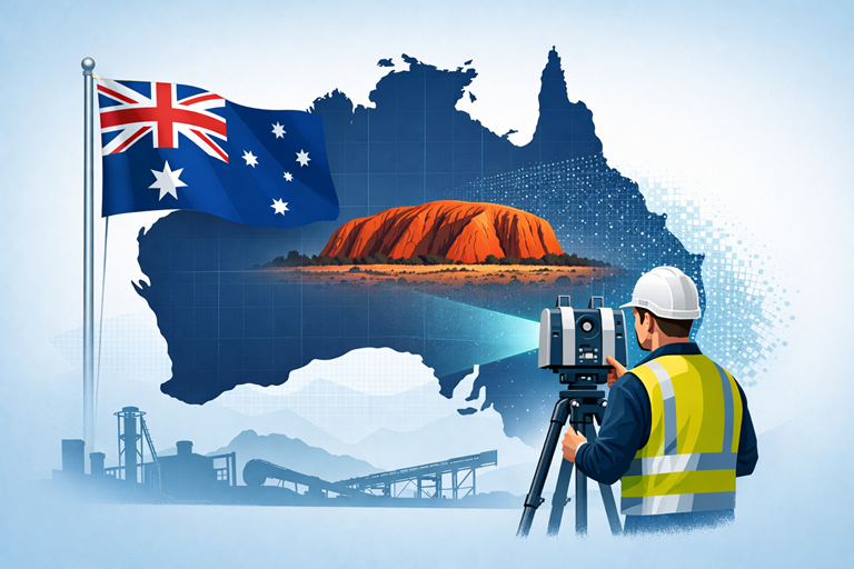
Why FARO Laser Scanners Deliver the Best Outcomes for Mining and Manufacturing Sites

ARO laser scanning workflow showing point cloud processing, SOLIDWORKS modelling, and fabrication drawings for a mining and manufacturing plant

In mining and manufacturing, the difference between success and rework comes down to one thing:

The quality of your dataโ€”and how you use it.

While many providers can โ€œcapture a scan,โ€ not all can deliver usable engineering outcomes. This is where FARO laser scanners and the FARO software ecosystem stand apart.


Engineer-Led Scanning vs Generic Data Capture

Most scanning providers deliver:

  • Raw point clouds
  • Mesh files (STL, OBJ)
  • Limited usability for engineering

At Hamilton By Design, we take a different approach:

Engineering-led scanning using FARO tools, built for design, modelling, and fabrication.

The real advantage of FARO is not just the hardwareโ€”itโ€™s the software ecosystem that turns scan data into engineering decisions.


The Real Advantage: FARO SCENE Software

At the core of the FARO workflow is FARO SCENE, purpose-built for point cloud processing, registration, and validation.

Unlike generic tools, SCENE allows:

1. Hybrid Registration (Accuracy You Can Trust)

  • Combine cloud-to-cloud, targets, and survey control
  • Validate alignment visually and numerically
  • Eliminate stitching errors before they reach design

โžก๏ธ This ensures engineering-grade accuracy, not just visual alignment

FARO SCENE enables flexible registration workflows that combine multiple methods for precise alignment of complex sites


2. On-Site Registration (No Return Visits)

  • Register scans in the field
  • Identify gaps immediately
  • Confirm coverage before leaving site

โžก๏ธ Critical for:

  • Shutdowns
  • Remote mine sites
  • High-cost mobilisation environments

SCENE supports real-time, on-site registration and validation, allowing immediate data verification and reducing the need for rework


3. Clean, Usable Point Clouds (Not Just Raw Data)

  • Automatic filtering of noise
  • Colour balancing
  • Duplicate point removal
  • Density optimisation

โžก๏ธ Result:
Clean datasets ready for CAD, not bloated unusable files

SCENE includes filtering, validation, and optimisation tools to improve data quality and usability for downstream workflows


4. Full Workflow Integration (Scan โ†’ CAD โ†’ Engineering)

FARO integrates directly into engineering workflows:

  • Export to CAD and BIM platforms
  • Compatible with tools like:
    • SOLIDWORKS
    • Revit
    • Navisworks

โžก๏ธ This is the key difference:

FARO data is built to be engineered, not just viewed

SCENE enables export into multiple CAD and point cloud formats for modelling and engineering applications


5. Visual Validation (What You See Is What You Build)

  • 3D visualisation
  • VR inspection
  • Flythrough and walkthrough capability

โžก๏ธ Engineers and stakeholders can:

  • Verify design intent
  • Identify clashes early
  • Reduce construction risk

SCENE supports immersive 2D, 3D, and VR visualisation for detailed project evaluation


6. Scalable for Large Industrial Sites

Mining and manufacturing sites are:

  • Large
  • Complex
  • Often poorly documented

FARO SCENE allows:

  • Management of thousands of scans
  • Structured project organisation
  • Fast visualisation of large datasets

โžก๏ธ This is critical for:

  • CHPP plants
  • Smelters
  • Conveyor systems
  • Brownfield upgrades

Why This Matters for Mining & Manufacturing

Reduce Rework

Accurate, validated data reduces:

  • Site clashes
  • Fabrication errors
  • Installation delays

Improve Shutdown Efficiency

  • Capture once
  • Model correctly
  • Execute without surprises

Enable Brownfield Engineering

Most sites are not โ€œgreenfieldโ€:

  • Legacy assets
  • Unknown geometry
  • Modifications over time

โžก๏ธ FARO enables:
True as-built modelling, not assumptions


Support Fabrication-Level Detail

With the right workflow (FARO + engineering):

  • Steel detailing
  • Mechanical integration
  • Conveyor and chute design
  • Retrofit design

โžก๏ธ Deliverables become:
Fabrication-readyโ€”not conceptual


FARO vs โ€œOther Scanning Solutionsโ€

Many alternatives focus on:

  • Speed over accuracy
  • Visual outputs over engineering use
  • Meshes instead of parametric models

FARO, combined with SCENE, delivers:

  • Controlled accuracy
  • Transparent registration
  • Engineering-ready outputs

The Hamilton By Design Approach

We donโ€™t just use FARO toolsโ€”we use them properly.

  • Engineer-led scanning
  • Structured workflows
  • Point cloud to CAD conversion
  • SOLIDWORKS-based modelling
  • Fabrication-ready deliverables

Our focus is on outcomesโ€”not just data.


Anyone can scan.

Very few can:

  • Validate the data
  • Convert it into engineering models
  • Deliver drawings that can be built

Thatโ€™s why FARO, when used correctly, is not just a scanning toolโ€”

Itโ€™s a complete engineering data solution for mining and manufacturing.



3D LiDAR scanning and 3D modelling service button โ€” laser scanner capturing a point cloud for engineering and CAD modelling
Mechanical engineering services

Our Clients


Name
Would you like us to arrange a phone consultation for you?
Address
3D CAD Modelling Australia service banner for Hamilton By Design
3D LiDAR Scanning Darwin for engineering surveys, laser scanning, reality capture and point cloud modelling services
3D LiDAR Scanning Australia engineering services for laser scanning, reality capture, scan-to-CAD, Scan-to-BIM and as-built documentation across Australia
3D LiDAR scanning services on the Central Coast providing engineering-grade laser scanning, point cloud capture, scan-to-CAD modelling and industrial reality capture for infrastructure and industrial projects.
3D LiDAR Scanning Perth for engineering surveys, laser scanning, reality capture and point cloud modelling services
3D LiDAR Scanning Sydney for engineering surveys, laser scanning, reality capture and point cloud modelling services
3D LiDAR Scanning Brisbane for engineering surveys, laser scanning, reality capture and point cloud modelling services
3D LiDAR Scanning Canberra for engineering surveys, laser scanning, reality capture and point cloud modelling services
3D LiDAR Scanning Newcastle for engineering surveys, laser scanning, reality capture and point cloud modelling services
3D LiDAR Scanning Adelaide for engineering surveys, laser scanning, reality capture and point cloud modelling services

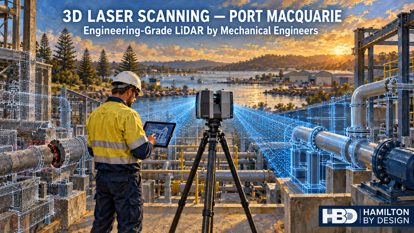
3D Laser Scanning Port Macquarie | Engineering-Grade LiDAR by Mechanical Engineers

Oil painting of an engineer using a tripod-mounted 3D laser scanner to capture industrial pipework in Port Macquarie.

3D Laser Scanning Port Macquarie โ€“ Why Accuracy Matters for Engineering Projects

If you’re planning a plant upgrade, fabrication project, or site modification in Port Macquarie, the quality of your 3D scan data directly impacts the success of your project.

At Hamilton By Design, we provide engineering-grade 3D laser scanning services led by mechanical engineers, ensuring the data captured is not only accurate, but also suitable for real-world design, fabrication, and construction outcomes.

Not All 3D Scanning Is the Same

With the rise of low-cost scanning technology, many providers now offer handheld scanning solutions as a fast and affordable option.

While these systems can be useful for general visualisation, they often rely on SLAM-based positioning, which estimates location as the operator moves through a site.

This can introduce:

  • positional drift over distance
  • reduced dimensional accuracy
  • inconsistencies in large or complex environments

In many cases, these services are delivered by non-qualified operators using handheld equipment without a clear understanding of engineering requirements.

Why Mechanical Engineers Deliver Better Outcomes

3D scanning is only one part of the process. The real value comes from how the data is understood and applied.

A mechanical engineer-led scanning approach ensures:

  • critical areas are prioritised during capture
  • scan density aligns with fabrication requirements
  • line-of-sight limitations are identified and managed
  • downstream modelling and design risks are reduced
  • data is validated against real engineering constraints

Rather than simply collecting data, mechanical engineers focus on what the data needs to achieve.

The Risk of Handheld โ€œCowboyโ€ Scanning

While handheld scanning has its place, relying solely on it โ€” particularly when carried out by inexperienced or non-qualified operators โ€” often leads to poor engineering outcomes.

These โ€œfast and cheapโ€ approaches can produce point clouds and 3D models that look correct visually but are not dimensionally reliable.

Typical issues include:

  • accumulated positional drift across the model
  • misalignment of structural and mechanical elements
  • missing critical geometry due to poor capture planning
  • inconsistent scaling across large areas

The result is 3D models that cannot be trusted for fabrication, retrofit design, or installation.

Why Tripod-Based LiDAR Scanning Is Different

Tripod-mounted LiDAR scanners capture data from fixed, controlled positions, delivering a stable and repeatable dataset.

This is critical when your project requires:

  • accurate tie-in points
  • fabrication-ready measurements
  • structural or mechanical design
  • clash detection and modelling
  • confidence in as-built conditions

For engineering projects, the difference is clear:

Handheld scanning shows you what it looks like.
LiDAR scanning โ€” guided by mechanical engineers โ€” tells you what it actually is.

The Risk of Low-Accuracy Data

Choosing the wrong scanning method โ€” or the wrong provider โ€” can lead to:

  • rework during fabrication
  • misalignment on installation
  • increased project costs
  • delays during shutdowns or upgrades

In industrial environments, even small dimensional errors can have significant downstream impacts.

A Smarter Approach to Reality Capture

At Hamilton By Design, we take an engineering-led approach to 3D scanning, combining the right technology with real engineering expertise.

Where required, we may use multiple capture methods โ€” but critical areas are always captured using high-accuracy LiDAR scanning guided by mechanical engineering judgement.

Supporting Port Macquarie and Regional NSW

We support clients across Port Macquarie and regional New South Wales, delivering professional 3D laser scanning services for industrial facilities, manufacturing plants, infrastructure upgrades, and mechanical and structural projects.

Talk to Hamilton By Design – Contact Us

If you need accurate, engineering-grade site data in Port Macquarie, backed by mechanical engineering expertise, get in touch to discuss your project.


Name
Would you like us to arrange a phone consultation for you?
Address

Our clients

Mechanical Engineers

3D Lidar Scanning

3D CAD Modelling Australia service banner for Hamilton By Design

Industrial 3D Scanning Sydney | Mining & Plant Scanning

Sydney industrial sites often involve tight shutdown windows, congested plant areas, ageing infrastructure and limited tolerance for error. Our industrial 3D scanning Sydney service helps project teams capture accurate site conditions before design, fabrication and installation begin.

At Hamilton By Design Co., we provide 3D scanning services in Sydney for mining infrastructure, conveyors, transfer chutes, processing plants, workshops and heavy industrial assets. By converting existing conditions into reliable point cloud data, we help reduce rework, improve fit-up accuracy and support better engineering decisions.

Learn more about our core Sydney scanning capability here:

Engineering-grade scanning delivers measurable geometry โ€” not just visuals โ€” enabling confident decision-making across design, fabrication and construction workflows.


Why Industrial 3D Scanning Matters

Industrial facilities evolve over time. Steelwork is modified, equipment is relocated, and plant layouts drift away from original drawings. This creates significant risk when new components must fit within existing infrastructure.

Our scanning process captures real-world site geometry so engineers and project teams can work from current conditions.

This is especially valuable where:

  • shutdown durations are limited
  • access is restricted
  • plant environments are congested

  • existing drawings are outdated or unreliable
  • fabrication accuracy is critical

For a broader overview of how this applies across Sydney projects:


Industrial 3D Scanning Services in Sydney

We deliver industrial 3D laser scanning in Sydney for:

  • conveyors and conveyor galleries
  • transfer chutes and discharge points
  • bins, hoppers and ore handling systems

  • processing plants and workshops
  • structural steel and support frames
  • pipework and plant interfaces
  • shutdown capture and upgrade areas

These services support engineering workflows where accurate site data feeds directly into CAD modelling, design verification and fabrication planning.


Typical Applications

Conveyor and Chute Upgrades

3D scanning captures the true geometry of existing conveyors and chutes, allowing new designs to fit correctly within tight plant constraints.

Shutdown Planning

Scan data allows detailed engineering work to continue after limited shutdown access windows โ€” reducing risk and repeat site visits.

Brownfield Plant Modifications

For retrofit projects, scanning provides a reliable base for integrating new structures, mechanical systems and access platforms.

๐Ÿ‘‰ See how scanning supports full engineering workflows:


Benefits of Industrial 3D Scanning

Using 3D scanning services in Sydney provides:

  • improved dimensional accuracy
  • reduced reliance on manual measurement
  • fewer design assumptions
  • better fit between new and existing assets
  • earlier clash detection
  • reduced fabrication and installation risk
  • stronger shutdown planning outcomes

Accurate scan data forms a reliable digital record of site conditions, supporting coordination and verification across projects.


From Site Capture to Engineering Outcomes

Our workflow moves beyond scanning into engineering use:

  • site capture using LiDAR scanning
  • registered 3D point cloud generation
  • CAD modelling and layout development
  • design validation and clash detection
  • fabrication-ready engineering outputs

This aligns with a full scan โ†’ model โ†’ engineer โ†’ build workflow used across Sydney projects.

Explore the full workflow here:


Mining and Heavy Industry Focus

This page is specifically positioned for mining, bulk materials handling and heavy industrial applications in Sydney.

Typical systems include:

  • conveyor systems
  • transfer chutes
  • processing infrastructure
  • maintenance shutdown zones
  • structural interfaces for upgrades

Hamilton By Design combines engineering expertise with LiDAR scanning and 3D modelling to support plant design, retrofits and digital engineering workflows.


Supporting Shutdowns and Plant Upgrades

Shutdown work carries high risk and tight time constraints. Accurate as-built data reduces uncertainty before fabrication and installation.

Our industrial 3D scanning Sydney service helps teams:

  • capture plant conditions before shutdown
  • validate upgrade space and constraints
  • reduce rework during installation
  • support fabrication-ready design

For full Sydney coverage and workflows:


Why Work With Hamilton By Design Co.

Hamilton By Design delivers engineering-led 3D scanning, not just data capture.

This means:

  • scan accuracy is defined by engineering requirements
  • outputs are suitable for design and construction
  • data integrates directly into CAD and engineering workflows
  • projects are supported from capture through to design

Our services are designed for real-world outcomes โ€” helping projects fit, function and perform as intended.


Call to Action

If you need industrial 3D scanning in Sydney for conveyors, chutes, plant upgrades or shutdown planning, Hamilton By Design Co. can help.

We deliver accurate, engineering-ready site data so your team can reduce risk, improve accuracy and move forward with confidence.

Start your project here:


FAQ Section

What is industrial 3D scanning?

Industrial 3D scanning uses laser scanners to capture accurate measurements of plant, structures and equipment, creating a point cloud for engineering use.

Can you scan conveyors and transfer chutes?

Yes โ€” conveyors, chutes and bulk materials handling systems are a core application.

Is this useful for shutdowns?

Yes โ€” scanning allows capture during shutdown and continued engineering work afterwards.

3D LiDAR scanning and 3D modelling service button โ€” laser scanner capturing a point cloud for engineering and CAD modelling
Mechanical engineering services

Can the data be used for CAD?

Yes โ€” scan data supports 2D drawings, 3D models and fabrication workflows.

Hamilton By Design logo displayed on a blue tilted rectangle with a grey gradient background


3D Scanning Sydney banner promoting engineering-grade 3D laser scanning, LiDAR scanning, and reality capture services by Hamilton By Design.
Mechanical Engineering Sydney banner with white text on a blue background representing Hamilton By Design's mechanical engineering services in Sydney.
Mechanical Drafting and 3D Modelling Sydney banner highlighting Hamilton By Design's CAD drafting, 3D modelling, and engineering design services in Sydney.

Mechanical Engineering | Structural Engineering


Hamilton By Design provides engineering-led 3D scanning, LiDAR scanning, mechanical engineering and digital engineering services throughout Sydney and Greater Sydney.

Explore our related Sydney services:


  • 3D Scanning Sydney โ€“ Engineering-grade terrestrial laser scanning, as-built surveys and point cloud capture for industrial, infrastructure and commercial projects.
  • Reality Capture Sydney โ€“ High-accuracy reality capture, digital twins, asset documentation and engineering-grade site verification.
  • Scan to CAD Sydney โ€“ Convert point cloud data into AutoCAD, SolidWorks, Inventor and other engineering-ready CAD deliverables.
  • Point Cloud Modelling Sydney โ€“ Engineering-grade point cloud processing, clash detection, as-built verification and 3D modelling.
  • Mechanical Engineering Sydney โ€“ Mechanical design, plant upgrades, materials handling systems, conveyors, chutes, platforms and engineering support.
  • Structural Drafting Sydney โ€“ Structural steel drafting, fabrication drawings, GA drawings, workshop detailing and as-built documentation.

Hamilton By Design supports projects throughout Sydney CBD, Parramatta, Liverpool, Penrith, Blacktown, Chatswood, Alexandria, Mascot, Newcastle and the Central Coast.


Name
Would you like us to arrange a phone consultation for you?
Address

Our clients

CHPP Engineering title graphic featuring bold white text reading "CHPP Engineering" centred on a blue rounded rectangle background.
Pipework Drafting title graphic featuring bold white text reading "Pipework Drafting" centred on a blue rounded rectangle background.
3D LiDAR Scanning for Engineering Projects title graphic featuring bold white text on a blue rounded rectangle background.
Blue banner graphic displaying the text "Point Cloud to CAD - Australia" in large white lettering, representing point cloud processing, scan-to-CAD conversion and digital engineering services across Australia.
Blue banner graphic displaying the text "Scan to CAD Sydney" in large white lettering, representing engineering-led point cloud to CAD conversion, LiDAR scanning and digital engineering services in Sydney.
Blue banner graphic displaying the text "Reality Capture Sydney - CBD" in large white lettering, representing engineering-led reality capture, LiDAR scanning and digital engineering services within Sydney CBD commercial buildings and infrastructure.
3D CAD Modelling Australia service banner for Hamilton By Design
3D LiDAR Scanning Darwin for engineering surveys, laser scanning, reality capture and point cloud modelling services
3D LiDAR Scanning Australia engineering services for laser scanning, reality capture, scan-to-CAD, Scan-to-BIM and as-built documentation across Australia
3D LiDAR scanning services on the Central Coast providing engineering-grade laser scanning, point cloud capture, scan-to-CAD modelling and industrial reality capture for infrastructure and industrial projects.

Engineering Preparation for Coal Plant Shutdowns

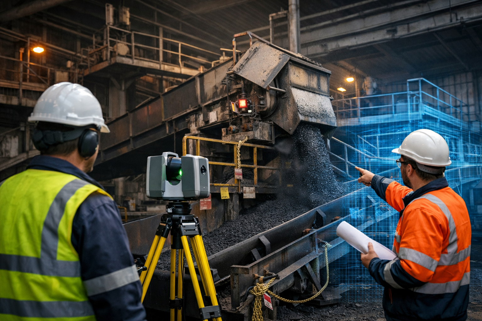
Coal plant shutdown engineering using a 3D laser scanner to capture conveyor and transfer chute infrastructure.

Coal Plant Shutdown Engineering | Preparation for Mining & Industrial Shutdowns

Planned shutdowns are a critical part of maintaining reliability in coal handling plants, port infrastructure, and large industrial facilities. During these scheduled outages, engineers must inspect, upgrade, or replace equipment across complex mechanical systems including conveyors, transfer chutes, crushers, and structural infrastructure.

Effective coal plant shutdown engineering focuses on preparation before the shutdown begins. Accurate plant data, detailed engineering models, and well-planned maintenance activities allow shutdown teams to complete work safely and within tight time windows.

Shutdown planning is essential because many maintenance activities must be performed while equipment is offline, often under strict time constraints with multiple trades working simultaneously. Without careful planning, shutdowns can quickly become unsafe, inefficient, or costly.


Why Engineering Preparation Matters

Coal processing plants operate continuously for long periods. Over time equipment is modified, upgraded, or repaired during multiple shutdown cycles. As a result, the original plant drawings often no longer represent the true layout of the facility.

Before a shutdown begins, engineering teams must confirm:

  • Existing conveyor alignments
  • Transfer chute geometry
  • Structural steel clearances
  • Access platforms and walkways
  • Equipment interfaces and installation areas

Modern engineering teams increasingly rely on laser scanning and digital modelling to capture the exact geometry of existing infrastructure. This produces a high-resolution point cloud of the plant that can be used to develop accurate engineering models before modifications begin.

These models allow engineers to validate equipment installations and reduce risk during the shutdown window.


The Role of Engineering Scanning Services

Engineering scanning services are now widely used across mining and industrial sectors to support shutdown planning.

Laser scanning technology can capture millions of measurement points across a facility, creating a detailed digital model of conveyors, chutes, structural steel and equipment installations.

Typical shutdown engineering scanning applications include:

  • Coal handling plant conveyors and transfer stations
  • Ship loader infrastructure at export terminals
  • Port stockpile systems and stacker reclaimers
  • Manufacturing production lines
  • Industrial processing plants

These digital datasets can then be converted into engineering-grade CAD models, enabling detailed design work to be completed before the shutdown occurs.

This approach significantly reduces installation risk and allows fabrication work to begin before the plant outage.

For a deeper explanation of shutdown preparation workflows see:


Coal Handling Plant Infrastructure Challenges

Coal plants contain some of the most complex materials handling systems in heavy industry. Conveyors move thousands of tonnes of material per hour through crushers, screens, transfer chutes, and stockpiles.

Common shutdown engineering tasks include:

  • Transfer chute redesign
  • Conveyor upgrades
  • Structural steel modifications
  • Dust control improvements
  • Maintenance access upgrades

These areas are typically congested with equipment and structural supports. Engineering teams must therefore confirm clearances and installation access before shutdown work begins.

Laser scanning and digital modelling allow engineers to identify clashes and installation constraints early in the design phase.

Learn more about mechanical engineering support for these systems:


Transfer Chute Design During Shutdowns

Transfer chutes are often a major focus of shutdown engineering work. Poorly designed chutes can cause:

  • Conveyor belt wear
  • Blockages and carryback
  • Excessive dust generation
  • Reduced throughput

Because chutes are located at conveyor transfer points, modifications must often be installed during shutdown windows when conveyors are offline.

Engineering models developed from site scans allow designers to develop improved chute geometries that optimise material flow and reduce maintenance issues.

Further design guidance can be found here:
https://www.hamiltonbydesign.com.au/coal-chute-design/

You may also find additional engineering insights in this technical article:
https://chutesandtransferstations.blogspot.com/2025/07/designing-for-durability-chutes.html


Shutdown Engineering Across Industrial Facilities

Although coal handling plants are a major focus, the same engineering preparation methods apply across many industries.

Shutdown engineering scanning is increasingly used in:

  • Mining processing plants
  • Bulk material handling facilities
  • Manufacturing plants
  • Power stations
  • Port infrastructure
  • Industrial processing facilities

By developing accurate digital models before shutdowns occur, engineering teams can plan work packages, confirm installation sequences, and minimise delays during the outage period.

Proper shutdown planning improves safety, reduces downtime, and helps ensure maintenance projects are completed efficiently.


The Future of Shutdown Engineering

As mining and industrial infrastructure becomes more complex, shutdown preparation is increasingly relying on digital engineering workflows.

Technologies such as:

  • 3D laser scanning
  • point cloud modelling
  • digital twins
  • engineering simulation

are transforming the way shutdowns are planned and executed.

For operators of coal plants, ports, and manufacturing facilities, investing in accurate engineering data before a shutdown begins is one of the most effective ways to reduce project risk and improve plant reliability.

Hamilton By Design logo displayed on a blue tilted rectangle with a grey gradient background

3D LiDAR scanning and 3D modelling service button โ€” laser scanner capturing a point cloud for engineering and CAD modelling
Mechanical engineering services
Name
Would you like us to arrange a phone consultation for you?
Address
CHPP Engineering title graphic featuring bold white text reading "CHPP Engineering" centred on a blue rounded rectangle background.
Pipework Drafting title graphic featuring bold white text reading "Pipework Drafting" centred on a blue rounded rectangle background.
3D LiDAR Scanning for Engineering Projects title graphic featuring bold white text on a blue rounded rectangle background.

3D CAD Modelling Australia service banner for Hamilton By Design

3D LiDAR Construction Scanning

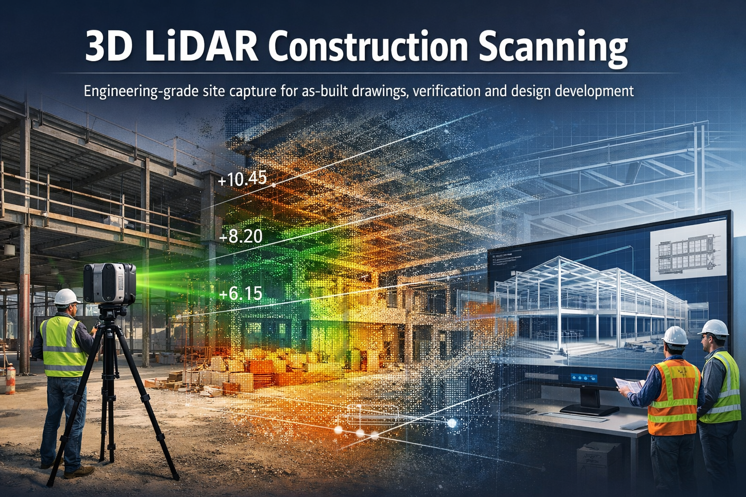
3D LiDAR construction scanning capturing a building site and converting it into a point cloud and engineering model

Engineering-Grade Reality Capture for Construction Projects

3D LiDAR construction scanning is transforming how engineers, builders, and project teams capture and understand existing site conditions.

Structural steel I-beam bolted connection with column in isometric view.

Hamilton By Design provides engineering-grade 3D LiDAR scanning services for construction projects, helping capture accurate digital models of buildings, structures, and construction sites before, during, and after construction works. Using advanced laser scanning technology, millions of precise measurements can be captured within minutes to produce detailed 3D point clouds and digital models of real-world structures. These models provide reliable information for planning, design, verification and as-built documentation.

Our scanning workflows allow project teams to move from existing construction conditions to accurate engineering models, helping reduce uncertainty and improve project outcomes.


What is 3D LiDAR Construction Scanning?

3D LiDAR scanning uses laser-based sensors to measure distances between the scanner and surrounding surfaces. The system records millions of measurements which form a point cloud representing the exact geometry of the construction environment.

These point clouds create highly detailed digital representations of buildings, infrastructure and construction sites that can be measured, analysed and modelled in engineering software.

For construction projects this provides a powerful way to:

  • capture existing building geometry
  • verify construction progress
  • generate accurate as-built drawings
  • support design coordination
  • analyse levels, clearances and spatial constraints

Modern LiDAR scanning allows engineers to capture entire buildings and construction sites quickly and accurately, creating reliable digital data for planning and engineering workflows.


Applications of LiDAR Scanning in Construction

3D LiDAR scanning supports a wide range of construction and engineering tasks.

As-Built Documentation

Construction drawings often become outdated as projects evolve. LiDAR scanning provides accurate as-built documentation of structures, capturing the exact conditions present on site.

These datasets can be used to generate:

  • floor plans
  • elevations
  • cross sections
  • building models
  • digital twins of facilities

Learn more:


Construction Verification and Quality Control

Scanning can be used during construction to verify that structures match the design intent.

Point cloud data can be compared against design models to identify:

  • structural deviations
  • alignment issues
  • level variations
  • installation conflicts

This helps project teams identify problems early before they become costly construction errors.


Renovation and Refurbishment Projects

Older buildings often have incomplete or inaccurate drawings.

3D LiDAR scanning provides a reliable way to capture existing conditions before renovation works begin. Engineers and designers can then develop new designs directly from the scanned data.

This reduces risk and ensures that new components fit correctly within existing structures.

Related page:


Structural and Architectural Analysis

Construction scanning can also be used to analyse structural geometry and building profiles, including:

  • roof profiles and screed levels
  • slab levels and floor flatness
  • faรงade alignment
  • structural steel positioning
  • drainage and fall verification

These measurements allow engineers to identify geometry problems early and support accurate construction planning.


The Scan to Engineering Model Workflow

Hamilton By Design integrates LiDAR scanning with engineering modelling workflows.

Typical project workflow:

Existing Construction Site
โ†“
3D LiDAR Scanning
โ†“
Point Cloud Processing
โ†“
Scan-to-CAD Modelling
โ†“
Engineering Analysis and Design

This workflow allows engineers to work from accurate digital representations of real-world conditions, reducing the need for repeated site visits and manual measurements.


Benefits of LiDAR Scanning for Construction Projects

3D LiDAR scanning provides several advantages compared with traditional measurement methods.

Accurate Site Data

Laser scanners capture millions of measurements quickly, producing detailed datasets that accurately represent site conditions.

Reduced Project Risk

Accurate site data reduces the risk of design errors, construction conflicts and unexpected site conditions.

Faster Site Surveys

Entire buildings and construction areas can be captured in a short time, reducing the need for multiple survey visits.

Improved Project Coordination

Point cloud data can be shared between architects, engineers and contractors, ensuring everyone works from the same information.

Support for Digital Engineering Workflows

LiDAR scanning supports modern design processes such as:

  • scan-to-CAD modelling
  • digital twins
  • BIM coordination
  • construction verification

Engineering-Grade 3D Laser Scanning

Blue 3D LiDAR scanner icon on a tripod with scanning waves

Hamilton By Design provides professional scanning services focused on engineering and industrial applications, not just visualisation.

Our scanning workflows support projects across:

  • industrial facilities
  • infrastructure projects
  • buildings and structures
  • construction sites
  • mechanical and structural engineering projects

Learn more about our scanning capabilities:


When is LiDAR Construction Scanning Most Valuable?

3D scanning is particularly useful in situations where accurate geometry is critical.

Examples include:

  • building renovations
  • structural modifications
  • plant installations within buildings
  • roof level and drainage analysis
  • verifying construction tolerances
  • documenting existing conditions before construction

In many cases the cost of scanning is small compared with the potential cost of construction errors.


Hamilton By Design logo displayed on a blue tilted rectangle with a grey gradient background
3D LiDAR scanning and 3D modelling service button โ€” laser scanner capturing a point cloud for engineering and CAD modelling
Mechanical engineering services

Talk With Hamilton By Design

If you require 3D LiDAR construction scanning for engineering or building projects, Hamilton By Design can help capture accurate digital models of your site.

Our team specialises in scanning workflows that support engineering analysis, design development and construction planning.

Contact Hamilton By Design to discuss your project requirements.

Name
Would you like us to arrange a phone consultation for you?
Address
3D CAD Modelling Australia service banner for Hamilton By Design

Mechanical Engineering | Structural Engineering


LiDAR vs Photogrammetry for Industrial Engineering

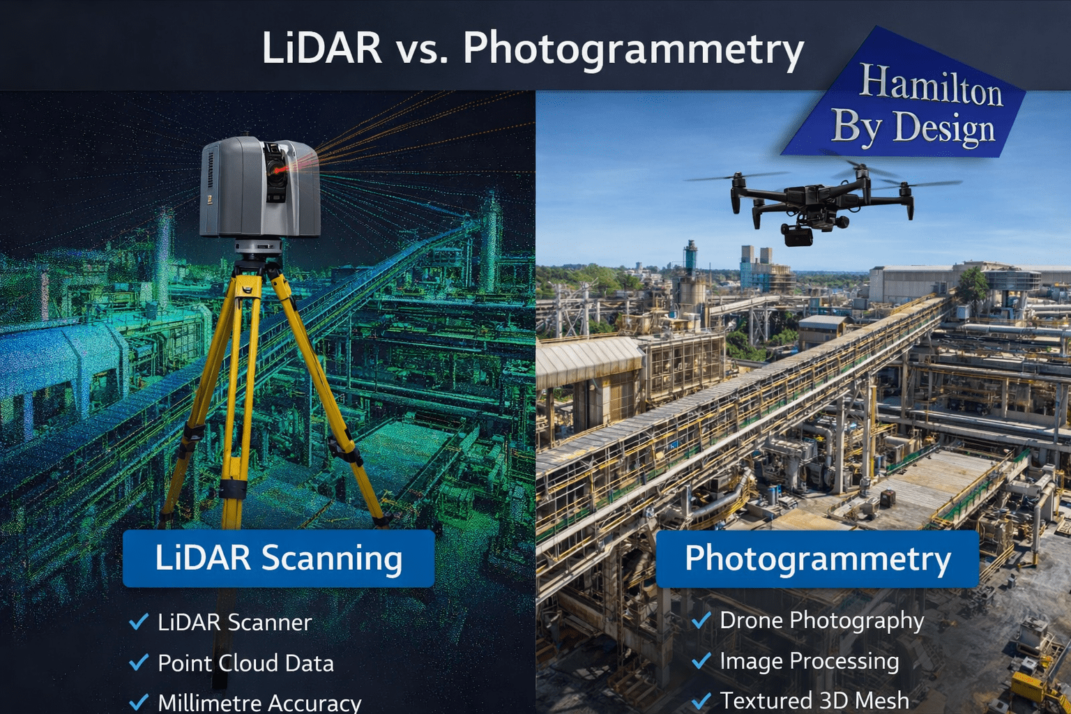
Engineering comparison of LiDAR scanning and photogrammetry used for capturing industrial plants and infrastructure.

Understanding the Difference Between LiDAR and Photogrammetry

When engineers need to capture accurate measurements of industrial infrastructure, two technologies are commonly considered: LiDAR scanning and photogrammetry.

Both methods allow engineers to create 3D digital models of real-world environments. However, when comparing LiDAR vs photogrammetry, each technology has different strengths depending on the type of engineering project.

For industries such as mining, processing plants, and heavy industrial facilities, choosing the right technology can significantly affect the accuracy, speed, and reliability of engineering design work.

At Hamilton By Design, LiDAR scanning is frequently used to capture existing conditions in complex industrial environments where precision is critical.

Learn more about engineering-grade scanning here:
https://www.hamiltonbydesign.com.au/home/engineering-grade-3d-laser-scanning-mining-industrial/


What is LiDAR Scanning?

LiDAR (Light Detection and Ranging) uses laser pulses to measure the distance between the scanner and surrounding surfaces. A terrestrial laser scanner emits millions of laser pulses per second and records the returned signal to calculate precise spatial coordinates.

The result is a dense 3D point cloud representing the scanned environment.

Engineering-grade LiDAR scanners commonly achieve millimetre-level accuracy, making them well suited for capturing industrial infrastructure such as:

  • pipework systems
  • structural steel
  • conveyors
  • tanks and vessels
  • pump stations
  • processing equipment

LiDAR scanning is widely used for plant upgrades, shutdown planning, and mechanical design where accurate site data is essential.

More information on LiDAR scanning services:
https://www.hamiltonbydesign.com.au/home/engineering-services/3d-laser-scanning/


What is Photogrammetry?

Photogrammetry is a technique that creates 3D models using photographs captured from multiple angles. Specialised software analyses overlapping images and reconstructs a three-dimensional model of the scene.

Photogrammetry is commonly used in:

  • aerial mapping
  • surveying large land areas
  • construction progress monitoring
  • environmental mapping
  • drone-based inspections

Because the technique relies on photographs rather than laser measurements, the accuracy of photogrammetry depends on factors such as image quality, lighting conditions, and camera calibration.


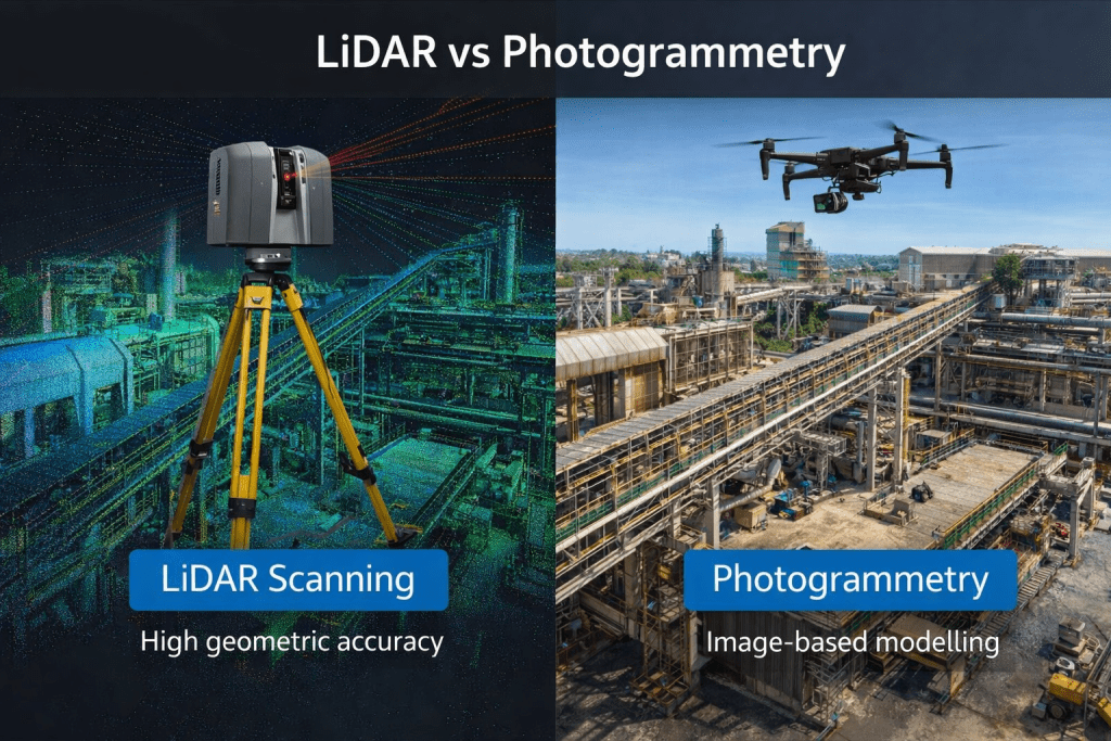
Comparison between LiDAR scanning and photogrammetry capturing an industrial engineering facility for 3D modelling.

LiDAR vs Photogrammetry: Key Differences

When comparing LiDAR vs photogrammetry, the main differences relate to measurement accuracy, speed of data capture, and suitability for complex environments.

FeatureLiDAR ScanningPhotogrammetry
Measurement MethodLaser distance measurementImage-based reconstruction
Typical AccuracyMillimetre-levelCentimetre-level (depending on conditions)
Performance in Low LightExcellentLimited
Surface DetailHigh geometric accuracyHigh visual detail
Performance in Complex PlantVery strongMore challenging
Data Capture SpeedVery fastModerate

For industrial engineering projects, LiDAR scanning typically provides more reliable geometric data, especially when scanning dense plant environments.


When LiDAR is Preferred in Industrial Engineering

LiDAR scanning is often the preferred technology for projects involving complex infrastructure.

Common engineering applications include:

  • plant upgrades and retrofits
  • pipework modifications
  • structural steel design
  • conveyor and materials handling systems
  • pump installations
  • shutdown planning

In these environments, millimetre-level accuracy is required to ensure new components fit correctly within existing structures.

LiDAR scanning is also effective in environments with limited lighting or reflective metal surfaces, which are common in industrial facilities.

You can read more about how engineers capture existing conditions before plant upgrades here:
https://www.hamiltonbydesign.com.au/capture-existing-conditions-before-plant-upgrades/


LiDAR scanning survey across Australia with engineer capturing industrial site data

When Photogrammetry is Useful

Photogrammetry remains a valuable tool for certain types of projects, particularly where large areas must be captured quickly.

Typical applications include:

  • drone-based terrain mapping
  • stockpile measurement
  • topographic surveys
  • construction progress documentation
  • infrastructure inspections

In these situations, photogrammetry provides an efficient method of capturing large datasets using aerial imagery.

However, for detailed industrial modelling, additional processing may be required to achieve the level of precision needed for engineering design.


Combining LiDAR and Photogrammetry

In some projects, engineers combine LiDAR scanning with photogrammetry to capture both accurate geometry and high-quality visual textures.

This approach can be useful when:

  • documenting heritage structures
  • visualising infrastructure for presentations
  • creating digital twins of facilities

However, for most industrial engineering applications, LiDAR scanning remains the primary technology used for accurate measurement.


From Scan Data to Engineering Models

Regardless of the capture method used, the final goal in engineering projects is often to convert the captured data into usable CAD models.

The typical workflow includes:

  1. Site data capture
  2. Data processing and alignment
  3. Point cloud generation
  4. Engineering modelling in CAD software
  5. Design and fabrication documentation

You can learn more about this process here:

Hamilton By Design logo displayed on a blue tilted rectangle with a grey gradient background

Conclusion

When comparing LiDAR vs photogrammetry, both technologies offer valuable tools for capturing real-world environments.

However, for most industrial engineering applications where accuracy and reliability are critical, LiDAR scanning typically provides the best results.

For mining, processing plants, and heavy industrial facilities, engineering-grade LiDAR scanning allows project teams to work from highly accurate digital models of existing infrastructure.

This improves design confidence, reduces installation risk, and helps ensure that new components integrate successfully with existing plant systems.

Hamilton By Design provides engineering-grade LiDAR scanning services to support industrial engineering projects across Australia.

3D LiDAR scanning and 3D modelling service button โ€” laser scanner capturing a point cloud for engineering and CAD modelling
Mechanical engineering services
Name
Would you like us to arrange a phone consultation for you?
Address
3D CAD Modelling Australia service banner for Hamilton By Design

Mechanical Engineering | Structural Engineering


3D LiDAR Scanning Darwin for engineering surveys, laser scanning, reality capture and point cloud modelling services
3D LiDAR Scanning Australia engineering services for laser scanning, reality capture, scan-to-CAD, Scan-to-BIM and as-built documentation across Australia
3D LiDAR scanning services on the Central Coast providing engineering-grade laser scanning, point cloud capture, scan-to-CAD modelling and industrial reality capture for infrastructure and industrial projects.
3D LiDAR Scanning Perth for engineering surveys, laser scanning, reality capture and point cloud modelling services
3D LiDAR Scanning Sydney for engineering surveys, laser scanning, reality capture and point cloud modelling services
3D LiDAR Scanning Brisbane for engineering surveys, laser scanning, reality capture and point cloud modelling services
3D LiDAR Scanning Canberra for engineering surveys, laser scanning, reality capture and point cloud modelling services
3D LiDAR Scanning Newcastle for engineering surveys, laser scanning, reality capture and point cloud modelling services
3D LiDAR Scanning Adelaide for engineering surveys, laser scanning, reality capture and point cloud modelling services