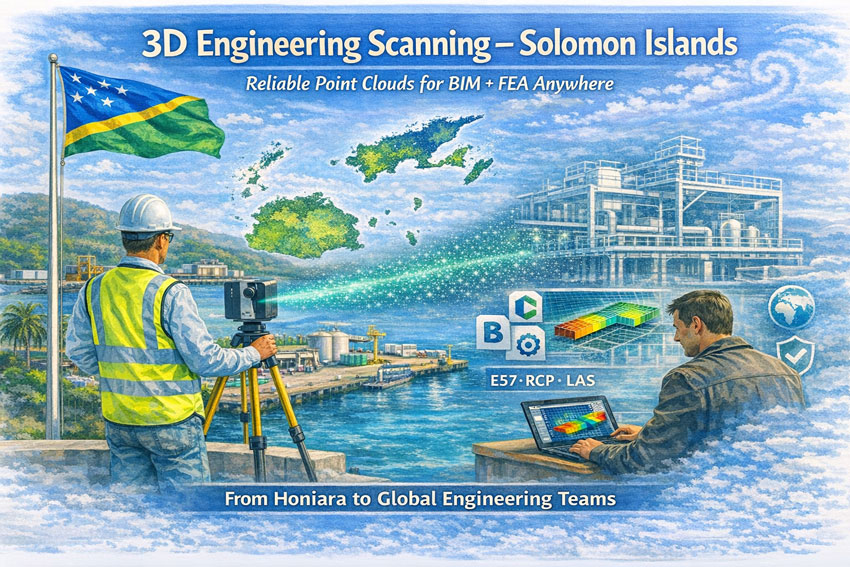
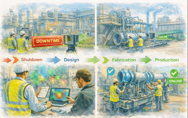
3D Engineering Scanning Solomon Islands – Point Clouds for BIM & FEA
Reliable Point Clouds for BIM, CAD & FEA Anywhere in the World
Hamilton By Design provides engineering-grade 3D laser scanning services across the Solomon Islands, delivering accurate point clouds that allow designers, engineers, and asset owners to work from real measured data—without the need to be on site.
From Honiara ports to remote island infrastructure, our scans create the digital backbone for modelling, analysis, and fabrication.
Engineering Data You Can Trust
Many assets in the Solomon Islands have:
limited or missing drawings
decades of informal modifications
corrosion from marine environments
cyclone and seismic exposure
mixed construction standards
Traditional measurement methods struggle in these conditions. Our 3D scanning service captures the true as-built condition so your team can:
create BIM and CAD models
perform structural and mechanical FEA
plan brownfields tie-ins
fabricate off-site with confidence
complete clash detection before shutdowns
We deliver open, neutral formats so engineers anywhere in Australia, New Zealand, Asia or Europe can immediately begin work.
What We Deliver
Core Outputs
Registered point clouds – E57 / RCP / LAS
Colourised engineering datasets
Site grid or project datum
Mesh models for Navisworks
2D plans, elevations and sections
Optional Engineering Deliverables
Scan-to-BIM models (LOD 200–350)
Steel and pipe geometry extraction
Tie-in coordinates for upgrades
Deformation and roundness reports
Clash and constructability reviews
All data is processed in Australia under formal QA so it can be relied upon for design approvals and FEA studies.
Designed for Solomon Islands Conditions
Scanning in the Solomons requires Pacific experience:
high heat and humidity
sudden tropical rain
reflective stainless and bright sunlight
inter-island logistics
remote power availability
cyclone season planning
Our workflows are built for efficient field capture with processing completed by our Australian engineering team.
Industries We Support
Honiara ports and marine infrastructure
Power generation and substations
Water and wastewater assets
Timber and processing facilities
Government and commercial buildings
Bridges and civil structures
Post-cyclone condition surveys
A Digital Backbone for Global Teams
A quality scan is the backbone of every downstream task. If the backbone is wrong, every model and FEA result is compromised.
Our service provides a foundation that:
removes re-measure risk
supports remote engineering
shortens shutdowns
improves safety and constructability
Designers anywhere in the world can open our data and begin work immediately.
Talk to Us About Your Solomon Islands Project
Whether you need a single building, a wharf, or a full plant captured, we can mobilise quickly and deliver data your team can trust.
Hamilton By Design Engineering certainty through 3D scanning.
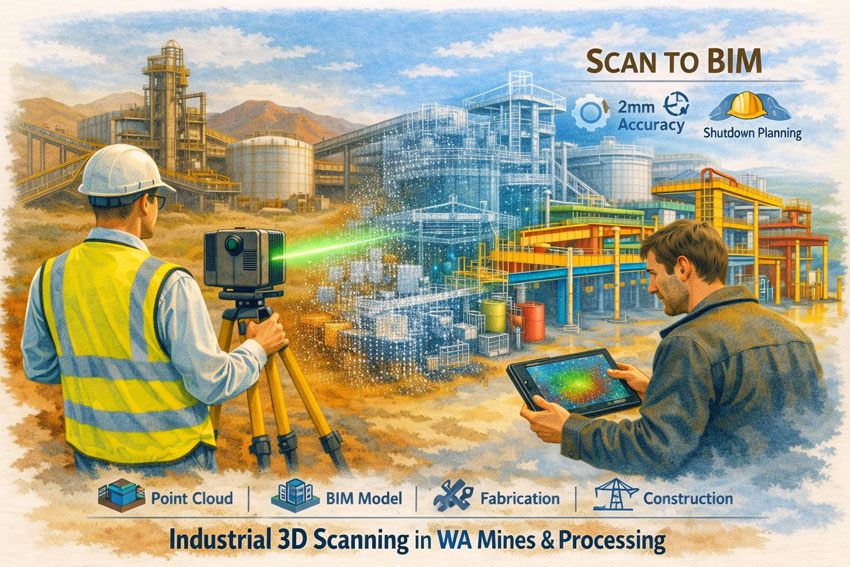
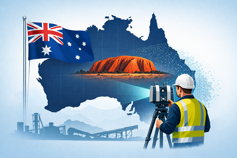
Industrial 3D Scanning in WA Mines & Processing | Scan-to-BIM
Building Engineering Certainty in Brownfield Environments
Western Australia’s mining and mineral processing sector operates some of the most complex industrial assets in the world. Aging infrastructure, continuous production demands, and aggressive expansion schedules mean that every engineering decision must be based on accurate, reliable information. Industrial 3D Scanning in WA Mines & Processing has become the foundation for achieving this certainty—providing precise digital representations of plants, structures, and equipment before a single drawing is issued.
The Backbone of Modern Mine Engineering
A laser scan is not simply a survey tool; it is the backbone of the entire project lifecycle. The quality of the initial scan determines the ease and accuracy of every task that follows—layout design, clash detection, fabrication, and construction. If the backbone is broken, even simple tasks become difficult. Poor capture leads to rework, fabrication errors, and costly shutdown delays.
Industrial 3D scanning captures millions of measured points across conveyors, tanks, structural steel, pipe racks, and mechanical equipment with millimetre accuracy. For WA mine sites where access is restricted and downtime is expensive, this technology removes guesswork and replaces assumptions with verified data.
The true value of scanning lies in what is delivered after capture. For mines and processing facilities, typical outputs include:
Engineering-grade point clouds for AutoCAD, Revit, and plant design platforms
Scan-to-BIM models of structures, pipework, and mechanical systems
Fabrication-ready DXF, STEP, or Parasolid files
Navisworks meshes for stakeholder review and constructability planning
As-built verification for shutdown and tie-in works
These deliverables allow engineering teams to design remotely, plan upgrades with confidence, and eliminate the need for repeated site visits across the vast distances of Western Australia.
Protecting the Project Team
Industrial projects are often pressured by schedules and budgets. High-quality 3D scanning protects the entire delivery team—project managers, engineers, designers, and fabricators—by providing an objective source of truth. When design decisions are based on measured reality rather than tape measures and sketches, disputes reduce and collaboration improves.
For brownfield WA sites with decades of undocumented modifications, scanning becomes the neutral reference that aligns contractors, owners, and operators around the same dataset.
Applications Across WA Mines & Processing
Industrial 3D Scanning in WA Mines & Processing supports a wide range of activities:
Shutdown planning and tie-in verification
Conveyor and chute upgrades
Tank and structural remediation
Pipe spool prefabrication
Access platform and maintenance improvements
Expansion of crushing and screening circuits
Safety and egress compliance reviews
Whether in the Pilbara iron ore operations, Goldfields processing plants, or nickel and lithium facilities, scanning reduces risk in some of Australia’s harshest and most remote environments.
Remote Doesn’t Mean Isolated
Western Australian mine sites can feel isolated, yet digital capture connects them directly to engineering teams anywhere in Australia. A single field visit can provide enough data for months of detailed design work. Teams can “walk the plant” virtually, measure clearances, and develop solutions without repeated flights or shutdown interruptions.
An Engineer-Led Approach
Effective scan programs must be led by engineers who understand how the data will be used. Capture strategies, target placement, and accuracy tolerances are defined around the BIM deliverables, not around the scanner. This ensures that the final models support fabrication, not just visualisation.
Industrial 3D Scanning in WA Mines & Processing is no longer optional—it is the starting point for safe, efficient, and predictable project delivery. When the backbone is strong, every downstream task becomes easier.
If your operation is planning upgrades, shutdowns, or expansions, begin with a measured digital foundation and let the data drive the outcome.
3D Laser Scanning New Caledonia | Hamilton By Design
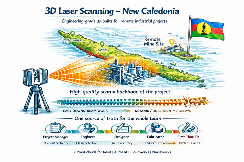
Engineering projects in New Caledonia operate in a unique environment. Nickel processing plants, port facilities, power stations and infrastructure are often decades old, heavily modified and located far from design offices. Accurate site information is the difference between a smooth project and an expensive lesson.
3D laser scanning has become the most reliable way to capture existing conditions across Nouméa, Koné and the remote mine sites of the Grande Terre. Instead of relying on tape measures and assumptions, LiDAR technology records millions of precise measurements to create a true digital twin of the asset.
The Challenge of Brownfields Projects in New Caledonia
Many facilities in New Caledonia share the same constraints:
Limited shutdown windows
Corrosive coastal environments
Historical modifications with poor drawings
Logistics that make repeat site visits costly
Multi-discipline coordination between local and overseas teams
Traditional survey methods struggle to capture congested pipe racks, structural steel distortions or equipment that has shifted over time. When drawings do not match reality, fabrication delays and site rework quickly follow.
The Scan Is the Backbone of the Project
The initial scan quality sets the tone for every task that follows. The point cloud becomes the backbone of the project—design, detailing, fabrication and construction all rely on it.
If you start with a broken backbone, you will have problems everywhere else:
Simple tasks become difficult
Measurements are questioned
models need rework
fabricators lose confidence
schedules start to slip
A clean, well-registered scan makes coordination easy. A poor scan multiplies effort for every member of the team.
Protecting the Whole Project Team
3D laser scanning is not just about creating a model—it is about protecting everyone involved:
Project managers who must control time and cost
Engineers responsible for safe and compliant designs
Designers and draftspersons who need reliable geometry
Fabricators who must build components that fit
Construction crews who install the work on short shutdowns
When the as-built data is right, the entire chain works with confidence. When it is wrong, every discipline inherits the problem.
How 3D Laser Scanning Changes the Outcome
A terrestrial laser scanner captures a complete point cloud of the site in hours rather than weeks. The data can then be used for:
Accurate as-built models for upgrades and expansions
Tie-in design for new conveyors, tanks and platforms
Structural verification of aging infrastructure
Clash detection before fabrication
Shutdown planning and risk reduction
Asset documentation for long-term maintenance
For New Caledonian projects, the biggest benefit is capture once, design anywhere. Local scanning crews can collect the data while engineering teams in Australia or New Zealand work from the same digital environment without further travel.
Typical Applications Across New Caledonia
Mining & Processing
Nickel plant upgrades
Conveyor replacements
Chute and transfer redesign
Tank and thickener modifications
Access platforms and walkways
Ports & Infrastructure
Wharf structural assessments
Ship loader interfaces
Pipe bridges and services
Electrical and control building upgrades
Energy & Utilities
Power station retrofits
Water treatment facilities
Fuel storage terminals
From Point Cloud to Deliverables
A professional workflow generally includes:
On-site LiDAR capture with survey control
Registration and quality assurance
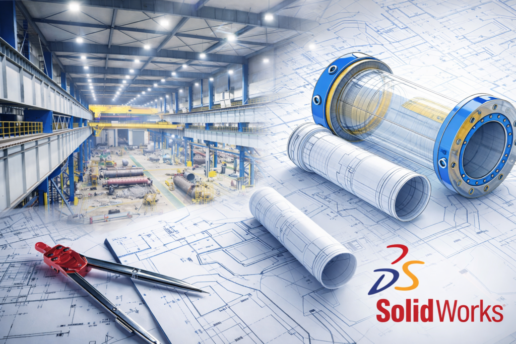
Creation of usable formats for Revit, AutoCAD, SolidWorks or Navisworks
Extraction of models, drawings or clash reports
Ongoing support during fabrication and installation
The result is engineering data you can trust—without the need for multiple trips to site.
Ready to De-Risk Your Project?
Whether your project is in Nouméa, Koné or a remote mine site, 3D laser scanning provides the foundation for safe, predictable and efficient engineering. Get the backbone right at the start and the rest of the project becomes easier.
Mobile 3D LiDAR Scanning Services Melbourne | Engineering-Grade Capture
Melbourne’s industrial landscape is built on decades of growth—factories expanded in stages, plant modified during shutdowns, and buildings adapted to new processes. The challenge today is that many of these facilities no longer match their original drawings.
Mobile 3D LiDAR scanning services solve that problem by capturing the site exactly as it exists, providing engineers, designers, and fabricators with reliable data to work from—without guesswork.
At Hamilton By Design we bring engineering-grade reality capture directly to your Melbourne site. Our mobile LiDAR workflows are designed to support real projects: shutdown upgrades, conveyor installations, brownfield modifications, and compliance documentation.
Capture the Real Site – Not an Assumption
Traditional measuring methods struggle in complex industrial environments. Pipe bridges, mezzanines, mixed generations of equipment, and tight access areas make manual measurement risky and inaccurate.
Mobile LiDAR scanning delivers:
Millimetre-level point clouds of structures and equipment
Accurate tie-in points for new installations
Clearance checks for conveyors, elevators, and pipework
As-built records for compliance and asset management
Digital twins ready for design and clash detection
One site visit can capture more information than weeks of manual survey.
A Service Built for Melbourne Industry
From the inner west manufacturing belt to the northern logistics hubs and south-east processing plants, Melbourne projects share common pressures:
Short shutdown windows
Ageing plant with incomplete drawings
Multiple contractors working in the same space
Increasing safety and compliance requirements
Our mobile 3D LiDAR scanning services are structured to fit these realities. Most sites can be captured in a single day with minimal disruption to operations. Extra detail is focused around critical interfaces so new equipment fits first time.
Engineering First – Scanning With Purpose
We are not just data collectors. Hamilton By Design is an engineering business that uses scanning as the foundation for practical outcomes.
From a Melbourne scan we can deliver:
Registered point clouds in industry formats
AutoCAD & SOLIDWORKS models
General arrangement drawings
Fabrication-ready models
Clash and tolerance reports
Documentation for Safe Design reviews
Because the team understands fabrication and installation, the data is captured with the end goal in mind—equipment that bolts in without rework.
Applications Across Melbourne
Mobile LiDAR scanning supports a wide range of sectors:
Food & beverage processing
Recycling and resource recovery
Warehousing and logistics
Water & wastewater facilities
Manufacturing upgrades
Conveyor and bulk handling
Heritage building retrofits
Vehicle and specialised fit-outs
Whether it’s a small workshop in Dandenong or a complex plant in the western suburbs, the approach is the same: capture once, design with confidence.
Reduce Risk Before You Build
The cost of getting measurements wrong is far higher than the cost of a scan:
Delayed shutdowns
Steel that doesn’t fit
Emergency redesigns
Additional crane and labour hire
Compromised safety outcomes
Mobile 3D LiDAR scanning removes those uncertainties at the start of the project, giving Melbourne businesses control over time, budget, and risk.
Booking & Delivery
One day onsite is typically sufficient for most facilities
Registered point cloud delivered promptly
CAD outputs tailored to your design platform
50% deposit with purchase order, balance on delivery
Our calendar fills quickly around Melbourne shutdown periods—early booking ensures your project stays on track.
Talk to an Engineering-Led Scanning Team
If you’re planning an upgrade or need accurate as-builts in Melbourne, let’s capture the site properly before design begins.
Hamilton By Design – Mobile 3D LiDAR Scanning Services Engineering-grade capture for real industrial projects.
Mobile 3D Scanning Services | Onsite LiDAR for Regional Australia
When a project is outside the major cities, access to accurate engineering data can be the difference between a smooth upgrade and an expensive mistake. Mobile 3D scanning services bring high-accuracy LiDAR and reality capture directly to your site—whether that’s a regional workshop, a mine in the outback, a water treatment plant, or a small manufacturing facility in a local town.
At Hamilton By Design, our approach is simple: we come to you, capture the site as it really exists, and convert that data into build-ready CAD and point clouds that engineers, fabricators, and asset owners can rely on.
What Are Mobile 3D Scanning Services?
Mobile 3D scanning means deploying professional laser scanners and engineering workflows on location, not in a lab or office. Instead of measuring with tape, sketches, and guesswork, we capture millions of precise points that represent:
Structural steel and concrete
Pipework and mechanical equipment
Conveyor systems and bulk handling plant
Buildings, workshops, and brownfield sites
Vehicles, tanks, and custom machinery
The result is a digital twin of your asset that can be used for design, fabrication, clash detection, and maintenance planning—without repeated site visits.
Perfect for Smaller Towns and Regional Projects
Regional businesses often face the same challenges:
Limited access to specialist surveyors
Old drawings that don’t match reality
Upgrades carried out over decades
Shutdown windows that are tight and costly
Our mobile service is designed for these exact conditions. We regularly travel to local towns, industrial hubs, and remote facilities to provide the same level of engineering capture normally reserved for major city projects.
Whether you’re in the Central Coast, Mount Isa, Broken Hill, Bathurst, Rockhampton, or anywhere in between, we can mobilise quickly and deliver professional data without the need for you to bring contractors from multiple companies.
How the Process Works
1. One Day Onsite – Minimal Disruption
Most projects can be captured in a single day. We position the scanner, record high-resolution point clouds, and focus extra detail around critical tie-in points.
2. Registered Point Cloud
Back in the office we register and clean the data into a single accurate model referenced to real-world coordinates.
3. Engineering Deliverables
From that scan we can provide:
Registered point cloud files
PDF site layouts
AutoCAD / SOLIDWORKS models
Fabrication drawings
Clash and tolerance checks
Because we are engineers first—not just surveyors—the outputs are created with practical fabrication and construction in mind.
Why Mobile Scanning Beats Traditional Measuring
✔ No more hand sketches that don’t fit
✔ Reduce rework during shutdowns
✔ Design directly to existing conditions
✔ Accurate tie-ins for conveyors, elevators, pipework
✔ Evidence for compliance and asset records
✔ Faster quoting for fabricators
For small towns where every hour counts and access is limited, this approach removes uncertainty before a single piece of steel is cut.
Industries We Support
Our mobile 3D scanning services are commonly used for:
CHPP and mining upgrades
Local manufacturing plants
Food and beverage facilities
Water and wastewater sites
Sawmills and timber processing
Vehicle and van fit-outs
Heritage and retrofit projects
Conveyor and bucket elevator installations
No site is too small—if it needs to fit first time, scanning makes sense.
Book Early – Our Calendar Fills Fast
Regional shutdowns and plant upgrades often happen at the same time of year. Booking early ensures:
Availability when your site is ready
Data delivered before design deadlines
Your project stays on track
We typically work on a 50% deposit with purchase order and balance on delivery of the registered point cloud and agreed outputs.
Let’s Capture Your Site – Wherever It Is
If you’re planning an upgrade in a smaller town or regional facility, talk to a team that understands both engineering and scanning.
Call Hamilton By Design www.hamiltonbydesign.com.au 📍 Servicing Sydney, Central Coast, Bathurst, Broken Hill, Perth, Mount Isa and regional Australia
Mobile 3D scanning services—bringing city-level engineering to every local town.
Every Shutdown Matters – FARO LiDAR for As-Built Scanning
In heavy industry, a shutdown is not just another project milestone — it is the most expensive window on the calendar. Production stops, contractors mobilise, and every hour has a dollar value attached. When something does not fit, the cost is immediate and visible. This is why every shutdown matters, and why the approach to measurement and design before the outage has become critical.
Traditional site measurement relies on tape measures, sketches, and assumptions about existing conditions. In brownfield environments those assumptions are often wrong. Steel moves, plant is modified without drawings, and tolerances stack up over decades. Engineering-led 3D scanning, particularly using FARO terrestrial LiDAR for as-built capture, has changed the way shutdowns are planned and delivered.
From Guesswork to Measured Reality
A terrestrial LiDAR scanner captures millions of accurate points across an entire facility. Instead of a handful of manual dimensions, designers receive a complete digital replica of the plant — every beam, pipe, handrail and obstruction recorded in context. The result is a point cloud that becomes the single source of truth for engineering decisions.
The difference between scanning and traditional measurement is not just accuracy; it is completeness. A fitter with a tape can only measure what they think is relevant. A LiDAR scan measures everything, including the issues no one knew to look for: misaligned bases, out-of-square structures, undocumented modifications and clearance problems that would otherwise appear during the shutdown itself.
When this data is managed by engineers rather than survey technicians alone, it becomes more than a pretty model — it becomes a design tool.
Engineering-Led Scanning
Scanning by itself does not deliver value. The benefit comes when point clouds are interpreted through an engineering lens:
What tolerances actually matter?
Which surfaces are datums and which are cosmetic?
Where will fabrication interfaces occur?
How will the new design be installed within the shutdown sequence?
At Hamilton By Design we approach LiDAR capture as part of the engineering workflow, not a separate service. FARO scans are registered, cleaned and aligned to suit the specific design task — whether that is a conveyor upgrade, pump replacement, structural modification or access platform.
The aim is simple: design once, fit first time.
FARO LiDAR for As-Built Confidence
FARO terrestrial scanners are built for industrial environments. They capture long-range, high-density point clouds that allow designers to work with real conditions rather than idealised drawings. Typical applications include:
As-built capture of processing plants and mine infrastructure
Pipework routing and clash detection
Structural modifications and tie-ins
Equipment change-outs and baseplate verification
Access and safety improvements
By modelling new work directly over the point cloud, engineers can test installation paths, crane clearances and maintenance access long before the shutdown begins. Fabrication drawings are generated from a model that already “fits” the site.
The Cost of Getting It Wrong
During outages the smallest oversight becomes expensive:
A pipe spool 20 mm too long
A bracket that fouls an existing conduit
A motor base drilled to the wrong PCD
A platform clash discovered after hot works have started
Each of these problems triggers rework, additional labour, hot work permits and schedule delays. The true cost is rarely the part itself — it is the lost hours in the critical path.
Engineering-led LiDAR scanning attacks these risks at the source. By understanding existing geometry before fabrication begins, contractors arrive on site with components that have already been proven digitally.
Complementing LiDAR with Object Scanning
Large-scale LiDAR captures the plant; structured-light scanners such as EinScan capture the individual components within it. Motors, guards, cast housings and legacy parts can be digitised on the bench and integrated back into the LiDAR model. This two-tool approach supports:
Reverse engineering of obsolete components
Design of adapters and mounting brackets
Verification of replacement equipment
Creation of accurate fabrication models
The result is a seamless path from reality capture to parametric CAD in Fusion 360 or SolidWorks — guided by engineering intent rather than raw mesh data.
Planning the Shutdown Backwards
Successful outages are designed backwards from the installation day. FARO as-built scanning supports this process:
Pre-shutdown capture – full LiDAR survey of affected areas
Engineering modelling – new design built over the point cloud
Workshop fabrication – components manufactured to verified geometry
Dry fit digitally – clash and access checks completed
By the time the shutdown begins, the unknowns have been removed. Crews are executing a plan rather than solving problems in real time.
More Than Measurement
LiDAR point clouds are also powerful communication tools. Maintenance teams, project managers and contractors can visualise the work in context, improving safety and coordination. Decisions that once required multiple site visits can be made from the office with confidence.
For organisations moving toward digital twin strategies, as-built scans provide the foundation layer — an accurate spatial framework that future projects can reference.
Why Every Shutdown Matters
In mining, manufacturing and energy sectors the shutdown window defines the success of the year. Budgets are tight, schedules are fixed, and tolerance for rework is zero. Engineering-led scanning recognises that reality capture is not an optional extra; it is risk management.
FARO LiDAR for as-builts delivers:
Reduced site hours
Fewer fabrication errors
Safer installation planning
Better collaboration between design and maintenance
Confidence that new work will integrate with old
Most importantly, it respects the fact that every shutdown matters.
Talk to Us
Hamilton By Design provides engineering-led LiDAR scanning across Sydney, the Central Coast and regional Australia, supporting brownfield upgrades, shutdown planning and reverse engineering.
If you’re preparing for an outage or plant modification, speak with our team about capturing accurate as-builts before the clock starts ticking.
To provide the best experiences, we use technologies like cookies to store and/or access device information. Consenting to these technologies will allow us to process data such as browsing behaviour or unique IDs on this site. Not consenting or withdrawing consent, may adversely affect certain features and functions.
Functional
Always active
The technical storage or access is strictly necessary for the legitimate purpose of enabling the use of a specific service explicitly requested by the subscriber or user, or for the sole purpose of carrying out the transmission of a communication over an electronic communications network.
Preferences
The technical storage or access is necessary for the legitimate purpose of storing preferences that are not requested by the subscriber or user.
Statistics
The technical storage or access that is used exclusively for statistical purposes.The technical storage or access that is used exclusively for anonymous statistical purposes. Without a subpoena, voluntary compliance on the part of your Internet Service Provider, or additional records from a third party, information stored or retrieved for this purpose alone cannot usually be used to identify you.
Marketing
The technical storage or access is required to create user profiles to send advertising, or to track the user on a website or across several websites for similar marketing purposes.