Engineer-Led 3D Laser Scanning, CAD Modelling and Mechanical Engineering for Port Assets
Port infrastructure operates under demanding mechanical, environmental and operational conditions.
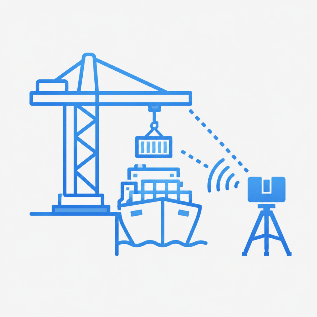
Ship loaders, conveyors, transfer chutes, hoppers, pipework, access platforms, wharf equipment and structural support systems must operate reliably while being exposed to vibration, corrosion, abrasive materials, heavy loads and continuous production demands.
When these assets require modification, replacement or refurbishment, engineering decisions need to be based on accurate information about the equipment and surrounding site conditions.
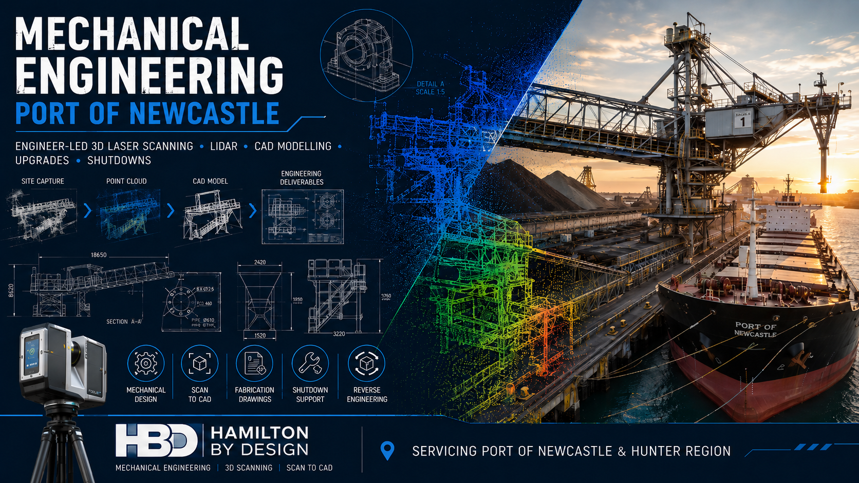
Hamilton By Design provides mechanical engineering services for Port of Newcastle projects, combining engineering-grade 3D laser scanning, LiDAR reality capture, Scan to CAD, mechanical design and fabrication documentation.
Our integrated approach helps port operators, terminal operators, consultants, contractors and fabricators plan upgrades and shutdown work around the actual installed condition of the facility.
Mechanical Engineering for Port of Newcastle Assets
The Port of Newcastle contains a broad mix of coal, bulk-material, liquid-bulk, general-cargo, fuel, rail and logistics infrastructure. Its operating facilities include coal terminals, bulk-liquid terminals, storage areas, road and rail connections, multipurpose berths and associated materials-handling equipment.
Mechanical-engineering support may be required for assets such as:
- Ship loaders and unloaders
- Belt conveyors
- Transfer stations
- Chutes and hoppers
- Feeders and gates
- Pipework and pumping systems
- Mechanical skids
- Wharf-mounted equipment
- Crane interfaces
- Access platforms and walkways
- Machine guards
- Dust-extraction systems
- Equipment supports
- Maintenance lifting systems
- Replacement components
Hamilton By Design can support these projects from initial site capture through to CAD modelling, engineering development and fabrication drawings.
Why Port Engineering Projects Need Accurate Existing-Condition Data
Port facilities frequently contain equipment that has been modified over many years.
An asset may have been:
- Repaired
- Reinforced
- Relocated
- Replaced
- Extended
- Distorted
- Worn
- Supplemented with additional steelwork
- Modified without corresponding drawing updates
Original drawings remain useful, but they may not represent the current physical arrangement.
Hamilton By Design uses engineering-grade 3D scanning in Newcastle to capture the visible position and geometry of existing equipment, structures and services.
The registered point cloud can then provide a reliable basis for mechanical design, fit-up checks, installation planning and engineering studies.
Engineer-Led 3D Laser Scanning
A useful port scan requires more than simply positioning a scanner on site.
The capture should be planned around the engineering purpose of the project.
Before scanning, we consider:
- The proposed modification
- Critical tie-in points
- Required accuracy
- Equipment interfaces
- Access restrictions
- Installation routes
- Crane and lifting requirements
- Areas requiring detailed modelling
- File-format requirements
- Coordinate-control requirements
This helps ensure that the point cloud captures the information required by the engineers, designers and fabricators who will use it.
Our existing 3D Scanning Port of Newcastle service supports port infrastructure, ship loaders, conveyors, structural steel, shutdowns and brownfield upgrades.
Mechanical Design for Brownfield Port Upgrades
Most port engineering projects are brownfield projects.
New equipment must be designed around existing structures, platforms, pipework, conveyors, electrical services and operating assets.
Even a small dimensional error can cause:
- Fabrication rework
- Site cutting and welding
- Installation delays
- Additional crane time
- Extended isolations
- Access problems
- Unexpected clashes
- Increased shutdown costs
- Increased safety exposure
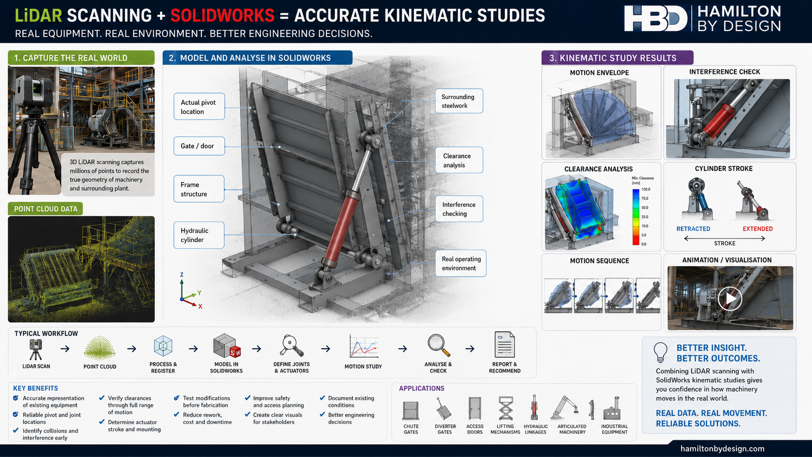
By combining LiDAR point-cloud data with CAD modelling, proposed components can be developed within the measured site environment.
This allows the engineering team to consider:
- Whether the new equipment will fit
- Whether adequate maintenance access exists
- Whether removal paths are available
- Whether surrounding infrastructure creates a clash
- Whether fabricated sections can reach their installation location
- Whether lifting and installation sequences are practical
Ship Loader and Conveyor Engineering
The Port of Newcastle includes extensive bulk-handling and coal-export infrastructure, including conveyors, stockyard systems and ship-loading equipment.
Hamilton By Design can support projects involving:
- Ship-loader chute modifications
- Conveyor replacements
- Transfer-station upgrades
- Skirt and sealing improvements
- Deflector plates
- Wear-liner arrangements
- Access-platform modifications
- Maintenance walkways
- Equipment-support frames
- Guarding upgrades
- Dust-control improvements
- Replacement mechanical components
The point cloud can provide the surrounding structural and mechanical context needed to design new equipment accurately.
Chutes, Hoppers and Materials-Handling Equipment
Transfer chutes and hoppers are exposed to abrasive material flow, impact, blockage, dust and wear.
Mechanical-engineering work may include:
- Existing-condition assessment
- Chute geometry review
- Wear-liner replacement
- Impact-zone modifications
- Flow-path improvements
- Deflector and spoon design
- Access-door upgrades
- Dust-sealing improvements
- Support-frame modifications
- Fabrication drawing development
LiDAR scanning can capture both the materials-handling equipment and the surrounding support structure.
This can be particularly useful where the equipment is elevated, congested or difficult to measure manually.
Pipework and Mechanical Services
Port terminals may contain fuel, water, compressed-air, hydraulic, lubrication, dust-suppression and process-pipe systems.
Mechanical-engineering and Scan to CAD support can assist with:
- Pipe-routing modifications
- Pump and valve replacements
- New branch connections
- Flange and nozzle location capture
- Pipe-support design
- Mechanical-skid installation
- Access and maintenance reviews
- Clash detection
- Replacement spool planning
- Existing-condition documentation
Accurate scanning of tie-in points can reduce uncertainty when designing pipe spools and replacement equipment.
Structural Interfaces and Access Systems
Mechanical modifications frequently connect to structural steel.
Hamilton By Design can capture and model:
- Beams and columns
- Equipment-support frames
- Platforms
- Stairs
- Walkways
- Handrails
- Ladders
- Guarding
- Connection points
- Existing foundations
This information can support mechanical arrangement design and coordination with structural engineers and fabricators.
Our Kooragang and Carrington industrial scanning and engineering service is particularly relevant to projects within Newcastle’s port and heavy-industrial precincts.
Shutdown Engineering Support
Port shutdowns may have tightly controlled work windows.
A delay caused by missing measurements, an unexpected clash or incorrect fit-up can affect labour, crane bookings, contractors and the return-to-service schedule.
Hamilton By Design can support shutdown preparation through:
- Pre-shutdown LiDAR scanning
- Existing-condition verification
- Work-pack drawing development
- Removal-path studies
- Installation-sequence reviews
- Crane and lifting-layout support
- Fit-up checks
- Clash detection
- Temporary-access planning
- Demolition planning
- Fabrication documentation
The digital site record also allows engineering teams, fabricators and contractors to review the work area remotely before mobilisation.
Scan to CAD for Mechanical Engineering
Registered point-cloud information can be converted into practical CAD geometry.
Depending on the project, deliverables may include:
- Existing-condition models
- Mechanical-equipment models
- Conveyor models
- Chute and hopper models
- Structural interfaces
- Pipework models
- Equipment envelopes
- Platform and access models
- General-arrangement drawings
- Plans, sections and elevations
- Fabrication-support models
- Installation-planning models
Hamilton By Design can prepare models using:
- SolidWorks
- AutoCAD
- Autodesk Inventor
- Navisworks-compatible formats
- STEP
- SAT
- Parasolid
- DWG
- DXF
The level of detail is matched to the engineering objective. A project does not necessarily require every visible object to be modelled.
Mechanical Engineering Studies
Point-cloud data can support a range of engineering studies for port assets.
These may include:
- Existing-condition studies
- Drawing-verification studies
- Fit-up assessments
- Equipment-clearance studies
- Maintenance-access reviews
- Constructability assessments
- Wear and erosion studies
- Deformation assessments
- Refurbishment planning
- Reverse-engineering studies
- Remaining-service-life investigations
- Incident and damage documentation
- As-built verification
The scanning scope can be targeted to the equipment and interfaces relevant to the study.
Reverse Engineering of Port Equipment
Original manufacturing drawings may be unavailable for older port equipment.
Hamilton By Design can use 3D scanning and physical inspection to support the reconstruction of:
- Chute components
- Guards
- Covers
- Housings
- Duct sections
- Equipment brackets
- Support frames
- Wear plates
- Mechanical interfaces
- Replacement components
The scan data can be combined with manual measurements and engineering judgement to develop replacement CAD geometry.
Learn more about our reverse engineering with 3D scanning services.
Fabrication and Fit-Up Support
Mechanical-engineering projects often succeed or fail at the physical interface between new and existing equipment.
Scan-derived CAD models can support:
- Fabrication-ready geometry
- General-arrangement drawings
- Shop and detail drawings
- Interface checking
- Bolt and flange alignment
- Equipment fit checks
- Structural connection coordination
- Installation planning
- Clash detection
- As-built verification
This approach helps reduce the risk that fabricated equipment will require extensive modification after arriving on site.
As-Built Verification
After installation, selected equipment and infrastructure may be rescanned.
The scan can be compared with the design model to assess:
- Installed position
- Equipment orientation
- Pipe routing
- Structural alignment
- Clearances
- Interface locations
- Construction tolerances
- Differences from the approved design
The updated information can also support future maintenance, asset management and modification work.
Mechanical Engineering for Asset Maintenance
The Port of Newcastle operates a large and complex infrastructure portfolio requiring ongoing maintenance, lifecycle planning and coordination around operational continuity.
Hamilton By Design can support maintenance-related work through:
- Asset-condition capture
- Replacement-component modelling
- Equipment modification design
- Maintenance-access improvements
- Guarding and safety upgrades
- Drawing updates
- Reverse engineering
- Wear assessment
- Refurbishment planning
- Shutdown documentation
The result is a more reliable connection between field conditions, engineering decisions and maintenance execution.
Our Project Workflow
1. Scope Definition
We establish:
- Project objective
- Equipment to be scanned
- Required accuracy
- Critical interfaces
- Deliverables
- Site constraints
- Required CAD formats
- Engineering responsibilities
2. Site and Safety Planning
Port projects may require consideration of:
- Site inductions
- Maritime-security requirements
- Work permits
- Traffic management
- Vessel movements
- Crane operations
- Operating conveyors
- Work near water
- Exclusion zones
- Shutdown and isolation requirements
3. LiDAR Capture
Multiple scan positions are selected to capture the equipment, surrounding structures and important tie-in points.
4. Point-Cloud Registration
Individual scans are aligned into a coordinated point cloud and reviewed for coverage and registration quality.
5. CAD Modelling
Relevant geometry is converted into fit-for-purpose mechanical and structural CAD information.
6. Mechanical Engineering
The measured model is used to support design, assessment, equipment modification, fit-up review or drawing development.
7. Project Delivery
Final files and documentation are issued in the agreed formats.
Available Deliverables
Project deliverables may include:
- Registered point clouds
- E57 files
- RCP and RCS files
- LAS files
- AutoCAD DWG drawings
- DXF files
- SolidWorks parts and assemblies
- Autodesk Inventor models
- STEP files
- SAT files
- Parasolid files
- General-arrangement drawings
- Plans, sections and elevations
- Fabrication drawings
- Existing-condition reports
- Engineering-study documentation
- As-built models
Benefits for Port Operators
Mechanical engineering supported by LiDAR scanning can provide:
- More reliable existing-condition information
- Reduced reliance on outdated drawings
- Fewer repeated site visits
- Better shutdown preparation
- Improved design coordination
- Earlier clash identification
- Reduced fabrication uncertainty
- Improved installation planning
- Better asset documentation
- A reusable digital site record
Benefits for Engineers and Consultants
Engineering teams can use the captured data to:
- Design around measured geometry
- Review mechanical and structural interfaces
- Develop accurate layouts
- Assess maintenance access
- Produce sections through congested areas
- Review constructability
- Reduce assumptions
- Coordinate multiple disciplines
- Prepare fabrication documentation
- Communicate modifications clearly
Benefits for Fabricators and Contractors
Fabricators and contractors can benefit from:
- Better-defined interfaces
- Improved fit-up confidence
- Clearer fabrication drawings
- Reduced dimensional uncertainty
- Better lifting and installation planning
- Fewer unexpected site modifications
- Reduced rework
- Better shutdown coordination
Port of Newcastle Areas Serviced
Hamilton By Design can support projects throughout:
- Port of Newcastle
- Kooragang Island
- Carrington
- Mayfield
- Mayfield West
- Walsh Point
- Steel River
- Newcastle
- Lower Hunter
- Hunter Valley
- Greater Newcastle
- Regional New South Wales
Access remains subject to the requirements of the relevant port operator, terminal operator, asset owner or site controller.
Why Choose Hamilton By Design?
Hamilton By Design combines:
- Mechanical-engineering capability
- Trade and fabrication experience
- Engineering-grade LiDAR scanning
- Point-cloud processing
- Scan to CAD
- SolidWorks modelling
- AutoCAD drafting
- Structural and mechanical detailing
- Reverse engineering
- Brownfield-design experience
- Shutdown and installation planning
Our Mayfield West and Steel River engineering services and broader Newcastle 3D scanning capability demonstrate this integrated local approach.
Frequently Asked Questions
What mechanical-engineering services can you provide for port assets?
Services may include site scanning, mechanical design, equipment modification, Scan to CAD, reverse engineering, fabrication drawings, access reviews, clash detection and shutdown support.
Can you scan operating port equipment?
In many cases, yes. LiDAR scanning is non-contact, although work must be coordinated with site operations, permits, exclusion zones and relevant safety controls.
Can the point cloud be converted into SolidWorks?
Yes. Relevant scan geometry can be used to develop SolidWorks parts, assemblies, layouts and fabrication documentation.
Can you scan conveyors and ship loaders?
Yes. LiDAR scanning can capture conveyor systems, ship loaders, chutes, transfer stations, support structures and surrounding infrastructure.
Can the scan support a shutdown?
Yes. Pre-shutdown scanning can support planning, fit-up checks, clash detection, work-pack drawings, installation sequencing and contractor coordination.
Can you design replacement components?
Hamilton By Design can support reverse engineering and replacement-component development where suitable site data, measurements and engineering information are available.
Can existing drawings be checked against the scan?
Yes. Existing drawings or CAD models can be compared with the measured point cloud to identify differences from actual site conditions.
Do all projects require a complete CAD model?
No. Some projects need only registered point-cloud data, while others require targeted modelling, detailed drawings or engineering analysis.
Discuss a Port of Newcastle Mechanical Engineering Project
Reliable port engineering begins with accurate information about the existing asset.
Hamilton By Design provides engineer-led 3D laser scanning, LiDAR reality capture, CAD modelling and mechanical engineering for Port of Newcastle assets, upgrades and shutdowns.
Whether the project involves a ship loader, conveyor, transfer chute, platform, pipework system, mechanical skid or broader terminal upgrade, the scanning and engineering scope can be tailored to the required outcome.
Contact Hamilton By Design to discuss mechanical engineering and 3D scanning support for your Port of Newcastle project.

Contact Us – Talk To Us
Our clients: