


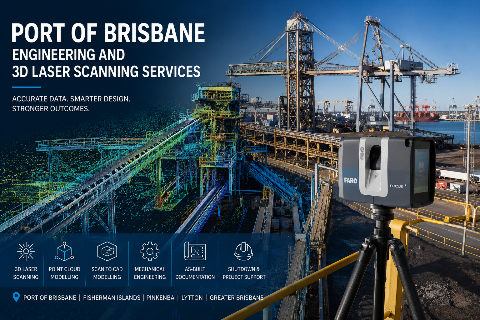
Port of Brisbane Engineering and 3D Laser Scanning Services
Engineer-Led LiDAR Scanning, Mechanical Design and As-Built Documentation for Brisbane Port Facilities
The Port of Brisbane is a major multi-cargo port supporting container handling, general cargo, motor vehicles, roll-on/roll-off operations, bulk commodities, warehousing and associated logistics activities. Its terminals and industrial precincts contain a complex mix of wharves, cranes, conveyors, storage systems, buildings, roads and mechanical infrastructure.
Hamilton By Design provides engineering and 3D laser scanning services for projects at and around the Port of Brisbane, Fisherman Islands, Pinkenba, Lytton and surrounding Brisbane industrial areas.
Our services combine engineering-grade LiDAR scanning with mechanical engineering, point-cloud processing, reverse engineering, 3D CAD modelling and fabrication-ready drafting.
This integrated approach allows port operators, terminal operators, engineering consultants, maintenance teams, contractors and fabricators to work from reliable existing-condition information rather than incomplete drawings or manually measured approximations.
Accurate site capture, engineering-ready point clouds and practical design documentation for complex port and industrial environments.
Engineering Services for Port of Brisbane Projects
Port facilities are continually maintained, upgraded and modified. Original drawings may no longer accurately represent what is physically installed because of previous repairs, plant modifications, equipment replacements and undocumented site changes.
Traditional measurement can also be difficult where equipment is:
- Large or geometrically complex
- Installed above conveyors or operating machinery
- Surrounded by structural steel, services or pipework
- Close to wharves or exposed water edges
- Located within active vehicle or cargo-handling areas
- Accessible only during a planned shutdown
- Difficult to measure safely using tapes and hand tools
Our 3D scanning services in Brisbane capture millions of spatial measurements from multiple scanner positions to create a detailed three-dimensional record of the facility.
The resulting point cloud can support engineering, design, verification, fabrication, construction planning and maintenance without relying solely on repeated site measurements.
Port of Brisbane 3D Laser Scanning
Hamilton By Design uses terrestrial LiDAR scanning to document the visible geometry of port infrastructure, industrial equipment and surrounding structures.
Our broader Brisbane 3D scanning service can be applied to projects involving:
- Container-terminal infrastructure
- General-cargo facilities
- Bulk-material handling systems
- Conveyor systems
- Transfer stations
- Hoppers and bins
- Chutes and wear liners
- Wharves and berths
- Crane rails and support structures
- Loading and unloading equipment
- Maintenance platforms
- Stairs and handrails
- Pipework and mechanical services
- Warehouses and workshops
- Equipment foundations
- Roads, hardstands and vehicle clearances
- Marine and waterfront infrastructure
The captured point cloud provides a measurable digital representation of the existing area. Engineers, designers and project personnel can navigate the dataset, extract measurements and review spatial relationships after the site visit.
For projects requiring engineering or fabrication decisions, our approach is based on collecting the right information for the intended purpose—not simply creating the largest possible point cloud. This principle is explained further in Not All Scans, Point Clouds or Meshes Are Equal.
Existing-Condition and As-Built Documentation
Accurate existing-condition information is particularly important when new equipment must connect to older port infrastructure.
Hamilton By Design can use registered scan data to prepare:
- Existing-condition plans
- General arrangement drawings
- Floor plans
- Sections and elevations
- Structural-steel layouts
- Equipment-location drawings
- Pipe and service layouts
- Interface drawings
- Clearance envelopes
- Dimensional verification drawings
- Three-dimensional as-built models
Our engineering-grade 3D point-cloud scanning service in Brisbane can help verify existing geometry, identify spatial constraints and create an accurate foundation for proposed modifications.
Scan-to-CAD Modelling
A registered point cloud contains valuable measurement information, but many engineering projects also require usable CAD geometry.
Hamilton By Design can convert selected point-cloud information into models representing:
- Structural steel
- Mechanical equipment
- Conveyor assemblies
- Chutes and transfer stations
- Platforms and access systems
- Pipework and services
- Machinery guards
- Buildings and industrial rooms
- Equipment foundations
- Proposed replacement components
Depending on the project requirements, deliverables may include:
- SolidWorks models
- Autodesk Inventor models
- AutoCAD drawings
- STEP files
- SAT files
- Parasolid files
- DWG files
- DXF files
- Navisworks-compatible coordination models
- Registered E57 point clouds
- Autodesk RCP or RCS files
- LAS point-cloud files
The level of modelling can be matched to the intended project outcome, whether the client requires general spatial coordination, detailed reverse engineering or fabrication documentation.
Mechanical Engineering for Port Infrastructure
Hamilton By Design provides mechanical-engineering support for port, logistics, industrial and materials-handling projects.
Our services can include:
- Existing-equipment assessments
- Engineering studies
- Concept and feasibility development
- Mechanical arrangement design
- Conveyor modifications
- Transfer-chute design
- Hopper and bin modifications
- Machine-guarding design
- Maintenance-access improvements
- Equipment replacement planning
- Platforms, stairs and handrails
- Structural-support concepts
- Reverse engineering
- Wear and erosion assessments
- Design verification
- Fabrication drawings
- Installation planning
- Shutdown planning
Our wider engineering studies and assessments can be combined with LiDAR data to establish the existing condition of an asset before a design or maintenance decision is made.
The principal advantage of integrating engineering and scanning is that proposed designs can be developed directly around verified site geometry.
Conveyor and Bulk-Materials-Handling Projects
Port facilities may include extensive conveyor, loading, storage and transfer infrastructure. These systems frequently contain worn components, irregular geometry, restricted access and modifications that are not shown on the original drawings.
LiDAR scanning can capture:
- Conveyor stringers
- Conveyor gantries
- Head and tail pulley arrangements
- Drive stations
- Transfer towers
- Chutes
- Hoppers
- Bins
- Wear liners
- Walkways
- Maintenance platforms
- Support frames
- Adjacent pipework
- Electrical services
- Access restrictions
The resulting point cloud can support the design of replacement equipment and help determine how proposed components will interface with the surrounding plant.
This is especially valuable where shutdown time is limited and equipment must be designed and fabricated before the existing assembly is removed.
Our approach to establishing a reliable digital baseline for mechanical, structural and piping work is also described in 3D Laser Scanning for SMP Project Delivery.
Wharf, Berth and Marine Infrastructure Scanning
Port projects may involve a combination of mechanical, structural, civil and marine infrastructure.
Three-dimensional laser scanning may assist with:
- Wharf-access structures
- Loading and unloading equipment
- Fender-support arrangements
- Mooring infrastructure
- Gangways
- Access platforms
- Crane-support structures
- Pipe bridges
- Marine-loading equipment
- Equipment foundations
- Structural-steel verification
- Service connections
- Clearance studies
Terrestrial LiDAR can document visible above-water geometry from safe and accessible scanner positions.
Where below-water geometry is required, terrestrial laser scanning may need to be coordinated with hydrographic, bathymetric or specialist subsea-survey methods.
Crane and Heavy-Equipment Scanning
Port cranes and heavy mechanical equipment can be difficult to measure using conventional site techniques.
LiDAR scanning may support:
- Crane-rail assessments
- Existing-geometry verification
- Equipment-envelope studies
- Structural-member location
- Access-platform modifications
- Replacement-machinery planning
- Guarding design
- Exclusion-zone planning
- Maintenance-clearance assessment
- Clash detection
- Installation-path planning
A coordinated point cloud can show the relationship between the crane or mechanical equipment and the surrounding wharf, structural steel, services, access areas and operating environment.
Where formal rail alignment, deformation, settlement or high-precision tolerance reporting is required, the laser-scanning work may need to be supplemented by specialist survey control or metrology.
Reverse Engineering of Existing Port Equipment
Original drawings are not always available for older port equipment. Existing drawings may also be inaccurate because the machinery has been repaired or modified during its operating life.
Hamilton By Design can use laser scanning, direct measurements and 3D CAD modelling to reverse engineer:
- Chutes
- Hoppers
- Machinery guards
- Covers
- Frames
- Brackets
- Platforms
- Ducting
- Pipe supports
- Access structures
- Wear liners
- Replacement structural assemblies
- Mechanical components
The resulting CAD model can form the basis for design review, equipment modification and the preparation of fabrication drawings.
Where components contain fine tolerances or small features, LiDAR data may be supplemented with direct measurement, close-range scanning, photogrammetry or specialist metrology.
Brownfield Port Upgrades
Brownfield projects are challenging because new equipment must often fit within an operating facility containing existing structures, services and machinery.
A scan-based project workflow can involve:
- Capturing the existing area before detailed design begins
- Registering the individual scans into a coordinated point cloud
- Identifying relevant interfaces and surrounding obstructions
- Creating a model of the proposed equipment
- Positioning the proposed design within the point cloud
- Reviewing access, clearances and possible clashes
- Preparing drawings around verified site geometry
- Supporting off-site fabrication
- Reviewing installation conditions before mobilisation
This approach can reduce the likelihood of replacement equipment arriving on site and failing to fit the existing interfaces.
Shutdown Planning
Port shutdowns and operational interruptions can be expensive and tightly controlled.
Incomplete drawings, missing dimensions and unexpected obstructions can delay demolition, fabrication or installation activities.
Pre-shutdown laser scanning can assist project teams with:
- Confirming equipment interfaces
- Planning demolition boundaries
- Locating structural members
- Checking available lifting space
- Reviewing crane access
- Planning removal routes
- Planning installation routes
- Coordinating temporary works
- Identifying potential service clashes
- Verifying replacement-component dimensions
- Developing contractor work packs
- Reviewing maintenance access
Project personnel can use the registered point cloud to become familiar with the work area before the shutdown begins.
A detailed digital record can also support future engineering studies and asset assessments after the immediate project has been completed.
Clash Detection and Constructability Review
New equipment can be modelled within the existing-condition point cloud to check how it relates to surrounding infrastructure.
Potential clashes may involve:
- Structural steel
- Conveyor frames
- Pipework
- Cable trays
- Electrical equipment
- Handrails
- Access platforms
- Existing machinery
- Building elements
- Vehicle envelopes
- Maintenance-removal zones
Clash detection does not replace formal engineering review. However, it can identify obvious spatial conflicts while the proposed design can still be adjusted economically.
Our Brisbane structural drafting and 3D scanning services can also support projects where structural arrangements must be developed around the verified existing environment.
Machine Guarding and Safe Access
Port and materials-handling equipment may require new or upgraded guarding around conveyors, drives, pulleys, shafts, couplings and other moving components.
Laser scanning can help establish:
- Existing machinery geometry
- Hazard locations
- Available mounting positions
- Access requirements
- Maintenance-removal zones
- Guard clearances
- Structural attachment points
- Relationships with platforms and walkways
Hamilton By Design can then develop machine-guarding concepts and fabrication drawings appropriate to the identified machinery and project requirements.
The final design must be assessed against the legislation, standards, site rules and risk controls applicable to the particular facility and item of equipment.
Platforms, Stairs, Walkways and Handrails
Port and terminal facilities frequently require access improvements to support operation, inspection and maintenance.
Hamilton By Design can assist with the scanning and design of:
- Maintenance platforms
- Conveyor walkways
- Access stairs
- Step-over platforms
- Crossovers
- Handrails
- Guardrails
- Access ladders
- Equipment-support frames
- Removable access sections
Capturing the surrounding area helps ensure that the proposed access system accounts for existing machinery, operating clearances and maintenance requirements.
Wear and Erosion Studies
Chutes, hoppers, transfer points and other materials-handling equipment are subject to progressive wear and erosion.
Periodic scanning may help engineering and maintenance teams:
- Establish a baseline geometry
- Compare an asset at different points in time
- Identify visible geometric changes
- Locate concentrated wear areas
- Quantify material loss where suitable data is available
- Plan liner replacement
- Prioritise maintenance
- Create replacement geometry
- Develop a digital condition record
Hamilton By Design’s wear and erosion studies can combine site observations, engineering assessment and digital measurement to support maintenance and refurbishment decisions.
Repeat scans should be collected using a controlled methodology where meaningful comparison between datasets is required.
Typical Port of Brisbane Projects
Hamilton By Design can assist with projects involving:
- Container-terminal upgrades
- Conveyor modifications
- Transfer-chute replacement
- Bulk-material handling equipment
- Wharf-access improvements
- Crane infrastructure
- Crane rails and support structures
- Maintenance platforms
- Machine guarding
- Warehouse alterations
- Pipework modifications
- Equipment relocation
- Fabrication verification
- Structural-steel detailing
- As-built documentation
- Shutdown planning
- Reverse engineering
- Asset-condition capture
- Equipment-interface verification
- Installation planning
- Lift and access planning
Our Engineering and Scanning Workflow
1. Define the Project Requirements
We review the asset, required scan coverage, access conditions, site restrictions, accuracy requirements, final deliverables and intended engineering use of the information.
2. Plan the Site Capture
The scanning methodology is developed around site inductions, work permits, exclusion zones, operating equipment, vehicle movements, water-edge risks and access limitations.
3. Complete the On-Site Scanning
Multiple scanner positions are used to capture the equipment and surrounding environment.
Critical dimensions or important interfaces can also be independently checked where required.
4. Register the Point Cloud
The individual scans are aligned into a coordinated three-dimensional dataset and reviewed for coverage and registration quality.
5. Conduct the Engineering Review
The registered point cloud is examined to identify important interfaces, clearances, obstructions and areas that may require further investigation.
6. Prepare CAD Models and Drawings
Selected geometry is converted into the required CAD models, general arrangements, sections, details or fabrication drawings.
7. Coordinate the Proposed Design
Proposed equipment can be positioned within the point cloud to support clash detection, access assessment and constructability review.
8. Deliver the Project Information
The final information is supplied in the agreed point-cloud, CAD, drawing or report formats.
Why Choose Hamilton By Design?
Engineer-Led Reality Capture
Our scanning work is planned with an understanding of how the captured information will be used for engineering, design, fabrication and installation.
Industrial and Materials-Handling Experience
Our project experience includes conveyors, chutes, hoppers, machine guarding, access structures, mechanical equipment and brownfield plant modifications.
Integrated Project Delivery
Site capture, point-cloud registration, CAD modelling, mechanical engineering and drafting can be delivered through one coordinated workflow.
Reduced Site Reattendance
A comprehensive point cloud allows many measurements and interfaces to be reviewed remotely after the site visit.
Support for Off-Site Fabrication
Fabricators can receive models and drawings developed around captured existing conditions.
Engineering-Ready Information
Our focus is on creating information that engineers, project managers, maintenance teams, contractors and fabricators can use.
Hamilton By Design also provides engineering-grade 3D laser scanning throughout Australia for clients with projects across multiple states or industrial locations.
Port Safety and Site Requirements
Work at an operational port may require:
- Site-specific inductions
- Maritime Security Identification Card requirements
- Work permits
- Safe work method statements
- Take 5 or task-risk assessments
- Working-at-heights controls
- Water-edge controls
- Traffic-management arrangements
- Exclusion zones
- Personal protective equipment
- Site escorts
- Coordination with terminal operations
- Weather and lighting considerations
- Tidal or marine-operational considerations
The final scanning methodology will be developed around the access, safety and operational requirements established by the relevant site operator.
Areas Serviced
Hamilton By Design can support port, industrial and infrastructure projects throughout:
- Port of Brisbane
- Fisherman Islands
- Pinkenba
- Lytton
- Hemmant
- Murarrie
- Wynnum
- Manly
- Eagle Farm
- Brisbane Airport industrial precinct
- Greater Brisbane
- South-East Queensland
Our main LiDAR scanning Brisbane service also supports industrial, manufacturing, infrastructure, construction and regional Queensland projects.
Travel can be arranged for port, mining and industrial projects throughout Queensland and other Australian locations.
Frequently Asked Questions
What can be scanned at the Port of Brisbane?
LiDAR can capture visible geometry including conveyors, buildings, platforms, structural steel, pipework, machinery, crane infrastructure, wharf equipment and surrounding industrial areas.
Can scanning be completed while a port facility remains operational?
Scanning can often be completed while surrounding operations continue, provided suitable access, permits, exclusion zones and operating controls are established.
Some equipment may need to be stopped where accurate capture of moving components is required.
How accurate is 3D laser scanning?
Accuracy depends on the scanner, distance, site geometry, surface characteristics, environmental conditions, registration method and required deliverable.
The project accuracy requirements should be established before the scanning methodology is selected.
Can point-cloud information be used in SolidWorks?
Yes. Registered point clouds can be used as references when developing SolidWorks models. Selected equipment and structural geometry can also be converted into usable CAD models.
Can Hamilton By Design produce fabrication drawings?
Yes. Fabrication drawings can be prepared for suitable mechanical and structural assemblies, subject to the agreed engineering scope and required design review.
Can equipment above water be scanned?
Visible above-water infrastructure can generally be captured from safe and accessible scanner positions.
Below-water geometry requires an appropriate hydrographic, bathymetric or subsea-survey method.
Can moving conveyors and machinery be scanned?
Stationary infrastructure surrounding operational equipment can often be captured safely, subject to site controls.
Moving belts, rotating machinery and other moving surfaces may appear incomplete or distorted. The equipment may need to be stopped when accurate component geometry is required.
Can scans from different dates be compared?
Yes. Repeat scan datasets may be compared to identify geometric changes where suitable survey control, coverage, resolution and registration methods have been used.
Can Hamilton By Design provide the registered point cloud without modelling?
Yes. A project can be scoped for site scanning and registered point-cloud delivery only.
Additional services such as scan-to-CAD modelling, engineering assessment and drafting can be included where required.
Is Hamilton By Design affiliated with Port of Brisbane Pty Ltd?
No. Hamilton By Design is an independent engineering and 3D laser scanning service provider.
This page describes services that may be provided for projects located at or around the Port of Brisbane. It does not imply endorsement, appointment, partnership or affiliation with Port of Brisbane Pty Ltd.
Discuss a Port of Brisbane Project
Reliable existing-condition information can reduce uncertainty before design, fabrication and installation begin.
Hamilton By Design can assist with:
- Engineering-grade 3D laser scanning
- Registered point-cloud creation
- Existing-condition documentation
- Scan-to-CAD modelling
- Mechanical engineering
- Reverse engineering
- Conveyor and chute modifications
- Machine guarding
- Platforms and access structures
- Fabrication drawings
- Clash detection
- Brownfield upgrade planning
- Shutdown engineering support
Explore our broader 3D laser scanning services or contact Hamilton By Design to discuss the equipment, facility, required accuracy and intended deliverables for your Port of Brisbane project.

Contact Us – Talk To Us
Our clients:
























