3D Construction Scan in Brisbane

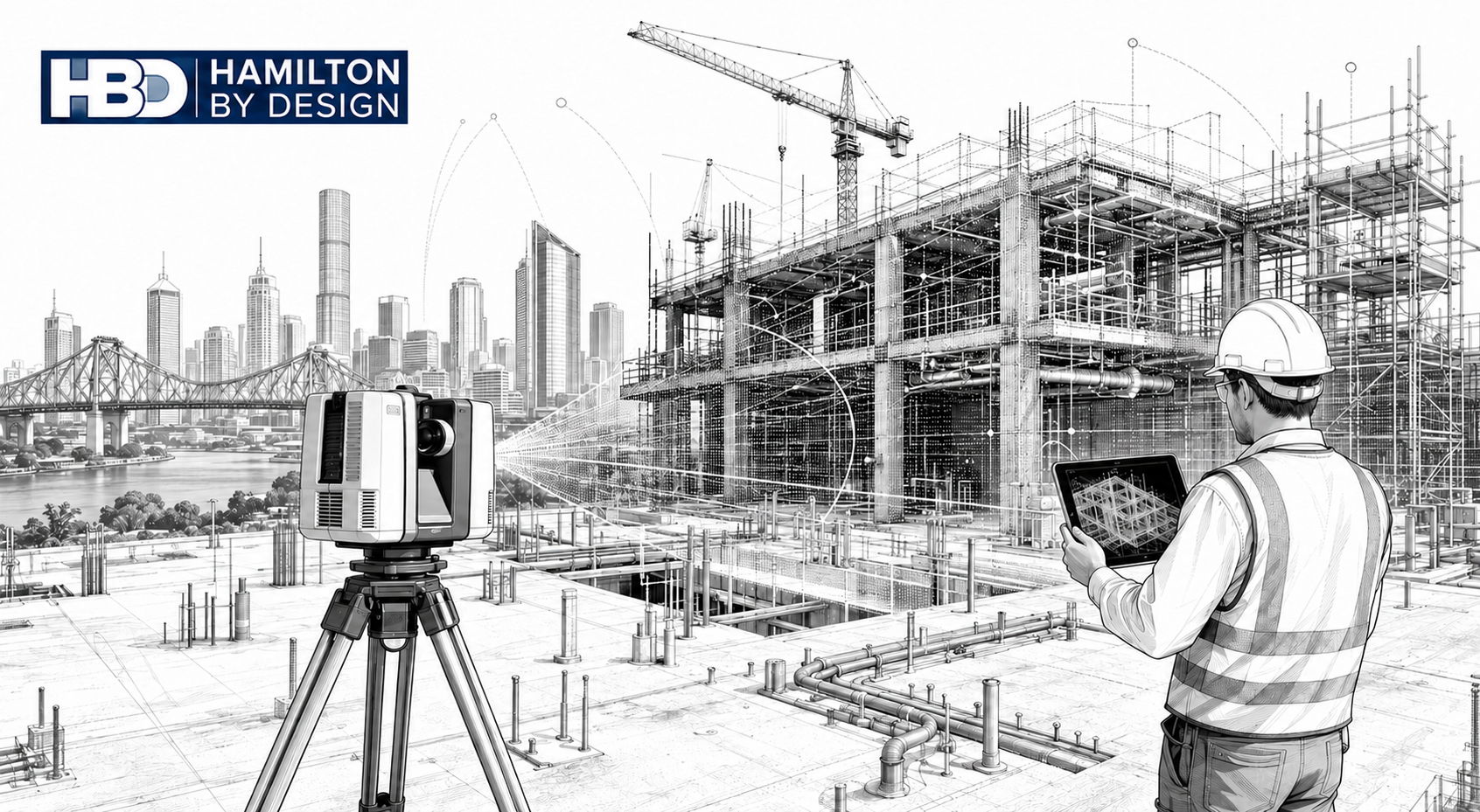
Black-and-white illustration of a 3D laser scanner capturing a Brisbane construction site, with point cloud data overlaid on steel framing, services, cranes, the Story Bridge and Hamilton By Design logo.

Engineering-Grade Reality Capture for Live Construction Environments

Construction projects in Brisbane operate under conditions that place unique pressure on engineers, builders, and asset owners. Subtropical climate, flood-affected sites, reactive soils, dense CBD logistics, and a strong reliance on brownfield upgrades all increase one fundamental risk: designing and constructing from incorrect or outdated site information.

A 3D construction scan in Brisbane provides engineering-grade certainty by capturing what actually exists on site, enabling informed decisions during live construction, refurbishment, and staged delivery projects.
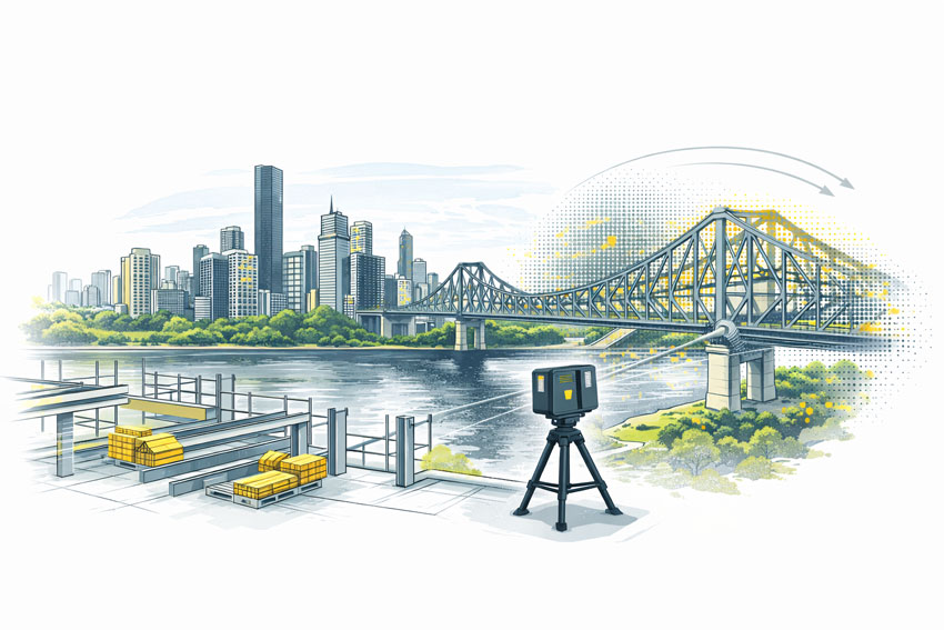


3D construction scanning in Brisbane using a FARO laser scanner at a building site overlooking the Story Bridge and Brisbane River

3D LiDAR scanning and 3D modelling service button โ€” laser scanner capturing a point cloud for engineering and CAD modelling
Mechanical engineering services

What Is a 3D Construction Scan?

A 3D construction scan uses high-accuracy LiDAR laser scanning to capture the true as-built condition of a site at a specific point in time. Unlike visual scans or phone-based capture, engineering-grade scanning produces registered point clouds that can be trusted for:

  • Construction coordination
  • Design verification
  • Clash detection
  • Fabrication-ready modelling
  • As-built documentation

Hamilton By Design delivers these outcomes through its engineering-led laser scanning services, where accuracy, downstream use, and construction risk are defined before scanning begins.


Why Brisbane Construction Projects Require a Different Approach

Subtropical Climate & Structural Movement

Brisbaneโ€™s humidity and temperature cycles contribute to thermal expansion, contraction, and cumulative movement across steelwork, pipe runs, conveyors, faรงades, and plant installations.

When construction decisions rely on assumed geometry or legacy drawings, even small movements can result in:

  • Misaligned interfaces
  • Fabrication clashes
  • Installation delays

A 3D construction scan captures the current, in-situ geometry, allowing engineers to design and coordinate based on reality โ€” not historical intent.

Flood-Affected & Modified Assets

Many Brisbane sites โ€” particularly river-adjacent commercial and industrial facilities โ€” have undergone multiple flood recovery and modification cycles. Over time, this results in:

  • Changed floor levels
  • Unrecorded ramps and bunds
  • Altered drainage and gravity-dependent systems

Construction scanning establishes a true datum and elevation baseline, supporting engineering verification of falls, access clearances, and tie-in points.

This capability aligns directly with Hamilton By Designโ€™s broader reality capture and as-built verification workflows.


Brownfield Construction Is the Norm

A significant proportion of Brisbane construction work occurs in live, operational environments, including:

  • Commercial refurbishments
  • Industrial plant upgrades
  • Infrastructure modifications
  • Asset life-extension projects

These sites often contain undocumented steelwork, legacy penetrations, and accumulated modifications. A 3D construction scan enables non-intrusive capture of this complexity, supporting engineering coordination without disrupting operations.

Tight CBD Logistics & Vertical Construction

Brisbaneโ€™s CBD presents unique logistical challenges:

  • Limited laydown space
  • Vertical risers and congested services zones
  • Restricted crane and hoist access
  • Staged installation sequencing

In these environments, components must fit first time. Construction scanning supports:

  • Early clash detection
  • Verification before fabrication
  • Confident off-site prefabrication

This process integrates directly with Hamilton By Designโ€™s 3D point cloud modelling and coordination services.


Reactive Soils & Differential Settlement

Reactive clay soils common throughout South-East Queensland contribute to long-term differential settlement, particularly where new construction interfaces with older structures. Over time, this can lead to:

  • Misaligned columns and beams
  • Drift in conveyors and pipe racks
  • Geometry that no longer matches design intent

A construction scan captures current condition, enabling engineers to design extensions and upgrades that reflect actual site geometry.


Construction Scanning vs Generic 3D Scanning

Not all scanning is suitable for construction engineering.

AspectGeneric ScanEngineering-Led Construction Scan
AccuracyVisual or indicativeMillimetre-grade
OutputMeshes or imagesRegistered point clouds
Engineering UseLimitedDesign & fabrication
Risk ReductionLowHigh
Construction ReadyNoYes

Hamilton By Design positions construction scanning as part of an integrated engineering workflow, not a standalone data capture exercise.

3D Engineering Services in Brisbane


How 3D Construction Scans Are Used on Brisbane Projects

Engineering-grade construction scans are routinely used to support:

  • Clash detection across structure and services
  • Verification scans prior to fabrication
  • Construction sequencing and staging
  • As-built documentation for handover
  • Reduced RFIs, rework, and site delays

These outcomes are particularly valuable on commercial and construction projects where access, timing, and accuracy are critical.

Commercial & Construction 3D Scanning Services
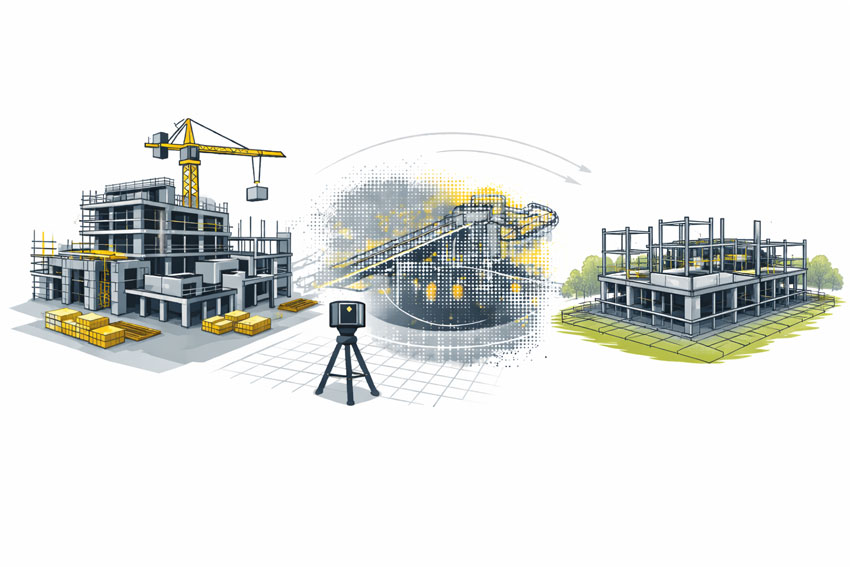

3D laser scanning of a commercial building under construction showing as-built capture and coordination before wall closure

The Hamilton By Design Difference

Hamilton By Design delivers engineering-grade 3D construction scanning with a clear focus on constructability and downstream use.

Our approach combines:

  • Engineer-led scanning strategies
  • Defined accuracy requirements
  • Integration with mechanical and structural design
  • Outputs suitable for fabrication and installation

This approach ensures construction teams can rely on scan data with confidence โ€” especially on complex Brisbane projects.


When should a 3D Construction Scan Be Used?

A 3D construction scan in Brisbane is most valuable when:

  • Working in brownfield or live environments
  • Verifying conditions before fabrication
  • Coordinating multiple trades in tight spaces
  • Managing staged refurbishments
  • Reducing construction risk and uncertainty

Hamilton By Design logo displayed on a blue tilted rectangle with a grey gradient background

In Brisbane, construction risk is rarely driven by poor engineering.
It is driven by decisions made using incorrect or outdated information.

A 3D Construction Scan in Brisbane provides one critical advantage:
certainty about what actually exists on site, at the moment decisions are made.

Finite Element Analysis (FEA) engineering simulation button
3D LiDAR scanning and 3D modelling services button
Building and construction services button

Our clients:

Name
Would you like us to arrange a phone consultation for you?
Address
Finite Element Analysis (FEA) engineering simulation button
Mechanical engineering services
Reality Capture Brisbane title graphic with white text on a blue background promoting reality capture, LiDAR scanning and digital engineering services in Brisbane, Queensland.
3D Scanning Brisbane text graphic on a blue background promoting engineering-led laser scanning and reality capture services in Brisbane.

LiDAR Scanning Brisbane title graphic with white text on a blue background promoting terrestrial LiDAR scanning, point cloud capture and reality capture services in Brisbane, Queensland.
SolidWorks Brisbane title graphic with white text on a blue background promoting SolidWorks mechanical design, 3D CAD modelling and engineering drafting services in Brisbane, Queensland.


3D Scanning Brisbane

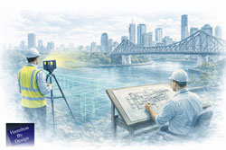
Engineer completing structural drafting while a LiDAR scanner captures as-built data along the Brisbane River with the Story Bridge in view

3D Scanning Brisbane | Engineering-Led LiDAR & Risk Management


We are engineers. Let us manage your risk.

3D scanning is often treated as a visual exercise. In engineering, it is a measurement task. The difference matters.

At Hamilton By Design, 3D scanning in Brisbane is approached as an engineering activity, not just data capture. Our role is to ensure the information collected on site can be safely relied upon for design, fabrication, and installation โ€” without rework, uncertainty, or guesswork.


What People Mean When They Say โ€œ3D Scanningโ€

When someone searches for 3D scanning Brisbane, they are usually trying to answer one question:

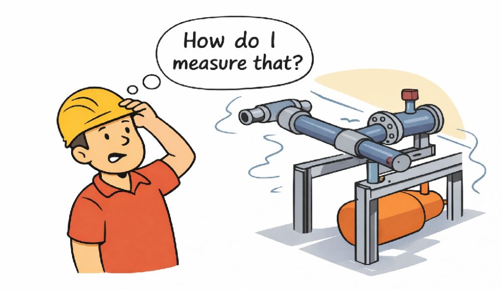
โ€œHow do I measure what already exists?โ€

That might be to:

  • Capture existing site conditions
  • Reduce uncertainty before fabrication
  • Avoid clashes or rework on site

The challenge is that not all scanning methods actually measure geometry.


Cartoon showing a worker asking โ€œHow do I measure that?โ€ while looking at complex pipework, illustrating the need for accurate engineering-grade 3D scanning.

3D Scanning in Brisbane โ€“ Typical Use Cases

Across Brisbane and South-East Queensland, 3D scanning is commonly used for:

  • Industrial plant upgrades and brownfield sites
  • As-built capture of steel, services, and structures
  • Fabrication completed off-site
  • Retrofit works with limited access
  • Shutdown and tie-in planning

For projects like these, scanning is typically carried out using engineering-grade laser scanning, not visual or consumer-grade tools.
3D Laser Scanning


Scanning Is Not the Same as Measuring

(Simple cartoon here: character looking at an object asking โ€œHow do I measure that?โ€)

Scanning is not the same as measuring.
In fabrication, we measure twice and cut once.
With the right scanner, you only need to scan once.

Many scanning tools create models that look right but are based on inferred or smoothed geometry. For engineering, appearance is not enough โ€” the data must be measurable and accurate.


Not All 3D Scanning Is the Same

There are different ways to โ€œscanโ€ a site, each producing very different outcomes:

  • Phone and visual scans
    Useful for reference and visualisation, but not suitable for engineering.
  • Photogrammetry
    Good for context and large areas, but geometry is inferred rather than directly measured.
  • Engineering-grade LiDAR scanning
    Uses direct distance measurement to generate a true 3D point cloud.

Measured scan data can then be converted into usable engineering information through point cloud modelling workflows.
3D Point Cloud Modelling Brisbane


When Engineering-Grade Scanning Is Required

Engineering-grade scanning is required when:

  • Steelwork must fit first time
  • Pipework or spools are fabricated off-site
  • Structural members must be verified
  • Clearances and clashes carry cost or safety risk
  • There is only one opportunity to access the site

In these cases, scan data is typically followed by a Scan-to-CAD process, where point clouds are converted into accurate 3D models and drawings.
Scan to CAD Brisbane


Our Approach to 3D Scanning

Hamilton By Design treats scanning as part of a complete engineering workflow, not a standalone service.

Our approach includes:

  • Engineer-led scanning
  • Measurement-first mindset
  • Engineering-grade LiDAR equipment
  • Clear understanding of downstream use

By integrating scanning with mechanical engineering services, we maintain single-source accountability from site capture through to fabrication-ready deliverables.
Mechanical Engineering Services


What Happens After the Scan

3D scanning is the starting point, not the end.

Accurate scan data supports:

  • 3D CAD modelling
  • Fabrication and shop drawings
  • Structural verification
  • Clash detection and layout validation

Every downstream decision depends on the quality of the measurement captured at the start.


Talk to an Engineer Before You Scan

Many project issues begin with the wrong question:

โ€œCan you scan this?โ€

The better question is:

โ€œHow do I measure this so it can be engineered?โ€

If you need 3D scanning in Brisbane that can safely support engineering and fabrication decisions, Hamilton By Design can help you get it right the first time.


We are engineers. Let us manage your risk.


Hamilton By Design logo displayed on a blue tilted rectangle with a grey gradient background

Our clients:

Name
Would you like us to arrange a phone consultation for you?
Address
3D LiDAR scanning and 3D modelling service button โ€” laser scanner capturing a point cloud for engineering and CAD modelling
Mechanical engineering services
Finite Element Analysis (FEA) engineering simulation button
Mechanical engineering services

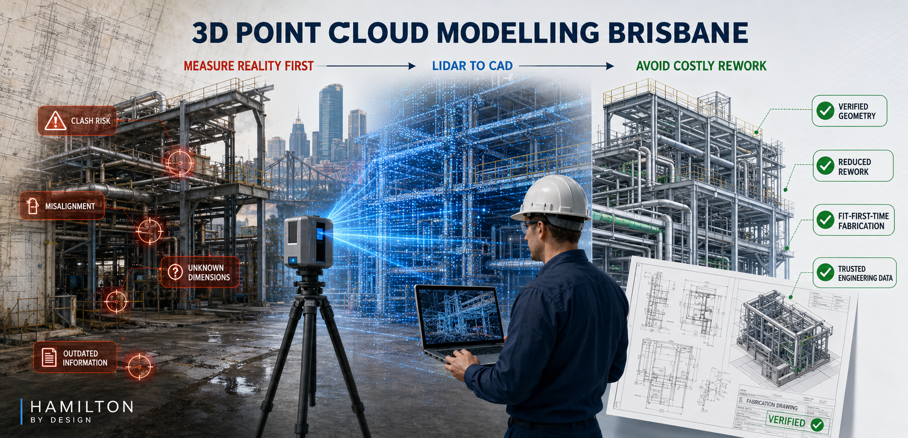
3D Point Cloud Modelling Brisbane

3D point cloud modelling Brisbane image showing LiDAR scanning of industrial pipework and steelwork, converting site conditions into CAD models and fabrication drawings.

Getting the Data Right First

Blue 3D LiDAR scanner icon on a tripod with scanning waves

Modern engineering, fabrication, and asset upgrades increasingly rely on 3D point cloud data as the foundation for design decisions. However, not all โ€œ3D scansโ€ produce data that is suitable for engineering-grade modelling.

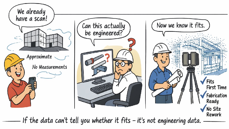
At Hamilton By Design, we regularly encounter projects where scanning has already been undertaken, yet the data cannot be safely relied upon for structural checks, fabrication drawings, or fit-first-time installation. The reason is simple: many common scanning technologies do not generate a true, measurable 3D point cloud.


Cartoon illustrating the difference between visual scanning and engineering-grade 3D point cloud scanning, showing how accurate scan data enables fit-first-time fabrication.

What Is a True Engineering 3D Point Cloud?

A true 3D point cloud consists of millions of directly measured XYZ coordinates, captured using survey-grade LiDAR technology. Each point represents a real, measured position in space, with known accuracy and traceable error.

This level of data is essential when:

  • Steelwork must fit without site modification
  • Pipe spools are fabricated off-site
  • Structural members must be verified
  • Clearances and clashes carry cost or safety risk

Visual models, meshes, or approximated surfaces may look correct, but without direct distance measurement and accuracy control, they cannot be relied upon for engineering.


Not All โ€œ3D Scansโ€ Produce a Usable Point Cloud

The table below compares common capture methods against engineering-grade LiDAR scanning.

Engineering Data Comparison โ€“ 3D Capture Technologies

CriteriaPhone / App ScanPhoto-grammetryReal-Estate / Visual ScannersEngineering LiDAR (Hamilton By Design)
Direct distance measurementโŒ NoโŒ Noโš ๏ธ Limitedโœ… Yes (time-of-flight)
True 3D point cloud outputโš ๏ธ Low-densityโŒ No (mesh only)โš ๏ธ Filteredโœ… Raw XYZ data
Global accuracy controlโŒ NoneโŒ NoneโŒ Noneโœ… Survey-controlled
Typical usable accuracyยฑ20โ€“50 mmยฑ10โ€“30 mmยฑ10โ€“20 mmยฑ1โ€“2 mm
Consistent point densityโŒ NoโŒ NoโŒ Noโœ… Yes
Steel & reflective surfacesโŒ PoorโŒ Poorโš ๏ธ Limitedโœ… Yes
Pipework & beam definitionโŒ Noโš ๏ธ LimitedโŒ Noโœ… Yes
Large industrial site captureโŒ Noโš ๏ธ LimitedโŒ Noโœ… Yes
Registration error reportingโŒ NoโŒ NoโŒ Noโœ… Yes
Suitable for fabrication drawingsโŒ NoโŒ NoโŒ Noโœ… Yes
Suitable for structural checks / FEAโŒ NoโŒ NoโŒ Noโœ… Yes
Fit-first-time confidenceโŒ NoโŒ NoโŒ Noโœ… Yes

Why This Matters for Brisbane Projects

In Brisbane and across South-East Queensland, many projects involve:

  • Industrial plant upgrades
  • Infrastructure retrofits
  • Fabrication undertaken off-site
  • Tight shutdown windows

In these environments, millimetres matter. If a beam, pipe, or support cannot be accurately defined in the model, the risk of rework, delays, and site modification increases significantly.

Put simply:

If the data cannot reliably tell you whether something fits, clears, or carries load, it is not suitable for engineering.


Engineer-Led Point Cloud Modelling

Hamilton By Design uses engineering-grade terrestrial LiDAR scanners and an engineer-led workflow to ensure point cloud data is suitable for:

  • SolidWorks 3D modelling
  • Fabrication-ready drawings
  • Structural verification
  • Clash detection and layout validation

By controlling both data capture and modelling, we maintain single-source accountability โ€” reducing risk and ensuring the model reflects reality.


Hamilton By Design logo displayed on a blue tilted rectangle with a grey gradient background
3D LiDAR scanning and 3D modelling service button โ€” laser scanner capturing a point cloud for engineering and CAD modelling
Mechanical engineering services

From Scan to Shop Floor โ€” Done Right

3D point cloud modelling is not about creating a visually impressive model. It is about creating a reliable digital representation of reality that engineers, fabricators, and contractors can trust.

If you are planning a project in Brisbane and need point cloud data that supports real engineering decisions, speak with Hamilton By Design before relying on consumer or visual-only scanning methods.

Our clients:

Name
Would you like us to arrange a phone consultation for you?
Address

3D Scanning Brisbane CBD

Finite Element Analysis (FEA) engineering simulation button
Mechanical engineering services
Reality Capture Brisbane title graphic with white text on a blue background promoting reality capture, LiDAR scanning and digital engineering services in Brisbane, Queensland.
3D Scanning Brisbane text graphic on a blue background promoting engineering-led laser scanning and reality capture services in Brisbane.

LiDAR Scanning Brisbane title graphic with white text on a blue background promoting terrestrial LiDAR scanning, point cloud capture and reality capture services in Brisbane, Queensland.
SolidWorks Brisbane title graphic with white text on a blue background promoting SolidWorks mechanical design, 3D CAD modelling and engineering drafting services in Brisbane, Queensland.


Reality Capture in the Hunter Valley

The Hunter Valley is one of Australiaโ€™s most technically complex industrial regions, combining power generation, mining, bulk materials handling, manufacturing, and logistics infrastructure within a tightly interconnected operational landscape. Projects in this environment frequently involve legacy assets, constrained access, and high consequences for design or construction error.

Reality capture in the Hunter Valley provides a structured, engineering-led method for documenting existing conditions using measured data rather than assumption-based interpretation. At Hamilton By Design, reality capture is applied as part of a broader engineering workflowโ€”ensuring captured information directly supports design development, upgrade planning, fabrication coordination, and risk management.


Defining reality capture in an industrial context

Reality capture is the process of recording physical site conditions using spatially accurate technologies and converting that information into usable engineering references. In practical terms, this includes:

  • Engineering-grade laser scanning and LiDAR acquisition
  • Spatial data registration and validation
  • Interpretation of existing geometry in the context of mechanical and structural systems
  • Translation of measured data into drawings, models, and coordination outputs

The objective is not simply to visualise a site, but to create a reliable, defensible representation of existing conditions that can be used throughout the project lifecycle.

For projects where laser scanning forms the core capture method, refer to:
3D Laser Scanning
https://www.hamiltonbydesign.com.au/home/3d-lidar-scanning-digital-quality-assurance/3d-laser-scanning/


Why reality capture is critical in the Hunter Valley

Industrial facilities across the Hunter Valley often operate continuously while upgrades, modifications, and expansions are undertaken. Common project challenges include:

  • Brownfield environments with incomplete or outdated documentation
  • Complex interfaces between mechanical, structural, and civil systems
  • Fabrication occurring off-site with limited tolerance for dimensional error
  • Restricted access windows and safety-critical operating conditions

In these scenarios, traditional measurement approaches are often insufficient. Reality capture reduces uncertainty by establishing a single source of measured truth, enabling informed decisions before fabrication or installation begins.

For an overview of how scanning is applied to regional industry, see:
3D Scanning for Industrial Projects in Newcastle and the Hunter Valley
https://www.hamiltonbydesign.com.au/3d-scanning-for-industrial-projects-in-newcastle-and-the-hunter-valley/


Typical Hunter Valley applications

Existing-condition baselining

Reality capture provides accurate documentation where legacy drawings no longer reflect actual site conditions. This baseline supports engineering assessments, upgrade feasibility studies, and staged project planning.

Plant upgrades and retrofit works

Measured spatial data allows new systems to be designed around existing plant, services, and structures, reducing clash risk and rework during installation.

Fabrication and construction coordination

Accurate capture of interfaces, clearances, and connection points improves alignment between design intent and fabricated componentsโ€”particularly where fabrication is completed remotely.

Risk reduction and decision support

From an engineering governance perspective, reality capture improves information quality, reduces assumptions, and supports more defensible technical decisions.


Engineering-led reality capture methodology

Hamilton By Design approaches reality capture as a project-specific engineering activity, not a generic surveying exercise.

1. Scope definition aligned to outcomes

Capture scope is defined based on how the data will be usedโ€”design development, drafting, verification, or coordinationโ€”ensuring the level of detail and accuracy is appropriate.

2. Structured site data acquisition

Capture activities are planned to manage occlusion, access limitations, and operational constraints commonly encountered on Hunter Valley industrial sites.

3. Data validation and preparation

Captured datasets are reviewed, registered, and structured so they can be confidently used for engineering interpretation rather than remaining as raw data.

4. Engineering-ready deliverables

Where required, reality capture outputs are converted into:

  • As-built drawings
  • General arrangement layouts
  • Reference models for coordination
  • Documentation suitable for engineering review and approvals

Relationship between reality capture and laser scanning

While laser scanning and LiDAR are commonly used tools within reality capture, the distinction lies in how the data is applied. Laser scanning provides the measurements; reality capture ensures those measurements are contextualised, validated, and integrated into engineering workflows.

This distinction is particularly important in industrial regions such as the Hunter Valley, where inaccurate interpretation of spatial data can have significant cost and safety implications.


Value for Hunter Valley stakeholders

Reality capture supports multiple stakeholder groups:

  • Asset owners and operators gain confidence in upgrade planning
  • Engineers work from verified existing-condition data
  • Fabricators receive clearer interface definitions
  • Project teams reduce site disruption and variation risk

From a systems engineering perspective, this represents an improvement in information reliability and traceabilityโ€”both key drivers of project performance.


Regional capability and service coverage

Hamilton By Design services the Hunter Valley as part of its broader NSW engineering and reality capture capability, supporting projects across industrial, energy, and infrastructure sectors.

Service coverage includes Newcastle and the wider Hunter region, as outlined in:
Frequently Asked Questions โ€“ Service Areas
https://www.hamiltonbydesign.com.au/frequently-asked-questions/


Next steps

For Hunter Valley projects, effective reality capture begins by clearly defining:

  1. Which areas and interfaces require measurement
  2. What engineering decisions the data must support
  3. The required accuracy for design, fabrication, or verification

Once these parameters are established, reality capture can be aligned to project risk, schedule, and delivery requirements.

For scanning-focused services, return to:
3D Laser Scanning
https://www.hamiltonbydesign.com.au/home/3d-lidar-scanning-digital-quality-assurance/3d-laser-scanning/

For industrial scanning examples in the region, see:
3D Scanning for Industrial Projects in Newcastle and the Hunter Valley
https://www.hamiltonbydesign.com.au/3d-scanning-for-industrial-projects-in-newcastle-and-the-hunter-valley/

3D LiDAR scanning and 3D modelling service button โ€” laser scanner capturing a point cloud for engineering and CAD modelling
Mechanical engineering services

Our clients:

Name
Would you like us to arrange a phone consultation for you?
Address
https://www.hamiltonbydesign.com.au/mechanical-engineering
3D CAD Modelling Australia service banner for Hamilton By Design
Australian Drafting logo featuring bold white text reading "Australian Drafting" centred on a blue rounded rectangle background.
Engineering Governance title graphic featuring bold white text reading "Engineering Governance" centred on a blue rounded rectangle background.
Mechanical, Structural & Pipework Drafting service banner by Hamilton By Design featuring white text on a blue background.
Mechanical engineering services
Blue rounded button with the text โ€œSolidWorks Designโ€ in white.
Finite Element Analysis (FEA) engineering simulation button
3D LiDAR Scanning Darwin for engineering surveys, laser scanning, reality capture and point cloud modelling services
3D LiDAR Scanning Australia engineering services for laser scanning, reality capture, scan-to-CAD, Scan-to-BIM and as-built documentation across Australia
3D LiDAR scanning services on the Central Coast providing engineering-grade laser scanning, point cloud capture, scan-to-CAD modelling and industrial reality capture for infrastructure and industrial projects.
3D LiDAR Scanning Perth for engineering surveys, laser scanning, reality capture and point cloud modelling services
3D LiDAR Scanning Sydney for engineering surveys, laser scanning, reality capture and point cloud modelling services
3D LiDAR Scanning Brisbane for engineering surveys, laser scanning, reality capture and point cloud modelling services
3D LiDAR Scanning Canberra for engineering surveys, laser scanning, reality capture and point cloud modelling services
3D LiDAR Scanning Newcastle for engineering surveys, laser scanning, reality capture and point cloud modelling services
3D LiDAR Scanning Adelaide for engineering surveys, laser scanning, reality capture and point cloud modelling services

Reality Capture in Wyong

Wyong sits at the centre of the NSW Central Coastโ€™s industrial, infrastructure, and manufacturing activity. With a mix of legacy assets, live industrial facilities, and expanding development corridors, projects in the region often require accurate, defensible knowledge of existing site conditions before design, fabrication, or construction can proceed.

Reality capture in Wyong provides a structured approach to documenting real-world conditions using measured data rather than assumptions. At Hamilton By Design, reality capture is integrated into an engineering-led workflowโ€”ensuring the information collected on site can be reliably used for design coordination, retrofit planning, and downstream documentation.


What reality capture means for Wyong projects

Reality capture refers to the process of recording existing conditions using spatially accurate methods and translating that data into engineering-usable outputs. In practice, this includes:

  • Engineering-grade laser scanning and LiDAR capture
  • Controlled registration and validation of spatial data
  • Interpretation of site geometry in the context of mechanical and structural design
  • Conversion of captured data into drawings, models, and reference documents

Rather than treating capture as a visual exercise, the emphasis is on measured accuracy, traceability, and fitness for purpose.

For an overview of regional engineering capability, see:
Mechanical Engineers in Wyong
https://www.hamiltonbydesign.com.au/mechanical-engineers-in-wyong/


Why reality capture is critical in Wyong and the Central Coast

Projects across Wyong and the broader Central Coast commonly involve:

  • Brownfield industrial upgrades
  • Plant modifications within operational facilities
  • Interface works between new and existing infrastructure
  • Fabrication occurring off-site with limited tolerance for error
  • Incomplete or outdated as-built documentation

In these environments, traditional measurement methods often fail to provide sufficient confidence. Reality capture reduces this risk by creating a single, verifiable representation of site conditions that can be referenced throughout the project lifecycle.


Typical reality capture applications in Wyong

1. Existing-condition documentation

Reality capture establishes a measured baseline where drawings are missing, inconsistent, or no longer representative of site conditions. This is particularly valuable for long-standing industrial facilities across Wyong and the surrounding region.

2. Retrofit and upgrade planning

Captured data supports the design of upgrades that must integrate precisely with existing structures, equipment, and servicesโ€”reducing the likelihood of clashes or rework.

3. Fabrication and installation coordination

When fabrication is undertaken away from site, accurate geometry is essential. Reality capture helps ensure fabricated components align correctly once delivered and installed.

4. Risk reduction and project certainty

By replacing assumptions with measured data, reality capture improves decision-making, reduces uncertainty, and supports more reliable cost and schedule outcomes.

For a broader discussion of engineering activity on the Central Coast, see:
Mechanical Engineering at the Heart of Mining on the Central Coast
https://www.hamiltonbydesign.com.au/mechanical-engineering-at-heart-of/


3D LiDAR scanning services on the Central Coast providing engineering-grade laser scanning, point cloud capture, scan-to-CAD modelling and industrial reality capture for infrastructure and industrial projects.
Drafting services on the Central Coast providing engineering drawings, fabrication detailing, as-built documentation, reverse engineering and CAD drafting for industrial and infrastructure projects.
Mechanical engineering services on the Central Coast providing industrial design, plant inspections, pump calculations, reverse engineering and engineering support for manufacturing, infrastructure and heavy industry projects.

How Hamilton By Design approaches reality capture

Hamilton By Design applies reality capture as part of an integrated engineering process rather than a standalone service.

Project-led scoping

Each capture scope is defined by how the data will be usedโ€”whether for design, drafting, verification, or coordination. Accuracy requirements, areas of interest, and deliverables are established upfront.

Field data acquisition

Capture activities are planned to minimise occlusions, maintain consistency, and achieve the level of detail required for engineering interpretation.

Validation and preparation

Spatial datasets are reviewed and structured to ensure they are suitable for downstream use, avoiding the common issue of high-volume data with limited engineering value.

Engineering-ready outputs

Where required, captured data is translated into:

  • As-built drawings
  • General arrangement layouts
  • Reference models for coordination
  • Documentation suitable for design development and approvals

This approach aligns reality capture outputs with real project decisions rather than producing isolated datasets.


Relationship to laser scanning services

Reality capture in Wyong often incorporates laser scanning and LiDAR technologies; however, the distinction lies in how the data is applied. Laser scanning is the toolโ€”reality capture is the methodology that ensures the data is usable, traceable, and relevant to engineering outcomes.

For dedicated scanning capability, see:
3D Laser Scanning
https://www.hamiltonbydesign.com.au/home/3d-lidar-scanning-digital-quality-assurance/3d-laser-scanning/


Value for Wyong-based stakeholders

Reality capture delivers value across multiple stakeholder groups:

  • Owners and operators gain confidence in upgrade feasibility
  • Engineers work from reliable existing-condition data
  • Fabricators receive clearer interfaces and reduced rework risk
  • Project teams benefit from fewer site disruptions and variations

From an academic perspective, this represents an improvement in information quality and decision reliabilityโ€”both critical contributors to successful project delivery.


Reality capture as part of regional engineering capability

Wyongโ€™s role as a Central Coast engineering hub makes it an ideal location for engineering-led reality capture services. The ability to capture, interpret, and apply site data locally supports faster turnaround and better alignment between site conditions and engineering intent.

For a broader overview of Hamilton By Designโ€™s presence and services in the region, return to:
Mechanical Engineers in Wyong
https://www.hamiltonbydesign.com.au/mechanical-engineers-in-wyong/


Next steps

If you are planning a project in Wyong or the wider Central Coast and require reliable existing-condition information, the first step is defining:

  1. The areas and interfaces that must be captured
  2. The decisions the data needs to support
  3. The level of accuracy required for design or fabrication

From there, reality capture can be aligned to your project objectives, risk profile, and delivery programme.

Our clients

3D LiDAR scanning and 3D modelling service button โ€” laser scanner capturing a point cloud for engineering and CAD modelling
Mechanical engineering services
Name
Would you like us to arrange a phone consultation for you?
Address

Darwin LiDAR & Laser Scanning Services

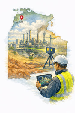
Industrial plant in Darwin being digitally captured with 3D scanning to support engineering design and upgrade planning.

Engineering-Grade Reality Capture for the Top End

Darwin projects operate in one of Australiaโ€™s most demanding environments. Remote logistics, extreme heat, cyclone exposure, corrosive coastal conditions and ageing infrastructure all place pressure on engineering projects to get it right the first time.

Hamilton By Design provides LiDAR and laser scanning services in Darwin that go beyond basic measurement. Our scanning is engineering-led, meaning data is captured with the end goal in mind โ€” mechanical design, structural verification, fabrication and construction.

This page complements our 3D Scanning Darwin landing page by focusing specifically on LiDAR and laser scanning and clearly explaining why these methods outperform traditional measurement techniques on Darwin-based projects.


What Is LiDAR & Laser Scanning?

LiDAR (Light Detection and Ranging) and terrestrial laser scanning use high-precision laser pulses to capture millions of spatial data points per second. These points form a 3D point cloud, accurately representing existing structures, plant, terrain and assets.

Unlike manual measurement, LiDAR captures entire environments, not just selected dimensions. This creates a permanent, revisit able digital record that engineers can interrogate long after leaving site.

In Darwin, where site access is costly and conditions are challenging, this capability is invaluable.


Why LiDAR & Laser Scanning Are Ideal for Darwin Projects

Darwin projects often involve:

  • Brownfield assets with poor documentation
  • Live facilities with limited access windows
  • Remote locations where repeat visits are expensive
  • Structures affected by corrosion, movement and deformation

LiDAR scanning directly addresses these challenges by replacing assumptions with measured reality.


LiDAR & Laser Scanning vs Traditional Measurement Methods

Traditional Measurement Methods

Common traditional approaches include:

  • Tape measures and laser distos
  • Total stations used selectively
  • Manual sketching and hand-marked dimensions
  • Assumptions based on legacy drawings

While these methods still have a place, they struggle in Darwinโ€™s complex industrial environments.


LiDAR & Laser Scanning โ€“ A Comparative Overview

AspectTraditional MethodsLiDAR & Laser Scanning
Data capturedLimited, selectiveMillions of points
AccuracyDepends on access & operatorConsistent, verifiable
Site timeHighReduced
Rework riskHighSignificantly reduced
Ability to revisit dataNoYes
SafetyManual access requiredReduced physical access
Suitability for brownfield sitesLimitedExcellent

Key Benefits of LiDAR & Laser Scanning in Darwin

1. Reduced Site Time in Remote Locations

Darwin projects often involve:

  • Fly-in/fly-out logistics
  • Restricted access windows
  • Live plant environments

LiDAR allows large, complex sites to be captured in a single visit, reducing the need for repeated trips.


2. Improved Safety in Harsh Conditions

Traditional measurement often requires:

  • Working at height
  • Accessing confined or hot spaces
  • Measuring near live equipment

Laser scanning significantly reduces the need for physical interaction with hazardous environments, improving safety outcomes.


3. Accurate Capture of Deformed & Corroded Assets

Darwinโ€™s tropical climate accelerates:

  • Steel corrosion
  • Structural movement
  • Alignment drift

LiDAR captures as-is geometry, not what drawings say should exist. This is critical for:

  • Port infrastructure
  • Marine assets
  • Industrial plant and pipework

4. Better Outcomes for Brownfield Engineering

Most Darwin projects are brownfield in nature. LiDAR supports:

  • Clash-free design
  • Accurate retrofit modelling
  • Confident fabrication

Designers can work knowing the model reflects reality, not assumptions.


5. Permanent Digital Record of Existing Conditions

Once scanned, a site becomes a digital asset. Engineers can:

  • Take additional measurements remotely
  • Validate future changes
  • Use scans as baseline data

This is particularly valuable for long-term asset management in the Northern Territory.


Engineering-Led LiDAR Scanning (Why It Matters)

Not all scanning services are equal.

Hamilton By Design delivers engineering-led LiDAR scanning, meaning:

  • Scans are planned around engineering outcomes
  • Data density suits mechanical and structural modelling
  • Critical interfaces and tolerances are prioritised

This ensures the point cloud transitions cleanly into design, analysis and fabrication, not just visualisation.


Typical Darwin Projects Using LiDAR & Laser Scanning

Defence & Government Facilities

  • Existing buildings with no drawings
  • Secure sites with limited access
  • Retrofit and upgrade projects

LiDAR reduces site exposure while improving design accuracy.


Ports & Marine Infrastructure

  • Wharf structures and steelwork
  • Bulk handling systems
  • Corrosion and deformation monitoring

Scanning enables fit-first-time fabrication in marine environments.


Oil, Gas & Energy Facilities

  • Congested process plants
  • Pipework tie-ins
  • Structural verification

LiDAR supports safe, efficient shutdown planning.


Mining & Bulk Materials

  • Crushing and screening plants
  • Conveyors and chutes
  • Remote site upgrades

Scanning allows design work to occur off-site with confidence.


Cyclone Remediation & Compliance

  • Structural assessment
  • Asset hardening
  • Documentation for compliance

LiDAR provides accurate baseline data for engineering decisions.


Utilities & Water Infrastructure

  • Pump stations
  • Treatment plants
  • Pipework routing

Scanning reduces excavation risk and coordination issues.


From LiDAR Scan to Engineering Deliverables

Hamilton By Design provides more than raw data.

Our Typical Deliverables Include:

  • Registered point clouds
  • 3D CAD models aligned to engineering standards
  • Fabrication-ready drawings
  • Structural and mechanical layouts
  • As-built documentation

This ensures scanning data is immediately useful, not an additional burden for project teams.


Integration With Hamilton By Design Services

LiDAR scanning in Darwin is often combined with:

Together, these services support a single-source, accountable workflow from capture to construction.


Why LiDAR Is Replacing Traditional Measurement in Darwin

In Darwin, traditional measurement methods often result in:

  • Missed dimensions
  • Rework and fabrication issues
  • Costly site returns
  • Program delays

LiDAR & laser scanning replace this uncertainty with measured reality, improving project certainty and reducing risk โ€” particularly in remote and high-cost environments.


Darwin LiDAR & Laser Scanning โ€“ Built for Real Conditions

Whether you are working on defence infrastructure, ports, LNG facilities, mining plant or cyclone-prone assets, LiDAR and laser scanning provide the foundation for better engineering outcomes.

Hamilton By Design delivers Darwin LiDAR scanning services that are practical, accurate and engineered for real-world construction โ€” not just data capture.

If your project requires certainty before design or fabrication begins, LiDAR scanning is not an optional extra โ€” itโ€™s the smart starting point.

Hamilton By Design logo displayed on a blue tilted rectangle with a grey gradient background
3D LiDAR scanning and 3D modelling service button โ€” laser scanner capturing a point cloud for engineering and CAD modelling
Mechanical engineering services

Our clients:

Name
Would you like us to arrange a phone consultation for you?
Address