Not All Scans, Point Clouds or Meshes Are Equal โ€“ The Hamilton By Design Philosophy

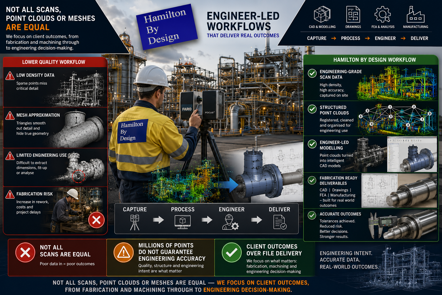
Hamilton By Design engineer-led LiDAR scanning workflow showing engineering-grade point cloud capture, CAD modelling, fabrication-ready deliverables, and comparison between low-quality scans and structured engineering data

Based on a number of enquiries received this week, we thought it would be useful to clarify and streamline the Hamilton By Design philosophy regarding engineering-grade reality capture, drafting and engineering outcomes.

Not all scans are equal.

Not all point clouds are equal.

Not all meshes are equal.

One of the biggest misconceptions in industry is that once a point cloud has been generated, or once a mesh file or STL model has been created, the engineering work is complete. In reality, capturing a scan is only the beginning of the process.

The value does not come from simply obtaining a file.

The value comes from understanding the required outcome and ensuring the data collected is appropriate for that purpose.

At Hamilton By Design, we are engineer-led and provide engineering-grade scanning and reality capture services designed around the intended engineering outcome.

Whether you require outcomes associated with:

  • Fabrication and steel fit-up
  • Mechanical drafting
  • Reverse engineering
  • Plant modifications
  • Mechanical assemblies
  • Precision machining
  • Toolmaking
  • Engineering studies and analysis

our process begins by understanding the final requirement rather than assuming one scan methodology can satisfy every project.

Because different engineering outcomes require different levels of information.

A Scan Is Not the Final Product

Many discussions begin with questions such as:

“Can you provide a point cloud?”

“Can you create a mesh?”

“Can you provide an STL file?”

These are important questions; however, they often miss the larger engineering discussion.

The better question is:

What are you trying to achieve?

The same scan dataset may be used for several completely different purposes:

  • General plant layouts
  • Fabrication fit-up
  • Reverse engineering
  • Structural modifications
  • Mechanical assemblies
  • Existing condition verification
  • Bearing and shaft measurements
  • Precision tooling

The level of detail required for these outcomes can vary significantly.

A dataset that may be suitable for one application may be completely unsuitable for another.

Drafting Is More Than Drawing Lines

Modern industrial drafting has evolved considerably.

A capable draftsperson or designer should understand:

  • Point cloud datasets
  • Mesh and STL files
  • Scan quality and limitations
  • Measurable geometry development
  • CAD model generation
  • Manufacturing requirements
  • Installation requirements
  • Practical engineering considerations

The objective is not simply creating a drawing.

The objective is converting real-world conditions into useful engineering information.

Drafting Should Understand Manufacturing Reality

At Hamilton By Design we believe drafting extends beyond geometry displayed on a screen.

Strong design outcomes often come from understanding how components are actually manufactured, assembled and maintained.

Experience or understanding in areas such as:

  • Fabrication
  • Machining
  • Toolmaking
  • Manufacturing processes
  • Site installation
  • Plant maintenance

can significantly improve engineering decisions.

Understanding manufacturing realities affects:

  • Material selection
  • Weld access
  • Machining stock allowances
  • Tolerances
  • Assembly methods
  • Maintenance requirements
  • Manufacturing costs

A component may appear correct in CAD while still creating practical manufacturing issues.

Questions still need to be asked:

  • Can the component actually be manufactured?
  • Can welding equipment physically access the location?
  • Is sufficient machining stock available?
  • Can bearings be assembled correctly?
  • Can maintenance personnel access components?

Good drafting is not simply producing drawings.

Good drafting understands the complete journey from concept through to manufacture and operation.

Data Quality In = Data Quality Out

At Hamilton By Design we regularly work with:

  • Engineering-grade point clouds
  • Surface meshes
  • STL datasets
  • Reverse engineered components
  • Existing CAD models

One engineering principle remains consistent:

You cannot create information that was never captured.

Software may improve visual appearance and optimise workflows; however, software cannot accurately create missing information.

Examples include:

  • Higher point density generally captures more geometric detail
  • Lower point density captures less information
  • Reduced mesh resolution removes geometric definition
  • STL files can contain smoothing effects
  • Mesh reduction can remove critical engineering features

Reducing points reduces available information.

At some point, a measured representation becomes an approximation.

Bigger Data Sets Are Not Always Better

Many people assume larger datasets automatically create better outcomes.

The reality is there is a balance between detail and practicality.

Large datasets may increase:

  • Processing time
  • Storage requirements
  • Hardware demands
  • Registration effort
  • Modelling time
  • File management complexity
  • Project delivery time

The objective should not be creating the largest point cloud possible.

The objective should be collecting sufficient information to satisfy the engineering requirement.

Greater Accuracy Usually Comes With Greater Cost

Higher accuracy requirements typically require greater effort.

As required accuracy increases, additional work may include:

  • Increased point density
  • Larger point cloud datasets
  • Higher mesh resolution
  • Additional scan positions
  • Greater registration effort
  • Increased verification requirements
  • Additional modelling effort
  • More engineering review

As detail increases:

  • File sizes increase
  • Processing requirements increase
  • Engineering effort increases
  • Costs may increase

The objective should not be maximum data.

The objective should be the correct data.

One Project Can Contain Multiple Tolerances

One of the most common misunderstandings is assuming an entire project operates under one tolerance requirement.

Real engineering projects rarely operate this way.

Consider a pulley assembly.

The fabricated support structure, guards and mounting arrangement may comfortably operate within fabrication tolerances of:

Approximately ยฑ2 mm

However, the same assembly may also include:

  • Shaft diameters
  • Bearing journals
  • Keyways
  • Bearing fits
  • Machined interfaces

These features may require significantly tighter dimensional control.

Typical examples include:

Fabrication and steel fit-up
Approximately ยฑ2 mm

Machined components and mechanical interfaces
Approximately ยฑ0.1 mm

Precision tooling and specialised manufacturing
Potentially <0.1 mm

A fabricator and a toolmaker are not working to the same expectations.

Applying toolmaking tolerances to general fabrication may unnecessarily increase complexity and cost.

Likewise, applying fabrication assumptions to precision-machined components may create significant issues.

One mesh does not automatically solve every engineering requirement.

The Hamilton By Design Approach

At Hamilton By Design we work backwards from the final outcome.

Questions we commonly ask include:

  • Is the project for fabrication?
  • Is machining required?
  • Is reverse engineering required?
  • Is there a critical bearing or shaft interface?
  • Is this for plant modifications?
  • Is this for a precision component?
  • Is this for engineering studies?

These answers determine:

  • Scan methodology
  • Point cloud density
  • Registration strategy
  • Modelling approach
  • Verification requirements
  • Engineering effort
  • Final deliverables

We focus on providing the right information at the right level for the intended purpose.

Because engineering-grade scanning is not about creating the biggest point cloud.

Engineering-grade scanning is not about creating the largest mesh.

Engineering-grade scanning is about producing reliable information that supports real-world engineering outcomes.

Hamilton By Design logo displayed on a blue tilted rectangle with a grey gradient background

Our clients

3D LiDAR scanning and 3D modelling service button โ€” laser scanner capturing a point cloud for engineering and CAD modelling
Mechanical engineering services
Finite Element Analysis (FEA) engineering simulation button
Mechanical engineering services
Name
Would you like us to arrange a phone consultation for you?
Address
3D CAD Modelling Australia service banner for Hamilton By Design
Australian Drafting logo featuring bold white text reading "Australian Drafting" centred on a blue rounded rectangle background.
Engineering Governance title graphic featuring bold white text reading "Engineering Governance" centred on a blue rounded rectangle background.
Mechanical, Structural & Pipework Drafting service banner by Hamilton By Design featuring white text on a blue background.
Mechanical engineering services
Blue rounded button with the text โ€œSolidWorks Designโ€ in white.
Finite Element Analysis (FEA) engineering simulation button
3D LiDAR Scanning Darwin for engineering surveys, laser scanning, reality capture and point cloud modelling services
3D LiDAR Scanning Australia engineering services for laser scanning, reality capture, scan-to-CAD, Scan-to-BIM and as-built documentation across Australia
3D LiDAR scanning services on the Central Coast providing engineering-grade laser scanning, point cloud capture, scan-to-CAD modelling and industrial reality capture for infrastructure and industrial projects.
3D LiDAR Scanning Perth for engineering surveys, laser scanning, reality capture and point cloud modelling services
3D LiDAR Scanning Sydney for engineering surveys, laser scanning, reality capture and point cloud modelling services
3D LiDAR Scanning Brisbane for engineering surveys, laser scanning, reality capture and point cloud modelling services
3D LiDAR Scanning Canberra for engineering surveys, laser scanning, reality capture and point cloud modelling services
3D LiDAR Scanning Newcastle for engineering surveys, laser scanning, reality capture and point cloud modelling services
3D LiDAR Scanning Adelaide for engineering surveys, laser scanning, reality capture and point cloud modelling services

3D Scanning Company

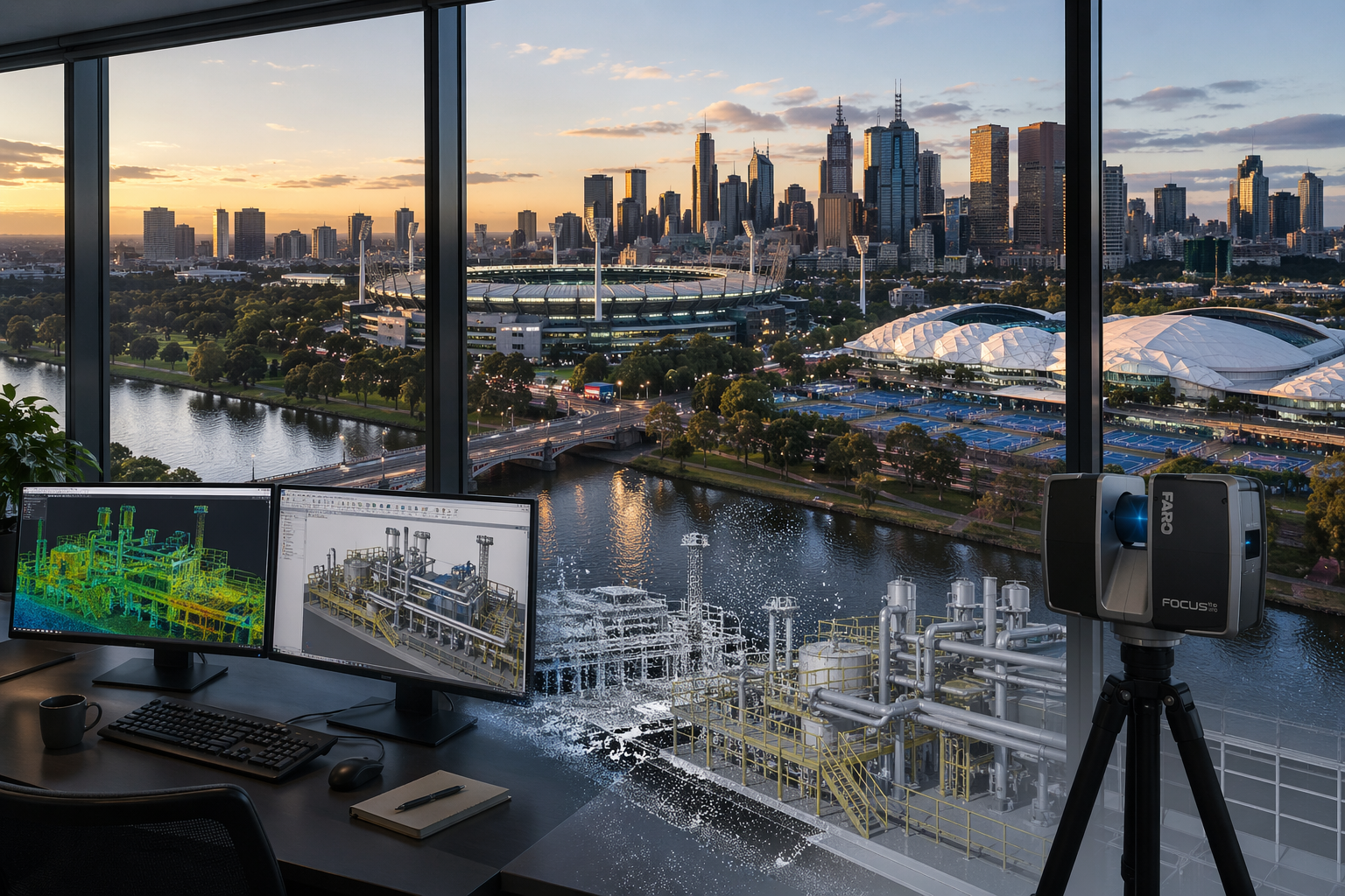
Melbourne office view with Yarra River, MCG and 3D modelling workstation
Blue 3D LiDAR scanner icon on a tripod with scanning waves

A professional 3D scanning company does more than capture data โ€” it delivers accurate, engineering-ready information that can be used for design, construction, and asset management.

At Hamilton By Design, we provide engineering-led 3D laser scanning services, converting real-world conditions into precise digital models for industrial, mining, and infrastructure projects.


What We Do

We provide 3D scanning services including:

  • Terrestrial LiDAR scanning
  • Point cloud to CAD modelling
  • Reverse engineering
  • Industrial plant scanning
  • Brownfield project support

Our focus is on delivering accurate data that can be used for real engineering outcomes.


3D LiDAR scanning and 3D modelling service button โ€” laser scanner capturing a point cloud for engineering and CAD modelling
Mechanical engineering services

LiDAR Scanning

We use high-accuracy LiDAR scanners to capture millions of data points across your site.

This allows us to:

  • Capture true as-built conditions
  • Measure complex environments
  • Improve design accuracy
  • Reduce reliance on outdated drawings

Point Cloud to CAD

Captured scan data is processed into usable engineering models.

This helps:

  • Reduce design clashes
  • Improve installation accuracy
  • Minimise rework

Models are developed in platforms such as SolidWorks and delivered in formats suitable for design and fabrication.


Reverse Engineering

We convert scan data into detailed models where drawings are missing or outdated.

This is ideal for:

  • Legacy equipment
  • Conveyor systems
  • Pipework and mechanical assemblies

Brownfield Projects

Most scanning work is carried out in existing plants where drawings are limited or inaccurate.

We support these projects by:

  • Scanning existing infrastructure
  • Developing accurate 3D models
  • Supporting design that fits first time

3D CAD Modelling Australia service banner for Hamilton By Design

Deliverables

We provide:

  • Registered point clouds (.E57, .RCP, .LAS)
  • 3D CAD models
  • General arrangement drawings
  • Fabrication drawings

We also offer drawing management through the 3DEXPERIENCE Platform, providing secure access to project data.


Why Choose Hamilton By Design

  • Engineering-led approach
  • High-accuracy LiDAR scanning
  • Integration with CAD workflows
  • Fast turnaround times
  • Experience in mining and industrial environments

Get Started

If you need a reliable 3D scanning company, Hamilton By Design can support your project from scan through to design and fabrication.


Our clients

Contact Us – Talk to Us

Name
Would you like us to arrange a phone consultation for you?
Address

Brownfield Costโ€“Benefit: Engineering Design vs Continuous Navisworks Model Maintenance

Executive Summary

In brownfield projects, the highest return comes from applying engineering design effort at the point of change, supported by accurate point cloud data, rather than continuously updating a federated model.

The practical reality is:

Invest in engineering decisions, not in maintaining a model that becomes outdated faster than the plant changes.


3D LiDAR scanning and 3D modelling service button โ€” laser scanner capturing a point cloud for engineering and CAD modelling
Mechanical engineering services

Two Approaches

1. Model Maintenanceโ€“Centric (Navisworks)

Using Autodesk Navisworks Manage as an ongoing platform:

  • Maintain a full federated model
  • Update after every site change
  • Re-run coordination and clash detection
  • Manage model alignment across disciplines

2. Engineering-Driven (Point Cloud + Targeted CAD)

Using:

  • FARO SCENE
  • SOLIDWORKS eDrawings
  • Capture and retain point cloud data as the primary asset
  • Model only what is being modified
  • Use CAD and drawings for fabrication and communication

Cost Drivers

Navisworks Model Maintenance

  • Initial model creation and federation
  • Continuous updates after modifications
  • Data conversion and reprocessing
  • Coordination meetings and clash resolution
  • Ongoing QA and model validation

Additional hidden costs include:

  • Model drift corrections
  • Rework due to mismatch with site conditions
  • Reliance on a limited number of trained users

Engineering-Driven Workflow

  • Targeted scanning where required
  • Point cloud processing and validation
  • Engineering design effort for modifications
  • Drawing and component model production

Additional benefits include:

  • Reusable scan data
  • No requirement to maintain a full plant model
  • Faster response to site-driven changes

3D CAD Modelling Australia service banner for Hamilton By Design

Benefit Comparison

Navisworks model maintenance offers strong upfront coordination, particularly in greenfield projects, but suffers from degradation over time and high ongoing cost.

Engineering-driven workflows using point cloud data provide higher long-term accuracy, faster turnaround for small changes, and better alignment with real site conditions.


Line-of-Sight Reality

Point cloud data is inherently line-of-sight dependent. This means:

  • Only visible surfaces are captured
  • Occlusions result in gaps in the dataset

This limitation exists regardless of software platform.

Importing a point cloud into Navisworks does not improve data completeness or accuracy โ€” it simply presents the same data in a different environment.


Practical Example

For a minor electrical upgrade:

Navisworks Approach

  • Update the federated model
  • Re-run coordination
  • Issue revised model
  • Proceed with installation

This introduces significant overhead for a simple task.


Engineering Approach

  • Review point cloud or site conditions
  • Confirm clearances
  • Design locally
  • Install
  • Update drawings if required

This approach is faster, lower cost, and aligned with how work is actually executed.


Where Navisworks Adds Value

Navisworks remains effective when:

  • Multiple disciplines are designing simultaneously
  • Large-scale coordination is required
  • Clash detection is critical

This typically applies to:

  • Greenfield projects
  • Major brownfield upgrades

It should be treated as a project-phase coordination tool, not a long-term data management system.


  • Use point cloud data as the primary reference
  • Maintain raw and registered datasets (e.g. E57)
  • Model only critical interfaces and new work
  • Use drawings for formal deliverables
  • Apply Navisworks selectively where coordination is required

Final Position

In brownfield environments, value is created through engineering design and decision-making, not through continuous model maintenance.


One-Line Summary

Design what youโ€™re changing. Scan what youโ€™re keeping. Donโ€™t model what you wonโ€™t maintain.

Our clients

Talk to Us – Contact Us

Name
Would you like us to arrange a phone consultation for you?
Address
CHPP Engineering title graphic featuring bold white text reading "CHPP Engineering" centred on a blue rounded rectangle background.
Pipework Drafting title graphic featuring bold white text reading "Pipework Drafting" centred on a blue rounded rectangle background.
3D LiDAR Scanning for Engineering Projects title graphic featuring bold white text on a blue rounded rectangle background.

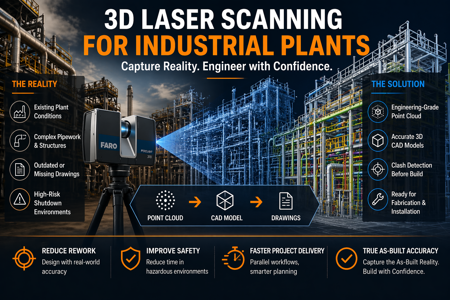
3D Laser Scanning for Industrial Plants

3D laser scanning for industrial plants

3D Laser Scanning for Industrial Plants | Hamilton By Design

Precision Capture. Smarter Engineering. Reduced Risk.

Blue 3D LiDAR scanner icon on a tripod with scanning waves

Industrial plants are complex, high-risk environments where accuracy is everything. Whether you’re working in mining, processing, manufacturing, or energy, one incorrect dimension can lead to costly rework, shutdown delays, or safety issues.

At Hamilton By Design, we specialise in 3D laser scanning for industrial plantsโ€”capturing real-world conditions with engineering-grade accuracy and turning them into usable models, drawings, and digital assets.


3D LiDAR scanning and 3D modelling service button โ€” laser scanner capturing a point cloud for engineering and CAD modelling
Mechanical engineering services

What is 3D Laser Scanning for Industrial Plants?

3D laser scanning (LiDAR) uses high-speed laser measurement technology to capture millions of points in spaceโ€”creating a point cloud that represents the exact geometry of your plant.

Unlike traditional measuring methods:

  • No manual tape measurements
  • No guesswork or assumptions
  • No reliance on outdated drawings

Instead, you get a true digital representation of reality.


Why Industrial Plants Need 3D Laser Scanning

1. Brownfield Accuracy

Most industrial facilities have evolved over time. Drawings rarely reflect whatโ€™s actually been built.

3D scanning provides:

  • Accurate as-built conditions
  • Clash detection before fabrication
  • Confidence in design decisions

2. Shutdown Planning & Risk Reduction

Shutdowns are expensive. Every hour matters.

With a full point cloud:

  • Work can be planned offsite
  • Fabrication can occur before shutdown
  • Installation becomes faster and safer

3. Complex Geometry Capture

Industrial plants include:

  • Dense pipework
  • Structural steel
  • Conveyor systems
  • Mechanical equipment

3D scanning captures all of itโ€”simultaneouslyโ€”with millimetre-level detail.


4. Engineering-Ready Deliverables

At Hamilton By Design, we donโ€™t just scanโ€”we engineer.

Typical outputs include:

  • Registered point clouds (.E57, .RCP)
  • 3D CAD models (STEP, Parasolid)
  • 2D drawings (AutoCAD layouts, sections, elevations)
  • Simplified models for coordination and fabrication

Point Cloud vs STL โ€“ Why It Matters

Many scanning providers deliver mesh files (STL), which are often:

  • Heavy and difficult to edit
  • Not dimensionally reliable
  • Not suitable for engineering workflows

We focus on point cloud to CAD workflows, ensuring:

  • Traceability back to real-world data
  • Editable, parametric models
  • Engineering-grade outputsโ€”not just visuals

Our Technology & Workflow

We utilise high-precision scanning systems such as the FARO Focus S70 to capture industrial environments efficiently and accurately.

Our workflow:

  1. Site scanning (minimal disruption)
  2. Point cloud registration & validation
  3. Engineering model development
  4. Drawing production & issue

We also support integration into platforms like SolidWorks and Autodesk ReCap Pro for seamless design workflows.


Real Benefits for Industrial Clients

  • Reduced rework โ€“ design with confidence
  • Faster project delivery โ€“ parallel workflows
  • Improved safety โ€“ less time in hazardous areas
  • Better communication โ€“ visual clarity across teams
  • Digital asset creation โ€“ foundation for digital twins

Applications Across Industry

Our 3D laser scanning services are used across:

  • Mining and mineral processing plants
  • Power stations and utilities
  • Manufacturing facilities
  • Oil & gas infrastructure
  • Water treatment plants

From conveyors and chutes to pump stations and structural steel upgradesโ€”we connect design to reality.


Why Hamilton By Design?

Weโ€™re not just scanning techniciansโ€”weโ€™re engineers.

That means:

  • We understand fabrication tolerances
  • We design for real-world installation
  • We deliver outputs that your team can actually use

Our focus is simple:
Accurate data โ†’ Better decisions โ†’ Successful projects


Hamilton By Design logo displayed on a blue tilted rectangle with a grey gradient background
3D CAD Modelling Australia service banner for Hamilton By Design

Get Started

If youโ€™re planning an upgrade, shutdown, or new installation within an existing plant, 3D laser scanning is no longer optionalโ€”itโ€™s essential.

Hamilton By Design provides reliable, engineering-grade 3D laser scanning for industrial plants across Australia.

Our clients

Contact us today to discuss your project and see how we can support your next job with precision and clarity.

Name
Would you like us to arrange a phone consultation for you?
Address
CHPP Engineering title graphic featuring bold white text reading "CHPP Engineering" centred on a blue rounded rectangle background.
Pipework Drafting title graphic featuring bold white text reading "Pipework Drafting" centred on a blue rounded rectangle background.
3D LiDAR Scanning for Engineering Projects title graphic featuring bold white text on a blue rounded rectangle background.

LiDAR Scanning vs Handheld Scanning for Engineering Projects | Hamilton By Design

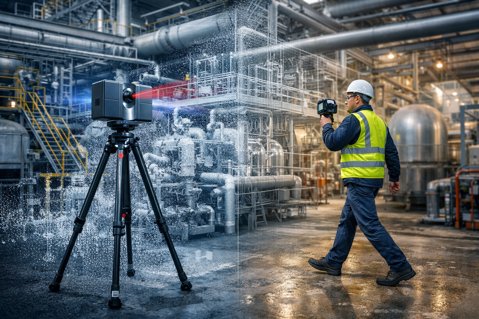
Tripod LiDAR scanner and handheld 3D scanner capturing an industrial plant with point cloud overlay for engineering design

LiDAR Scanning vs Handheld Scanning for Engineering Projects

When clients first look at 3D scanning solutions, one of the most common questions is whether they need a tripod-based LiDAR scanner or a handheld scanner. Both technologies have a place, but the right choice depends on the outcome required.

At Hamilton By Design, we focus on engineering-led reality capture. That means selecting the scanning method that best supports accurate design, fabrication, brownfield upgrades, and reliable project delivery.

3D LiDAR scanning and 3D modelling service button โ€” laser scanner capturing a point cloud for engineering and CAD modelling
Mechanical engineering services

What is the difference?

A tripod-based LiDAR scanner captures highly accurate point cloud data from fixed scan positions. This method is ideal when projects require dependable geometry, repeatable measurements, and engineering-grade outputs.

A handheld scanner is typically used to move quickly through a space and capture data on the go. It can be useful for general visualisation, rapid site understanding, and concept-level work, but it is not always the best fit where tight tolerances or fabrication-ready information is required.

Benefits of tripod-based LiDAR scanning

Higher accuracy

Tripod-based LiDAR scanning is better suited to projects where dimensional accuracy matters. This is particularly important for:

  • plant upgrades
  • tie-in design
  • structural modifications
  • pipework alterations
  • reverse engineering
  • fabrication support

Reliable fixed-position data

Because scans are captured from known stationary positions, the data can be registered into a stable point cloud. This gives engineers, designers, and project teams greater confidence in the model and the measurements taken from it.

Better for engineering and design

Where a project needs scan-to-CAD modelling, design development, clash checking, or digital twin support, tripod LiDAR scanning generally provides the more dependable base dataset.

Stronger project governance

Engineering projects need traceable and reviewable information. LiDAR scanning supports this by providing a robust record of existing conditions that can be referenced throughout the project lifecycle.

Benefits of handheld scanning

Faster capture over large areas

Handheld scanning can be useful where speed is more important than precision, or where the objective is to quickly understand a space.

Flexible for walkthrough-style capture

These systems can help capture general layouts, access routes, and broader site context in areas where rapid movement is an advantage.

Useful for concept and visualisation work

For early-stage planning or non-critical site representation, handheld scanning can sometimes provide a suitable outcome.

Which one is right for your project?

If your project involves fabrication, engineering design, plant modification, shutdown planning, or accurate as-built records, tripod-based LiDAR scanning is usually the better choice.

If your priority is speed, general layout capture, or conceptual understanding, handheld scanning may have a role.

In many cases, the best result comes from an engineering-led approach, where the required deliverables drive the capture method.

Why Hamilton By Design?

Hamilton By Design provides engineering-grade 3D laser scanning and reality capture services for industrial, mining, mechanical, and brownfield environments. Our focus is not just on collecting data, but on delivering data that supports real engineering outcomes.

We understand that a point cloud is only valuable if it helps reduce uncertainty, improve design confidence, and support practical decision-making.

Learn more

To explore our broader scanning and engineering services, visit:

Talk to Hamilton By Design

If you need accurate site data for design, drafting, reverse engineering, or plant upgrades, Hamilton By Design can help you choose the right scanning approach for your project.

Contact us to discuss your site, deliverables, and required level of detail.


Name
Would you like us to arrange a phone consultation for you?
Address


3D CAD Modelling Australia service banner for Hamilton By Design
Reality Capture Brisbane title graphic with white text on a blue background promoting reality capture, LiDAR scanning and digital engineering services in Brisbane, Queensland.
3D Scanning Brisbane text graphic on a blue background promoting engineering-led laser scanning and reality capture services in Brisbane.

LiDAR Scanning Brisbane title graphic with white text on a blue background promoting terrestrial LiDAR scanning, point cloud capture and reality capture services in Brisbane, Queensland.
SolidWorks Brisbane title graphic with white text on a blue background promoting SolidWorks mechanical design, 3D CAD modelling and engineering drafting services in Brisbane, Queensland.


Mechanical Engineering | Structural Engineering


Accuracy of LiDAR Scanning for Engineering Applications

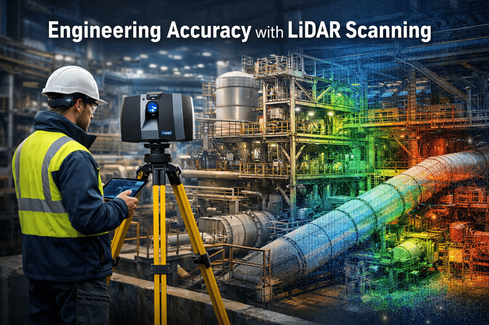
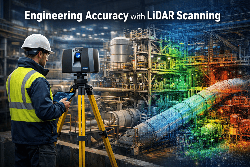
Industrial engineer operating a LiDAR laser scanner capturing high-accuracy point cloud data of a processing plant for engineering design and infrastructure upgrades.

Modern engineering projects increasingly rely on accurate digital representations of existing infrastructure before design, fabrication, or modification begins. One of the most powerful technologies enabling this is LiDAR scanning (Light Detection and Ranging).

At Hamilton By Design, LiDAR scanning is used to capture engineering-grade point cloud data of industrial facilities, mining infrastructure, processing plants, and mechanical systems across Australia.

Understanding the accuracy of LiDAR scanning is essential for engineers, project managers, and asset owners when planning upgrades or modifications to existing facilities.


LiDAR scanning of industrial infrastructure with a 3D point cloud overlay showing engineering-grade measurement accuracy.

What is LiDAR Scanning?

LiDAR scanning works by emitting thousands of laser pulses per second. These pulses strike surrounding surfaces and return to the scanner, allowing precise calculation of distance.

The result is a dense three-dimensional point cloud that captures the exact geometry of an environment.

This digital dataset can then be used for:

โ€ข Engineering modelling
โ€ข Plant layout verification
โ€ข Clash detection
โ€ข Structural analysis
โ€ข Reverse engineering
โ€ข Retrofit design

At Hamilton By Design, these datasets are commonly converted into engineering models and SolidWorks design geometry using our established workflow.

Learn more about this process here:

Point Cloud to Engineering Model Workflow
https://www.hamiltonbydesign.com.au/point-cloud-to-engineering-model-workflow/


Typical Accuracy of Engineering LiDAR Scanning

The accuracy of LiDAR scanning depends on several factors including the scanner type, range to the object, scanning environment, and control methodology.

Typical engineering-grade terrestrial LiDAR systems achieve:

ParameterTypical Accuracy
Scanner measurement accuracyยฑ1 mm to ยฑ3 mm
Registered scan network accuracyยฑ2 mm to ยฑ6 mm
Large plant scan accuracyยฑ5 mm to ยฑ10 mm

For most industrial engineering applications, this level of accuracy is more than sufficient to support:

โ€ข Structural steel modifications
โ€ข Pipework routing and tie-ins
โ€ข Mechanical equipment installation
โ€ข Conveyor and materials handling upgrades
โ€ข Plant shutdown engineering works


Factors That Affect LiDAR Accuracy

Although LiDAR scanning can achieve extremely high accuracy, several practical factors influence final results.

Scan Resolution

Higher resolution scanning increases the number of measured points and improves detail, but also increases processing time and file size.

Distance to Target

Accuracy decreases slightly as the distance between the scanner and the object increases. Industrial scanning programs typically maintain distances between 5โ€“40 metres.

Scan Registration

Multiple scans must be aligned together to form a complete dataset. Proper registration and survey control ensures that the final point cloud remains accurate across large areas.

Surface Conditions

Highly reflective, transparent, or moving surfaces may introduce noise or missing data within the scan.


Why Accuracy Matters for Engineering Projects

Engineering projects often involve modifying existing assets that may have been constructed decades ago.

Original drawings may be missing, outdated, or inaccurate.

By capturing true existing conditions, LiDAR scanning reduces risk during design and construction.

Benefits include:

โ€ข Reduced site rework
โ€ข Fewer installation clashes
โ€ข Faster shutdown execution
โ€ข Improved fabrication accuracy
โ€ข Reduced project uncertainty

This is why many engineering teams now perform scanning before commencing plant upgrades.

Capture Existing Conditions Before Plant Upgrades
https://www.hamiltonbydesign.com.au/capture-existing-conditions-before-plant-upgrades/


LiDAR Scanning for Mining and Industrial Infrastructure

Industries where LiDAR scanning is particularly valuable include:

โ€ข Mining and mineral processing
โ€ข Water and wastewater facilities
โ€ข Power generation plants
โ€ข Heavy manufacturing facilities
โ€ข Materials handling systems

At Hamilton By Design, scanning is commonly used to support:

โ€ข Shutdown planning
โ€ข Structural modifications
โ€ข Mechanical equipment upgrades
โ€ข Brownfield engineering projects

Learn more about our scanning services across Australia:

Engineering Grade 3D Laser Scanning for Mining and Industrial Projects
https://www.hamiltonbydesign.com.au/home/engineering-grade-3d-laser-scanning-mining-industrial/


From Scan Data to Engineering Design

Once captured, LiDAR data becomes the foundation for digital engineering workflows.

Point clouds can be converted into:

โ€ข SolidWorks models
โ€ข Structural steel models
โ€ข Pipe routing layouts
โ€ข Mechanical equipment models
โ€ข Digital twins of plant infrastructure

This allows engineers to design modifications directly against the existing environment, dramatically reducing project risk.


Hamilton By Design logo displayed on a blue tilted rectangle with a grey gradient background

Conclusion

LiDAR scanning has become an essential tool for modern engineering projects, providing millimetre-level accuracy when capturing existing infrastructure.

When combined with experienced engineering workflows, LiDAR enables faster, safer, and more reliable plant upgrades.

At Hamilton By Design, we specialise in transforming high-accuracy LiDAR data into practical engineering models and design solutions for mining, industrial, and infrastructure projects.


Need LiDAR Scanning for Your Project?

Hamilton By Design provides engineering-grade 3D laser scanning services across Australia to support plant upgrades, shutdown projects, and infrastructure modifications.

Learn more about our services here:

3D LiDAR scanning and 3D modelling service button โ€” laser scanner capturing a point cloud for engineering and CAD modelling
Mechanical engineering services
Name
Would you like us to arrange a phone consultation for you?
Address
3D CAD Modelling Australia service banner for Hamilton By Design
Australian Drafting logo featuring bold white text reading "Australian Drafting" centred on a blue rounded rectangle background.
Engineering Governance title graphic featuring bold white text reading "Engineering Governance" centred on a blue rounded rectangle background.
Mechanical, Structural & Pipework Drafting service banner by Hamilton By Design featuring white text on a blue background.
Mechanical engineering services
Blue rounded button with the text โ€œSolidWorks Designโ€ in white.
Finite Element Analysis (FEA) engineering simulation button
3D LiDAR Scanning Darwin for engineering surveys, laser scanning, reality capture and point cloud modelling services
3D LiDAR Scanning Australia engineering services for laser scanning, reality capture, scan-to-CAD, Scan-to-BIM and as-built documentation across Australia
3D LiDAR scanning services on the Central Coast providing engineering-grade laser scanning, point cloud capture, scan-to-CAD modelling and industrial reality capture for infrastructure and industrial projects.
3D LiDAR Scanning Perth for engineering surveys, laser scanning, reality capture and point cloud modelling services
3D LiDAR Scanning Sydney for engineering surveys, laser scanning, reality capture and point cloud modelling services
3D LiDAR Scanning Brisbane for engineering surveys, laser scanning, reality capture and point cloud modelling services
3D LiDAR Scanning Canberra for engineering surveys, laser scanning, reality capture and point cloud modelling services
3D LiDAR Scanning Newcastle for engineering surveys, laser scanning, reality capture and point cloud modelling services
3D LiDAR Scanning Adelaide for engineering surveys, laser scanning, reality capture and point cloud modelling services