Mechanical Engineering | 3D Scanning | 3D Modelling
Tag: LiDAR Scanning
Explore articles and resources on LiDAR scanning, including 3D laser scanning, point cloud capture, reality capture, as-built documentation, scan-to-CAD workflows, and engineering-grade applications for mining, industrial, and infrastructure projects.
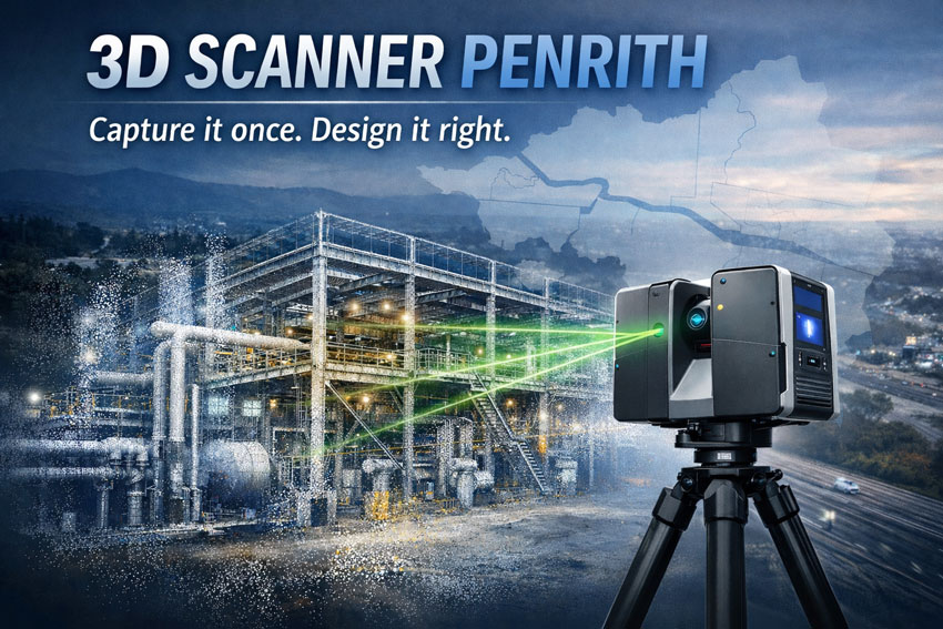
Engineering-grade LiDAR & laser scanning in Penrith, Western Sydney — capture it once, design it right.
When you’re upgrading a plant, refurbishing a building, or tying new steel into an existing structure, you don’t want “close enough”. You want site truth — fast. Hamilton By Design delivers 3D laser scanning (LiDAR) and point clouds in Penrith and Western Sydney, so your engineers, designers, and fabricators can work from accurate as-built data and reduce rework.
Penrith is in the middle of major growth and infrastructure change across Western Sydney, which makes reliable existing-condition data even more valuable for upgrades and brownfields work.
What “3D scanning” means for your project
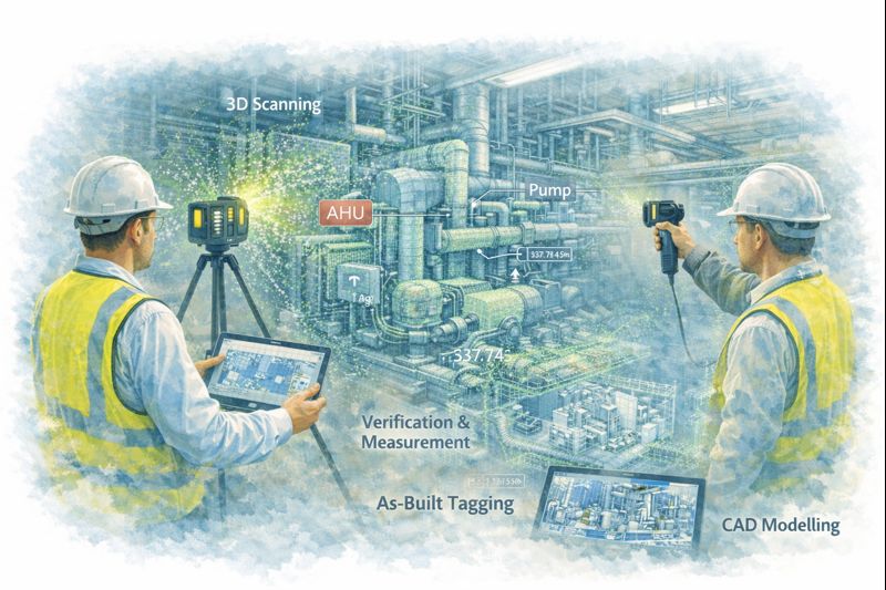
A 3D scanner captures millions of points per second to create a high-density point cloud of your site. That point cloud becomes the backbone of the job:
Faster measuring and fewer return site visits
Better clash detection and tie-in confidence
Cleaner fabrication drawings and install fit-up
Reduced variations caused by missing or outdated as-built information
If the initial scan quality is poor, everything downstream gets harder — modelling, detailing, QA checks, and construction coordination all suffer.
3D scanning services in Penrith
We support projects across Penrith, St Marys, Kingswood, Werrington, Emu Plains, Glenmore Park and surrounding industrial/commercial areas.
Typical use cases
Structural steel tie-ins & refurbishments (accurate interface points)
Capture (multiple scan positions for full coverage)
Registration & QA (clean, aligned dataset)
Delivery (point cloud + agreed outputs, with notes on any occlusions)
For live environments we can plan around operations, access restrictions, and foot traffic to protect equipment and improve capture outcomes.
Why Hamilton By Design for Penrith scanning
We’re an engineering-led team. That matters because scanning isn’t just “collecting data” — it’s collecting the right data to make design and fabrication easier.
You’ll get:
Practical capture strategies that target tie-ins and risk areas
Clear communication on what’s captured (and what can’t be seen)
Outputs designed to reduce RFIs, assumptions, and rework
Penrith’s ongoing development and precinct planning means brownfields interfaces are common — and accurate as-builts help projects stay predictable.
Get a quote for 3D scanning in Penrith
If you want a fast, accurate capture and a dataset your team can trust:
Call / Email: (add your preferred contact details) Service area: Penrith + Western Sydney Turnaround: dependent on site size and deliverables
What to include in your enquiry
Site address + access constraints
What you’re building / modifying
Priority areas (tie-ins, steel interfaces, plant items)
Required deliverables and required accuracy (if specified)
FAQ
How accurate is a 3D scan?
Accuracy depends on scanner type, site conditions, scan geometry, and required control. For most engineering upgrades, the goal is fit-for-purpose accuracy around tie-in areas, not just a pretty model.
Can you scan operating sites?
Yes — we plan around operations, safe access, and line-of-sight limitations.
Do you do scan-to-model?
Yes. We can deliver point clouds only, or provide scan-to-model packages depending on your scope and downstream needs.
3D Scanning Meets SolidWorks AI: AURA & Automated Drawings
If you’ve spent any time in SolidWorks, you know the truth: the real work doesn’t start at modelling — it starts at documentation. Drawings, dimensions, revisions, and change control are where hours disappear.
That’s exactly where AURA — the AI Virtual Assistant inside 3DEXPERIENCE platform and SolidWorks Connected is quietly changing the game — especially when it’s paired with engineering-grade 3D scanning and LiDAR data.
For engineers, asset owners, and project teams working in brownfield or live environments, this combination is moving work from painful to almost effortless.
What Is AURA in SolidWorks?
AURA is the AI assistant embedded into the 3DEXPERIENCE ecosystem. It’s not a chatbot bolted on the side — it’s context-aware AI that understands what you’re doing inside SolidWorks and helps automate repetitive, high-friction tasks.
AURA is already leading the way in:
Automated drawing creation
Intelligent dimension and view suggestions
Faster annotation and documentation workflows
Reduced manual clean-up during revisions
In short, AURA reduces the time between a finished model and a usable drawing set.
Why 3D Scanning Changes Everything
On its own, AI automation is powerful. But when you feed it accurate real-world geometry from 3D scanning, it becomes transformational.
Traditional Workflow (The Old Pain)
Manual site measurement
Assumptions about what’s “square” or “level”
Rework when drawings hit site reality
Revisions, RFIs, delays
Modern Workflow with 3D Scanning + AURA
Site captured with 3D LiDAR scanning
Dense, accurate point clouds imported into SolidWorks
Models built from reality, not assumptions
AURA automates drawing views, dimensions, and documentation
Faster sign-off, fewer clashes, less rework
This is where 3D scanning stops being “nice to have” and becomes mission-critical.
Automated Drawings Built on Reality
When point cloud data drives the model, AURA has something incredibly valuable to work with: truth.
That means:
Drawings reflect as-built conditions, not legacy CAD
Dimensions align with real geometry
Hidden clashes are identified earlier
Fabrication drawings match site conditions the first time
For shutdowns, upgrades, and brownfield projects, this is huge.
The result: 👉 Fewer site variations 👉 Fewer fabrication surprises 👉 Faster approvals 👉 Lower project risk
Why Engineers Are Leaning Into AI + 3D Scanning
Once teams experience this workflow, it’s hard to go back.
Engineers quickly notice:
Drawing creation time drops dramatically
Less mental load managing repetitive documentation
More time spent on engineering decisions, not drafting chores
Greater confidence that drawings reflect reality
When 3D scanning feeds SolidWorks and AURA handles the busywork, engineering becomes cleaner, calmer, and far more predictable.
Where Hamilton By Design Fits In
At Hamilton By Design, we sit at the intersection of:
Engineering-led 3D scanning
Point cloud to SolidWorks modelling
Real-world industrial and building services projects
Practical deployment of AI-enabled workflows
We don’t just scan — we engineer with the data.
That means:
LiDAR scans captured with downstream modelling in mind
Clean, structured point clouds optimised for SolidWorks
Models built to support AURA-driven automated drawings
Outputs that fabrication teams and contractors can actually use
The Rise of the “AURA + LiDAR Consultant”
This is a new role emerging in modern engineering teams: someone who understands 3D scanning, SolidWorks, and how AI like AURA fits into real project delivery.
That’s exactly the conversation we’re having every day.
If you’re:
Struggling with drawing production time
Managing upgrades in complex existing facilities
Tired of site conditions not matching drawings
Curious how AI and 3D scanning actually work together (not just in marketing slides)
👉 Check in at www.hamiltonbydesign.com.au We’re always happy to chat with you as your AURA + LiDAR consultant.
Final Thought: This Isn’t the Future — It’s Already Here
AI-assisted design isn’t replacing engineers. It’s removing the friction that slows good engineers down.
When AURA automates drawing creation and 3D scanning ensures models are grounded in reality, the result is simple:
✔ Better drawings ✔ Faster delivery ✔ Fewer surprises ✔ More time spent engineering
And once you work this way, there’s no going back.
Why Graduate Engineers Quickly Become Addicted to LiDAR Scanning
Ask any graduate engineer what surprised them most in their first few years on the job and you’ll often hear the same answer:
“The drawings were wrong.”
Not maliciously wrong. Not incompetently wrong. Just… out of date, incomplete, or disconnected from what actually exists on site.
That realisation is often the moment graduate engineers discover LiDAR scanning — and once they do, it’s very hard to go back.
Across Greater Sydney, from dense inner-city refurbishments to industrial upgrades in the west, graduate engineers are finding that 3D laser scanning becomes indispensable almost as soon as they’ve worked with it properly. It’s not just helpful. It’s addictive — because it replaces uncertainty with clarity.
The graduate engineer’s first shock: reality doesn’t match the drawing
Most graduate engineers come out of university trained to think in:
idealised geometry
clean load paths
well-defined dimensions
drawings that represent truth
Then they step onto a live site in Sydney CBD, Surry Hills, Parramatta, Mascot, Alexandria, Chatswood, or North Sydney and realise something important:
Existing buildings, plant, and infrastructure are messy.
Services don’t run straight. Columns aren’t perfectly plumb. Steel has been modified, trimmed, plated, or shifted over decades. Mechanical equipment has been replaced multiple times, often without full documentation. In inner suburbs especially, space constraints mean “creative” solutions become permanent.
For a graduate engineer trying to do the right thing, this mismatch creates anxiety:
Am I designing to the right information?
What happens if this doesn’t fit?
How confident should I be signing this off?
This is where LiDAR scanning changes everything.
The first scan changes how graduates think
The first time a graduate engineer works with a real point cloud, something clicks.
Instead of guessing:
they can measure directly
they can see spatial relationships
they can verify assumptions
they can design in context
Suddenly, the question shifts from “what does the drawing say?” to “what actually exists?”
Once that shift happens, it’s very hard to go back to traditional workflows.
Hamilton By Design’s approach to engineering-led LiDAR scanning highlights this transition clearly — scanning isn’t just data capture, it’s digital quality assurance for engineering decisions.
For graduate engineers, this is often the first time they feel genuinely confident that their design inputs reflect reality.
Why LiDAR scanning becomes “addictive”
LiDAR scanning is addictive to graduate engineers for one simple reason:
It removes doubt.
Once you’ve experienced what it’s like to design from verified geometry, going back to hand measurements and assumptions feels risky — even irresponsible.
1. Confidence replaces guesswork
Instead of hoping clearances exist, graduates can prove they exist. Instead of estimating offsets, they can measure them. This builds technical confidence very quickly.
2. Mistakes become learning, not disasters
When designs are checked against a point cloud, errors are caught early — in the model, not on site. Graduates learn faster because mistakes are visible and correctable.
These lessons are difficult to teach from textbooks alone.
Inner Sydney makes scanning essential, not optional
In inner Sydney suburbs, LiDAR scanning is not a luxury — it’s often the only practical way to work.
Areas like:
Sydney CBD
Ultimo
Pyrmont
Surry Hills
Redfern
Alexandria
Zetland
Newtown
are characterised by:
tight sites
layered services
heritage structures
mixed-use refurbishments
minimal tolerance for rework
Graduate engineers working on these projects quickly learn that:
traditional site measurement is slow and disruptive
access is limited and time-boxed
errors are expensive and highly visible
Scanning allows:
rapid capture without extended site shutdowns
remote review and collaboration
fewer repeat site visits
better coordination between disciplines
Once graduates experience this efficiency, they naturally push for scanning on future projects.
How scanning supports better engineering decisions
LiDAR scanning doesn’t replace engineering judgement — it supports it.
Hamilton By Design frames scanning as a core part of engineering projects, not a bolt-on service. That distinction matters, especially for younger engineers still developing confidence.
Point clouds make design reviews clearer. Instead of explaining issues abstractly, graduates can show the problem in 3D context — especially helpful when working with senior engineers, fabricators, or clients.
Safer decisions
Designing from verified geometry reduces the risk of unsafe site improvisation. Graduates learn early that safety is tied directly to design certainty.
The “digital safety net” for early-career engineers
For many graduates, LiDAR scanning acts as a digital safety net.
Early in a career, the fear of “missing something obvious” is real. Scanning provides reassurance:
Have I considered the surrounding structure?
Did I allow enough clearance?
Is this installable?
Instead of relying solely on experience they haven’t yet built, graduates can lean on measured reality.
Over time, this accelerates professional growth:
better spatial awareness
improved constructability thinking
stronger questioning of legacy documentation
Ironically, the more graduates use scanning, the faster they develop the intuition to know when it’s needed — and when it’s not.
Greater Sydney: scanning as a standard workflow
Across Greater Sydney, LiDAR scanning is increasingly becoming standard practice for:
building refurbishments
industrial upgrades
mechanical plant modifications
structural alterations
asset verification and compliance work
In western Sydney industrial areas, scanning supports large-scale plant and warehouse projects. In the north and east, it supports constrained commercial and infrastructure upgrades. In the inner suburbs, it often makes projects feasible at all.
Graduate engineers exposed to this environment quickly learn:
projects that scan early run smoother
fewer RFIs come back from site
fabrication issues drop dramatically
install teams trust the drawings more
Once they’ve seen this pattern a few times, scanning stops being a “special request” and becomes the default question:
“Can we scan this first?”
Why engineers struggle to go back once they’ve scanned
After working with LiDAR scanning, graduates often struggle with projects that don’t include it.
They notice:
more uncertainty
more site clarification calls
more “we’ll fix it on site” language
more reliance on assumptions
This is why scanning feels addictive — not because it’s flashy technology, but because it reduces friction at every stage of an engineering project.
For young engineers trying to build credibility, that reduction in friction is powerful. It allows them to:
deliver cleaner designs
ask better questions
contribute meaningfully earlier in their careers
Digital quality assurance becomes a mindset
Perhaps the biggest shift LiDAR scanning creates is cultural.
Graduate engineers exposed to scanning early start to think in terms of digital quality assurance:
verify before design
check before fabrication
confirm before installation
This mindset aligns closely with modern engineering governance, risk management, and professional accountability.
Hamilton By Design’s emphasis on scanning as digital quality assurance reflects this evolution — scanning isn’t about technology for its own sake, it’s about engineering confidence.
Final thoughts: once you see clearly, you don’t want to design blind again
For graduate engineers, LiDAR scanning often marks a turning point.
It’s the moment they realise engineering doesn’t have to rely on best guesses, inherited drawings, or incomplete information. It’s the moment they understand that good engineering starts with seeing clearly.
In Greater Sydney, especially across dense inner suburbs, that clarity isn’t optional — it’s essential.
Once graduate engineers experience what it’s like to design from reality, not assumption, LiDAR scanning stops being a tool and becomes part of how they think. And that’s why, once they’ve scanned properly, most engineers never want to design without it again.
Choosing the Right 3D Scanning Tool for Engineering Projects
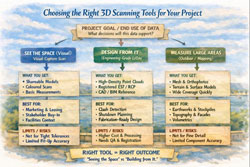
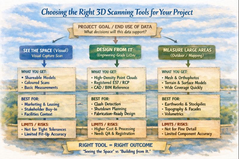
3D scanning is now widely used across construction, property, manufacturing, and heavy industry — but not all scanning tools are designed for the same outcomes. Choosing the right technology depends less on the buzzwords and more on what you actually need to do with the data after it’s captured.
This article explains the main types of 3D scanning commonly used in Australia today, what they’re best suited for, and how to choose the right approach for your project.
1. Visual Capture Scanning (Property, Architecture & Digital Twins)
Best for:
Property marketing and virtual tours
Design coordination
Facilities management
Heritage documentation
Basic Scan-to-BIM
Typical outputs:
Web-based walk‑through models
Coloured point clouds
Floor plans and simple BIM geometry
OBJ / E57 exports for modelling
Strengths:
Fast capture
Lower cost
Easy sharing via web platforms
Excellent for stakeholder engagement
Limitations:
Lower geometric accuracy
Not suitable for fabrication tolerances
Not reliable for mechanical or structural fit‑up
This type of scanning is ideal when the goal is visual context and spatial understanding, rather than precise dimensional control.
Engineering LiDAR is used when design decisions and fabrication depend on accurate geometry, not just visual representation.
3. Photogrammetry (Large Areas & Outdoor Mapping)
Best for:
Stockpile measurement
Terrain mapping
Façade capture
Infrastructure corridors
Typical outputs:
Mesh models
Orthophotos
Surface models
Strengths:
Covers large areas quickly
Drone‑based access
Useful for topography
Limitations:
Less accurate for fine detail
Poor performance in tight or indoor environments
Limited for mechanical components
Photogrammetry is excellent for scale and surface data, but not for high‑precision engineering work.
4. Why the End Use of Data Matters More Than the Scanner
The most common mistake in 3D scanning projects is choosing a capture method before defining:
Will the data be used for design and fabrication?
Or mainly for visualisation and documentation?
Do tolerances matter?
Will components be manufactured from this data?
If scanning is only used for:
Layout confirmation
Space planning
Stakeholder communication
Then visual scanning platforms may be entirely sufficient.
If scanning is used for:
Equipment replacement
Structural modification
Pipework or conveyor interfaces
Custom fabrication
Then engineering‑grade LiDAR is essential.
5. Matching the Tool to the Job
Project Type
Recommended Technology
Real estate & virtual tours
Visual capture scanning
Office and building refurbishments
Visual capture or LiDAR depending on tolerances
Plant upgrades & shutdowns
Engineering‑grade LiDAR
Mechanical retrofits
Engineering‑grade LiDAR
Large outdoor mapping
Photogrammetry or LiDAR
Fabrication from existing assets
Engineering‑grade LiDAR only
6. Scanning Is Only Step One
Regardless of the technology used, scanning only creates value when paired with:
Proper registration and QA
Engineering interpretation
CAD modelling and documentation
Design validation
Without these steps, point clouds remain large files with limited practical use.
The biggest performance gains come when scanning is directly integrated into:
Engineering design
Constructability reviews
Clash detection
Fabrication planning
Final Thoughts
3D scanning is not a single solution — it is a group of technologies with very different strengths.
The right approach depends on whether your project is focused on:
Seeing the space, or
Building from the space
Understanding that difference early can save significant time, cost, and rework later in the project lifecycle.
If you’re unsure which approach fits your project, start by defining what decisions and deliverables will rely on the data — then choose the scanning method that supports those outcomes, not just the fastest or cheapest option.
Engineering-Grade Reality Capture for Live Construction Environments
Construction projects in Brisbane operate under conditions that place unique pressure on engineers, builders, and asset owners. Subtropical climate, flood-affected sites, reactive soils, dense CBD logistics, and a strong reliance on brownfield upgrades all increase one fundamental risk: designing and constructing from incorrect or outdated site information.
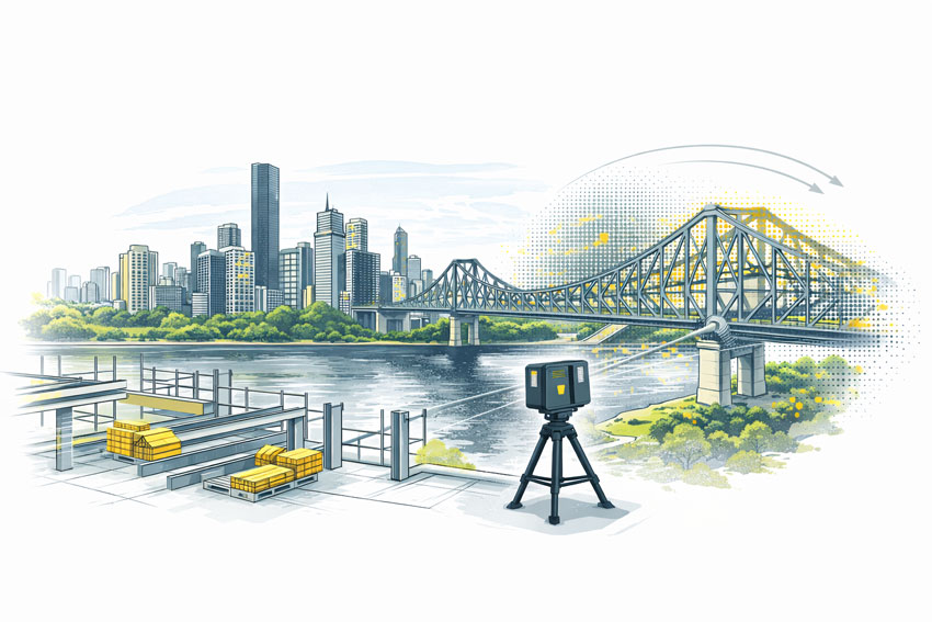
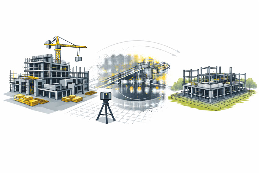
A 3D construction scan in Brisbane provides engineering-grade certainty by capturing what actually exists on site, enabling informed decisions during live construction, refurbishment, and staged delivery projects.
What Is a 3D Construction Scan?
A 3D construction scan uses high-accuracy LiDAR laser scanning to capture the true as-built condition of a site at a specific point in time. Unlike visual scans or phone-based capture, engineering-grade scanning produces registered point clouds that can be trusted for:
Construction coordination
Design verification
Clash detection
Fabrication-ready modelling
As-built documentation
Hamilton By Design delivers these outcomes through its engineering-led laser scanning services, where accuracy, downstream use, and construction risk are defined before scanning begins.
Why Brisbane Construction Projects Require a Different Approach
Subtropical Climate & Structural Movement
Brisbane’s humidity and temperature cycles contribute to thermal expansion, contraction, and cumulative movement across steelwork, pipe runs, conveyors, façades, and plant installations.
When construction decisions rely on assumed geometry or legacy drawings, even small movements can result in:
Misaligned interfaces
Fabrication clashes
Installation delays
A 3D construction scan captures the current, in-situ geometry, allowing engineers to design and coordinate based on reality — not historical intent.
Flood-Affected & Modified Assets
Many Brisbane sites — particularly river-adjacent commercial and industrial facilities — have undergone multiple flood recovery and modification cycles. Over time, this results in:
Changed floor levels
Unrecorded ramps and bunds
Altered drainage and gravity-dependent systems
Construction scanning establishes a true datum and elevation baseline, supporting engineering verification of falls, access clearances, and tie-in points.
This capability aligns directly with Hamilton By Design’s broader reality capture and as-built verification workflows.
Brownfield Construction Is the Norm
A significant proportion of Brisbane construction work occurs in live, operational environments, including:
Commercial refurbishments
Industrial plant upgrades
Infrastructure modifications
Asset life-extension projects
These sites often contain undocumented steelwork, legacy penetrations, and accumulated modifications. A 3D construction scan enables non-intrusive capture of this complexity, supporting engineering coordination without disrupting operations.
Reactive clay soils common throughout South-East Queensland contribute to long-term differential settlement, particularly where new construction interfaces with older structures. Over time, this can lead to:
Misaligned columns and beams
Drift in conveyors and pipe racks
Geometry that no longer matches design intent
A construction scan captures current condition, enabling engineers to design extensions and upgrades that reflect actual site geometry.
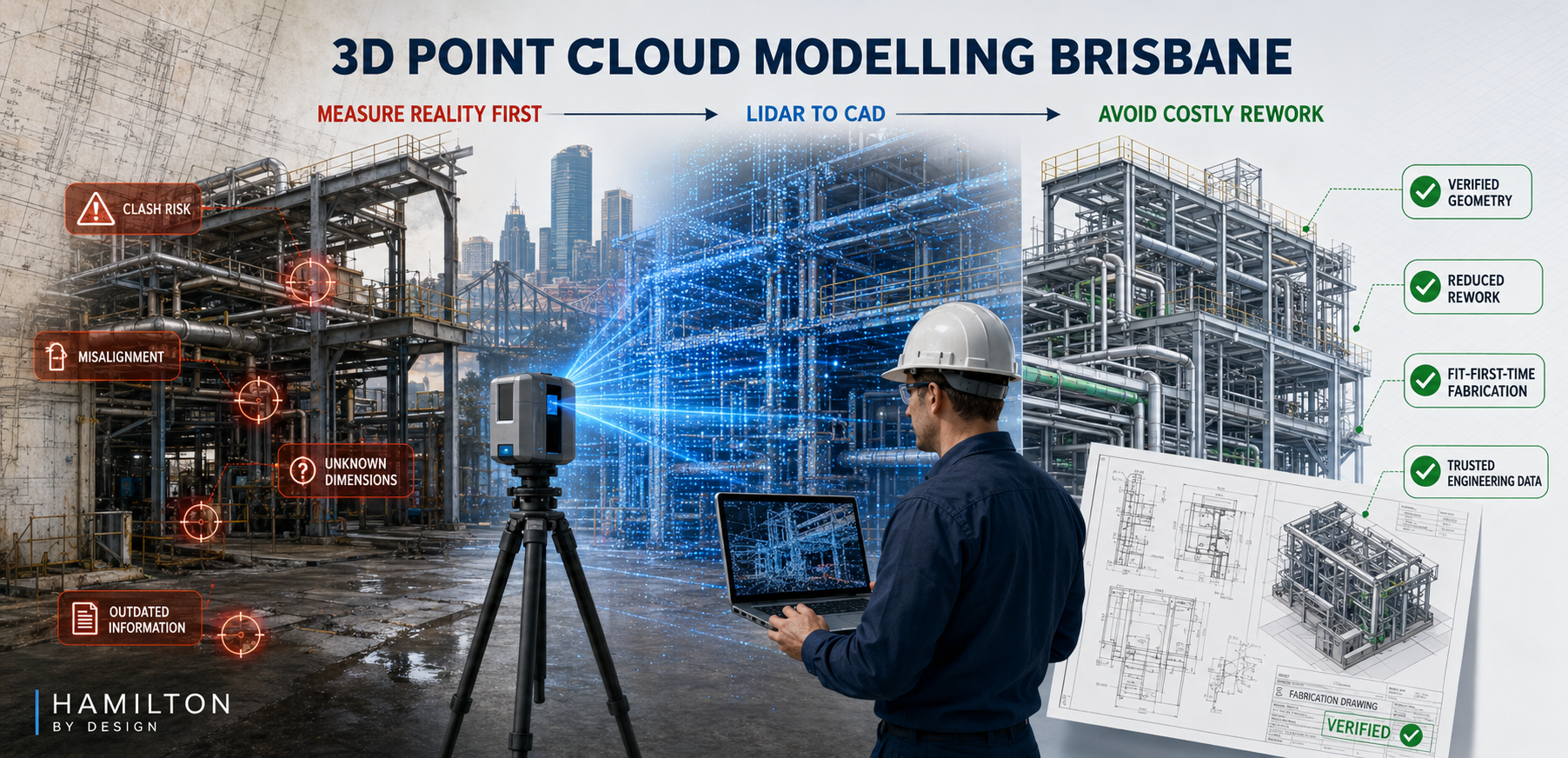
Modern engineering, fabrication, and asset upgrades increasingly rely on 3D point cloud data as the foundation for design decisions. However, not all “3D scans” produce data that is suitable for engineering-grade modelling.
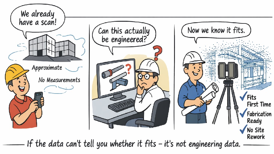
At Hamilton By Design, we regularly encounter projects where scanning has already been undertaken, yet the data cannot be safely relied upon for structural checks, fabrication drawings, or fit-first-time installation. The reason is simple: many common scanning technologies do not generate a true, measurable 3D point cloud.
What Is a True Engineering 3D Point Cloud?
A true 3D point cloud consists of millions of directly measured XYZ coordinates, captured using survey-grade LiDAR technology. Each point represents a real, measured position in space, with known accuracy and traceable error.
This level of data is essential when:
Steelwork must fit without site modification
Pipe spools are fabricated off-site
Structural members must be verified
Clearances and clashes carry cost or safety risk
Visual models, meshes, or approximated surfaces may look correct, but without direct distance measurement and accuracy control, they cannot be relied upon for engineering.
Not All “3D Scans” Produce a Usable Point Cloud
The table below compares common capture methods against engineering-grade LiDAR scanning.
Engineering Data Comparison – 3D Capture Technologies
Criteria
Phone / App Scan
Photo-grammetry
Real-Estate / Visual Scanners
Engineering LiDAR (Hamilton By Design)
Direct distance measurement
❌ No
❌ No
⚠️ Limited
✅ Yes (time-of-flight)
True 3D point cloud output
⚠️ Low-density
❌ No (mesh only)
⚠️ Filtered
✅ Raw XYZ data
Global accuracy control
❌ None
❌ None
❌ None
✅ Survey-controlled
Typical usable accuracy
±20–50 mm
±10–30 mm
±10–20 mm
±1–2 mm
Consistent point density
❌ No
❌ No
❌ No
✅ Yes
Steel & reflective surfaces
❌ Poor
❌ Poor
⚠️ Limited
✅ Yes
Pipework & beam definition
❌ No
⚠️ Limited
❌ No
✅ Yes
Large industrial site capture
❌ No
⚠️ Limited
❌ No
✅ Yes
Registration error reporting
❌ No
❌ No
❌ No
✅ Yes
Suitable for fabrication drawings
❌ No
❌ No
❌ No
✅ Yes
Suitable for structural checks / FEA
❌ No
❌ No
❌ No
✅ Yes
Fit-first-time confidence
❌ No
❌ No
❌ No
✅ Yes
Why This Matters for Brisbane Projects
In Brisbane and across South-East Queensland, many projects involve:
Industrial plant upgrades
Infrastructure retrofits
Fabrication undertaken off-site
Tight shutdown windows
In these environments, millimetres matter. If a beam, pipe, or support cannot be accurately defined in the model, the risk of rework, delays, and site modification increases significantly.
Put simply:
If the data cannot reliably tell you whether something fits, clears, or carries load, it is not suitable for engineering.
Engineer-Led Point Cloud Modelling
Hamilton By Design uses engineering-grade terrestrial LiDAR scanners and an engineer-led workflow to ensure point cloud data is suitable for:
SolidWorks 3D modelling
Fabrication-ready drawings
Structural verification
Clash detection and layout validation
By controlling both data capture and modelling, we maintain single-source accountability — reducing risk and ensuring the model reflects reality.
From Scan to Shop Floor — Done Right
3D point cloud modelling is not about creating a visually impressive model. It is about creating a reliable digital representation of reality that engineers, fabricators, and contractors can trust.
If you are planning a project in Brisbane and need point cloud data that supports real engineering decisions, speak with Hamilton By Design before relying on consumer or visual-only scanning methods.
To provide the best experiences, we use technologies like cookies to store and/or access device information. Consenting to these technologies will allow us to process data such as browsing behaviour or unique IDs on this site. Not consenting or withdrawing consent, may adversely affect certain features and functions.
Functional
Always active
The technical storage or access is strictly necessary for the legitimate purpose of enabling the use of a specific service explicitly requested by the subscriber or user, or for the sole purpose of carrying out the transmission of a communication over an electronic communications network.
Preferences
The technical storage or access is necessary for the legitimate purpose of storing preferences that are not requested by the subscriber or user.
Statistics
The technical storage or access that is used exclusively for statistical purposes.The technical storage or access that is used exclusively for anonymous statistical purposes. Without a subpoena, voluntary compliance on the part of your Internet Service Provider, or additional records from a third party, information stored or retrieved for this purpose alone cannot usually be used to identify you.
Marketing
The technical storage or access is required to create user profiles to send advertising, or to track the user on a website or across several websites for similar marketing purposes.