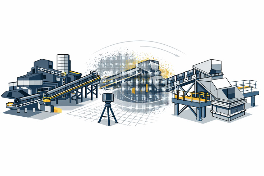
Mining & Mineral Processing

LiDAR laser scanner capturing a mining and mineral processing plant to create an accurate 3D digital model for engineering and fabrication
Blue icon of a conveyor belt carrying material into a crusher or processing unit

We support mining and mineral processing operations with engineering-grade LiDAR scanning and mechanical design for CHPPs, conveyors, transfer stations, plant upgrades, and brownfield modifications. Our experience in live operating environments helps reduce shutdown risk, rework, and costly fabrication errors.

Mining & Mineral Processing Engineering Services

Hamilton By Design supports mining and mineral processing operations with engineering-grade LiDAR scanning, mechanical engineering, and design support for complex, live operating environments.
Our work focuses on delivering accurate existing-condition data and engineering outcomes that reduce shutdown risk, minimise rework, and support safe, efficient plant upgrades.

We work across the full project lifecycle โ€” from early site capture and feasibility through to detailed design, fabrication support, and construction verification โ€” with a strong emphasis on brownfield and retrofit projects where getting the geometry right is critical.


Mining Engineering Services

Our mining engineering services are built around a clear principle: engineering decisions must be based on accurate site data. We combine reality capture with mechanical engineering to support informed design, modification, and execution of mining projects.

These services support:

  • Existing asset validation
  • Upgrade and modification planning
  • Engineering design development
  • Risk reduction in live operating plants

By integrating scanning and engineering under one workflow, we provide mining teams with confidence that designs reflect real-world conditions.


Mining & Industrial Engineering

Mining operations rely on complex industrial systems that must perform reliably under demanding conditions. Hamilton By Design works at the interface between mining infrastructure and industrial plant systems, supporting projects where mechanical, structural, and operational requirements overlap.

Our experience includes:

  • Mineral processing facilities and CHPPs
  • Materials handling systems
  • Industrial plant equipment within mining sites
  • Brownfield integration and asset upgrades

This cross-disciplinary approach allows us to support mining clients with solutions that are practical, buildable, and aligned with operational constraints.


Mining Services

Our mining services focus on practical project delivery support. We work alongside site teams, engineers, and contractors to capture existing conditions, verify designs, and support construction and shutdown activities.

Typical services include:

  • Engineering-grade LiDAR and as-built capture
  • Existing condition verification
  • Design coordination support
  • Construction and installation validation

These services help reduce uncertainty on site and provide a reliable digital foundation for engineering and fabrication activities.


Mechanical Engineering in Mining

Mechanical engineering is central to the safe and efficient operation of mining assets. Hamilton By Design provides mechanical engineering support informed directly by site-captured data, ensuring designs are suitable for real operating environments.

Our mechanical engineering capabilities support:

  • Conveyors, chutes, and transfer stations
  • Plant upgrades and modifications
  • Structural and mechanical interfaces
  • Fabrication-ready design documentation

Where required, our work can be supported by engineering verification and analysis to provide additional confidence in design outcomes.


Engineering-Led, Fit-for-Purpose Outcomes

Hamilton By Design operates with a strong focus on:

  • Accuracy over assumption
  • Engineering accountability
  • Fit-first-time outcomes
  • Reduced risk in brownfield environments

By combining reality capture with mechanical engineering, we help mining and mineral processing clients move from uncertain existing conditions to confident engineering decisions.


Hamilton By Design logo displayed on a blue tilted rectangle with a grey gradient background

If you are planning a mining or mineral processing upgrade, modification, or verification project, Hamilton By Design can support your team with engineering-grade scanning and mechanical design services tailored to live operating environments.


Structural drafting services button
3D LiDAR scanning and 3D modelling services button
Mechanical drafting services button

Our clients:

Name
Would you like us to arrange a phone consultation for you?
Address
3D LiDAR scanning and 3D modelling service button โ€” laser scanner capturing a point cloud for engineering and CAD modelling
Mechanical engineering services

3D Laser Scanning

3D LiDAR Scanning โ€“ Digital Quality Assurance

Mechanical Engineering Perth WA banner for Hamilton By Design featuring white text on a blue background.
3D Laser Scanning Perth WA banner for Hamilton By Design with white text on a blue background.
SolidWorks Perth WA banner for Hamilton By Design featuring white text on a blue background.

SolidWorks Mechanical Design Services

As-Built Drawings from a LiDAR Scanner

3D LiDAR Scanning and 3D Modelling – Hamilton By Design

https://www.hamiltonbydesign.com.au/perth-wa
3D CAD Modelling Australia service banner for Hamilton By Design
3D LiDAR scanning and 3D modelling service button โ€” laser scanner capturing a point cloud for engineering and CAD modelling
Mechanical engineering services
3D CAD Modelling Australia service banner for Hamilton By Design
Mechanical, Structural & Pipework Drafting service banner by Hamilton By Design featuring white text on a blue background.
Australian Drafting logo featuring bold white text reading "Australian Drafting" centred on a blue rounded rectangle background.
Blue banner graphic displaying the text "Point Cloud to CAD - Australia" in large white lettering, representing point cloud processing, scan-to-CAD conversion and digital engineering services across Australia.
CHPP Engineering title graphic featuring bold white text reading "CHPP Engineering" centred on a blue rounded rectangle background.
Engineering Governance title graphic featuring bold white text reading "Engineering Governance" centred on a blue rounded rectangle background.
Mechanical engineering services
Australian Drafting logo featuring bold white text reading "Australian Drafting" centred on a blue rounded rectangle background.
https://www.hamiltonbydesign.com.au/lidar-scanning-brisbane-2
3D LiDAR Scanning Hunter & Newcastle banner with white text on a blue background promoting engineering-grade laser scanning services for industrial, mining and infrastructure projects across the Hunter Valley and Newcastle region.
Mechanical Engineering Hunter & Newcastle banner promoting mechanical engineering services for mining, industrial plants, power generation, manufacturing and heavy industry throughout the Hunter Valley and Newcastle region.
Structural Drafting Hunter & Newcastle banner promoting structural drafting services for mining, industrial plants, power generation, manufacturing and infrastructure projects across the Hunter Valley and Newcastle region.
Mechanical Engineering Perth WA banner for Hamilton By Design featuring white text on a blue background.
3D Laser Scanning Perth WA banner for Hamilton By Design with white text on a blue background.
SolidWorks Perth WA banner for Hamilton By Design featuring white text on a blue background.
Fabrication and product design services
Finite Element Analysis (FEA) engineering simulation button
3D LiDAR scanning and 3D modelling service button โ€” laser scanner capturing a point cloud for engineering and CAD modelling
Blue rounded button with the text โ€œSolidWorks Designโ€ in white.
Mechanical drafting services button
Structural drafting services button

Mechanical Engineering | Structural Engineering


3D Scanning Brisbane

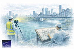
Engineer completing structural drafting while a LiDAR scanner captures as-built data along the Brisbane River with the Story Bridge in view

3D Scanning Brisbane | Engineering-Led LiDAR & Risk Management


We are engineers. Let us manage your risk.

3D scanning is often treated as a visual exercise. In engineering, it is a measurement task. The difference matters.

At Hamilton By Design, 3D scanning in Brisbane is approached as an engineering activity, not just data capture. Our role is to ensure the information collected on site can be safely relied upon for design, fabrication, and installation โ€” without rework, uncertainty, or guesswork.


What People Mean When They Say โ€œ3D Scanningโ€

When someone searches for 3D scanning Brisbane, they are usually trying to answer one question:

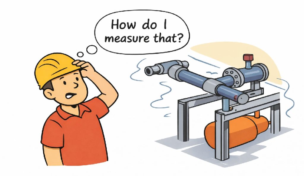
โ€œHow do I measure what already exists?โ€

That might be to:

  • Capture existing site conditions
  • Reduce uncertainty before fabrication
  • Avoid clashes or rework on site

The challenge is that not all scanning methods actually measure geometry.


Cartoon showing a worker asking โ€œHow do I measure that?โ€ while looking at complex pipework, illustrating the need for accurate engineering-grade 3D scanning.

3D Scanning in Brisbane โ€“ Typical Use Cases

Across Brisbane and South-East Queensland, 3D scanning is commonly used for:

  • Industrial plant upgrades and brownfield sites
  • As-built capture of steel, services, and structures
  • Fabrication completed off-site
  • Retrofit works with limited access
  • Shutdown and tie-in planning

For projects like these, scanning is typically carried out using engineering-grade laser scanning, not visual or consumer-grade tools.
3D Laser Scanning


Scanning Is Not the Same as Measuring

(Simple cartoon here: character looking at an object asking โ€œHow do I measure that?โ€)

Scanning is not the same as measuring.
In fabrication, we measure twice and cut once.
With the right scanner, you only need to scan once.

Many scanning tools create models that look right but are based on inferred or smoothed geometry. For engineering, appearance is not enough โ€” the data must be measurable and accurate.


Not All 3D Scanning Is the Same

There are different ways to โ€œscanโ€ a site, each producing very different outcomes:

  • Phone and visual scans
    Useful for reference and visualisation, but not suitable for engineering.
  • Photogrammetry
    Good for context and large areas, but geometry is inferred rather than directly measured.
  • Engineering-grade LiDAR scanning
    Uses direct distance measurement to generate a true 3D point cloud.

Measured scan data can then be converted into usable engineering information through point cloud modelling workflows.
3D Point Cloud Modelling Brisbane


When Engineering-Grade Scanning Is Required

Engineering-grade scanning is required when:

  • Steelwork must fit first time
  • Pipework or spools are fabricated off-site
  • Structural members must be verified
  • Clearances and clashes carry cost or safety risk
  • There is only one opportunity to access the site

In these cases, scan data is typically followed by a Scan-to-CAD process, where point clouds are converted into accurate 3D models and drawings.
Scan to CAD Brisbane


Our Approach to 3D Scanning

Hamilton By Design treats scanning as part of a complete engineering workflow, not a standalone service.

Our approach includes:

  • Engineer-led scanning
  • Measurement-first mindset
  • Engineering-grade LiDAR equipment
  • Clear understanding of downstream use

By integrating scanning with mechanical engineering services, we maintain single-source accountability from site capture through to fabrication-ready deliverables.
Mechanical Engineering Services


What Happens After the Scan

3D scanning is the starting point, not the end.

Accurate scan data supports:

  • 3D CAD modelling
  • Fabrication and shop drawings
  • Structural verification
  • Clash detection and layout validation

Every downstream decision depends on the quality of the measurement captured at the start.


Talk to an Engineer Before You Scan

Many project issues begin with the wrong question:

โ€œCan you scan this?โ€

The better question is:

โ€œHow do I measure this so it can be engineered?โ€

If you need 3D scanning in Brisbane that can safely support engineering and fabrication decisions, Hamilton By Design can help you get it right the first time.


We are engineers. Let us manage your risk.


Hamilton By Design logo displayed on a blue tilted rectangle with a grey gradient background

Our clients:

Name
Would you like us to arrange a phone consultation for you?
Address
3D LiDAR scanning and 3D modelling service button โ€” laser scanner capturing a point cloud for engineering and CAD modelling
Mechanical engineering services
Finite Element Analysis (FEA) engineering simulation button
Mechanical engineering services

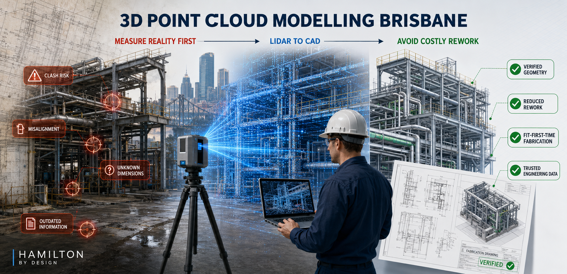
3D Point Cloud Modelling Brisbane

3D point cloud modelling Brisbane image showing LiDAR scanning of industrial pipework and steelwork, converting site conditions into CAD models and fabrication drawings.

Getting the Data Right First

Blue 3D LiDAR scanner icon on a tripod with scanning waves

Modern engineering, fabrication, and asset upgrades increasingly rely on 3D point cloud data as the foundation for design decisions. However, not all โ€œ3D scansโ€ produce data that is suitable for engineering-grade modelling.

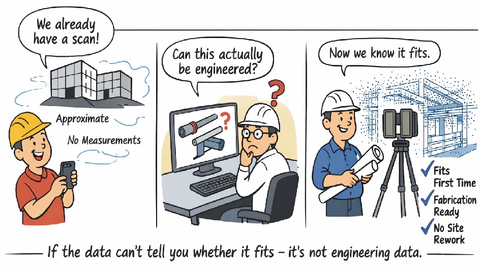
At Hamilton By Design, we regularly encounter projects where scanning has already been undertaken, yet the data cannot be safely relied upon for structural checks, fabrication drawings, or fit-first-time installation. The reason is simple: many common scanning technologies do not generate a true, measurable 3D point cloud.


Cartoon illustrating the difference between visual scanning and engineering-grade 3D point cloud scanning, showing how accurate scan data enables fit-first-time fabrication.

What Is a True Engineering 3D Point Cloud?

A true 3D point cloud consists of millions of directly measured XYZ coordinates, captured using survey-grade LiDAR technology. Each point represents a real, measured position in space, with known accuracy and traceable error.

This level of data is essential when:

  • Steelwork must fit without site modification
  • Pipe spools are fabricated off-site
  • Structural members must be verified
  • Clearances and clashes carry cost or safety risk

Visual models, meshes, or approximated surfaces may look correct, but without direct distance measurement and accuracy control, they cannot be relied upon for engineering.


Not All โ€œ3D Scansโ€ Produce a Usable Point Cloud

The table below compares common capture methods against engineering-grade LiDAR scanning.

Engineering Data Comparison โ€“ 3D Capture Technologies

CriteriaPhone / App ScanPhoto-grammetryReal-Estate / Visual ScannersEngineering LiDAR (Hamilton By Design)
Direct distance measurementโŒ NoโŒ Noโš ๏ธ Limitedโœ… Yes (time-of-flight)
True 3D point cloud outputโš ๏ธ Low-densityโŒ No (mesh only)โš ๏ธ Filteredโœ… Raw XYZ data
Global accuracy controlโŒ NoneโŒ NoneโŒ Noneโœ… Survey-controlled
Typical usable accuracyยฑ20โ€“50 mmยฑ10โ€“30 mmยฑ10โ€“20 mmยฑ1โ€“2 mm
Consistent point densityโŒ NoโŒ NoโŒ Noโœ… Yes
Steel & reflective surfacesโŒ PoorโŒ Poorโš ๏ธ Limitedโœ… Yes
Pipework & beam definitionโŒ Noโš ๏ธ LimitedโŒ Noโœ… Yes
Large industrial site captureโŒ Noโš ๏ธ LimitedโŒ Noโœ… Yes
Registration error reportingโŒ NoโŒ NoโŒ Noโœ… Yes
Suitable for fabrication drawingsโŒ NoโŒ NoโŒ Noโœ… Yes
Suitable for structural checks / FEAโŒ NoโŒ NoโŒ Noโœ… Yes
Fit-first-time confidenceโŒ NoโŒ NoโŒ Noโœ… Yes

Why This Matters for Brisbane Projects

In Brisbane and across South-East Queensland, many projects involve:

  • Industrial plant upgrades
  • Infrastructure retrofits
  • Fabrication undertaken off-site
  • Tight shutdown windows

In these environments, millimetres matter. If a beam, pipe, or support cannot be accurately defined in the model, the risk of rework, delays, and site modification increases significantly.

Put simply:

If the data cannot reliably tell you whether something fits, clears, or carries load, it is not suitable for engineering.


Engineer-Led Point Cloud Modelling

Hamilton By Design uses engineering-grade terrestrial LiDAR scanners and an engineer-led workflow to ensure point cloud data is suitable for:

  • SolidWorks 3D modelling
  • Fabrication-ready drawings
  • Structural verification
  • Clash detection and layout validation

By controlling both data capture and modelling, we maintain single-source accountability โ€” reducing risk and ensuring the model reflects reality.


Hamilton By Design logo displayed on a blue tilted rectangle with a grey gradient background
3D LiDAR scanning and 3D modelling service button โ€” laser scanner capturing a point cloud for engineering and CAD modelling
Mechanical engineering services

From Scan to Shop Floor โ€” Done Right

3D point cloud modelling is not about creating a visually impressive model. It is about creating a reliable digital representation of reality that engineers, fabricators, and contractors can trust.

If you are planning a project in Brisbane and need point cloud data that supports real engineering decisions, speak with Hamilton By Design before relying on consumer or visual-only scanning methods.

Our clients:

Name
Would you like us to arrange a phone consultation for you?
Address

3D Scanning Brisbane CBD

Finite Element Analysis (FEA) engineering simulation button
Mechanical engineering services
Reality Capture Brisbane title graphic with white text on a blue background promoting reality capture, LiDAR scanning and digital engineering services in Brisbane, Queensland.
3D Scanning Brisbane text graphic on a blue background promoting engineering-led laser scanning and reality capture services in Brisbane.

LiDAR Scanning Brisbane title graphic with white text on a blue background promoting terrestrial LiDAR scanning, point cloud capture and reality capture services in Brisbane, Queensland.
SolidWorks Brisbane title graphic with white text on a blue background promoting SolidWorks mechanical design, 3D CAD modelling and engineering drafting services in Brisbane, Queensland.


You wouldnโ€™t expect plasticine to hold up a roof

So why expect precision measurement from a low-grade scanner?

You would never expect plasticine to hold up a roof.

It is simply not designed for that purpose.

So why would you expect precision, fabrication-grade measurements from a low-grade scanner that was never intended for engineering, structural verification, or load-critical decision-making?

At Hamilton By Design, this distinction matters โ€” because the consequences of poor data do not appear on a screen.
They appear later, on site, in steel, time, cost, and risk.


The problem with โ€œone-size-fits-allโ€ scanning

The term โ€œ3D scanningโ€ is often used to describe vastly different technologies with vastly different outcomes.

A phone-based scan, poly scan, or real-estate laser capture tool is designed to:

  • Look good
  • Be fast
  • Be easy to use
  • Support visualisation and marketing

An engineering-grade laser scanner is designed to:

  • Capture true geometry
  • Provide repeatable, verifiable measurements
  • Support CAD modelling, fabrication drawings, and structural assessment

These tools are not interchangeable, even if the outputs look similar at first glance.

Visual accuracy is not structural accuracy.


When โ€œclose enoughโ€ becomes very expensive

Low-grade scanners may produce models that appear accurate, but engineering does not work on appearances.

When steel is being fabricated, installed, or retrofitted, millimetres matter.

Errors in geometry can lead to:

  • Beams that are too short to achieve adequate bearing
  • Misaligned columns or plates
  • Clashes with existing services or structure
  • Forced site modifications and rework
  • Extended shutdowns and access costs

This is why Hamilton By Design approaches scanning as an engineering input, not a visual product.

๐Ÿ‘‰ Related service: 3D Laser Scanning Services


You cannot engineer what you cannot see

Phone scans and visual capture methods only record what is visible.

They cannot:

  • Establish footing depth
  • Confirm foundation geometry
  • Identify slab thickening or edge beams
  • Verify load paths below ground

If you cannot see or verify how loads are transferred into the ground, you cannot responsibly design the structure above it.

Hamilton By Design addresses this gap through an engineering-led approach that combines:

  • Measured geometry
  • Subsurface investigation (where appropriate)
  • Structural logic and interpretation

๐Ÿ‘‰ Related service: Ground Penetrating Radar (GPR) Services
๐Ÿ‘‰ Related service: As-Built Documentation


Beam length, bearing, and support are not optional details

A structural beam does not just need to โ€œfit in the spaceโ€.

It must:

  • Span between actual supports
  • Achieve sufficient bearing length
  • Align with load-bearing elements
  • Transfer load safely and compliantly

Low-grade scanning tools often:

  • Smooth over out-of-square conditions
  • Hide offsets and construction tolerances
  • Mask inadequate support conditions

Engineering-grade scanning reveals what really exists, not what drawings or assumptions suggest.

๐Ÿ‘‰ Related service: Scan-to-CAD Modelling
๐Ÿ‘‰ Related service: Structural Drafting


Why engineering-grade scanners exist

Industrial laser scanners are not expensive or complex by accident.

They exist because engineering requires:

  • Known accuracy performance
  • Repeatable measurement results
  • Controlled registration and QA
  • Traceable geometry suitable for design and fabrication

Just as structural steel exists because plasticine cannot carry load, engineering scanners exist because consumer tools cannot provide engineering certainty.

Hamilton By Design uses engineering-grade scanners because the outcomes demand it.

๐Ÿ‘‰ Learn more: Reality Capture for Engineering


Scanning is not the outcome โ€” engineering is

At Hamilton By Design, scanning is never delivered in isolation.

It is part of a single-source engineering workflow that connects:

  • Reality capture
  • Subsurface understanding
  • CAD modelling
  • Fabrication-ready documentation

This reduces:

  • Misinterpretation of raw data
  • Risk transfer between consultants
  • Late design changes
  • Site improvisation

๐Ÿ‘‰ Related service: Mechanical Engineering Services
๐Ÿ‘‰ Related service: Fabrication Drawings


Where low-grade scanning does make sense

This is not about dismissing phone scans entirely.

They are suitable when:

  • The outcome is visualisation
  • Measurements are indicative only
  • No structural or fabrication decisions depend on the data

They are not suitable when:

  • Steel is being fabricated
  • Loads are being introduced or modified
  • Compliance and safety are required
  • Errors would surface on site

You match the tool to the consequence.


The Hamilton By Design position

Hamilton By Design exists to support projects where:

  • Accuracy matters
  • Geometry drives cost
  • Fabrication must fit first time
  • Engineering accountability is required

We do not promise โ€œquick scansโ€.
We deliver engineering confidence.

๐Ÿ‘‰ Explore projects by region:


The simple truth

You would not trust plasticine to hold up a roof.

And you should not trust a low-grade scanner to deliver precision geometry for structural or mechanical engineering.

If the outcome needs to be safe, compliant, and fit-first-time, the data must be engineered โ€” not approximated.


Next steps

If you are planning:

  • Structural modifications
  • Beam or column installation
  • Retrofit or upgrade works
  • Fabrication based on existing geometry

Talk to Hamilton By Design about engineering-grade reality capture and a workflow designed for real-world outcomes.

Hamilton By Design logo displayed on a blue tilted rectangle with a grey gradient background
3D LiDAR scanning and 3D modelling service button โ€” laser scanner capturing a point cloud for engineering and CAD modelling
Mechanical engineering services

Our clients:

Name
Would you like us to arrange a phone consultation for you?
Address
Mechanical Engineering Perth WA banner for Hamilton By Design featuring white text on a blue background.
3D Laser Scanning Perth WA banner for Hamilton By Design with white text on a blue background.
SolidWorks Perth WA banner for Hamilton By Design featuring white text on a blue background.
https://www.hamiltonbydesign.com.au/perth-wa
3D CAD Modelling Australia service banner for Hamilton By Design
3D LiDAR scanning and 3D modelling service button โ€” laser scanner capturing a point cloud for engineering and CAD modelling
Mechanical engineering services
3D CAD Modelling Australia service banner for Hamilton By Design
Mechanical, Structural & Pipework Drafting service banner by Hamilton By Design featuring white text on a blue background.
Australian Drafting logo featuring bold white text reading "Australian Drafting" centred on a blue rounded rectangle background.
Blue banner graphic displaying the text "Point Cloud to CAD - Australia" in large white lettering, representing point cloud processing, scan-to-CAD conversion and digital engineering services across Australia.
CHPP Engineering title graphic featuring bold white text reading "CHPP Engineering" centred on a blue rounded rectangle background.
Engineering Governance title graphic featuring bold white text reading "Engineering Governance" centred on a blue rounded rectangle background.
Mechanical engineering services
Australian Drafting logo featuring bold white text reading "Australian Drafting" centred on a blue rounded rectangle background.
3D LiDAR Scanning Hunter & Newcastle banner with white text on a blue background promoting engineering-grade laser scanning services for industrial, mining and infrastructure projects across the Hunter Valley and Newcastle region.
Mechanical Engineering Hunter & Newcastle banner promoting mechanical engineering services for mining, industrial plants, power generation, manufacturing and heavy industry throughout the Hunter Valley and Newcastle region.
Structural Drafting Hunter & Newcastle banner promoting structural drafting services for mining, industrial plants, power generation, manufacturing and infrastructure projects across the Hunter Valley and Newcastle region.
Mechanical Engineering Perth WA banner for Hamilton By Design featuring white text on a blue background.
3D Laser Scanning Perth WA banner for Hamilton By Design with white text on a blue background.
SolidWorks Perth WA banner for Hamilton By Design featuring white text on a blue background.
Fabrication and product design services
Finite Element Analysis (FEA) engineering simulation button
3D LiDAR scanning and 3D modelling service button โ€” laser scanner capturing a point cloud for engineering and CAD modelling
Blue rounded button with the text โ€œSolidWorks Designโ€ in white.
Mechanical drafting services button
Structural drafting services button

Mechanical Engineering | Structural Engineering


Reality Capture in the Hunter Valley

The Hunter Valley is one of Australiaโ€™s most technically complex industrial regions, combining power generation, mining, bulk materials handling, manufacturing, and logistics infrastructure within a tightly interconnected operational landscape. Projects in this environment frequently involve legacy assets, constrained access, and high consequences for design or construction error.

Reality capture in the Hunter Valley provides a structured, engineering-led method for documenting existing conditions using measured data rather than assumption-based interpretation. At Hamilton By Design, reality capture is applied as part of a broader engineering workflowโ€”ensuring captured information directly supports design development, upgrade planning, fabrication coordination, and risk management.


Defining reality capture in an industrial context

Reality capture is the process of recording physical site conditions using spatially accurate technologies and converting that information into usable engineering references. In practical terms, this includes:

  • Engineering-grade laser scanning and LiDAR acquisition
  • Spatial data registration and validation
  • Interpretation of existing geometry in the context of mechanical and structural systems
  • Translation of measured data into drawings, models, and coordination outputs

The objective is not simply to visualise a site, but to create a reliable, defensible representation of existing conditions that can be used throughout the project lifecycle.

For projects where laser scanning forms the core capture method, refer to:
3D Laser Scanning
https://www.hamiltonbydesign.com.au/home/3d-lidar-scanning-digital-quality-assurance/3d-laser-scanning/


Why reality capture is critical in the Hunter Valley

Industrial facilities across the Hunter Valley often operate continuously while upgrades, modifications, and expansions are undertaken. Common project challenges include:

  • Brownfield environments with incomplete or outdated documentation
  • Complex interfaces between mechanical, structural, and civil systems
  • Fabrication occurring off-site with limited tolerance for dimensional error
  • Restricted access windows and safety-critical operating conditions

In these scenarios, traditional measurement approaches are often insufficient. Reality capture reduces uncertainty by establishing a single source of measured truth, enabling informed decisions before fabrication or installation begins.

For an overview of how scanning is applied to regional industry, see:
3D Scanning for Industrial Projects in Newcastle and the Hunter Valley
https://www.hamiltonbydesign.com.au/3d-scanning-for-industrial-projects-in-newcastle-and-the-hunter-valley/


Typical Hunter Valley applications

Existing-condition baselining

Reality capture provides accurate documentation where legacy drawings no longer reflect actual site conditions. This baseline supports engineering assessments, upgrade feasibility studies, and staged project planning.

Plant upgrades and retrofit works

Measured spatial data allows new systems to be designed around existing plant, services, and structures, reducing clash risk and rework during installation.

Fabrication and construction coordination

Accurate capture of interfaces, clearances, and connection points improves alignment between design intent and fabricated componentsโ€”particularly where fabrication is completed remotely.

Risk reduction and decision support

From an engineering governance perspective, reality capture improves information quality, reduces assumptions, and supports more defensible technical decisions.


Engineering-led reality capture methodology

Hamilton By Design approaches reality capture as a project-specific engineering activity, not a generic surveying exercise.

1. Scope definition aligned to outcomes

Capture scope is defined based on how the data will be usedโ€”design development, drafting, verification, or coordinationโ€”ensuring the level of detail and accuracy is appropriate.

2. Structured site data acquisition

Capture activities are planned to manage occlusion, access limitations, and operational constraints commonly encountered on Hunter Valley industrial sites.

3. Data validation and preparation

Captured datasets are reviewed, registered, and structured so they can be confidently used for engineering interpretation rather than remaining as raw data.

4. Engineering-ready deliverables

Where required, reality capture outputs are converted into:

  • As-built drawings
  • General arrangement layouts
  • Reference models for coordination
  • Documentation suitable for engineering review and approvals

Relationship between reality capture and laser scanning

While laser scanning and LiDAR are commonly used tools within reality capture, the distinction lies in how the data is applied. Laser scanning provides the measurements; reality capture ensures those measurements are contextualised, validated, and integrated into engineering workflows.

This distinction is particularly important in industrial regions such as the Hunter Valley, where inaccurate interpretation of spatial data can have significant cost and safety implications.


Value for Hunter Valley stakeholders

Reality capture supports multiple stakeholder groups:

  • Asset owners and operators gain confidence in upgrade planning
  • Engineers work from verified existing-condition data
  • Fabricators receive clearer interface definitions
  • Project teams reduce site disruption and variation risk

From a systems engineering perspective, this represents an improvement in information reliability and traceabilityโ€”both key drivers of project performance.


Regional capability and service coverage

Hamilton By Design services the Hunter Valley as part of its broader NSW engineering and reality capture capability, supporting projects across industrial, energy, and infrastructure sectors.

Service coverage includes Newcastle and the wider Hunter region, as outlined in:
Frequently Asked Questions โ€“ Service Areas
https://www.hamiltonbydesign.com.au/frequently-asked-questions/


Next steps

For Hunter Valley projects, effective reality capture begins by clearly defining:

  1. Which areas and interfaces require measurement
  2. What engineering decisions the data must support
  3. The required accuracy for design, fabrication, or verification

Once these parameters are established, reality capture can be aligned to project risk, schedule, and delivery requirements.

For scanning-focused services, return to:
3D Laser Scanning
https://www.hamiltonbydesign.com.au/home/3d-lidar-scanning-digital-quality-assurance/3d-laser-scanning/

For industrial scanning examples in the region, see:
3D Scanning for Industrial Projects in Newcastle and the Hunter Valley
https://www.hamiltonbydesign.com.au/3d-scanning-for-industrial-projects-in-newcastle-and-the-hunter-valley/

3D LiDAR scanning and 3D modelling service button โ€” laser scanner capturing a point cloud for engineering and CAD modelling
Mechanical engineering services

Our clients:

Name
Would you like us to arrange a phone consultation for you?
Address
https://www.hamiltonbydesign.com.au/mechanical-engineering
3D CAD Modelling Australia service banner for Hamilton By Design
Australian Drafting logo featuring bold white text reading "Australian Drafting" centred on a blue rounded rectangle background.
Engineering Governance title graphic featuring bold white text reading "Engineering Governance" centred on a blue rounded rectangle background.
Mechanical, Structural & Pipework Drafting service banner by Hamilton By Design featuring white text on a blue background.
Mechanical engineering services
Blue rounded button with the text โ€œSolidWorks Designโ€ in white.
Finite Element Analysis (FEA) engineering simulation button
3D LiDAR Scanning Darwin for engineering surveys, laser scanning, reality capture and point cloud modelling services
3D LiDAR Scanning Australia engineering services for laser scanning, reality capture, scan-to-CAD, Scan-to-BIM and as-built documentation across Australia
3D LiDAR scanning services on the Central Coast providing engineering-grade laser scanning, point cloud capture, scan-to-CAD modelling and industrial reality capture for infrastructure and industrial projects.
3D LiDAR Scanning Perth for engineering surveys, laser scanning, reality capture and point cloud modelling services
3D LiDAR Scanning Sydney for engineering surveys, laser scanning, reality capture and point cloud modelling services
3D LiDAR Scanning Brisbane for engineering surveys, laser scanning, reality capture and point cloud modelling services
3D LiDAR Scanning Canberra for engineering surveys, laser scanning, reality capture and point cloud modelling services
3D LiDAR Scanning Newcastle for engineering surveys, laser scanning, reality capture and point cloud modelling services
3D LiDAR Scanning Adelaide for engineering surveys, laser scanning, reality capture and point cloud modelling services

Reality Capture in Wyong

Wyong sits at the centre of the NSW Central Coastโ€™s industrial, infrastructure, and manufacturing activity. With a mix of legacy assets, live industrial facilities, and expanding development corridors, projects in the region often require accurate, defensible knowledge of existing site conditions before design, fabrication, or construction can proceed.

Reality capture in Wyong provides a structured approach to documenting real-world conditions using measured data rather than assumptions. At Hamilton By Design, reality capture is integrated into an engineering-led workflowโ€”ensuring the information collected on site can be reliably used for design coordination, retrofit planning, and downstream documentation.


What reality capture means for Wyong projects

Reality capture refers to the process of recording existing conditions using spatially accurate methods and translating that data into engineering-usable outputs. In practice, this includes:

  • Engineering-grade laser scanning and LiDAR capture
  • Controlled registration and validation of spatial data
  • Interpretation of site geometry in the context of mechanical and structural design
  • Conversion of captured data into drawings, models, and reference documents

Rather than treating capture as a visual exercise, the emphasis is on measured accuracy, traceability, and fitness for purpose.

For an overview of regional engineering capability, see:
Mechanical Engineers in Wyong
https://www.hamiltonbydesign.com.au/mechanical-engineers-in-wyong/


Why reality capture is critical in Wyong and the Central Coast

Projects across Wyong and the broader Central Coast commonly involve:

  • Brownfield industrial upgrades
  • Plant modifications within operational facilities
  • Interface works between new and existing infrastructure
  • Fabrication occurring off-site with limited tolerance for error
  • Incomplete or outdated as-built documentation

In these environments, traditional measurement methods often fail to provide sufficient confidence. Reality capture reduces this risk by creating a single, verifiable representation of site conditions that can be referenced throughout the project lifecycle.


Typical reality capture applications in Wyong

1. Existing-condition documentation

Reality capture establishes a measured baseline where drawings are missing, inconsistent, or no longer representative of site conditions. This is particularly valuable for long-standing industrial facilities across Wyong and the surrounding region.

2. Retrofit and upgrade planning

Captured data supports the design of upgrades that must integrate precisely with existing structures, equipment, and servicesโ€”reducing the likelihood of clashes or rework.

3. Fabrication and installation coordination

When fabrication is undertaken away from site, accurate geometry is essential. Reality capture helps ensure fabricated components align correctly once delivered and installed.

4. Risk reduction and project certainty

By replacing assumptions with measured data, reality capture improves decision-making, reduces uncertainty, and supports more reliable cost and schedule outcomes.

For a broader discussion of engineering activity on the Central Coast, see:
Mechanical Engineering at the Heart of Mining on the Central Coast
https://www.hamiltonbydesign.com.au/mechanical-engineering-at-heart-of/


3D LiDAR scanning services on the Central Coast providing engineering-grade laser scanning, point cloud capture, scan-to-CAD modelling and industrial reality capture for infrastructure and industrial projects.
Drafting services on the Central Coast providing engineering drawings, fabrication detailing, as-built documentation, reverse engineering and CAD drafting for industrial and infrastructure projects.
Mechanical engineering services on the Central Coast providing industrial design, plant inspections, pump calculations, reverse engineering and engineering support for manufacturing, infrastructure and heavy industry projects.

How Hamilton By Design approaches reality capture
Hamilton By Design applies reality capture as part of an integrated engineering process rather than a standalone service.
Project-led scoping

Each capture scope is defined by how the data will be usedโ€”whether for design, drafting, verification, or coordination. Accuracy requirements, areas of interest, and deliverables are established upfront.

Field data acquisition

Capture activities are planned to minimise occlusions, maintain consistency, and achieve the level of detail required for engineering interpretation.

Validation and preparation

Spatial datasets are reviewed and structured to ensure they are suitable for downstream use, avoiding the common issue of high-volume data with limited engineering value.

Engineering-ready outputs

Where required, captured data is translated into:

  • As-built drawings
  • General arrangement layouts
  • Reference models for coordination
  • Documentation suitable for design development and approvals
This approach aligns reality capture outputs with real project decisions rather than producing isolated datasets.


Relationship to laser scanning services

Reality capture in Wyong often incorporates laser scanning and LiDAR technologies; however, the distinction lies in how the data is applied. Laser scanning is the toolโ€”reality capture is the methodology that ensures the data is usable, traceable, and relevant to engineering outcomes.

For dedicated scanning capability, see:
3D Laser Scanning
https://www.hamiltonbydesign.com.au/home/3d-lidar-scanning-digital-quality-assurance/3d-laser-scanning/


Value for Wyong-based stakeholders

Reality capture delivers value across multiple stakeholder groups:

  • Owners and operators gain confidence in upgrade feasibility
  • Engineers work from reliable existing-condition data
  • Fabricators receive clearer interfaces and reduced rework risk
  • Project teams benefit from fewer site disruptions and variations

From an academic perspective, this represents an improvement in information quality and decision reliabilityโ€”both critical contributors to successful project delivery.


Reality capture as part of regional engineering capability

Wyongโ€™s role as a Central Coast engineering hub makes it an ideal location for engineering-led reality capture services. The ability to capture, interpret, and apply site data locally supports faster turnaround and better alignment between site conditions and engineering intent.

For a broader overview of Hamilton By Designโ€™s presence and services in the region, return to:
Mechanical Engineers in Wyong
https://www.hamiltonbydesign.com.au/mechanical-engineers-in-wyong/


Next steps

If you are planning a project in Wyong or the wider Central Coast and require reliable existing-condition information, the first step is defining:

  1. The areas and interfaces that must be captured
  2. The decisions the data needs to support
  3. The level of accuracy required for design or fabrication
From there, reality capture can be aligned to your project objectives, risk profile, and delivery programme.

Our clients

3D LiDAR scanning and 3D modelling service button โ€” laser scanner capturing a point cloud for engineering and CAD modelling
Mechanical engineering services
Name
Would you like us to arrange a phone consultation for you?
Address