Onsite Scanning Australia Wide

3D laser scanning services in Australia for mining and infrastructure modelling

Engineering-grade 3D laser scanning, LiDAR and digital captureโ€”delivered to site, anywhere in Australia.

When youโ€™re working in a live facility, a remote site, or an aging asset thatโ€™s been modified a hundred times, the biggest risk is uncertainty. Missing dimensions. Out-of-date drawings. Unknown interferences. A โ€œclose enoughโ€ site measure that turns into rework, delays, and variations.

Hamilton By Design provides onsite scanning Australia wide to capture accurate, verifiable site conditionsโ€”so your engineers, designers, fabricators, and project managers can make confident decisions from day one.
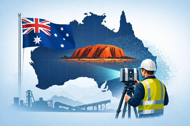

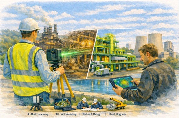
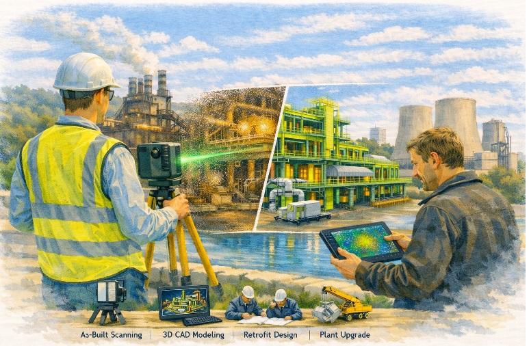
LiDAR scanning survey across Australia with engineer capturing industrial site data

Why onsite scanning matters

Onsite scanning is the fastest way to convert real-world assets into reliable digital informationโ€”especially in brownfield and retrofit environments where original documentation is incomplete or incorrect.

Our field capture provides a precise baseline for:

  • As-built verification before upgrades, tie-ins, and shutdown works
  • Retrofit engineering for legacy plants and facilities
  • Clash detection and constructability checks before fabrication or installation
  • Digital engineering workflows (scan-to-model / scan-to-drawings)
  • Condition documentation for risk reduction, scope definition and handover records

In plain terms: the scan becomes the backbone of your project. If that backbone is broken (poor capture, gaps, or low confidence), everything downstream becomes harderโ€”engineering, drafting, fabrication and installation.


Australia-wide coverage, site-ready delivery

We mobilise to projects across Australiaโ€”metro, regional and remoteโ€”bringing the scanning equipment, field workflow and practical site experience needed to operate safely and efficiently.

Typical deployment environments include:

  • Mining & resources (processing plants, conveyors, workshops, pump stations)
  • Industrial manufacturing (steel, smelting, production lines, utilities)
  • Infrastructure and utilities (water, wastewater, power, transport assets)
  • Commercial and government assets (plantrooms, services corridors, legacy buildings)
  • Marine and ship repair (fit-up checks, reverse engineering, space claims)

If your site is difficult to access, operational, or time-restricted (e.g., night works), we can plan around your constraints.


What we scan onsite

We support a wide range of scanning objectives, including:

As-built capture for engineering and design

Capture existing steelwork, pipework, structures, platforms, equipment skids, services, and building geometryโ€”so design is based on reality, not assumptions.

Retrofit and brownfield modification support

Ideal for upgrades where the facility has changed over time and legacy drawings donโ€™t match current conditions.

Fabrication and installation verification

Use scans to confirm fitment, alignment, clearances, and integration points before committing to fabrication or mobilisation.

Reverse engineering and metrology-style capture

Where components are undocumented, worn, or customโ€”scanning provides a measurement foundation for remanufacture or replacement design.


Deliverables that suit real projects

Every project is different, so we align deliverables to what your team actually needs.

Common outputs include:

  • Registered point clouds (for design coordination and record)
  • 2D CAD outputs (elevations, sections, plans where required)
  • 3D model-ready datasets to support engineering and drafting
  • Digital verification notes to support design sign-off and QA

If youโ€™re not sure what deliverable is best, weโ€™ll recommend a practical option based on your scope, schedule, and how the data will be used downstream.


How our onsite scanning service works

  1. Scope & goals โ€“ what needs to be captured, why, and what level of detail is required
  2. Site requirements โ€“ access windows, inductions, permits, traffic management, WAH/EWP needs
  3. Onsite scanning mobilisation โ€“ safe, efficient field capture with a plan to minimise disruption
  4. Processing & registration โ€“ structured datasets prepared for engineering use
  5. Delivery & support โ€“ files issued with clear naming, coordination notes, and handover guidance

Safety and site integration

We operate with a strong focus on safe field work, practical site coordination, and minimal disruption to operations. Where required, we can work alongside site teams to manage access, exclusion zones, and staged capture.


Why Hamilton By Design

Weโ€™re an engineering-led team. That mattersโ€”because onsite scanning isnโ€™t just โ€œcollecting data.โ€ Itโ€™s collecting the right data, at the right density, in the right areas, with a clear understanding of how the information will be used for design, verification, and construction.

If you need confidence in your existing conditionsโ€”we can help.


Hamilton By Design logo displayed on a blue tilted rectangle with a grey gradient background

3D LiDAR scanning and 3D modelling service button โ€” laser scanner capturing a point cloud for engineering and CAD modelling
Mechanical engineering services

Request onsite scanning Australia wide

If you have an upcoming retrofit, upgrade, verification, or design project and you need accurate site capture, get in touch.

Contact Hamilton By Design to discuss your site, your schedule, and the deliverables you needโ€”anywhere in Australia.


Send us your site location, a brief scope, and any drawings/photos available, and weโ€™ll advise the best scanning approach.

Name
Would you like us to arrange a phone consultation for you?
Address
3D Scanning Sydney banner promoting engineering-grade 3D laser scanning, LiDAR scanning, and reality capture services by Hamilton By Design.
Mechanical Engineering Sydney banner with white text on a blue background representing Hamilton By Design's mechanical engineering services in Sydney.
Mechanical Drafting and 3D Modelling Sydney banner highlighting Hamilton By Design's CAD drafting, 3D modelling, and engineering design services in Sydney.

3D CAD Modelling Australia service banner for Hamilton By Design

Mechanical Engineering | Structural Engineering


Industrial LiDAR Scanning & Retrofit Engineering โ€“ Pittsburgh, Pennsylvania

Industrial facility captured using 3D laser scanning for brownfield plant upgrade

Engineering Certainty in Legacy Industrial Facilities

Pittsburgh is not a new-build engineering market.

It is a modification market.

Steel mills, manufacturing plants, utilities and infrastructure in the Pittsburgh region have evolved over decades โ€” often across multiple owners, upgrades and undocumented changes. As a result, existing drawings rarely represent real conditions.

Hamilton By Design supports engineering and project teams by capturing accurate as-built data before modification work begins.

Rather than designing around assumptions, projects are developed from measured reality.


Engineer performing industrial LiDAR scan of a processing plant for retrofit design

Why Retrofit Projects in Pittsburgh Require LiDAR Scanning

Legacy facilities typically contain:

  • undocumented plant changes
  • relocated equipment
  • structural distortion over time
  • incomplete or missing drawings
  • congested services and pipework

When upgrades are designed from outdated information, installation conflicts occur and shutdown durations increase.

High-accuracy LiDAR scanning captures millions of measurement points and creates a true digital representation of the operating facility, reducing rework and unexpected site conflicts.


Typical Pittsburgh Projects We Support

Steel & Heavy Manufacturing

  • equipment replacement
  • access platforms and walkways
  • structural refurbishment
  • plant safety upgrades

Utilities & Processing Facilities

  • pipe routing modifications
  • pump and tank replacement
  • tie-in engineering
  • maintenance shutdown planning

Industrial Infrastructure & Brownfield Sites

  • facility upgrades
  • expansion works
  • mechanical retrofits
  • reverse engineering of existing equipment

Hamilton By Design combines engineering knowledge with reality capture to reduce fabrication and installation risk on operating assets.


Our Engineering-Led Workflow

(See full process: Industrial Retrofit LiDAR Scanning)

1 โ€” Site Capture

We collect high-density scan data without interrupting operations.

2 โ€” Digital As-Built Model

Point clouds are converted into coordinated engineering models.

3 โ€” Retrofit Design

Designs are developed directly from actual geometry.

4 โ€” Fabrication & Installation Confidence

Projects install correctly the first time, reducing shutdown risk.

Engineering-grade scanning enables clash detection, brownfield integration and efficient shutdown planning.


What Problems This Solves

For retrofit projects the largest risk is dimensional uncertainty.

Our workflow removes:

  • field modification work
  • fabrication rework
  • installation clashes
  • extended shutdown durations

Hamilton By Design focuses on reducing engineering and fabrication risk on existing industrial assets using accurate scan data and mechanical design integration.


Engineering-Led, Not Survey-Led

Many providers deliver point clouds.

We deliver engineering decisions.

One team is responsible from measurement through to design support โ€” ensuring the data collected is practical and usable for real construction outcomes.


Supporting Pittsburghโ€™s Ongoing Industrial Evolution

Regions like Pittsburgh continue to modernise existing infrastructure rather than replace it. Successful upgrades depend on understanding what is already built.

LiDAR scanning provides the digital foundation for safe modification, accurate fabrication and predictable installation.


Hamilton By Design logo displayed on a blue tilted rectangle with a grey gradient background

3D LiDAR scanning and 3D modelling service button โ€” laser scanner capturing a point cloud for engineering and CAD modelling
Mechanical engineering services

Talk to Hamilton By Design

If your project involves modifying an existing facility, engage scanning before design begins.

Design from reality โ€” not assumption.


Name
Would you like us to arrange a phone consultation for you?
Address

3D CAD Modelling Australia service banner for Hamilton By Design
Australian Drafting logo featuring bold white text reading "Australian Drafting" centred on a blue rounded rectangle background.
Engineering Governance title graphic featuring bold white text reading "Engineering Governance" centred on a blue rounded rectangle background.
Mechanical, Structural & Pipework Drafting service banner by Hamilton By Design featuring white text on a blue background.
Mechanical engineering services
Blue rounded button with the text โ€œSolidWorks Designโ€ in white.
Finite Element Analysis (FEA) engineering simulation button
3D LiDAR Scanning Darwin for engineering surveys, laser scanning, reality capture and point cloud modelling services
3D LiDAR Scanning Australia engineering services for laser scanning, reality capture, scan-to-CAD, Scan-to-BIM and as-built documentation across Australia
3D LiDAR scanning services on the Central Coast providing engineering-grade laser scanning, point cloud capture, scan-to-CAD modelling and industrial reality capture for infrastructure and industrial projects.
3D LiDAR Scanning Perth for engineering surveys, laser scanning, reality capture and point cloud modelling services
3D LiDAR Scanning Sydney for engineering surveys, laser scanning, reality capture and point cloud modelling services
3D LiDAR Scanning Brisbane for engineering surveys, laser scanning, reality capture and point cloud modelling services
3D LiDAR Scanning Canberra for engineering surveys, laser scanning, reality capture and point cloud modelling services
3D LiDAR Scanning Newcastle for engineering surveys, laser scanning, reality capture and point cloud modelling services
3D LiDAR Scanning Adelaide for engineering surveys, laser scanning, reality capture and point cloud modelling services

3D Engineering Scanning โ€“ Solomon Islands

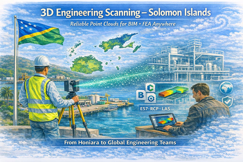
Engineer performing 3D laser scanning in the Solomon Islands with point cloud transitioning to BIM model and FEA analysis.

3D Engineering Scanning Solomon Islands โ€“ Point Clouds for BIM & FEA

Reliable Point Clouds for BIM, CAD & FEA Anywhere in the World

Hamilton By Design provides engineering-grade 3D laser scanning services across the Solomon Islands, delivering accurate point clouds that allow designers, engineers, and asset owners to work from real measured dataโ€”without the need to be on site.

From Honiara ports to remote island infrastructure, our scans create the digital backbone for modelling, analysis, and fabrication.


Engineering Data You Can Trust

Many assets in the Solomon Islands have:

  • limited or missing drawings
  • decades of informal modifications
  • corrosion from marine environments
  • cyclone and seismic exposure
  • mixed construction standards

Traditional measurement methods struggle in these conditions. Our 3D scanning service captures the true as-built condition so your team can:

  • create BIM and CAD models
  • perform structural and mechanical FEA
  • plan brownfields tie-ins
  • fabricate off-site with confidence
  • complete clash detection before shutdowns

We deliver open, neutral formats so engineers anywhere in Australia, New Zealand, Asia or Europe can immediately begin work.


3D engineering scanning in the Solomon Islands depicting site capture, point cloud creation and remote BIM and FEA design.

What We Deliver

Core Outputs

  • Registered point clouds โ€“ E57 / RCP / LAS
  • Colourised engineering datasets
  • Site grid or project datum
  • Mesh models for Navisworks
  • 2D plans, elevations and sections

Optional Engineering Deliverables

  • Scan-to-BIM models (LOD 200โ€“350)
  • Steel and pipe geometry extraction
  • Tie-in coordinates for upgrades
  • Deformation and roundness reports
  • Clash and constructability reviews

All data is processed in Australia under formal QA so it can be relied upon for design approvals and FEA studies.


Designed for Solomon Islands Conditions

Scanning in the Solomons requires Pacific experience:

  • high heat and humidity
  • sudden tropical rain
  • reflective stainless and bright sunlight
  • inter-island logistics
  • remote power availability
  • cyclone season planning

Our workflows are built for efficient field capture with processing completed by our Australian engineering team.


Industries We Support

  • Honiara ports and marine infrastructure
  • Power generation and substations
  • Water and wastewater assets
  • Timber and processing facilities
  • Government and commercial buildings
  • Bridges and civil structures
  • Post-cyclone condition surveys

A Digital Backbone for Global Teams

A quality scan is the backbone of every downstream task.
If the backbone is wrong, every model and FEA result is compromised.

Our service provides a foundation that:

  • removes re-measure risk
  • supports remote engineering
  • shortens shutdowns
  • improves safety and constructability

Designers anywhere in the world can open our data and begin work immediately.


3D LiDAR scanning and 3D modelling service button โ€” laser scanner capturing a point cloud for engineering and CAD modelling
Mechanical engineering services

Talk to Us About Your Solomon Islands Project

Whether you need a single building, a wharf, or a full plant captured, we can mobilise quickly and deliver data your team can trust.

Hamilton By Design
Engineering certainty through 3D scanning.

Name
Would you like us to arrange a phone consultation for you?
Address

3D CAD Modelling Australia service banner for Hamilton By Design
Australian Drafting logo featuring bold white text reading "Australian Drafting" centred on a blue rounded rectangle background.
Engineering Governance title graphic featuring bold white text reading "Engineering Governance" centred on a blue rounded rectangle background.
Mechanical, Structural & Pipework Drafting service banner by Hamilton By Design featuring white text on a blue background.
Mechanical engineering services
Blue rounded button with the text โ€œSolidWorks Designโ€ in white.
Finite Element Analysis (FEA) engineering simulation button
3D LiDAR Scanning Darwin for engineering surveys, laser scanning, reality capture and point cloud modelling services
3D LiDAR Scanning Australia engineering services for laser scanning, reality capture, scan-to-CAD, Scan-to-BIM and as-built documentation across Australia
3D LiDAR scanning services on the Central Coast providing engineering-grade laser scanning, point cloud capture, scan-to-CAD modelling and industrial reality capture for infrastructure and industrial projects.
3D LiDAR Scanning Perth for engineering surveys, laser scanning, reality capture and point cloud modelling services
3D LiDAR Scanning Sydney for engineering surveys, laser scanning, reality capture and point cloud modelling services
3D LiDAR Scanning Brisbane for engineering surveys, laser scanning, reality capture and point cloud modelling services
3D LiDAR Scanning Canberra for engineering surveys, laser scanning, reality capture and point cloud modelling services
3D LiDAR Scanning Newcastle for engineering surveys, laser scanning, reality capture and point cloud modelling services
3D LiDAR Scanning Adelaide for engineering surveys, laser scanning, reality capture and point cloud modelling services

3D LiDAR Laser Scanning Services in Bahrain

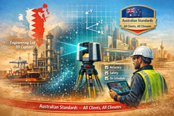
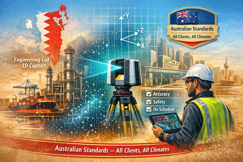
Watercolour illustration of 3D LiDAR laser scanning in Bahrain showing engineers capturing an industrial site with a scanner and tablet, styled in Bahrain flag colours with Australian quality standards message.

3D LiDAR Laser Scanning Services in Bahrain | Australian Standards

Engineering Certainty Through Measured Reality

Bahrainโ€™s construction, industrial and infrastructure sectors are evolving rapidly. Successful projects depend on accurate knowledge of existing conditions rather than historical drawings or assumptions. 3D LiDAR laser scanning services in Bahrain provide that verified foundation.

Hamilton By Design delivers engineering-led 3D LiDAR scanning services in Bahrain, capturing complex facilities and structures with millimetre precision so that design, analysis and construction can proceed from fact.


Verification Before Calculation

Many Bahrain projects involve brownfield environments where documentation no longer reflects reality. Modifications, corrosion, settlement and incremental upgrades create risk for designers and contractors.

Terrestrial LiDAR scanning enables:

  • Objective measurement of existing assets
  • Accurate tie-ins for new works
  • Reduction of site variations
  • Shorter shutdown durations
  • Remote engineering collaboration
  • Reliable prefabrication

The scan is the backbone of the project.
The quality of the initial capture determines the ease of every task that follows. If the backbone is compromised, even simple engineering becomes difficult.


3D laser scanning services Bahrain visual showing LiDAR capture, point cloud workflow and Australian Standards compliance in watercolour engineering style.

Engineering-Led 3D LiDAR Scanning in Bahrain

Our services are not limited to data collection. We approach every Bahrain project as engineers first, ensuring the capture supports:

  • Structural and mechanical verification
  • Constructability and access reviews
  • Interface definition for fabrication
  • Maintenance and shutdown planning
  • Risk reduction for project teams

This perspective protects project managers, engineers, designers and fabricators from decisions based on assumption.


Tailored to Your Systems

Hamilton By Design delivers vendor-neutral outputs that integrate with your existing workflows.

We tailor Bahrain LiDAR deliverables to suit your:

  • CAD platforms
  • BIM environments
  • FEA and analysis tools
  • Engineering and asset systems

Our role is to provide accurate engineering information โ€” your team chooses the software.


Australian Quality โ€“ Across All Clients and All Climates

All 3D LiDAR laser scanning services in Bahrain are delivered in accordance with:

  • Australian quality expectations
  • Australian build standards
  • Proven engineering procedures
  • Consistent methodology across all climates

Our workflows are designed for heat, humidity, coastal exposure and heavy industrial environments common to Bahrain, providing defensible and traceable data for every client.


Sectors Supported in Bahrain

  • Oil & gas and process facilities
  • Ports and marine structures
  • Commercial and mixed-use buildings
  • Transport and utilities
  • Manufacturing and logistics
  • Heritage and architectural assets

Whether the requirement is a single tie-in or a full facility digital record, the principle remains the same โ€” measure first, then engineer.


Hamilton By Design logo displayed on a blue tilted rectangle with a grey gradient background

3D LiDAR scanning and 3D modelling service button โ€” laser scanner capturing a point cloud for engineering and CAD modelling
Mechanical engineering services

The Hamilton By Design Process

  1. Investigate โ€“ High-accuracy LiDAR capture on site in Bahrain
  2. Verify โ€“ Registration and quality assurance
  3. Design โ€“ Data prepared for your engineering workflow

This structured approach ensures Bahrain projects commence with measured reality rather than interpretation.


Engage 3D LiDAR Laser Scanning Services in Bahrain

If your Bahrain project requires reliable as-built information, Hamilton By Design can mobilise to capture, process and deliver engineering-ready data aligned with Australian standards.

Start your project with certainty, not assumption.

Contact Hamilton By Design to discuss 3D LiDAR laser scanning services in Bahrain.

Name
Would you like us to arrange a phone consultation for you?
Address
3D CAD Modelling Australia service banner for Hamilton By Design
3D LiDAR scanning and 3D modelling service button โ€” laser scanner capturing a point cloud for engineering and CAD modelling
Mechanical engineering services
Mechanical drafting services button
Blue rounded button with the text โ€œSolidWorks Designโ€ in white.
Blue banner graphic displaying the text "Point Cloud to CAD - Australia" in large white lettering, representing point cloud processing, scan-to-CAD conversion and digital engineering services across Australia.
Mechanical, Structural & Pipework Drafting service banner by Hamilton By Design featuring white text on a blue background.
Engineering Governance title graphic featuring bold white text reading "Engineering Governance" centred on a blue rounded rectangle background.
Mining Plant Upgrades promotional graphic with bold white text on a blue background representing mining infrastructure, plant improvement, and engineering upgrade projects.
3D Pipework promotional graphic with bold white text on a blue background representing pipework design, modelling, drafting, and engineering services.
Australian Drafting logo featuring bold white text reading "Australian Drafting" centred on a blue rounded rectangle background.
3D Pipework promotional graphic with bold white text on a blue background representing pipework design, modelling, drafting, and engineering services.
Mining Plant Upgrades promotional graphic with bold white text on a blue background representing mining infrastructure, plant improvement, and engineering upgrade projects.
3D LiDAR Scanning for Engineering Projects title graphic featuring bold white text on a blue rounded rectangle background.
Australian Drafting logo featuring bold white text reading "Australian Drafting" centred on a blue rounded rectangle background.
Engineering Governance title graphic featuring bold white text reading "Engineering Governance" centred on a blue rounded rectangle background.
Mechanical, Structural & Pipework Drafting service banner by Hamilton By Design featuring white text on a blue background.
Mechanical engineering services
Blue rounded button with the text โ€œSolidWorks Designโ€ in white.
Finite Element Analysis (FEA) engineering simulation button

Mechanical Engineering | Structural Engineering


SMP Projects: Enabling Project Success Through a Scan โ†’ Design โ†’ Scan Workflow

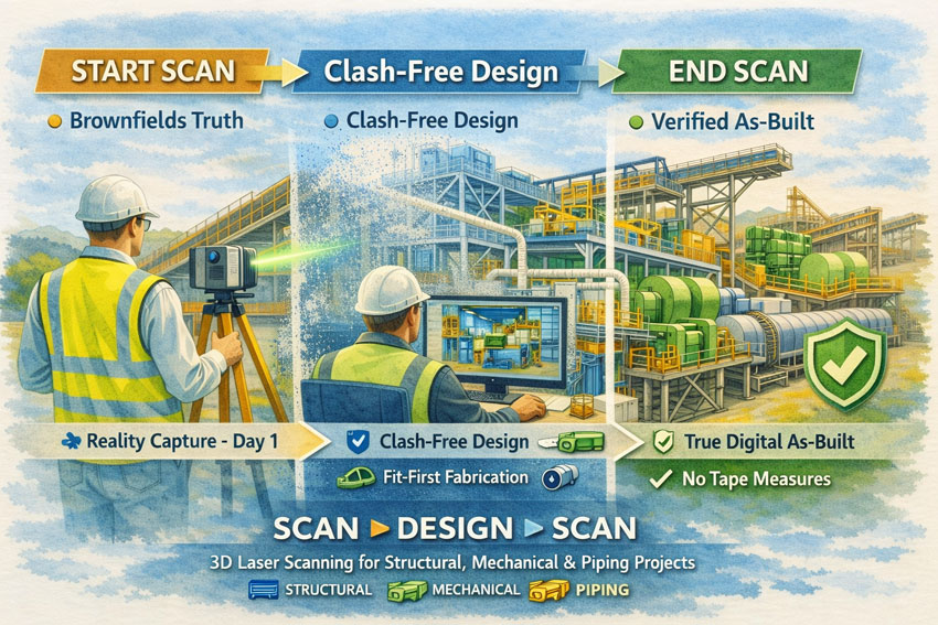
Watercolour-style illustration showing SMP 3D laser scanning workflow from start capture to clash-free design and final digital as-built.

Successful Structural, Mechanical and Piping (SMP) projects are built on one fundamental principle: decisions must be based on accurate knowledge of existing conditions. In brownfields industrial environments, legacy drawings and manual measurements rarely reflect the current state of an asset. Over years of operation, piping is rerouted, structures are strengthened, and equipment is modified to meet changing production demands.

Commencing design on the basis of incomplete or inaccurate information introduces uncertainty that can affect safety, cost, schedule, and quality. Modern 3D laser scanning provides a disciplined method to remove this uncertainty and establish a reliable foundation for project delivery.


Establishing a Reliable Baseline

An initial 3D laser scan captures a high-resolution digital representation of the facility, recording structural elements, mechanical equipment, and piping systems exactly as they exist. This dataset becomes the authoritative reference for all subsequent engineering activities.

By beginning with a comprehensive reality capture, project teams can:

  • Define accurate tie-in locations for new works
  • Understand spatial constraints and access requirements
  • Identify potential clashes before detailed design
  • Reduce reliance on manual surveys and assumptions
  • Provide designers with objective, measurable data

This approach aligns engineering decisions with actual site conditions, supporting informed planning and reducing the likelihood of downstream rework.


SMP scanโ€“designโ€“scan process illustrated with laser scanner, point cloud model and finished industrial plant.

Designing From Truth Rather Than Assumption

When the design phase is grounded in verified scan data, coordination across structural, mechanical, and piping disciplines becomes more effective. Engineers are able to develop models that reflect the real environment rather than an idealised interpretation of it.

The benefits to project success include:

  • Improved accuracy of fabrication documentation
  • Reduced design revisions and RFIs
  • Greater confidence in constructability
  • More reliable cost and schedule forecasting
  • Enhanced collaboration between designers, fabricators, and site teams

A scan-based workflow supports the objective of โ€œfit-firstโ€ construction, where components are manufactured with confidence that they will integrate with existing assets.


Verifying Outcomes With a Final Scan

Project success is not only measured by installation, but by the quality of information handed to the asset owner. A second 3D scan at project completion provides a verified digital as-built of all SMP works.

This final dataset delivers:

  • An accurate record of installed structural, mechanical, and piping systems
  • Validation that construction matches design intent
  • A foundation for maintenance and asset management
  • Reliable data for future modifications or expansions
  • Elimination of manual tape-based as-built surveys

The organisation is left with a living digital asset rather than static drawings that quickly lose relevance.


Supporting Measurable Project Outcomes

Adopting a Scan โ†’ Design โ†’ Scan methodology directly contributes to recognised measures of project success:

  • Safety: Reduced site rework and unplanned interventions
  • Cost Control: Fewer field modifications and claims
  • Schedule Reliability: Shorter shutdowns and predictable installation
  • Quality: Higher confidence in alignment and tolerances
  • Knowledge Retention: Creation of enduring digital records

These outcomes are particularly critical in SMP environments where interfaces between steel, equipment, and piping are complex and tolerances are unforgiving.


Applications Across Industrial Sectors

This workflow is suited to a wide range of SMP activities, including:

  • Conveyor and materials handling upgrades
  • Plant expansions and debottlenecking
  • Tank, hopper and bin modifications
  • Piping reroutes and tie-ins
  • Shutdown and turnaround works
  • Brownfields engineering studies

In each case, accurate spatial data enables better engineering judgement and more predictable project delivery.

3D LiDAR scanning and 3D modelling service button โ€” laser scanner capturing a point cloud for engineering and CAD modelling
Mechanical engineering services

Hamilton By Design logo displayed on a blue tilted rectangle with a grey gradient background

A Framework for Sustainable Project Success

For organisations seeking consistent performance from SMP projects, the integration of 3D laser scanning is not a survey exerciseโ€”it is a strategic project control measure. By capturing reality at project commencement and verifying it at completion, stakeholders gain confidence that engineering decisions, construction outcomes, and asset records are aligned.

Start with verified data.
Design with confidence.
Finish with a true digital as-built.

Hamilton By Design Co. partners with project teams to implement this approach, supporting safer, more reliable, and more successful SMP outcomes.

Name
Would you like us to arrange a phone consultation for you?
Address

Finite Element Analysis (FEA) engineering simulation button
Mechanical engineering services

3D Scanner Penrith

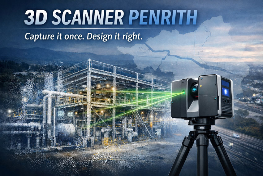
3D laser scanner in Penrith capturing industrial facility as point cloud for engineering design

3D Scanner Penrith | Engineering LiDAR Scanning

Engineering-grade LiDAR & laser scanning in Penrith, Western Sydney โ€” capture it once, design it right.

When youโ€™re upgrading a plant, refurbishing a building, or tying new steel into an existing structure, you donโ€™t want โ€œclose enoughโ€. You want site truth โ€” fast. Hamilton By Design delivers 3D laser scanning (LiDAR) and point clouds in Penrith and Western Sydney, so your engineers, designers, and fabricators can work from accurate as-built data and reduce rework.

Penrith is in the middle of major growth and infrastructure change across Western Sydney, which makes reliable existing-condition data even more valuable for upgrades and brownfields work.


3D scanner Penrith creating accurate as-built point cloud of factory for upgrades

What โ€œ3D scanningโ€ means for your project

A 3D scanner captures millions of points per second to create a high-density point cloud of your site. That point cloud becomes the backbone of the job:

  • Faster measuring and fewer return site visits
  • Better clash detection and tie-in confidence
  • Cleaner fabrication drawings and install fit-up
  • Reduced variations caused by missing or outdated as-built information

If the initial scan quality is poor, everything downstream gets harder โ€” modelling, detailing, QA checks, and construction coordination all suffer.


3D scanning services in Penrith

We support projects across Penrith, St Marys, Kingswood, Werrington, Emu Plains, Glenmore Park and surrounding industrial/commercial areas.

Typical use cases

  • Structural steel tie-ins & refurbishments (accurate interface points)
  • Industrial sites & plants (brownfields upgrades, shutdown planning)
  • Commercial buildings (facade/elevation capture, services coordination)
  • Mechanical & piping modifications (spools, supports, and retrofit work)
  • Condition capture for tendering (reduce unknowns before you price)

Deliverables that plug into your workflow

We keep deliverables practical and construction-ready, including:

  • Registered point cloud (industry-standard formats)
  • 2D outputs (plans/elevations/sections as required)
  • 3D model support (scan-to-model packages if needed)
  • Interface extraction (critical tie-in set-out points and checks)

(If you tell us what platform your team uses, weโ€™ll align deliverables to suit your workflow.)


How the onsite scan usually runs

  1. Scope & safety planning (access, traffic, operating plant constraints)
  2. Capture (multiple scan positions for full coverage)
  3. Registration & QA (clean, aligned dataset)
  4. Delivery (point cloud + agreed outputs, with notes on any occlusions)

For live environments we can plan around operations, access restrictions, and foot traffic to protect equipment and improve capture outcomes.


Why Hamilton By Design for Penrith scanning

Weโ€™re an engineering-led team. That matters because scanning isnโ€™t just โ€œcollecting dataโ€ โ€” itโ€™s collecting the right data to make design and fabrication easier.

Youโ€™ll get:

  • Practical capture strategies that target tie-ins and risk areas
  • Clear communication on whatโ€™s captured (and what canโ€™t be seen)
  • Outputs designed to reduce RFIs, assumptions, and rework

Penrithโ€™s ongoing development and precinct planning means brownfields interfaces are common โ€” and accurate as-builts help projects stay predictable.


Get a quote for 3D scanning in Penrith

If you want a fast, accurate capture and a dataset your team can trust:

Call / Email: (add your preferred contact details)
Service area: Penrith + Western Sydney
Turnaround: dependent on site size and deliverables

What to include in your enquiry

  • Site address + access constraints
  • What youโ€™re building / modifying
  • Priority areas (tie-ins, steel interfaces, plant items)
  • Required deliverables and required accuracy (if specified)

Hamilton By Design logo displayed on a blue tilted rectangle with a grey gradient background

Name
Would you like us to arrange a phone consultation for you?
Address
3D Scanning Sydney banner promoting engineering-grade 3D laser scanning, LiDAR scanning, and reality capture services by Hamilton By Design.
Mechanical Engineering Sydney banner with white text on a blue background representing Hamilton By Design's mechanical engineering services in Sydney.
Mechanical Drafting and 3D Modelling Sydney banner highlighting Hamilton By Design's CAD drafting, 3D modelling, and engineering design services in Sydney.

FAQ

How accurate is a 3D scan?

Accuracy depends on scanner type, site conditions, scan geometry, and required control. For most engineering upgrades, the goal is fit-for-purpose accuracy around tie-in areas, not just a pretty model.

3D LiDAR scanning and 3D modelling service button โ€” laser scanner capturing a point cloud for engineering and CAD modelling
Mechanical engineering services

Can you scan operating sites?

Yes โ€” we plan around operations, safe access, and line-of-sight limitations.

Do you do scan-to-model?

Yes. We can deliver point clouds only, or provide scan-to-model packages depending on your scope and downstream needs.


3D CAD Modelling Australia service banner for Hamilton By Design
Finite Element Analysis (FEA) engineering simulation button
Mechanical engineering services
Blue banner graphic displaying the text "Point Cloud to CAD - Australia" in large white lettering, representing point cloud processing, scan-to-CAD conversion and digital engineering services across Australia.
Blue banner graphic displaying the text "Scan to CAD Sydney" in large white lettering, representing engineering-led point cloud to CAD conversion, LiDAR scanning and digital engineering services in Sydney.
Blue banner graphic displaying the text "Reality Capture Sydney - CBD" in large white lettering, representing engineering-led reality capture, LiDAR scanning and digital engineering services within Sydney CBD commercial buildings and infrastructure.

Mechanical Engineering | Structural Engineering