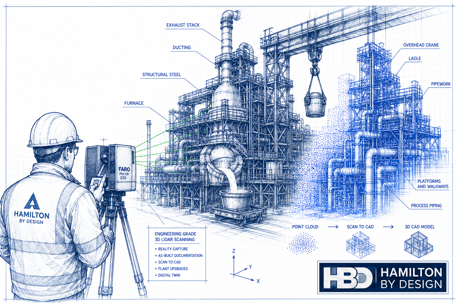
Reducing Shutdown Risk Using Digital Engineering Models

Mining shutdown planning using digital engineering models and plant layout visualisation.

How Digital Engineering Improves Shutdown Planning

Shutdown projects are among the most critical operational events in mining and industrial facilities. During these planned outages, maintenance work, equipment upgrades, inspections, and infrastructure modifications must all be completed within a limited timeframe.

Because production is halted during these periods, even small delays can significantly affect operations.

This is why shutdown planning engineering plays such an important role in reducing risk and improving shutdown performance.

Digital engineering models allow engineering teams to visualise the plant environment before shutdown work begins. By using accurate digital representations of existing infrastructure, engineers can identify potential issues early and ensure shutdown work is properly planned.

At Hamilton By Design, digital modelling is frequently used to support shutdown planning, helping operations teams reduce uncertainty and improve execution of shutdown projects.


Why Shutdown Projects Carry Significant Risk

Shutdown projects typically involve multiple teams performing complex work within a restricted time window.

Common shutdown risks include:

• equipment installation clashes
• inaccurate plant drawings
• limited access to equipment
• unexpected infrastructure conflicts
• delays caused by redesign during shutdown

When engineering teams rely solely on outdated drawings or manual measurements, these risks increase significantly.

Digital engineering models provide a way to analyse plant geometry and equipment layout before shutdown work begins.


What Are Digital Engineering Models?

Digital engineering models are accurate three-dimensional representations of plant infrastructure created using engineering data and site measurements.

These models are typically developed using technologies such as:

3D laser scanning
point cloud modelling
CAD engineering models
plant layout modelling

By combining these technologies, engineers can create digital models that represent the current condition of plant infrastructure.

This approach allows engineers to perform planning and design work using reliable data before shutdown activities begin.


Using 3D Scanning to Capture Existing Infrastructure

One of the most effective ways to build digital engineering models is through 3D laser scanning.

Laser scanning captures millions of measurement points across plant infrastructure, producing a point cloud dataset that accurately represents the geometry of the facility.

Engineers can then use this data to develop digital models used for shutdown planning and equipment design.

Learn more about engineering-grade scanning services here:


From Scan Data to Engineering Models

Once scan data has been captured, engineers convert the point cloud data into engineering models used for design and planning.

This process typically includes:

  1. Processing scan data into a unified point cloud
  2. Creating engineering CAD models of equipment and structures
  3. Analysing plant layout and installation requirements
  4. Preparing fabrication drawings for shutdown work

This digital workflow allows engineers to evaluate installation scenarios before work begins.

You can read more about this process here:


Identifying Risks Before Shutdown Begins

Digital engineering models allow engineers to identify potential issues before shutdown activities begin.

Examples include:

• pipework clashes with structural steel
• insufficient installation clearance
• access restrictions for lifting equipment
• equipment alignment problems
• interference with existing infrastructure

By resolving these issues during the planning stage, engineering teams can significantly reduce the likelihood of delays during shutdown execution.


Supporting Safer Shutdown Operations

In addition to improving planning efficiency, digital engineering models also support safer shutdown operations.

Engineering teams can use digital plant models to:

• evaluate safe access routes
• plan equipment removal procedures
• coordinate multiple work crews
• verify installation tolerances

This helps ensure shutdown work is performed safely and according to engineering specifications.


Integrating Digital Engineering into Shutdown Planning

Digital engineering models are most effective when integrated into the broader shutdown planning process.

Shutdown planning typically involves:

• engineering design preparation
• plant scanning and documentation
• fabrication of new equipment
• contractor coordination
• installation planning

Digital models allow these activities to be coordinated more effectively.

You can read more about engineering planning for shutdown projects here:


Hamilton By Design logo displayed on a blue tilted rectangle with a grey gradient background

Conclusion

Shutdown projects represent critical operational windows for mining and industrial facilities.

Through the use of shutdown planning engineering and digital engineering models, organisations can significantly reduce risk and improve the efficiency of shutdown work.

By capturing accurate plant data and developing digital engineering models before shutdown begins, engineers can identify potential conflicts, improve installation planning, and ensure shutdown activities proceed as efficiently as possible.

Hamilton By Design supports mining and industrial operations by providing engineering services that assist with shutdown planning, digital modelling, and plant upgrade projects.

3D LiDAR scanning and 3D modelling service button — laser scanner capturing a point cloud for engineering and CAD modelling
Mechanical engineering services
Name
Would you like us to arrange a phone consultation for you?
Address

Our Clients

3D CAD Modelling Australia service banner for Hamilton By Design
Australian Drafting logo featuring bold white text reading "Australian Drafting" centred on a blue rounded rectangle background.
Engineering Governance title graphic featuring bold white text reading "Engineering Governance" centred on a blue rounded rectangle background.
Mechanical, Structural & Pipework Drafting service banner by Hamilton By Design featuring white text on a blue background.
Mechanical engineering services
Blue rounded button with the text “SolidWorks Design” in white.
Finite Element Analysis (FEA) engineering simulation button
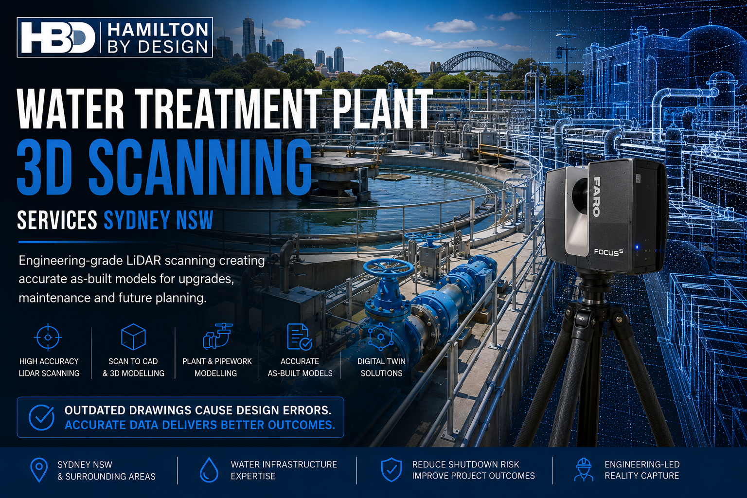
3D LiDAR Scanning Darwin for engineering surveys, laser scanning, reality capture and point cloud modelling services
3D LiDAR Scanning Australia engineering services for laser scanning, reality capture, scan-to-CAD, Scan-to-BIM and as-built documentation across Australia
3D LiDAR scanning services on the Central Coast providing engineering-grade laser scanning, point cloud capture, scan-to-CAD modelling and industrial reality capture for infrastructure and industrial projects.
3D LiDAR Scanning Perth for engineering surveys, laser scanning, reality capture and point cloud modelling services
3D LiDAR Scanning Sydney for engineering surveys, laser scanning, reality capture and point cloud modelling services
3D LiDAR Scanning Brisbane for engineering surveys, laser scanning, reality capture and point cloud modelling services
3D LiDAR Scanning Canberra for engineering surveys, laser scanning, reality capture and point cloud modelling services
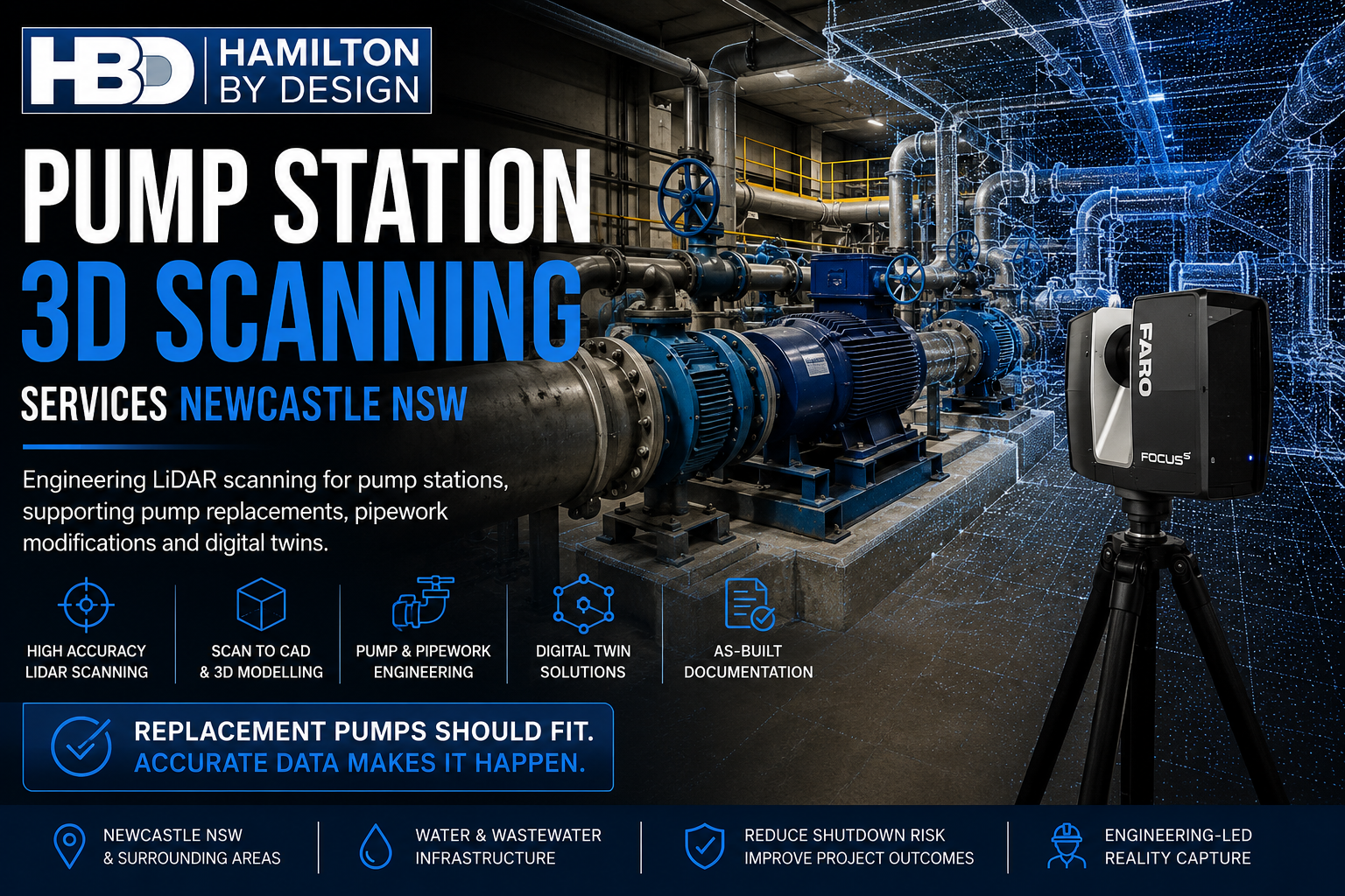
3D LiDAR Scanning Newcastle for engineering surveys, laser scanning, reality capture and point cloud modelling services
3D LiDAR Scanning Adelaide for engineering surveys, laser scanning, reality capture and point cloud modelling services

Engineering Support During Mining Shutdown Projects

Engineering team reviewing plant drawings and digital models during planning for a mining shutdown maintenance project.

Why Engineering Planning Is Critical During Mining Shutdowns

Mining shutdowns are among the most complex operational events in industrial facilities. During these periods, large volumes of maintenance, upgrades, inspections, and equipment replacements must be completed within a tightly controlled timeframe.

Because production stops during shutdown work, every hour of delay can have a significant financial impact on operations.

This is where mining shutdown engineering plays a critical role. Proper engineering preparation ensures that upgrade work, equipment installation, and plant modifications can be executed safely and efficiently during the shutdown window.

Engineering support during shutdown projects often involves planning, documentation, scanning existing infrastructure, and preparing fabrication drawings before the shutdown begins.

At Hamilton By Design, engineering teams support mining shutdown work by providing accurate design data and technical documentation to ensure shutdown activities proceed as planned.


The Challenges of Mining Shutdown Projects

Mining shutdown projects involve coordinating multiple teams working across different areas of the plant simultaneously.

Common challenges include:

• limited shutdown timeframes
• complex plant infrastructure
• multiple contractors working concurrently
• incomplete or outdated plant drawings
• installation clashes between new and existing equipment

Without proper engineering preparation, shutdown work can quickly encounter unexpected obstacles that extend downtime and increase costs.

Engineering support helps minimise these risks by ensuring the plant layout, equipment geometry, and installation requirements are clearly understood before work begins.


Engineering Services That Support Shutdown Planning

Mining shutdown engineering typically involves several technical activities carried out prior to the shutdown window.

Plant Layout Verification

Before any upgrade work begins, engineers often need to verify the existing layout of equipment, pipework, and structures.

Many mining facilities have evolved over decades of maintenance work, meaning the actual plant configuration may differ from the original drawings.

Capturing accurate existing conditions ensures that shutdown installation work can proceed without unexpected clashes.

Learn more about capturing existing conditions here:


3D Laser Scanning of Existing Infrastructure

3D laser scanning is frequently used to document plant geometry before shutdown work begins.

Scanning allows engineers to capture millions of measurement points from existing infrastructure and generate accurate point cloud models of the plant environment.

These models help engineers design equipment modifications and plan installation sequences with greater confidence.

More information about engineering-grade scanning services:


Engineering Modelling and Design

Once site data has been captured, engineers can develop digital models used to design plant modifications or equipment upgrades.

These models help engineering teams:

• design new components that fit existing plant infrastructure
• identify potential clashes before installation
• improve coordination between mechanical and structural systems
• support fabrication of new equipment

The workflow of converting scan data into engineering models is explained here:


Equipment Upgrades During Shutdown Work

Shutdown windows are often used to install new equipment or upgrade existing plant systems.

Typical shutdown upgrade projects may include:

• conveyor system upgrades
• pump replacements
• pipework modifications
• structural upgrades
• installation of new process equipment

Engineering support ensures these modifications are designed to integrate with the existing plant layout while meeting operational and safety requirements.


Benefits of Engineering Preparation Before Shutdown

Engineering preparation carried out before the shutdown window helps mining operations complete work more efficiently.

Key benefits include:

• reduced installation risk
• improved equipment fitment
• shorter shutdown durations
• improved coordination between contractors
• reduced rework during installation

By preparing engineering documentation in advance, shutdown teams can focus on executing work safely and efficiently.


Supporting Safe and Efficient Shutdown Operations

Mining shutdown engineering is not only about improving efficiency — it also supports safe operations.

Accurate engineering documentation helps ensure that:

• installation procedures are clearly defined
• equipment interfaces are properly designed
• access and maintenance requirements are considered
• potential safety hazards are identified early

For complex mining plants, this level of preparation significantly improves shutdown execution.


Hamilton By Design logo displayed on a blue tilted rectangle with a grey gradient background

Conclusion

Mining shutdowns are critical operational events where significant maintenance and upgrade work must be completed within a limited timeframe.

Engineering preparation plays an essential role in ensuring shutdown projects are executed safely and efficiently.

Through activities such as plant scanning, engineering modelling, and design preparation, mining shutdown engineering helps reduce operational risk and improve the success of shutdown projects.

Hamilton By Design provides engineering support services to assist mining operations with shutdown planning, plant upgrades, and infrastructure modifications.

3D LiDAR scanning and 3D modelling service button — laser scanner capturing a point cloud for engineering and CAD modelling
Mechanical engineering services
Name
Would you like us to arrange a phone consultation for you?
Address

Our clients

3D CAD Modelling Australia service banner for Hamilton By Design
Australian Drafting logo featuring bold white text reading "Australian Drafting" centred on a blue rounded rectangle background.
Engineering Governance title graphic featuring bold white text reading "Engineering Governance" centred on a blue rounded rectangle background.
Mechanical, Structural & Pipework Drafting service banner by Hamilton By Design featuring white text on a blue background.
Mechanical engineering services
Blue rounded button with the text “SolidWorks Design” in white.
Finite Element Analysis (FEA) engineering simulation button
3D LiDAR Scanning Darwin for engineering surveys, laser scanning, reality capture and point cloud modelling services
3D LiDAR Scanning Australia engineering services for laser scanning, reality capture, scan-to-CAD, Scan-to-BIM and as-built documentation across Australia
3D LiDAR scanning services on the Central Coast providing engineering-grade laser scanning, point cloud capture, scan-to-CAD modelling and industrial reality capture for infrastructure and industrial projects.
3D LiDAR Scanning Perth for engineering surveys, laser scanning, reality capture and point cloud modelling services
3D LiDAR Scanning Sydney for engineering surveys, laser scanning, reality capture and point cloud modelling services
3D LiDAR Scanning Brisbane for engineering surveys, laser scanning, reality capture and point cloud modelling services
3D LiDAR Scanning Canberra for engineering surveys, laser scanning, reality capture and point cloud modelling services
3D LiDAR Scanning Newcastle for engineering surveys, laser scanning, reality capture and point cloud modelling services
3D LiDAR Scanning Adelaide for engineering surveys, laser scanning, reality capture and point cloud modelling services

Reverse Engineering Industrial Equipment Using 3D Scanning

Reverse engineering workflow showing LiDAR scanning, point cloud processing, CAD modelling, and fabrication drawings for industrial equipment.

How 3D Scanning Supports Reverse Engineering in Mining and Industrial Facilities

In many mining and industrial operations, critical equipment often remains in service for decades. Over time, original design drawings may be lost, outdated, or incomplete. When upgrades, repairs, or replacements are required, engineers frequently need to recreate accurate models of existing components.

This is where reverse engineering scanning using 3D laser scanning technology has become an important engineering tool.

By capturing highly accurate measurements of existing equipment and infrastructure, engineers can develop digital models that support redesign, modification, or replication of components used in industrial operations.

At Hamilton By Design, 3D scanning is commonly used to support plant upgrades, equipment refurbishment, and engineering redesign projects across mining and industrial facilities.

Learn more about our scanning services here:


What is Reverse Engineering Using 3D Scanning?

Reverse engineering is the process of analysing an existing component or system in order to recreate its design data.

In industrial environments this often involves:

  • worn or obsolete equipment
  • legacy plant installations
  • components without available drawings
  • equipment modifications over time

Using 3D laser scanning, engineers can capture millions of measurement points across the surface of a component or installation. These measurements form a point cloud dataset, which can then be converted into a detailed CAD model.

This model can be used to redesign components, manufacture replacements, or integrate upgrades into existing plant infrastructure.


Why Reverse Engineering Is Common in Mining Operations

Mining facilities frequently operate with equipment that may have been installed many years earlier. Over time, modifications are made during shutdowns or maintenance activities, and the documentation of these changes may not always be updated.

When engineering teams plan upgrades, they often encounter situations where:

  • original drawings are unavailable
  • components have been modified in the field
  • replacement parts are no longer manufactured
  • installation geometry differs from the original design

In these cases, reverse engineering scanning allows engineers to capture the current condition of the equipment and create accurate digital models for design work.


How 3D Scanning Improves Reverse Engineering Accuracy

Traditional reverse engineering often relied on manual measurements and site sketches. While useful, these methods can introduce uncertainty when modelling complex components.

3D laser scanning improves this process by capturing a highly detailed representation of the equipment geometry.

Benefits include:

  • accurate measurement of complex shapes
  • capture of worn or distorted components
  • reduced manual measurement time
  • improved confidence in engineering models
  • better integration with existing plant infrastructure

Because scanning captures millions of points, engineers can analyse the exact condition of equipment before beginning redesign work.


Reverse Engineering Workflow Using 3D Scanning

A typical reverse engineering scanning workflow includes several steps.

1. Equipment Scanning

Engineers capture the geometry of the component or installation using a terrestrial laser scanner or handheld scanning system.

2. Point Cloud Processing

The captured scans are registered and processed to create a unified point cloud dataset representing the object.

3. CAD Model Creation

Engineers convert the scan data into engineering models using CAD software such as SolidWorks.

4. Design and Modification

The model can then be used to redesign components, analyse fitment, or prepare fabrication drawings.

You can learn more about this process here:


Applications of Reverse Engineering in Industrial Plants

Reverse engineering scanning is widely used in industrial facilities for many types of engineering work.

Common applications include:

  • reverse engineering pump components
  • redesigning worn mechanical equipment
  • recreating legacy machine parts
  • documenting existing plant installations
  • designing upgrades for conveyors and materials handling systems
  • integrating new equipment into existing plant layouts

These applications allow engineering teams to modernise infrastructure while maintaining compatibility with existing systems.


Reverse Engineering for Plant Upgrade Projects

Plant upgrades often require engineers to integrate new equipment into an existing facility that may have evolved over many years.

Using reverse engineering scanning, engineers can capture accurate geometry of the surrounding infrastructure before beginning design work.

This approach helps reduce risks such as:

  • component clashes
  • installation issues
  • inaccurate fabrication drawings
  • extended shutdown durations

Accurate digital models allow engineers to design upgrades with confidence and improve coordination between mechanical, structural, and fabrication teams.

Learn more about capturing existing conditions before plant upgrades here:


Conclusion

Reverse engineering using 3D scanning has become an essential engineering tool for mining and industrial facilities where accurate design data may not always be available.

By capturing precise measurements of existing equipment and infrastructure, engineers can recreate digital models that support repairs, upgrades, and replacement components.

For industries that rely on complex infrastructure and long operational lifecycles, reverse engineering scanning provides a reliable foundation for modern engineering design and plant upgrades.

Hamilton By Design provides engineering-grade 3D scanning services to support reverse engineering and upgrade projects across mining and industrial operations.

3D LiDAR scanning and 3D modelling service button — laser scanner capturing a point cloud for engineering and CAD modelling
Mechanical engineering services
Name
Would you like us to arrange a phone consultation for you?
Address

Our Clients

3D CAD Modelling Australia service banner for Hamilton By Design
Finite Element Analysis (FEA) engineering simulation button
Mechanical engineering services

Creating Digital Twins of Industrial Plants

Industrial digital twin concept showing a mining processing plant transitioning from a real facility to a point cloud scan and CAD engineering model.

What Is an Industrial Digital Twin?

An industrial digital twin is a highly accurate digital representation of a physical plant, facility, or asset. It combines real-world measurements, engineering models, and operational data into a virtual environment where engineers can analyse, simulate, and plan improvements before making changes in the real world.

For industries such as mining, processing plants, refineries, and manufacturing, digital twins allow engineering teams to visualise complex systems and understand how equipment, structures, and services interact.

At Hamilton By Design, digital twins are typically created by combining engineering-grade 3D laser scanning, point cloud modelling, and CAD engineering workflows.


Why Industrial Plants Are Moving Toward Digital Twins

Industrial sites are often built and modified over decades. Drawings can become outdated, and documentation may not reflect the current state of the plant.

An industrial digital twin solves this problem by providing an accurate digital baseline of the facility.

Key benefits include:

  • Improved engineering planning and design accuracy
  • Reduced risk during plant upgrades
  • Better shutdown planning
  • Improved asset management and maintenance planning
  • Safer engineering decisions

Before any upgrade or modification, engineers must understand existing conditions. Technologies such as 3D laser scanning allow teams to capture the plant exactly as it exists.

You can learn more about capturing plant conditions here:
https://www.hamiltonbydesign.com.au/capture-existing-conditions-before-plant-upgrades/


How Digital Twins Are Created for Industrial Plants

Creating an industrial digital twin typically follows a structured workflow.

1. Engineering-Grade 3D Laser Scanning

The first step is capturing the plant using high-accuracy LiDAR or laser scanning systems. These scanners collect millions of measurement points, producing a point cloud that represents the physical environment.

Hamilton By Design provides engineering-grade scanning services across mining and industrial sites:
https://www.hamiltonbydesign.com.au/home/engineering-grade-3d-laser-scanning-mining-industrial/

These scans capture:

  • Structural steel
  • Pipework systems
  • Mechanical equipment
  • Conveyors and material handling systems
  • Pumps and processing equipment
  • Access platforms and walkways

The result is a precise digital snapshot of the plant.


Industrial mining facility in PNG captured with engineering-grade 3D scanning technology.

2. Point Cloud Processing

Once scanning is complete, the raw scan data is processed into a registered point cloud model.

This step involves:

  • Aligning multiple scans
  • Cleaning unwanted data
  • Verifying spatial accuracy
  • Preparing the data for engineering modelling

Hamilton By Design uses this workflow when converting scans into engineering models:
https://www.hamiltonbydesign.com.au/point-cloud-to-engineering-model-workflow/


3. Engineering CAD Modelling

The processed point cloud is then used to develop engineering models in CAD platforms such as SolidWorks.

At this stage engineers can generate:

  • Mechanical layouts
  • Structural models
  • Pipework routing
  • Equipment positioning
  • Access and maintenance clearances

The digital twin becomes an engineering-ready model, not just a visual scan.


4. Integration With Engineering Projects

Once the digital twin is created, it becomes a core engineering tool used for:

  • Plant upgrades
  • Shutdown planning
  • Clash detection
  • Design validation
  • Construction planning

Many mining operations now rely on digital twins during major shutdowns and upgrades.

More information on scanning for shutdown projects can be found here:
https://www.hamiltonbydesign.com.au/3d-laser-scanning-mining-shutdowns/


Practical Applications of Industrial Digital Twins

Digital twins are becoming common across mining and heavy industry because they reduce uncertainty in engineering projects.

Common use cases include:

Plant Upgrades

Engineers can design new equipment within the digital model before installation.

Equipment Replacement

Digital twins allow accurate measurement of existing assets when replacing pumps, conveyors, or tanks.

Brownfield Engineering

Older plants often have incomplete drawings. Digital twins provide accurate geometry for redesign.

Safety Planning

Access, maintenance space, and structural modifications can be analysed before construction begins.


Why Accuracy Matters

A digital twin is only useful if it reflects the plant accurately.

Engineering-grade scanning typically achieves millimetre-level accuracy, which allows engineers to confidently design new systems within existing infrastructure.

Without this level of accuracy, design clashes and construction delays become more likely.

Hamilton By Design specialises in high-accuracy scanning for mining and industrial engineering projects across Australia:
https://www.hamiltonbydesign.com.au/home/engineering-services/3d-laser-scanning/3d-laser-scanning-across-australia/


The Future of Industrial Engineering

As industries adopt automation, remote operations, and predictive maintenance, digital twins are becoming central to engineering workflows.

They allow companies to:

  • Simulate plant modifications
  • Plan maintenance strategies
  • Visualise complex infrastructure
  • Improve collaboration between engineering teams

For companies managing large industrial assets, an industrial digital twin is quickly becoming a core engineering resource rather than an optional tool.


Hamilton By Design logo displayed on a blue tilted rectangle with a grey gradient background

Learn More About Engineering Digital Workflows

If you are interested in how digital technologies support industrial engineering projects, these resources may be useful:

3D LiDAR scanning and 3D modelling service button — laser scanner capturing a point cloud for engineering and CAD modelling
Mechanical engineering services
Name
Would you like us to arrange a phone consultation for you?
Address
CHPP Engineering title graphic featuring bold white text reading "CHPP Engineering" centred on a blue rounded rectangle background.
Pipework Drafting title graphic featuring bold white text reading "Pipework Drafting" centred on a blue rounded rectangle background.
3D LiDAR Scanning for Engineering Projects title graphic featuring bold white text on a blue rounded rectangle background.
3D CAD Modelling Australia service banner for Hamilton By Design

Mechanical Engineering | Structural Engineering


LiDAR vs Photogrammetry for Industrial Engineering

Engineering comparison of LiDAR scanning and photogrammetry used for capturing industrial plants and infrastructure.

Understanding the Difference Between LiDAR and Photogrammetry

When engineers need to capture accurate measurements of industrial infrastructure, two technologies are commonly considered: LiDAR scanning and photogrammetry.

Both methods allow engineers to create 3D digital models of real-world environments. However, when comparing LiDAR vs photogrammetry, each technology has different strengths depending on the type of engineering project.

For industries such as mining, processing plants, and heavy industrial facilities, choosing the right technology can significantly affect the accuracy, speed, and reliability of engineering design work.

At Hamilton By Design, LiDAR scanning is frequently used to capture existing conditions in complex industrial environments where precision is critical.

Learn more about engineering-grade scanning here:
https://www.hamiltonbydesign.com.au/home/engineering-grade-3d-laser-scanning-mining-industrial/


What is LiDAR Scanning?

LiDAR (Light Detection and Ranging) uses laser pulses to measure the distance between the scanner and surrounding surfaces. A terrestrial laser scanner emits millions of laser pulses per second and records the returned signal to calculate precise spatial coordinates.

The result is a dense 3D point cloud representing the scanned environment.

Engineering-grade LiDAR scanners commonly achieve millimetre-level accuracy, making them well suited for capturing industrial infrastructure such as:

  • pipework systems
  • structural steel
  • conveyors
  • tanks and vessels
  • pump stations
  • processing equipment

LiDAR scanning is widely used for plant upgrades, shutdown planning, and mechanical design where accurate site data is essential.

More information on LiDAR scanning services:
https://www.hamiltonbydesign.com.au/home/engineering-services/3d-laser-scanning/


What is Photogrammetry?

Photogrammetry is a technique that creates 3D models using photographs captured from multiple angles. Specialised software analyses overlapping images and reconstructs a three-dimensional model of the scene.

Photogrammetry is commonly used in:

  • aerial mapping
  • surveying large land areas
  • construction progress monitoring
  • environmental mapping
  • drone-based inspections

Because the technique relies on photographs rather than laser measurements, the accuracy of photogrammetry depends on factors such as image quality, lighting conditions, and camera calibration.


Comparison between LiDAR scanning and photogrammetry capturing an industrial engineering facility for 3D modelling.

LiDAR vs Photogrammetry: Key Differences

When comparing LiDAR vs photogrammetry, the main differences relate to measurement accuracy, speed of data capture, and suitability for complex environments.

FeatureLiDAR ScanningPhotogrammetry
Measurement MethodLaser distance measurementImage-based reconstruction
Typical AccuracyMillimetre-levelCentimetre-level (depending on conditions)
Performance in Low LightExcellentLimited
Surface DetailHigh geometric accuracyHigh visual detail
Performance in Complex PlantVery strongMore challenging
Data Capture SpeedVery fastModerate

For industrial engineering projects, LiDAR scanning typically provides more reliable geometric data, especially when scanning dense plant environments.


When LiDAR is Preferred in Industrial Engineering

LiDAR scanning is often the preferred technology for projects involving complex infrastructure.

Common engineering applications include:

  • plant upgrades and retrofits
  • pipework modifications
  • structural steel design
  • conveyor and materials handling systems
  • pump installations
  • shutdown planning

In these environments, millimetre-level accuracy is required to ensure new components fit correctly within existing structures.

LiDAR scanning is also effective in environments with limited lighting or reflective metal surfaces, which are common in industrial facilities.

You can read more about how engineers capture existing conditions before plant upgrades here:
https://www.hamiltonbydesign.com.au/capture-existing-conditions-before-plant-upgrades/


LiDAR scanning survey across Australia with engineer capturing industrial site data

When Photogrammetry is Useful

Photogrammetry remains a valuable tool for certain types of projects, particularly where large areas must be captured quickly.

Typical applications include:

  • drone-based terrain mapping
  • stockpile measurement
  • topographic surveys
  • construction progress documentation
  • infrastructure inspections

In these situations, photogrammetry provides an efficient method of capturing large datasets using aerial imagery.

However, for detailed industrial modelling, additional processing may be required to achieve the level of precision needed for engineering design.


Combining LiDAR and Photogrammetry

In some projects, engineers combine LiDAR scanning with photogrammetry to capture both accurate geometry and high-quality visual textures.

This approach can be useful when:

  • documenting heritage structures
  • visualising infrastructure for presentations
  • creating digital twins of facilities

However, for most industrial engineering applications, LiDAR scanning remains the primary technology used for accurate measurement.


From Scan Data to Engineering Models

Regardless of the capture method used, the final goal in engineering projects is often to convert the captured data into usable CAD models.

The typical workflow includes:

  1. Site data capture
  2. Data processing and alignment
  3. Point cloud generation
  4. Engineering modelling in CAD software
  5. Design and fabrication documentation

You can learn more about this process here:

Hamilton By Design logo displayed on a blue tilted rectangle with a grey gradient background

Conclusion

When comparing LiDAR vs photogrammetry, both technologies offer valuable tools for capturing real-world environments.

However, for most industrial engineering applications where accuracy and reliability are critical, LiDAR scanning typically provides the best results.

For mining, processing plants, and heavy industrial facilities, engineering-grade LiDAR scanning allows project teams to work from highly accurate digital models of existing infrastructure.

This improves design confidence, reduces installation risk, and helps ensure that new components integrate successfully with existing plant systems.

Hamilton By Design provides engineering-grade LiDAR scanning services to support industrial engineering projects across Australia.

3D LiDAR scanning and 3D modelling service button — laser scanner capturing a point cloud for engineering and CAD modelling
Mechanical engineering services
Name
Would you like us to arrange a phone consultation for you?
Address
3D CAD Modelling Australia service banner for Hamilton By Design

Mechanical Engineering | Structural Engineering


3D LiDAR Scanning Darwin for engineering surveys, laser scanning, reality capture and point cloud modelling services
3D LiDAR Scanning Australia engineering services for laser scanning, reality capture, scan-to-CAD, Scan-to-BIM and as-built documentation across Australia
3D LiDAR scanning services on the Central Coast providing engineering-grade laser scanning, point cloud capture, scan-to-CAD modelling and industrial reality capture for infrastructure and industrial projects.
3D LiDAR Scanning Perth for engineering surveys, laser scanning, reality capture and point cloud modelling services
3D LiDAR Scanning Sydney for engineering surveys, laser scanning, reality capture and point cloud modelling services
3D LiDAR Scanning Brisbane for engineering surveys, laser scanning, reality capture and point cloud modelling services
3D LiDAR Scanning Canberra for engineering surveys, laser scanning, reality capture and point cloud modelling services
3D LiDAR Scanning Newcastle for engineering surveys, laser scanning, reality capture and point cloud modelling services
3D LiDAR Scanning Adelaide for engineering surveys, laser scanning, reality capture and point cloud modelling services

LiDAR Accuracy in Engineering Applications

LiDAR scanning workflow showing an engineering laser scanner capturing industrial infrastructure and converting the data into a point cloud and CAD model.

Understanding LiDAR Accuracy for Engineering Projects

In modern engineering projects, capturing accurate measurements of existing infrastructure is critical before design work begins. LiDAR accuracy engineering plays a central role in this process by allowing engineers to capture millions of precise measurements of structures, plant equipment, and terrain in a matter of minutes.

LiDAR (Light Detection and Ranging) technology uses laser pulses to measure distances to surfaces and create a detailed 3D point cloud model of the scanned environment. These datasets provide engineers with reliable dimensional information that can be used for plant upgrades, mechanical design, structural modifications, and site documentation.

At Hamilton By Design, LiDAR scanning is commonly used to capture existing conditions for mining infrastructure, industrial facilities, and complex engineering environments.

You can learn more about our scanning services here:


What Determines LiDAR Accuracy in Engineering?

Several factors influence the overall accuracy of LiDAR scanning in engineering applications.

1. Scanner Hardware Accuracy

Modern engineering-grade scanners typically provide millimetre-level accuracy. High-end terrestrial LiDAR scanners commonly achieve:

• ±1–3 mm accuracy at 10 metres
• ±2–6 mm accuracy across larger industrial spaces
• Millions of points captured per second

These scanners allow engineers to measure structures without physical contact while maintaining high dimensional reliability.

Hamilton By Design uses professional scanning workflows designed specifically for engineering environments such as mining plants, conveyors, pump stations, and processing infrastructure.

More about these applications:

https://www.hamiltonbydesign.com.au/home/engineering-services/3d-laser-scanning/3d-laser-scanning-across-australia


2. Scan Setup and Registration

Accuracy is not only determined by the scanner itself. It also depends on how the scans are set up and aligned together.

During a project, multiple scans are captured from different positions and then registered together to create a complete 3D dataset.

Proper registration ensures:

• accurate alignment of overlapping scans
• minimal cumulative error across large sites
• reliable geometry for engineering modelling

In mining plants or processing facilities, dozens or sometimes hundreds of scans may be combined to create a full site model.


3. Surface Conditions and Environment

The environment being scanned also affects measurement accuracy.

Common factors include:

• reflective metal surfaces
• dust or airborne particles
• complex pipework and structural steel
• long scanning distances

Experienced operators account for these factors by selecting optimal scan locations and controlling the scanning workflow.

This is particularly important during shutdown projects or plant upgrades, where accurate measurements must be captured quickly.

See how scanning supports shutdown projects:


From LiDAR Data to Engineering Models

Once scanning is complete, the raw point cloud data is processed and converted into engineering models.

Typical workflow includes:

  1. Site LiDAR scanning
  2. Point cloud registration
  3. Data cleaning and segmentation
  4. Conversion to engineering models
  5. CAD design and drafting

The result is a highly accurate digital representation of the existing infrastructure, allowing engineers to design modifications with confidence.

A detailed explanation of this process can be found here:


Why LiDAR Accuracy Matters in Engineering Design

The accuracy of LiDAR scanning directly impacts engineering outcomes.

High-quality scan data helps engineers:

• avoid clashes with existing structures
• reduce site rework during installation
• shorten shutdown durations
• design prefabricated components
• improve documentation of existing assets

For mining and industrial environments, this level of accuracy significantly reduces project risk.

You can also read more about capturing existing conditions before plant upgrades here:


LiDAR Accuracy vs Traditional Measurement

Traditional measurement methods often rely on manual tape measurements, total stations, or site sketches.

While useful, these methods can introduce gaps in documentation.

LiDAR scanning provides several advantages:

MethodTypical AccuracyData DensitySite Time
Manual measurementVariableLowHigh
Total station surveyHighMediumModerate
LiDAR scanningMillimetre-levelExtremely HighVery Fast

Because LiDAR captures millions of measurement points, engineers gain a complete digital record of the site rather than a limited set of measurements.


LiDAR Accuracy for Mining and Industrial Engineering

Industries that benefit most from LiDAR accuracy include:

• mining operations
• mineral processing plants
• pump stations
• materials handling systems
• heavy industrial facilities

These environments typically contain complex pipework, structural steel, and equipment layouts where traditional measurement can be difficult.

Engineering-grade scanning provides a reliable foundation for future design work.


Engineering Applications of LiDAR Scanning

Some common engineering applications include:

• plant upgrade design
• piping modifications
• structural steel design
• conveyor and materials handling systems
• pump and mechanical equipment installations
• shutdown planning and prefabrication

At Hamilton By Design, these datasets are frequently converted into SolidWorks engineering models used for mechanical design and fabrication documentation.


The accuracy of LiDAR scanning in engineering applications has transformed how engineers capture and document complex infrastructure.

With millimetre-level accuracy, LiDAR allows engineering teams to build precise digital models of existing environments and design upgrades with confidence.

For industries such as mining and heavy industrial processing, this capability reduces project risk, improves design reliability, and enables faster project delivery.

Hamilton By Design provides engineering-grade LiDAR scanning services to support plant upgrades, shutdown projects, and mechanical design across Australia.

3D LiDAR scanning and 3D modelling service button — laser scanner capturing a point cloud for engineering and CAD modelling
Mechanical engineering services
Name
Would you like us to arrange a phone consultation for you?
Address
Hamilton By Design logo displayed on a blue tilted rectangle with a grey gradient background
3D CAD Modelling Australia service banner for Hamilton By Design
Australian Drafting logo featuring bold white text reading "Australian Drafting" centred on a blue rounded rectangle background.
Engineering Governance title graphic featuring bold white text reading "Engineering Governance" centred on a blue rounded rectangle background.
Mechanical, Structural & Pipework Drafting service banner by Hamilton By Design featuring white text on a blue background.
Mechanical engineering services
Blue rounded button with the text “SolidWorks Design” in white.
Finite Element Analysis (FEA) engineering simulation button
3D LiDAR Scanning Darwin for engineering surveys, laser scanning, reality capture and point cloud modelling services
3D LiDAR Scanning Australia engineering services for laser scanning, reality capture, scan-to-CAD, Scan-to-BIM and as-built documentation across Australia
3D LiDAR scanning services on the Central Coast providing engineering-grade laser scanning, point cloud capture, scan-to-CAD modelling and industrial reality capture for infrastructure and industrial projects.
3D LiDAR Scanning Perth for engineering surveys, laser scanning, reality capture and point cloud modelling services
3D LiDAR Scanning Sydney for engineering surveys, laser scanning, reality capture and point cloud modelling services
3D LiDAR Scanning Brisbane for engineering surveys, laser scanning, reality capture and point cloud modelling services
3D LiDAR Scanning Canberra for engineering surveys, laser scanning, reality capture and point cloud modelling services
3D LiDAR Scanning Newcastle for engineering surveys, laser scanning, reality capture and point cloud modelling services
3D LiDAR Scanning Adelaide for engineering surveys, laser scanning, reality capture and point cloud modelling services