3D Laser Scanning for Hospitality | Hamilton By Design

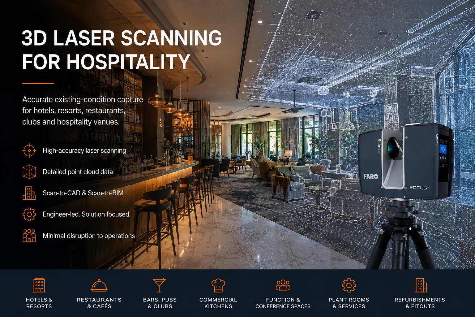
3D laser scanning for hospitality venues, showing a FARO scanner capturing a hotel restaurant and lounge with a point-cloud overlay.

3D Laser Scanning for Hospitality

Blue five-star hotel icon with the word โ€œHOTELโ€ on a black background.

Hamilton By Design provides engineer-led 3D laser scanning, LiDAR capture, point-cloud processing and scan-to-CAD modelling for hospitality buildings and venues across Australia.

Our services support hotels, resorts, restaurants, clubs, pubs, cafรฉs, commercial kitchens, function centres, entertainment venues and mixed-use hospitality developments.

Using high-accuracy terrestrial laser scanning, we capture existing conditions quickly and create reliable digital information for refurbishment, fitout, services coordination, asset upgrades and engineering design.

Accurate Existing-Condition Capture for Hospitality Projects

Hospitality buildings are often complex, highly serviced and continuously occupied.

Original drawings may be incomplete, outdated or inconsistent with the current building. Previous renovations can also result in undocumented walls, ceilings, pipework, ductwork, electrical services, structural elements and equipment.

3D laser scanning creates a detailed record of the visible site conditions at the time of capture.

The resulting point cloud can be used to support:

  • Hotel and resort refurbishments
  • Restaurant and commercial kitchen upgrades
  • Pub and club renovations
  • Function-room reconfiguration
  • Guest-room remodelling
  • Bar and dining-area fitouts
  • Building-services coordination
  • Plant-room upgrades
  • Accessibility improvements
  • Faรงade and external-area documentation
  • Scan-to-CAD and Scan-to-BIM workflows
  • As-built verification

Hospitality Areas We Can Scan

Hamilton By Design can capture individual rooms, selected work areas or entire hospitality facilities.

Typical scanning areas include:

  • Guest rooms and suites
  • Hotel corridors and lift lobbies
  • Reception and concierge areas
  • Restaurants and cafรฉs
  • Commercial kitchens
  • Bars and beverage-service areas
  • Ballrooms and function rooms
  • Conference and meeting spaces
  • Gaming and entertainment areas
  • Clubs and pubs
  • Amenities and accessible bathrooms
  • Laundries and back-of-house areas
  • Loading docks and delivery areas
  • Roof spaces and ceiling cavities
  • Mechanical and electrical plant rooms
  • Service risers
  • Swimming pools and recreation areas
  • Building faรงades
  • Outdoor dining areas
  • Car parks and access routes

The scope can be tailored to the project so that only the areas required for design, coordination or construction are captured.

Hotel and Resort Refurbishment Scanning

Hotels and resorts frequently undergo staged refurbishments while continuing to operate.

3D laser scanning can reduce the need for repeated manual site measurement and provide consultants with a shared digital record of the existing building.

Scanning can support refurbishment works involving:

  • Guest-room layouts
  • Bathrooms and wet areas
  • Corridors and common areas
  • Reception areas
  • Restaurants and bars
  • Conference facilities
  • Building services
  • Plant rooms
  • Pool and recreation areas
  • External faรงades
  • Accessibility upgrades

The point cloud allows designers to check dimensions remotely and develop proposed works around verified existing conditions.

Restaurants, Bars, Pubs and Clubs

Hospitality venues often contain tight spaces, irregular layouts and dense building services.

A laser scan can capture the relationship between walls, ceilings, floors, counters, fixed equipment, structural elements and visible services.

This can assist with:

  • New restaurant fitouts
  • Bar redesigns
  • Commercial kitchen modifications
  • Gaming-floor changes
  • Club refurbishment projects
  • New equipment installation
  • Mechanical ventilation upgrades
  • Hydraulic-services coordination
  • Fire-services coordination
  • Accessibility and circulation reviews
  • Interior-design documentation

Capturing the existing venue before demolition or modification can also create a useful record for the project team.

Commercial Kitchen Scanning

Commercial kitchens contain closely coordinated equipment, exhaust systems, services and access requirements.

3D laser scanning can document:

  • Cooking equipment
  • Benches and preparation areas
  • Cool rooms and freezers
  • Exhaust canopies
  • Ductwork
  • Pipework
  • Floor wastes
  • Electrical connections
  • Walls and ceilings
  • Structural supports
  • Equipment clearances
  • Access and maintenance zones

The point cloud can then be used to prepare CAD models, equipment layouts and design drawings for proposed modifications.

This is particularly useful when replacing equipment or redesigning a kitchen within an existing building envelope.

Plant Rooms and Building Services

Hospitality facilities depend on mechanical, electrical, hydraulic and fire-service systems that are often installed in constrained spaces.

Laser scanning can capture visible services within:

  • Mechanical plant rooms
  • Electrical rooms
  • Pump rooms
  • Boiler rooms
  • Chiller areas
  • Service corridors
  • Ceiling spaces
  • Roof-mounted plant areas
  • Hydraulic-service rooms
  • Fire-pump and sprinkler areas

The scan data can assist engineers and contractors with upgrade planning, clash checking, access reviews and equipment replacement.

Function Centres and Event Spaces

Ballrooms, conference rooms and function spaces may require regular changes to layouts, lighting, audiovisual systems and building services.

3D scanning can provide accurate spatial information for:

  • Stage design
  • Lighting layouts
  • Audiovisual installations
  • Ceiling-service coordination
  • Acoustic upgrades
  • Partition changes
  • Accessibility improvements
  • Seating layouts
  • Exhibition planning
  • Structural and suspended-load reviews

The captured point cloud provides a detailed reference for consultants who may not be able to visit the site repeatedly.

Scan-to-CAD and Scan-to-BIM Deliverables

Hamilton By Design can process the laser-scan data and prepare outputs suitable for architects, engineers, designers, contractors and facility managers.

Available deliverables may include:

  • Registered point clouds
  • E57 files
  • RCP and RCS files
  • LAS files
  • 2D floor plans
  • Reflected ceiling plans
  • Building elevations
  • Cross-sections
  • Existing-condition drawings
  • 3D CAD models
  • SolidWorks models
  • AutoCAD drawings
  • STEP or SAT files
  • Navisworks-compatible data
  • Scan-to-BIM reference models
  • Marked-up screenshots
  • Dimensional verification reports

Deliverables are selected based on the intended use of the data.

Mechanical Engineering Support

Hamilton By Design combines reality capture with mechanical engineering and CAD capability.

Where required, the scan data can support:

  • Equipment-layout design
  • Commercial kitchen modifications
  • Plant-access reviews
  • Mechanical-services upgrades
  • Pipework and duct-routing studies
  • Machine and equipment replacement
  • Structural-support concepts
  • Maintenance-access planning
  • Guarding and safety improvements
  • Platform, stair and handrail design
  • Clash and interference reviews
  • Existing-equipment modelling

This engineer-led approach helps connect the site capture with the design and implementation requirements of the project.

Reduced Disruption to Hospitality Operations

Hotels, restaurants and entertainment venues often need to remain operational while investigation and design work is completed.

Laser scanning allows large amounts of dimensional information to be captured efficiently without measuring every item individually by hand.

Depending on the site, scanning may be scheduled:

  • During quiet operating periods
  • Before opening
  • After closing
  • Between guest check-in periods
  • During planned maintenance
  • During partial shutdowns
  • In isolated work zones
  • As part of staged refurbishment works

Site access, guest privacy, food-service requirements and operational constraints can be considered when preparing the scanning plan.

Benefits of 3D Laser Scanning for Hospitality Projects

Reduced Site Rework

A detailed point cloud can reduce the need for repeated site visits and additional manual measurement.

Better Design Coordination

Architects, engineers, contractors and suppliers can work from a common digital reference.

Improved Fitout Accuracy

Proposed joinery, equipment, ductwork, pipework and structural elements can be checked against the existing building geometry.

Faster Existing-Condition Documentation

Large areas can be documented more efficiently than traditional point-by-point measurement.

Improved Clash Detection

Proposed services and equipment can be reviewed against existing walls, ceilings, structures and visible services.

Digital Site Record

The point cloud creates a detailed record of the visible site conditions before refurbishment, demolition or modification.

Support for Off-Site Design

Consultants can review the captured environment remotely and extract measurements from the point cloud.

Hospitality Refurbishments and Live Sites

Working within an operating hospitality venue requires planning and coordination.

Before scanning, the project team may need to consider:

  • Public and guest access
  • Privacy requirements
  • Food-preparation areas
  • Working hours
  • Noise limitations
  • Restricted areas
  • Security procedures
  • Housekeeping schedules
  • Plant operating conditions
  • Temporary obstructions
  • Lighting conditions
  • Areas requiring staged capture

Hamilton By Design can work with the client, facility manager or principal contractor to develop a practical capture approach.

Typical Hospitality Project Workflow

1. Scope Review

We review the project area, intended deliverables, required level of detail and access constraints.

2. Site Planning

The scanning sequence is planned around venue operations, restricted areas and required coverage.

3. 3D Laser Scanning

The relevant rooms, services, equipment and building elements are captured using terrestrial LiDAR equipment.

4. Point-Cloud Registration

Individual scans are aligned into a coordinated point-cloud dataset.

5. Quality Review

The registered data is reviewed for coverage, alignment and suitability for the agreed deliverables.

6. CAD or BIM Development

Where required, the point cloud is used to prepare drawings, CAD models, sections, elevations or BIM reference geometry.

7. Project Delivery

The agreed files are issued in formats suitable for the project team.

Hospitality Facilities We Support

Our scanning and engineering services are suitable for:

  • Hotels
  • Resorts
  • Serviced apartments
  • Restaurants
  • Cafรฉs
  • Pubs
  • Registered clubs
  • Nightclubs
  • Function centres
  • Conference venues
  • Casinos
  • Commercial kitchens
  • Food courts
  • Entertainment precincts
  • Sporting hospitality facilities
  • Mixed-use developments
  • Tourism facilities

Australia-Wide Hospitality Scanning

Hamilton By Design provides 3D laser scanning and engineering support across Australia.

Project locations can include:

  • Sydney
  • Central Coast
  • Newcastle
  • Hunter Valley
  • Canberra
  • Brisbane
  • Gold Coast
  • Melbourne
  • Adelaide
  • Perth
  • Regional and remote locations

Travel and site requirements can be incorporated into the project scope.

Why Choose Hamilton By Design?

Hamilton By Design provides more than point-cloud capture.

Our capability combines:

  • Engineer-led 3D laser scanning
  • FARO terrestrial LiDAR equipment
  • Point-cloud registration and processing
  • Mechanical engineering
  • 3D CAD modelling
  • SolidWorks and AutoCAD capability
  • Existing-condition documentation
  • Reverse engineering
  • Plant and equipment design
  • Practical site and fabrication experience

This integrated capability is valuable for hospitality projects where accurate measurement must be converted into useful design information.

Frequently Asked Questions

Can you scan an operating hotel?

Yes. Scanning can often be staged around hotel operations, guest access and room availability. The capture plan should be coordinated with hotel management before the site visit.

Can you scan only selected rooms?

Yes. The scope may include a single guest room, a representative room type, one floor, a plant room, a kitchen or an entire facility.

Can laser scanning capture ceiling services?

Visible services can be captured where there is a clear line of sight. Ceiling tiles may need to be removed in selected areas where above-ceiling services are required.

Can the scan be used for refurbishment drawings?

Yes. Point-cloud data can be used to prepare floor plans, elevations, sections and 3D CAD models for refurbishment planning.

Can you model commercial kitchen equipment?

Yes. Existing equipment and surrounding geometry can be modelled to the agreed level of detail for layout and modification work.

Can scan data be provided to architects?

Yes. Common formats include E57, RCP, RCS and LAS. The required format should be confirmed with the architect or BIM consultant before delivery.

Does laser scanning capture hidden services?

No. Laser scanning captures visible surfaces. Hidden services may require access panels, ceiling removal, service locating, drawings or other investigation methods.

Can the point cloud be used in Navisworks?

Yes. Point-cloud files can be prepared in formats suitable for Navisworks and other common design and coordination software.

Discuss Your Hospitality Scanning Project

Hamilton By Design can assist with 3D laser scanning, point-cloud processing, scan-to-CAD modelling and engineering support for hotels, restaurants, clubs, resorts and other hospitality facilities.

Contact Hamilton By Design to discuss your site, required deliverables, access constraints and project objectives.


Hamilton By Design logo displayed on a blue tilted rectangle with a grey gradient background

Contact Us – Talk To Us

Name
Would you like us to arrange a phone consultation for you?
Address

Our clients:


Mechanical Engineering Port of Newcastle | 3D Scanning

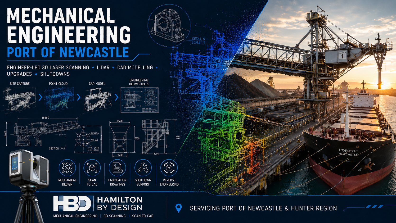
Mechanical engineering at the Port of Newcastle showing a bulk cargo ship, ship loader, conveyors, LiDAR scanner, point-cloud data and engineering drawings.

Engineer-Led 3D Laser Scanning, CAD Modelling and Mechanical Engineering for Port Assets

Port infrastructure operates under demanding mechanical, environmental and operational conditions.

Blue line icon showing a port crane loading a cargo ship while a tripod-mounted LiDAR scanner captures the vessel and crane.

Ship loaders, conveyors, transfer chutes, hoppers, pipework, access platforms, wharf equipment and structural support systems must operate reliably while being exposed to vibration, corrosion, abrasive materials, heavy loads and continuous production demands.

When these assets require modification, replacement or refurbishment, engineering decisions need to be based on accurate information about the equipment and surrounding site conditions.

Hamilton By Design provides mechanical engineering services for Port of Newcastle projects, combining engineering-grade 3D laser scanning, LiDAR reality capture, Scan to CAD, mechanical design and fabrication documentation.

Our integrated approach helps port operators, terminal operators, consultants, contractors and fabricators plan upgrades and shutdown work around the actual installed condition of the facility.


Mechanical Engineering for Port of Newcastle Assets

The Port of Newcastle contains a broad mix of coal, bulk-material, liquid-bulk, general-cargo, fuel, rail and logistics infrastructure. Its operating facilities include coal terminals, bulk-liquid terminals, storage areas, road and rail connections, multipurpose berths and associated materials-handling equipment.

Mechanical-engineering support may be required for assets such as:

  • Ship loaders and unloaders
  • Belt conveyors
  • Transfer stations
  • Chutes and hoppers
  • Feeders and gates
  • Pipework and pumping systems
  • Mechanical skids
  • Wharf-mounted equipment
  • Crane interfaces
  • Access platforms and walkways
  • Machine guards
  • Dust-extraction systems
  • Equipment supports
  • Maintenance lifting systems
  • Replacement components

Hamilton By Design can support these projects from initial site capture through to CAD modelling, engineering development and fabrication drawings.


Why Port Engineering Projects Need Accurate Existing-Condition Data

Port facilities frequently contain equipment that has been modified over many years.

An asset may have been:

  • Repaired
  • Reinforced
  • Relocated
  • Replaced
  • Extended
  • Distorted
  • Worn
  • Supplemented with additional steelwork
  • Modified without corresponding drawing updates

Original drawings remain useful, but they may not represent the current physical arrangement.

Hamilton By Design uses engineering-grade 3D scanning in Newcastle to capture the visible position and geometry of existing equipment, structures and services.

The registered point cloud can then provide a reliable basis for mechanical design, fit-up checks, installation planning and engineering studies.


Engineer-Led 3D Laser Scanning

A useful port scan requires more than simply positioning a scanner on site.

The capture should be planned around the engineering purpose of the project.

Before scanning, we consider:

  • The proposed modification
  • Critical tie-in points
  • Required accuracy
  • Equipment interfaces
  • Access restrictions
  • Installation routes
  • Crane and lifting requirements
  • Areas requiring detailed modelling
  • File-format requirements
  • Coordinate-control requirements

This helps ensure that the point cloud captures the information required by the engineers, designers and fabricators who will use it.

Our existing 3D Scanning Port of Newcastle service supports port infrastructure, ship loaders, conveyors, structural steel, shutdowns and brownfield upgrades.


Mechanical Design for Brownfield Port Upgrades

Most port engineering projects are brownfield projects.

New equipment must be designed around existing structures, platforms, pipework, conveyors, electrical services and operating assets.

Even a small dimensional error can cause:

  • Fabrication rework
  • Site cutting and welding
  • Installation delays
  • Additional crane time
  • Extended isolations
  • Access problems
  • Unexpected clashes
  • Increased shutdown costs
  • Increased safety exposure

By combining LiDAR point-cloud data with CAD modelling, proposed components can be developed within the measured site environment.

This allows the engineering team to consider:

  • Whether the new equipment will fit
  • Whether adequate maintenance access exists
  • Whether removal paths are available
  • Whether surrounding infrastructure creates a clash
  • Whether fabricated sections can reach their installation location
  • Whether lifting and installation sequences are practical

Ship Loader and Conveyor Engineering

The Port of Newcastle includes extensive bulk-handling and coal-export infrastructure, including conveyors, stockyard systems and ship-loading equipment.

Hamilton By Design can support projects involving:

  • Ship-loader chute modifications
  • Conveyor replacements
  • Transfer-station upgrades
  • Skirt and sealing improvements
  • Deflector plates
  • Wear-liner arrangements
  • Access-platform modifications
  • Maintenance walkways
  • Equipment-support frames
  • Guarding upgrades
  • Dust-control improvements
  • Replacement mechanical components

The point cloud can provide the surrounding structural and mechanical context needed to design new equipment accurately.


Chutes, Hoppers and Materials-Handling Equipment

Transfer chutes and hoppers are exposed to abrasive material flow, impact, blockage, dust and wear.

Mechanical-engineering work may include:

  • Existing-condition assessment
  • Chute geometry review
  • Wear-liner replacement
  • Impact-zone modifications
  • Flow-path improvements
  • Deflector and spoon design
  • Access-door upgrades
  • Dust-sealing improvements
  • Support-frame modifications
  • Fabrication drawing development

LiDAR scanning can capture both the materials-handling equipment and the surrounding support structure.

This can be particularly useful where the equipment is elevated, congested or difficult to measure manually.


Pipework and Mechanical Services

Port terminals may contain fuel, water, compressed-air, hydraulic, lubrication, dust-suppression and process-pipe systems.

Mechanical-engineering and Scan to CAD support can assist with:

  • Pipe-routing modifications
  • Pump and valve replacements
  • New branch connections
  • Flange and nozzle location capture
  • Pipe-support design
  • Mechanical-skid installation
  • Access and maintenance reviews
  • Clash detection
  • Replacement spool planning
  • Existing-condition documentation

Accurate scanning of tie-in points can reduce uncertainty when designing pipe spools and replacement equipment.


Structural Interfaces and Access Systems

Mechanical modifications frequently connect to structural steel.

Hamilton By Design can capture and model:

  • Beams and columns
  • Equipment-support frames
  • Platforms
  • Stairs
  • Walkways
  • Handrails
  • Ladders
  • Guarding
  • Connection points
  • Existing foundations

This information can support mechanical arrangement design and coordination with structural engineers and fabricators.

Our Kooragang and Carrington industrial scanning and engineering service is particularly relevant to projects within Newcastleโ€™s port and heavy-industrial precincts.


Shutdown Engineering Support

Port shutdowns may have tightly controlled work windows.

A delay caused by missing measurements, an unexpected clash or incorrect fit-up can affect labour, crane bookings, contractors and the return-to-service schedule.

Hamilton By Design can support shutdown preparation through:

  • Pre-shutdown LiDAR scanning
  • Existing-condition verification
  • Work-pack drawing development
  • Removal-path studies
  • Installation-sequence reviews
  • Crane and lifting-layout support
  • Fit-up checks
  • Clash detection
  • Temporary-access planning
  • Demolition planning
  • Fabrication documentation

The digital site record also allows engineering teams, fabricators and contractors to review the work area remotely before mobilisation.


Scan to CAD for Mechanical Engineering

Registered point-cloud information can be converted into practical CAD geometry.

Depending on the project, deliverables may include:

  • Existing-condition models
  • Mechanical-equipment models
  • Conveyor models
  • Chute and hopper models
  • Structural interfaces
  • Pipework models
  • Equipment envelopes
  • Platform and access models
  • General-arrangement drawings
  • Plans, sections and elevations
  • Fabrication-support models
  • Installation-planning models

Hamilton By Design can prepare models using:

  • SolidWorks
  • AutoCAD
  • Autodesk Inventor
  • Navisworks-compatible formats
  • STEP
  • SAT
  • Parasolid
  • DWG
  • DXF

The level of detail is matched to the engineering objective. A project does not necessarily require every visible object to be modelled.


Mechanical Engineering Studies

Point-cloud data can support a range of engineering studies for port assets.

These may include:

  • Existing-condition studies
  • Drawing-verification studies
  • Fit-up assessments
  • Equipment-clearance studies
  • Maintenance-access reviews
  • Constructability assessments
  • Wear and erosion studies
  • Deformation assessments
  • Refurbishment planning
  • Reverse-engineering studies
  • Remaining-service-life investigations
  • Incident and damage documentation
  • As-built verification

The scanning scope can be targeted to the equipment and interfaces relevant to the study.


Reverse Engineering of Port Equipment

Original manufacturing drawings may be unavailable for older port equipment.

Hamilton By Design can use 3D scanning and physical inspection to support the reconstruction of:

  • Chute components
  • Guards
  • Covers
  • Housings
  • Duct sections
  • Equipment brackets
  • Support frames
  • Wear plates
  • Mechanical interfaces
  • Replacement components

The scan data can be combined with manual measurements and engineering judgement to develop replacement CAD geometry.

Learn more about our reverse engineering with 3D scanning services.


Fabrication and Fit-Up Support

Mechanical-engineering projects often succeed or fail at the physical interface between new and existing equipment.

Scan-derived CAD models can support:

  • Fabrication-ready geometry
  • General-arrangement drawings
  • Shop and detail drawings
  • Interface checking
  • Bolt and flange alignment
  • Equipment fit checks
  • Structural connection coordination
  • Installation planning
  • Clash detection
  • As-built verification

This approach helps reduce the risk that fabricated equipment will require extensive modification after arriving on site.


As-Built Verification

After installation, selected equipment and infrastructure may be rescanned.

The scan can be compared with the design model to assess:

  • Installed position
  • Equipment orientation
  • Pipe routing
  • Structural alignment
  • Clearances
  • Interface locations
  • Construction tolerances
  • Differences from the approved design

The updated information can also support future maintenance, asset management and modification work.


Mechanical Engineering for Asset Maintenance

The Port of Newcastle operates a large and complex infrastructure portfolio requiring ongoing maintenance, lifecycle planning and coordination around operational continuity.

Hamilton By Design can support maintenance-related work through:

  • Asset-condition capture
  • Replacement-component modelling
  • Equipment modification design
  • Maintenance-access improvements
  • Guarding and safety upgrades
  • Drawing updates
  • Reverse engineering
  • Wear assessment
  • Refurbishment planning
  • Shutdown documentation

The result is a more reliable connection between field conditions, engineering decisions and maintenance execution.


Our Project Workflow

1. Scope Definition

We establish:

  • Project objective
  • Equipment to be scanned
  • Required accuracy
  • Critical interfaces
  • Deliverables
  • Site constraints
  • Required CAD formats
  • Engineering responsibilities

2. Site and Safety Planning

Port projects may require consideration of:

  • Site inductions
  • Maritime-security requirements
  • Work permits
  • Traffic management
  • Vessel movements
  • Crane operations
  • Operating conveyors
  • Work near water
  • Exclusion zones
  • Shutdown and isolation requirements

3. LiDAR Capture

Multiple scan positions are selected to capture the equipment, surrounding structures and important tie-in points.

4. Point-Cloud Registration

Individual scans are aligned into a coordinated point cloud and reviewed for coverage and registration quality.

5. CAD Modelling

Relevant geometry is converted into fit-for-purpose mechanical and structural CAD information.

6. Mechanical Engineering

The measured model is used to support design, assessment, equipment modification, fit-up review or drawing development.

7. Project Delivery

Final files and documentation are issued in the agreed formats.


Available Deliverables

Project deliverables may include:

  • Registered point clouds
  • E57 files
  • RCP and RCS files
  • LAS files
  • AutoCAD DWG drawings
  • DXF files
  • SolidWorks parts and assemblies
  • Autodesk Inventor models
  • STEP files
  • SAT files
  • Parasolid files
  • General-arrangement drawings
  • Plans, sections and elevations
  • Fabrication drawings
  • Existing-condition reports
  • Engineering-study documentation
  • As-built models

Benefits for Port Operators

Mechanical engineering supported by LiDAR scanning can provide:

  • More reliable existing-condition information
  • Reduced reliance on outdated drawings
  • Fewer repeated site visits
  • Better shutdown preparation
  • Improved design coordination
  • Earlier clash identification
  • Reduced fabrication uncertainty
  • Improved installation planning
  • Better asset documentation
  • A reusable digital site record

Benefits for Engineers and Consultants

Engineering teams can use the captured data to:

  • Design around measured geometry
  • Review mechanical and structural interfaces
  • Develop accurate layouts
  • Assess maintenance access
  • Produce sections through congested areas
  • Review constructability
  • Reduce assumptions
  • Coordinate multiple disciplines
  • Prepare fabrication documentation
  • Communicate modifications clearly

Benefits for Fabricators and Contractors

Fabricators and contractors can benefit from:

  • Better-defined interfaces
  • Improved fit-up confidence
  • Clearer fabrication drawings
  • Reduced dimensional uncertainty
  • Better lifting and installation planning
  • Fewer unexpected site modifications
  • Reduced rework
  • Better shutdown coordination

Port of Newcastle Areas Serviced

Hamilton By Design can support projects throughout:

  • Port of Newcastle
  • Kooragang Island
  • Carrington
  • Mayfield
  • Mayfield West
  • Walsh Point
  • Steel River
  • Newcastle
  • Lower Hunter
  • Hunter Valley
  • Greater Newcastle
  • Regional New South Wales

Access remains subject to the requirements of the relevant port operator, terminal operator, asset owner or site controller.


Why Choose Hamilton By Design?

Hamilton By Design combines:

  • Mechanical-engineering capability
  • Trade and fabrication experience
  • Engineering-grade LiDAR scanning
  • Point-cloud processing
  • Scan to CAD
  • SolidWorks modelling
  • AutoCAD drafting
  • Structural and mechanical detailing
  • Reverse engineering
  • Brownfield-design experience
  • Shutdown and installation planning

Our Mayfield West and Steel River engineering services and broader Newcastle 3D scanning capability demonstrate this integrated local approach.


Frequently Asked Questions

What mechanical-engineering services can you provide for port assets?

Services may include site scanning, mechanical design, equipment modification, Scan to CAD, reverse engineering, fabrication drawings, access reviews, clash detection and shutdown support.

Can you scan operating port equipment?

In many cases, yes. LiDAR scanning is non-contact, although work must be coordinated with site operations, permits, exclusion zones and relevant safety controls.

Can the point cloud be converted into SolidWorks?

Yes. Relevant scan geometry can be used to develop SolidWorks parts, assemblies, layouts and fabrication documentation.

Can you scan conveyors and ship loaders?

Yes. LiDAR scanning can capture conveyor systems, ship loaders, chutes, transfer stations, support structures and surrounding infrastructure.

Can the scan support a shutdown?

Yes. Pre-shutdown scanning can support planning, fit-up checks, clash detection, work-pack drawings, installation sequencing and contractor coordination.

Can you design replacement components?

Hamilton By Design can support reverse engineering and replacement-component development where suitable site data, measurements and engineering information are available.

Can existing drawings be checked against the scan?

Yes. Existing drawings or CAD models can be compared with the measured point cloud to identify differences from actual site conditions.

Do all projects require a complete CAD model?

No. Some projects need only registered point-cloud data, while others require targeted modelling, detailed drawings or engineering analysis.


Discuss a Port of Newcastle Mechanical Engineering Project

Reliable port engineering begins with accurate information about the existing asset.

Hamilton By Design provides engineer-led 3D laser scanning, LiDAR reality capture, CAD modelling and mechanical engineering for Port of Newcastle assets, upgrades and shutdowns.

Whether the project involves a ship loader, conveyor, transfer chute, platform, pipework system, mechanical skid or broader terminal upgrade, the scanning and engineering scope can be tailored to the required outcome.

Contact Hamilton By Design to discuss mechanical engineering and 3D scanning support for your Port of Newcastle project.


Hamilton By Design logo displayed on a blue tilted rectangle with a grey gradient background

Contact Us – Talk To Us

Name
Would you like us to arrange a phone consultation for you?
Address

Our clients:


Port Facility LiDAR Scanning Port of Brisbane | Asset Capture

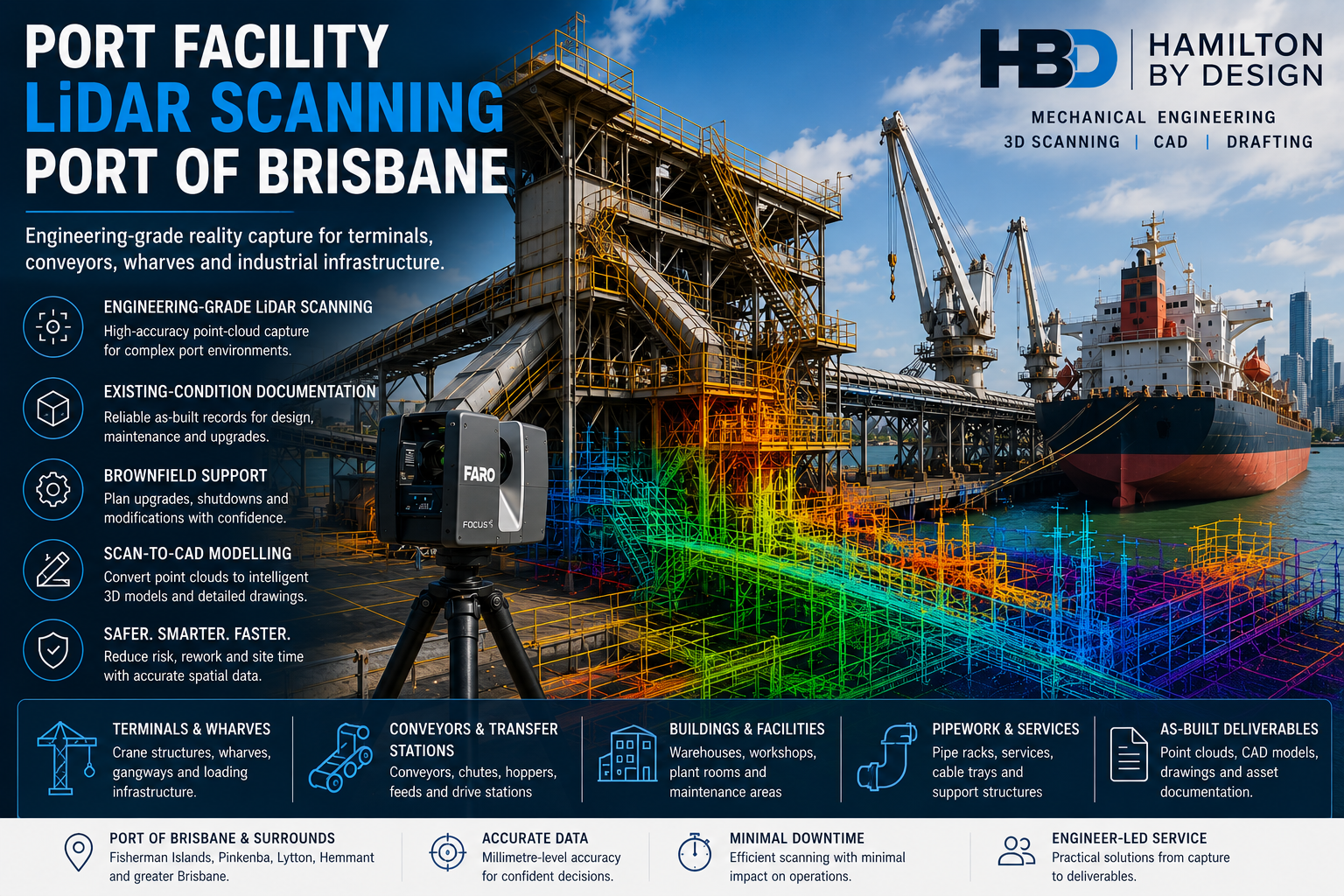
Port facility LiDAR scanning at the Port of Brisbane showing a FARO scanner, conveyors, wharf infrastructure, cargo ship and coloured point-cloud overlay.

Port Facility LiDAR Scanning Port of Brisbane

Engineering-Grade Reality Capture for Terminals, Wharves, Conveyors and Brownfield Port Infrastructure

Port facilities contain some of the most complex engineering environments in industry. Container-handling equipment, conveyors, transfer stations, structural steel, pipework, access systems, wharf infrastructure and mobile plant often operate within restricted areas and tightly controlled shutdown windows.

Hamilton By Design provides port facility LiDAR scanning at the Port of Brisbane, supporting terminal operators, asset owners, engineering consultants, maintenance teams, contractors and fabricators working across Fisherman Islands, Pinkenba, Lytton, Hemmant and the wider Brisbane port precinct.

Our service is focused on capturing reliable existing-condition data for engineering, asset documentation, maintenance planning, tender development, brownfield modifications and fabrication coordination.

Unlike the broader Port of Brisbane engineering and 3D laser scanning service, this page focuses specifically on facility-wide LiDAR capture, port asset documentation and engineering-ready point-cloud delivery.


Why Port Facilities Need Reliable Existing-Condition Data

Port infrastructure changes throughout its operating life.

Conveyors may be extended, platforms altered, guards replaced, pipework rerouted and equipment upgraded without every modification being transferred back to the original drawings.

This can create uncertainty when planning:

  • Terminal upgrades
  • Conveyor replacements
  • Chute modifications
  • New access systems
  • Wharf maintenance
  • Equipment relocation
  • Structural alterations
  • Shutdown work
  • Fabrication and installation
  • Asset-management programs

Traditional site measurement can be slow and incomplete when assets are large, congested, elevated or difficult to access safely.

Engineering-grade LiDAR scanning captures millions of spatial measurements and produces a measurable three-dimensional record of the visible environment. Hamilton By Design uses this approach across industrial and infrastructure projects where point-cloud data must support engineering, design and fabrication decisions.


What Is Port Facility LiDAR Scanning?

LiDAR means Light Detection and Ranging. A laser scanner emits light pulses and records the distance to visible surfaces, creating a dense collection of three-dimensional measurement points known as a point cloud.

For a port facility, the registered point cloud may capture the spatial relationship between:

  • Buildings
  • Wharves
  • Conveyors
  • Transfer towers
  • Loading equipment
  • Structural steel
  • Mechanical assets
  • Platforms and stairs
  • Pipework and services
  • Roads and hardstands
  • Maintenance areas
  • Adjacent infrastructure

The point cloud can then be reviewed, measured and converted into suitable engineering or asset-management deliverables.


Port Assets That Can Be Captured

Hamilton By Design can use terrestrial LiDAR scanning to document visible port and terminal assets such as:

Container-terminal infrastructure

  • Container-handling areas
  • Crane-support infrastructure
  • Equipment clearances
  • Terminal buildings
  • Maintenance zones
  • Traffic and operational interfaces

Bulk-material handling systems

  • Conveyors
  • Transfer stations
  • Chutes
  • Hoppers
  • Bins
  • Feeders
  • Drive stations
  • Support frames
  • Walkways and platforms

Wharf and marine-side infrastructure

  • Wharf-access structures
  • Loading and unloading equipment
  • Gangways
  • Mooring-related structures
  • Service connections
  • Pipe bridges
  • Above-water structural geometry
  • Crane rails and associated steelwork

Buildings and supporting facilities

  • Warehouses
  • Workshops
  • Plant rooms
  • Maintenance buildings
  • Service corridors
  • Electrical rooms
  • Equipment foundations
  • Structural framing

Where below-water geometry is required, terrestrial scanning may need to be combined with hydrographic, bathymetric or specialist subsea survey methods.


Facility-Wide Existing-Condition Capture

A port facility scan can extend beyond one isolated item of equipment.

Where required, Hamilton By Design can establish a broader digital record of:

  • Multiple conveyor routes
  • Transfer stations
  • Terminal buildings
  • Wharf structures
  • Road and equipment interfaces
  • Mechanical plant areas
  • Access systems
  • Existing services
  • Maintenance zones
  • Surrounding structural steel

This wider capture can help project teams understand how one proposed modification may affect other parts of the terminal.

It can also reduce repeated site visits by allowing engineers, designers and contractors to revisit the measured environment remotely.


Point-Cloud Deliverables

The registered point cloud can be supplied in formats selected to suit the clientโ€™s software and intended workflow.

Typical deliverables may include:

  • E57 point clouds
  • Autodesk RCP files
  • Autodesk RCS files
  • LAS files
  • Registered scan databases
  • Scan-location documentation
  • Coverage images
  • Selected measurements
  • Point-cloud viewing files
  • Cropped project areas
  • Coordinate or survey-control information where applicable

Hamilton By Design also provides 3D point-cloud scanning in Brisbane for projects requiring traceable, fit-for-purpose spatial information for engineering and construction decisions.


Scan-to-CAD for Port Facilities

A point cloud is a measurement dataset rather than a complete engineering model.

Where required, selected geometry can be converted into CAD representations of:

  • Structural steel
  • Conveyors
  • Chutes and hoppers
  • Mechanical equipment
  • Platforms and access structures
  • Pipework
  • Machinery guards
  • Equipment foundations
  • Buildings and plant rooms
  • Replacement components

The required modelling level should be defined according to the project purpose.

A broad coordination model may be sufficient for clash detection, while equipment replacement or fabrication work may require more detailed geometry and independently verified interfaces.

Hamilton By Designโ€™s Brisbane scanning and engineering service connects site capture with mechanical and structural engineering, CAD modelling and fabrication-ready drafting.


As-Built Documentation for Port Assets

Port facility LiDAR scanning can support the preparation of:

  • Existing-condition plans
  • General arrangement drawings
  • Floor plans
  • Sections and elevations
  • Structural layouts
  • Equipment-location drawings
  • Conveyor layouts
  • Pipe and service layouts
  • Clearance envelopes
  • Access-system drawings
  • Asset registers
  • Three-dimensional as-built models

These records can provide a more reliable basis for future maintenance, design and tender work than drawings that may not include later site modifications.


Brownfield Port Upgrades

Brownfield work is completed within an existing operational facility, where new equipment must fit around assets that remain in place.

Typical constraints include:

  • Incomplete drawings
  • Undocumented modifications
  • Restricted installation space
  • Existing services
  • Active operations
  • Limited shutdown periods
  • Difficult lifting access
  • Corrosion or wear
  • Multiple project interfaces

Hamilton By Design uses engineering-led LiDAR capture to reduce uncertainty in these environments.

A typical workflow may include:

  1. Defining the intended engineering use of the scan
  2. Capturing the existing facility and relevant interfaces
  3. Registering and reviewing the point-cloud data
  4. Isolating the project area
  5. Modelling the proposed equipment
  6. Positioning the design within the existing point cloud
  7. Reviewing clashes, access and constructability
  8. Preparing drawings for fabrication or installation

This approach is similar to the scan-led workflows Hamilton By Design applies to brownfield port engineering and industrial retrofit projects.


Conveyor and Transfer-Station Scanning

Port conveyors and transfer systems are often difficult to measure because they contain elevated steelwork, guarding, moving equipment, worn components and restricted access.

LiDAR scanning can document:

  • Conveyor stringers
  • Gantries
  • Head and tail stations
  • Pulley positions
  • Drive frames
  • Transfer towers
  • Chutes
  • Hoppers
  • Walkways
  • Platforms
  • Guarding
  • Pipework
  • Cable trays
  • Nearby structures

The resulting dataset can support:

  • Conveyor modifications
  • Replacement chute design
  • Guarding upgrades
  • Access improvements
  • Structural coordination
  • Wear assessments
  • Shutdown planning
  • Fabrication documentation

Wharf and Berth Infrastructure

Terrestrial LiDAR scanning may be used to document visible wharf and berth infrastructure from safe scanner locations.

Possible applications include:

  • Wharf-access upgrades
  • Loading-equipment modifications
  • Service-routing projects
  • Gangway replacement
  • Platform alterations
  • Structural-steel verification
  • Clearance studies
  • Crane-support interfaces
  • Pipe-bridge modifications
  • Maintenance planning

A scanner can capture geometry that would otherwise require numerous manual measurements at height or near operational equipment.

All site work remains subject to the port operatorโ€™s access, permit, exclusion-zone and water-edge requirements.


Crane and Heavy-Equipment Interfaces

Port cranes and heavy mechanical equipment frequently interact with surrounding steelwork, rails, services and operational areas.

LiDAR scanning can assist with:

  • Existing equipment envelopes
  • Crane-support geometry
  • Crane rail locations
  • Access-platform modifications
  • Guarding design
  • Structural interfaces
  • Maintenance clearances
  • Removal and installation paths
  • Surrounding obstructions
  • Clash detection

Where a project requires formal alignment, settlement, deformation or high-precision tolerance reporting, specialist survey control or metrology may also be needed.


Shutdown Planning and Work-Pack Development

Port shutdowns can involve significant operational and commercial consequences.

Pre-shutdown scanning may help project teams:

  • Confirm existing interfaces
  • Review demolition boundaries
  • Check replacement-component dimensions
  • Plan lifting access
  • Review crane positions
  • Examine installation routes
  • Identify obstructions
  • Coordinate temporary works
  • Prepare contractor work packs
  • Reduce dependence on shutdown measurements

The point cloud can be reviewed before mobilisation, allowing more project questions to be resolved while changes remain less expensive.


Clash Detection and Spatial Coordination

Proposed equipment can be positioned within the registered point cloud to identify conflicts with:

  • Structural steel
  • Conveyors
  • Pipework
  • Cable trays
  • Platforms
  • Handrails
  • Buildings
  • Existing machinery
  • Vehicle routes
  • Maintenance envelopes

Clash detection does not replace engineering verification, but it can identify spatial conflicts before fabrication or installation.

This is particularly valuable where replacement equipment must be fabricated off site before an existing asset is removed.


Asset Management and Digital Baselines

A registered point cloud can provide a digital baseline of a port facility at a specific time.

Depending on the project methodology, future scans may be compared with the baseline to support:

  • Asset-condition monitoring
  • Change documentation
  • Upgrade records
  • Maintenance planning
  • Wear studies
  • Structural reviews
  • Refurbishment planning
  • Digital twin development

Reality capture is commonly used as a foundation for digital representations of existing assets and infrastructure. Hamilton By Designโ€™s broader reality-capture services use LiDAR data to support as-built records and digital engineering workflows.


Repeat Scanning and Change Assessment

Repeat scans may help identify geometric change between two points in time.

Applications may include:

  • Chute wear
  • Hopper wear
  • Structural movement
  • Equipment replacement
  • Progressive modifications
  • Stockpile or volume studies
  • Construction progress
  • As-built verification

Meaningful comparison requires appropriate control, registration, scan coverage, resolution and consistency between datasets.

The methodology should be defined before the first baseline scan if repeat comparison is an important project requirement.


Scanning Around Operating Plant

Some port areas may be captured while surrounding operations continue, provided the work is permitted and suitable controls are in place.

Important considerations include:

  • Moving vehicles
  • Operating conveyors
  • Rotating machinery
  • Exclusion zones
  • Water edges
  • Lighting
  • Dust
  • Weather
  • Reflective surfaces
  • Restricted access
  • Line-of-sight limitations

Moving surfaces may appear incomplete or distorted in the scan.

Where accurate geometry of a belt, pulley, crane component or other moving equipment is required, the equipment may need to be isolated and stationary.


Engineering-Led Scan Planning

A large point cloud is not automatically a useful engineering deliverable.

The scanning plan should consider:

  • What equipment is being modified
  • Which interfaces are critical
  • Required accuracy
  • Required level of detail
  • Intended CAD outputs
  • Survey-control requirements
  • Areas requiring repeat scanning
  • Site access restrictions
  • File size and software compatibility
  • Fabrication and installation tolerances

Hamilton By Design plans scanning around the intended engineering outcome rather than treating scanning as a standalone photographic exercise.


Typical Port Facility Projects

Port facility LiDAR scanning can support:

  • Container-terminal modifications
  • Conveyor upgrades
  • Chute replacement
  • Hopper modifications
  • Wharf-access projects
  • Crane-support work
  • Maintenance platforms
  • Machine guarding
  • Pipework changes
  • Warehouse upgrades
  • Equipment relocation
  • Structural alterations
  • Fabrication verification
  • Shutdown planning
  • Asset documentation
  • Brownfield engineering
  • Construction coordination
  • Digital twin development

Port Safety and Access Requirements

Work within a port facility may require:

  • Site-specific inductions
  • Maritime Security Identification Card requirements
  • Safe work method statements
  • Task-risk assessments
  • Work permits
  • Working-at-heights controls
  • Water-edge controls
  • Traffic-management arrangements
  • Exclusion zones
  • Personal protective equipment
  • Site escorts
  • Operational coordination
  • Environmental controls

Hamilton By Design develops the scanning methodology around the requirements established by the relevant facility or terminal operator.


Areas Serviced

Port facility LiDAR scanning can be provided throughout:

  • Port of Brisbane
  • Fisherman Islands
  • Pinkenba
  • Lytton
  • Hemmant
  • Murarrie
  • Wynnum
  • Eagle Farm
  • Greater Brisbane
  • South-East Queensland

Hamilton By Design also supports port, industrial, mining and infrastructure projects throughout Australia through its national engineering-grade LiDAR service.


Why Choose Hamilton By Design?

Engineering-led site capture

The scan scope is developed around how the data will be used by engineers, designers, contractors and fabricators.

Port and industrial project focus

Our workflows are suited to conveyors, chutes, mechanical equipment, structural steel, platforms and brownfield infrastructure.

Integrated deliverables

Point-cloud processing, CAD modelling, mechanical engineering and drafting can be provided through a coordinated workflow.

Reduced repeat attendance

A well-planned scan can allow measurements and interfaces to be revisited remotely.

Fabrication and installation support

The captured data can be used to prepare models and drawings around verified existing geometry.

Flexible project scope

Projects can range from registered point-cloud delivery to complete scan-to-CAD and engineering documentation.


Frequently Asked Questions

What is port facility LiDAR scanning?

Port facility LiDAR scanning uses terrestrial laser scanners to create a measurable three-dimensional point cloud of visible port infrastructure, buildings, equipment and surrounding assets.

What can be scanned at the Port of Brisbane?

Visible assets may include conveyors, transfer stations, chutes, hoppers, structural steel, platforms, cranes, wharf equipment, buildings, pipework, roads and terminal infrastructure.

Can a complete terminal be scanned?

Yes, subject to project size, access, line of sight, operational restrictions and the required level of detail. Large facilities may be divided into stages or priority zones.

Can scanning be completed during normal operations?

Some areas may be scanned while operations continue, provided the activity is approved and appropriate controls are established. Moving equipment may need to be stopped when precise component geometry is required.

What files can be supplied?

Typical files include E57, RCP, RCS and LAS point clouds, together with CAD models, drawings or selected measurements where these form part of the scope.

Can the scan data be used in SolidWorks?

Yes. Point-cloud data can be used as a reference for SolidWorks modelling, and selected geometry can be converted into engineering CAD models.

Can the scans support fabrication drawings?

Yes. Where the project includes engineering and drafting, the point cloud can support the preparation of general arrangements, fabrication drawings and installation documentation.

Can scans be compared over time?

Yes, provided suitable control, coverage and registration methods are used. Repeat scanning should be planned from the beginning where change assessment is required.

Is Hamilton By Design affiliated with Port of Brisbane Pty Ltd?

No. Hamilton By Design is an independent engineering and LiDAR scanning service provider. This page describes services available for projects in the Port of Brisbane area and does not imply endorsement, appointment or affiliation.


Discuss Port Facility LiDAR Scanning at the Port of Brisbane

Hamilton By Design can assist with:

  • Facility-wide terrestrial LiDAR scanning
  • Registered point-cloud delivery
  • Port asset documentation
  • Existing-condition capture
  • Scan-to-CAD modelling
  • As-built drawings
  • Conveyor and transfer-station scanning
  • Wharf and terminal scanning
  • Clash detection
  • Shutdown planning
  • Brownfield project support
  • Mechanical engineering and drafting

Explore the broader Port of Brisbane engineering and 3D laser scanning service or contact Hamilton By Design to discuss the facility, scan coverage, required accuracy and intended project deliverables.

Hamilton By Design logo displayed on a blue tilted rectangle with a grey gradient background

Contact Us – Talk To Us

Name
Would you like us to arrange a phone consultation for you?
Address

Our clients:


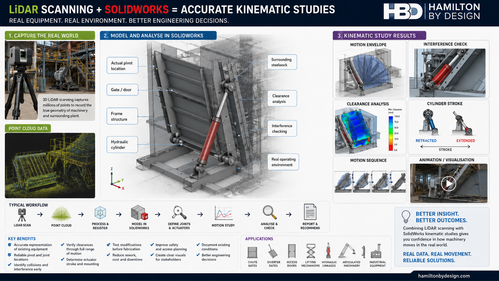
LiDAR Scanning and SolidWorks for Kinematic Studies

Infographic showing how LiDAR scanning and SOLIDWORKS are combined to create accurate kinematic studies, including point cloud capture, CAD modelling, motion analysis, interference checking, clearance analysis and actuator stroke review.

Combining LiDAR Scanning and SolidWorks for Kinematic Studies

Understanding how machinery moves within an existing industrial environment can be difficult when drawings are unavailable, outdated or do not reflect site modifications.

By combining 3D LiDAR scanning with SolidWorks, engineers can create kinematic studies based on the actual installed geometry of machinery, structures and surrounding plant. This provides a more reliable foundation for assessing movement, clearances, interference risks and proposed mechanical modifications.

What Is a Kinematic Study?

A kinematic study examines the movement of mechanical components without initially focusing on the forces that create that movement.

It may assess:

  • component position;
  • direction of movement;
  • travel distance;
  • angular rotation;
  • velocity;
  • acceleration;
  • linkage behaviour;
  • actuator stroke;
  • motion envelopes;
  • clearances between components;
  • potential collisions or interference.

Kinematic studies are commonly used for mechanical linkages, hydraulic cylinders, access doors, gates, chutes, diverters, lifting systems, articulated equipment and other moving machinery.

Why Existing Geometry Matters

A motion study is only as reliable as the geometry used to create it.

Many industrial machines have been modified, repaired or repositioned over time. Original drawings may no longer represent the actual equipment. Manual measurements may also be difficult where machinery is large, complex, elevated or surrounded by operating plant.

LiDAR scanning provides a detailed three-dimensional record of the equipment and its surroundings. The resulting point cloud can be used as a reference for developing an accurate SolidWorks model.

How LiDAR Scanning Supports the Study

A terrestrial LiDAR scanner records millions of measurement points across the visible surfaces of machinery, structures and plant.

The scan can help establish:

  • shaft and pivot locations;
  • hinge centres;
  • actuator mounting positions;
  • linkage lengths;
  • equipment orientation;
  • machine-frame geometry;
  • surrounding structural steel;
  • guards and access platforms;
  • nearby pipework;
  • operating clearances;
  • fixed obstructions.

This reduces reliance on assumptions and provides an engineering record of the existing condition at the time of capture.

How SolidWorks Is Used

Once the LiDAR data has been processed, the point cloud can be used to develop simplified or detailed SolidWorks models of the relevant machinery.

SolidWorks can then be used to:

  • create individual parts and assemblies;
  • locate pivots, shafts and mounting points;
  • define mechanical mates and joints;
  • simulate rotational and linear movement;
  • represent hydraulic-cylinder extension;
  • evaluate linkage positions;
  • calculate displacement, velocity and acceleration;
  • check component interference;
  • assess minimum clearances;
  • determine the swept path of moving equipment;
  • test proposed modifications before fabrication.

The surrounding plant can also be included as reference geometry so the machinery is analysed within its actual operating environment.

Typical LiDAR-to-SolidWorks Workflow

A typical workflow may include:

  1. Capture the machinery and surrounding plant using a LiDAR scanner.
  2. Register and process the scan data into a coordinated point cloud.
  3. Import or reference the point cloud within the CAD workflow.
  4. Identify the equipment required for the kinematic study.
  5. Create simplified SolidWorks models of the moving components.
  6. Position the models using the scanned geometry.
  7. Define mates, joints, travel limits and actuator movement.
  8. Run the SolidWorks motion study.
  9. Review clearances, collisions and movement envelopes.
  10. Develop recommendations, modifications or fabrication drawings.

Example: Hydraulic Chute Gate

A hydraulic chute gate may include a gate plate, pivot shaft, support frame and hydraulic cylinder.

A LiDAR scan can capture:

  • the existing chute geometry;
  • the gate position;
  • the pivot-shaft location;
  • upper and lower cylinder mounts;
  • surrounding structural steel;
  • platforms, guards and walkways;
  • nearby services and obstructions.

The geometry can then be recreated in SolidWorks to assess:

  • the gate opening angle;
  • the required cylinder stroke;
  • the relationship between cylinder travel and gate rotation;
  • potential dead-centre positions;
  • interference with the chute or surrounding steelwork;
  • clearances through the full operating cycle;
  • whether a proposed replacement cylinder will fit;
  • whether revised mounting points will improve movement.

This allows potential problems to be identified before components are manufactured or installed.

Collision and Interference Assessment

One of the main advantages of combining LiDAR with SolidWorks is the ability to assess moving machinery against the real site environment.

A standalone CAD model may show that a mechanism operates correctly. However, it may not reveal that the moving equipment could contact:

  • an existing handrail;
  • a structural beam;
  • electrical cable trays;
  • nearby pipework;
  • a maintenance platform;
  • machine guarding;
  • adjacent equipment.

By modelling the mechanism within the scanned environment, these conflicts can be identified before shutdown, fabrication or installation.

Evaluating Hydraulic Cylinders and Actuators

SolidWorks motion studies can assist with assessing actuator geometry, including:

  • extended and retracted cylinder lengths;
  • required stroke;
  • cylinder mounting angles;
  • connection-point movement;
  • mechanical advantage;
  • actuator alignment;
  • over-travel;
  • end-of-stroke position;
  • potential side loading;
  • approach to dead-centre conditions.

Where forces and loads must also be evaluated, the kinematic model may be expanded into a dynamic motion or structural assessment using suitable engineering inputs.

Benefits for Brownfield Engineering

LiDAR and SolidWorks are particularly valuable for brownfield projects where machinery must be modified within an existing facility.

The combined workflow can provide:

  • improved confidence in existing dimensions;
  • reduced dependence on outdated drawings;
  • fewer manual site measurements;
  • improved identification of site constraints;
  • better interference detection;
  • more reliable actuator selection;
  • improved design coordination;
  • reduced fabrication rework;
  • better shutdown planning;
  • clearer communication with stakeholders;
  • visual animations of proposed movement;
  • a documented digital record of existing conditions.

Static Scanning and Multiple Equipment Positions

A conventional terrestrial LiDAR scanner generally captures static geometry rather than continuously recording fast mechanical movement.

For this reason, equipment may be scanned in several controlled positions, such as:

  • fully closed;
  • partially open;
  • fully open;
  • maintenance position;
  • parked position.

These positions can be compared and used to confirm the geometry and range of movement.

Where actual operating speed or time-dependent behaviour is required, LiDAR data may be combined with:

  • video footage;
  • shaft encoders;
  • linear displacement sensors;
  • accelerometers;
  • control-system data;
  • hydraulic pressure records;
  • machine operating logs.

From Kinematic Study to Engineering Deliverables

The SolidWorks model developed from the LiDAR data can support more than the motion study itself.

Potential deliverables may include:

  • existing-condition 3D models;
  • kinematic study reports;
  • movement-envelope drawings;
  • interference reports;
  • clearance assessments;
  • actuator-stroke calculations;
  • SolidWorks motion animations;
  • general arrangement drawings;
  • modification concepts;
  • fabrication drawings;
  • installation planning models;
  • shutdown work packs;
  • stakeholder presentation images.

Applications

LiDAR-supported kinematic studies may be suitable for:

  • chute gates;
  • diverter gates;
  • conveyor take-up systems;
  • hydraulic linkages;
  • access doors;
  • lifting mechanisms;
  • maintenance hatches;
  • articulated machinery;
  • robotic systems;
  • positioning equipment;
  • stackers and reclaimers;
  • mobile plant attachments;
  • mechanical dampers;
  • valve-actuation systems;
  • machine guarding;
  • equipment relocation projects.

A More Reliable Basis for Mechanical Design

Combining LiDAR scanning with SolidWorks allows a kinematic study to be developed around the actual machine and the actual site environment.

LiDAR captures the existing geometry. SolidWorks converts that information into an intelligent mechanical model that can be moved, tested and reviewed.

Together, these tools can help engineers identify movement restrictions, confirm actuator requirements, assess clearances and test proposed modifications before work reaches fabrication or site installation.

LiDAR Scanning and SolidWorks Support

Hamilton By Design provides engineer-led 3D LiDAR scanning, point-cloud processing, SolidWorks modelling and mechanical design support for existing industrial machinery and brownfield facilities.

Our services can assist with:

  • existing-condition capture;
  • reverse engineering;
  • SolidWorks assembly modelling;
  • kinematic studies;
  • motion-envelope assessments;
  • interference checking;
  • actuator and linkage reviews;
  • mechanical modifications;
  • fabrication drawings;
  • installation planning.

For assistance with a kinematic study, machinery modification or LiDAR-based SolidWorks model, contact Hamilton By Design to discuss the equipment, required movement and project objectives.

Hamilton By Design logo displayed on a blue tilted rectangle with a grey gradient background

Contact Us – Talk To Us

Name
Would you like us to arrange a phone consultation for you?
Address

Our clients:


Central Coast Pump Station 3D Scanning Services

Grey pencil drawing of a LiDAR scanner capturing a Central Coast pump station with pumps, pipework, valves, access platforms and point cloud scan detail.

Engineering-Grade LiDAR Scanning for Pump Stations, Pipework, Access Platforms and As-Built Documentation

Blue 3D LiDAR scanner icon on a tripod with scanning waves

Hamilton By Design provides Central Coast pump station 3D scanning services for councils, water utilities, infrastructure owners, contractors, engineers and maintenance teams who need accurate site information before starting upgrade, maintenance or replacement work.

Pump stations are often congested, ageing and difficult to measure safely using traditional methods. Existing drawings may be missing, outdated or no longer match the real installation. This creates risk when replacing pumps, modifying pipework, installing new valves, upgrading access platforms or planning shutdown work.

Our 3D laser scanning service captures the existing pump station in high detail, creating accurate point cloud data that can be converted into CAD models, drawings and engineering documentation. This helps reduce rework, improve planning and give project teams confidence that new work will fit the existing site.

Hamilton By Design is based on the NSW Central Coast and supports pump station scanning projects across Gosford, Wyong, Tuggerah, Somersby, Erina, Woy Woy, Ourimbah, Lisarow, Lake Macquarie, Newcastle and the wider Hunter region.

Why Pump Stations Need 3D Scanning

Pump stations contain a mix of mechanical, civil, structural and electrical infrastructure. A single site may include pumps, motors, pipework, valves, supports, access platforms, pits, tanks, switchboards, cable trays and building structures.

Over time, many pump stations are modified during maintenance or upgrade work. Pipework may be rerouted, equipment may be replaced, platforms may be added, and drawings may not be updated. When engineers rely on old drawings or manual measurements, small errors can lead to major problems during installation.

3D scanning helps solve this by capturing the real site condition before design work begins.

Typical issues include:

  • Existing drawings do not match the site
  • Pipework routes are unclear
  • Pump and motor layouts are difficult to measure
  • Access platforms and handrails need upgrading
  • Valve locations and flange positions need verification
  • New equipment must fit around existing structures
  • Shutdown windows are short
  • Site access is limited
  • Manual measurement creates safety and accuracy risks

With accurate 3D scan data, engineers and contractors can plan upgrades using measured reality rather than assumptions.

What We Scan

Hamilton By Design can capture internal and external pump station assets, including:

  • Pump and motor assemblies
  • Pipework and valve layouts
  • Flanges, bends, reducers and fittings
  • Structural steel supports
  • Access platforms, stairs and handrails
  • Concrete pits, plinths and foundations
  • Tanks, vessels and wet well areas where accessible
  • Cable trays and service routes
  • Building envelopes and roof structures
  • Maintenance access zones
  • Existing clearances and installation constraints

The scan data can be used to support design, drafting, reverse engineering, clash checking and long-term asset documentation.

Scan-to-CAD for Pump Station Upgrades

A point cloud is useful, but the real value comes from converting the scan into practical engineering outputs.

Hamilton By Design can convert pump station scan data into:

  • 3D CAD models
  • 2D general arrangement drawings
  • Pipework layouts
  • Equipment location drawings
  • Structural platform layouts
  • As-built documentation
  • Fabrication drawings
  • Clearance studies
  • Reverse engineered components
  • Design-ready geometry for SolidWorks, AutoCAD, Inventor or ReCap workflows

This is especially useful when planning pump replacements, pipework modifications, new valve installations, access upgrades or structural support changes.

For broader industrial scanning capability, you can also refer to our Industrial 3D Scanning Services Australia page.

Local Central Coast Engineering Support

Because Hamilton By Design is based on the Central Coast, we can support local projects quickly and practically. We understand the needs of regional infrastructure, water assets, council facilities, industrial sites and brownfield upgrade work.

Our Central Coast scanning services are suited to:

  • Council pump stations
  • Water infrastructure
  • Wastewater facilities
  • Industrial pumping systems
  • Stormwater pump stations
  • Treatment plant assets
  • Manufacturing and process facilities
  • Brownfield plant upgrades
  • Maintenance and shutdown planning

For more general local scanning services, see our 3D Scanning Services Central Coast page.

Benefits of 3D Scanning Pump Stations

3D scanning provides a reliable foundation for engineering decisions.

Key benefits include:

  • Accurate as-built documentation
  • Reduced site rework
  • Fewer repeat site visits
  • Safer data capture
  • Improved design accuracy
  • Better shutdown planning
  • Faster engineering decisions
  • Better coordination between designers, fabricators and contractors
  • Clearer records for future asset management
  • Reduced risk when replacing or modifying equipment

For pump station projects, the biggest advantage is confidence. The design team can work from accurate existing conditions before fabrication or installation begins.

Typical Project Workflow

1. Project Review

We review the project scope, site access, required deliverables and available drawings. This helps determine the best scanning approach.

2. Site Scanning

Using FARO laser scanning equipment, we capture the pump station from multiple positions to record equipment, pipework, structures and surrounding constraints.

3. Point Cloud Registration

The scan data is processed and registered into a coordinated point cloud.

4. CAD Modelling and Drawing Production

Depending on the project, the point cloud can be converted into 3D models, 2D drawings, pipework layouts, equipment models or fabrication-ready documentation.

5. Engineering Support

We can support design review, reverse engineering, upgrade planning and documentation for contractors, councils and asset owners.

Common Pump Station Projects We Support

Hamilton By Design can assist with:

  • Pump replacement projects
  • Pipework upgrades
  • Valve and flange modifications
  • Access platform upgrades
  • Structural support design
  • Maintenance planning
  • Shutdown preparation
  • Reverse engineering of existing parts
  • As-built documentation recovery
  • Clash checking for new installations
  • Contractor tender documentation
  • Long-term asset records

For related pump station reverse engineering content, see our page on 3D Laser Scanning of Pump Stations for Reverse Engineering.

Why Choose Hamilton By Design

Hamilton By Design combines 3D laser scanning with mechanical engineering, CAD modelling and practical site experience.

We do more than capture a point cloud. We understand how the data will be used for design, fabrication, installation and maintenance.

Our strengths include:

  • Central Coast based service
  • Engineering-led scanning workflow
  • FARO laser scanning equipment
  • SolidWorks and AutoCAD capability
  • Scan-to-CAD modelling
  • Mechanical and structural drafting
  • Brownfield upgrade experience
  • Pump, pipework and plant layout understanding
  • Practical documentation for real projects

This makes our service suitable for clients who need accurate engineering information, not just visual site capture.

Central Coast Pump Station 3D Scanning

If you are planning a pump station upgrade, pipework change, equipment replacement or as-built documentation project on the Central Coast, Hamilton By Design can help capture the existing site accurately before design or fabrication begins.

Accurate scan data reduces uncertainty, improves project planning and helps ensure new work fits the real site conditions.

Contact Hamilton By Design to discuss your Central Coast pump station scanning project.

FAQs

What is pump station 3D scanning?

Pump station 3D scanning uses laser scanning technology to capture the real shape, position and layout of pumps, pipework, valves, structures and surrounding site conditions. The scan creates a point cloud that can be used for CAD modelling, drawings and engineering design.

Why is 3D scanning useful for pump station upgrades?

It helps confirm what is actually on site before design work begins. This is important because many pump stations have outdated drawings or undocumented modifications. Scanning reduces the risk of new pipework, pumps or platforms not fitting during installation.

Can you scan pipework and valve layouts?

Yes. We can scan pipework, valves, flanges, bends, reducers, supports and surrounding structures. This information can then be used to create CAD models, layouts or drawings for upgrade planning.

Can you convert the scan into CAD drawings?

Yes. Hamilton By Design can convert point cloud data into 2D drawings, 3D CAD models, general arrangements, pipework layouts and fabrication-ready documentation depending on the project requirements.

Do you work with councils and water infrastructure?

Yes. Our services are suitable for councils, water utilities, wastewater facilities, infrastructure contractors, engineers and asset owners managing pump stations or treatment plant assets.

What areas of the Central Coast do you service?

We support projects across Gosford, Wyong, Tuggerah, Somersby, Erina, Woy Woy, Ourimbah, Lisarow and surrounding Central Coast areas. We also service Newcastle, Lake Macquarie, Sydney and regional NSW.

What files can be delivered?

Common deliverables include registered point clouds, E57 files, RCP/RCS files, DWG drawings, DXF files, STEP models, SolidWorks models, Inventor models, AutoCAD layouts and PDF drawing packages.

Can scanning help with reverse engineering pump parts?

Yes. 3D scanning can assist with reverse engineering pump components, pipework assemblies, supports, access structures and other assets where drawings are missing or incomplete.

Is 3D scanning safer than manual measuring?

In many cases, yes. Laser scanning can capture large amounts of site information from a distance, reducing the need for repeated manual measurement around congested or difficult-to-access areas.

How do I know if my pump station needs scanning?

If the drawings are missing, outdated, unreliable or the upgrade needs to fit around existing equipment, scanning is usually worthwhile. It is especially useful before fabrication, shutdown work or equipment replacement.

Hamilton By Design logo displayed on a blue tilted rectangle with a grey gradient background

Talk to Us – Contact Us

Name
Would you like us to arrange a phone consultation for you?
Address

Our clients:
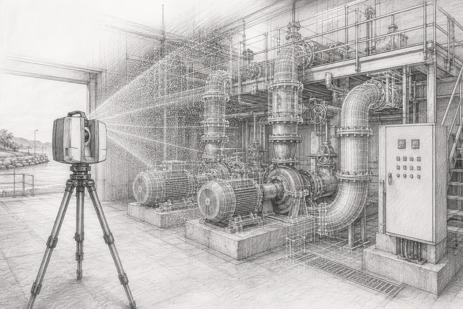


https://www.hamiltonbydesign.com.au/scan-to-bim-services-australia-lidar-point-clouds-cad-modelling

Engineering-Grade 3D LiDAR Scanning in Parkes NSW

Technical drawing style image of 3D LiDAR scanning in Parkes NSW, showing a scanner capturing conveyors, structural steel, platforms and processing plant equipment with Hamilton By Design branding.

Engineering-Grade 3D LiDAR Scanning in Parkes NSW

Blue 3D LiDAR scanner icon on a tripod with scanning waves

Processing plants, logistics facilities, fabrication workshops, recycling plants and materials handling assets around Parkes NSW often rely on equipment that has been modified many times over its working life. Conveyors are extended, chutes are repaired, platforms are added, guards are changed, pipework is rerouted and structural steel is strengthened or replaced.

Over time, the original drawings may no longer match the real site.

That creates a major problem when a business needs to plan a shutdown, install new equipment, fabricate replacement components or upgrade a brownfield plant. If the engineering team is working from old drawings, site assumptions or manual measurements, the risk of clashes, poor fit-up and costly rework increases quickly.

Hamilton By Design provides engineering-grade 3D LiDAR scanning in Parkes NSW for processing plants, conveyors, transfer points, structural steel, pipework, access platforms and shutdown engineering projects. Our scanning service helps turn existing site conditions into reliable engineering information.

For clients who need broader technical support beyond scanning, Hamilton By Design also provides engineering services across mechanical design, structural drafting, 3D CAD modelling, verification and brownfield project support.

Why Parkes NSW Needs Accurate Brownfield Survey Data

Parkes is an important industrial and logistics location in Central West NSW. The region supports freight, rail, agriculture, mining services, fabrication, recycling, resource recovery and industrial development. These industries often depend on conveyors, fixed plant, loading systems, workshops, platforms, stairs, pipework and structural steel.

Many of these assets are not clean greenfield projects. They are existing operating plants where the real challenge is understanding what is already there.

A processing plant may have had years of small upgrades. A conveyor may have been modified during shutdowns. A fabrication package may need to tie into existing steelwork. A chute replacement may need to fit between a belt, a transfer tower and a piece of equipment with limited clearance.

This is where 3D LiDAR scanning becomes valuable. Instead of relying on incomplete drawings or repeated site measurements, the project team can work from a registered point cloud that captures the real plant geometry.

The Biggest Problem: Existing Assets Are Hard to Verify

The biggest problem for processing and materials handling sites is not always the design of the new work. Often, the problem is confirming the existing site conditions before design begins.

Common issues include:

  • Existing drawings are missing or outdated
  • Plant layouts have changed over time
  • Conveyor transfer points have been modified
  • Structural steel has been added or repaired
  • Access platforms and walkways do not match drawings
  • Pipework and services have been rerouted
  • Shutdown changes were never fully documented
  • Manual measurements are difficult in congested areas
  • Fabrication teams do not have reliable tie-in dimensions

When these issues are not resolved early, they can cause problems during fabrication and installation. A chute may not fit. A platform may clash with existing steel. A pipe route may be blocked. A conveyor guard may interfere with access. A shutdown task may take longer than planned because the real site does not match the design model.

3D LiDAR scanning helps reduce those risks by capturing the existing asset before design, fabrication and installation work starts.

What 3D LiDAR Scanning Can Capture

For Parkes NSW industrial and processing sites, 3D LiDAR scanning can capture a wide range of assets, including:

  • Conveyor systems
  • Transfer stations
  • Chutes and hoppers
  • Screens, crushers and feeders
  • Structural steel frames
  • Access platforms and walkways
  • Stairs, ladders and handrails
  • Pipework and service routes
  • Tanks, bins and silos
  • Workshop layouts
  • Plant rooms and equipment areas
  • Shutdown work zones
  • Fabrication tie-in points
  • Existing mechanical equipment

The scan creates a detailed 3D point cloud of the site. This point cloud can then be used for measurements, layouts, clash checks, CAD modelling, fabrication planning and engineering review.

Hamilton By Designโ€™s 3D laser scanning for engineering is focused on producing data that supports practical engineering decisions, not just visual site records.

How the Scanning Process Works

A typical Parkes NSW 3D LiDAR scanning project starts with a discussion about the asset and the reason for scanning.

The project may involve a conveyor upgrade, a chute replacement, a structural steel modification, a plant layout review, an access improvement or shutdown planning. Once the purpose is understood, the scan scope can be planned around the areas that need to be captured.

On site, the scanner is set up in multiple positions to capture the required plant geometry. These scan positions are then registered together to create a single point cloud. Depending on the project, the point cloud can be aligned to site control, a local coordinate system or a practical project datum.

From there, the data can be exported into common formats such as E57, RCP, RCS or LAS. These files can be used in CAD, modelling and coordination software.

Where required, Hamilton By Design can also convert scan data into CAD models, 2D layouts, sections, elevations, mechanical arrangements or fabrication reference drawings.

Tools That Assist in Solving the Problem

The value of 3D scanning comes from combining the right capture method with the right engineering workflow.

Useful tools include:

  • Terrestrial LiDAR scanning for accurate site capture
  • Point cloud registration software for scan alignment
  • Autodesk ReCap for preparing point cloud files
  • Navisworks for coordination and clash checking
  • SolidWorks for mechanical design and modelling
  • Inventor and AutoCAD for layouts and drafting
  • E57, RCP, RCS and LAS point cloud deliverables
  • Scan-to-CAD modelling for engineering and fabrication support

Hamilton By Design treats point cloud laser scanning as an engineering tool. The point cloud becomes the base information for design, review, measurement and decision-making.

Common Applications in Parkes NSW

3D LiDAR scanning can support many industrial and materials handling projects around Parkes.

For a conveyor upgrade, scanning can capture the head pulley, tail pulley, belt line, transfer point, support steel, access platforms, guards and surrounding equipment.

For a chute replacement, scanning can capture the existing discharge point, receiving belt, liner access, chute supports, surrounding steel and available installation space.

For a structural steel modification, scanning can capture columns, beams, base plates, bracing, platforms, stairs and handrail geometry.

For a shutdown project, scanning can help the team plan work before the outage begins. This can reduce the need for repeated site visits and help fabrication teams prepare components before the shutdown window.

For a processing plant layout, scanning can help confirm equipment locations, access routes, clearances and installation constraints.

Who Uses This Service?

The service is useful for a range of Parkes and Central West NSW businesses.

Plant managers use scanning to understand existing assets before approving upgrades.

Maintenance managers use scanning to plan repairs, replacements and shutdown work.

Project engineers use point clouds to design around real site conditions.

Fabricators use scan data to confirm dimensions before manufacturing steelwork, guards, chutes, platforms or mechanical components.

Shutdown planners use the data to identify access issues, tie-in points and installation constraints before work starts.

Contractors use the point cloud to understand the work area before arriving on site.

The common benefit is simple: everyone works from the same accurate site information.

Skill Sets Companies Are Looking For

The Parkes industrial market commonly needs practical heavy industry and project delivery skills. These include mechanical fitters, boilermakers, welders, poly welders, fabricators, maintenance technicians, shutdown workers, leading hands, project engineers, draftspersons and site supervisors.

These skill sets all rely on accurate information.

A mechanical fitter needs to know how equipment fits together. A boilermaker needs reliable dimensions. A fabricator needs confidence that the workshop-built item will fit on site. A project engineer needs accurate site context. A shutdown planner needs to understand access and sequence.

Hamilton By Design can also support clients through secondment services where skilled engineering and technical personnel are required for shutdowns, upgrades, project delivery or operational workloads.

Why Use Hamilton By Design?

Hamilton By Design combines 3D LiDAR scanning with mechanical engineering, CAD modelling, structural drafting and brownfield project experience.

This matters because industrial scanning is not only about capturing millions of points. The scan needs to support real engineering work. It needs to help answer practical questions:

Will the new chute fit?

Is there enough access?

Where does the existing steelwork sit?

Can the replacement component be fabricated before shutdown?

Will the pipe route clash with the platform?

Do the old drawings match the real plant?

By combining site scanning with engineering judgement, Hamilton By Design helps clients move from uncertainty to usable project information.

Need 3D LiDAR Scanning in Parkes NSW?

Hamilton By Design provides engineering-grade 3D LiDAR scanning for Parkes NSW and the Central West.

We support processing plants, conveyors, transfer stations, workshops, fabrication contractors, logistics facilities, agribusiness operations, mining-related assets and industrial sites that need accurate brownfield survey data.

If your existing drawings are incomplete, outdated or difficult to trust, 3D LiDAR scanning can help turn the real site into reliable engineering information before design, fabrication or shutdown work begins.

FAQs

What is 3D LiDAR scanning?

3D LiDAR scanning is a method of capturing existing site conditions using laser measurement. The scanner records millions of points to create a 3D point cloud of the asset, structure or work area.

Why is 3D LiDAR scanning useful for Parkes NSW industrial sites?

It is useful because many processing, logistics, fabrication and materials handling sites have existing assets that have changed over time. Scanning helps verify what is actually on site before new work is designed or fabricated.

Can 3D scanning be used for conveyors?

Yes. Conveyors are one of the strongest applications for 3D scanning. The scan can capture belt lines, pulleys, transfer points, guards, supports, access platforms and nearby structures.

Can scan data help with chute replacements?

Yes. Chute replacements often depend on accurate tie-in dimensions and clearances. Scanning can capture the existing conveyor, discharge point, receiving equipment, support steel and access restrictions.

What files can be supplied after scanning?

Depending on the project, deliverables may include E57, RCP, RCS or LAS point cloud files. CAD models, sections, layouts and fabrication reference drawings can also be produced where required.

Does 3D scanning replace engineering design?

No. Scanning captures the existing site. Engineering design is still required to assess, modify, design or document the new work. The benefit is that the design is based on accurate existing conditions.

Is 3D scanning suitable before a shutdown?

Yes. Scanning before a shutdown can reduce uncertainty, support fabrication planning and help identify access or clash issues before the outage begins.

Does Hamilton By Design service areas outside Parkes?

Yes. Hamilton By Design supports Parkes, Central West NSW and industrial projects across Australia, including mining, processing, manufacturing, infrastructure and brownfield upgrade work.

Hamilton By Design logo displayed on a blue tilted rectangle with a grey gradient background

Talk to Us – Contact Us

Name
Would you like us to arrange a phone consultation for you?
Address

Our clients:


https://www.hamiltonbydesign.com.au/scan-to-bim-services-australia-lidar-point-clouds-cad-modelling