Trimble Scanners vs FARO Scanners | Which is Best for Engineering?

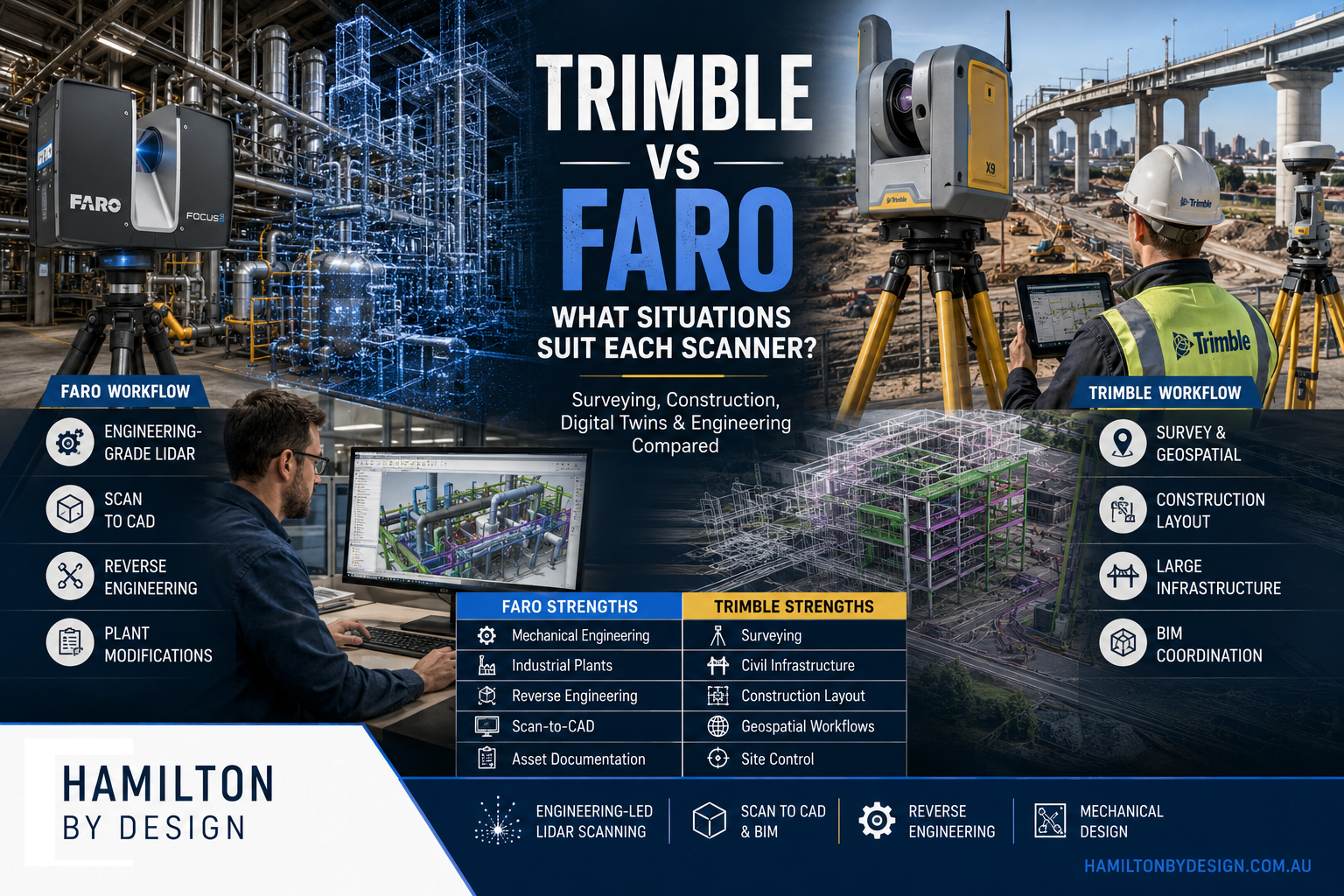
Comparison graphic showing FARO and Trimble 3D laser scanning technologies for engineering, surveying and construction projects. The left side features a FARO Focus scanner capturing an industrial processing plant with point cloud and CAD modelling workflows, highlighting engineering-grade LiDAR, scan-to-CAD, reverse engineering and plant modifications. The right side shows a Trimble scanner on a large infrastructure construction site, highlighting surveying, geospatial data collection, BIM coordination, construction layout and civil infrastructure applications.

Trimble Scanners vs FARO Scanners |Which Technology Is Right for Your Project?

The laser scanning industry has evolved significantly over the last decade. Modern reality capture systems can document entire buildings, processing plants, infrastructure assets, mining operations, and manufacturing facilities with remarkable speed and accuracy.

Two of the most recognised names in the terrestrial laser scanning market are Trimble and FARO Technologies.

Both manufacturers produce capable scanning equipment, but they were developed with different target markets and project requirements in mind.

The question is not necessarily which scanner is better.

The real question is:

Which scanner is best suited to the type of project you are trying to complete?

At Hamilton By Design, we focus primarily on engineering, industrial facilities, manufacturing plants, mining infrastructure, reverse engineering, and Scan-to-CAD projects. Because of this, our requirements differ significantly from those of surveyors, construction layout teams, BIM consultants, or mobile mapping providers.

This article explains where Trimble systems excel, where FARO systems excel, and which technology may be the best fit for your application.


Understanding Laser Scanning Objectives

Before comparing scanner brands, it is important to understand the purpose of the project.

Most scanning projects fall into one of the following categories:

Surveying

Surveyors typically require:

  • Geospatial accuracy
  • Coordinate control
  • GIS integration
  • Large-scale topographic surveys
  • Infrastructure corridors
  • Road and rail mapping

Construction

Construction projects often require:

  • BIM coordination
  • Progress monitoring
  • Clash detection
  • Layout verification
  • Digital twins

Engineering

Engineering projects typically require:

  • Mechanical design
  • Reverse engineering
  • Fabrication drawings
  • Plant modifications
  • Structural steel detailing
  • Pipework design

Asset Management

Asset owners often require:

  • Digital records
  • Facility management
  • Lifecycle documentation
  • Maintenance planning

Different scanners have been optimised for different objectives.


Trimble Overview

Trimble has built its reputation through:

  • Surveying equipment
  • GPS systems
  • Construction technology
  • Machine control
  • Geospatial software
  • BIM workflows

Their scanning solutions are designed to integrate into broader construction and survey ecosystems.

Popular Trimble scanners include:

Trimble X7

A compact scanner targeting:

  • Surveyors
  • Construction professionals
  • BIM teams

Trimble X9

A higher-performance evolution of the X7 featuring:

  • Greater range
  • Faster scanning
  • Improved workflows

Trimble SX12

A hybrid scanner and total station offering:

  • Survey functionality
  • Laser scanning
  • High-precision measurement

Trimble MX Series

Vehicle-mounted mobile mapping systems designed for:

  • Roads
  • Railways
  • Utility corridors
  • City modelling

FARO Overview

FARO Technologies has historically focused on:

  • Industrial measurement
  • Manufacturing
  • Metrology
  • Quality control
  • Engineering documentation

Their scanners are widely used for:

  • Industrial plants
  • Refineries
  • Manufacturing facilities
  • Reverse engineering
  • Scan-to-CAD

Popular FARO systems include:

FARO Focus S70

Optimised for:

  • Engineering projects
  • Indoor scanning
  • Plant scanning
  • Industrial facilities

FARO Focus Premium

Provides:

  • Extended range
  • Faster scan speeds
  • Improved HDR imaging

FARO Orbis

A mobile scanning system designed for:

  • Walking surveys
  • Rapid reality capture
  • Large facilities

FARO Quantum Arm

A portable coordinate measuring machine (CMM) used for:

  • Metrology
  • Manufacturing inspection
  • Reverse engineering

Accuracy Comparison

Accuracy is often the first specification people examine.

However, accuracy must be considered within the context of the project.

Trimble

Trimble systems generally provide excellent accuracy for:

  • Surveying
  • Construction
  • Geospatial projects

Their workflows place strong emphasis on:

  • Coordinate systems
  • Site control
  • Survey networks

This makes them highly attractive to surveyors and construction teams.


FARO

FARO scanners have traditionally focused on:

  • Engineering accuracy
  • Mechanical systems
  • Industrial facilities

When documenting:

  • Pipework
  • Structural steel
  • Mechanical equipment
  • Fabrication interfaces

FARO scanners have established a strong reputation for producing dense, high-quality point clouds suitable for engineering design.


Range Comparison

Range requirements vary significantly between projects.

Trimble Range Strengths

Trimble performs exceptionally well when scanning:

  • Roads
  • Bridges
  • Rail corridors
  • Civil infrastructure
  • Large construction sites

These environments benefit from long-range scanning and integration with survey control.


FARO Range Strengths

The FARO Focus series performs extremely well in:

  • Buildings
  • Processing plants
  • Manufacturing facilities
  • Mechanical rooms
  • Industrial environments

For many engineering projects, scanners are positioned:

  • 5โ€“40 metres from equipment
  • 5โ€“50 metres from structures

In these situations, extremely long-range scanning is often unnecessary.


Mobile Mapping Comparison

One of the biggest changes in recent years has been the growth of mobile mapping.


Trimble Mobile Mapping

Trimble has invested heavily in:

  • Vehicle-mounted systems
  • Corridor mapping
  • Geospatial workflows

Ideal applications include:

  • Road surveys
  • Utility networks
  • Large infrastructure projects

FARO Orbis

The FARO Orbis allows operators to:

  • Walk through facilities
  • Capture large areas quickly
  • Reduce field time

Applications include:

  • Warehouses
  • Airports
  • Shopping centres
  • Large industrial facilities

The advantage is speed.

The limitation is that mobile systems generally require more processing and validation than static scanning.


Registration Workflows

Registration is the process of combining scans into a unified point cloud.


Trimble Registration

Trimble provides strong registration tools aimed at:

  • Survey workflows
  • Construction workflows
  • BIM projects

Their ecosystem integrates effectively with coordinate control networks.


FARO Registration

FARO’s software platform, particularly FARO SCENE, has become a well-established standard for industrial registration.

Strengths include:

  • Target-based registration
  • Cloud-to-cloud registration
  • Engineering workflows
  • Industrial documentation

For plant environments, SCENE remains a highly capable platform.


Surveying Applications

Where Trimble excels:

Large Survey Projects

Examples include:

  • Highways
  • Rail networks
  • Airports
  • Utility corridors

Trimble’s heritage in surveying makes these projects a natural fit.

Construction Control

Projects requiring:

  • Set-out
  • Coordinate control
  • Site surveys

benefit from Trimble’s integrated ecosystem.


Engineering Applications

Where FARO excels:

Reverse Engineering

Examples include:

  • Pumps
  • Conveyors
  • Structural steel
  • Mechanical assemblies

The ability to create engineering-grade point clouds is critical.


Plant Modification Projects

Examples include:

  • Pipe rerouting
  • Chute redesign
  • Conveyor upgrades
  • Equipment replacement

The scanner becomes the foundation of the design process.


Fabrication Projects

Fabrication projects often require:

  • As-built verification
  • Fit-up confirmation
  • Clash detection

FARO scanners are commonly used for these tasks.


Mining Industry Comparison

Mining presents unique challenges.

Projects often involve:

  • Dust
  • Restricted access
  • Complex plant layouts

Trimble in Mining

Common uses:

  • Site surveys
  • Civil infrastructure
  • Haul roads
  • Tailings facilities

FARO in Mining

Common uses:

  • CHPP plants
  • Conveyors
  • Crushers
  • Structural steel
  • Transfer stations

Engineering teams frequently prefer detailed plant scans for design work.


Scan-to-CAD Workflows

This is where many engineering firms spend most of their time.

The objective is not merely collecting data.

The objective is producing:

  • CAD models
  • Drawings
  • Fabrication packages

Trimble Workflow

Often integrated into:

  • BIM
  • Construction
  • Survey deliverables

FARO Workflow

Frequently integrated into:

  • AutoCAD
  • SolidWorks
  • Inventor
  • Navisworks
  • Plant design software

For engineering-driven Scan-to-CAD workflows, FARO has become particularly popular.


Metrology Comparison

This category creates the biggest distinction between the two companies.


Trimble

Trimble’s focus is largely:

  • Geospatial
  • Construction
  • Infrastructure

FARO

FARO offers dedicated metrology products such as the:

FARO Quantum Arm

Applications include:

  • Manufacturing inspection
  • Tooling verification
  • Reverse engineering
  • Precision measurement

Measurement uncertainty can be measured in fractions of a millimetre.

This is an entirely different category from traditional terrestrial scanning.


Digital Twin Applications

Both systems can contribute to digital twin projects.


Trimble Advantages

Particularly strong when projects involve:

  • BIM integration
  • Construction workflows
  • Asset management

FARO Advantages

Particularly strong when projects involve:

  • Engineering assets
  • Industrial plants
  • Manufacturing facilities

Cost Considerations

Scanner purchase decisions should not be based solely on hardware cost.

Consider:

  • Software
  • Training
  • Registration
  • Processing
  • Deliverables

The cheapest scanner often becomes the most expensive solution if it fails to meet project requirements.


When Trimble Is the Better Choice

Choose Trimble when your primary focus is:

Surveying

  • Geospatial control
  • Land surveying
  • Corridor mapping

Construction

  • BIM coordination
  • Progress monitoring
  • Site verification

Infrastructure

  • Roads
  • Rail
  • Utilities

Mobile Mapping

  • Vehicle-based capture
  • Large-area mapping

When FARO Is the Better Choice

Choose FARO when your primary focus is:

Mechanical Engineering

  • Equipment design
  • Reverse engineering
  • Plant modifications

Industrial Facilities

  • Refineries
  • Processing plants
  • Manufacturing sites

Structural Steel

  • Existing structure capture
  • Fabrication verification

Scan-to-CAD

  • AutoCAD workflows
  • SolidWorks workflows
  • Inventor workflows

Metrology

  • Inspection
  • Precision measurement
  • Manufacturing verification

The Hamilton By Design Perspective

At Hamilton By Design, our work typically involves:

  • Mining plants
  • Manufacturing facilities
  • Process equipment
  • Structural steel
  • Conveyors
  • Chutes
  • Pipework
  • Mechanical upgrades

We are generally not:

  • Surveying housing estates
  • Mapping road corridors
  • Building GIS databases
  • Performing civil infrastructure surveys

Our goal is usually to answer engineering questions such as:

  • Will the new chute fit?
  • Can the conveyor be upgraded?
  • Does the pipe clash?
  • Can the fabricated structure be installed?
  • What does the existing plant actually look like?

For those objectives, the combination of:

  • FARO Focus S70
  • FARO SCENE
  • AutoCAD
  • SOLIDWORKS

provides an efficient engineering workflow.


Conclusion

Neither Trimble nor FARO is universally better.

They were developed to solve different problems.

Trimble is exceptionally strong in:

  • Surveying
  • Construction
  • Geospatial workflows
  • Infrastructure mapping
  • Coordinate control

FARO is exceptionally strong in:

  • Mechanical engineering
  • Industrial facilities
  • Reverse engineering
  • Scan-to-CAD
  • Metrology
  • Plant modification projects

If your objective is mapping kilometres of roadway, Trimble may be the logical choice.

If your objective is redesigning a conveyor transfer chute, replacing a pump station, upgrading a processing plant, or creating fabrication-ready CAD models from existing infrastructure, FARO is often the more suitable engineering-focused solution.

The best scanner is not the one with the longest specification sheet. The best scanner is the one that produces the deliverable your project actually needs. For many industrial engineering projects, that deliverable is not a point cloudโ€”it is an accurate model, drawing package, fabrication detail, or engineered solution built from the scan data.


Australian Drafting logo featuring bold white text reading "Australian Drafting" centred on a blue rounded rectangle background.
Engineering Governance title graphic featuring bold white text reading "Engineering Governance" centred on a blue rounded rectangle background.
Mechanical, Structural & Pipework Drafting service banner by Hamilton By Design featuring white text on a blue background.
Mechanical engineering services
Blue rounded button with the text โ€œSolidWorks Designโ€ in white.
Finite Element Analysis (FEA) engineering simulation button
3D LiDAR Scanning Darwin for engineering surveys, laser scanning, reality capture and point cloud modelling services
3D LiDAR Scanning Australia engineering services for laser scanning, reality capture, scan-to-CAD, Scan-to-BIM and as-built documentation across Australia
3D LiDAR scanning services on the Central Coast providing engineering-grade laser scanning, point cloud capture, scan-to-CAD modelling and industrial reality capture for infrastructure and industrial projects.
3D LiDAR Scanning Perth for engineering surveys, laser scanning, reality capture and point cloud modelling services
3D LiDAR Scanning Sydney for engineering surveys, laser scanning, reality capture and point cloud modelling services
3D LiDAR Scanning Brisbane for engineering surveys, laser scanning, reality capture and point cloud modelling services
3D LiDAR Scanning Canberra for engineering surveys, laser scanning, reality capture and point cloud modelling services
3D LiDAR Scanning Newcastle for engineering surveys, laser scanning, reality capture and point cloud modelling services
3D LiDAR Scanning Adelaide for engineering surveys, laser scanning, reality capture and point cloud modelling services

Point Cloud to CAD Australia

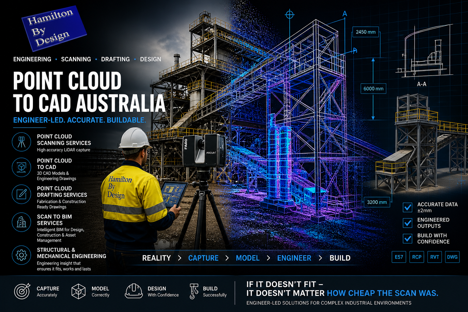
Engineer using LiDAR scanner capturing an industrial plant with overlay showing point cloud to CAD conversion and scan to BIM engineering workflow in Australia.

Engineer-Led Point Cloud to CAD Services Across Australia

At Hamilton By Design, we deliver engineering-grade point cloud to CAD services in Australia, purpose-built for industrial, mining, and complex mechanical environments.

We are not a visualisation or real estate scanning company.

We are a structural mechanical engineering-led organisation, using high-accuracy LiDAR scanning to support real-world design, fabrication, and construction outcomes.

3D CAD Modelling Australia service banner for Hamilton By Design

What We Do

We provide a complete workflow from point cloud scanning through to engineered deliverables, including:

  • Point cloud scanning services (LiDAR reality capture)
  • Point cloud to CAD conversion (2D & 3D)
  • Point cloud drafting services for fabrication and construction
  • Scan to BIM services for buildings and infrastructure
  • Mechanical and structural engineering integration

Our focus is simple:

๐Ÿ‘‰ Capture accurately. Model correctly. Design with confidence.


Point Cloud Scanning Service (Engineering Grade)

Our scanning services are built around engineering accuracy, not visual output.

Using high-precision LiDAR systems, we capture:

  • Industrial plants and processing facilities
  • Conveyor systems, chutes, and transfer stations
  • Structural steel and platforms
  • Pipework and mechanical systems
  • Existing buildings and infrastructure

Unlike low-cost scanning providers, we scan with design intent in mind โ€” ensuring the data can be used for:

  • Fabrication fit-up
  • Brownfield upgrades
  • Shutdown planning
  • Engineering verification

Point Cloud to CAD Australia

We convert raw point cloud data into usable engineering models and drawings, including:

  • 3D CAD models (SolidWorks-based workflows)
  • 2D AutoCAD drawings (plans, sections, elevations)
  • General Arrangement (GA) drawings
  • Fabrication-ready outputs

Our models are developed to support:

  • Clash detection
  • Design validation
  • Accurate measurement and geometry extraction
  • Integration into existing engineering workflows

Point Cloud Drafting Services

Our drafting services go beyond simple tracing.

We deliver engineering-controlled documentation, including:

  • Revision-controlled drawings (IFR / IFA / IFC)
  • Structured layouts driven from 3D models
  • Consistent drawing standards aligned with Australian practice
  • Clear geometry for fabrication and installation

This ensures your drawings are not just โ€œdrawnโ€ โ€” they are buildable.


Scan to BIM Services

For building and infrastructure projects, we offer Scan to BIM services tailored for:

  • Commercial buildings
  • Government assets
  • Industrial facilities
  • Upgrade and refurbishment projects

We create intelligent BIM models that support:

  • Asset management
  • Design coordination
  • Construction planning
  • Lifecycle management

Structural Mechanical Engineer-Led Approach

This is where Hamilton By Design is different.

We are not technicians capturing data.

We are engineers solving problems.

Our team understands:

  • Load paths and structural behaviour
  • Mechanical fit-up and tolerances
  • Fabrication constraints
  • Installation sequencing
  • Australian Standards and compliance requirements

This means:

๐Ÿ‘‰ We scan with purpose
๐Ÿ‘‰ We model with intent
๐Ÿ‘‰ We design for reality


Why Engineer-Led Scanning Matters

Low-cost scanning often leads to:

  • Incomplete data
  • Poor alignment
  • Unusable geometry
  • Costly rework during fabrication

Our approach eliminates that risk.

We provide:

  • Engineering-grade accuracy
  • Clear, structured deliverables
  • Confidence in fit and function

Because at the end of the day:

๐Ÿ‘‰ If it doesnโ€™t fit โ€” it doesnโ€™t matter how cheap the scan was.


Typical Applications

Our services are used across:

Mining & Heavy Industry

  • Conveyor upgrades
  • Transfer chute design
  • Plant modifications
  • Shutdown engineering

Industrial Plants

  • Brownfield expansions
  • Pipe routing and modifications
  • Structural upgrades

Buildings & Infrastructure

  • Scan to BIM for refurbishments
  • As-built documentation
  • Structural verification

Deliverables

Depending on your scope, we can provide:

  • Registered point clouds (.E57 / .RCP / .LAS)
  • Scan location plans
  • 3D CAD models
  • 2D engineering drawings
  • BIM models
  • Engineering review and input

Work With Hamilton By Design

If you are looking for:

  • Point cloud to CAD Australia
  • Reliable point cloud scanning service
  • Professional point cloud drafting services
  • High-quality scan to BIM services
  • A structural mechanical engineer who understands real-world constraints

Then weโ€™re ready to support your project.

3D LiDAR scanning and 3D modelling service button โ€” laser scanner capturing a point cloud for engineering and CAD modelling
Mechanical engineering services

Get Started

We typically operate on a day rate basis, with clear scope and deliverables.

๐Ÿ“ฉ Contact us today to:

  • Discuss your project
  • Arrange a site visit
  • Receive a proposal

Hamilton By Design logo displayed on a blue tilted rectangle with a grey gradient background

Final Word

At Hamilton By Design, we donโ€™t just capture data.

We deliver engineering certainty.

Our Clients

Finite Element Analysis (FEA) engineering simulation button
Mechanical engineering services

Engineering Projects in Cheyenne, Wyoming

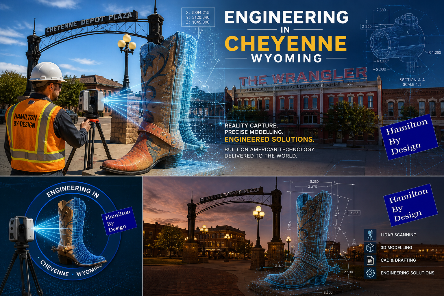
Engineer scanning Cheyenne Wyoming landmark using LiDAR with digital twin and CAD model overlay

Aussie Know-How. Built on American Technology. Delivered to the World.

Cheyenne, Wyoming โ€” A Growing Engineering Hub

Cheyenne, the capital and largest city of Wyoming, is rapidly evolving into a centre for:

  • Data centres and digital infrastructure
  • Energy and utilities
  • Logistics and distribution
  • Industrial development

Its location and investment pipeline make it an ideal environment for engineering-led project delivery.


Aussie Know-How. Building the World.

At Hamilton By Design, we deliver practical, buildable engineering outcomes backed by experience in:

  • Mining and heavy industry
  • Brownfield upgrades
  • Remote and high-risk environments

Our work is grounded in real-world application โ€” not just theory.


We Donโ€™t Stop at Scanning โ€” We Build Relationships

We donโ€™t deliver a scan and walk away.

We focus on long-term engineering relationships, becoming part of your delivery team.

  • Ongoing support across multiple projects
  • Understanding your standards and assets
  • Consistent, reliable engineering delivery

Because the real value isnโ€™t the scan โ€” itโ€™s what happens after the scan.


3D CAD Modelling Australia service banner for Hamilton By Design

24/7 Global Access with the 3DEXPERIENCE Platform

Using the 3DEXPERIENCE platform, we provide:

  • 24/7 access to CAD models, drawings, and data
  • DXF files, eDrawings, and 3D models accessible anywhere
  • Real-time collaboration across teams and time zones
  • Controlled revisions and engineering governance

Wherever you are in the world โ€” your engineering data is always available.


๐Ÿ‡บ๐Ÿ‡ธ Built on American Technology โ€” Delivered Globally

Our workflow is built on industry-leading tools including:

  • SolidWorks
  • 3DEXPERIENCE platform

We combine this technology with:

  • Australian engineering discipline
  • Practical industrial experience
  • A focus on buildable, efficient outcomes

We donโ€™t replace your systems โ€” we strengthen them.


No Outsourcing โ€” Full Responsibility

We take full ownership of our work.

We do not outsource engineering to low-cost offshore providers.

  • No hidden third parties
  • No loss of quality control
  • No communication gaps

All work is delivered under our direct responsibility.

This ensures:

  • Consistent engineering standards
  • Clear communication
  • Confidence in every deliverable

When you work with Hamilton By Design, you know exactly who is accountable โ€” and we stand behind the result.


Engineering Services for Cheyenne Projects

Reality Capture (LiDAR Scanning)

  • Accurate as-built conditions
  • Engineering-grade point clouds
  • Reduced project risk

Mechanical Design & 3D Modelling

  • Fabrication-ready models
  • Brownfield integration
  • Equipment and structural design

Drafting & Documentation

  • GA drawings and detailed outputs
  • DXF files for fabrication
  • Clear, controlled deliverables

Engineering Governance

  • Revision control and auditability
  • Structured drawing registers
  • Single source of truth

Why This Matters in Cheyenne

In fast-growing regions like Cheyenne:

  • Projects move quickly
  • Teams are distributed
  • Decisions are made under pressure

Our approach provides clarity and control:

Scan โ†’ Model โ†’ Share โ†’ Collaborate โ†’ Deliver

Reducing:

  • Rework
  • Miscommunication
  • Project delays

The Opportunity

Cheyenne is emerging as a key engineering location in the United States.

Success will depend on:

  • Accurate data
  • Strong collaboration
  • Trusted engineering partners

Hamilton By Design logo displayed on a blue tilted rectangle with a grey gradient background

Work With Hamilton By Design

We support projects with:

  • Mechanical Engineering
  • 3D LiDAR Scanning
  • Drafting & Modelling
  • Engineering Data Governance

We build long-term relationships and take full responsibility for what we deliver.

Contact Us – Talk to Us – Work with Us

Name
Would you like us to arrange a phone consultation for you?
Address
3D LiDAR scanning and 3D modelling service button โ€” laser scanner capturing a point cloud for engineering and CAD modelling
Mechanical engineering services
Finite Element Analysis (FEA) engineering simulation button
Mechanical engineering services

Laser Scanning for Engineering

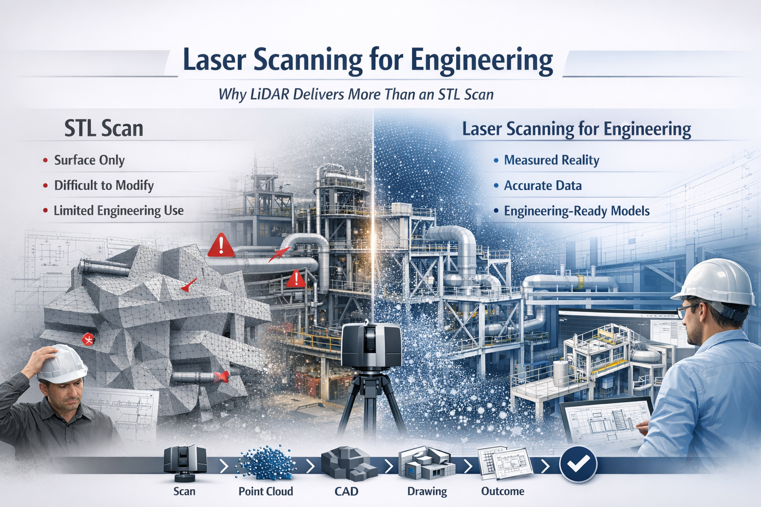
Laser scanning for engineering infographic comparing LiDAR point cloud data with STL mesh scanning, showing improved CAD modelling and engineering workflows.

Why LiDAR Delivers Real Engineering Outcomes

In modern engineering, accuracy is everything. Whether you are working in mining, manufacturing, infrastructure, or plant design, the difference between success and costly rework often comes down to how well you understand what has actually been built.

This is where laser scanning for engineering has become a critical tool.

While many providers offer โ€œ3D scanning,โ€ not all data is created equal. There is a significant difference between engineering-grade LiDAR point cloud data and basic STL mesh outputs. Understanding that difference can determine whether your project moves forward efficientlyโ€”or gets stuck in rework, assumptions, and redesign.


3D LiDAR scanning and 3D modelling service button โ€” laser scanner capturing a point cloud for engineering and CAD modelling
Mechanical engineering services

What is Laser Scanning for Engineering?

Laser scanning for engineering uses LiDAR (Light Detection and Ranging) technology to capture millions of precise measurements of a physical environment. The result is a high-density point cloudโ€”a true digital representation of reality.

Unlike traditional measurement methods, LiDAR captures:

  • Complex geometry
  • Structural relationships
  • Equipment positioning
  • Real-world deviations from design

This data becomes the foundation for:

  • CAD modelling (SolidWorks, AutoCAD, Revit)
  • Engineering drawings
  • Clash detection
  • Retrofit and upgrade design

In short, it bridges the gap between design intent and as-built reality.


The Problem with STL-Based Scanning

Many scanning providers deliver outputs as STL, OBJ, or mesh files. While these formats are useful for visualisation or 3D printing, they fall short in engineering applications.

Key limitations of STL scans:

  • No intelligence โ€“ Meshes are just surfaces, not structured geometry
  • Difficult to modify โ€“ Not suitable for parametric design workflows
  • Poor for engineering drawings โ€“ Cannot easily generate sections, tolerances, or fabrication details
  • Heavy and inefficient โ€“ Large file sizes with limited usability
  • No clear chain of accuracy โ€“ Hard to verify measurement reliability

In practical terms, an STL file often becomes a dead-end deliverableโ€”you can look at it, but you canโ€™t engineer from it effectively.


Why LiDAR Point Clouds Are Built for Engineering

LiDAR-based laser scanning for engineering produces structured, measurable, and verifiable data that integrates directly into engineering workflows.

Key advantages:

1. True-to-Reality Accuracy

Point clouds capture millions of measured points, providing a high-confidence representation of the real world.

2. Direct CAD Integration

Data can be converted into:

  • Parametric 3D models
  • Fabrication-ready drawings
  • Plant layouts and assemblies

3. Supports Engineering Decisions

Engineers can:

  • Measure directly from the dataset
  • Validate clearances and tolerances
  • Design with confidence

4. Enables Retrofit and Brownfield Design

In existing plants, nothing is ever exactly โ€œas drawn.โ€ LiDAR ensures your design fits what is actually there, not what was intended years ago.

5. Reduces Risk and Rework

Accurate input data leads to:

  • Fewer site revisits
  • Reduced fabrication errors
  • Lower project costs

6. Maintains Chain of Custody

Engineering-grade scanning supports data governance, traceability, and verificationโ€”critical in legal, compliance, and high-risk environments.


Engineering vs Visualisation: A Critical Distinction

A key misunderstanding in the industry is assuming all 3D scanning is equal.

  • STL / Mesh Scanning โ†’ Visualisation Output
  • LiDAR Point Cloud โ†’ Engineering Input

If your goal is:

  • 3D printing โ†’ STL may be enough
  • Engineering design, fabrication, or upgrades โ†’ LiDAR is essential

Real-World Application: Engineering in Practice

Across mining, manufacturing, and infrastructure, laser scanning for engineering is used to:

  • Capture conveyor systems before modification
  • Model structural steel for upgrades
  • Verify equipment installation
  • Design pipework and mechanical systems
  • Plan shutdown works with precision

Instead of guessing dimensions or relying on outdated drawings, engineers work from measured reality.


The Workflow That Delivers Results

A proper engineering workflow looks like this:

Scan โ†’ Register โ†’ Model โ†’ Detail โ†’ Deliver

Not:

Scan โ†’ Export STL โ†’ End

That difference defines whether you receive a usable engineering deliverable or just a digital artifact.


3D CAD Modelling Australia service banner for Hamilton By Design

Laser scanning for engineering is not just about capturing dataโ€”itโ€™s about enabling better engineering outcomes.

LiDAR-based point cloud data provides:

  • Accuracy
  • Usability
  • Engineering value

In contrast, STL-based scanning often limits what you can achieve.

If your project requires real design, real drawings, and real decisions, then the choice is clear:

Use laser scanning for engineeringโ€”not just scanning for appearance.

Our clients

Contact Us

Name
Would you like us to arrange a phone consultation for you?
Address
3D CAD Modelling Australia service banner for Hamilton By Design
Australian Drafting logo featuring bold white text reading "Australian Drafting" centred on a blue rounded rectangle background.
Engineering Governance title graphic featuring bold white text reading "Engineering Governance" centred on a blue rounded rectangle background.
Mechanical, Structural & Pipework Drafting service banner by Hamilton By Design featuring white text on a blue background.
Mechanical engineering services
Blue rounded button with the text โ€œSolidWorks Designโ€ in white.
Finite Element Analysis (FEA) engineering simulation button
3D LiDAR Scanning Darwin for engineering surveys, laser scanning, reality capture and point cloud modelling services
3D LiDAR Scanning Australia engineering services for laser scanning, reality capture, scan-to-CAD, Scan-to-BIM and as-built documentation across Australia
3D LiDAR scanning services on the Central Coast providing engineering-grade laser scanning, point cloud capture, scan-to-CAD modelling and industrial reality capture for infrastructure and industrial projects.
3D LiDAR Scanning Perth for engineering surveys, laser scanning, reality capture and point cloud modelling services
3D LiDAR Scanning Sydney for engineering surveys, laser scanning, reality capture and point cloud modelling services
3D LiDAR Scanning Brisbane for engineering surveys, laser scanning, reality capture and point cloud modelling services
3D LiDAR Scanning Canberra for engineering surveys, laser scanning, reality capture and point cloud modelling services
3D LiDAR Scanning Newcastle for engineering surveys, laser scanning, reality capture and point cloud modelling services
3D LiDAR Scanning Adelaide for engineering surveys, laser scanning, reality capture and point cloud modelling services

Choosing the Right 3D Scanning Tools for Your Project

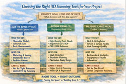
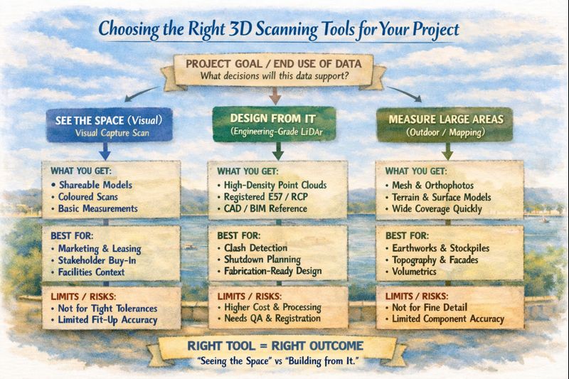
Diagram comparing visual scanning, engineering LiDAR and photogrammetry to help choose the right 3D scanning method for construction and engineering projects.

Choosing the Right 3D Scanning Tool for Engineering Projects

3D scanning is now widely used across construction, property, manufacturing, and heavy industry โ€” but not all scanning tools are designed for the same outcomes. Choosing the right technology depends less on the buzzwords and more on what you actually need to do with the data after itโ€™s captured.

This article explains the main types of 3D scanning commonly used in Australia today, what theyโ€™re best suited for, and how to choose the right approach for your project.


1. Visual Capture Scanning (Property, Architecture & Digital Twins)

Best for:

  • Property marketing and virtual tours
  • Design coordination
  • Facilities management
  • Heritage documentation
  • Basic Scan-to-BIM

Typical outputs:

  • Web-based walkโ€‘through models
  • Coloured point clouds
  • Floor plans and simple BIM geometry
  • OBJ / E57 exports for modelling

Strengths:

  • Fast capture
  • Lower cost
  • Easy sharing via web platforms
  • Excellent for stakeholder engagement

Limitations:

  • Lower geometric accuracy
  • Not suitable for fabrication tolerances
  • Not reliable for mechanical or structural fitโ€‘up

This type of scanning is ideal when the goal is visual context and spatial understanding, rather than precise dimensional control.


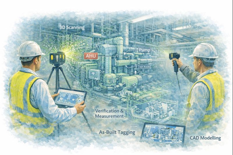
Engineers using LiDAR scanners to capture plant equipment and convert point cloud data into CAD models for verification and as-built documentation.

2. Engineeringโ€‘Grade LiDAR Scanning (Industrial & Retrofit Projects)

Best for:

  • Mechanical and structural design
  • Plant upgrades and brownfield sites
  • Clash detection
  • Fabricationโ€‘ready modelling
  • Shutdown planning

Typical outputs:

  • Highโ€‘density point clouds
  • Registered E57 / RCP datasets
  • CADโ€‘ready reference geometry
  • Scanโ€‘toโ€‘CAD and Scanโ€‘toโ€‘BIM models

Strengths:

  • Millimetreโ€‘level accuracy
  • Longโ€‘range capability
  • Reliable for engineering measurement
  • Suitable for design verification

Limitations:

  • Higher equipment and processing cost
  • Longer setup and registration time
  • Requires engineering workflows to extract value

Engineering LiDAR is used when design decisions and fabrication depend on accurate geometry, not just visual representation.


3. Photogrammetry (Large Areas & Outdoor Mapping)

Best for:

  • Stockpile measurement
  • Terrain mapping
  • Faรงade capture
  • Infrastructure corridors

Typical outputs:

  • Mesh models
  • Orthophotos
  • Surface models

Strengths:

  • Covers large areas quickly
  • Droneโ€‘based access
  • Useful for topography

Limitations:

  • Less accurate for fine detail
  • Poor performance in tight or indoor environments
  • Limited for mechanical components

Photogrammetry is excellent for scale and surface data, but not for highโ€‘precision engineering work.


4. Why the End Use of Data Matters More Than the Scanner

The most common mistake in 3D scanning projects is choosing a capture method before defining:

  • Will the data be used for design and fabrication?
  • Or mainly for visualisation and documentation?
  • Do tolerances matter?
  • Will components be manufactured from this data?

If scanning is only used for:

  • Layout confirmation
  • Space planning
  • Stakeholder communication

Then visual scanning platforms may be entirely sufficient.

If scanning is used for:

  • Equipment replacement
  • Structural modification
  • Pipework or conveyor interfaces
  • Custom fabrication

Then engineeringโ€‘grade LiDAR is essential.


5. Matching the Tool to the Job

Project TypeRecommended Technology
Real estate & virtual toursVisual capture scanning
Office and building refurbishmentsVisual capture or LiDAR depending on tolerances
Plant upgrades & shutdownsEngineeringโ€‘grade LiDAR
Mechanical retrofitsEngineeringโ€‘grade LiDAR
Large outdoor mappingPhotogrammetry or LiDAR
Fabrication from existing assetsEngineeringโ€‘grade LiDAR only

6. Scanning Is Only Step One

Regardless of the technology used, scanning only creates value when paired with:

  • Proper registration and QA
  • Engineering interpretation
  • CAD modelling and documentation
  • Design validation

Without these steps, point clouds remain large files with limited practical use.

The biggest performance gains come when scanning is directly integrated into:

  • Engineering design
  • Constructability reviews
  • Clash detection
  • Fabrication planning

Infographic explaining how to choose the right 3D scanning tool based on whether a project needs visualisation, engineering design, or large-area measurement.

Final Thoughts

3D scanning is not a single solution โ€” it is a group of technologies with very different strengths.

The right approach depends on whether your project is focused on:

  • Seeing the space, or
  • Building from the space

Understanding that difference early can save significant time, cost, and rework later in the project lifecycle.

If youโ€™re unsure which approach fits your project, start by defining what decisions and deliverables will rely on the data โ€” then choose the scanning method that supports those outcomes, not just the fastest or cheapest option.

Hamilton By Design logo displayed on a blue tilted rectangle with a grey gradient background
3D LiDAR scanning and 3D modelling service button โ€” laser scanner capturing a point cloud for engineering and CAD modelling
Mechanical engineering services
Name
Would you like us to arrange a phone consultation for you?
Address
3D LiDAR scanning and 3D modelling service button โ€” laser scanner capturing a point cloud for engineering and CAD modelling
Mechanical engineering services
Finite Element Analysis (FEA) engineering simulation button
Mechanical engineering services

Mechanical Engineering | Structural Engineering


3D Scanning outside of Australia

3D Scanning outside of Australia

In todayโ€™s fast-moving construction, infrastructure and industrial-upgrade sectors โ€” whether in Europe, Asia, North America, Africa or South America โ€” reality is rarely simple. Projects are large, environments complex, and legacy structures old or undocumented. Thatโ€™s where 3D scanning (or 3D LiDAR scanning) becomes a game-changer.

With modern 3D scanning services, you can capture an entire site, plant, asset or building โ€” every surface, every pipe run, every structural detail โ€” in accurate digital form. Traditional measuring tools (tape measures, laser meters, manual surveying) are still useful. But on large or congested sites, or when you donโ€™t have safe access everywhere, manual methods can be slow, error-prone, and often incomplete.

By contrast, 3D scanning uses laser-based (or LiDAR-based) measurements to gather millions of data points quickly and remotely. The result is a dense โ€œpoint cloudโ€ โ€” a highly detailed and accurate 3D snapshot of reality.

3D LiDAR scanning and 3D modelling service button โ€” laser scanner capturing a point cloud for engineering and CAD modelling
Mechanical engineering services

Why 3D Scanning Works โ€” No Matter Where You Are

Hereโ€™s why 3D scanning works so well globally:

  • Speed and Efficiency: A detailed 3D scan that might take days or weeks with traditional survey methods can often be completed in hours. That means faster project starts, shorter downtime, and less disruption.
  • Safety: Because the scan can be done remotely (laser pulses travel to surfaces without the need for physical access), itโ€™s ideal for hazardous zones, tight spaces, or unstable structures.
  • Full Context: Unlike isolated point measurements, 3D scanning captures full spatial context โ€” geometry, dimensions, relationships between elements and spatial orientation. This is invaluable for retrofit design, expansions, refurbishments, or structural assessments.
  • As-Built Accuracy: For heritage buildings, older industrial plants, or legacy infrastructure โ€” where existing drawings may be outdated or missing โ€” 3D scanning provides a reliable, accurate โ€œas-builtโ€ record. Great for restoration, renovation, maintenance, or future planning.
  • Reduced Errors & Rework: Because your base designs, additions, installations or repairs on real-world data, the risk of clashes, misfits, or unexpected surprises drops dramatically โ€” which saves time and money downstream.

Where 3D Scanning Is Already Making a Difference Globally

Across the world, 3D scanning is being used in a range of industries and projects โ€” and its benefits scale with scope and complexity. Some examples:

  • Industrial plants and processing facilities โ€” mapping existing installations for maintenance, retrofits or expansions
  • Construction and infrastructure โ€” buildings, bridges, tunnels, utilities, and structural inspections
  • Heritage and restoration projects โ€” capturing intricate architectural details of historical buildings or monuments without physical contact
  • Manufacturing, factories and heavy industry โ€” reverse engineering, component inspection, machinery layout, and plant upgrades
  • Survey, mapping and urban planning โ€” terrain, topography, urban structures, utilities and civil works

Because 3D scanning is not location-specific, firms and clients worldwide โ€” regardless of local regulations or industry sector โ€” can leverage its advantages.


What Makes a 3D Scanning Service Valuable โ€” Anywhere

If youโ€™re looking to engage a 3D scanning service outside Australia, hereโ€™s what you should check to get the most value:

  • Use of current, high-resolution scanners (LiDAR or equivalent 3D scanning technology), able to generate dense point clouds with millimetre-level detail.
  • Skilled operators who understand not only how to capture data, but how to process it. Raw scans need thoughtful post-processing, registration, and sometimes CAD/BIM conversion to be truly useful.
  • Delivery of actionable, usable outputs โ€” not just raw point clouds. That means as-built models, CAD drawings, BIM-ready files or structural drawings depending on the project.
  • Clear scope definition: What you need โ€” renovation planning, plant upgrade, heritage restoration, clash detection, quality control โ€” and an understanding of what a scan can and cannot do.
  • Flexibility to work in different environments โ€” industrial sites, confined spaces, heritage structures, remote locations.

Why You Should Consider 3D Scanning for Your Next Project

Whether youโ€™re managing a factory upgrade, planning a structural refurbishment, restoring a heritage building, or designing a new facility โ€” 3D scanning gives you clarity. It removes guesswork. It captures reality, not drawings.

In many global markets today, the pressure for speed, accuracy, and cost-effectiveness is growing. Regulations, safety standards, environmental concerns and complexity of infrastructure demand better data โ€” and 3D scanning delivers.

If you havenโ€™t tried 3D scanning yet, or if youโ€™re depending on old drawings or manual survey methods, now may be the time to reconsider. The technology โ€” and the workflow โ€” has matured, and the benefits are real: faster turnarounds, safer operations, clearer documentation, and fewer surprises.

For engineers, architects, contractors, heritage specialists, surveyors and project managers around the world โ€” adopting 3D scanning could be the most efficient way to ensure project success.

Hamilton By Design logo displayed on a blue tilted rectangle with a grey gradient background
3D LiDAR scanning and 3D modelling service button โ€” laser scanner capturing a point cloud for engineering and CAD modelling
Mechanical engineering services
Name
Address
You would like to:

3D Laser Scanning

3D LiDAR Scanning โ€“ Digital Quality Assurance

3D Scanning for Construction

Transforming Projects with 3D Scanning


3D Scanning Sydney banner promoting engineering-grade 3D laser scanning, LiDAR scanning, and reality capture services by Hamilton By Design.
Mechanical Engineering Sydney banner with white text on a blue background representing Hamilton By Design's mechanical engineering services in Sydney.
Mechanical Drafting and 3D Modelling Sydney banner highlighting Hamilton By Design's CAD drafting, 3D modelling, and engineering design services in Sydney.

Mechanical Engineering | Structural Engineering