Engineering 3D Scanning for Mining Projects in Zambia

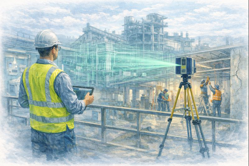
Engineer using LiDAR scanner to capture copper processing plant and open-pit mine within a map of Zambia for engineering design and upgrade planning.

Engineering 3D Scanning for Mining Projects in Zambia

Supporting safer, faster and more accurate plant upgrades across the Copperbelt

Zambia is one of Africaโ€™s most important copper-producing nations, with large-scale mining and mineral processing facilities operating across the Copperbelt region. Many of these sites are complex, brownfield environments that have evolved over decades, making accurate design and upgrade work challenging without reliable as-built information.

Engineering-grade 3D laser scanning is now playing a critical role in supporting safer, faster and more accurate mining projects by providing detailed digital representations of existing plant and infrastructure.
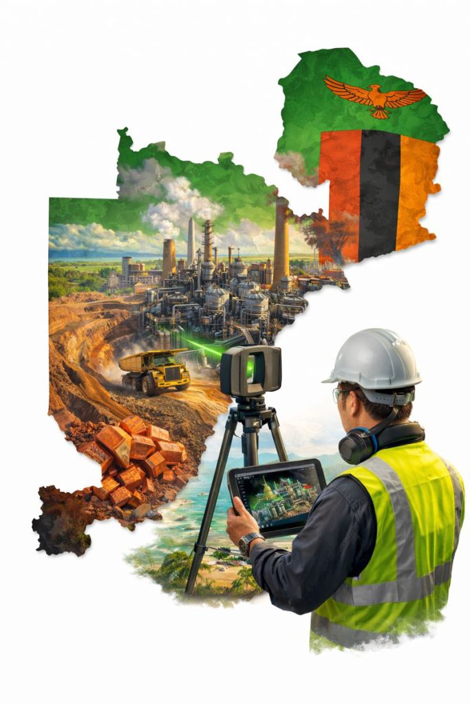

Zambian mining facility being digitally captured with 3D scanning to create accurate models for engineering and shutdown planning.

Why Accurate As-Built Data Matters in Mining

Mining and processing plants typically undergo continuous modification to improve capacity, efficiency and reliability. Unfortunately, legacy drawings and documentation are often incomplete or no longer reflect the current configuration of the plant.

This creates risks such as:

  • Design clashes with existing services or structures
  • Unexpected installation constraints
  • Increased shutdown durations
  • Safety risks from unverified site conditions

3D laser scanning addresses these risks by capturing high-density point cloud data that reflects the true geometry of the operating facility at the time of capture.


How Engineering-Grade Scanning Supports Mining Projects

Plant Upgrades and Expansions

When installing new crushers, mills, pumps, pipework or conveyors, accurate spatial data is essential. Laser scanning allows engineers to design new equipment layouts directly within the existing plant model, validating clearances and interfaces before construction begins.

Shutdown and Maintenance Planning

Shutdown work is high-risk and time-critical. Point cloud models enable teams to:

  • Assess access routes
  • Plan lifting and installation sequences
  • Identify congestion points

This improves safety outcomes and reduces downtime during critical maintenance windows.
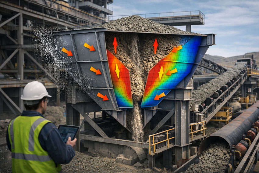

Mining hopper in a transfer station shown in cutaway, illustrating steady-state material flow, structural load distribution, and engineered hopper design.

Structural and Mechanical Retrofits

For structural strengthening, equipment replacement or capacity upgrades, scanning provides the geometry required to produce fabrication-ready drawings without relying on extensive manual site measurement in hazardous areas.

Digital Twin and Asset Management

Reality capture data can also be used to support longer-term asset management strategies, enabling:

  • Improved inspection planning
  • Better maintenance coordination
  • Faster future upgrade design

Digital plant models become a valuable operational asset, not just a project deliverable.


Why Engineering-Grade LiDAR Is Required for Industrial Sites

Not all 3D scanning technologies are suitable for mining environments.

While visual scanning systems are useful for building documentation and general layout capture, mining and processing facilities typically require:

  • Millimetre-level dimensional accuracy
  • Long-range scanning capability
  • Reliable reference data for CAD and BIM modelling

Engineering-grade LiDAR systems are designed for these conditions, making them suitable for mechanical and structural design workflows where tolerances and fit-up are critical.

For projects involving fabrication and installation, scanning must support engineering decisions โ€” not just visualisation.


Benefits for Mining Operators and Project Teams

Integrating engineering scanning into mining workflows delivers tangible benefits, including:

  • Reduced re-measurement on site
  • Fewer design clashes and construction rework
  • Improved constructability reviews
  • Safer design development off-site
  • Shorter shutdown durations
  • Higher confidence in project outcomes

In high-value mining projects, even small improvements in planning accuracy can result in significant cost and schedule savings.


Engineering-Led Reality Capture Workflows

The real value of 3D scanning is realised when it is integrated directly into engineering and design processes. At Hamilton By Design, reality capture is used to support:

  • Mechanical and structural design
  • Scan-to-CAD and Scan-to-BIM modelling
  • Fabrication drawing development
  • Installation planning and coordination

This ensures scan data is converted into practical engineering deliverables that support construction and long-term asset management.


Supporting Mining Projects Across Southern Africa

With ongoing investment in copper and critical minerals, Southern Africa continues to present strong demand for plant upgrades, expansions and reliability improvements.

Engineering-led reality capture provides a safer and more efficient way to support these projects, particularly in operating facilities where downtime and site access are highly constrained.

By combining laser scanning with mechanical and structural engineering expertise, project teams can reduce uncertainty and deliver upgrades with greater confidence.



Hamilton By Design logo displayed on a blue tilted rectangle with a grey gradient background

3D LiDAR scanning and 3D modelling service button โ€” laser scanner capturing a point cloud for engineering and CAD modelling
Mechanical engineering services

Final Thoughts

For mining operations in Zambia, 3D laser scanning is no longer a specialist add-on โ€” it is becoming a core engineering tool that supports safer and more efficient project delivery.

When paired with strong design and project management workflows, reality capture enables better planning, better coordination and better construction outcomes in some of the worldโ€™s most demanding industrial environments.

Name
Would you like us to arrange a phone consultation for you?
Address
Finite Element Analysis (FEA) engineering simulation button
Mechanical engineering services

Choosing the Right 3D Scanning Tools for Your Project

Diagram comparing visual scanning, engineering LiDAR and photogrammetry to help choose the right 3D scanning method for construction and engineering projects.

Choosing the Right 3D Scanning Tool for Engineering Projects

3D scanning is now widely used across construction, property, manufacturing, and heavy industry โ€” but not all scanning tools are designed for the same outcomes. Choosing the right technology depends less on the buzzwords and more on what you actually need to do with the data after itโ€™s captured.

This article explains the main types of 3D scanning commonly used in Australia today, what theyโ€™re best suited for, and how to choose the right approach for your project.


1. Visual Capture Scanning (Property, Architecture & Digital Twins)

Best for:

  • Property marketing and virtual tours
  • Design coordination
  • Facilities management
  • Heritage documentation
  • Basic Scan-to-BIM

Typical outputs:

  • Web-based walkโ€‘through models
  • Coloured point clouds
  • Floor plans and simple BIM geometry
  • OBJ / E57 exports for modelling

Strengths:

  • Fast capture
  • Lower cost
  • Easy sharing via web platforms
  • Excellent for stakeholder engagement

Limitations:

  • Lower geometric accuracy
  • Not suitable for fabrication tolerances
  • Not reliable for mechanical or structural fitโ€‘up

This type of scanning is ideal when the goal is visual context and spatial understanding, rather than precise dimensional control.


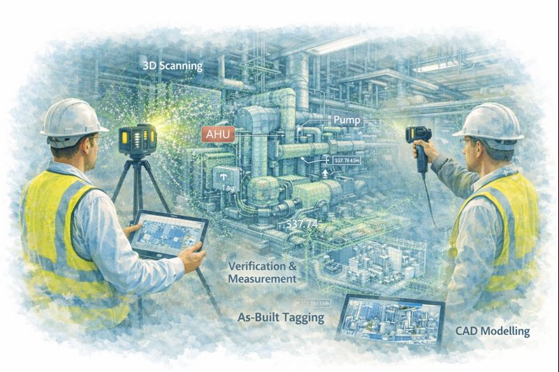
Engineers using LiDAR scanners to capture plant equipment and convert point cloud data into CAD models for verification and as-built documentation.

2. Engineeringโ€‘Grade LiDAR Scanning (Industrial & Retrofit Projects)

Best for:

  • Mechanical and structural design
  • Plant upgrades and brownfield sites
  • Clash detection
  • Fabricationโ€‘ready modelling
  • Shutdown planning

Typical outputs:

  • Highโ€‘density point clouds
  • Registered E57 / RCP datasets
  • CADโ€‘ready reference geometry
  • Scanโ€‘toโ€‘CAD and Scanโ€‘toโ€‘BIM models

Strengths:

  • Millimetreโ€‘level accuracy
  • Longโ€‘range capability
  • Reliable for engineering measurement
  • Suitable for design verification

Limitations:

  • Higher equipment and processing cost
  • Longer setup and registration time
  • Requires engineering workflows to extract value

Engineering LiDAR is used when design decisions and fabrication depend on accurate geometry, not just visual representation.


3. Photogrammetry (Large Areas & Outdoor Mapping)

Best for:

  • Stockpile measurement
  • Terrain mapping
  • Faรงade capture
  • Infrastructure corridors

Typical outputs:

  • Mesh models
  • Orthophotos
  • Surface models

Strengths:

  • Covers large areas quickly
  • Droneโ€‘based access
  • Useful for topography

Limitations:

  • Less accurate for fine detail
  • Poor performance in tight or indoor environments
  • Limited for mechanical components

Photogrammetry is excellent for scale and surface data, but not for highโ€‘precision engineering work.


4. Why the End Use of Data Matters More Than the Scanner

The most common mistake in 3D scanning projects is choosing a capture method before defining:

  • Will the data be used for design and fabrication?
  • Or mainly for visualisation and documentation?
  • Do tolerances matter?
  • Will components be manufactured from this data?

If scanning is only used for:

  • Layout confirmation
  • Space planning
  • Stakeholder communication

Then visual scanning platforms may be entirely sufficient.

If scanning is used for:

  • Equipment replacement
  • Structural modification
  • Pipework or conveyor interfaces
  • Custom fabrication

Then engineeringโ€‘grade LiDAR is essential.


5. Matching the Tool to the Job

Project TypeRecommended Technology
Real estate & virtual toursVisual capture scanning
Office and building refurbishmentsVisual capture or LiDAR depending on tolerances
Plant upgrades & shutdownsEngineeringโ€‘grade LiDAR
Mechanical retrofitsEngineeringโ€‘grade LiDAR
Large outdoor mappingPhotogrammetry or LiDAR
Fabrication from existing assetsEngineeringโ€‘grade LiDAR only

6. Scanning Is Only Step One

Regardless of the technology used, scanning only creates value when paired with:

  • Proper registration and QA
  • Engineering interpretation
  • CAD modelling and documentation
  • Design validation

Without these steps, point clouds remain large files with limited practical use.

The biggest performance gains come when scanning is directly integrated into:

  • Engineering design
  • Constructability reviews
  • Clash detection
  • Fabrication planning

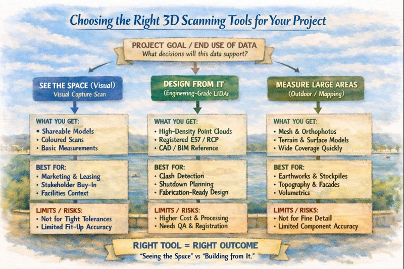
Infographic explaining how to choose the right 3D scanning tool based on whether a project needs visualisation, engineering design, or large-area measurement.

Final Thoughts

3D scanning is not a single solution โ€” it is a group of technologies with very different strengths.

The right approach depends on whether your project is focused on:

  • Seeing the space, or
  • Building from the space

Understanding that difference early can save significant time, cost, and rework later in the project lifecycle.

If youโ€™re unsure which approach fits your project, start by defining what decisions and deliverables will rely on the data โ€” then choose the scanning method that supports those outcomes, not just the fastest or cheapest option.

Hamilton By Design logo displayed on a blue tilted rectangle with a grey gradient background
3D LiDAR scanning and 3D modelling service button โ€” laser scanner capturing a point cloud for engineering and CAD modelling
Mechanical engineering services
Name
Would you like us to arrange a phone consultation for you?
Address
3D LiDAR scanning and 3D modelling service button โ€” laser scanner capturing a point cloud for engineering and CAD modelling
Mechanical engineering services
Finite Element Analysis (FEA) engineering simulation button
Mechanical engineering services

Mechanical Engineering | Structural Engineering


Digital Twin Creation & Long-Term Asset Management

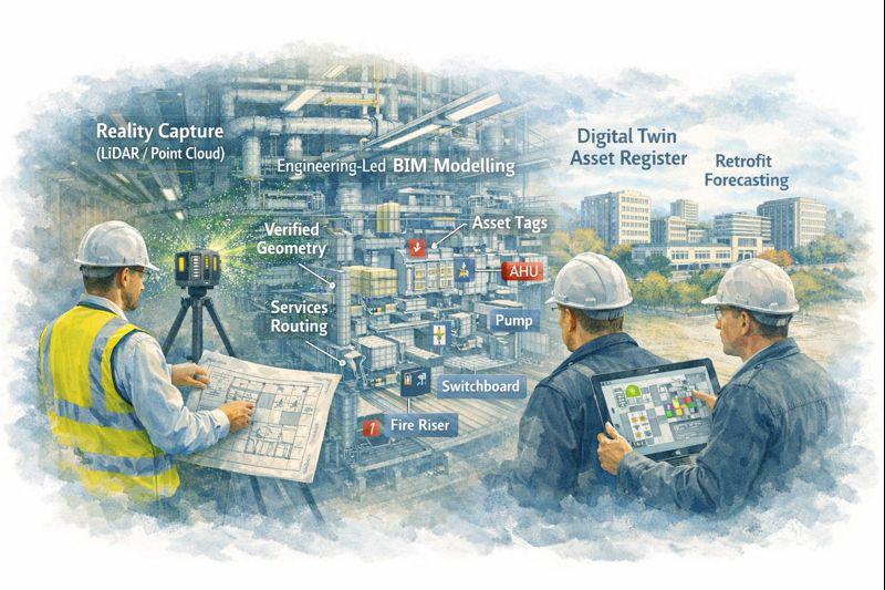
Digital twin created from LiDAR scanning showing asset tags and maintenance planning in industrial facility

Digital Twin Asset Management Sydney | Hamilton By Design

From Point Cloud to Digital Twin: Better Asset Control for Sydney Precincts

For asset owners and facilities managers across Greater Sydney and the Central Coast, accurate and accessible building data is no longer a luxury โ€” it is critical for maintenance planning, compliance, risk management, and future upgrades.

Yet many facilities still rely on incomplete drawings, outdated asset registers, or disconnected documentation spread across multiple systems.

At Hamilton By Design, we use high-accuracy 3D scanning and engineering-led modelling to create digital twins โ€” intelligent, data-rich representations of real facilities that support long-term asset management, not just one-off construction projects.


Why Traditional Building Records Fall Short

Over the life of a facility, buildings change constantly:

  • Services are upgraded or rerouted
  • Plant is replaced or relocated
  • Structural movement occurs over time
  • Temporary works become permanent
  • Documentation becomes fragmented or lost

As a result, asset owners are often forced to make decisions based on assumptions instead of verified data, increasing operational risk and lifecycle costs.

Digital twins replace uncertainty with measurable, current, and verifiable building intelligence.


What Is a Digital Twin โ€” and Why It Matters

A digital twin is more than a 3D model. It is a continuously usable digital representation of your physical asset that can support:

  • Asset lifecycle management
  • Maintenance planning and scheduling
  • Retrofit and upgrade forecasting
  • Compliance verification and reporting
  • Insurance documentation and risk mitigation

Using LiDAR and reality capture, we first create highly accurate point cloud data of your facility. This is then converted into structured engineering models and documentation, forming the foundation of a usable digital twin environment.


Supporting the Full Asset Lifecycle

Digital twins created by Hamilton By Design are designed to support decision-making across the entire life of an asset.

Asset Lifecycle Management

Digital twins provide a verified reference for:

  • Plant locations and access paths
  • Service routing and capacity
  • Structural geometry and tolerances
  • Interface points between systems

This allows asset teams to plan interventions without repeated site surveys or intrusive investigations.


Maintenance Planning and Access Strategy

Maintenance activities often fail not due to equipment faults, but due to poor access planning and unknown service constraints.

Digital twins allow teams to:

  • Visualise maintenance access zones
  • Plan shutdown sequences
  • Coordinate contractor access safely
  • Reduce unexpected site conditions

This is particularly valuable in hospitals, transport facilities, and industrial plants where downtime is extremely costly.


From point cloud to digital twin for lifecycle management of Sydney industrial and precinct assets

Retrofit and Upgrade Forecasting

When assets age, upgrade programs become unavoidable โ€” but without accurate models, forecasting becomes unreliable.

With digital twins, asset owners can:

  • Test retrofit scenarios digitally
  • Assess spatial constraints early
  • Coordinate staged construction programs
  • Validate new services layouts before installation

This significantly reduces redesign cycles and programme risk.


Compliance, Insurance and Risk Documentation

High-accuracy digital records also support:

  • Compliance audits
  • Fire and safety system verification
  • Engineering certification
  • Insurance risk assessments

Digital twins provide verifiable evidence of current conditions, which is increasingly important for regulatory and insurer requirements.


Enterprise-Value Scanning, Not Just Project Scanning

Many scanning services stop at delivering point clouds. Hamilton By Design goes further by integrating scanning into an engineering and asset management workflow.

Our service extends beyond capture into:

  • Mechanical engineering interpretation
  • Systems modelling and coordination
  • Project and asset integration support
  • Fabrication and modification planning

This makes digital twins a strategic asset tool, not just a design input.


Construction, Operations and Future-Proofing โ€” All in One Model

Our digital twin workflows support:

  • Operational facilities
  • Construction planning
  • Ongoing modifications
  • Future asset strategies

By maintaining continuity between engineering, construction, and asset management data, digital twins become a single source of truth for multiple stakeholders.


Deliverables Designed for Asset Teams

We provide digital twin outputs in formats compatible with enterprise asset and design systems:

  • High-resolution point clouds (RCP / E57)
  • Revit asset models
  • AutoCAD documentation
  • SolidWorks equipment and systems models
  • Asset-aligned 2D drawings
  • Data structured for future updates

These can be used directly by engineering consultants, maintenance teams, and facilities management platforms.


Supporting Sydney and Central Coast Asset Portfolios

We work with asset owners across:

  • Healthcare precincts
  • Commercial property portfolios
  • Industrial facilities
  • Infrastructure and transport sites
  • Education campuses
  • Heritage and government assets

Our local support allows ongoing engagement as facilities evolve, not just one-off capture projects.


Turn Building Data into an Asset Strategy

Digital twins transform buildings from static structures into data-driven, manageable systems.

They allow asset owners to move from reactive maintenance to planned lifecycle control, improving reliability, safety, and financial predictability.


Hamilton By Design logo displayed on a blue tilted rectangle with a grey gradient background
3D LiDAR scanning and 3D modelling service button โ€” laser scanner capturing a point cloud for engineering and CAD modelling
Mechanical engineering services

Arrange a Digital Twin Consultation

If you are responsible for long-term facility performance, compliance, or upgrade planning:

Please fill out the form below to arrange a phone consultation.

Weโ€™ll discuss your asset portfolio, operational requirements, and long-term objectives, and recommend a digital twin strategy that supports both current operations and future upgrades.

Name
Would you like us to arrange a phone consultation for you?
Address

3D CAD Modelling Australia service banner for Hamilton By Design


CHPP Engineering title graphic featuring bold white text reading "CHPP Engineering" centred on a blue rounded rectangle background.
Pipework Drafting title graphic featuring bold white text reading "Pipework Drafting" centred on a blue rounded rectangle background.
3D LiDAR Scanning for Engineering Projects title graphic featuring bold white text on a blue rounded rectangle background.


Finite Element Analysis (FEA) engineering simulation button
Structural drafting services button
Mechanical drafting services button


Australian Drafting logo featuring bold white text reading "Australian Drafting" centred on a blue rounded rectangle background.
Engineering Governance title graphic featuring bold white text reading "Engineering Governance" centred on a blue rounded rectangle background.
Engineering-Grade LiDAR Scanning title graphic featuring bold white text on a blue rounded rectangle background.


Mechanical drafting services button
Structural drafting services button


Fabrication and product design services
3D CAD Modelling Australia service banner for Hamilton By Design
Mechanical, Structural & Pipework Drafting service banner by Hamilton By Design featuring white text on a blue background.


3D LiDAR scanning and 3D modelling service button โ€” laser scanner capturing a point cloud for engineering and CAD modelling
Mechanical engineering services

Mechanical Engineering | Structural Engineering


Reality Capture for Live or Operational Sites (High-Risk Environments)

Engineer performing LiDAR scanning on live construction site with BIM model overlay for clash-free installation

Reality Capture for Live Sites Sydney | 3D Scanning Without Shutdowns

Keep Sydney Projects Running: Accurate Reality Capture Without Shutdowns

Many projects across Greater Sydney and the Central Coast take place in live, operational environments โ€” hospitals, shopping centres, CBD offices, industrial plants, transport facilities, and heritage buildings โ€” where shutdowns are either impossible or extremely costly.

At Hamilton By Design, we provide engineer-led reality capture and 3D scanning services that allow accurate measurement, modelling, and verification without interrupting operations. Our approach supports safe access, staged construction, and clash-free installation โ€” keeping your project moving while reducing risk, rework, and variations.


The Challenge of Working in Live Environments

Builders, project managers, and facilities teams face real risks when upgrading or modifying operational sites:

  • Buildings that have moved over time, with visible cracking or deformation
  • Changes in soil conditions or legacy engineering affecting structure and services
  • Outdated or unreliable drawings that no longer reflect site conditions
  • Unexpected clashes once walls, ceilings, or plant rooms are opened
  • High costs from rework and contract variations
  • Safety risks from confined spaces, working at heights, or restricted access zones

Relying on manual measurement or assumptions in these environments increases both programme risk and safety exposure.


Reality capture of operational industrial facility using 3D laser scanning without site shutdown

Non-Contact Measurement for High-Risk and Restricted Sites

Our reality capture solutions use non-contact laser scanning and LiDAR technology to safely collect accurate site data, even in difficult or restricted environments.

This allows us to capture:

  • Services above ceilings and within plant rooms
  • Structural elements and building geometry
  • Equipment clearances and access constraints
  • Deformed or out-of-plumb structures

All while minimising disruption to occupants and operations.

Safety and Access Benefits

  • Reduced need for working at heights
  • Faster site presence and data capture
  • Minimal interference with daily operations
  • Scanning possible from walkways or public-access areas
  • Fewer permits, isolations, and shutdown windows required

This makes scanning ideal for live hospitals, retail centres, offices, and industrial facilities where safety and continuity are critical.


Supporting Staged Construction and Live Upgrades

Live environments rarely allow full shutdowns. Our reality capture workflows are designed to support:

  • Staged construction programs
  • Progressive installation of services
  • Ongoing refurbishment works
  • Verification before each construction phase

We can also perform repeat scanning to monitor:

  • Structural movement
  • Progressive cracking
  • Deformation of walls, floors, or structural members

This is especially valuable where movement, settlement, or ageing infrastructure is a concern.


Practical Outcomes for Builders and Project Teams

Our scan data is not just collected โ€” it is engineered into practical construction deliverables that support real project decisions.

Clients use our reality capture outputs for:

  • Design of new mechanical, electrical, and plumbing services
  • Accurate as-built verification prior to fabrication
  • Set-out and coordination models for installation
  • Clash detection before construction begins
  • Monitoring movement or deformation over time

This reduces uncertainty, improves coordination between trades, and significantly lowers the risk of costly on-site surprises.


Construction-Ready Deliverables

We provide data in formats that integrate directly into your existing workflows and design platforms:

  • Point clouds (RCP / E57)
  • Revit models
  • AutoCAD files
  • SolidWorks models
  • 2D drawings (plans, sections, elevations)
  • Clash-ready coordination models

Our focus is on delivering usable, construction-ready information, not just raw scan files.


Engineer-Led Reality Capture โ€” Not Just Scanning

Hamilton By Design is not a scanning-only provider. We deliver end-to-end technical services, allowing us to support projects from concept through to installation.

Our integrated capabilities include:

  • Reality capture and 3D scanning
  • Mechanical engineering
  • Systems management
  • Project management
  • Machining and fabrication support

Because our work is engineer-led, scan data is interpreted with constructability, tolerances, and installation constraints in mind โ€” not simply converted into drawings by offshore drafting teams.

This means better decisions, fewer assumptions, and stronger outcomes on site.


Supporting Greater Sydney and the Central Coast

We regularly support projects across:

  • Sydney CBD and metropolitan areas
  • Major commercial and retail precincts
  • Health and education facilities
  • Industrial and processing plants
  • Infrastructure and heritage assets
  • Central Coast commercial and industrial sites

Our local presence allows efficient mobilisation and ongoing project support throughout staged works.


Hamilton By Design logo displayed on a blue tilted rectangle with a grey gradient background
3D LiDAR scanning and 3D modelling service button โ€” laser scanner capturing a point cloud for engineering and CAD modelling
Mechanical engineering services

Reduce Risk. Avoid Shutdowns. Build With Confidence.

Reality capture is no longer just a documentation tool โ€” it is a risk management strategy for live environments.

By capturing what is truly on site before construction begins, you can:

  • Prevent clashes and redesign
  • Reduce variations and rework
  • Improve safety planning
  • Protect programme and operational continuity

Arrange a Phone Consultation

If you are planning works in a live or high-risk environment and need reliable site data without shutdowns:

Please fill out the form below to arrange a phone consultation.

Weโ€™ll discuss your site conditions, construction staging, and deliverable requirements, and recommend the most effective reality capture approach for your project.

Name
Would you like us to arrange a phone consultation for you?
Address
Finite Element Analysis (FEA) engineering simulation button
Mechanical engineering services

Mechanical Engineering | Structural Engineering


3D LiDAR Scanning Darwin for engineering surveys, laser scanning, reality capture and point cloud modelling services
3D LiDAR Scanning Australia engineering services for laser scanning, reality capture, scan-to-CAD, Scan-to-BIM and as-built documentation across Australia
3D LiDAR scanning services on the Central Coast providing engineering-grade laser scanning, point cloud capture, scan-to-CAD modelling and industrial reality capture for infrastructure and industrial projects.

The Digital Source of Truth: Using LiDAR Scanning to Resolve Residential Property Disputes

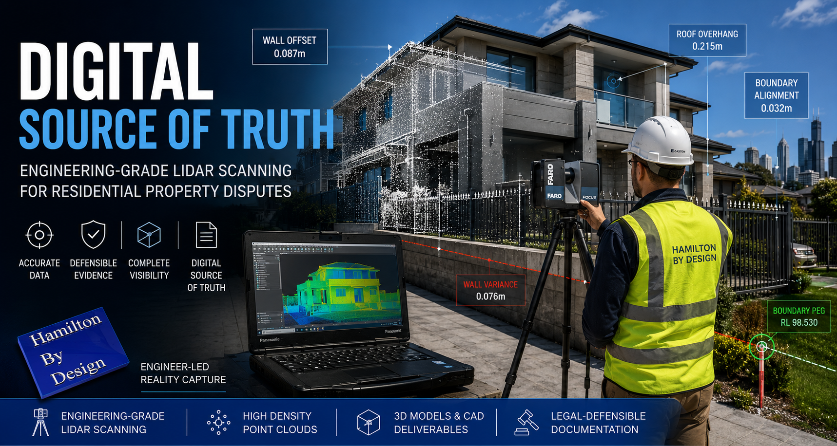
Engineer operating a FARO LiDAR scanner outside a modern Australian home while capturing point cloud data for residential property dispute analysis.

In residential property, a few centimeters can be the difference between a successful renovation and a decade-long legal battle. Whether itโ€™s a dispute over a boundary fence, a claim regarding a construction defect, or an insurance argument over structural movement, the “he-said, she-said” of manual measurements is no longer enough.

At Hamilton By Design, we provide homeowners and legal teams with a “Digital Source of Truth” through high-precision LiDAR (Light Detection and Ranging) scanning.

Why “Near Enough” Isn’t Enough in Residential Law

Traditional property documentation often relies on old paper titles or handheld tape measurements. These methods are prone to human error and fail to capture the complex, three-dimensional reality of a home.

In a legal setting, ambiguity is the enemy. If you are heading to mediation or court, you need data that is objective, repeatable, and millimeter-accurate. LiDAR offers a simple, non-invasive solution for documenting every corner of a propertyโ€™s geometry.

1. Encroachment & Boundary Disputes

The most common residential dispute often involves a fence, retaining wall, or overhanging structure. A LiDAR scan creates a “Point Cloud”โ€”a 3D map of millions of data pointsโ€”that can be overlaid with official cadastral surveys. This proves exactly where a structure sits in relation to the legal boundary, leaving no room for argument.

2. Construction Defect & Variation Claims

If a builder has installed a wall that isn’t plumb, or a slab that is out of level, manual checks can be disputed. A LiDAR scan captures the entire surface geometry of the building. We can produce “heat maps” that visually demonstrate deviations from the design plans, providing undeniable evidence of whether or not a project meets Australian Standards.

3. Dilapidation Surveys (The “Before & After”)

Before a neighbor begins a major excavation or a council starts roadworks, a LiDAR scan acts as a “digital time capsule.” It documents the exact current state of your homeโ€”including existing cracks or structural leans. If damage occurs during the nearby construction, you have a 3D record to prove the change, making insurance claims significantly smoother.

4. Forensic Investigation & Evidence

In more serious cases, such as structural failures or fire damage, LiDAR allows for a “virtual walkthrough” of the scene. Judges and juries can navigate a digital twin of the property, understanding spatial relationships and damage patterns that 2D photos simply cannot convey.

The Value of Geometry

Geometry is the mathematical language of your property. By capturing the precise angles, elevations, and volumes of a home, we help owners:

  • Identify structural movement over time.
  • Calculate exact volumes for material disputes.
  • Verify solar access or view loss in planning disputes.

Bringing Certainty to Your Case

A point cloud is more than just a scan; it is a permanent, digital record that can be revisited years later if new issues arise. At Hamilton By Design, we bridge the gap between complex laser data and practical legal evidence.

Protect your most valuable asset with data that stands up in court. —

Would you like me to create a “Checklist for Homeowners” section to add to this post, detailing when they should consider a scan?

Hamilton By Design logo displayed on a blue tilted rectangle with a grey gradient background
3D LiDAR scanning and 3D modelling service button โ€” laser scanner capturing a point cloud for engineering and CAD modelling
Mechanical engineering services
3D LiDAR scanning and 3D modelling service button โ€” laser scanner capturing a point cloud for engineering and CAD modelling
Mechanical engineering services
Finite Element Analysis (FEA) engineering simulation button
Mechanical engineering services

Mechanical Engineering | Structural Engineering


Beyond Assumptions: Why Accurate Geometry and LiDAR Scanning are the Gold Standard for Modern Projects

Engineering-grade LiDAR scanning infographic showing a FARO laser scanner capturing an industrial plant and converting site data into point clouds, scan-to-CAD models, and engineering-ready drawings to reduce rework and improve project outcomes.

In the world of industrial engineering and brownfield upgrades, there is a dangerous word: Assumption.

Whether you are upgrading a CHPP, modifying a conveyor system, or retrofitting a processing plant, your project is only as strong as the data itโ€™s built on. At Hamilton By Design, weโ€™ve seen how “near enough” measurements lead to costly rework, extended shutdowns, and safety risks.

The solution? Moving from manual estimation to Engineering-Led LiDAR Scanning.

The High Cost of Inaccurate Information

Traditional “manual” documentationโ€”using tape measures, spirit levels, and old 2D drawingsโ€”is prone to human error. In complex industrial environments, missing a single pipe interference or a slight structural lean by even 20mm can mean a prefabricated component wonโ€™t fit during a critical shutdown.

When site data is inaccurate:

  • Fabrication fails: Parts arrive on-site but don’t clear existing structures.
  • Costs skyrocket: Emergency “hot works” and on-site modifications blow out budgets.
  • Safety is compromised: Forced fits can create structural stress and unforeseen hazards.

Why Geometry is the Foundation of Engineering

Geometry isn’t just about shapes; it’s about the spatial relationship between every asset on your site. Accurate geometry is critical because:

  1. Clash Detection: It allows us to identify “soft” and “hard” clashes in a digital environment before a single bolt is turned.
  2. Structural Integrity: Precise angles and load-path documentation ensure that new modifications integrate safely with legacy steelwork.
  3. Efficiency: Understanding the exact volume, pitch, and clearance of a site allows for “First-Time-Fit” engineering.

LiDAR Scanning: The Simple Solution for Complex Reality

LiDAR (Light Detection and Ranging) removes the guesswork. A LiDAR scanner emits millions of laser pulses per second to create a Point Cloudโ€”a highly accurate 3D digital “twin” of your facility.

Why itโ€™s a game-changer:

  • Speed: Capture entire plant rooms or structural towers in minutes, not days.
  • Safety: We can scan hazardous or hard-to-reach areas from a safe distance, removing the need for scaffolding just to take a measurement.
  • Completeness: Unlike a manual survey that only measures what you think is important, LiDAR captures everything in its line of sight, providing context you might need later.

Beyond design, point cloud data serves as an indisputable “source of truth” in legal and insurance contexts. Because a scan is a timestamped, millimeter-accurate record of reality, it is increasingly used in:

  • Construction Disputes: Providing evidence of “as-built” conditions vs. “as-designed” plans to settle variations or defect claims.
  • Incident Investigation: In the event of a structural failure or site accident, a pre-existing or post-incident scan provides an objective 3D map for forensic analysis.
  • Asset Accountability: Scans serve as a permanent record of site conditions before a contractor begins work, protecting owners and contractors alike from liability.

The Hamilton By Design Difference

We don’t just provide “data.” We provide engineering-led reality capture. Because we are engineers and fabricators ourselves, we know what to look for when we scan. We don’t just give you a cloud of dots; we translate that data into usable CAD models and fabrication-ready drawings that respect Australian Standards (like AS 4324.1).

Stop guessing and start building with confidence. [Contact the Hamilton By Design team today] to discuss how our LiDAR scanning services can de-risk your next project.

Hamilton By Design logo displayed on a blue tilted rectangle with a grey gradient background
3D LiDAR scanning and 3D modelling service button โ€” laser scanner capturing a point cloud for engineering and CAD modelling
Mechanical engineering services
3D LiDAR scanning and 3D modelling service button โ€” laser scanner capturing a point cloud for engineering and CAD modelling
Mechanical engineering services
Finite Element Analysis (FEA) engineering simulation button
Mechanical engineering services

Mechanical Engineering | Structural Engineering