Industrial 3D Scanning in Perth and Western Australia

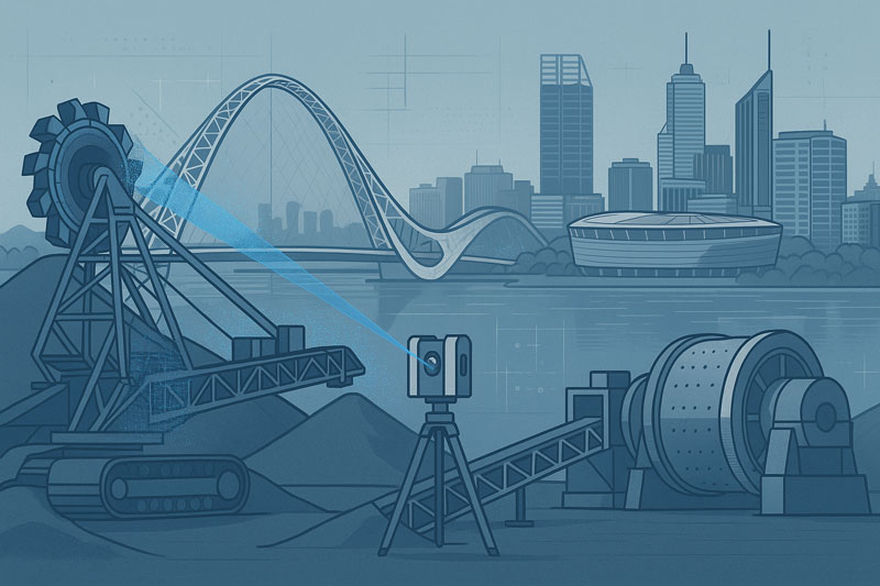
Stylised illustration of a 3D laser scanner capturing point-cloud data from mining equipment, including a reclaimer and a SAG mill, set against the Perth skyline. Visible landmarks include Matagarup Bridge, Optus Stadium, and city skyscrapers across the Swan River. The image represents industrial 3D scanning and engineering services in Western Australia

Engineering-Grade Terrestrial LiDAR Scanning Services Across Perth and Western Australia

Blue 3D LiDAR scanner icon on a tripod with scanning waves

Hamilton By Design provides 3D LiDAR scanning for industrial facilities in Perth and across Western Australia. We capture existing plant, equipment, pipework and structures, then turn the scan data into registered point clouds, CAD models and drawings for plant upgrades, shutdowns and equipment replacement.

Tell us the site location, the asset or area to be scanned, and whether you need scan data only or engineering drawings. We will scope the site visit, deliverables and mobilisation in your quotation.


LiDAR scanning has become one of the most effective methods for capturing accurate three-dimensional information from existing industrial facilities, infrastructure assets and commercial buildings. By using terrestrial laser scanning technology, millions of survey-grade measurement points can be collected in a matter of hours, creating a highly detailed digital representation of real-world environments.

Hamilton By Design provides engineering-led LiDAR scanning services throughout Perth and Western Australia, supporting mining operations, mineral processing facilities, manufacturing plants, infrastructure projects and complex industrial environments.

Unlike traditional measurement methods that rely on individual dimensions and manual site sketches, terrestrial LiDAR captures complete environments, enabling project teams to work from measured reality rather than assumptions.

The resulting point cloud data provides an accurate digital record of existing conditions and can be used to support asset management, engineering studies, refurbishment projects, shutdown planning, construction verification and digital transformation initiatives.

What Is LiDAR Scanning?

LiDAR (Light Detection and Ranging) is a measurement technology that uses laser pulses to determine the position of objects and surfaces within an environment. By recording the time taken for each laser pulse to travel to a surface and return to the scanner, millions of highly accurate measurements can be captured and converted into a three-dimensional digital representation of the real world.

Modern terrestrial LiDAR scanners can collect hundreds of thousands of measurements per second, enabling large industrial facilities, processing plants, infrastructure assets and commercial buildings to be documented quickly and accurately.

The resulting dataset is commonly referred to as a point cloud. Each point represents a measured location in three-dimensional space and collectively forms a detailed digital record of the scanned environment.

For industrial and engineering projects, LiDAR scanning provides a practical alternative to traditional tape measures, manual surveys and incomplete legacy drawings. Rather than measuring individual dimensions, entire facilities can be captured in a single coordinated dataset, allowing project teams to review, analyse and measure existing conditions long after the site visit has been completed.

LiDAR scanning is now widely used throughout mining, mineral processing, manufacturing, power generation, water treatment, transport infrastructure and commercial construction projects where accurate existing-condition information is essential for successful project delivery.


How Terrestrial LiDAR Scanning Works

Terrestrial LiDAR scanners are positioned at multiple locations throughout a site to capture measurements from different viewpoints. During each scan, the instrument emits laser pulses that reflect from surrounding surfaces and return to the scanner. These measurements are combined with angular position information to determine the precise three-dimensional location of each point.

Because industrial facilities often contain equipment, structures, pipework and other objects that can obstruct the line of sight, multiple scan positions are typically required to capture the complete environment. The individual scans are then aligned and registered together to create a unified point cloud representing the entire site.

Modern LiDAR systems can capture millions of measurements within a relatively short period, allowing large areas to be documented efficiently while maintaining a high level of detail. Colour imagery can also be captured during the scanning process, providing additional visual context for project teams reviewing the data.

Once registration and quality checks have been completed, the resulting point cloud can be viewed, measured and analysed using specialised software platforms. Engineers, designers, asset owners and project managers can then access accurate existing-condition information without requiring repeated site visits.

This process creates a digital record of the facility at the time of capture, providing valuable information for refurbishment projects, shutdown planning, asset management, engineering studies, construction verification and future modifications.

Benefits of LiDAR Scanning for Industrial Facilities

Industrial facilities are constantly evolving. Equipment is upgraded, pipework is rerouted, structures are modified and assets are replaced over time. In many cases, existing drawings no longer accurately represent current site conditions, creating challenges for maintenance teams, engineers, contractors and asset owners.

LiDAR scanning provides a reliable method of capturing accurate existing-condition information before project work begins. By collecting millions of measurement points across an entire facility, project teams gain access to a detailed digital representation of the site that can be reviewed and measured long after fieldwork has been completed.

One of the primary benefits of LiDAR scanning is the reduction in repeat site visits. Rather than returning to site to confirm dimensions or investigate potential clashes, teams can often access the required information directly from the registered point cloud.

LiDAR scanning can also improve project planning and coordination. Designers, engineers and stakeholders can review existing conditions using a common dataset, helping to identify spatial constraints, access requirements and potential conflicts before fabrication or construction activities commence.

For operational facilities, data capture can often be completed while minimising disruption to production activities. This allows project teams to obtain accurate site information without the extended downtime that may be associated with traditional measurement methods.

Additional benefits of LiDAR scanning include:

  • Rapid capture of complex environments
  • Improved visibility of existing conditions
  • Reduced reliance on legacy drawings
  • Enhanced project planning and coordination
  • Better understanding of spatial relationships
  • Reduced risk of measurement errors
  • Improved documentation of assets and infrastructure
  • Support for digital engineering and asset management initiatives

As industrial facilities continue to adopt digital engineering workflows, LiDAR scanning is increasingly becoming a foundational tool for capturing reliable information that supports decision-making throughout the asset lifecycle.

LiDAR Scanning for Mining and Resources Projects

The mining and resources sector operates some of the most complex industrial facilities in Australia. Processing plants, conveyors, crushers, transfer stations, stockpile systems, workshops, tank farms, smelters and materials handling infrastructure often undergo continuous modification throughout their operational life.

Accurate existing-condition information is essential when planning upgrades, shutdowns, equipment replacements and brownfield expansion projects. Unfortunately, many sites rely on legacy drawings that may no longer accurately reflect the current configuration of the facility.

Terrestrial LiDAR scanning provides a practical solution by capturing the actual physical environment as it exists on site. Millions of measurement points can be collected across plant areas, creating a detailed digital record that supports engineering, maintenance and asset management activities.

Within mining and resource operations, LiDAR scanning is commonly used to document:

  • Processing plants and beneficiation facilities
  • Conveyors and materials handling systems
  • Crushers, screens and transfer stations
  • Smelters and refining operations
  • Structural steel and access platforms
  • Pipe racks and process services
  • Tank farms and storage facilities
  • Workshops and maintenance infrastructure
  • Shutdown and turnaround project areas
  • Brownfield expansion locations

The resulting point cloud provides project teams with a reliable source of information for planning and decision-making. Existing conditions can be reviewed before personnel return to site, helping improve project preparation and reducing uncertainty during design and construction activities.

LiDAR scanning is particularly valuable where access is difficult, production schedules are constrained or facilities have undergone numerous modifications over time. By capturing measured reality, project teams can work from current site information rather than assumptions or outdated documentation.

Across Western Australia, LiDAR scanning is increasingly supporting mining, mineral processing, oil and gas, bulk materials handling and heavy industrial facilities as organisations continue to adopt digital engineering and asset management practices.

Point Cloud Registration and Quality Assurance

The quality of a LiDAR scanning project is determined not only by the data collected in the field but also by the processes used to align, verify and validate that information after capture. Individual scans must be accurately combined to create a single coordinated dataset that represents the facility as a whole.

This process is known as point cloud registration. During registration, overlapping scan positions are aligned using common reference points and geometric features captured throughout the scanning process. The objective is to ensure that all scans occupy the correct position within the three-dimensional environment and accurately represent the physical site conditions.

For industrial facilities, registration is particularly important because projects often involve multiple scan locations, complex structures and extensive plant areas. Without proper registration, measurement accuracy can be reduced and inconsistencies may be introduced into the final dataset.

Quality assurance procedures are typically undertaken throughout both fieldwork and data processing activities. These checks may include:

  • Verification of scan coverage
  • Review of registration quality reports
  • Validation of overlapping scan positions
  • Identification of missing or obscured areas
  • Assessment of point cloud consistency
  • Confirmation of coordinate systems where applicable
  • Review of deliverable requirements

By applying structured registration and quality assurance processes, project teams can have greater confidence that the resulting point cloud accurately reflects the conditions present at the time of capture.

A well-registered point cloud provides a reliable foundation for future project activities including asset documentation, engineering studies, refurbishment planning, digital engineering workflows and construction verification. It also enables stakeholders to extract measurements, review spatial relationships and investigate site conditions without relying solely on field observations.

As industrial facilities become increasingly reliant on digital information, point cloud registration and quality assurance remain essential components of delivering accurate, dependable and usable LiDAR scanning data.

Engineering-Grade Accuracy and Data Validation

Accuracy is one of the primary reasons organisations choose terrestrial LiDAR scanning for industrial, infrastructure and asset management projects. The ability to capture millions of measured points across an environment provides project teams with a detailed representation of existing site conditions that can support planning, design and decision-making activities.

However, achieving reliable results requires more than simply operating a scanner. The quality of the final point cloud is influenced by factors including scan planning, equipment selection, site conditions, registration workflows and quality assurance procedures.

Engineering-grade LiDAR scanning focuses on capturing data that is suitable for practical project applications. This begins with identifying the objectives of the survey and understanding the level of detail required. Different projects may require different scanning resolutions, coverage areas and validation procedures depending on how the data will ultimately be used.

Several factors can influence data quality, including:

  • Distance between the scanner and the target
  • Surface characteristics and material reflectivity
  • Environmental conditions during capture
  • Line-of-sight restrictions
  • Plant congestion and equipment density
  • Scan position planning
  • Registration quality between scans

Industrial facilities can present additional challenges due to elevated structures, confined spaces, complex pipework arrangements and restricted access areas. Effective scan planning helps minimise these challenges and improves overall dataset quality.

Data validation is an important part of the workflow and helps confirm that the point cloud accurately represents the physical environment. Validation activities may include reviewing registration reports, checking critical dimensions, assessing coverage and confirming that project-specific requirements have been achieved.

It is also important to recognise that no measurement technology is entirely free from limitations. Areas hidden from the scanner’s line of sight, highly reflective surfaces and inaccessible locations may require additional scan positions or supplementary verification methods. Understanding these limitations helps ensure realistic project expectations and reliable outcomes.

When supported by appropriate planning, registration and quality assurance procedures, terrestrial LiDAR scanning provides a dependable source of existing-condition information for industrial facilities, mining operations, infrastructure assets and complex engineering environments.

As digital engineering and asset management practices continue to evolve, accurate and validated point cloud data is becoming an increasingly important resource for organisations seeking to make informed decisions based on measured reality rather than assumptions.

Point Cloud Deliverables and Data Formats

One of the advantages of terrestrial LiDAR scanning is the flexibility of the data that can be generated and shared with project stakeholders. The information collected during scanning can be processed into a range of deliverables depending on project objectives, software requirements and intended workflows.

The primary output of a LiDAR scanning project is typically a registered point cloud. This dataset contains millions of measured points representing the surfaces and geometry of the scanned environment. Point clouds can be viewed, measured and analysed using a variety of industry-standard software platforms.

Depending on project requirements, point cloud data may be delivered in formats such as:

  • E57
  • RCP
  • RCS
  • LAS
  • XYZ
  • PTS
  • PTX

These formats allow owners, engineers, consultants and contractors to access and utilise the captured information within their preferred software environment.

Point cloud data can support a wide range of activities including:

  • Existing-condition documentation
  • Asset management
  • Engineering studies
  • Refurbishment planning
  • Construction verification
  • Shutdown planning
  • Clash detection
  • Digital engineering workflows
  • Digital twin development

In addition to point cloud deliverables, project teams may use the captured data to generate drawings, models and visualisations that assist with planning and communication. The level of detail required will depend on the intended use of the information and the objectives of the project.

An important advantage of maintaining point cloud datasets is that measurements can often be extracted after the site visit has been completed. This allows stakeholders to review dimensions, investigate site conditions and obtain additional information without necessarily returning to the field.

As organisations continue to adopt digital engineering and asset management practices, LiDAR-generated datasets are becoming an increasingly valuable source of information for understanding, documenting and managing existing assets throughout their lifecycle.

By providing accurate and accessible digital representations of real-world environments, LiDAR scanning helps establish a foundation for informed decision-making across planning, design, operations and maintenance activities.
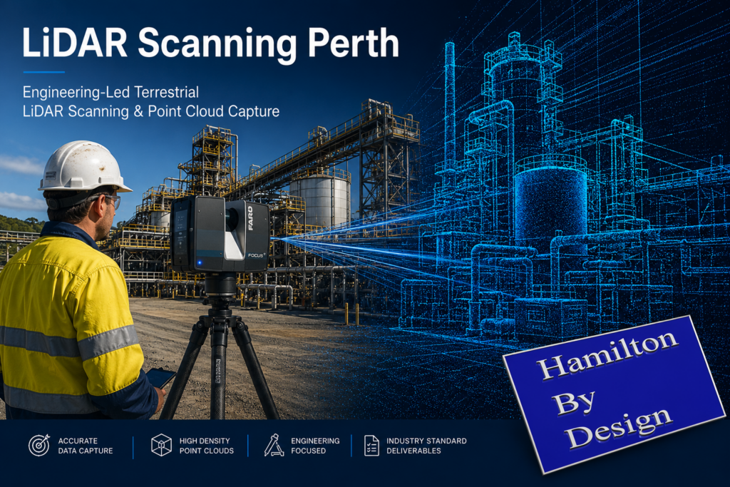
LiDAR Scanning Perth promotional banner showing a terrestrial laser scanner capturing an industrial processing facility, with a digital point cloud overlay illustrating engineering-led reality capture and high-density data collection.

LiDAR Scanning Applications Across Western Australia

Western Australia is home to some of the world’s largest mining, processing, manufacturing and infrastructure assets. From metropolitan Perth through to the Pilbara, Goldfields and South West regions, organisations are increasingly adopting LiDAR scanning technologies to improve the way existing assets are documented, maintained and upgraded.

LiDAR scanning is particularly well suited to environments where accurate existing-condition information is critical for planning, engineering, construction and asset management activities. By capturing millions of measurement points, facilities can be documented quickly and accurately, providing stakeholders with a reliable digital representation of the physical environment.

Across Western Australia, LiDAR scanning is commonly applied within:

Mining Operations

Mining facilities often contain extensive materials handling systems, processing infrastructure, workshops, storage facilities and supporting assets. LiDAR scanning can assist with documenting existing conditions, planning upgrades and supporting brownfield expansion projects while reducing reliance on outdated drawings and manual measurements.

Mineral Processing Facilities

Mineral processing plants are continuously evolving as equipment is upgraded, replaced or modified to improve performance. LiDAR scanning enables plant operators and project teams to capture current site conditions before undertaking engineering studies, shutdown activities or capital projects.

Refineries and Smelters

Refineries and smelting operations contain complex networks of process equipment, pipework, structural steel and access systems. Accurate digital records can support maintenance planning, asset management initiatives and future project development by providing a detailed understanding of the existing facility layout.

Ports and Bulk Materials Handling Infrastructure

Western Australia’s export industries rely on extensive bulk materials handling infrastructure including conveyors, transfer stations, stockpile facilities and ship-loading systems. LiDAR scanning can assist with documenting these assets and supporting maintenance, refurbishment and expansion activities.

Industrial Manufacturing Facilities

Manufacturing facilities frequently require equipment upgrades, production line modifications and plant optimisation projects. LiDAR scanning provides a comprehensive record of existing conditions that can support planning and project coordination activities.

Commercial and Institutional Assets

In addition to industrial facilities, LiDAR scanning is increasingly used to document commercial buildings, hospitals, educational campuses, transport infrastructure and public facilities. Accurate digital records can support refurbishment projects, asset management programs and long-term maintenance planning.

Hamilton By Design supports LiDAR scanning projects throughout Perth and Western Australia, including Kwinana, Pinjarra, Wagerup, Bunbury, Geraldton, Kalgoorlie, Port Hedland, Karratha and the Pilbara region. Our engineering-led approach combines practical industrial experience with advanced reality capture technologies to deliver accurate and reliable digital representations of existing assets.

As organisations continue to invest in digital engineering, asset management and operational efficiency, LiDAR scanning is becoming an increasingly valuable tool for understanding existing conditions and supporting informed decision-making across the entire asset lifecycle.

Why Choose Hamilton By Design for LiDAR Scanning Perth

Successful LiDAR scanning projects require more than the ability to operate a laser scanner. The real value lies in understanding how the captured information will be used and ensuring that the resulting dataset supports project objectives.

Hamilton By Design combines terrestrial LiDAR scanning technology with practical engineering, drafting and industrial experience. This enables us to understand the challenges commonly encountered within mining operations, mineral processing facilities, manufacturing plants, infrastructure assets and complex industrial environments.

Our approach focuses on capturing information that supports informed decision-making. By understanding project requirements before fieldwork begins, scan coverage, resolution and deliverables can be aligned with the intended use of the data, helping project teams obtain information that is relevant, accurate and practical.

We regularly support projects involving:

  • Mining and resource operations
  • Mineral processing facilities
  • Refineries and smelters
  • Materials handling systems
  • Manufacturing facilities
  • Infrastructure assets
  • Commercial and institutional buildings
  • Brownfield expansion projects
  • Asset management initiatives
  • Digital engineering programs

Hamilton By Design utilises professional terrestrial LiDAR scanning equipment and industry-standard processing workflows to produce registered point cloud datasets suitable for a wide range of engineering, operational and asset management applications.

Beyond data capture, our team understands how point cloud information is commonly used throughout the project lifecycle. This broader understanding assists in identifying critical areas for capture, supporting quality outcomes and ensuring project stakeholders receive information that can be effectively integrated into existing workflows.

We support projects throughout Perth and Western Australia, including regional mining and industrial locations where accurate existing-condition information is essential for planning, maintenance, engineering and capital works activities.

As organisations continue to adopt digital engineering and asset management practices, LiDAR scanning is becoming an increasingly important tool for capturing measured reality and establishing a reliable foundation for future project activities.

Hamilton By Design remains committed to providing engineering-led LiDAR scanning services that deliver accurate, dependable and practical digital information for industrial, infrastructure and commercial projects across Western Australia.

Frequently Asked Questions

What is LiDAR scanning?

LiDAR (Light Detection and Ranging) is a technology that uses laser pulses to measure the position of objects and surfaces within an environment. The collected measurements are combined to create a highly detailed three-dimensional representation known as a point cloud. LiDAR scanning is widely used to document existing facilities, infrastructure and industrial assets.

How accurate is terrestrial LiDAR scanning?

Accuracy depends on the equipment used, scan planning, site conditions and registration processes. Modern terrestrial LiDAR scanners are capable of capturing highly accurate measurements suitable for engineering, asset management and industrial applications. Quality assurance and data validation procedures are important to ensure reliable project outcomes.

What is a point cloud?

A point cloud is a collection of millions of individual measurement points captured during the scanning process. Each point represents a location in three-dimensional space. When combined, these points create a digital representation of the scanned environment that can be viewed, measured and analysed using specialised software.

What deliverables can be provided?

LiDAR scanning projects can produce a variety of deliverables depending on project requirements. Common outputs include registered point clouds, E57 files, RCP files, RCS files, LAS files and other industry-standard formats that can be used within engineering, construction and asset management workflows.

Can LiDAR scanning be completed during plant shutdowns?

Yes. LiDAR scanning is frequently used during shutdowns, maintenance outages and capital works projects. Capturing accurate existing-condition information before work begins can help project teams plan modifications, identify potential constraints and improve overall project coordination.

How long does a LiDAR scanning project take?

Project duration depends on the size and complexity of the facility being captured. Small areas may be completed within a single day, while large industrial facilities, processing plants or mining operations may require multiple days of fieldwork and additional processing time to register and validate the point cloud data.

Do you provide LiDAR scanning services outside Perth?

Yes. Hamilton By Design supports projects throughout Western Australia, including mining, industrial and infrastructure locations. Services can be provided across Perth, Kwinana, Pinjarra, Wagerup, Bunbury, Geraldton, Kalgoorlie, Port Hedland, Karratha and the Pilbara region, as well as interstate locations where required.

What industries commonly use LiDAR scanning?

LiDAR scanning is used across a wide range of industries including mining, mineral processing, manufacturing, oil and gas, infrastructure, utilities, water treatment, ports, transport, commercial construction and asset management. The technology provides accurate existing-condition information that can support planning, maintenance, engineering and operational activities.

Many organisations are adopting digital engineering and asset management practices that require reliable existing-condition information. LiDAR scanning enables facilities to be captured quickly and accurately, providing a digital record that can support decision-making throughout the lifecycle of an asset.

Can point cloud data be used in engineering software?

Yes. Point cloud datasets can typically be imported into a range of engineering, design and modelling software platforms. This allows project teams to reference existing site conditions, extract measurements and integrate scanned information into digital engineering workflows.


Hamilton By Design logo displayed on a blue tilted rectangle with a grey gradient background
3D LiDAR scanning and 3D modelling service button โ€” laser scanner capturing a point cloud for engineering and CAD modelling
Mechanical engineering services

Discuss Your LiDAR Scanning Project

Whether you are planning a plant upgrade, documenting existing assets, preparing for a shutdown, or investigating digital engineering opportunities, accurate existing-condition information is the foundation of successful project delivery.

Hamilton By Design provides engineering-led terrestrial LiDAR scanning services throughout Perth and Western Australia, supporting mining operations, processing facilities, industrial plants, infrastructure assets and commercial projects.

Our team can help determine the most suitable scanning approach, required deliverables and level of detail needed to achieve your project objectives.

Complete the enquiry form below and tell us about your project requirements.

A member of our team will review your information and contact you to discuss scope, site access, deliverables, project timing and any technical requirements.

Typical Information to Include

  • Project location
  • Facility or asset type
  • Approximate area to be scanned
  • Required deliverables
  • Project timeframe
  • Site access requirements
  • Shutdown or outage windows
  • Any existing drawings or reference information

Need advice before requesting a quotation?

We are happy to discuss your project requirements and provide guidance on scanning methodology, deliverables and project planning before work commences.
Mechanical Engineering Perth WA banner for Hamilton By Design featuring white text on a blue background.
3D Laser Scanning Perth WA banner for Hamilton By Design with white text on a blue background.
SolidWorks Perth WA banner for Hamilton By Design featuring white text on a blue background.

Ready for 3D Scanning in Perth or WA?

Speak to our engineering team about your project, shutdown or scanning requirements.

Name
You would like to:

As-Built Drawings from a LiDAR Scanner


Bridging Reality and Design: How 3D Scanning + 3D Modelling Supercharge Mining Process Plants

In mining and mineral processing environments, small mis-fits, outdated drawings, or inaccurate assumptions can translate into shutdowns, costly rework, or worse, safety incidents. For PMs, superintendents, engineering managers and plants operating under heavy uptime and safety constraints, combining 3D scanning and 3D modelling isnโ€™t just โ€œnice to haveโ€ โ€” itโ€™s becoming essential. At Hamilton By Design, weโ€™ve leveraged this combination to deliver greater predictability, lower cost, and improved safety across multiple projects.


What are 3D Scanning and 3D Modelling?

  • 3D Scanning (via LiDAR, laser, terrestrial/mobile scanners): captures the existing geometry of structures, equipment, piping, chutes, supports, tanks, etc., as a dense point cloud. Creates a digital โ€œreality captureโ€ of the plant in its current (often messy) state.
  • 3D Modelling: turning that data (point clouds, mesh) into clean, usable engineering-geometry โ€” CAD models, as-built / retrofit layouts, clash-detection, wear mapping, digital twins, etc.

The power comes when you integrate the two โ€” when the reality captured in scan form feeds directly into your modelling/design workflows rather than being a separate survey activity thatโ€™s then โ€œinterpretedโ€ or โ€œassumed.โ€


Why Combine Scanning + Modelling? Key Benefits

Here are the main advantages you get when you deploy both in an integrated workflow:

BenefitWhat it Means for PMs / Engineering / Plant OpsExamples / Impacts
Accuracy & Reality VerificationVerify whatโ€™s actually in the plant vs what drawings say. Identify deformations, misalignments, wear, obstructions, or changes that werenโ€™t captured in paper drawings.Mill liner wear profiles; chute/hopper buildup; misaligned conveyors or supports discovered post-scan.
Reduced Risk, Safer AccessScanning can be done with limited or no shutdown, and from safer vantage points. Less need for personnel to enter hazardous or confined spaces.Scanning inside crushers, under conveyors, or at height without scaffolding.
Time & Cost SavingsFaster surveying; fewer repeat field trips; less rework; fewer surprises during shutdowns or retrofit work.Scan once, model many; clashes found in model instead of in the field; pre-fabrication of replacement parts.
Better Shutdown / Retrofit PlanningUse accurate as-built models so new equipment fits, interferences are caught, installation time is optimized.New pipelines routed without conflict; steelwork/supports prefabricated; shutdown windows shortened.
Maintenance & Asset Lifecycle ManagementScan history becomes a baseline for monitoring wear or deformation. Enables predictive maintenance rather than reactive.Comparing scans over time to track wear; scheduling relining of chutes; monitoring structural integrity.
Improved Decision Making & VisualisationEngineers, superintendents, planners can visualise the plant as it is โ€” space constraints, access routes, clearances โ€” before making decisions.Clash-detection between new and existing frames; planning maintenance access; safety audits.
Digital Twin / Integration for Future-Ready PlantOnce you have accurate geometric models you can integrate with IoT, process data, simulation tools, condition monitoring etc.Digital twins that simulate flow, energy use, wear; using scan data to feed CFD or FEA; feeding into operational dashboards.

Challenges & How to Overcome Them

Of course, there are pitfalls. Ensuring scanning + modelling delivers value requires attention to:

  • Planning the scanning campaign (scan positions, control points, resolution) to avoid shadow zones or missing data.
  • Choosing hardware and equipment that can operate under plant conditions (dust, vibration, temperature, restricted access).
  • Processing & registration of point clouds, managing the large data sets, and ensuring clean, usable models.
  • Ensuring modelling workflow aligns with engineering design tools (CAD systems, formats, tolerances) so that the scan data is usable without excessive cleanup.
  • Maintaining the model: when plant layouts or equipment change, keeping the scan or model up to date so your decisions are based on recent reality.

At Hamilton By Design we emphasise these aspects; our scan-to-CAD workflows are built to align with plant engineering needs, and we help clients plan and manage the full lifecycle.


Real World Applications in Mining & Process Plants

Hereโ€™s how combined scanning + modelling is applied (and what you might look for in your own facility):

  • Wear & Relining: scanning mill, crusher liners, chutes or hoppers to model wear profiles; predict failures; design replacement parts that fit exactly.
  • Retrofits & Expansions: mapping existing steel, pipe racks, conveyors, etc., creating accurate โ€œas builtโ€ model, checking for clashes, optimizing layouts, prefabricating supports.
  • Stockpile / Volumetric Monitoring: using scans or LiDAR to measure stockpile volumes for planning and reporting; integrating with models to monitor material movement and flow.
  • Safety & Clearance Checking: verifying that walkways, egress paths, platforms have maintained their clearances; assess structural changes; check for deformation or damage.
  • Shutdown Planning: using accurate 3D models to plan the scope, access, scaffold/frame erection, pipe removal etc., so shutdown time is minimised.

Why Choose Hamilton By Design

To get full value from the scan + model combination, you need more than just โ€œweโ€™ll scan itโ€ or โ€œweโ€™ll make a modelโ€ โ€” you need a partner who understands both the field realities and the engineering rigour. Here’s where Hamilton By Design excels:

  • Strong engineering experience in mining & processing plant settings, so we know what level of detail, what tolerances, and what access constraints matter.
  • Proven tools & workflows: from LiDAR / laser scanner work that captures site conditions even under harsh conditions, to solid CAD modelling/reporting that aligns with your fabrication/installation requirements.
  • Scan-to-CAD workflows: not just raw point clouds, but models that feed directly into design, maintenance, procurement and operations.
  • Focus on accuracy, safety, and reduced downtime: ensuring that field work, design, installation etc., are as efficient and risk-averse as possible.
  • Use of modern digital techniques (digital twins, clash detection etc.) so that data isnโ€™t just stored, but actively used to drive improvements.

Practical Steps to Get Started / Best Practice Tips

If youโ€™re managing a plant or engineering project, here are some steps to adopt scanning + modelling optimally:

  1. Define Clear Objectives: What do you want from this scan + model? Wear profiles, retrofit, layout changes, safety audit etc.
  2. Survey Planning: Decide scan positions, control points, resolution (density) based on the objectives and site constraints. Consider access, safety, shutdown windows.
  3. Use Appropriate Hardware: Choose scanners suited to environment (dust, heat), also ensure regulatory and IP protection etc.
  4. Data Processing & Modelling Tools: Have the capacity/software to register, clean, mesh or extract CAD geometry.
  5. Integrate into Existing Engineering Processes: Ensure the outputs are compatible with your CAD standards, procurement, installation etc.
  6. Iterate & Maintain: Frequent scans over time to track changes; update models when plant changes; feed maintenance, design and operations with new data.

Conclusion

In mining process plants, time, safety, and certainty matter. By combining 3D scanning with sound 3D modelling you donโ€™t just get a snapshot of your plant โ€” you gain a powerful toolset to reduce downtime, avoid rework, improve safety, and enhance decision-making.

If youโ€™re responsible for uptime, capital works, maintenance or process improvements, this integration can reshape how you plan, maintain, and operate. At Hamilton By Design, weโ€™re helping clients in Australia harness this power โ€” turning reality into design confidence, and giving stakeholders peace of mind that the layout, equipment, and safety are aligned not to yesterdayโ€™s drawings but to todayโ€™s reality.

Name
Would you like us to arrange a phone consultation for you?
Address
3D LiDAR scanning and 3D modelling service button โ€” laser scanner capturing a point cloud for engineering and CAD modelling
Mechanical engineering services
Finite Element Analysis (FEA) engineering simulation button
Mechanical engineering services
3D LiDAR Scanning Darwin for engineering surveys, laser scanning, reality capture and point cloud modelling services
3D LiDAR Scanning Australia engineering services for laser scanning, reality capture, scan-to-CAD, Scan-to-BIM and as-built documentation across Australia
3D LiDAR scanning services on the Central Coast providing engineering-grade laser scanning, point cloud capture, scan-to-CAD modelling and industrial reality capture for infrastructure and industrial projects.
3D LiDAR Scanning Perth for engineering surveys, laser scanning, reality capture and point cloud modelling services
3D LiDAR Scanning Sydney for engineering surveys, laser scanning, reality capture and point cloud modelling services
3D LiDAR Scanning Brisbane for engineering surveys, laser scanning, reality capture and point cloud modelling services
3D LiDAR Scanning Canberra for engineering surveys, laser scanning, reality capture and point cloud modelling services
3D LiDAR Scanning Newcastle for engineering surveys, laser scanning, reality capture and point cloud modelling services
3D LiDAR Scanning Adelaide for engineering surveys, laser scanning, reality capture and point cloud modelling services

From 3D Scanning to Digital Twins: The Next Step in Mining Data

Mining is evolving faster than ever.
What was once an industry defined by physical muscle โ€” haul trucks, crushers, conveyors โ€” is now being transformed by data intelligence, digital modelling, and real-time insight.

At the heart of this transformation lies a quiet revolution: 3D scanning.
Once used primarily for design verification or plant modification, scanning is now the gateway technology that feeds the emerging world of digital twins โ€” live, data-driven replicas of mine assets that help engineers predict, plan, and optimise before problems occur.

At Hamilton By Design, weโ€™ve spent years scanning and modelling chutes, hoppers, and material-handling systems across Australiaโ€™s mining sector. Each project has shown us one thing clearly:

Scanning isnโ€™t just about geometry โ€” itโ€™s about knowledge.
And digital twins are the next logical step in turning that knowledge into action.


What Exactly Is a Digital Twin?

Think of a digital twin as the digital counterpart of a physical asset โ€” a chute, a conveyor, a processing plant, even an entire mine site.

Itโ€™s not a static 3D model; itโ€™s a dynamic, data-linked environment that mirrors the real system in near real time.
Sensors feed performance data into the twin: wear rates, temperature, vibration, flow speed, throughput. The twin then responds, updating its state and allowing engineers to simulate scenarios, forecast failures, and test design changes before touching the physical equipment.

In essence, a digital twin gives you a real-time window into the life of your assets โ€” one thatโ€™s predictive, not reactive.


How 3D Scanning Powers the Digital Twin

To create a digital twin, you first need an accurate foundation โ€” and thatโ€™s where 3D scanning comes in.
The twin can only be as good as the geometry beneath it.

Laser scanning or LiDAR technology captures millimetre-accurate measurements of chutes, hoppers, crushers, conveyors, and processing structures.
This creates a precise 3D โ€œas-isโ€ model โ€” not what the plant was designed to be, but what it actually is after years of wear, repair, and modification.

That baseline geometry is then aligned with:

  • Operational data from sensors and PLCs (e.g. flow rates, temperatures, vibrations)
  • Material behaviour data from CFD and wear simulations
  • Design intent data from CAD and engineering archives

Once these layers are synchronised, the model becomes a living system โ€” continuously updated, measurable, and comparable to its physical twin.

You can see how we capture and prepare that foundation in our detailed article:
3D Scanning Chutes, Hoppers & Mining


From Reactive Maintenance to Predictive Performance

In most operations today, maintenance still works on a reactive cycle โ€” wait for a fault, shut down, repair, restart.
Itโ€™s expensive, unpredictable, and risky.

With digital twins, that model flips.
Instead of waiting for wear to become a failure, the twin uses real-time and historical data to forecast when parts will reach their limits.
The result is predictive maintenance โ€” planning shutdowns based on evidence, not emergency.

Imagine being able to simulate how a chute will behave under new flow conditions, or when a liner will reach its critical wear thickness, before you commit to a shutdown.
Thatโ€™s not future-speak โ€” itโ€™s what forward-thinking operators are doing right now.

Every hour of avoided downtime can mean tens or even hundreds of thousands of dollars saved.
Even a modest 5 % reduction in unplanned outages can add millions to annual output.


Integrating Scanning, Simulation, and Sensors

A full digital-twin workflow in mining usually includes four steps:

  1. Capture: 3D scanning provides the exact geometry of the asset.
  2. Model: Engineers integrate the geometry with CAD, CFD, and FEA models.
  3. Connect: Real-time data from sensors is linked to the model.
  4. Predict: Algorithms and engineers analyse the twin to predict future performance.

The power lies in connection.
Each new scan or dataset strengthens the model, improving its predictive accuracy. Over time, the digital twin evolves into a decision-support system for engineers, planners, and maintenance teams.


Real-World Applications Across the Mining Value Chain

1. Chute & Hopper Optimisation

Flow issues, blockages, and uneven wear can be modelled digitally before modifications are made.
This reduces trial-and-error shutdowns and improves throughput reliability.

2. Conveyor Alignment

Scanning allows engineers to identify misalignment over kilometres of belting.
A digital twin can then simulate tracking and tension to prevent belt failures.

3. Crusher and Mill Wear

By combining periodic scans with wear sensors, operators can visualise material loss and forecast replacement schedules.

4. Structural Monitoring

3D scanning enables long-term comparison between โ€œas-builtโ€ and โ€œas-maintainedโ€ geometry, detecting distortion or settlement early.

Each of these applications reinforces a core insight:

The line between mechanical engineering and data engineering is disappearing.


Why Digital Twins Matter for Australiaโ€™s Mining Future

Australiaโ€™s competitive advantage has always been resource-based.
But the next advantage will be knowledge-based โ€” how well we understand, model, and optimise those resources.

Digital twins represent that shift from raw extraction to engineering intelligence.
They help miners lower costs, reduce emissions, and improve safety, while extending asset life and reliability.

As Australia pushes toward decarbonisation and productivity targets, technologies like scanning and digital twinning will underpin the next generation of sustainable mining design.


The Hamilton By Design Approach

Our philosophy is simple: technology only matters if it serves engineering integrity.
Thatโ€™s why our process always begins with real-world problems โ€” not software.

  1. Field Capture: We conduct high-resolution 3D scans under live or shutdown conditions.
  2. Engineering Integration: Our designers and mechanical engineers turn that data into usable CAD and FEA models.
  3. Digital Twin Setup: We connect the digital model to operational data, creating a living reference that evolves with the asset.
  4. Continuous Support: We monitor, re-scan, and update as assets change.

This approach ensures every digital twin remains a tool for decision-making, not just a visualisation exercise.


A Connected Knowledge Chain

This article builds on our earlier discussion:


Digital Precision in Mining: How 3D Scanning Transforms Maintenance, Design, and Safety

That piece explored how scanning replaces manual measurement with safe, precise, data-rich modelling.
Digital twins take that same data and carry it forward โ€” connecting it to predictive insights and automated planning.

The flow looks like this:

3D Scan โ†’ Model โ†’ Digital Twin โ†’ Predict โ†’ Improve โ†’ Re-scan

Each loop makes the operation smarter, safer, and more efficient.


Lessons from Global Mining Leaders

  • Rio Tinto and BHP are already trialling digital twins for rail networks, conveyors, and entire processing plants.
  • Anglo American uses twin models to monitor tailings dam integrity, integrating LiDAR scans with geotechnical sensors.
  • Fortescue has explored twin-based predictive maintenance for haulage and fixed plant systems.

Internationally, countries like Finland and Canada have established digital-twin testbeds for mine ventilation, environmental monitoring, and process control โ€” demonstrating that twinning isnโ€™t a luxury, itโ€™s a competitive necessity.


Looking Forward: The Road to Real-Time Mines

The next decade will see digital twins move from project pilots to enterprise-wide ecosystems.
Future systems will integrate:

  • IoT sensors streaming continuous data
  • AI algorithms identifying anomalies in real time
  • Augmented-reality tools allowing operators to โ€œseeโ€ the twin overlaid on the physical plant

Combined, these will make mines safer, cleaner, and more efficient โ€” driven by data instead of downtime.


The Broader Economic Story

The technologyโ€™s value doesnโ€™t stop at the mine gate.
As digital twins become standard across energy, infrastructure, and manufacturing, Australiaโ€™s engineering capability grows alongside GDP.

Every dollar invested in scanning and twin development creates long-term dividends in productivity and sustainability.
By connecting our data and design skills to resource industries, we strengthen both our domestic economy and our global competitiveness.


Building Smarter, Safer, and More Predictable Mines

Mining will always be a physically demanding industry โ€” but its future will be defined by how intelligently we manage that physicality.

From the first laser scan to the fully connected digital twin, every step tightens the link between information and performance.

At Hamilton By Design, weโ€™re proud to stand at that intersection โ€” where mechanical precision meets digital innovation.
We help our clients not just capture data, but understand it โ€” turning measurements into models, and models into insight.

Because when you can see your mine in full digital clarity, you can shape its future with confidence.

Mechanical Engineering | Structural Engineering

Mechanical Drafting | Structural Drafting

3D CAD Modelling | 3D Scanning

Chute Design

SolidWorks Contractors in Australia

Hamilton By Design โ€“ Blog

Custom Designed – Shipping Containers

Coal Chute Design

Mechanical Engineers in Sydney


3D Scanning Sydney banner promoting engineering-grade 3D laser scanning, LiDAR scanning, and reality capture services by Hamilton By Design.
Mechanical Engineering Sydney banner with white text on a blue background representing Hamilton By Design's mechanical engineering services in Sydney.
Mechanical Drafting and 3D Modelling Sydney banner highlighting Hamilton By Design's CAD drafting, 3D modelling, and engineering design services in Sydney.

Mechanical Engineering | Structural Engineering


Digital Precision in Mining: How 3D Scanning Transforms Maintenance, Design, and Safety

Mining is no longer just about moving tonnes โ€” itโ€™s about precision, predictability, and performance.
Across Australiaโ€™s mining sector, the most forward-looking operators are adopting 3D scanning to transform the way they maintain and optimise chutes, hoppers, and material-handling systems.

At Hamilton By Design, weโ€™ve been applying advanced scanning technology to reduce downtime, improve plant design accuracy, and extend asset life.
You can read our detailed technical overview here:
๐Ÿ‘‰ 3D Scanning Chutes, Hoppers & Mining

But hereโ€™s the bigger picture โ€” why this shift matters for the future of mining.


From Manual Inspection to Measured Insight

Traditional inspections rely on tape measures, hand sketches, and assumptions.
3D laser scanning replaces that guesswork with millimetre-accurate data captured safely, often without shutting down production.

  • Reduced risk: Personnel spend less time inside confined spaces.
  • Shorter shutdowns: Entire structures can be captured in minutes.
  • Design-ready models: Engineers receive CAD-compatible data for modification or replacement.

This means decisions are made on facts, not estimates.


Integrating Data into the Design Cycle

The true value of scanning is unlocked when the data feeds directly into design and maintenance workflows.
Once a chute or hopper is scanned, engineers can:

  • Compare actual geometry to design intent.
  • Detect deformation, wear patterns, and misalignment early.
  • Pre-fit replacement liners or components in CAD โ€” reducing on-site rework.

This seamless link between field reality and digital design enables data-driven engineering, saving both time and capital.


A New Standard for Asset Reliability

3D scanning creates a living record of your assets.
Each scan becomes a baseline for future condition monitoring, allowing for proactive maintenance scheduling.

When combined with finite-element analysis (FEA) or wear modelling, site managers can predict failures before they happen.
That means safer plants, lower maintenance costs, and fewer unplanned stoppages.


Part of a Larger Digital Ecosystem

The rise of digital twins and predictive analytics in mining depends on accurate base geometry โ€” and thatโ€™s where scanning fits in.
By capturing exact dimensions, operators can:

  • Link asset data into their digital twin models.
  • Simulate flow behaviour and wear progression.
  • Train AI models using accurate 3D data.

3D scanning isnโ€™t just a tool โ€” itโ€™s the foundation of intelligent mining operations.


Why Hamilton By Design?

Our engineering approach combines field experience with digital precision.
We integrate scanning, modelling, and mechanical design into a single workflow โ€” from problem definition to implementable solutions.

Whether youโ€™re replacing a worn-out chute, upgrading a hopper, or building a new transfer station, our 3D scanning process gives you clarity, accuracy, and confidence.

Learn more about our methodology and recent projects here:
3D Scanning Chutes, Hoppers & Mining

Mechanical Engineering | Structural Engineering

Mechanical Drafting | Structural Drafting

3D CAD Modelling | 3D Scanning

Chute Design

SolidWorks Contractors in Australia

Hamilton By Design โ€“ Blog

Custom Designed – Shipping Containers

Coal Chute Design

Mechanical Engineers in Sydney


3D Scanning Sydney banner promoting engineering-grade 3D laser scanning, LiDAR scanning, and reality capture services by Hamilton By Design.
Mechanical Engineering Sydney banner with white text on a blue background representing Hamilton By Design's mechanical engineering services in Sydney.
Mechanical Drafting and 3D Modelling Sydney banner highlighting Hamilton By Design's CAD drafting, 3D modelling, and engineering design services in Sydney.

Mechanical Engineering | Structural Engineering


Opinion: What Cutting 50% of Australiaโ€™s Iron Ore Exports to China Would Really Mean


By Anthony Hamilton, Mechanical Engineer and Industry Analyst


Australiaโ€™s relationship with China has always been a balancing act between economic dependence and strategic independence. Nowhere is that tension clearer than in our trade of iron ore โ€” the mineral that built both our national budget and Chinaโ€™s skyline.

Imagine, then, a bold decision: Australia deliberately cuts its iron ore exports to China by half and pivots toward domestic manufacturing โ€” especially green steel and renewable-powered industry. What would that mean for our economy, our global influence, and our future as an industrial nation?

The answer is both disruptive and transformative.


The Shock: Short-Term Pain

Letโ€™s be clear: halving iron ore exports would jolt the economy.

Australia exported about 900 million tonnes of iron ore in 2024โ€“25, worth roughly A$160 billion, with China buying four-fifths of it. Slashing that volume by half would pull A$80โ€“90 billion out of export revenue almost overnight. Even if prices spiked 50% amid global shortages, our GDP would still take a hit of 2โ€“3% in the first years โ€” a deliberate, self-imposed economic slowdown.

Western Australia, which lives and breathes the ore trade, would feel it most: reduced royalties, idle capacity, and strained state budgets. Canberraโ€™s tax intake could drop by A$10โ€“15 billion per year in the early phase.

But these are short-term tremors โ€” not structural decline. The question is whether we can replace raw-ore exports with something better: value-added industrial activity on Australian soil.


The Transition: Turning Rocks into Revenue

If half of that diverted ore were converted into green steel, the economic story changes dramatically.
One tonne of steel is worth four to six times more than the same tonne of ore. Even modest domestic processing could create an A$100 billion green industry within a decade โ€” generating thousands of high-skill jobs across hydrogen, renewables, materials science, and engineering.

Projects in Whyalla, Gladstone, and the Pilbara already point the way. With the right investment โ€” perhaps A$60โ€“100 billion over ten years โ€” Australia could build the capacity to supply its own construction, defence, and transport sectors while exporting carbon-neutral steel to the world.

Thatโ€™s not deglobalisation. Itโ€™s smart industrialisation โ€” keeping the value chain at home instead of shipping our competitive advantage overseas.


The Payoff: Long-Term Strength

By 2035, the payoff could be substantial:

  • GDP grows larger and more balanced, driven by advanced manufacturing.
  • Australia becomes a reliable producer of green steel, battery materials, and hydrogen infrastructure.
  • Dependence on Chinese demand declines, while new trade with India, Japan, Korea, and Europe expands.

In this scenario, Australiaโ€™s GDP could be 2โ€“4% higher than the business-as-usual case โ€” smaller mining exports, but far greater industrial depth. Itโ€™s a shift from volume to value, from being the worldโ€™s quarry to being part of its workshop again.


The Risk: A Test of Political Will

Such a move isnโ€™t without risk. China would almost certainly retaliate โ€” delaying other imports, applying political pressure, and exploiting our internal divisions.
The mining lobby would fight hard to protect its margins. Politicians would face the same question every reformer does: why risk the comfortable present for an uncertain future?

Yet the uncomfortable truth is that comfort has bred complacency.
Australiaโ€™s prosperity is overly reliant on shipping low-value resources to one buyer. Thatโ€™s not economic freedom โ€” its dependency dressed as success.


The Opportunity: Building the Next Holden Moment

Half a century ago, Holden symbolised a confident, self-sufficient industrial Australia. Its closure marked the end of that era.
A green-steel renaissance could be the new Holden moment โ€” a chance to reconnect engineering, manufacturing, and national purpose. It would anchor new jobs, restore industrial pride, and ensure that Australia competes not on cost, but on competence.

Weโ€™d still dig things up โ€” but weโ€™d also make things again.


Conclusion: A Strategic Rebalance, Not an Economic Gamble

Cutting 50% of iron ore exports to China would be a strategic recalibration, not an act of economic self-harm. It would cost us in the short run, but it could redefine us in the long run โ€” from a resource economy to a resilient, innovation-driven nation.

For decades, Australiaโ€™s industrial conversation has ended with one refrain: โ€œWe canโ€™t afford to make things anymore.โ€
Perhaps the truth is the opposite.

We canโ€™t afford not to.


Mechanical Engineering | Structural Engineering

3D Scanning Sydney banner promoting engineering-grade 3D laser scanning, LiDAR scanning, and reality capture services by Hamilton By Design.
Mechanical Engineering Sydney banner with white text on a blue background representing Hamilton By Design's mechanical engineering services in Sydney.
Mechanical Drafting and 3D Modelling Sydney banner highlighting Hamilton By Design's CAD drafting, 3D modelling, and engineering design services in Sydney.

Mechanical Drafting | Structural Drafting

3D CAD Modelling | 3D Scanning

Chute Design

SolidWorks Contractors in Australia

Hamilton By Design โ€“ Blog

Custom Designed – Shipping Containers

Coal Chute Design

Mechanical Engineers in Sydney

3D LiDAR scanning and 3D modelling service button โ€” laser scanner capturing a point cloud for engineering and CAD modelling
Mechanical engineering services


Finite Element Analysis (FEA) engineering simulation button
Mechanical engineering services


3D CAD Modelling Australia service banner for Hamilton By Design


CHPP Engineering title graphic featuring bold white text reading "CHPP Engineering" centred on a blue rounded rectangle background.
Pipework Drafting title graphic featuring bold white text reading "Pipework Drafting" centred on a blue rounded rectangle background.
3D LiDAR Scanning for Engineering Projects title graphic featuring bold white text on a blue rounded rectangle background.


Finite Element Analysis (FEA) engineering simulation button
Structural drafting services button
Mechanical drafting services button


Australian Drafting logo featuring bold white text reading "Australian Drafting" centred on a blue rounded rectangle background.
Engineering Governance title graphic featuring bold white text reading "Engineering Governance" centred on a blue rounded rectangle background.
Engineering-Grade LiDAR Scanning title graphic featuring bold white text on a blue rounded rectangle background.


3D Scanning Sydney banner promoting engineering-grade 3D laser scanning, LiDAR scanning, and reality capture services by Hamilton By Design.
Mechanical Engineering Sydney banner with white text on a blue background representing Hamilton By Design's mechanical engineering services in Sydney.
Mechanical Drafting and 3D Modelling Sydney banner highlighting Hamilton By Design's CAD drafting, 3D modelling, and engineering design services in Sydney.

Mechanical Engineering | Structural Engineering


Engineering Integrity, Failure Evolution, and Energy Transition: A Mechanical Engineerโ€™s Perspective on Australiaโ€™s Ageing Coal Fleet

This paper examines the mechanical degradation, failure mechanisms, and system-level reliability implications of Australiaโ€™s ageing coal-fired power generation assets, focusing on Callide Power Station (Queensland) and Yallourn Power Station (Victoria). Both stations have experienced significant mechanical failures in the past five years, exposing vulnerabilities in maintenance, asset management, and risk governance under conditions of declining reinvestment.
From a mechanical engineering standpoint, these failures illustrate the predictable end-of-life behaviour of large rotating and pressure-bound systems when maintenance expenditure, material renewal, and operational monitoring decline. The paper argues that sustained industrial reliabilityโ€”and thus national energy and employment securityโ€”requires engineering-informed policy that balances decarbonisation with technical integrity management.


Coal-fired power stations are among the most complex mechanical systems ever built in Australia. They integrate high-temperature, high-pressure thermodynamic processes with massive rotating equipment, lubrication systems, and precision alignment tolerances.

From a mechanical engineerโ€™s perspective, their reliability depends on three interlinked pillars:

  1. Structural and material integrity,
  2. Lubrication and vibration control, and
  3. Predictive maintenance and monitoring.

However, as the nation accelerates toward renewable transition targets, investment in these legacy systems has declined. Mechanical failures at Callide and Yallourn are therefore not random accidents but the mechanical manifestation of economic and policy choices.

This analysis seeks to understand those failures in engineering terms, predict future risks, and outline how a re-commitment to industrial infrastructure and jobs requires a concurrent commitment to mechanical reliability.


Technical Overview of Recent Failures

Callide Power Station

Callideโ€™s units span several generations of design and material technology. The C4 explosion (2021) was catastrophic: the failure originated within the turbine hall, leading to structural collapse and large-scale ejection of debris.
Subsequent analysis by CS Energy and external investigators identified battery charger replacement errors, inadequate isolation protocols, and loss of process safety discipline as initiators.

From an engineering integrity perspective, the incident represents a compound failure:

  • Mechanical systems operated under degraded conditions;
  • Electrical and process-control systems failed to detect early anomalies;
  • Organisational maintenance controls were insufficient to interrupt escalation.

Later failures โ€” including the C3 boiler pressure event (2025) and cooling tower collapse (2022) โ€” further confirm that structural materials, corrosion protection, and load-carrying assemblies had entered the fatigueโ€“creep interaction phase of their service life.

Yallourn Power Station

At Yallourn, the August 2025 low-pressure turbine dislodgement occurred after decades of vibration monitoring alarms and bearing wear signals. Earlier (2024) shutdowns for โ€œhigh vibration alarmsโ€ indicated growing rotor dynamic instability.
When the Unit 2 turbine dislodged, the damage pattern suggested bearing wear, misalignment, or bolt relaxation leading to component displacement.

In mechanical engineering terms, this is a classic late-life failure sequence:

  1. Fatigue crack initiation in critical load-carrying components (rotor or coupling bolts),
  2. Progressive loosening and unbalance,
  3. Dynamic amplification under operating RPM,
  4. Catastrophic structural displacement.

The turbineโ€™s dislodgement was therefore an expected end-of-life event, accelerated by reduced overhaul investment and ageing metallurgical properties.


Comparative Engineering Analysis

Engineering DimensionCallideYallournComparison / Insight
Failure TypeExplosion / Pressure Containment BreachTurbine Mechanical DislodgementCallide shows energy-release failure; Yallourn a structural integrity loss.
Root Mechanical CauseOverpressure / process safetyFatigue, unbalance, bearing or bolt failureBoth reflect cumulative degradation.
Indicative Material StateCreep-fatigued pressure shells; corroded supportsThermal-fatigued steel, worn journalsMetallurgical ageing dominates both.
Maintenance CultureProcess-safety erosionReactive, โ€œrun-to-retirementโ€Organisational degradation common factor.
System OutcomeExplosion and total destructionSevere mechanical damage, unit outageBoth reduce grid reliability and reveal systemic neglect.

These failures share a unifying pattern recognised in mechanical reliability theory:

Late-life degradation compounded by maintenance deferral and organisational fatigue produces cascading mechanical failure modes that were once preventable.


Predicting Future Failure Behaviour

Mechanical engineers use reliability-centred maintenance (RCM) models to quantify end-of-life risk.
For rotating equipment, mean time to failure (MTTF) typically decreases exponentially once fatigue propagation exceeds ~70 % of material endurance life.

Data from the National Electricity Market (NEM) indicates:

  • Forced outage frequency has doubled since 2012.
  • Vibration and lubrication alarms are rising in frequency.
  • Unit unavailability correlates strongly (Rยฒ > 0.8) with turbine age and last major overhaul date.

Projected forward, these indicators imply that without major overhauls or component replacements, most Australian coal units will face critical mechanical reliability decline by 2032โ€“2035.


Engineering Economics and Policy Interaction

From an engineering management perspective, the problem is not purely technical โ€” it is thermo-economic.

  • A major turbine retrofit (~A$25โ€“40 million per unit) is uneconomic for plants scheduled for closure in under a decade.
  • Operators thus defer maintenance, accepting rising mechanical risk.
  • The probability of catastrophic failure increases sharply as the cost of prevention declines below the cost of repair.

This is the engineering expression of policy-induced obsolescence: political commitments to retire coal reduce the incentive to sustain its mechanical integrity, even while industries still depend on its output.


Industrial Reliability and the Employment Interface

Reliable baseload power is the foundation for industrial continuity.
From the standpoint of a mechanical engineer, industrial productivity is a function of mechanical uptime: Productivity=f(Power Reliability,Maintenance Efficiency)\text{Productivity} = f(\text{Power Reliability}, \text{Maintenance Efficiency})Productivity=f(Power Reliability,Maintenance Efficiency)

When power generation becomes intermittentโ€”whether from renewable intermittency or coal unreliabilityโ€”industrial operations must compensate with redundancy, backup generation, or load-shedding. These add capital and operational costs that ultimately affect employment.

Regional Implications

  • Queensland retains a stronger firm power horizon (coal + gas + hydro until ~2035), giving industry more operational certainty.
  • Victoria, by contrast, will face a reliability inflection point after Yallourn (2028) and Loy Yang A (2035) closures.

Without firm generation or large-scale storage online, manufacturing regions risk power volatilityโ€”directly translating to production downtime and job insecurity.


Engineering the Transition: Commitment to Jobs and Infrastructure

From a mechanical engineering ethics and systems standpoint, a commitment to industry must be synonymous with a commitment to mechanical reliability.
That requires three converging actions:

Asset Integrity Management:
Continuous structural health monitoring, vibration analysis, and overhaul planning for remaining thermal units.
Even in decline, they must be safely and predictably retired.

Design and Commissioning of Replacement Systems:
Engineers must ensure that renewable generation, storage, and transmission assets meet equivalent reliability and maintainability standards.
This includes redundancy design, grid inertia replacement, and mechanical resilience of large rotating machinery (e.g., pumped hydro, turbines, bearings).

Workforce Transition as Engineering Continuity:
The skills used to maintain turbines, bearings, and boilers are transferable to wind, hydro, and hydrogen equipment.
Protecting those jobs preserves both mechanical capability and national energy security.


Engineering Conclusions

From a mechanical engineerโ€™s viewpoint, the failures at Callide and Yallourn are textbook case studies of end-of-life degradation under policy-driven neglect.
They illustrate that:

  1. Mechanical degradation is predictable โ€” vibration, lubrication, and thermal-stress indicators were present years before failure.
  2. Organisational and policy decisions override engineering recommendations โ€” maintenance deferral was economic, not technical.
  3. Systemic reliability cannot be sustained without mechanical investment โ€” whether in turbines, batteries, or hydro equipment, engineering integrity remains central.
  4. A national commitment to industry equals a commitment to engineering.

If Australia seeks to safeguard its industrial base and employment, it must invest not only in new energy technologies but in the mechanical soundness of the systems that bridge the transition.
Neglecting this will reproduce the same failure patternsโ€”just in new forms of infrastructure.


References (Indicative)

  • CS Energy (2024). Callide C4 Incident Investigation Summary.
  • WattClarity (2025). Analysis of Yallourn Unit 2 Trip and Frequency Response.
  • AEMO (2025). Generator Reliability Performance Report.
  • EnergyAustralia (2025). Yallourn Mechanical Maintenance Overview.
  • IEEFA (2025). Delaying Coal Power Exits: Engineering and Economic Implications.
  • ASME (2023). Guidelines on Turbine Rotor Life Assessment and Remaining Life Prediction.
3D LiDAR scanning and 3D modelling service button โ€” laser scanner capturing a point cloud for engineering and CAD modelling
Mechanical engineering services


Finite Element Analysis (FEA) engineering simulation button
Mechanical engineering services


3D CAD Modelling Australia service banner for Hamilton By Design


CHPP Engineering title graphic featuring bold white text reading "CHPP Engineering" centred on a blue rounded rectangle background.
Pipework Drafting title graphic featuring bold white text reading "Pipework Drafting" centred on a blue rounded rectangle background.
3D LiDAR Scanning for Engineering Projects title graphic featuring bold white text on a blue rounded rectangle background.


Finite Element Analysis (FEA) engineering simulation button
Structural drafting services button
Mechanical drafting services button


Australian Drafting logo featuring bold white text reading "Australian Drafting" centred on a blue rounded rectangle background.
Engineering Governance title graphic featuring bold white text reading "Engineering Governance" centred on a blue rounded rectangle background.
Engineering-Grade LiDAR Scanning title graphic featuring bold white text on a blue rounded rectangle background.