Mechanical Engineering | 3D Scanning | 3D Modelling
Tag: fixed-plant-assets
Hamilton By Design provides fixed plant engineering, 3D scanning and CAD support for mining, materials-handling and mineral-processing facilities.
Fixed plant assets can include crushers, screens, conveyors, transfer chutes, bins, tanks, pumps, pipework, platforms, walkways and supporting structures. Accurate information about these assets is essential when planning maintenance, replacement equipment and brownfield plant modifications.
Our services include 3D LiDAR scanning, as-built capture, point-cloud registration, mechanical design, scan-to-CAD modelling, fabrication drawings and installation verification. Existing equipment and surrounding structures can be captured to help identify spatial constraints, connection points, maintenance access and potential clashes.
Models and drawings can support asset upgrades, shutdown planning, equipment replacement, reverse engineering and the development of reliable digital asset records. Deliverables may include registered point clouds, 3D CAD models, general arrangements, fabrication drawings and data for AutoCAD, SolidWorks, Inventor, ReCap and Navisworks workflows.
Services are available throughout NSW, Queensland, Western Australia, the Northern Territory and other mining and industrial regions across Australia.
Engineering Solutions for Manufacturers, Fabricators & Industrial Facilities Across the Coffs Coast
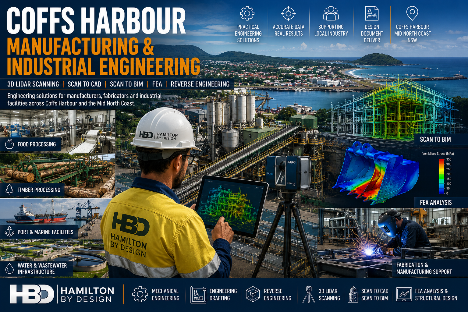
Hamilton By Design provides engineering-led mechanical engineering, 3D LiDAR scanning, Scan to CAD, Scan to BIM, reverse engineering, finite element analysis (FEA) and engineering drafting services throughout Coffs Harbour, Toormina, Sawtell, Woolgoolga, Grafton and the wider North Coast region.
Coffs Harbour is one of regional New South Wales’ most diverse industrial centres, supporting manufacturing, food processing, timber processing, transport infrastructure, marine industries, water utilities and industrial facilities.
As facilities expand and equipment ages, accurate engineering information becomes critical for reducing project risk, improving asset reliability and supporting future growth.
Hamilton By Design helps manufacturers, engineers, fabricators and industrial asset owners capture existing conditions, develop accurate engineering models and deliver practical engineering solutions for both brownfield and greenfield projects.
Engineering Services for Manufacturing & Industry
Supporting Regional Industry Growth
Our services support:
Manufacturers
Fabricators
Timber Processing Facilities
Food Processing Plants
Water Utilities
Industrial Workshops
Logistics Facilities
Airport Infrastructure
Marine Facilities
Government Infrastructure
Services include:
Mechanical Engineering
Engineering Design
Reverse Engineering
Engineering Drafting
FEA Analysis
3D LiDAR Scanning
Scan to CAD
Scan to BIM
Asset Documentation
3D LiDAR Scanning Coffs Harbour
Engineering Grade Reality Capture
Hamilton By Design provides engineering-grade terrestrial laser scanning services throughout Coffs Harbour and Northern NSW.
Laser scanning captures highly accurate site information that can be used for:
Existing Condition Surveys
Industrial Plant Upgrades
Manufacturing Facility Modifications
Structural Steel Modelling
Pipework Modelling
Asset Management
Construction Verification
Applications include:
Food Processing Facilities
Capture production equipment, processing lines, conveyors and services prior to upgrades and expansions.
Timber Processing Facilities
Accurately model sawmills, conveyors, log handling systems and timber processing infrastructure.
Industrial Manufacturing Facilities
Document existing plant conditions for engineering design and construction planning.
Sawmill & Timber Processing Engineering
Supporting Brownfield Upgrades
The North Coast has a strong timber processing industry with facilities often containing decades of modifications and undocumented changes.
Hamilton By Design supports:
Sawmill Expansions
Conveyor Upgrades
Dust Extraction Systems
Structural Modifications
Equipment Replacements
Facility Modernisation Projects
Using 3D LiDAR scanning and engineering modelling, we help reduce project risk and improve fabrication accuracy.
Scan to BIM Services
Building Information Modelling for Existing Assets
Hamilton By Design develops BIM models from laser scan data for:
Buildings
Manufacturing Facilities
Industrial Plants
Water Infrastructure
Utilities
Government Assets
Airport Infrastructure
Processing Facilities
Benefits include:
Improved project coordination
Reduced design clashes
Better asset management
Digital Twin Development
Enhanced project planning
Finite Element Analysis (FEA)
Engineering Validation Before Fabrication
Hamilton By Design provides FEA services for:
Loader Buckets
Wear analysis
Structural assessment
Reinforcement design
Excavator Buckets
Impact load analysis
Structural integrity reviews
Grader Blades
Ground engagement loading
Structural performance verification
Chutes & Hoppers
Material loading analysis
Wear zone identification
Structural optimisation
Industrial Structures
Platforms
Walkways
Support frames
Access systems
Reverse Engineering Services
When drawings are unavailable or outdated, reverse engineering allows valuable engineering information to be recovered.
Applications include:
Pumps
Shafts
Castings
Conveyor Components
Machine Components
Structural Assemblies
Wear Parts
Deliverables include:
SolidWorks Models
STEP Files
SAT Files
Manufacturing Drawings
Fabrication Documentation
Why Choose Hamilton By Design?
Engineering-Led Solutions
We understand how engineering information is used throughout the project lifecycle.
Scan to BIM Newcastle & Hunter | 3D LiDAR Scanning & BIM Modelling
Engineering-Led Scan to BIM Services Across Newcastle, the Hunter Valley and Regional NSW
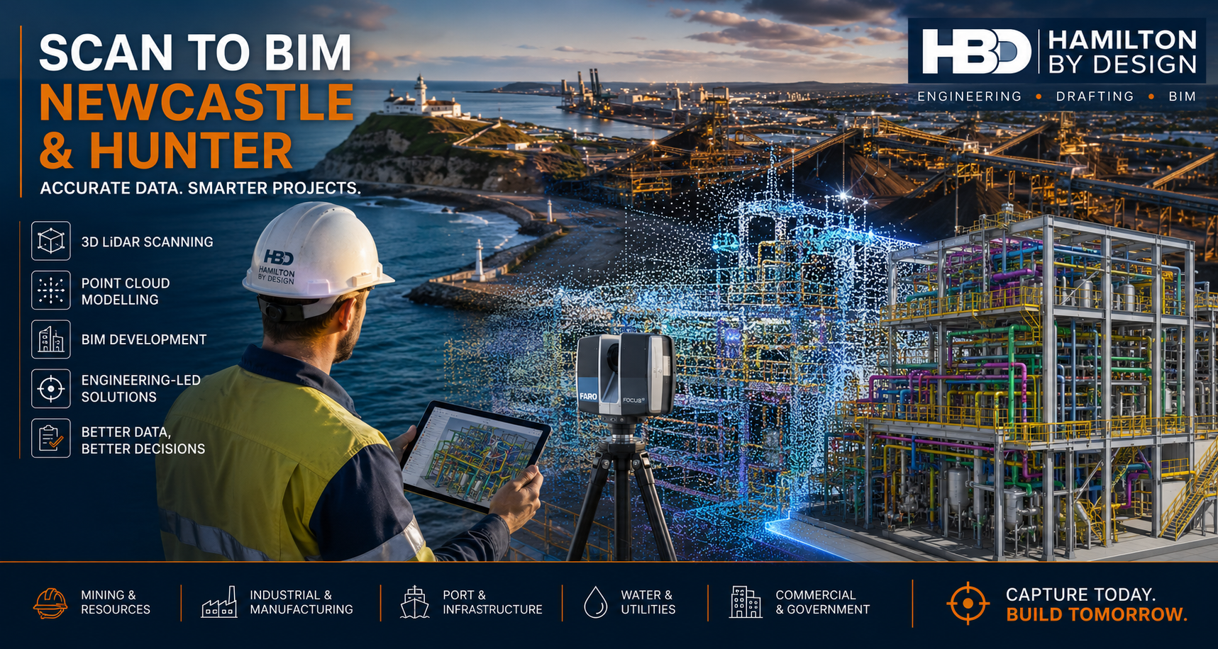
Hamilton By Design provides professional Scan to BIM Newcastle & Hunter services for industrial, mining, manufacturing, infrastructure, commercial and government projects throughout the region.
Using advanced 3D LiDAR scanning, point cloud processing and BIM modelling technologies, we transform existing buildings, plants and infrastructure into accurate digital models that support engineering, design, construction and asset management workflows.
Whether your project is located in Newcastle CBD, the Port of Newcastle, Kooragang Island, Tomago, Maitland, Singleton, Muswellbrook, Cessnock, Kurri Kurri, Raymond Terrace or the wider Hunter Valley, our engineering-led approach helps deliver accurate information from the very beginning of a project.
Why Scan to BIM is Important for Newcastle & Hunter Projects
The Newcastle and Hunter region is home to some of Australia’s most significant:
Mining operations
Coal handling facilities
Power generation assets
Manufacturing plants
Port infrastructure
Water treatment facilities
Rail infrastructure
Heavy industrial sites
Commercial developments
Health and education facilities
Many of these assets have been operating for decades.
As facilities evolve, original drawings often become outdated, modifications are undocumented and site conditions differ significantly from available records.
Scan to BIM provides a reliable method of capturing existing conditions before design, construction or upgrade work begins.
What is Scan to BIM?
Scan to BIM is the process of converting high-accuracy 3D laser scan data into intelligent BIM models and engineering documentation.
The workflow typically includes:
Stage 1 – Site Capture
Using professional 3D LiDAR scanning equipment, millions of measurements are collected across the site.
The result is a highly detailed digital representation of existing conditions.
Stage 2 – Point Cloud Registration
Individual scans are aligned and registered into a unified coordinate system.
This creates an accurate point cloud representing the entire site.
Stage 3 – BIM Development
The point cloud is converted into BIM models, CAD drawings or digital engineering deliverables suitable for project requirements.
Stage 4 – Engineering Integration
The resulting information can be used for:
Design development
Asset management
Refurbishment projects
Structural modifications
Mechanical upgrades
Clash detection
Construction planning
As-built documentation
Engineering-Led Site Capture
Hamilton By Design is not simply a scanning provider.
We are mechanical engineering, drafting and design professionals who understand how the information will be used downstream.
This distinction is important.
Many scanning providers deliver a point cloud and leave interpretation to the client.
Our engineering-led approach focuses on creating deliverables that support:
Mechanical engineering
Structural engineering
Plant upgrades
Access system design
Fabrication projects
Shutdown planning
Asset management
The result is information that can be used immediately by engineers, designers, fabricators and project teams.
Scan to BIM for Mining Operations
The Hunter Valley remains Australia’s largest coal-producing region.
Mining operations continually require:
Conveyor upgrades
Transfer chute modifications
Structural upgrades
Processing plant improvements
Materials handling projects
Shutdown planning
Asset inspections
Scan to BIM allows project teams to capture existing conditions before engineering begins.
Benefits include:
Reduced site revisits
Improved design accuracy
Better project planning
Improved safety outcomes
Reduced rework during installation
For active mining sites, accurate digital information significantly reduces project risk.
Scan to BIM for Manufacturing Facilities
The Newcastle and Hunter region hosts a diverse manufacturing sector including:
Food processing
Packaging
Steel fabrication
Chemical processing
Industrial manufacturing
Warehousing and logistics
Plant modifications often occur within operational facilities where downtime is expensive.
Scan to BIM provides:
Existing plant layouts
Equipment locations
Pipe routing verification
Structural verification
Access and maintenance assessments
This information supports more efficient project execution and improved design coordination.
Port and Infrastructure Applications
The Port of Newcastle and associated industrial infrastructure continue to undergo significant upgrades and maintenance programs.
Scan to BIM is ideally suited for:
Port facilities
Ship loading infrastructure
Bulk materials handling systems
Rail infrastructure
Water treatment assets
Industrial terminals
Civil infrastructure
Accurate digital twins improve planning and reduce uncertainty before construction activities commence.
Scan to BIM Deliverables
Depending on project requirements, Hamilton By Design can provide:
Point Cloud Deliverables
E57 Files
LAS Files
RCP Files
RCS Files
Registered point clouds
BIM Deliverables
Revit Models
BIM Coordination Models
Existing Condition Models
Architectural Models
Structural Models
Mechanical Models
CAD Deliverables
AutoCAD Drawings
Floor Plans
Sections
Elevations
General Arrangement Drawings
Fabrication Support Models
Engineering Deliverables
Plant Layout Models
Equipment Models
Structural Steel Models
Access Platform Designs
Mechanical Engineering Documentation
Brownfield Engineering Projects
Most projects throughout Newcastle and the Hunter are brownfield projects.
These sites often present challenges including:
Missing drawings
Incomplete records
Historic modifications
Access restrictions
Complex service routes
Scan to BIM significantly reduces uncertainty by creating an accurate representation of existing conditions.
This allows project teams to design around real-world constraints rather than assumptions.
Digital Engineering and Asset Management
Beyond design and construction, Scan to BIM supports long-term asset management.
Benefits include:
Accurate asset records
Improved maintenance planning
Digital twin development
Lifecycle management
Future project planning
Improved facility documentation
As infrastructure owners increasingly adopt digital engineering strategies, accurate existing-condition models become a valuable long-term asset.
Why Choose Hamilton By Design?
Hamilton By Design combines:
Engineering expertise
3D LiDAR scanning
Mechanical design
Structural drafting
BIM development
CAD modelling
Industrial project experience
Our team understands both the technology and the engineering outcomes required by clients.
This allows us to provide practical solutions that support project delivery rather than simply producing scan data.
Areas We Service
We support projects across:
Newcastle
Hunter Valley
Maitland
Singleton
Muswellbrook
Kurri Kurri
Cessnock
Raymond Terrace
Port Stephens
Lake Macquarie
Kooragang Island
Tomago
Central Coast
Upper Hunter
Mid North Coast
We also regularly support clients throughout regional NSW and interstate.
Need a Scan to BIM Newcastle & Hunter Quote?
If you require accurate existing-condition information for an upcoming engineering, construction, mining or industrial project, Hamilton By Design can help.
Our Scan to BIM services provide reliable digital information that supports better decision-making, improved design outcomes and reduced project risk.
Contact Hamilton By Design today to discuss your Scan to BIM Newcastle & Hunter project.
Engineering-Led Scan to BIM Services Across Perth and Western Australia
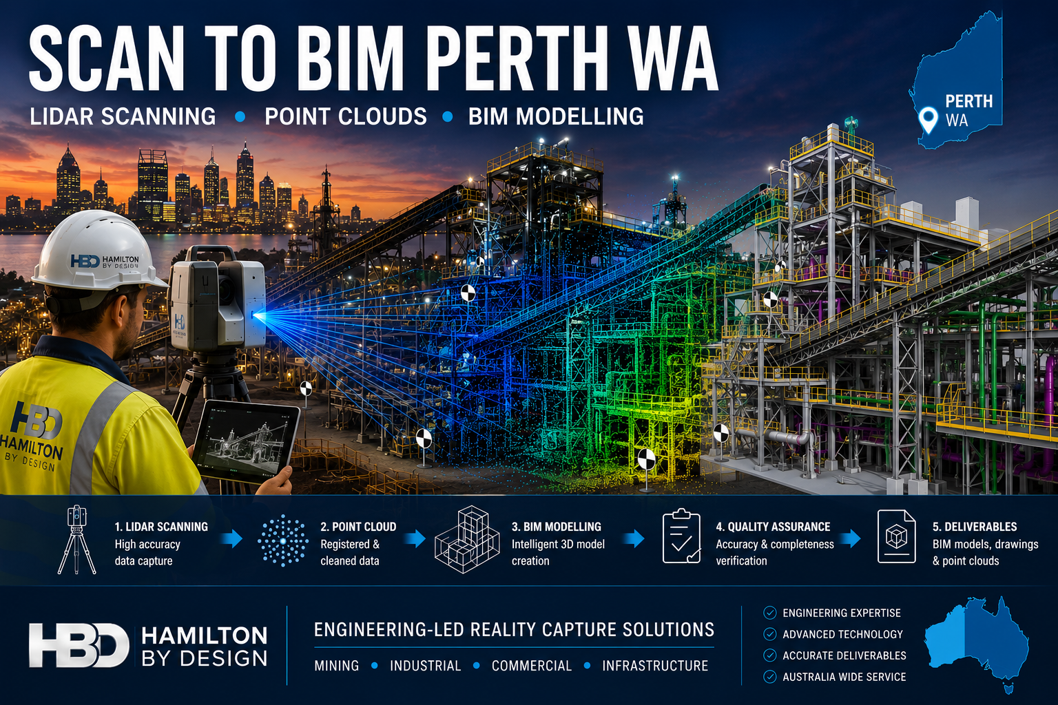
Hamilton By Design provides professional Scan to BIM services throughout Perth and Western Australia, helping mining, industrial, commercial, infrastructure and construction organisations transform accurate 3D laser scan data into intelligent Building Information Models (BIM).
Using engineering-grade LiDAR scanning technology and advanced BIM workflows, we capture existing facilities, process plants, buildings and infrastructure assets and convert them into accurate digital models suitable for design, planning, construction and asset management.
Whether your project involves a brownfield mining upgrade in the Pilbara, a commercial building in the Perth CBD, a processing plant in Kwinana or infrastructure works across regional Western Australia, our Scan to BIM services deliver reliable information for better engineering and project outcomes.
What is Scan to BIM?
Scan to BIM is the process of converting 3D laser scan data into an intelligent Building Information Model.
The process begins with high-accuracy LiDAR scanning, which captures millions of measurement points across a site. This data forms a point cloud that accurately represents existing conditions.
The point cloud is then used to create a BIM model containing structural, architectural and mechanical information that can be used throughout the project lifecycle.
The result is a highly accurate digital representation of the asset that supports:
Engineering design
Construction planning
Asset management
Facility upgrades
Maintenance planning
Clash detection
Digital twin development
Engineering-Led BIM Modelling
Unlike many scanning providers that focus only on data capture, Hamilton By Design combines engineering experience with reality capture technology.
This means the final BIM model is developed with an understanding of:
Mechanical systems
Structural steel
Conveyors
Chutes
Tanks
Pipework
Platforms and access systems
Process equipment
Material handling infrastructure
Our engineering background allows us to understand how facilities operate and how accurate models can improve future design decisions.
Western Australia remains one of the world’s largest mining regions.
Scan to BIM supports:
Iron ore facilities
Gold processing plants
Lithium operations
Rare earth projects
Bulk material handling systems
Port infrastructure
Accurate BIM models help engineering teams reduce shutdown durations and improve planning for plant upgrades.
Industrial Manufacturing
Many Perth manufacturers operate facilities that have evolved over decades.
Often existing drawings are incomplete or outdated.
Scan to BIM enables:
Accurate facility documentation
Equipment replacement projects
Structural upgrades
Capacity expansion projects
Maintenance planning
Commercial Buildings
Commercial property owners increasingly use BIM models to manage assets.
Applications include:
Building refurbishment
Services upgrades
HVAC replacement
Tenant fit-outs
Facility management
Infrastructure Projects
Scan to BIM can support:
Rail infrastructure
Ports
Water treatment facilities
Pump stations
Utility corridors
Government infrastructure
Accurate BIM models reduce project risk by ensuring designs are based on real-world conditions.
Our Scan to BIM Workflow
1. Site LiDAR Scanning
We perform engineering-grade laser scanning using professional reality capture equipment.
Millions of measurement points are collected across the facility.
2. Point Cloud Registration
Individual scans are aligned and processed into a unified point cloud.
Typical deliverables include:
E57
RCP
RCS
LAS
3. BIM Model Development
The point cloud is converted into BIM geometry using industry-standard software.
Models may include:
Structural steel
Mechanical equipment
Pipework
Buildings
Platforms
Access systems
4. Quality Assurance
Models are checked against scan data to verify accuracy and completeness.
5. Deliverables
Typical outputs include:
Autodesk Revit Models
Navisworks Models
IFC Files
DWG Drawings
PDF Documentation
Point Cloud Files
Benefits of Scan to BIM
Improved Accuracy
Laser scanning captures existing conditions with significantly greater accuracy than traditional site measurement methods.
Reduced Design Risk
Design teams can work from verified information rather than assumptions.
Faster Project Delivery
Accurate digital models reduce site revisits and minimise redesign.
Better Asset Management
Facility owners gain an accurate digital representation of their assets.
Improved Collaboration
BIM models provide a common source of information for engineers, designers, contractors and asset owners.
Scan to BIM for Brownfield Mining Projects
Brownfield projects often present unique challenges.
Existing facilities may contain undocumented modifications, ageing infrastructure and limited historical records.
Scan to BIM allows engineering teams to:
Verify existing conditions
Identify clashes before construction
Reduce shutdown risks
Improve design confidence
Support future digital twin initiatives
For mining operations throughout Perth, the Pilbara, Goldfields and regional Western Australia, accurate BIM models can significantly improve project outcomes.
Why Choose Hamilton By Design?
Hamilton By Design combines:
✔ Engineering Experience
✔ LiDAR Scanning Expertise
✔ BIM Modelling Capability
✔ Mechanical Design Knowledge
✔ Structural Drafting Experience
✔ Australia-Wide Project Delivery
✔ Mining Industry Experience
We understand both the technology and the engineering requirements behind successful Scan to BIM projects.
Scan to BIM Perth WA
If you require Scan to BIM services in Perth or anywhere across Western Australia, Hamilton By Design can provide engineering-grade reality capture and BIM modelling solutions tailored to your project requirements.
From mining facilities and industrial plants to commercial buildings and infrastructure projects, we help organisations capture existing conditions and create accurate digital models that support safer, more efficient project delivery.
How the Right Information, 3D Scanning and Engineering Tools Drive Project Success
Your Success Is Our Success
Every project manager starts with the same objective:
Deliver a successful project safely, on time and within budget.
Whether the project involves a mining operation, manufacturing facility, port infrastructure, processing plant, water treatment facility, conveyor system, structural upgrade or equipment installation, success ultimately depends on the quality of the decisions made throughout the project lifecycle.
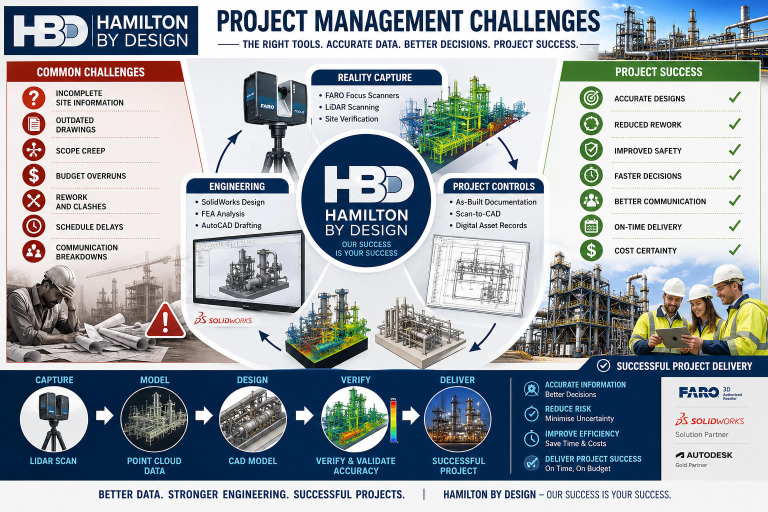
Unfortunately, project managers often face significant challenges:
Inaccurate drawings
Unknown site conditions
Scope creep
Communication issues
Budget pressures
Schedule constraints
Construction clashes
Fabrication errors
Asset documentation gaps
These challenges rarely occur because people are not trying hard enough.
Most occur because project teams are making decisions with incomplete or inaccurate information.
At Hamilton By Design, we believe project success starts with good information.
That is why we have invested in engineering-grade 3D scanning technologies, digital engineering workflows, CAD platforms, simulation tools and practical engineering expertise to help our clients reduce risk and improve project outcomes.
Portable metrology systems are used for precision measurement.
Applications:
Machined components
Gearboxes
Pump components
Manufacturing inspection
Typical accuracy:
±0.015 mm to ±0.05 mm
Drone LiDAR Systems
Drone-based systems capture large areas quickly.
Applications:
Mining
Infrastructure
Stockpiles
Terrain mapping
Typical accuracy:
±20 mm to ±100 mm
How Hamilton By Design Uses Scanning to Improve Project Outcomes
Scanning alone does not deliver project success.
Success comes from transforming captured data into useful engineering information.
Our workflow includes:
1. Site Verification
Capture existing conditions.
2. Point Cloud Registration
Align scan data accurately.
3. Scan-to-CAD
Convert reality into engineering models.
4. Engineering Design
Develop practical solutions.
5. Design Reviews
Identify issues before fabrication.
6. Drawing Production
Generate clear construction documentation.
7. Construction Support
Assist project teams during delivery.
8. As-Built Verification
Confirm final installation.
Hamilton By Design’s Project Delivery Toolkit
FARO Focus S70
Used for:
Industrial facilities
Pipework
Structural steel
Conveyors
Benefits:
Accurate existing-condition information
Improved project confidence
SOLIDWORKS
Used for:
Mechanical design
Equipment design
Reverse engineering
Benefits:
Manufacturing-ready models
Parametric design
AutoCAD
Used for:
General arrangements
Fabrication drawings
Construction documentation
FARO SCENE
Used for:
Registration
Quality control
Point cloud management
Autodesk ReCap
Used for:
Point cloud processing
Scan-to-CAD workflows
Navisworks
Used for:
Model reviews
Coordination
Clash detection
SOLIDWORKS Simulation
Used for:
Stress analysis
Structural verification
ANSYS
Used for:
Advanced engineering analysis
Rocky DEM
Used for:
Bulk materials handling
Chute design
Conveyor systems
The Benefits to Project Managers
When accurate information is available early:
Better Planning
Teams understand site conditions.
Better Budget Control
Unexpected variations are reduced.
Better Communication
Stakeholders review the same information.
Better Constructability
Designs are reviewed before fabrication.
Better Outcomes
Projects progress with greater confidence.
Why Experience Matters
Technology alone does not solve project challenges.
Hamilton By Design combines:
Mechanical engineering
Drafting
Manufacturing experience
Site experience
Reverse engineering
Reality capture
Digital engineering
Our objective is not simply to collect scan data.
Our objective is to help clients deliver successful projects.
Contact Us – Talk to Us
Our Clients
Project success begins with reliable information.
By combining engineering-grade 3D scanning, scan-to-CAD workflows, mechanical engineering, simulation and practical project experience, Hamilton By Design helps project managers reduce uncertainty and improve outcomes.
From reality capture through to engineering design and construction support, our focus remains simple:
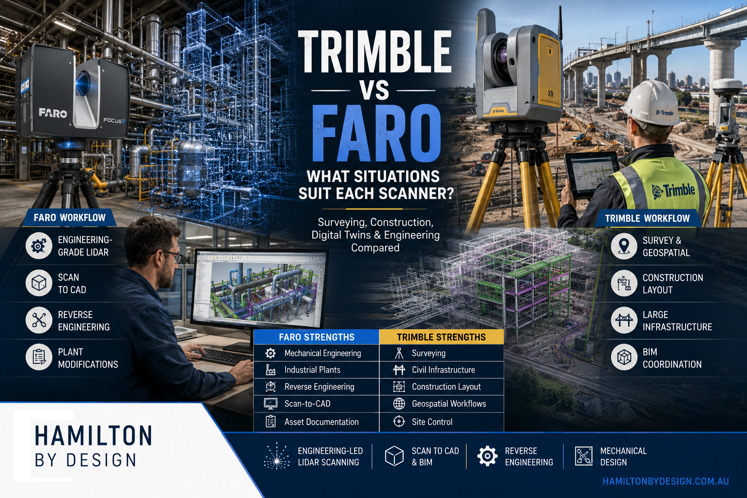
Trimble Scanners vs FARO Scanners |Which Technology Is Right for Your Project?
The laser scanning industry has evolved significantly over the last decade. Modern reality capture systems can document entire buildings, processing plants, infrastructure assets, mining operations, and manufacturing facilities with remarkable speed and accuracy.
Two of the most recognised names in the terrestrial laser scanning market are Trimble and FARO Technologies.
Both manufacturers produce capable scanning equipment, but they were developed with different target markets and project requirements in mind.
The question is not necessarily which scanner is better.
The real question is:
Which scanner is best suited to the type of project you are trying to complete?
At Hamilton By Design, we focus primarily on engineering, industrial facilities, manufacturing plants, mining infrastructure, reverse engineering, and Scan-to-CAD projects. Because of this, our requirements differ significantly from those of surveyors, construction layout teams, BIM consultants, or mobile mapping providers.
This article explains where Trimble systems excel, where FARO systems excel, and which technology may be the best fit for your application.
Understanding Laser Scanning Objectives
Before comparing scanner brands, it is important to understand the purpose of the project.
Most scanning projects fall into one of the following categories:
Surveying
Surveyors typically require:
Geospatial accuracy
Coordinate control
GIS integration
Large-scale topographic surveys
Infrastructure corridors
Road and rail mapping
Construction
Construction projects often require:
BIM coordination
Progress monitoring
Clash detection
Layout verification
Digital twins
Engineering
Engineering projects typically require:
Mechanical design
Reverse engineering
Fabrication drawings
Plant modifications
Structural steel detailing
Pipework design
Asset Management
Asset owners often require:
Digital records
Facility management
Lifecycle documentation
Maintenance planning
Different scanners have been optimised for different objectives.
Their ecosystem integrates effectively with coordinate control networks.
FARO Registration
FARO’s software platform, particularly FARO SCENE, has become a well-established standard for industrial registration.
Strengths include:
Target-based registration
Cloud-to-cloud registration
Engineering workflows
Industrial documentation
For plant environments, SCENE remains a highly capable platform.
Surveying Applications
Where Trimble excels:
Large Survey Projects
Examples include:
Highways
Rail networks
Airports
Utility corridors
Trimble’s heritage in surveying makes these projects a natural fit.
Construction Control
Projects requiring:
Set-out
Coordinate control
Site surveys
benefit from Trimble’s integrated ecosystem.
Engineering Applications
Where FARO excels:
Reverse Engineering
Examples include:
Pumps
Conveyors
Structural steel
Mechanical assemblies
The ability to create engineering-grade point clouds is critical.
Plant Modification Projects
Examples include:
Pipe rerouting
Chute redesign
Conveyor upgrades
Equipment replacement
The scanner becomes the foundation of the design process.
Fabrication Projects
Fabrication projects often require:
As-built verification
Fit-up confirmation
Clash detection
FARO scanners are commonly used for these tasks.
Mining Industry Comparison
Mining presents unique challenges.
Projects often involve:
Dust
Restricted access
Complex plant layouts
Trimble in Mining
Common uses:
Site surveys
Civil infrastructure
Haul roads
Tailings facilities
FARO in Mining
Common uses:
CHPP plants
Conveyors
Crushers
Structural steel
Transfer stations
Engineering teams frequently prefer detailed plant scans for design work.
Scan-to-CAD Workflows
This is where many engineering firms spend most of their time.
The objective is not merely collecting data.
The objective is producing:
CAD models
Drawings
Fabrication packages
Trimble Workflow
Often integrated into:
BIM
Construction
Survey deliverables
FARO Workflow
Frequently integrated into:
AutoCAD
SolidWorks
Inventor
Navisworks
Plant design software
For engineering-driven Scan-to-CAD workflows, FARO has become particularly popular.
Metrology Comparison
This category creates the biggest distinction between the two companies.
Trimble
Trimble’s focus is largely:
Geospatial
Construction
Infrastructure
FARO
FARO offers dedicated metrology products such as the:
FARO Quantum Arm
Applications include:
Manufacturing inspection
Tooling verification
Reverse engineering
Precision measurement
Measurement uncertainty can be measured in fractions of a millimetre.
This is an entirely different category from traditional terrestrial scanning.
Digital Twin Applications
Both systems can contribute to digital twin projects.
Trimble Advantages
Particularly strong when projects involve:
BIM integration
Construction workflows
Asset management
FARO Advantages
Particularly strong when projects involve:
Engineering assets
Industrial plants
Manufacturing facilities
Cost Considerations
Scanner purchase decisions should not be based solely on hardware cost.
Consider:
Software
Training
Registration
Processing
Deliverables
The cheapest scanner often becomes the most expensive solution if it fails to meet project requirements.
When Trimble Is the Better Choice
Choose Trimble when your primary focus is:
Surveying
Geospatial control
Land surveying
Corridor mapping
Construction
BIM coordination
Progress monitoring
Site verification
Infrastructure
Roads
Rail
Utilities
Mobile Mapping
Vehicle-based capture
Large-area mapping
When FARO Is the Better Choice
Choose FARO when your primary focus is:
Mechanical Engineering
Equipment design
Reverse engineering
Plant modifications
Industrial Facilities
Refineries
Processing plants
Manufacturing sites
Structural Steel
Existing structure capture
Fabrication verification
Scan-to-CAD
AutoCAD workflows
SolidWorks workflows
Inventor workflows
Metrology
Inspection
Precision measurement
Manufacturing verification
The Hamilton By Design Perspective
At Hamilton By Design, our work typically involves:
Mining plants
Manufacturing facilities
Process equipment
Structural steel
Conveyors
Chutes
Pipework
Mechanical upgrades
We are generally not:
Surveying housing estates
Mapping road corridors
Building GIS databases
Performing civil infrastructure surveys
Our goal is usually to answer engineering questions such as:
Will the new chute fit?
Can the conveyor be upgraded?
Does the pipe clash?
Can the fabricated structure be installed?
What does the existing plant actually look like?
For those objectives, the combination of:
FARO Focus S70
FARO SCENE
AutoCAD
SOLIDWORKS
provides an efficient engineering workflow.
Conclusion
Neither Trimble nor FARO is universally better.
They were developed to solve different problems.
Trimble is exceptionally strong in:
Surveying
Construction
Geospatial workflows
Infrastructure mapping
Coordinate control
FARO is exceptionally strong in:
Mechanical engineering
Industrial facilities
Reverse engineering
Scan-to-CAD
Metrology
Plant modification projects
If your objective is mapping kilometres of roadway, Trimble may be the logical choice.
If your objective is redesigning a conveyor transfer chute, replacing a pump station, upgrading a processing plant, or creating fabrication-ready CAD models from existing infrastructure, FARO is often the more suitable engineering-focused solution.
The best scanner is not the one with the longest specification sheet. The best scanner is the one that produces the deliverable your project actually needs. For many industrial engineering projects, that deliverable is not a point cloud—it is an accurate model, drawing package, fabrication detail, or engineered solution built from the scan data.
Why Scanner Stability Matters When Accuracy Matters
LiDAR stands for Light Detection and Ranging. It uses laser light to measure distance and create a 3D digital representation of the real world.
But in engineering, the distance measurement is only part of the story.
To produce reliable design, drafting and fabrication data, the scanner also needs to know exactly where it was positioned, how it was orientated, and how every measurement relates to the rest of the site.
That is why stable, engineering-grade scanning matters.
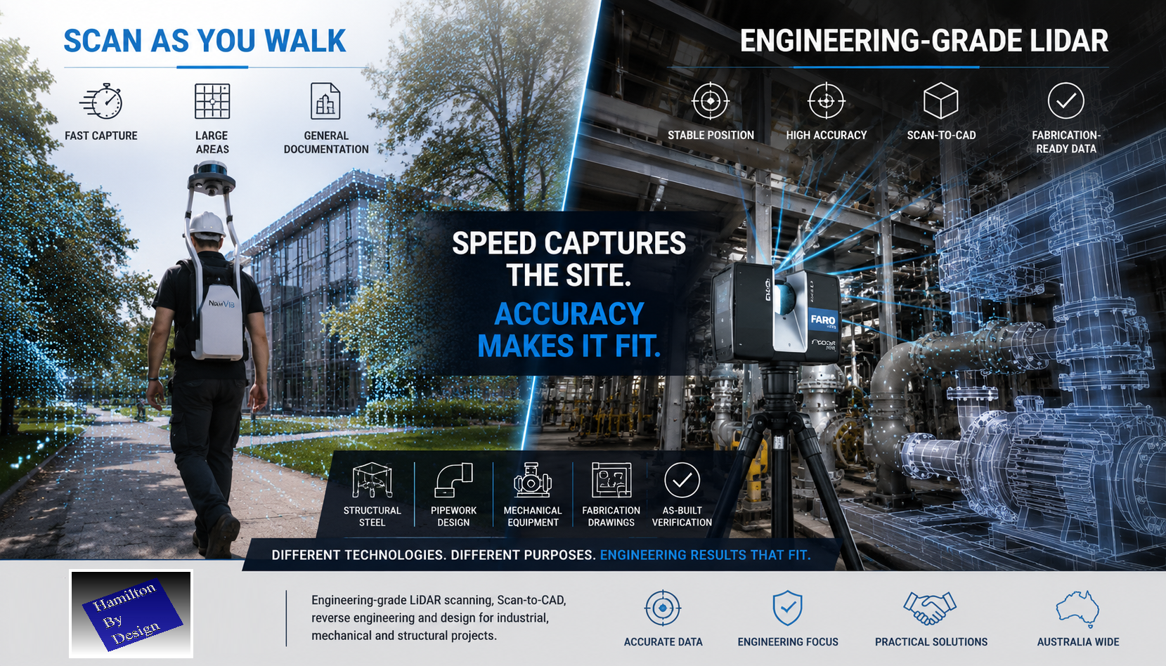
Scan as You Walk Has Its Place
Walk-through LiDAR systems such as NavVis-style mobile scanners are impressive technologies. They allow an operator to move through an environment while capturing large volumes of spatial data quickly.
For some applications, this is a major advantage.
Scan-as-you-walk systems can be useful for:
Facility documentation
Asset walkthroughs
Digital tours
Large building capture
Universities
Shopping centres
Hospitals
National parks
General spatial records
If the objective is to document a large area quickly, mobile scanning can be a practical solution.
But speed is not the same as engineering certainty.
Engineering Accuracy Requires More Than Walking Through a Site
When a scanner is moving, the system must continuously calculate:
where the scanner is located
which direction it is facing
how fast it is moving
how it is rotating
how each scan position connects to the next
This is normally achieved using SLAM, cameras, IMUs and software-based positioning.
These systems are powerful, but they can still be affected by drift, movement, poor geometry, reflective surfaces, repetitive structures and weak reference points.
In engineering, small errors can become expensive problems.
A point cloud may look good on screen, but that does not always mean it is suitable for mechanical design, structural detailing or fabrication.
Why Hamilton By Design Uses FARO Focus Technology
At Hamilton By Design, we use FARO Focus terrestrial laser scanning for engineering-grade reality capture.
The FARO Focus scanner is set up on a stable tripod position. It captures high-density scan data from fixed locations, allowing the point cloud to be registered, checked and used for design work with confidence.
This approach is slower than simply walking through a site, but it provides the quality of data required for engineering deliverables.
We use FARO scanning for:
Scan-to-CAD
Reverse engineering
Mechanical design
Structural steel modelling
Pipework layouts
Fabrication drawings
As-built documentation
Clash detection
Plant room scanning
Industrial site verification
Shutdown planning
When structural steel needs to fit, pipework needs to align and fabricated components need to be manufactured from the captured data, accuracy matters.
The Difference Is the Final Outcome
A walk-through scan may be suitable when the purpose is general documentation.
A FARO Focus scan is more suitable when the data will be used to design, manufacture, install or verify engineered components.
That difference matters.
If the objective is to walk through a national park, a mobile scanner may be the right tool.
If the objective is to make sure structural beams, pipe spools, platforms, chutes, hoppers or mechanical components fit together correctly, then engineering-grade LiDAR scanning is the safer choice.
Because when the fabrication team arrives on site, the steel either fits or it does not.
Real-World Engineering Experience
Hamilton By Design is often asked to revisit sites where previous scan data was not suitable for engineering use.
In recent weeks, we have been requested multiple times to rescan building and industrial sites after earlier walk-through scanning did not provide the level of accuracy or detail required for design and drafting.
This does not mean mobile scanning is wrong.
It means the scanning method must match the intended use.
For general site capture, speed may be the priority.
For engineering, fabrication and installation, accuracy must come first.
LiDAR Measures Distance. Engineering Requires Position Certainty.
LiDAR uses light to measure distance.
However, engineering-grade point clouds require more than distance. They require confidence in the scanner position, orientation, registration and final geometry.
A simple way to explain it is this:
A tape measure may be accurate, but if you do not know exactly where the measurement started, the result can still be wrong.
The same applies to LiDAR scanning.
The laser may measure accurately, but if the scanner position is uncertain, the final point cloud may not be suitable for engineering work.
Where FARO Focus Scanning Adds Value
Hamilton By Design provides engineering-led LiDAR scanning for clients who need usable design data, not just a visual point cloud.
Our scanning and modelling services support:
Industrial plants
Mechanical rooms
Processing facilities
Mining infrastructure
Conveyor systems
Structural platforms
Pipework and services
Equipment layouts
Existing buildings
Brownfield modification projects
We do not just scan the site.
We understand how the scan data will be used in design, drafting, fabrication and installation.
That engineering understanding is what makes the difference.
Engineering-Grade Deliverables
Depending on the project requirements, Hamilton By Design can provide:
Registered point clouds
E57 files
RCP / RCS files
Scan-to-CAD models
AutoCAD drawings
SolidWorks models
Inventor models
STEP / SAT / Parasolid files
General arrangement drawings
Sections and elevations
Fabrication drawings
As-built verification models
Our focus is to provide practical engineering information that can be used by designers, fabricators, builders, installers and asset owners.
Choose the Right Scanner for the Right Job
Scan-as-you-walk systems are fast and useful for many documentation tasks.
FARO Focus scanning is better suited to engineering-grade work where accuracy, registration and point cloud quality are critical.
At Hamilton By Design, we believe the technology should be selected based on the outcome required.
If you need to document a large space quickly, mobile scanning may be suitable.
If you need structural steel, pipework or mechanical components to fit together first time, FARO Focus scanning is hard to go past.
Hamilton By Design – Engineering-Led LiDAR Scanning
Hamilton By Design provides engineering-grade LiDAR scanning, Scan-to-CAD, reverse engineering, mechanical drafting and structural design support across Australia.
We combine reality capture with practical engineering experience to help clients move from existing site conditions to accurate design and fabrication deliverables.
For industrial, mechanical and structural projects, the question is not just how fast the site can be scanned.
The real question is:
Can the scan data be trusted when it is time to design, fabricate and install?
That is where engineering-grade LiDAR scanning matters.
To provide the best experiences, we use technologies like cookies to store and/or access device information. Consenting to these technologies will allow us to process data such as browsing behaviour or unique IDs on this site. Not consenting or withdrawing consent, may adversely affect certain features and functions.
Functional
Always active
The technical storage or access is strictly necessary for the legitimate purpose of enabling the use of a specific service explicitly requested by the subscriber or user, or for the sole purpose of carrying out the transmission of a communication over an electronic communications network.
Preferences
The technical storage or access is necessary for the legitimate purpose of storing preferences that are not requested by the subscriber or user.
Statistics
The technical storage or access that is used exclusively for statistical purposes.The technical storage or access that is used exclusively for anonymous statistical purposes. Without a subpoena, voluntary compliance on the part of your Internet Service Provider, or additional records from a third party, information stored or retrieved for this purpose alone cannot usually be used to identify you.
Marketing
The technical storage or access is required to create user profiles to send advertising, or to track the user on a website or across several websites for similar marketing purposes.